
12 Colorado Day Trips That Are Even Better Once The Summer Crowds Disappear
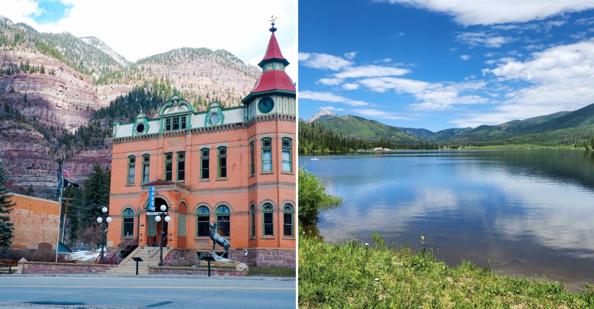
Crowds can change a day trip more than the weather ever does. Once summer traffic thins, familiar roads feel different, trailheads quiet down, and viewpoints give you space to stop instead of moving with the pack.
That slower pace can make autumn travel across Colorado feel sharper, calmer, and a little more personal. Of course, the season comes with conditions attached: mountain roads may close, temperatures swing fast, and some activities disappear as snow starts creeping higher.
Check access before you leave, bring layers, and keep the plan flexible enough to change with the forecast. The payoff is a lineup of outings that can include towering dunes, canyon overlooks, small towns, and long stretches of road that feel reset after summer.
In many corners of Colorado, fall does not shrink the adventure so much as edit out the noise. Pack the jacket, watch the weather, and enjoy the quieter version.
1. Great Sand Dunes National Park and Preserve, Mosca
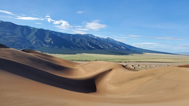
Colorado does not usually bring to mind a giant sandbox, which is exactly why the first view of these dunes feels so odd. Great Sand Dunes National Park and Preserve holds the tallest dunes in North America, rising below the Sangre de Cristo Mountains.
From the main dune access area, visitors can walk onto the sand without committing to a marked trail.
After the summer rush, a dune walk may feel less like following a parade. It still takes work.
Soft sand slows every step, and climbing a slope can turn a short distance into a real workout. Bring water, sturdy shoes, and layers.
Sand temperatures and mountain weather change with the season, so check the park forecast rather than packing for the weather back home.
Medano Creek is a spring and early summer feature, not a reliable fall attraction. Plan around the dunes themselves instead.
For a less demanding outing, walk partway out, turn around when you are ready, and enjoy the broad view of the dune field. The park also protects mountain and grassland areas, but access and conditions differ from the main dunes.
Check National Park Service updates before leaving, especially after storms. Sand does not keep a schedule, but your drive home probably should.
2. Black Canyon of the Gunnison National Park, Montrose
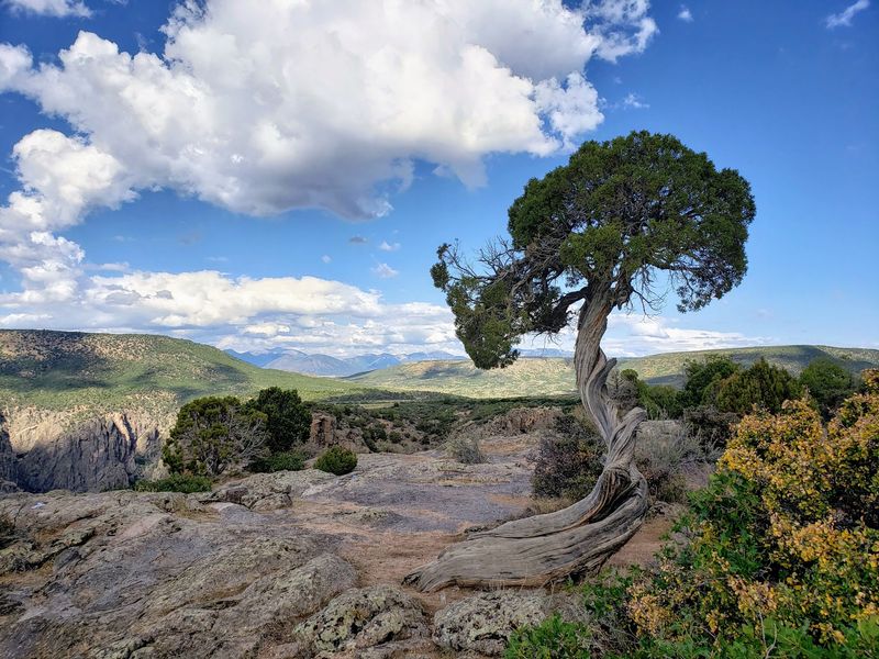
Some overlooks make you reach for a camera. At Black Canyon of the Gunnison National Park, you may want to look carefully before reaching for anything.
The Gunnison River carved a remarkably narrow, deep canyon through hard rock, and viewpoints along the South Rim offer a clear sense of its scale.
The South Rim is the practical choice for many day trips from the Montrose area. Its overlooks do not all show the same view, so choose a few rather than treating every stop as a race.
Painted Wall, named for the pale rock streaks across its face, is one of the canyon’s defining sights. Stay behind barriers and keep children close near exposed edges.
Anyone hoping to hike below the rim should know that inner canyon routes are difficult and require a permit.
Post summer travel calls for a weather check, not just a glance at the calendar. Roads and visitor facilities can have different seasonal schedules, and snow may affect access.
The North Rim is reached separately and is generally less convenient for a quick Montrose outing. Read current National Park Service conditions before setting out.
Colorado has many grand views, but this one rewards taking time to understand what you are seeing. The river looks tiny from above because the canyon is doing all the showing off.
3. Golden Gate Canyon State Park, Golden
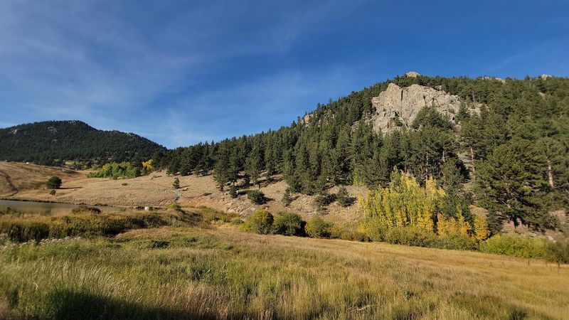
A mountain outing does not have to start with a long drive across the state. Golden Gate Canyon State Park lies west of Golden and spreads across foothills with trails, campgrounds, and overlooks.
Its mix of forest and open views makes it a flexible stop when the season is changing.
Panorama Point is a named scenic overlook where distant peaks can be visible on a clear day. If walking is the plan, pick a trail by length and difficulty instead of assuming every path is a casual loop.
Colorado Parks and Wildlife publishes a park map and trail information that make that decision much easier. Fall color can be a draw here, especially where aspens grow, but leaf timing shifts each year.
A late season visit can still work without a single yellow leaf.
The park requires a vehicle pass, so check current entry details before you go. Weather and trail conditions matter, too: shade can hold ice even when a sunny parking area looks harmless.
Pack a layer, water, and footwear suited to the forecast. Golden Gate Canyon State Park works best when you give it a clear purpose, such as one overlook and one manageable walk.
Otherwise, the many trail choices can turn a relaxing morning into a debate beside the map. The map usually wins, as it should.
4. Sylvan Lake State Park, Eagle
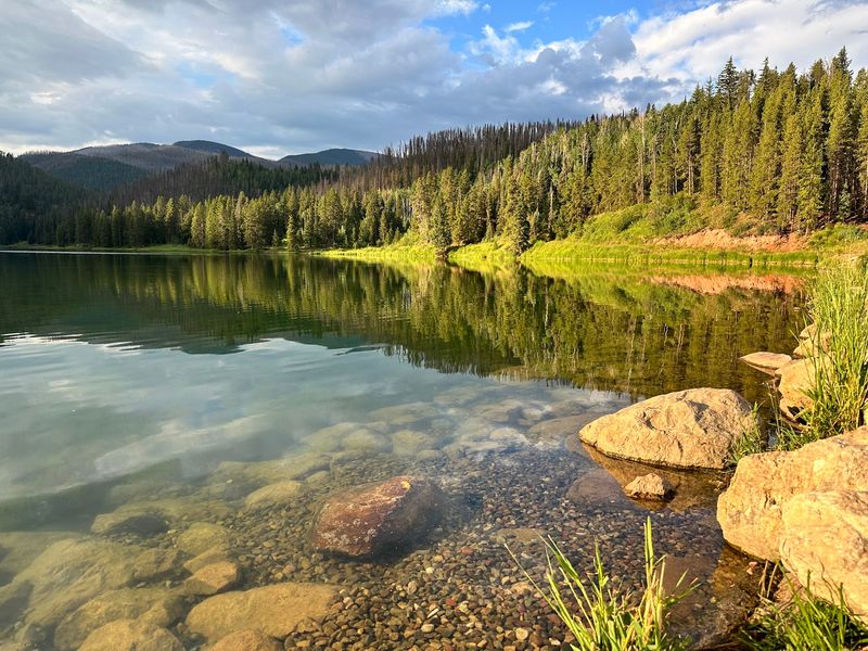
Not every lake day needs a boat, a swimsuit, or a heroic packing list. Sylvan Lake State Park, reached from the Eagle area, centers on a small mountain lake with a trail around its shore.
For a day trip, that straightforward layout is part of its appeal.
Walk the lake trail, pause to look across the water, and leave time for the drive back. The park also offers camping and fishing, though anyone planning those activities should check current rules and availability with Colorado Parks and Wildlife.
Do not assume every summer service continues into colder months. Restrooms, road conditions, and access can change as the season turns.
A jacket and shoes that handle damp or icy ground are sensible additions to the car.
Sylvan Lake State Park sits at a higher elevation than Eagle, which makes the local forecast more useful than the temperature reported for town. Check the route and park alerts before leaving, particularly if winter weather is possible.
Colorado’s smaller parks can be easier to overlook beside famous national parks, but size is not the point here. The lake gives the outing a natural center.
You can spend your energy on a walk rather than on deciding which of forty possible stops deserves the next hour.
5. Ridgway State Park, Ridgway
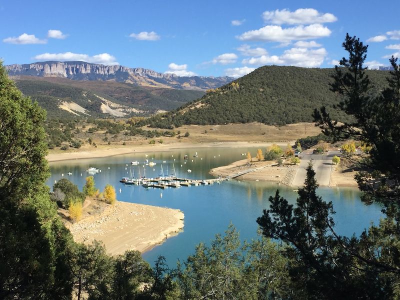
Ridgway State Park has a useful trick for day trippers: it can be a lakeside outing without asking everyone to enjoy the lake in the same way. Built around Ridgway Reservoir, the park has several developed areas with different access points and facilities.
Look at a park map before driving in, since the area you choose shapes the visit.
The reservoir sits in the Uncompahgre Valley, with mountain views that give even a short shoreline stop a strong sense of place. Walking, fishing, and camping are among the park’s established activities, subject to park rules and seasonal conditions.
Summer swimming should not be the reason for a cold weather trip. Instead, choose a trail or viewing area that suits your group and the forecast.
Bring water even when the day looks cool; a dry climate does not take a fall vacation.
Ridgway State Park requires a vehicle pass. Check Colorado Parks and Wildlife for current access, water levels, and facilities before leaving home.
The park’s separate areas also make meeting up important if friends are arriving in different cars. Agree on a specific entrance rather than sending a hopeful message that says only the lake.
With that settled, the reservoir and its mountain backdrop can carry the day without a crowded summer beach plan.
6. Pearl Lake State Park, Clark
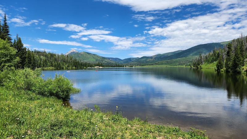
Pearl Lake makes a good case for putting one small lake, not five stops, on the day’s plan. Pearl Lake State Park lies near Clark, north of Steamboat Springs, and protects a mountain lake surrounded by forest.
Its limited scale is the attraction: the water and the surrounding landscape remain the focus.
The park allows nonmotorized boating and fishing, with rules that visitors should check before bringing equipment. If you would rather stay on land, use the park’s published map to plan a walk and locate the access area.
Cooler seasons change the calculation for any trip involving water. Check weather, park alerts, and boating access instead of assuming a lake activity advertised for summer will still be practical.
A vehicle pass is required for entry.
Pearl Lake State Park and nearby Steamboat Lake State Park are separate parks, so confirm which one your directions lead to. It sounds obvious until a navigation app, a tired passenger, and two similar names join the conversation.
For Colorado travelers hoping to slow down after summer, Pearl Lake offers a day with few moving parts. Bring food and water rather than counting on services at the lake.
Then let the actual conditions decide how long you stay, whether that means a longer walk or a brief look across the water.
7. Ouray, Colorado
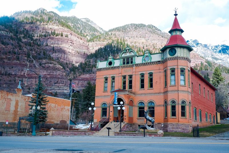
Ouray has the unusual problem of being almost too easy to photograph. Steep San Juan Mountain slopes rise around the town, while its historic streets and hot springs give visitors reasons to stop looking through a windshield.
Once the busiest summer travel period has passed, a day here can center on fewer plans and closer attention.
Start with the town itself. Ouray’s hot springs pool is a well known public attraction, but check its current hours and maintenance notices before building the whole day around a soak.
The Ouray County Historical Museum is another option when it is open; its schedule varies by season. An indoor stop matters when mountain weather changes its mind.
If you want a walk, research an established local trail and current conditions instead of treating every path on a map as suitable for a casual afternoon.
Ouray is also a base for mountain roads, but many high routes are not ordinary passenger car outings. Never follow an app onto an unfamiliar rough road without checking its requirements.
After summer, shorter daylight and possible snow make that advice more than a formality. A town visit avoids the need to conquer a pass just to call the day successful.
The mountains have already done the hard work of creating the view.
8. Crested Butte and Kebler Pass, Colorado
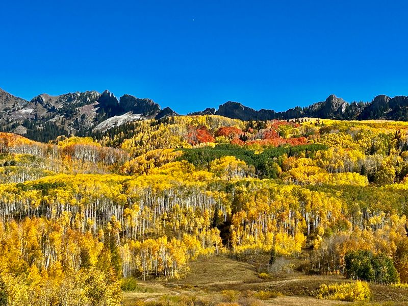
The road west of Crested Butte has a leafy reputation for a reason. Kebler Pass passes through extensive aspen groves, making it a popular fall color drive when conditions allow.
Crested Butte gives the trip a town anchor, with its historic district providing a different kind of scenery once you return from the road.
Timing matters more here than at most stops on this list. Aspen color varies by year and elevation, and Kebler Pass Road is a seasonal route that can close when snow arrives.
Its gravel surface also deserves attention. Check current Gunnison County road information and the forecast before leaving, and do not assume that a route shown on a map is open from end to end.
If the pass is closed, enjoy Crested Butte rather than trying to improvise a risky crossing.
A sensible day allows for stops only where parking is permitted. Pulling over wherever a tree looks good is not a travel strategy, even if the tree has excellent taste.
Around town, choose a meal or a short walk based on what is open that day. Colorado’s autumn scenery can attract its own crowds, so treat a quieter post summer outing as a possibility, not a promise.
The best plan leaves room for both road conditions and changing leaves.
9. Twin Lakes and Leadville, Colorado
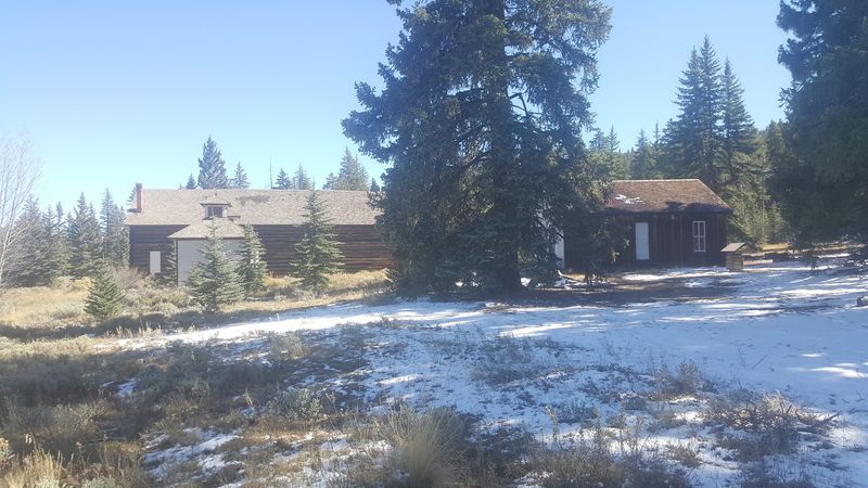
Here is a day trip with two very different measures of altitude. Twin Lakes sits near the base of Mount Elbert, Colorado’s highest peak, while nearby Leadville is famous for its high elevation and mining era history.
Together they offer a lake view and a town with a story, without requiring anyone to climb the mountain.
At Twin Lakes, choose an established public access point for a shoreline stop and respect posted rules. Weather can shift quickly near the water, especially after summer, so layers belong in the car.
Leadville’s National Mining Hall of Fame and Museum can add useful context to the region’s mining past, provided its current hours fit your trip. The town’s historic buildings also reward a look, though a high altitude stroll may feel harder than its distance suggests.
Give yourself time between stops instead of treating the two places as one parking lot. If you are coming from a lower elevation, drink water, take breaks, and pay attention to signs of altitude sickness.
Mountain weather can affect roads even when the calendar still says fall. Check forecasts and museum schedules before leaving.
Colorado day trips do not need a summit to feel ambitious; here, the setting and history do plenty of work from ground level.
10. Georgetown and the Georgetown Loop Railroad, Colorado
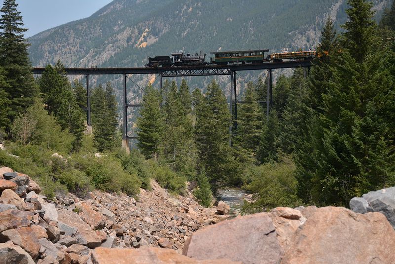
Most scenic drives ask you to watch the road. Georgetown offers a chance to let someone else handle the movement.
The Georgetown Loop Railroad runs between Georgetown and Silver Plume, following a historic mountain rail route whose signature feature is a high curved trestle. It is a memorable way to see how engineers worked with the area’s steep terrain.
Train departures and special events depend on the season, so check the railroad’s official schedule and book the ride you actually want. Do not assume a fall trip and a winter trip offer identical experiences.
In Georgetown, the historic district adds streets and buildings shaped by the mining era. Allow time to look around rather than arriving only minutes before boarding.
Comfortable shoes and a warm layer make sense for a mountain town and an outdoor train platform.
The route tells a larger story about travel before modern highways made Colorado distances seem smaller. Even so, the ride is an attraction with set departure times, not an open ended shuttle between towns.
Confirm where to park and board when purchasing tickets. If the train is not operating on your chosen day, Georgetown can still be a town outing, but it will be a different plan.
Nobody enjoys discovering that distinction after reaching the station.
11. Grand Mesa, Colorado
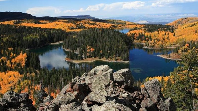
Grand Mesa does not look like a typical pointed Colorado peak. It is a huge, flat topped landform east of Grand Junction, with forests and many lakes spread across its high surface.
That change in shape gives a day trip here a different rhythm from a drive aimed at one summit.
The Grand Mesa Scenic Byway crosses the mesa and connects viewpoints with access to recreation areas. Decide in advance how much of the drive you want to do, then check road and weather reports.
Elevation changes can turn a mild start in the valley into much colder conditions above. Fall color may appear among the aspens, but its timing is never guaranteed.
Snow can arrive before your preferred photo date, and access to smaller side roads may differ from the main route.
Grand Mesa lies within the Grand Mesa National Forest, so the U.S. Forest Service is a useful source for current recreation and road information.
Take water and food, and do not expect every lakeside facility to stay open after summer. If your group wants a walk, select a named trail that matches its abilities and the day’s conditions.
The mesa’s scale is easy to underestimate from a map. Pick a few stops and enjoy them rather than trying to count every lake.
12. Peak to Peak Scenic and Historic Byway, Colorado
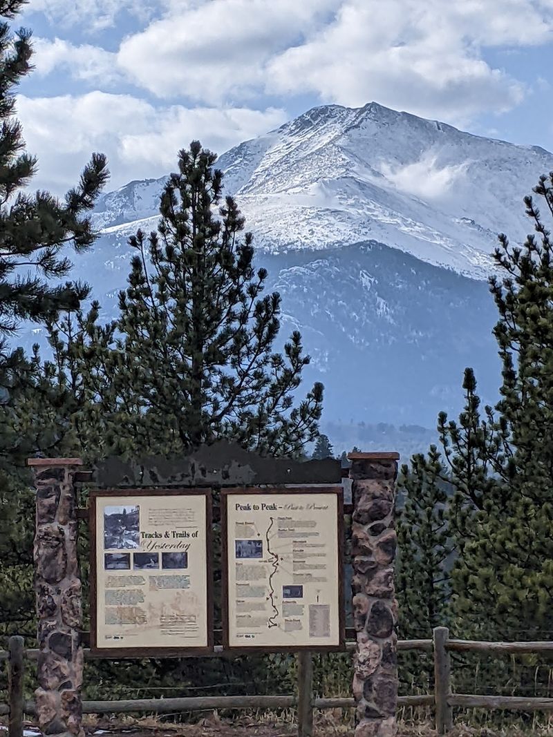
A road trip needs a destination, but sometimes the road makes a strong argument for itself. The Peak to Peak Scenic and Historic Byway follows Colorado mountain corridors between the Central City area and Estes Park.
Along the way, it passes through or near communities including Nederland and Allenspark, with views toward the Continental Divide.
Unlike a single overlook, the byway asks you to choose a pace. Pick a few legitimate pullouts or town stops before starting, and let the rest be a pleasant bonus.
Fall aspen color can be striking along portions of the route, yet leaf timing and traffic vary. Post summer does not mean you will have a famous fall color road to yourself.
Check road conditions before departure and give yourself enough daylight for the full route or a shorter section.
Mountain driving calls for attention to weather, curves, and elevation. Stay on the road rather than following a navigation shortcut onto an unfamiliar side route.
Some businesses and attractions along the way keep seasonal hours, so verify any stop that matters to your plan. The Peak to Peak Scenic and Historic Byway is especially useful for travelers who enjoy making choices as they go.
Just make the important choices, such as the turnaround point, before the daylight does it for you.