These Are The Forgotten Hiking Paths In Michigan Tourists Overlook
In the “Empty Quarters” of the Mitten State, the maps stop shouting and start whispering. As you turn off the paved highway, the sound of tires on crunching gravel becomes a rhythmic meditation; a prerequisite for finding Michigan’s most reclusive footpaths. Here, the air doesn’t just feel fresh; it feels “newly made,” carrying the sharp, medicinal snap of crushed cedar and the damp, sweet musk of ancient moss.
The atmosphere is thick with a prehistoric sort of quiet. You’ll notice the “hush” of pine needles underfoot, a natural carpet that mutes your presence until you’re just another part of the scenery. Between the towering trunks, the silver lake light flits like a shy animal, darting away as you round a bend.
There are no crowds here to curate your experience; instead, you’ll hear the frantic, cheerful dee-dee-dee of chickadees and the hollow drumming of a distant pileated woodpecker. Discover the best hidden hiking trails in Michigan for a peaceful, off-the-beaten-path outdoor adventure away from the crowds.
These overlooked trails are for the seekers who trade cell service for “gravel-road patience.” It’s a sensory trade-off where the reward is an unhurried story told in the language of rustling leaves and shifting shadows. Bring a compass, a sense of wonder, and a mood that matches the slow, intentional pace of the forest.
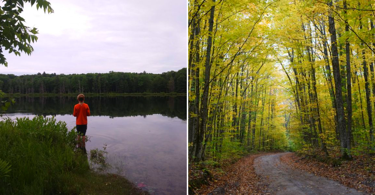
15. Reid Lake Foot Travel Area, Glennie
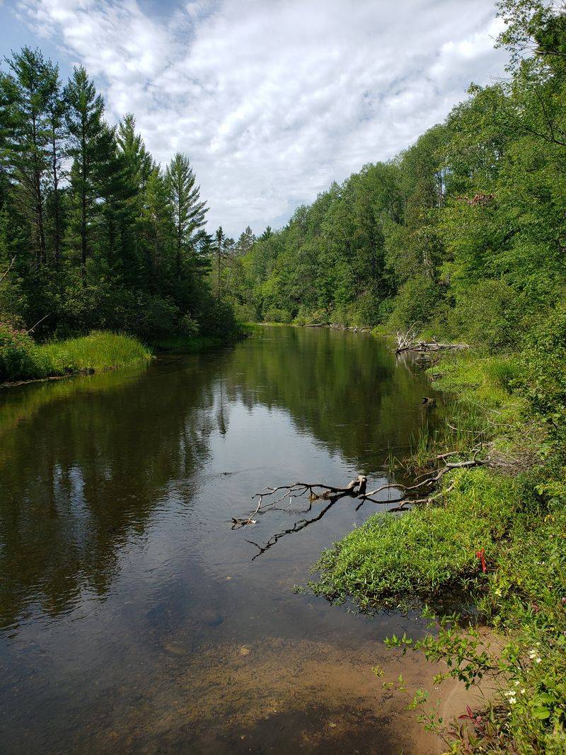
Pines hush the wind as the trail rings a scatter of small kettle lakes, each with its own personality and private reflection. The water sits glassy, mirroring tamarack and the odd osprey circling for a precise strike. Footing turns sandy in pockets, and spring adds frog song like beadwork along the shore.
This loop was set aside for quiet travel, part of the Huron National Forest’s subtle mosaic of protected spaces. Old logging tracks fade into duff, and you can read their ghosted lines beside blueberries. Wayfinding feels straightforward, with posts at key junctions that quietly keep you honest.
Start early to catch mist on Reid Lake, and bring bug spray in June when mosquitoes test your patience. Shoulder seasons are best, when the sun slants low and the loons practice melancholy scales. You will leave with pine on your cuffs and a softened sense of time.
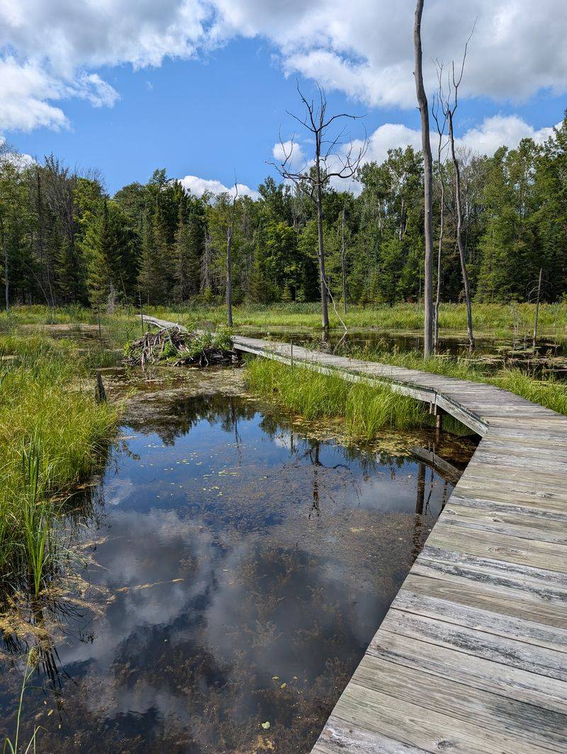
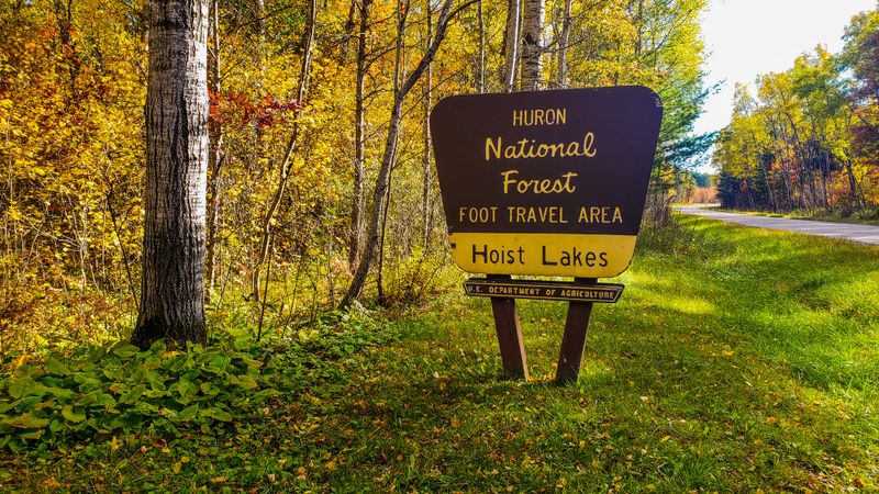
14. Hoist Lakes Foot Travel Area, Barton City
Quiet settles quickly here, broken by the cluck of grouse and the whisper of oak leaves moving without urgency. Scattered ponds flash between trunks, and beaver work scribbles the edges with purposeful geometry. Underfoot, the path alternates between rooty knuckles and soft pine duff.
The Hoist Lakes area preserves a slice of pre-road stillness within Huron National Forest. Its name nods to logging-era hoists once muscling timber from the woods, now long gone. Old camp traces linger in flat clearings where jack pine is reclaiming ground inch by inch.
Carry a good map and watch for signed loops that let you tailor mileage to your mood. Water can be tannic but plentiful, and mosquitoes hold meetings at dusk. You will feel pleasantly small among the ponds and their quiet business.
13. Sand Lakes Quiet Area Pathway, Williamsburg
The trail threads sandy rises that spill toward pale blue lakes, turning walking into a gentle rhythm. Sunlight shards through red pine rows, making the path glow like a warm ribbon. In spring, the scent is clean and resinous, and a woodpecker might stitch rhythm onto the silence.
Created to keep engines out, this Quiet Area sits just east of Traverse City yet feels removed. Glacial kettles explain the terrain’s graceless dips and sudden views across water. Old two-tracks appear now and then, but footpath signs steer you true.
Bring sturdy shoes for the sand and climb the short moraines without rushing. Swim if the day begs for it, but mind chilly depths that bite back. Parking is limited, so arrive early and let the quiet do its work.
12. Shingle Mill Pathway, Vanderbilt

Water talks constantly along this path, the Pigeon River sliding over stones with an amber sheen. Cedar and hemlock crowd the banks, giving the air a cool tea scent. A heron lifts like a polite umbrella when you round a bend.
The trail owes its existence to old resource roads and a desire to showcase the Wild and Scenic River. This is elk country, protected within Pigeon River Country State Forest. You may see tracks pressed into damp sand where the river braided last week.
Expect easy grades and occasional boardwalks, but carry a map for loops of different lengths. Dusk is generous for wildlife viewing if you keep your pace patient. Keep voices low, and you might hear elk bugling in September’s chill.
11. Mason Tract Pathway, Grayling area
The Au Sable runs clear as a thought beside this footpath, cobbles visible under jade water. Cedar roots braid along the shore, and trout noses dimple the current where shadows drift. Each bend offers a quiet bench of sand for lunch and listening.
This corridor was gifted for preservation, a promise to keep the river unhurried. The Mason family’s intent shows in minimal development and a foot-travel focus. Old angler paths intertwine, but the main route stays faithful to the river’s sweep.
Respect anglers by giving space and stepping off when needed. Mosquitoes audition in June, so sleeves help your patience. Plan a shuttle or out-and-back, and aim for sunrise when fog slides like silk across the water.
10. Cedar River Pathway, Menominee County
The Cedar River moves with an unshowy grace, folding around gravel bars and velvety moss. You hear kingfishers first, then notice their blue commas flashing above riffles. Footbridges feel handmade and sincere, arching low over quiet flow.
Down in Menominee County, this pathway traces state forest land shaped by logging and careful regrowth. Remnants of old grades cross the woods like faint seams, now softened by leaf litter. The loop options reflect practical routes for reaching fishable water.
Expect wet sections in spring and bring sturdy boots for the mud. Blackflies can be spirited in May, but the reward is new leaves glowing chartreuse. Take a patient pace and watch for brook trout flickers near shady bends.
9. Ogemaw Hills Pathway, West Branch area
Hills here are modest but numerous, like politely stacked quilts. The path moves through oak and aspen, then slips into pine with a softened hush. In fall, the color feels almost theatrical against a sky that keeps changing its mind.
This network began as a ski trail system, which explains the easy grades and broad curves. Old fire lanes are still legible in straight stretches that ignore the land’s smaller moods. Signage is straightforward and color-coded for loops.
Bring water, since services are lean, and expect winter grooming if you return with skis. Shoulder seasons are prime for solitude and long views. If the wind picks up, listen for leaves tumbling like coins down the slopes.
8. Buttles Road Pathway, Lewiston area

A sandy forest road gives way to slimmer tread wandering through jack pine and scrubby oak. Blueberries bead the edges in July, and the air tastes a little like sun-warmed resin. The quiet feels gentle, not lonely, with tire whispers far away.
This pathway uses fragments of old access tracks, stitched into a loop that favors simple pleasures over vistas. Plantings reflect fire-era management common in the northern lower peninsula. Signposts are modest, more nod than announcement.
Carry your own map and watch for sandy stretches that steal energy. Morning starts beat the heat, and long sleeves keep sun off in open patches. I always leave with purple-stained fingers and a calmer pulse.
7. Sinkhole Pathway, Atlanta area

The ground dips unexpectedly here, revealing ferny bowls that hold their own cool weather. A breeze moves differently in the sinkholes, circling like a careful rumor. Birdsong echoes oddly, as if the forest is speaking from two rooms at once.
Karst geology shapes this landscape, where dissolving limestone left cavities and sudden hollows. The pathway samples several features, with gentle grades and occasional interpretive signs. Local stewards keep the route tidy and understated.
Stay on trail to protect fragile rims and avoid ankle traps. Bring water, because these hollows do not promise reliable sources. Winter visits feel lunar, while summer brings blooming yarrow along the edges.
6. Black Mountain Pathway, Onaway area
A high ridge hands you glimpses of lakes, blue shards tucked into green folds. Wind tumbles along the spine, making birch leaves flash like fish scales. The trail shifts from firm to sandy, reminding you this is a dune’s inland cousin.
Black Mountain once hosted fire towers and motor trails; now the footpath carves a quieter line. State forest parcels and recreation areas mingle in a patchwork that rewards wandering. Old infrastructure lingers in clearings that feel purposeful but relaxed.
Bring a light layer for the ridge breeze and trust the posts at intersections. Mountain bike routes crisscross nearby, so confirm blaze colors. The sunsets run long here, as if the horizon forgot to close.
5. Corsair Trail, Oscoda area
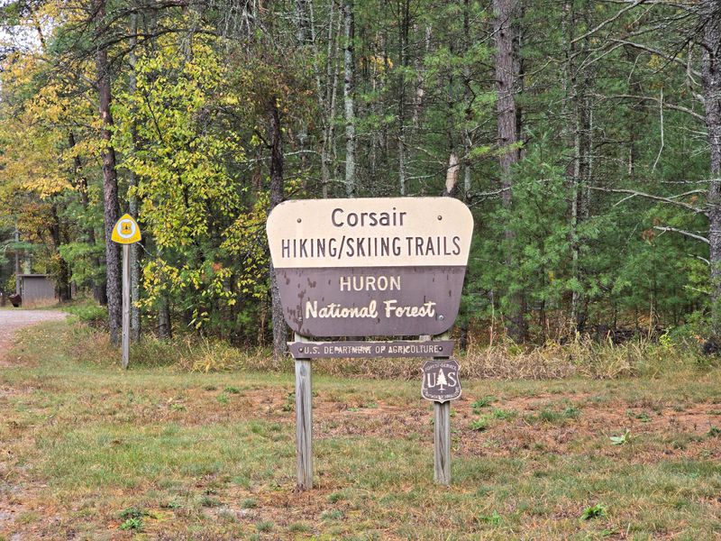
The Corsair loops travel like a steady conversation, never too steep, always considerate. Small creeks sneak under footbridges, and the forest trades pine for maple without ceremony. In October the color feels orchestral, a full section playing without bravado.
Built for skiing and loved by hikers, the system reflects careful grooming and classic curves. CCC-era influence shows in corridors that follow sensible lines through the Huron National Forest. Trailheads are well marked, with maps that actually help.
Choose a loop to match your mood and pack a snack for the longer turns. Summer mosquitoes notice you at dusk, so time your finish. I like the east loops after rain, when the pine smells freshly tuned.
4. Silver Creek Pathway, Manistee National Forest area
Mist sits low on Silver Creek, making spider webs look like strung instruments. The boardwalks tap softly underfoot, then give way to firm ground where cedar opens to maple. Water sounds are constant but polite, just enough to keep thoughts aligned.
This pathway shares the neighborhood with the Pine River, famed for swift canoe runs. The trail itself stays contemplative, reflecting an older, quieter Manistee mood. Built sections protect wetlands that still breathe naturally.
Bring insect defense and waterproof shoes for shoulder seasons. Parking is modest, so early arrivals win calm starts. If flows are high, expect the creek to show off its clarity and speed. You leave feeling rinsed, in the best way.
3. Fife Lake Loop, Fife Lake

Start near the village and the trail eases you into mixed woods before flirting with the shoreline. Lake light blinks through birch, and the path smells of sand and leaf sugar. Boats murmur far off, more suggestion than noise.
The loop traces public lands knitted with township access points, a practical arrangement that works. Old rail history brushes the area, visible in straight corridors nearby. Wayfinding signs are friendly, if slightly sun-faded.
Pack water and give yourself time to detour to the small docks. Weekdays feel especially unhurried. I like catching the last hour of sun when the lake surface hushes and dragonflies patrol with a sense of duty.
2. Pinckney Silver Lake Trail, Pinckney Recreation Area
Footfalls land on roots and sand as the trail rolls through oak ridges above blue water. Spring brings trillium carpeting shady pockets, while summer trades in cicada hum. The lake appears and vanishes, like someone opening and closing a door.
Pinckney’s network is a classic glacial playground, its moraines shaping the steady climbs. The Silver Lake loop is among the friendlier circuits, with heritage tied to regional trail building. Park infrastructure keeps things legible without getting loud.
Expect company on weekends, especially runners, so keep right and smile. Early mornings reclaim the quiet. Carry a small towel if you plan a legal swim after, because the path practically dares you to cool off.
1. High Country Pathway, Pigeon River Country area

The landscape stretches out in honest miles, with ridges that keep their promises and valleys that cool the air. Sand and grass share the tread, and kettle ponds glint between jack pine and oak. Nights bring stars that feel close enough to nudge.
This 80-plus mile loop anchors Michigan’s backpacking culture in elk country. Built by volunteers and agencies, it connects old roads and singletrack into a durable circuit. Rustic campsites punctuate segments that read like chapters of the same book.
Plan carefully: water sources vary by season, and navigation deserves attention. Autumn rewards with bug-light days and bugling elk. If you crave company, choose popular sections; if not, the northern arc will kindly leave you alone.