This Jaw-Dropping Colorado Canyon Hike Leads To Natural Arches You’d Expect In Utah
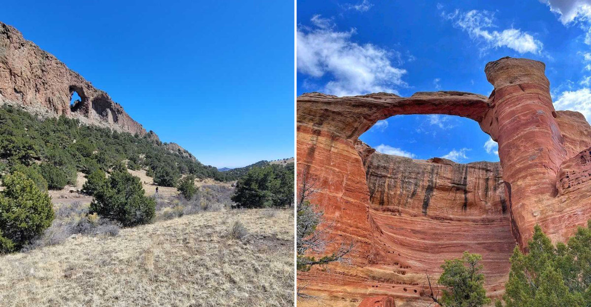
I never expected to find a landscape straight out of Utah hiding in western Colorado until I reached Rattlesnake Canyon.
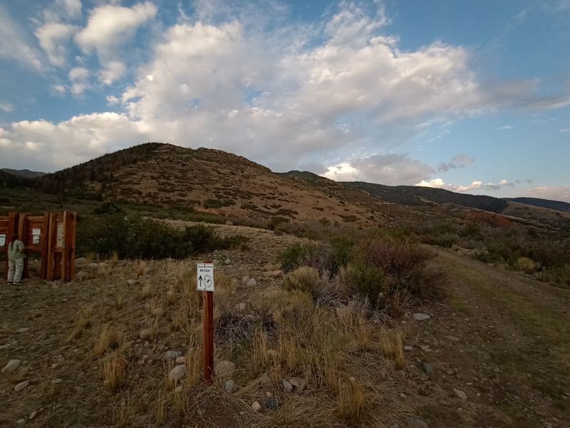
The Rattlesnake Arches Trail at Rattlesnake Canyon Trailhead on County Road 300 delivers one of the most spectacular natural arch collections outside of Utah’s famous parks, yet it sees only a fraction of the crowds.
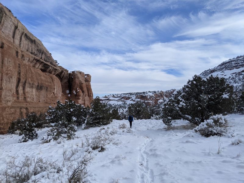
Towering sandstone formations rise overhead in shades of rust and amber, carved by wind and time into delicate spans that frame the wide Colorado sky.
Reaching this hidden canyon takes planning and a capable vehicle, but standing beneath these ancient arches makes every bumpy mile feel justified.
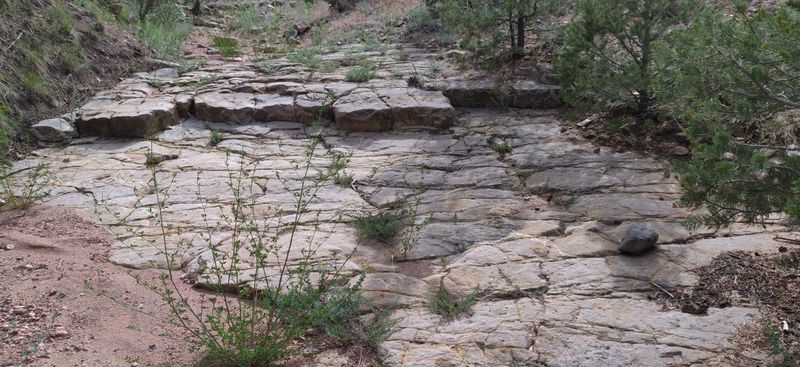
The trail winds through petrified sand dunes and layered cliff walls that reveal millions of years of geological history in vivid color.
I kept looping back through each arch, struck by the sense of discovering something quietly sacred.
By the time I finished exploring, my camera was full, my legs were tired, and I already knew I would return to this remarkable corner of Colorado.
Getting There Requires Grit and Ground Clearance
Reaching the trailhead is half the adventure and demands a vehicle built for real punishment rather than casual gravel driving. The final two miles along County Road 300 from Glade Park wind through rough, rocky terrain that will scrape anything without serious clearance, and during my drive I watched my passenger grip the door handle more than once as we bounced across embedded stones and uneven ledges.
High clearance four wheel drive is not just a recommendation here but a requirement, because low slung sedans and soft crossovers simply will not survive the approach without risking costly damage to the undercarriage.
I quickly learned to slow everything down, choosing my line carefully, easing around deep ruts, and trusting the suspension to absorb the constant jolts rather than fighting them.
Several online reviews mention people turning back after underestimating the road, and after experiencing it firsthand, that decision makes complete sense. Once you leave pavement, the drive adds roughly thirty minutes to the trip, but that extra effort serves a purpose.
The road naturally filters out casual visitors, keeping traffic light and the surrounding canyon quiet.
By the time I finally parked at the trailhead, dusty and focused, I felt a genuine sense of accomplishment, as if the journey itself had already earned me access to what waited beyond the trailhead.
An Arch Collection That Rivals Arches National Park
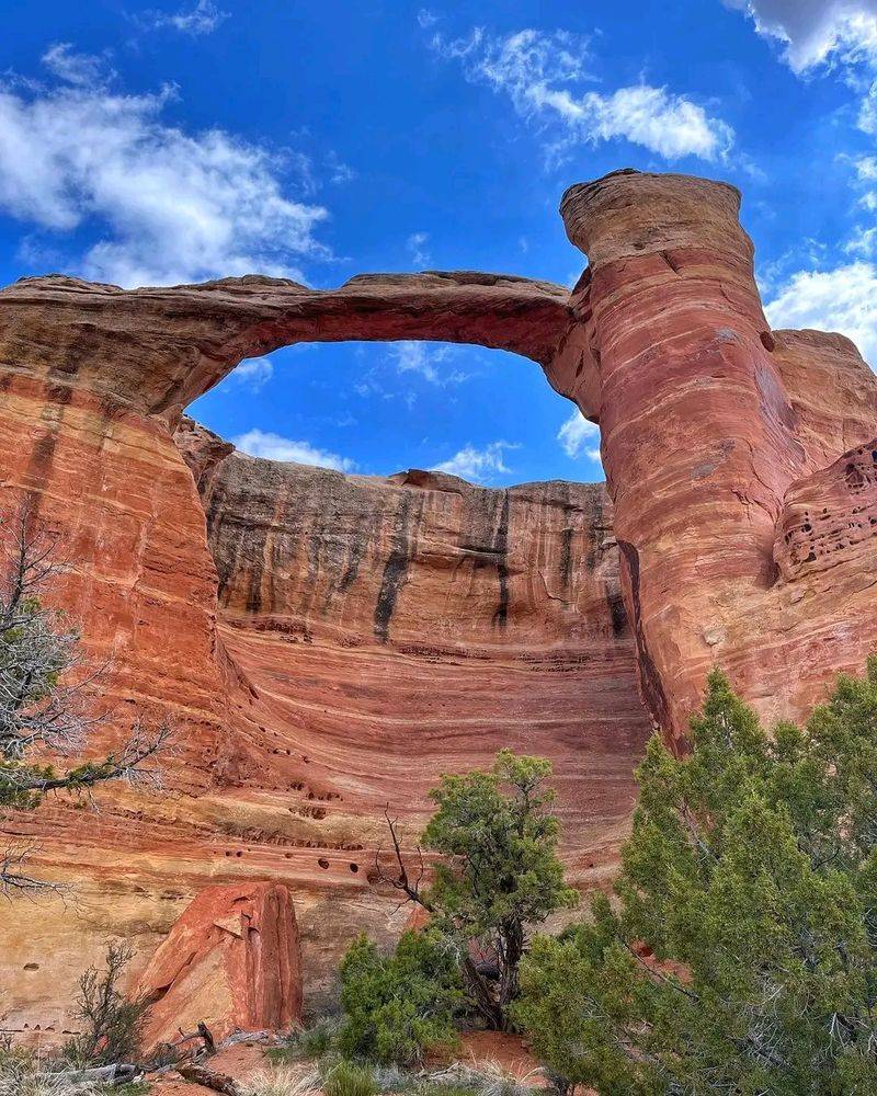
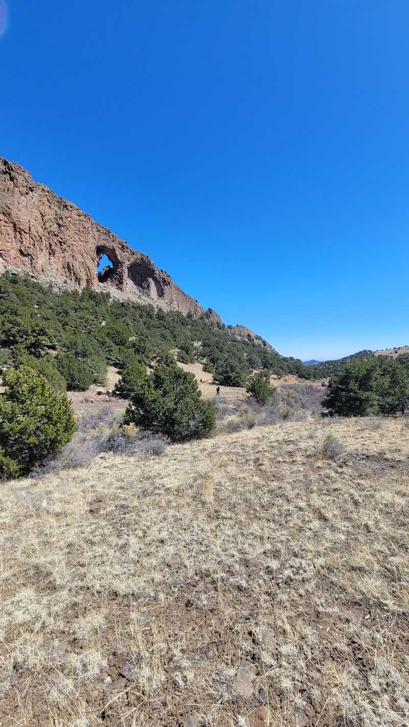
Rattlesnake Canyon holds the second largest concentration of natural arches in Colorado, a fact that sounds modest until you experience the landscape firsthand. Along the trail system I counted at least nine distinct arches, each with its own personality and form, ranging from massive stone spans wide enough to frame entire cliff faces to thin, delicate ribbons of sandstone that appear almost impossibly fragile.
The lower trail loops past most of these formations, allowing you to walk beneath them, circle around their bases, and look upward as canyon walls rise hundreds of feet on either side.
What left the strongest impression was the absence of crowds and barriers that define many well known parks, creating space to sit quietly beneath an arch and absorb its scale without interruption.
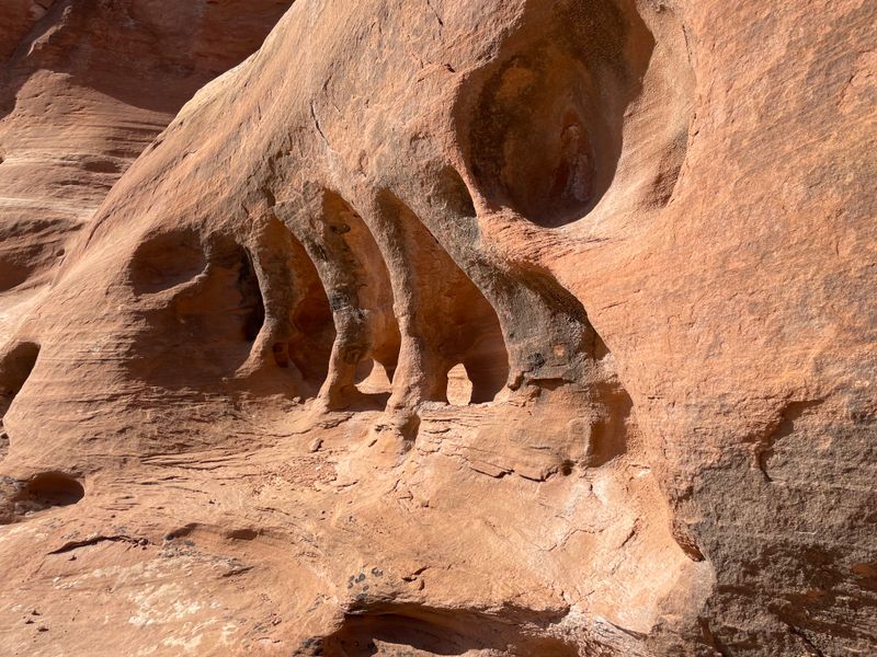
Petrified sand dunes line the canyon in layered bands of cream, rust, and orange, shifting subtly as the sun moves across the sky. Light and shadow constantly reshape the scene, making the same formation feel different from one bend in the trail to the next.
Several arches sit close enough to touch, and I found myself running my fingers along the smooth sandstone, feeling the texture shaped by wind, water, and time.
The stillness, combined with the sheer number of arches packed into one canyon, creates a sense of discovery that feels both personal and unhurried.
Trail Options for Different Stamina Levels
Your hiking distance depends entirely on which route you choose and how much of the canyon you want to explore during the day. The lower trail forms a loop of roughly eight miles and reaches most of the major arches without requiring excessive scrambling, which I found ideal for a half day outing with time built in for photos, breaks, and slow exploration.
The terrain stays engaging without becoming overwhelming, making it a good balance for hikers who want immersion without exhaustion.
More ambitious hikers can take on the upper trail or link both routes together for a longer push that stretches toward sixteen miles.
Reviews consistently note that this extended option demands strong fitness, careful pacing, and an early start to avoid fatigue and heat exposure. I once attempted the Colorado River approach and underestimated how demanding it would be.
After covering only about half of the fourteen mile round trip, daylight faded faster than expected, and I turned back with a new respect for desert distances. Rocky footing and uneven surfaces slow progress considerably, and miles feel longer than they appear on a map.
Route finding skills are important since trail markers thin out in places, and I relied heavily on downloaded GPS tracks to stay oriented.
Occasional scrambling and constant attention to foot placement kept me focused and made the hike feel earned rather than casual.
Timing Your Visit for Comfort and Safety
November through early spring offers the most comfortable window for tackling this exposed canyon hike, especially for anyone sensitive to heat or long sun exposure.
Summer temperatures climb quickly and often reach brutal levels, with very little shade along the route, turning an otherwise rewarding hike into a risky exercise in constant heat management.
During warmer months, the rock reflects sunlight and amplifies fatigue, making even short sections feel draining. I chose a November visit and found the crisp air made climbing noticeably easier, though I still went through more water than expected due to the dry desert conditions.
Winter introduces a different set of challenges, particularly when snow settles into shaded sections of the trail and obscures the route.
Navigation becomes more demanding, footing less predictable, and daylight shorter, sometimes forcing hikers to start before dawn to ensure enough time to reach the arches and return safely.
Spring and fall strike the best balance, offering moderate temperatures that allow focus to stay on scenery, geology, and route finding rather than physical survival.
One reviewer described needing two winter attempts because snow made the trail difficult to follow, which reinforced my decision to avoid the coldest months.
The desert setting provides no natural water sources, so carrying ample hydration remains essential in every season, regardless of how cool the air feels at the start.
Leave Your Dog at Home for This One
Multiple experienced hikers strongly advise against bringing dogs on this particular trail, and after completing it myself, I fully understand the reasoning behind that guidance.
The combination of long distances, complete lack of natural water sources, minimal shade, and consistently rocky terrain creates conditions that push even well conditioned dogs beyond safe limits.
Several sections of the trail required me to use my hands to climb rocky steps or squeeze through tight passages, movements that would be extremely difficult and potentially dangerous for a dog to navigate without injury. The exposed sandstone absorbs and radiates heat, which can quickly burn sensitive paw pads during warmer months and remain uncomfortably hot even in shoulder seasons.
Carrying enough water for a human hiker over eight to sixteen miles is already demanding, and realistically providing sufficient hydration for a dog at the same time is not practical.
Reviews from other hikers echo these concerns and specifically mention turning back after realizing the trail was unsuitable for pets.
While I enjoy hiking with dogs in environments designed for them, this canyon is simply not one of those places. The physical demands, exposure, and terrain make it unfair and unsafe for most pets.
Your dog will be far happier resting comfortably at a basecamp while you take on this challenging and rewarding hike alone.
Solitude That’s Rare in Today’s Crowded Parks
Perhaps the most valuable aspect of Rattlesnake Canyon is something you never actually see, other people. The notoriously rough access road works as a natural gatekeeper, discouraging casual visitors and leaving the canyon largely to hikers who are willing to put in real effort before ever stepping onto the trail.
That barrier makes a noticeable difference once you arrive. Over the course of an entire day hiking through the canyon, I encountered only three other groups, a level of solitude that feels increasingly rare in places with scenery this dramatic.
The contrast with heavily trafficked destinations like Utah’s Arches National Park is striking, where crowds often dominate the experience as much as the landscape itself. Here, the absence of people changes the tone completely.
Without voices, queues, or constant movement, the canyon becomes quiet enough to hear your own footsteps, the wind brushing sandstone, and the subtle echoes bouncing off towering walls. Sitting beneath an arch feels private and reflective rather than rushed or performative.
Many reviews highlight this solitude as a defining feature, and I found it just as meaningful as the arches themselves. That quiet, however, comes with responsibility.
With so few people around, help is not immediately available, making preparation, navigation skills, and self reliance far more important than they would be on a crowded trail.
Essential Preparation for a Remote Canyon Adventure
Success in Rattlesnake Canyon depends heavily on what you bring and how carefully you plan before ever leaving the trailhead, because once you are inside the canyon there is little margin for error. Downloading detailed GPS tracks or offline maps to your phone using tools like Gaia GPS or COTrex is critical, since trail markings are inconsistent and can vanish entirely where the route crosses slickrock or washes.
I carried three liters of water and still found myself rationing by early afternoon, wishing I had packed a fourth liter once the sun climbed high and shade disappeared.
A printed topographic map serves as an essential backup when batteries drain or signals fail, and many experienced hikers emphasize that this is not optional gear here.
Food matters just as much as navigation. Pack a real lunch and substantial snacks, because the hike often stretches most of the day.
I found salty foods far more effective than sugary ones for maintaining energy in the dry desert heat. Sun protection is equally important, with wide brimmed hats, sunscreen reapplied throughout the day, and lightweight layers making a noticeable difference.
Footwear with solid grip helps on slickrock and loose stone. The scenery easily earns its reputation, but this canyon rewards preparation and punishes shortcuts, making thoughtful planning the key to a safe and memorable experience.