This 3.6-Mile Florida Hike Winds Past Sinkholes, Caves, And Surprising Scenery
Some Florida trails promise scenery. This one promises surprises.
The kind that make you slow your step, glance down, and wonder what the ground might be hiding beneath your boots.
You start walking through quiet forest, everything calm and familiar, until the landscape suddenly changes. The earth dips.
The terrain opens. A hollow appears where solid ground should be.
Ever seen a place where nature looks like it pressed pause halfway through building the land? That is the feeling here.
Each turn reveals something different. Limestone shapes.
Hidden openings. Forest shadows that shift as the trail curves.
It feels less like a simple hike and more like stepping into a story written underground long before anyone arrived to read it. You do not rush this kind of place.
You pay attention.
Florida is famous for beaches and sunshine, but trails like this remind you the state keeps some of its most fascinating secrets out of sight, waiting for curious hikers willing to keep going just a little farther.
Big Dismal Sink
Big Dismal Sink stopped me in my tracks the first time I saw it, a massive limestone bowl that drops away from the trail like someone scooped out a chunk of the earth with a giant spoon.
The overlook platform lets you peer straight down into the sinkhole, where the walls reveal layers of rock that tell the story of ancient seas and slow erosion. I stood there for a solid ten minutes on my first visit, trying to wrap my head around the fact that this gaping hole simply appeared when the underground cave ceiling gave way centuries ago.
The forest grows right up to the edge, and trees lean inward as if they are curious about what lies below.
Interpretive signs explain the karst geology at work here, but honestly, the view does most of the talking. On humid mornings, mist sometimes hovers inside the sink, creating an eerie effect that makes the whole scene feel prehistoric.
I have watched families gather at the railing, kids pressing their faces between the bars to get a better look while parents snap photos and marvel at the sheer scale of the collapse.
The sinkhole measures roughly 130 feet across, and its depth varies depending on water levels in the underlying aquifer. Birds nest along the upper walls, and I have spotted hawks circling overhead, probably hunting the small creatures that make their homes in the rocky crevices.
Every visit reminds me that Florida’s most dramatic landscapes often hide just off the highway, waiting for someone to take a short walk and discover them.
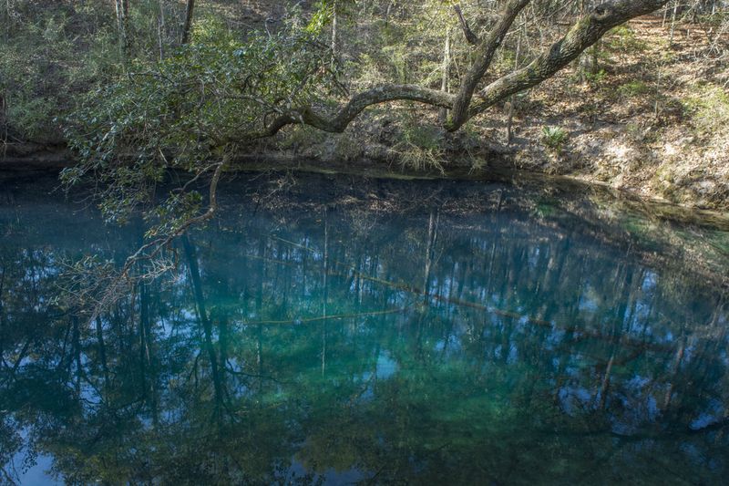
Hammock Sink
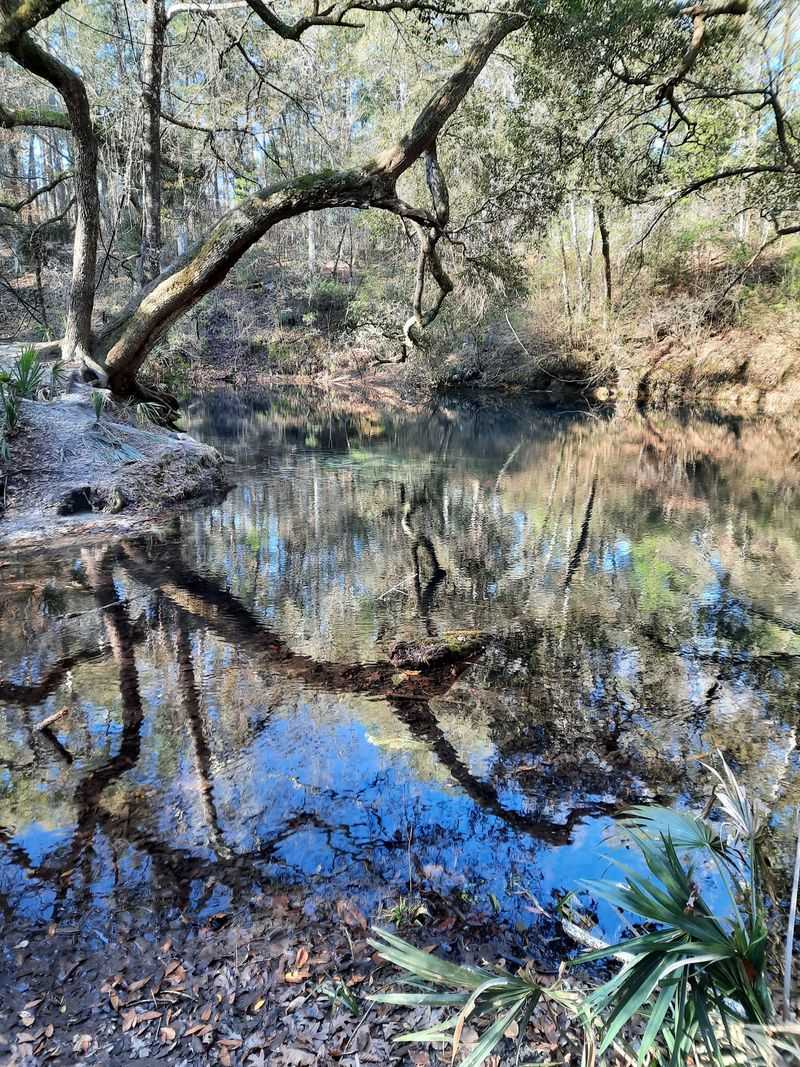
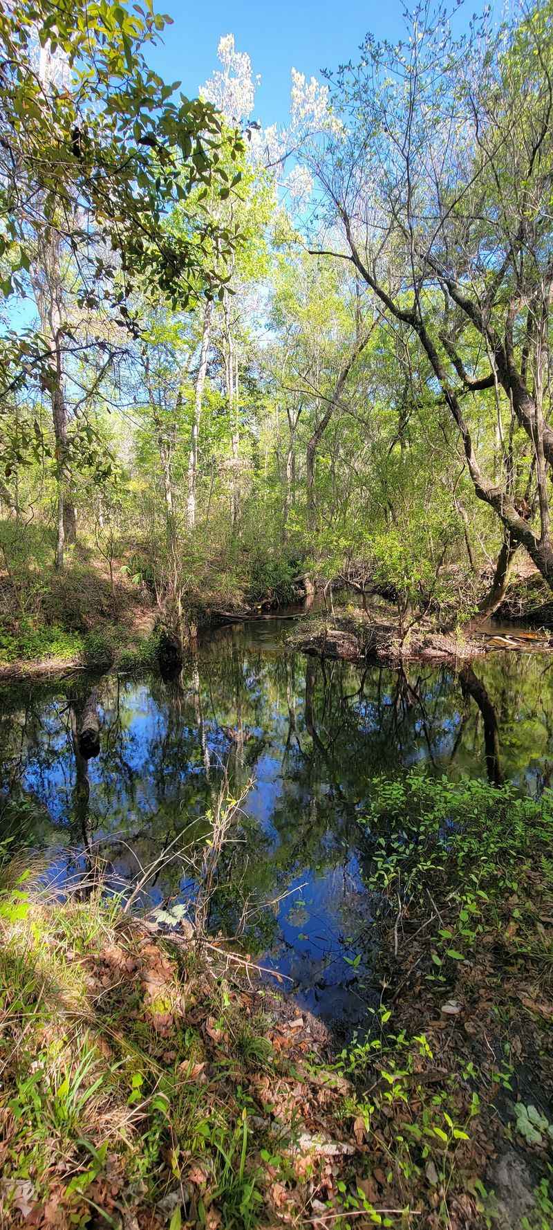
Hammock Sink sits lower on the trail, and the first thing you notice is the water, a still pool that fills the bottom of the depression and reflects the canopy above like a forest mirror.
Unlike Big Dismal, this sinkhole holds water year-round, fed by the aquifer that flows beneath the entire area. I have visited during both wet and dry seasons, and the water level shifts just enough to change the character of the sink, sometimes lapping at the roots of cypress trees, other times retreating to expose more of the limestone base.
The quiet here feels deeper than at other stops along the trail, probably because the water absorbs sound and creates a sense of stillness that invites you to linger.
Turtles sun themselves on half-submerged logs, and I once counted seven of them lined up like little sentinels, completely unbothered by my presence. The surrounding hammock forest grows thick with hardwoods and palms, creating shade that keeps the area cooler even on sweltering summer afternoons.
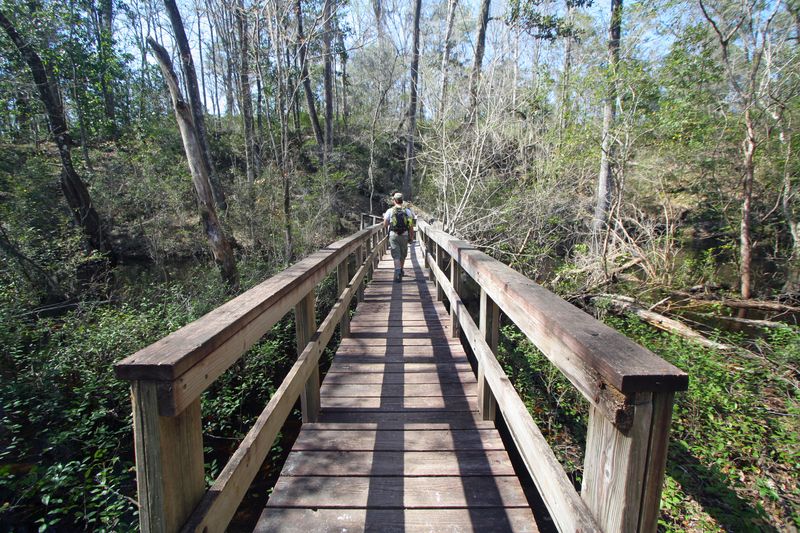
Boardwalks and viewing platforms make it easy to get close without trampling the vegetation, and I appreciate that the park service designed these features to blend into the landscape rather than dominate it.
Photographers love this spot for the reflections, especially in early morning light when the surface stays glassy and the colors pop. I have seen dragonflies skimming the water, their wings catching the sun in quick flashes of iridescence.
The sink reminds me that not all sinkholes are dramatic drop-offs; some settle into gentler depressions that become wetland habitats, supporting a whole different community of plants and animals than the dry forest surrounding them.
You can visit Hammock Sink inside Florida Caverns State Park.
Natural Bridge And Lost Stream
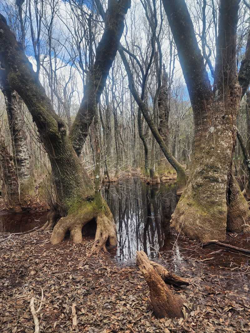
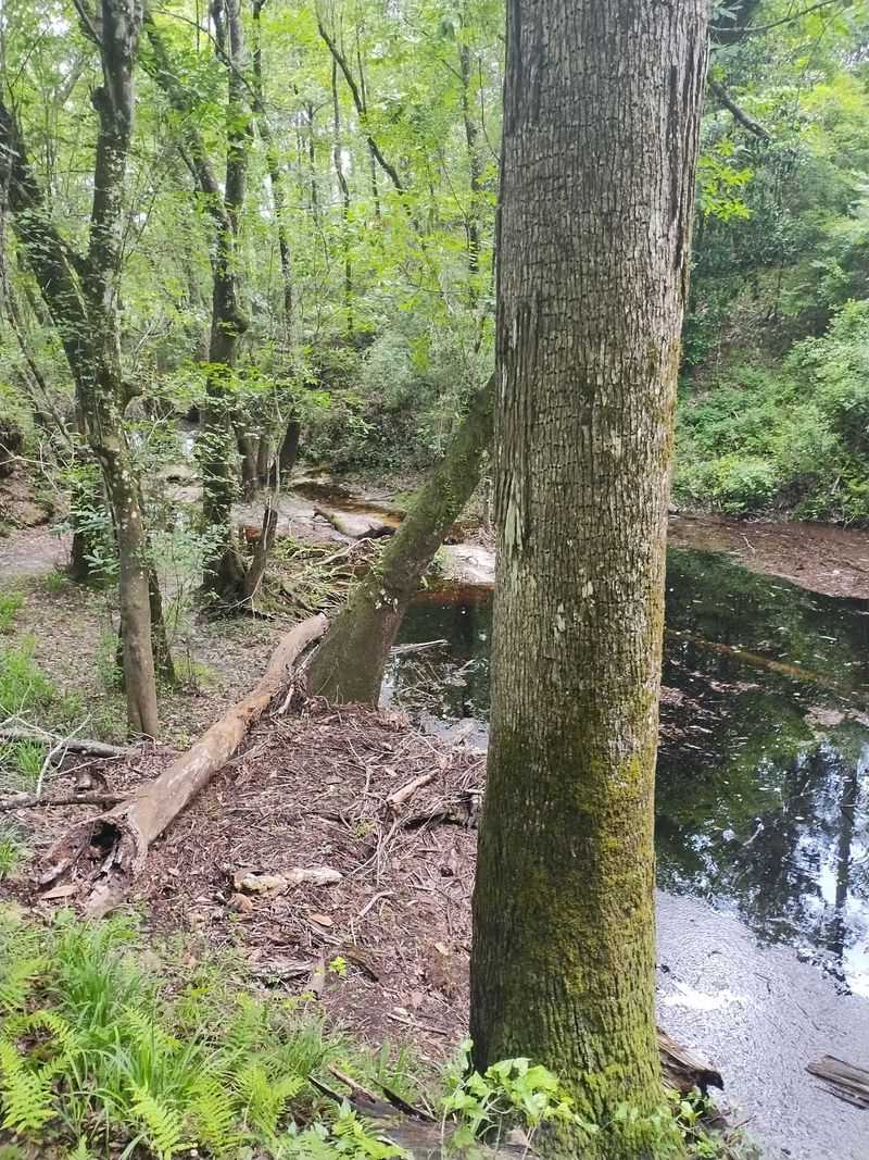
Walking toward Natural Bridge, I always feel a little like I am approaching a magic trick, because the stream that was flowing just upstream suddenly vanishes into the ground, leaving a dry creek bed in its wake.
The natural bridge itself is a limestone arch that formed when part of the cave ceiling remained intact while water carved out the passages below. I have stood on top of the bridge and listened for the sound of water moving beneath my feet, and on quiet days, you can actually hear it gurgling through the underground channels.
The Lost Stream lives up to its name, disappearing into a small cave entrance and reappearing downstream at another sink, a reminder that much of Florida’s water system operates out of sight.
Interpretive signs explain how this feature developed over thousands of years, but the real education happens when you walk the trail and see the progression from flowing stream to vanishing act to resurgence. I have brought friends here who grew up in other parts of the country, and they always react with a mix of confusion and delight, trying to figure out where the water went and why the creek bed stays dry.
Moss and ferns grow along the shaded banks, thriving in the humidity that lingers even when the surface water disappears.
The bridge itself is sturdy enough to walk across, though I always step carefully, aware that I am essentially standing on the roof of an underground river. During heavy rains, the system can overflow, and the Lost Stream becomes a visible creek again, rushing past the bridge and filling the sinkholes downstream.
Those rare moments offer a glimpse of how the landscape functioned thousands of years ago, before the caves grew large enough to swallow most of the flow.
Gopher Tortoise Habitat
Gopher tortoises own this trail in a way that no other creature does, and I have learned to watch my step because their burrows dot the sandy soil along several stretches of the loop.
These ancient reptiles dig deep tunnels that provide shelter for dozens of other species, earning them the title of keystone species in Florida’s upland ecosystems. I have spotted tortoises munching on wiregrass and low vegetation near the trail, moving with the kind of unhurried confidence that comes from having survived on this planet for millions of years.
Their shells show the wear of long lives, etched with growth rings and sometimes scarred from encounters with predators or vehicles, though the protected habitat here keeps them relatively safe.
The burrows themselves are engineering marvels, extending up to 40 feet underground and angled to stay cool in summer and warm in winter. I once watched a tortoise back into its burrow after a morning of foraging, pulling itself in with surprising speed and disappearing from view in seconds.
The sandy mounds at burrow entrances are easy to spot, and interpretive signs remind hikers to give these homes a wide berth, since disturbing a burrow can force the tortoise to abandon it and start over elsewhere.
Gopher tortoises face threats across Florida from habitat loss and disease, making protected areas like Leon Sinks crucial for their survival. I have seen young tortoises, too, their shells still soft and bright, poking around the edges of the trail as they learn to navigate their territory.
Every sighting feels like a small privilege, a chance to share the path with creatures that have called this landscape home far longer than humans have been building cities nearby.
Longleaf Pine Forest
Longleaf pines tower over much of the trail, their trunks rising straight and tall before branching into crowns that filter sunlight into dappled patterns on the forest floor.
These trees once dominated the southeastern United States, covering millions of acres before logging and development reduced their range to a fraction of the original. Walking through the longleaf sections at Leon Sinks feels like stepping into Florida’s ecological past, when fire-adapted pines shaped the landscape and supported a web of species that evolved alongside them.
The pines here are relatively young compared to old-growth stands, but they still reach impressive heights, and their long needles carpet the ground in thick layers that crunch underfoot.
I have learned to recognize the distinctive bark, with its scaly plates that resist fire damage, and the massive cones that litter the trail in late summer. Wiregrass grows beneath the pines, another fire-dependent species that thrives in the open understory these trees create.
Prescribed burns keep the forest healthy, clearing out undergrowth and allowing the pines to regenerate, and I have visited shortly after a burn to see the blackened ground already sprouting new growth.
The longleaf ecosystem supports red-cockaded woodpeckers, gopher tortoises, and dozens of other species that depend on this specific habitat structure. I have watched woodpeckers hammer at the pine trunks, their calls echoing through the open forest, and I have seen fox squirrels, larger and more silver than their gray cousins, bounding across the trail.
The pines also produce a resin that smells sharp and clean, especially on hot days, and that scent has become one of my favorite trail memories, a reminder of why protecting these forests matters.
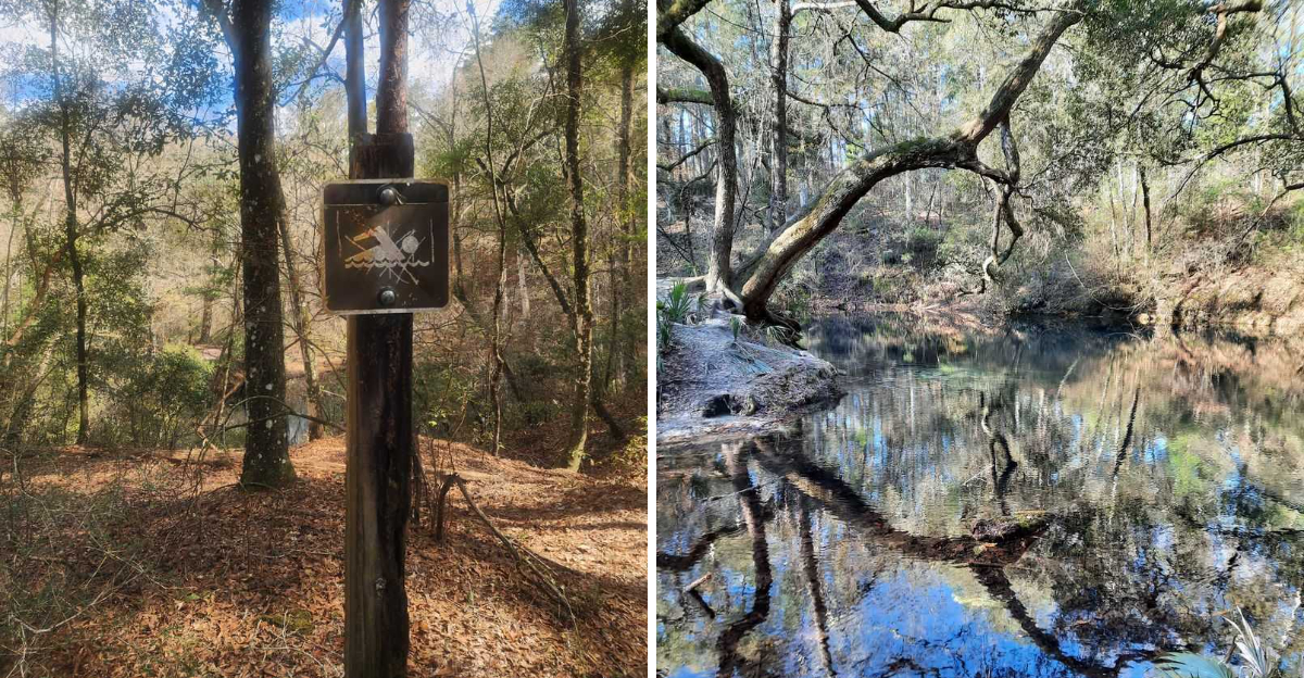
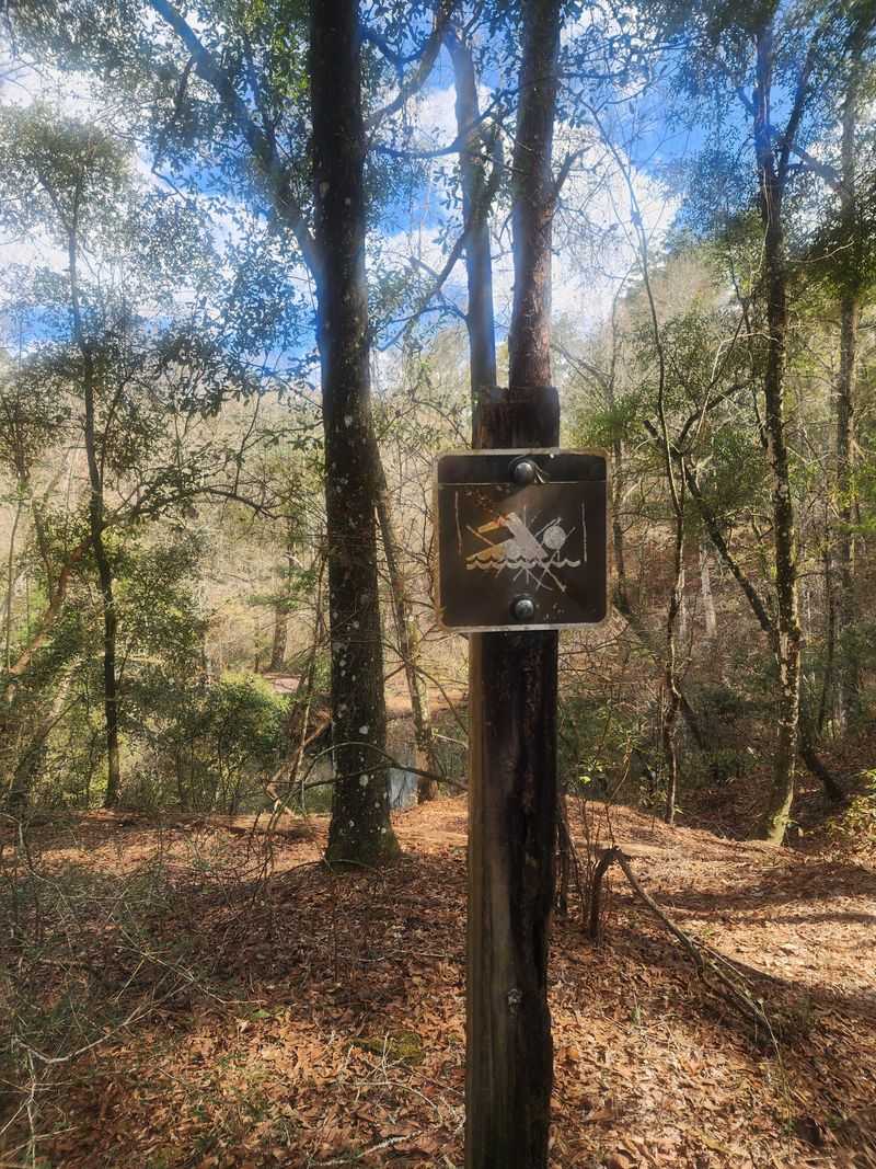
Wet Sink And Cave Access
Wet Sink lives up to its name, holding a pool of water so clear you can see straight down to the cave entrance that divers use to access the underwater passages below.
I have stood at the edge of this sink and watched certified cave divers gear up, checking their lights and tanks before slipping beneath the surface and disappearing into the darkness. The water stays around 68 degrees year-round, fed by the aquifer, and on cold mornings, steam rises from the surface in ghostly wisps.
This is one of the few places where you can actually see the connection between the surface landscape and the vast cave systems that honeycomb the limestone beneath Leon Sinks.
Interpretive signs warn non-divers to stay out of the water, and for good reason: cave diving ranks among the most dangerous forms of diving, requiring specialized training and equipment. I have talked with divers who explore these systems, and they describe cathedral-like chambers, narrow passages, and crystal-clear visibility that makes the risk worthwhile.
The underwater caves connect to other sinks in the area, forming a network that extends for miles beneath the forest.
From the surface, Wet Sink looks deceptively calm, just a round pool surrounded by trees and limestone ledges. But knowing what lies below adds a layer of mystery to the view, and I have spent more time than I care to admit staring into that water, imagining the hidden world just out of reach.
The sink also serves as a research site, helping scientists understand how the aquifer functions and how water moves through the karst landscape, information that matters for managing Florida’s water resources.
Trail Logistics And Seasonal Highlights
Planning your visit to Leon Sinks requires a bit of strategy, especially if you want to avoid the midday heat that can make Florida hiking feel like a test of endurance rather than a pleasant outing.
The park opens at 8 AM and closes at 6 PM, and I have found that arriving early gives you the best chance of spotting wildlife and enjoying cooler temperatures. The 3.6-mile loop is well-marked, with color-coded trail posts that guide you past all the major sinkholes and geological features, and the terrain stays relatively flat, making it accessible for most fitness levels.
I always carry more water than I think I need, because the humidity here can drain you faster than the mileage suggests.
Seasonal variations bring different experiences to the trail, with spring offering wildflowers and migrating birds, summer bringing afternoon thunderstorms that can roll in quickly, and fall delivering cooler weather and lower water levels in some sinks. Winter is my favorite time to hike here, when the temperature drops into the 50s and 60s and the forest feels crisp and quiet.
The park provides picnic tables near the trailhead, and I have packed lunch more than once to enjoy after completing the loop.
Cell service is spotty once you leave the parking area, so download trail maps before you arrive, and let someone know your plans if you are hiking alone. The trail surface alternates between sand, limestone, and wooden boardwalks, so sturdy shoes with good traction make the experience more comfortable.
I have hiked this loop in running shoes and hiking boots, and I prefer the latter for the ankle support they provide on uneven sections. Every visit reminds me that this trail packs remarkable diversity into a relatively short distance, making it one of the best ways to experience Florida’s karst geology without needing a full day or advanced hiking skills.