This Scenic Colorado Drive Will Lead You To Castles, Ghost Towns, And Stunning Mountain Views
Some roads are built for getting somewhere fast, and then there are roads like this, created to remind travelers that the journey can be the destination.
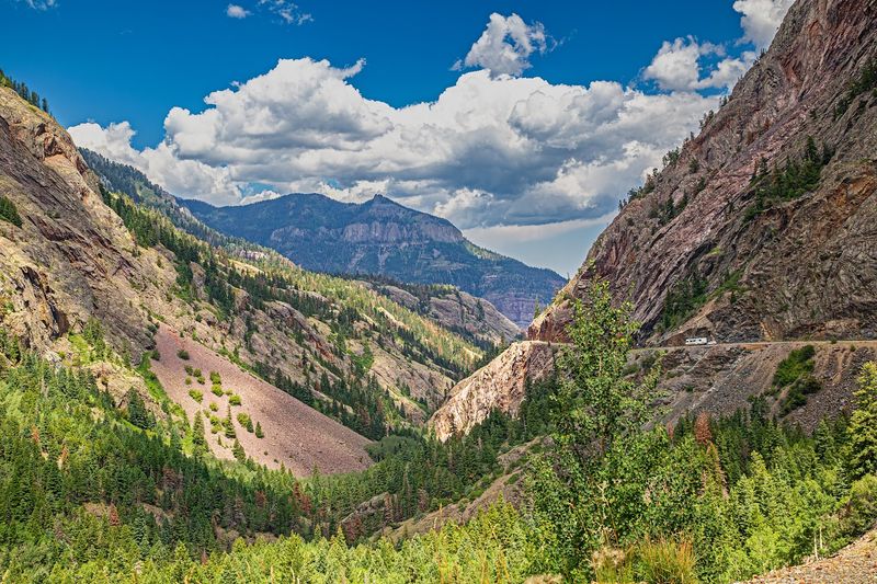
Stretching roughly 63 miles through the rugged San Juan Mountains of southwestern Colorado, this high elevation route links the historic communities of Ouray and Silverton while weaving through some of the most dramatic alpine scenery on the continent.
In Colorado, scenic drives often come with jaw dropping views, but few feel as raw and immersive as this one. Around each bend, crumbling ghost towns stand as quiet reminders of a booming mining era, while jagged peaks rise sharply against endless blue skies.
Wide valleys open below, dotted with wildflowers in summer and dusted with snow in colder months. Colorado’s untamed beauty reveals itself mile after mile, rewarding patient drivers with unforgettable vistas.
For anyone craving a road trip that feels adventurous and deeply satisfying, this is the route to plan.
Quick Snapshot: What The Alpine Loop Actually Is
Before you load up the truck and point it toward the San Juans, it helps to know exactly what you are signing up for. The Alpine Loop Back Country Byway is a 63-mile off-road route that cuts through the heart of Colorado’s most dramatic mountain terrain, connecting the towns of Ouray and Silverton through a landscape that feels almost deliberately cinematic.
This is not a paved scenic highway with guardrails and rest stop vending machines. It is a genuine backcountry experience that requires a high-clearance, four-wheel-drive vehicle and a driver who knows how to use it.
The route passes through alpine meadows, over high mountain passes, and through the remnants of a mining era that defined this entire region.
Quick Snapshot:
– Name: Alpine Loop Back Country Byway
– Type: Off-road backcountry byway
– Setting: High alpine terrain, San Juan Mountains
– Location: Between Ouray and Silverton, Colorado
– Arrival: Start near Ouray, CO 81427, or from the Silverton side
– Distance: Approximately 63 miles total loop
The loop can be started from either Ouray or Silverton, giving you flexibility depending on where you are staying. Plan for a full day at minimum, because rushing this route is both dangerous and a genuine waste of what it has to offer.
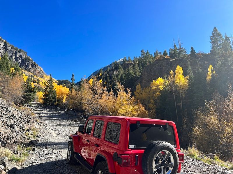
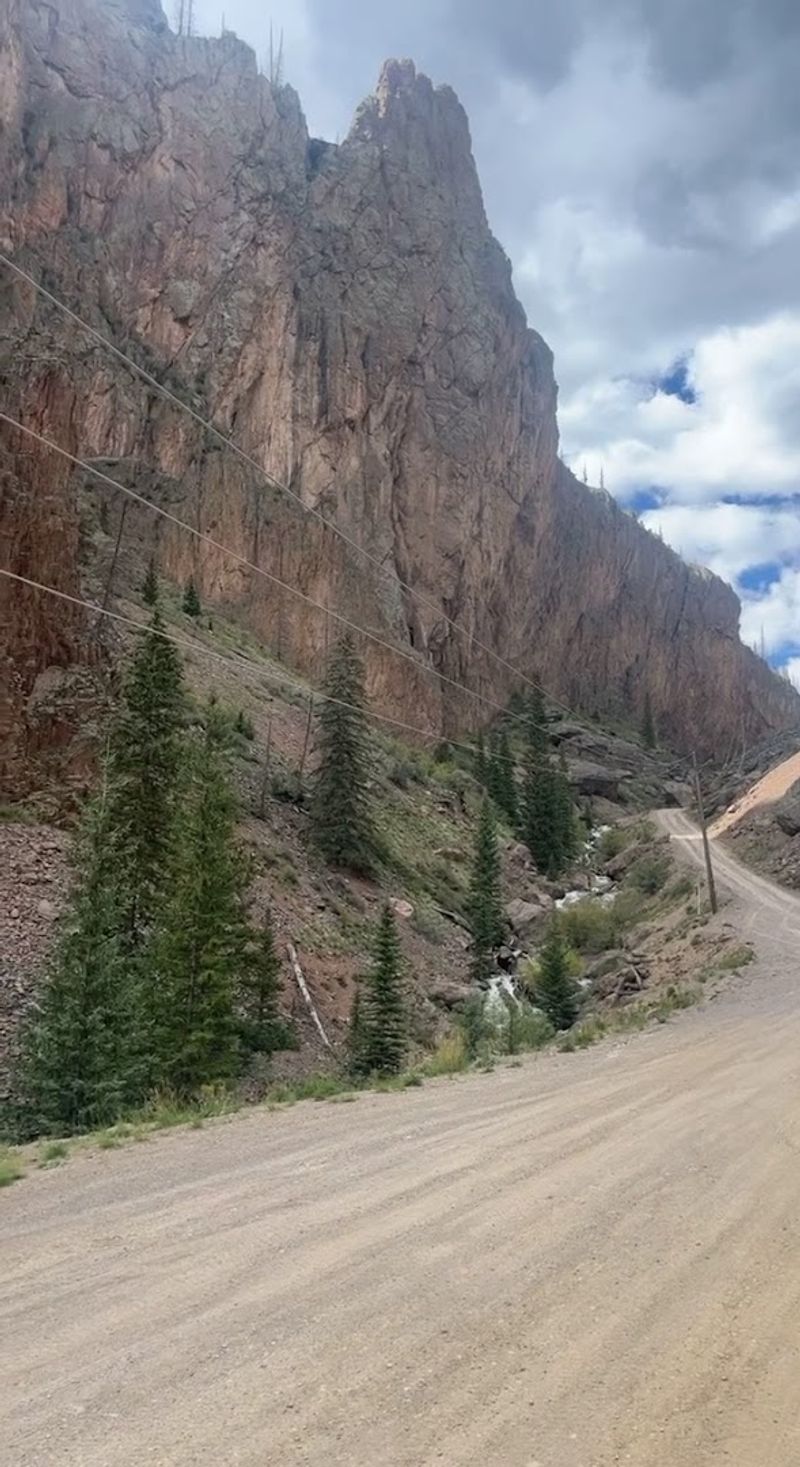
The Road Less Paved: Understanding The Terrain
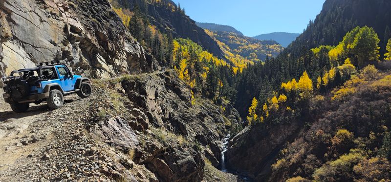
There is a particular kind of humility that a shelf road instills in you, and the Alpine Loop delivers that lesson with patience and stunning efficiency. The route includes narrow passages carved into the sides of steep mountain faces, where the road is barely wide enough for one vehicle and the drop on one side is not something you want to measure.
Reviewers consistently flag the shelf roads as the moments that separate the confident off-roaders from those who perhaps should have rented a guided tour. One driver noted that cell service is limited throughout and that two-way traffic on single-lane sections means you need to look ahead, move slowly, and be ready to squeeze past oncoming vehicles with calm precision.
Pro Tip: If you are not comfortable with heights or tight off-road maneuvering, consider joining an experienced group or hiring a local guide service out of Ouray before attempting the loop solo.
The rocky surface is unforgiving on standard highway tires, and sharp rocks are a real flat-tire risk. Multiple reviewers reported scraping skid plates and one noted running just barely enough clearance to make it through.
Aim for at least 12 inches of ground clearance if you want a comfortable margin of safety. The terrain rewards preparation and punishes overconfidence, which, honestly, is a fair arrangement for a road this spectacular.
Animas Forks Ghost Town: Where History Went Quiet
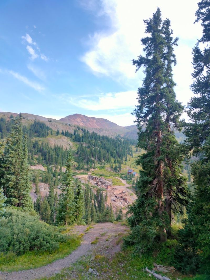
Standing in Animas Forks on a clear summer morning, with the wind cutting through the ruins of buildings that have not heard a human voice in over a century, you get a rare and slightly unsettling sense of just how quickly a place can go from boomtown to punchline. At its peak, Animas Forks was a working mining community perched above 11,000 feet, with a post office, a newspaper, and enough ambition to fill a history book.
Today it is one of the best-preserved ghost towns in Colorado, and passing through it on the Alpine Loop feels like flipping through a photo album that nobody claimed. The wooden structures are still standing in various states of dignified collapse, and the surrounding peaks make for a backdrop so dramatic it almost feels staged.
Why It Matters: Animas Forks is not just a scenic stop. It is a direct window into the silver and gold mining era that shaped this entire region of Colorado, and it costs nothing to walk through and explore on foot.
Wildflowers tend to bloom aggressively around the ruins in summer, creating a visual contrast between decay and renewal that photographers absolutely love. Give yourself at least 30 to 45 minutes here to walk the area, read the informational markers, and absorb the strange, quiet energy of a place that once had everything and then simply did not.
It is one of the most memorable stops on the entire loop.
Starting From Ouray: The Switzerland Of America Entry Point
Ouray has a nickname that it wears without any apparent embarrassment: the Switzerland of America. Tucked into a box canyon at around 7,800 feet, it is surrounded on nearly all sides by vertical mountain walls that make the town feel less like a Colorado destination and more like something a set designer would build if given an unlimited budget and a fondness for Victorian architecture.
Starting the Alpine Loop from Ouray is the more popular choice, and for good reason. The town itself is worth arriving a day early to explore, and the trailhead staging area just outside of town provides enough parking for 4×4 vehicles, though reviewers note it is not suitable for long trailers.
One reviewer described it plainly as having enough space for staging off-road vehicles but cautioned against bringing anything oversized.
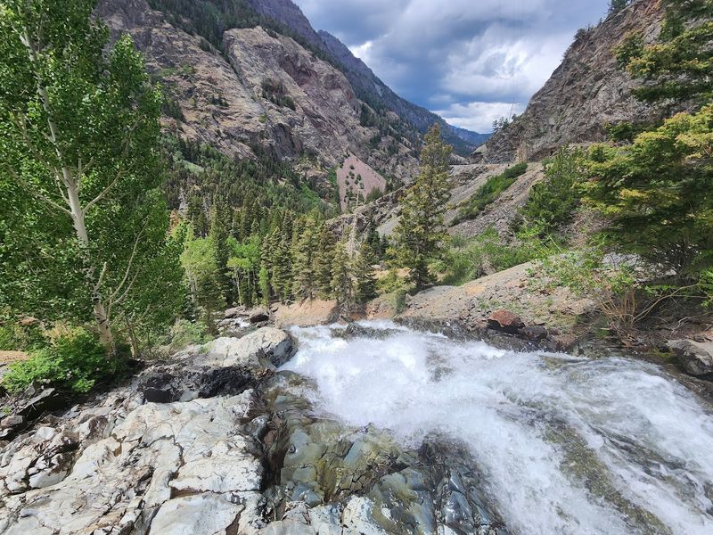
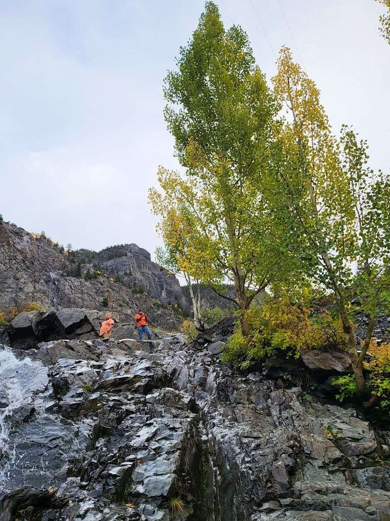
Insider Tip: Across the street from the loop’s start point, there is a waterfall with a short walk down to a small cave entrance. It is a quick but genuinely worthwhile stop before you commit to the full backcountry miles ahead.
Ouray sits along the famous Million Dollar Highway, which itself offers two roadside waterfalls worth stopping at even before the loop begins. If you are traveling with family members who may not be up for the full off-road experience, Ouray alone offers enough scenery and walkable character to make the trip worthwhile.
Think of it as the civilized warm-up act before the main event.
Silverton: The Other End Of The Story
If Ouray is the polished entry point, Silverton is the town that wears its mining history like a badge it has never bothered to polish. Sitting at just over 9,300 feet, it is one of the highest incorporated towns in Colorado, and the architecture along its main street has the kind of stubborn, weathered dignity that only comes from surviving over a century of hard winters and economic uncertainty.
Silverton serves as the other anchor of the Alpine Loop, and arriving here after completing the backcountry miles from Ouray produces a satisfying sense of accomplishment that is difficult to manufacture any other way. The town connects to the loop and also links up with Lake City via the byway, giving experienced drivers multiple routing options depending on how much time and fuel they have available.
Best For: History enthusiasts, photographers, and anyone who wants to bookend a serious backcountry drive with a town that has actual restaurants, a gas station, and a main street worth a slow afternoon walk.
The Durango and Silverton Narrow Gauge Railroad also terminates here, meaning you can occasionally watch a genuine steam locomotive pull into town while you are catching your breath after the loop. Silverton does not try to be charming in a manufactured way.
It simply exists, authentically and at altitude, and that straightforward quality is exactly what makes it the right ending for a drive this honest about what it is.
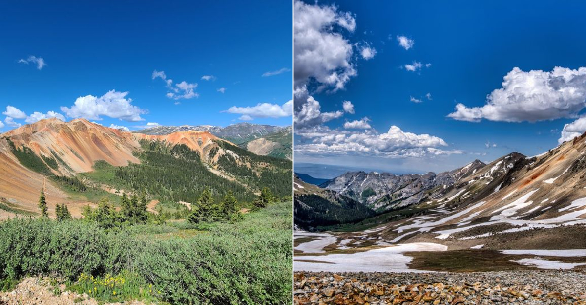
Alpine Wildflowers And High-Altitude Scenery Along The Route
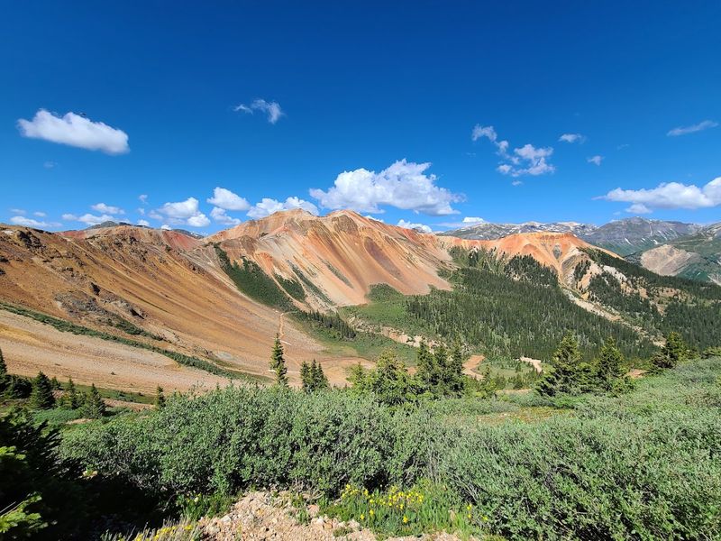
There is a specific moment on the Alpine Loop, somewhere above treeline with nothing but open sky and a carpet of wildflowers in every direction, where it becomes genuinely difficult to keep your eyes on the road. Reviewers have mentioned the wildflowers repeatedly, with one simply noting they are always gorgeous, which undersells them considerably but captures the sentiment accurately enough.
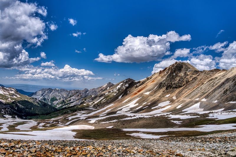
The route climbs through multiple ecological zones, transitioning from forested lower slopes to exposed alpine tundra where the vegetation becomes low, hardy, and extraordinarily colorful during peak bloom season. Summer visits, particularly July and August, tend to offer the most dramatic floral displays, though the exact timing shifts depending on snowpack and elevation.
Quick Tip: Bring a camera with a zoom lens if you have one. The combination of wildflowers in the foreground and jagged peaks in the background creates the kind of layered composition that makes for genuinely exceptional photos without requiring any particular skill beyond stopping the vehicle and pointing.
The sweeping valley views that open up at higher elevations are equally impressive, offering long sight lines across terrain that has remained essentially unchanged since the mining era. One reviewer used the word majestic, which is technically a single word but somehow manages to carry the full weight of what the landscape actually delivers.
The scenery along this route is not subtle, and it does not need to be. It earns every superlative thrown at it.
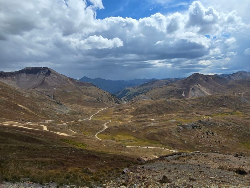
Mid-Route Check-In: The Drive Gets Even Better From Here
Somewhere around the midpoint of the Alpine Loop, a useful thing happens: you stop thinking about the logistics and start simply experiencing the place. The early nerves about clearance and shelf roads have either resolved themselves or you have already turned around, and what remains is a genuinely extraordinary stretch of Colorado backcountry that very few people ever see from this angle.
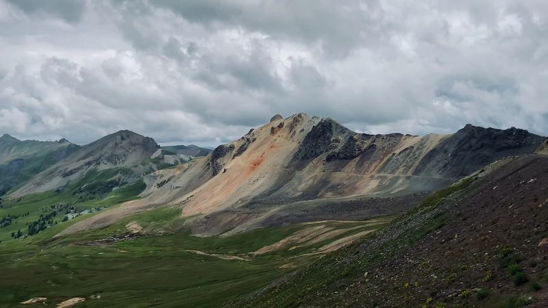
The route passes through terrain that shifts constantly, from narrow rocky canyons to open high-altitude basins where the horizon seems to extend indefinitely. The mining history becomes more visible here too, with remnants of old settlements and ore processing equipment scattered across the landscape in various states of photogenic decay.
Why It Matters: The middle section of the loop is where the combination of historical remnants and natural scenery reaches its highest density. Slowing down here is not optional if you want to get the full value of the drive.
Cell service remains limited throughout this stretch, which is either a feature or a bug depending on your relationship with your phone. One reviewer noted it as a practical concern for safety planning, while most others seemed to treat the disconnection as part of the appeal.
Bring a physical map or a downloaded offline route, let someone know your itinerary before you leave, and embrace the particular freedom that comes from being genuinely unreachable for a few hours in one of the most beautiful places in Colorado. The second half of the loop delivers everything the first half promised.
Abandoned Mining Settlements: Reading The Ruins
The San Juan Mountains were, for several decades in the late 1800s and early 1900s, among the most economically significant landscapes in North America. Silver and gold brought thousands of people to elevations where common sense might have suggested otherwise, and the evidence of that ambition is still visible all along the Alpine Loop in the form of collapsed buildings, rusted machinery, and mine portals cut directly into the mountain faces.
These are not manicured historical sites with interpretive signs at every turn. They are raw, unmediated remnants of a working industrial past, and the experience of encountering them in the middle of such dramatic natural scenery creates a particular kind of reflection that is hard to replicate anywhere else.
The Mineral Creek drainage area, mentioned by one reviewer as having some mining history worth noting, is among the sections where these remnants are most visible.
Planning Advice: Some mining structures are unstable and should be viewed from a safe distance rather than explored directly. The combination of altitude, remote location, and aging construction makes casual exploration of enclosed structures genuinely risky.
What makes these sites so compelling is the contrast they create. A rusted ore cart sitting in a meadow full of wildflowers tells a more complete story than any museum exhibit could manage, because it puts the human effort directly alongside the natural world that outlasted it.
The Alpine Loop is as much a history lesson as it is a scenic drive, and the abandoned settlements are where that lesson lands with the most force.
Vehicle Requirements: What You Actually Need To Complete The Loop
The single most consistent piece of advice from everyone who has driven the Alpine Loop is also the simplest: bring the right vehicle or do not go. This is not a route where optimism compensates for inadequate equipment, and the landscape has a reliable way of making that point clearly and expensively.
High clearance of at least 12 inches is the figure most experienced drivers cite as a reasonable minimum. Four-wheel drive is non-negotiable, not just recommended.
Standard highway tires dramatically increase the risk of a flat on the sharp rocky sections, and all-terrain tires are the practical choice for anyone planning to complete the full loop without incident. One reviewer noted running 9-inch clearance with all-terrain tires and described the experience as barely making it through, which is not the kind of margin most people find comfortable.
Common Mistakes To Avoid:
– Attempting the loop in a standard SUV or passenger car
– Relying on highway tires on sharp rock sections
– Starting the loop late in the day without accounting for the full time required
– Assuming cell service will be available for navigation or emergency calls
Stock Jeep-style vehicles and side-by-sides handle the route well according to multiple reviewers, and full-size trucks with proper clearance are also confirmed capable. The key is honest self-assessment before you leave the pavement behind.
The loop rewards preparation generously and charges a steep price for shortcuts. Bring recovery gear, carry extra water, and go prepared to handle minor issues without outside help.
Best Time To Go: Seasons, Snow, And Timing The Loop Right
Timing matters on the Alpine Loop in a way that it simply does not on most drives. The route sits at high elevation, and portions of it remain snowbound well into summer, with some sections not reliably passable until late June or even early July depending on the year.
Attempting the loop before conditions are ready is one of the more reliable ways to turn an adventure into an ordeal.
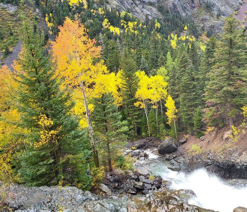
July and August represent the sweet spot for most visitors, offering the best combination of passable roads, peak wildflower bloom, and long daylight hours for completing the full 63-mile route without rushing. September can also be spectacular, with early fall color adding a different visual dimension to the alpine landscape, though weather can change rapidly at altitude and afternoon thunderstorms are a genuine consideration throughout the summer months.
Quick Tip: Check weather radar before departing, as multiple reviewers emphasized. A clear morning can turn into a lightning-and-hail situation at elevation within a matter of hours, and there is very little shelter available once you are deep in the backcountry.
One reviewer noted that the route gets significantly more crowded during school vacation periods and peak summer weekends, which affects both the experience and the practical logistics of navigating single-lane sections with heavy traffic. Early morning starts on weekdays tend to offer the most peaceful conditions.
The loop is typically closed from late fall through spring, so confirm current road conditions through the Bureau of Land Management before making the drive.
Who This Drive Is For And Who Should Think Twice
The Alpine Loop is genuinely one of the great backcountry drives in the American West, and it is also genuinely not for everyone, which is worth saying plainly rather than burying in fine print. The combination of technical terrain, remote location, limited cell service, and real consequences for vehicle or driver shortcomings makes honest self-assessment a necessary part of trip planning.
Who This Is For:
– Experienced 4×4 drivers with high-clearance vehicles and all-terrain tires
– History enthusiasts drawn to ghost towns and mining-era remnants
– Photographers and outdoor adventurers comfortable with backcountry conditions
– Families with older children who have the right vehicle and off-road experience
– Anyone who wants a full-day Colorado experience that goes well beyond the typical scenic pullout
Who This Is Not For:
– Drivers in standard passenger cars or low-clearance SUVs
– Anyone uncomfortable with heights, narrow shelf roads, or two-way traffic on single-lane sections
– Travelers with time pressure who cannot commit to a full day on the route
– Those who need reliable cell service throughout their trip
One reviewer offered a notably useful piece of advice for drivers on the edge of qualification: come with an experienced friend who can spot for you on the difficult sections. That is not a workaround for having the wrong vehicle, but it is a sensible approach for capable drivers who want an extra margin of confidence on their first run through the loop.
The route rewards respect and preparation in equal measure.
Final Verdict: A Colorado Drive That Earns Every Mile
There are scenic drives, and then there are experiences that reorganize your sense of what a road trip can actually be. The Alpine Loop Back Country Byway belongs firmly in the second category.
Sixty-three miles of alpine terrain, ghost towns, abandoned mining history, and mountain scenery that operates at a scale that makes most other landscapes feel modest by comparison.
The route is not easy, and it is not trying to be. It asks for a capable vehicle, a prepared driver, a full day, and the willingness to be genuinely far from the nearest gas station or cell tower for extended stretches.
In return, it delivers the kind of Colorado that most visitors never see from the paved roads, the version that has not been smoothed out or made convenient.
Key Takeaways:
– The Alpine Loop runs approximately 63 miles between Ouray and Silverton, Colorado
– High clearance 4×4 vehicles with all-terrain tires are required, not optional
– Animas Forks ghost town is the standout historical stop along the route
– Best visited July through early September; confirm road conditions before departing
– Plan for a full day and carry water, recovery gear, and an offline map
– Cell service is limited throughout; inform someone of your itinerary before you go
If you have the right vehicle and the inclination for a road that demands something real from you, the Alpine Loop will pay that investment back with interest. Few drives in Colorado, or anywhere else, offer this particular combination of history, terrain, and raw mountain beauty in a single continuous experience.