Travelers Are Calling This Colorado Road Trip The Ultimate Adventure Of 2026
Somewhere in the back of every road tripper’s imagination lives a highway so breathtaking it feels almost unreal, and this loop through Southwestern Colorado fits that vision perfectly.
Spanning roughly 236 miles, the drive carries travelers across soaring mountain passes, through rugged canyons, and into valleys that seem painted by hand.
In Colorado, scenic byways are part of the culture, yet few routes combine natural beauty and history so seamlessly. Along the way, you will pass through storied former mining towns, glimpse ancient cliff dwellings carved into sandstone walls, and round curves that reveal sweeping vistas before your coffee has time to cool.
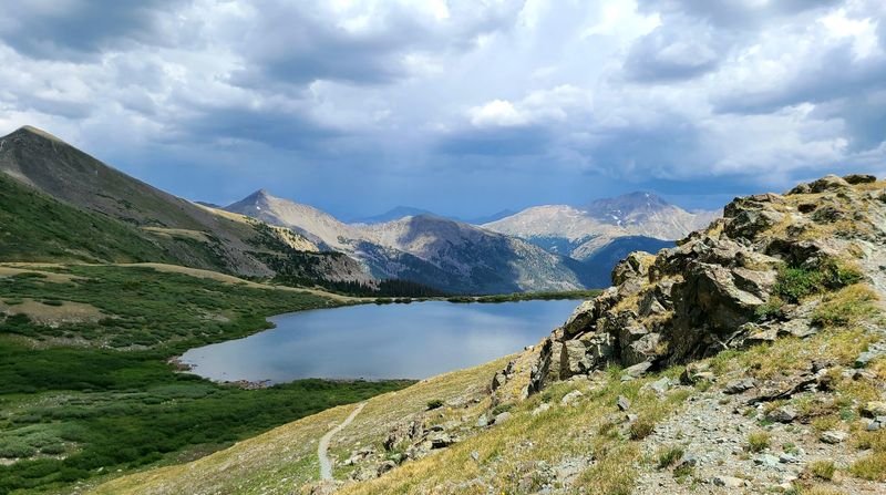
Colorado’s dramatic landscapes shift with every mile, from dense forests to wide open alpine stretches that make you pause just to take it all in. As 2026 approaches, more travelers are placing this unforgettable loop at the top of their lists for good reason.
Whether shared with family or savored solo, it delivers an experience that feels both humbling and exhilarating.
What the San Juan Skyway Loop Actually Is
The San Juan Skyway Scenic Byway Loop is a federally designated All-American Road stretching approximately 236 miles through Southwestern Colorado. It connects the towns of Durango, Silverton, Ouray, Ridgway, Telluride, Dolores, and Cortez in one continuous, driveable loop.
The route climbs through four mountain passes — including the legendary Red Mountain Pass — and passes through both the San Juan Mountains and the Colorado Plateau. Elevations along the drive range from around 6,500 feet to over 11,000 feet, so the scenery shifts dramatically as you travel.
The byway is open year-round in most sections, though winter driving on the high passes requires preparation and caution. Summer and fall are peak seasons, with autumn foliage drawing particularly large crowds between mid-September and mid-October.
Why It Matters: This isn’t just a pretty drive. It’s a route that threads together geology, history, and culture into a single, cohesive experience that rewards slow travel far more than a rushed day trip ever could.
Red Mountain Pass: The Drive That Makes Everyone Pull Over Twice
There are mountain passes, and then there is Red Mountain Pass. Sitting at 11,018 feet along U.S.
Highway 550 between Silverton and Ouray, this stretch of road is the kind of thing that makes passengers grip the door handle and stare out the window in equal measure.
The pass earns its name honestly. The surrounding peaks are stained a deep, rusty crimson from iron oxide and other minerals left behind by centuries of mining and volcanic activity.
Pull off at any one of the small gravel turnouts and you’ll feel like you’ve landed on a completely different planet — one that happens to have a guardrail-free highway running straight through it.
Pro Tip: Drive this section in the morning when light hits the red peaks from the east. The color contrast against a blue Colorado sky is genuinely unlike anything else on the loop.
The road narrows considerably in places, and the drop-offs are real. Confident drivers will find it thrilling; nervous ones will find it character-building.
Either way, most people stop at least twice because the views simply demand it.
Ouray sits at the northern base of the pass and offers a perfect reward after the descent — hot springs, a walkable downtown, and the kind of small-town relief that feels earned after gripping a steering wheel through switchbacks. Best For: Photographers, geology enthusiasts, and anyone who genuinely enjoys a road that takes itself seriously.
Ouray: The Switzerland of America That Actually Earns the Nickname
Most towns that claim a flattering European nickname are overselling themselves by a considerable margin. Ouray, Colorado, is a rare exception.
Tucked inside a narrow box canyon at 7,792 feet, it is genuinely hemmed in on three sides by sheer cliff walls that soar over a thousand feet above the rooftops.
The town itself is small — a few thousand residents — but it punches well above its weight in character. The main street is lined with well-preserved Victorian-era buildings that date back to the silver mining era, and the whole place has the satisfying feeling of a town that never had any reason to tear itself down and start over.
Insider Tip: The Ouray Hot Springs Pool sits right in town and is one of the most visited natural hot spring facilities in Colorado. After hours in the car navigating mountain passes, soaking in geothermally heated water with canyon walls rising around you is a genuinely memorable experience.
Ouray also serves as the self-proclaimed Ice Climbing Capital of the World, drawing athletes every winter to the Ouray Ice Park — a free public ice park built in a natural gorge just south of downtown. Summer visitors can hike the surrounding trails, many of which access old mining roads and waterfalls within a mile or two of the main street.
Best For: Couples, families, and solo travelers who want a walkable base camp with real mountain atmosphere and a hot spring within easy walking distance of dinner.
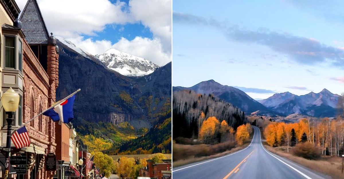
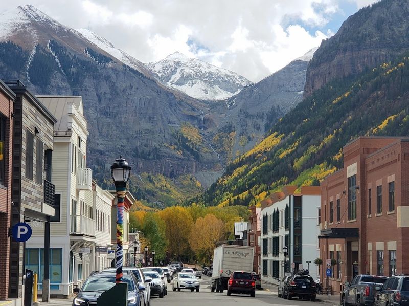
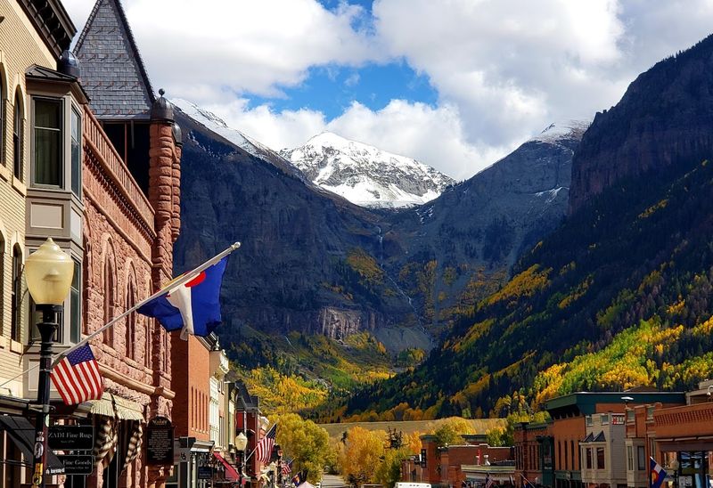
Telluride: The Mountain Town That Refuses to Be Ordinary
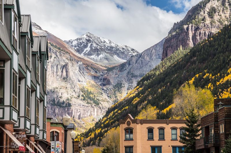
Telluride has always had a flair for the dramatic, and that starts with the geography. The town sits at the end of a box canyon at 8,750 feet, surrounded by peaks that push past 14,000 feet.
The only way in by road is through a single canyon entrance, which gives the whole place the feeling of a secret that geography is actively trying to keep.
The free gondola connecting Telluride to Mountain Village is one of the genuinely clever pieces of infrastructure in American mountain towns. It runs year-round, offers sweeping views of the surrounding San Juans, and costs absolutely nothing — which is the kind of thing that makes you feel unreasonably pleased with yourself for discovering it.
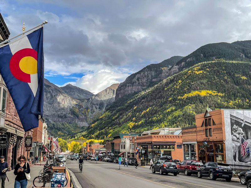
Quick Tip: Colorado Avenue, Telluride’s main street, is one of the most photogenic stretches of road on the entire loop. Walk it in the early morning before the crowds arrive and the light is still low on the canyon walls.
The town hosts a remarkable number of festivals throughout the year — film, bluegrass, jazz, and more — so checking the calendar before your visit can turn a good stop into a genuinely memorable one. That said, Telluride rewards visitors even on the quietest midweek days in the off-season.
Who This Is For: Festival-goers, architecture lovers, and anyone who wants a mountain town that feels alive without requiring a guidebook to navigate. Who This Is Not For: Travelers looking for a quick 30-minute stop — Telluride asks for more time than that and is worth every minute.
Mesa Verde National Park: Ancient History Built Into the Cliffs
Around the halfway point of the San Juan Skyway Loop, the scenery shifts from alpine drama to something altogether older and quieter. Mesa Verde National Park sits on a broad, forested plateau above the Montezuma Valley, and it holds one of the most remarkable archaeological sites in North America.
The Ancestral Puebloans built elaborate stone communities into the natural alcoves of the canyon walls here, some rising to four stories and containing hundreds of rooms. Cliff Palace, the largest cliff dwelling in North America, contains approximately 150 rooms and 23 kivas.
It was occupied from roughly 600 CE to 1300 CE — a civilization that predates the founding of most European nations.
Planning Advice: Ranger-guided tours are required to enter Cliff Palace and several other major dwellings, and they sell out. Book tickets through recreation.gov well in advance, especially for summer visits.
Self-guided viewing areas exist but don’t offer the same access or context.
The park’s Chapin Mesa Archeological Museum is a genuinely informative stop that helps frame what you’re seeing before you walk out to the overlooks. Kids and adults alike tend to leave Mesa Verde with more questions than they arrived with — which is exactly how a good cultural site should work.
Best For: Families with curious kids, history enthusiasts, and anyone who wants the loop to offer more than mountain scenery. Mesa Verde is the moment the San Juan Skyway becomes something more than just a beautiful drive.
Durango: The Loop’s Most Livable Anchor Town
Most road trips have a town that functions as the emotional anchor — the place you leave from, return to, and think about most fondly afterward. For the San Juan Skyway Loop, that town is Durango.
Situated at the southern end of the loop where the Animas River cuts through a broad valley, Durango has the rare quality of feeling both genuinely Western and thoroughly livable at the same time.
The historic downtown along Main Avenue is a full-service base camp: hotels, restaurants, gear shops, and coffee in every direction. The Durango and Silverton Narrow Gauge Railroad departs from downtown and runs a historic steam-powered train north through the Animas River canyon to Silverton — a 45-mile trip that covers some of the most inaccessible terrain on the entire loop and has been operating continuously since 1882.
Pro Tip: Taking the D&SNG train to Silverton and then driving Highway 550 back over Red Mountain Pass creates a one-day combination that covers the most dramatic section of the loop by two completely different modes of transport. It’s a genuinely efficient way to experience more with less backtracking.
Durango also sits adjacent to the Weminuche Wilderness, the largest wilderness area in Colorado, which makes it a natural staging point for longer backcountry trips beyond the byway itself.
Best For: First-time visitors to Southwestern Colorado who want a well-stocked, well-connected starting point that doesn’t require sacrificing character for convenience.
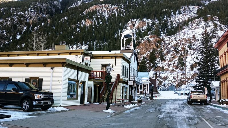
The Silverton Section: A Mining Town Frozen in Its Own Legend
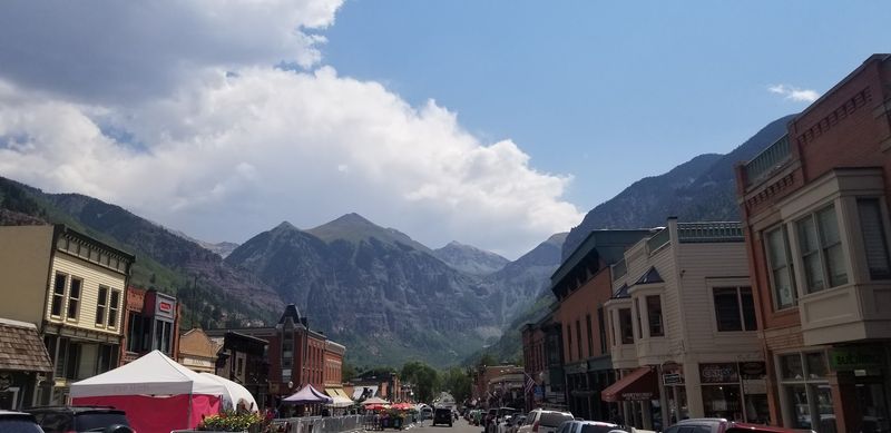
If Durango is the loop’s anchor, Silverton is its most theatrical stop. Sitting at 9,318 feet in a high alpine valley completely ringed by 13,000-foot peaks, Silverton is the kind of place that makes you wonder how anyone ever decided to build a town here in the first place — and then immediately understand why they couldn’t leave once they did.
The town’s main drag, Greene Street, is mostly unpaved and lined with 19th-century storefronts that have been maintained rather than renovated. There’s a deliberate authenticity to Silverton that sets it apart from more polished mountain resort towns.
The population hovers around 500 year-round, which gives the place a quiet intensity in the off-season that contrasts sharply with the summer crowds arriving by train and car.
Why It Matters: Silverton is the only town in the lower 48 states that sits entirely within a National Historic Landmark District. The designation covers the entire townsite, meaning the historic character you see isn’t an accident — it’s protected.
The drive into Silverton from either direction — north via Red Mountain Pass or south via the Animas River canyon — is among the most dramatic approach roads in the American West. Neither route lets you arrive casually; both demand full attention and reward it generously.
Common Mistakes to Avoid: Don’t treat Silverton as a quick photo stop between passes. Give it at least two hours.
Walk the streets, check the local museum, and let the altitude and the silence do their work on you.
Fall Color Season on the Loop: When the Aspen Trees Take Over
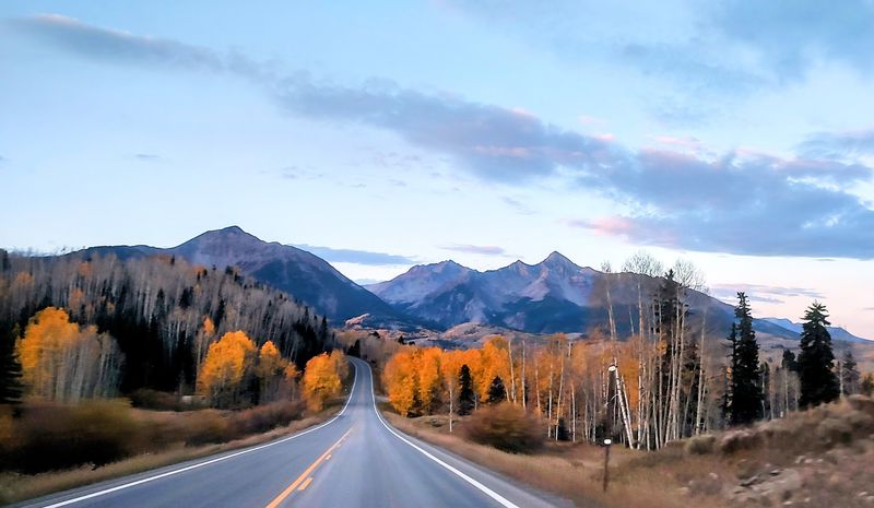
Colorado’s fall foliage season is not a subtle event. When the aspen trees turn in the San Juan Mountains, they turn all at once and without apology — entire mountainsides shifting from green to a gold so saturated it looks almost artificial.
The San Juan Skyway Loop sits squarely at the center of this annual spectacle, and peak color typically arrives between mid-September and mid-October depending on elevation and weather patterns.
The stretch between Ouray and Silverton along Highway 550 is widely considered one of the top fall foliage drives in the entire country. The combination of rust-red mineral peaks, golden aspen groves, and dark evergreen forests creates a color palette that photographers and casual observers alike find genuinely difficult to process without stopping repeatedly.
Planning Advice: Peak color dates shift by a week or more from year to year. Colorado Parks and Wildlife and various state tourism resources publish real-time foliage reports in September and October.
Checking these before finalizing travel dates can mean the difference between good color and extraordinary color.
Accommodation fills up fast during peak fall season, particularly in Ouray, Telluride, and Durango. Booking two to three months in advance is not excessive for mid-October weekends.
Weekday travel during peak color is noticeably less crowded than weekends and offers better parking at popular pullouts.
Best For: Photographers, couples on a scenic escape, and families looking for a fall outing that delivers maximum visual impact with minimal planning complexity beyond the accommodation booking.
Ridgway and the Dallas Divide: The View That Launched a Thousand Calendars

There’s a particular photograph that appears on Colorado tourism materials so frequently it has become almost shorthand for the state itself: a weathered wooden ranch fence, golden aspen trees, and the jagged Sneffels Range rising behind them under an impossibly wide sky. That photograph was taken at the Dallas Divide, a modest 8,970-foot pass on Highway 62 between Ridgway and Placerville — and it is every bit as good in person as it looks on a wall calendar.
Ridgway, the small town at the eastern base of the Dallas Divide, is one of the quieter stops on the loop but consistently earns high marks from travelers who take the time to pause there. The surrounding landscape was used as a filming location for the 1969 John Wayne film “True Grit,” and the wide valley views toward the Cimarron Ridge give the area a frontier scale that feels genuinely earned rather than manufactured.
Insider Tip: The Dallas Divide pullout on Highway 62 is one of the most photographed spots in Colorado during fall color season. Arrive before 8 a.m. to beat the tripod crowd and catch the early light on the Sneffels Range — the angle is best when the sun is still low in the east.
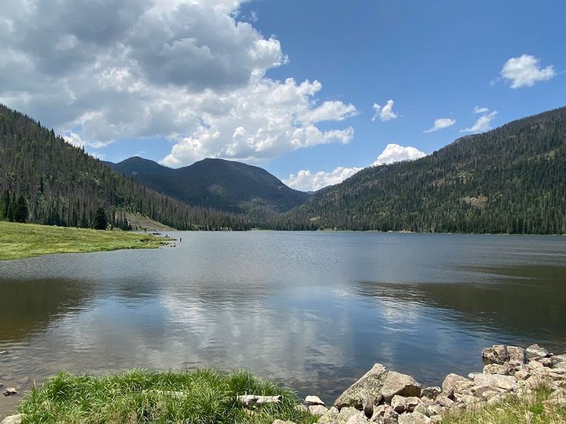
Ridgway State Park, just north of town, offers camping, fishing, and reservoir views that provide a welcome contrast to the high-alpine drama found elsewhere on the loop.
Best For: Landscape photographers, Western history fans, and travelers who want a genuinely uncrowded stop with outsized scenic rewards.
Final Verdict: Why the San Juan Skyway Loop Deserves the Hype in 2026
Some road trips are beautiful. The San Juan Skyway Scenic Byway Loop is something more than that — it’s a route that manages to be geologically spectacular, historically layered, and practically manageable all at the same time.
That combination is rarer than it sounds.
Over roughly 236 miles, the loop delivers four mountain passes, multiple National Historic Landmark sites, one National Park, a free gondola, a 19th-century steam railroad, hot springs, ancient cliff dwellings, and some of the best fall foliage in North America. Most road trips ask you to choose between scenery and substance.
This one refuses to make that trade.
Key Takeaways:
– Allow a minimum of 3 full days; 4 or 5 is better
– Start in Durango for the easiest logistics and best access to the D&SNG railroad
– Book Mesa Verde ranger tours and fall-season accommodations well in advance
– Drive Red Mountain Pass in daylight — the views and the road both require your full attention
– Fall color peaks mid-September to mid-October; check real-time reports before finalizing dates
Quick Verdict: The San Juan Skyway Loop is not a drive you take because you happen to be in the area. It’s a drive you plan a trip around.
In 2026, with more travelers actively seeking out routes that reward slow, attentive travel over rushed itineraries, this loop is exactly the kind of adventure that earns its reputation mile by mile.
Go. Take the long way.
Stop when the view demands it — and it will demand it often.