10 Breathtaking Drives In Texas That Should Be On Your 2026 Travel Radar
Imagine, you’re cruising down a Texas highway in a classic convertible, top down, wind messing up your hair, and “Blinding Lights” blasting through the speakers. The sun dips low, painting the hills in gold and fire, and every twist and turn steals your breath.
In Texas, the roads don’t just take you from point A to B, they perform. Desert stretches feel endless, rivers curl beside you like a scene from a movie, and tiny towns pop up just when you need a quirky detour.
It’s the kind of drive where the playlist, the scenery, and the sheer freedom all line up perfectly. Making every mile feel like its own epic adventure you didn’t know you needed.
1. FM 170 River Road, Presidio To Study Butte
There are roads that take you somewhere, and then there are roads that feel like the destination themselves.
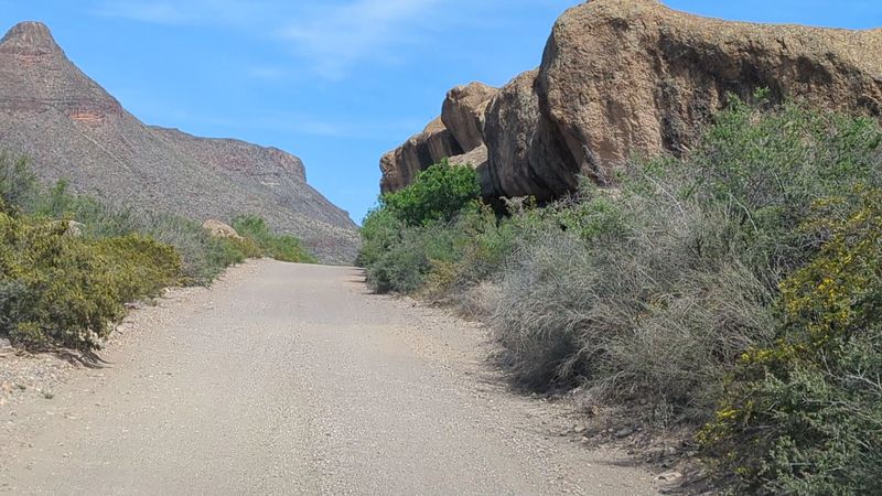
FM 170, also known as River Road, runs through the Big Bend region from Presidio to Study Butte, hugging the Rio Grande for miles through some of the most dramatic canyon scenery in the state. This stretch of highway is roughly 50 miles long and every single mile earns its place on your highlight reel.
The road winds through Contrabando canyon country with sheer volcanic walls rising on one side and the Rio Grande snaking along below you on the other. Big Bend Ranch State Park flanks much of the route, and the scale of the landscape out here is genuinely hard to process from a car window.
Pull over at the Barton Warnock Visitor Center near Lajitas for a quick orientation before heading west toward Presidio, or run the route in reverse and end near Study Butte for easier Big Bend National Park access.
Sunrise and late afternoon light turn the canyon walls into shades of amber and rust that no filter can replicate. The road itself is paved but narrow in sections, so take your time and watch for curves that come faster than you expect.
There are no gas stations for long stretches, so fill up before you start. Cell service is basically a rumor out here, which honestly just adds to the experience.
2. Ross Maxwell Scenic Drive
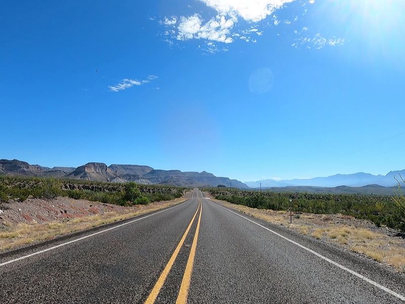
Big Bend is one of the least visited national parks, so Ross Maxwell Scenic Drive still feels blissfully quiet. The 30 mile route to Santa Elena Canyon is loaded with geological landmarks that thrill anyone who loves rocks and landscapes.
Starting near the Chisos Basin junction off the main park road in Big Bend National Park, the route takes you past Sotol Vista overlook, the Mule Ears Peaks viewpoint, and Castolon Historic District before dropping you right at the mouth of Santa Elena Canyon.
That canyon finale is one of the most dramatic payoffs of any scenic drive in Texas. The canyon walls rise 1,500 feet above the Rio Grande, and standing at the trailhead looking up at them feels genuinely surreal.
The road is paved the entire way and well-maintained, making it accessible for most vehicles. Early morning is the best time to drive it because the light hits the Chisos Mountains behind you and the canyon walls ahead in a way that makes the whole landscape glow.
You will want to stop at Tuff Canyon and walk the short trail there, because seeing ancient volcanic rock formations up close changes your perspective on deep time in a way that is hard to shake.
3. Davis Mountains Scenic Loop
Most people think of Texas as flat, and then they drive the Davis Mountains Scenic Loop and completely rethink everything they thought they knew.
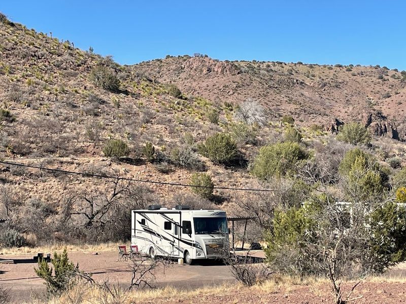
In West Texas’s Trans-Pecos, this roughly 74 to 76 mile loop circles the state’s highest in-state mountain range, with cooler air, dramatic skies, and scenery that feels closer to New Mexico.
The loop starts and ends in Fort Davis, a small historic town about 200 miles southeast of El Paso, and follows a combination of Highway 118 and Highway 166 through the heart of the mountains.
Along the way you pass through the McDonald Observatory area, where some of the darkest skies in the continental United States make this a legendary stargazing destination. The pull-offs along the upper elevations give you views that stretch for what feels like forever across the desert basin below.
Autumn is an underrated time to do this loop because the changing foliage adds unexpected color to the juniper and oak-covered slopes.
Summer afternoons can bring quick thunderstorms rolling across the mountains that are dramatic to watch from a safe pull-off. The loop takes about two hours at a relaxed pace, but give yourself a full half day if you want to stop at Limpia Creek, explore the fort ruins, or catch a solar viewing program at the observatory.
4. The Twisted Sisters
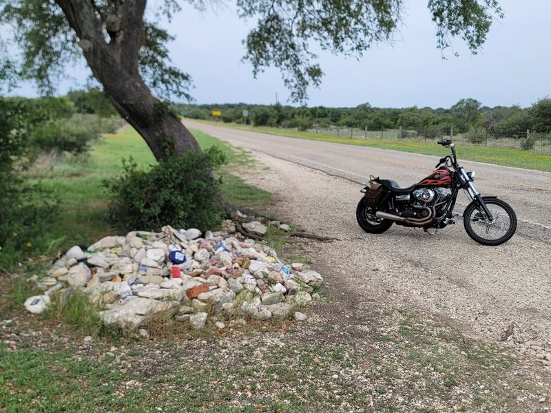
If Texas Hill Country has a signature road trip, it’s the Twisted Sisters, a loop of RR 335, RR 336, and RR 337 through some of the state’s best canyon and ranchland scenery. Riders love it, and road trippers should too for the world class views.
The loop is typically driven starting from Leakey, a small town in Real County about 90 miles west of San Antonio, and the roads twist through the canyons and ridgelines of the southern Hill Country in a way that feels almost too dramatic for Texas.
Ranch Road 336 is the most intense of the three, with steep switchbacks and tight curves that make even experienced drivers sit up straight and pay attention. The payoff at the top of each ridge is a panoramic view of layered canyon walls and cedar-dotted hills stretching in every direction.
Spring and fall are the best seasons to tackle this loop, when temperatures are manageable and the landscape is either blooming or turning golden. Stop in Leakey or Camp Wood for fuel and snacks before heading out because services are sparse once you are in the thick of it.
The full loop runs somewhere between 60 and 100 miles depending on your starting point and detours.
5. Willow City Loop
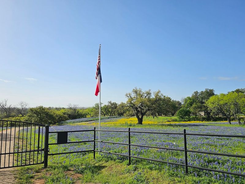
Every spring, a quiet road northeast of Fredericksburg becomes one of Texas’s most photographed drives. The roughly 13 mile Willow City Loop winds through private ranchland, and from late March to mid April the bluebonnets and Indian paintbrush turn the roadsides into a vivid carpet of color.
The loop runs off Highway 16 about 13 miles north of Fredericksburg in Gillespie County, winding through rolling granite hills and past old limestone farmhouses with views of cedar-covered ridges in every direction.
Even outside of wildflower season, the road is genuinely beautiful, with creek crossings, deer grazing in open meadows, and the kind of peaceful quiet that Hill Country does better than anywhere else in Texas. But wildflower season is when this loop earns its legendary status.
Because the road passes through private property, it is important to stay in your vehicle and on the road, which is a rule the landowners take seriously. Traffic can get surprisingly heavy during peak bloom weekends, so arriving early in the morning on a weekday gives you the best experience without the crowds.
The drive itself takes about 30 to 45 minutes at a leisurely pace, but most people spend longer because the urge to stop and photograph every hill is nearly impossible to resist.
6. FM 32 From Blanco To Wimberley
There’s a stretch of FM 32 between Blanco and Wimberley that locals have given a dramatic nickname, and once you drive it, you’ll understand why it stuck.
The road runs right along a narrow limestone ridgeline with the Hill Country dropping away sharply on both sides, giving you simultaneous views in two directions that feel almost impossible for a two-lane Texas road to deliver. It is one of those drives where you keep glancing left and then right because you genuinely cannot decide which view is better.
The route starts in Blanco, a charming small town in Blanco County about 45 miles west of Austin, and winds eastward toward Wimberley through some of the most classically beautiful Hill Country terrain in the state. The ridgeline section in the middle is the crown jewel, with pull-offs that let you stand at the edge and take in the full panorama of cedar valleys and limestone bluffs stretching to the horizon.
On clear days, the views extend for 20 miles or more in every direction.
Fall is arguably the best time to drive FM 32 because the cypress trees along the Blanco River corridor turn orange and gold, adding warm color to an already stunning landscape. The road is only about 20 miles long but it earns every bit of its reputation as one of the most scenic drives in central Texas.
7. Ennis Bluebonnet Trails
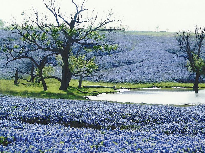
April in Texas means one thing above all else: bluebonnet season. And while the Hill Country gets most of the Instagram glory, the Ennis Bluebonnet Trails in Ellis County deliver a wildflower experience that is just as stunning and far more organized than anything you will find on a random Hill Country backroad.
The city of Ennis, located about 35 miles south of Dallas off Interstate 45, has been the official bluebonnet city of Texas since 1997, and they take that title seriously.
The trail system covers over 40 miles of mapped driving routes through the farmland and rolling fields surrounding Ennis, with new routes published each year based on where the blooms are thickest. During peak season, which typically falls in early to mid-April, the roadsides transform into thick ribbons of deep blue-purple that stretch for miles alongside wildflowers, old barns, and quiet country churches.
Pick up a printed trail map at the Ennis Visitors Center or download the routes online before you go, because the mapped roads change slightly from year to year depending on bloom conditions. Weekend traffic during peak bloom can be heavy, so a weekday morning visit is worth the extra planning.
There are several pull-off areas and even designated photography spots along the routes.
The Ennis Bluebonnet Trails prove that great road trip scenery does not always require mountains or canyons, sometimes a flat field covered in blue flowers is the most breathtaking thing you will see all year.
8. Surfside Beach To San Luis Pass
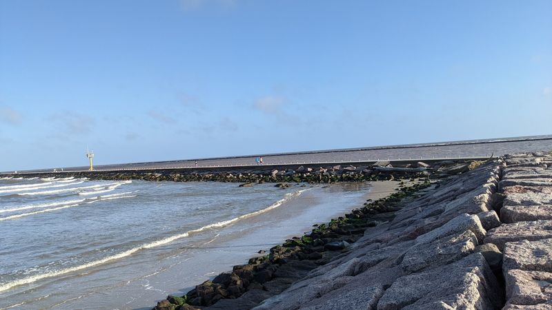
Not every great Texas drive involves mountains or canyons, and the Bluewater Highway is living proof of that. This mellow, sun-soaked stretch of road runs along the Gulf Coast from Surfside Beach down to San Luis Pass, tracing the shoreline of Follets Island with the Gulf of Mexico on one side and Chocolate Bay marshes on the other.
It is the kind of drive where you roll the windows down, let the salty air fill the car, and immediately feel your shoulders drop about three inches.
The highway, officially designated as FM 3005, starts near Surfside Beach in Brazoria County about 70 miles south of Houston and runs roughly 20 miles southwest to San Luis Pass. The road sits right between the beach and the bay for much of its length, giving you this narrow coastal corridor experience that feels genuinely different from any other drive in Texas.
Pelicans glide overhead, shrimp boats dot the horizon, and the light on the water in the late afternoon turns everything golden in a way that feels almost cinematic.
Summer weekends bring beach crowds, but the drive itself never loses its laid-back coastal charm even when traffic picks up. Birders love this stretch for the shorebird activity in the marsh areas, and the fishing access points along the route are popular stops year-round.
San Luis Pass at the southern end is a natural tidal pass where the bay meets the Gulf, and standing there watching the water churn through is a surprisingly dramatic way to end the drive.
9. Big Thicket Loop
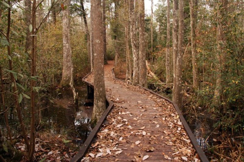
Southeast Texas does not get nearly enough road trip credit, and the Big Thicket Loop is the drive that should change that conversation entirely. The Big Thicket region, sometimes called the biological crossroads of North America, sits in the Piney Woods of Southeast Texas and contains an almost absurd variety of ecosystems packed into a relatively small area.
Driving through it feels like the landscape cannot make up its mind between swamp, forest, prairie, and bayou, and that constant shift is exactly what makes it so fascinating.
The loop connects a series of roads through and around Big Thicket National Preserve, which is headquartered near Kountze in Hardin County, about 90 miles northeast of Houston. Starting from the Turkey Creek Unit Visitor Center on FM 420 is a good anchor point for the drive, and from there you can branch out through the various units of the preserve via FM 787, US 69, and connecting county roads.
Spring and early summer bring wildflowers to the forest edges and the pitcher plant bogs in the Sundew Trail area are genuinely otherworldly. Fall turns the hardwoods golden and the whole region takes on a warm, hazy quality that is quietly beautiful.
Watch for wildlife crossing the roads because deer, alligators, and even red-cockaded woodpeckers are regulars in this corridor.
The Big Thicket Loop rewards slow drivers who are willing to stop, listen, and look closely, because the magic here is not always visible at 60 miles per hour.
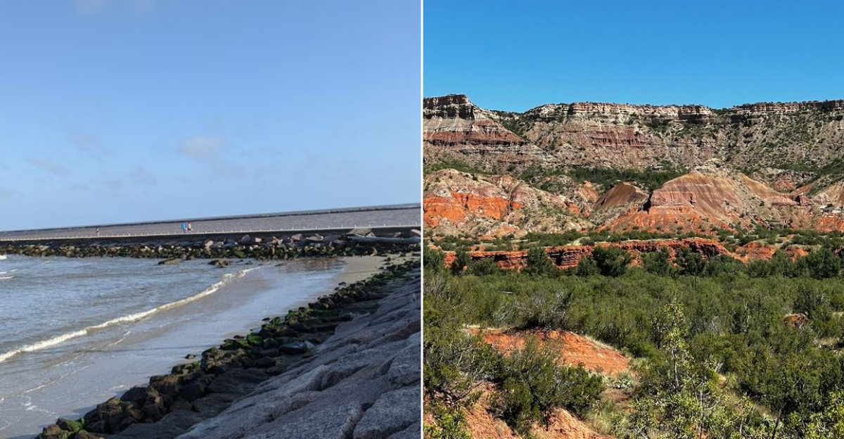
10. Palo Duro Canyon State Park Scenic Drive
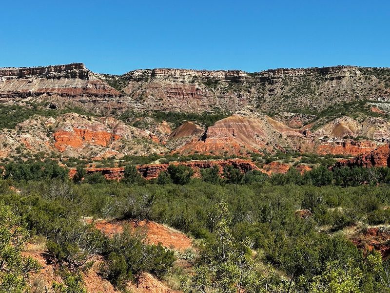
Texas has a Grand Canyon, and the fact that most people outside the state have never heard of it is one of the great undersold stories in American road trip history.
Palo Duro Canyon State Park, located just south of Amarillo near Canyon, Texas, is the second largest canyon in the United States, and the scenic drive that takes you from the rim down to the canyon floor is one of the most dramatic descents you can do in a regular passenger car anywhere in the country.
From the visitor center on Park Road 5 off Texas Highway 217, the paved road drops about 800 feet into the canyon, revealing layers of red, orange, and purple rock. The Lighthouse spire appears along the way, and the 5.5 mile hike to its base is worth the stop.
Sunrise and sunset are best because the canyon walls shift from shadow to bright orange in minutes. Summer mornings beat the heat, and fall brings cooler air and longer views.
The park also hosts an outdoor musical drama called Texas in the amphitheater during summer evenings, which is a uniquely Texan way to end a canyon day.
Palo Duro is the kind of place that makes you wonder why it took you so long to get there, and the drive in is just the beginning of why.