Virginia Has 15 Scenic Routes That Beat Any Screen Time
Virginia hides scenic routes like secret levels in a video game Each turn more jaw-dropping than the last. Forget binge-watching another series.
These roads deliver drama, peace, and plot twists that no screen can match. Rolling hills, river bends, and forests that glow like they were photoshopped in real life, this is the kind of view that makes you hit pause on everything else.
Whether chasing sunrise, sunset, or just a reason to roll down the windows and actually breathe, Virginia’s roads aren’t just paths, they’re experiences.
Buckle up your curiosity, because these routes demand attention, not Wi-Fi.
1. Front Royal To Rockfish Gap
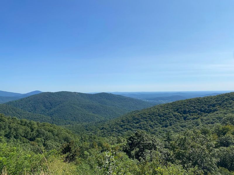
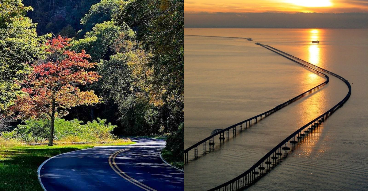
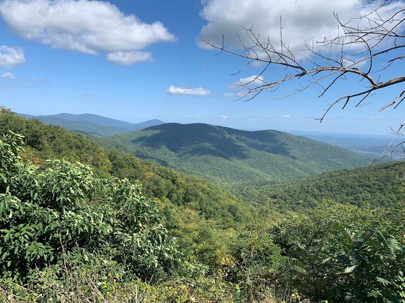
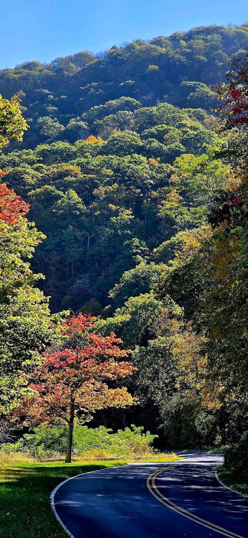
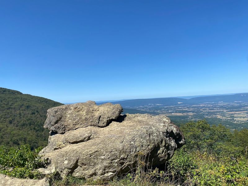
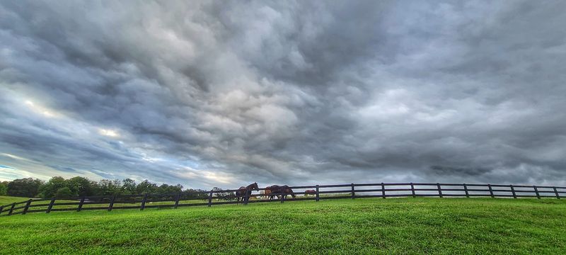
There is no casual way to describe driving all 105 miles of Skyline Drive. This is the full commitment, the whole story, starting at Front Royal and finishing at Rockfish Gap near Waynesboro, cutting straight through the spine of Shenandoah National Park in the Blue Ridge Mountains of Virginia.
The speed limit caps at 35 mph, and honestly, that feels fast once you start hitting the overlooks. You will want to stop constantly.
The views shift from rolling farmland to dense hardwood canopy to open ridgeline panoramas that make the horizon feel impossibly wide. Fall is peak season for obvious reasons, but spring bloom and summer mist have their own kind of magic.
Pack food, bring layers, and plan for the drive to take most of the day if you do it right. Skyline Drive is the kind of road that turns a Tuesday into a memory worth keeping.
2. Front Royal To Thornton Gap
Not everyone has a full day to spare, and that is where this northern stretch earns its spot. Running from Front Royal down to Thornton Gap, this segment of Skyline Drive packs a serious amount of scenery into a manageable chunk without asking you to clear your entire calendar.
Located within the northern section of Shenandoah National Park along Skyline Drive in Page County, Virginia, this stretch hits some of the most accessible and rewarding overlooks on the whole road.
Hogback Overlook and Range View Overlook are both along this corridor, and both deliver the kind of wide-open valley views that make you forget what you were stressed about an hour ago.
The drive feels spontaneous and easy, perfect for a weekend afternoon when you want maximum payoff with minimum planning.
Quick overlooks, no pressure, just solid Blue Ridge scenery doing what it does best. Sometimes less really is more on a road like this.
3. Swift Run Gap To Rockfish Gap
If the northern section of Skyline Drive is the social butterfly, this southern stretch is its quieter, more introspective sibling. Running from Swift Run Gap down to Rockfish Gap, this end of the road carries a different energy, less crowded, more meditative, and perfectly suited for late-day driving when the light turns everything golden.
Tucked in the southern portion of Shenandoah National Park near Augusta County, Virginia, this segment rewards patience. The overlooks feel more earned, the forest thicker, and the whole vibe is closer to a private showing than a public attraction.
Loft Mountain Overlook along this stretch offers sweeping southern valley views that are genuinely hard to beat.
Afternoons bleed into evenings beautifully here, especially in autumn when the ridgeline colors start glowing just before dusk. If you want Skyline Drive without the crowd energy, point yourself south and let this quieter half of the road do all the talking.
4. Rockfish Gap South
Where Skyline Drive ends, the Blue Ridge Parkway picks up without missing a beat. Starting at Rockfish Gap near Waynesboro and heading south through Virginia, this stretch of the Parkway is the kind of drive that makes you feel like you are moving through a painting that keeps changing every few miles.
The road runs along the crest of the Blue Ridge Mountains through Nelson and Bedford counties in Virginia, passing through Afton, past the James River crossing, and eventually into the higher elevations near the North Carolina border.
Otter Creek, the James River Visitor Center, and the overlooks near Apple Orchard Mountain are all worth slowing down for.
No commercial trucks, no stoplights, no billboards. The Parkway was designed specifically to make driving feel like an experience rather than a task, and the Virginia section delivers that promise fully.
Every curve feels intentional, like the road itself was built to show you something worth seeing.
5. Yorktown To Jamestown Historic Triangle
History and scenery rarely share the same road this gracefully. The Colonial Parkway runs 23 miles through the Historic Triangle of Virginia, connecting Yorktown, Colonial Williamsburg, and Jamestown in a way that feels more like a time corridor than a highway.
No billboards, no strip malls, just trees, river views, and the quiet weight of American history.
Managed by the National Park Service and running through York and James City counties in Virginia, this road traces the shorelines of both the York River and the James River at different points along its route.
The tunnel section beneath Colonial Williamsburg is a detail most people do not expect, and it adds a genuinely cinematic touch to the whole experience.
Fall and spring are spectacular here, but even a gray winter day on this parkway carries atmosphere. The Colonial Parkway is proof that the most interesting roads do not always show up on road trip highlight reels, yet they absolutely deserve to.
6. George Washington Memorial Parkway
Driving this road feels like the city and the wilderness agreed to share a border and somehow made it work beautifully. T
he George Washington Memorial Parkway hugs the Virginia side of the Potomac River, running from Mount Vernon north toward McLean, and the views across the water toward the DC skyline are genuinely unexpected for a road this close to a major metro area.
Administered by the National Park Service and running through Fairfax County, Virginia, the parkway passes through Turkey Run Park, overlooks the Potomac at multiple pull-offs, and connects to trails that dip right down to the riverbank.
The stretch near Great Falls is especially dramatic, where the river narrows and the rapids become audible from the road.
Morning drives here have a particular quality, mist on the water, early light cutting through the tree canopy, almost no traffic. It is the kind of commute people would actually look forward to, if commutes were allowed to be this beautiful.
7. Charlottesville To Leesburg
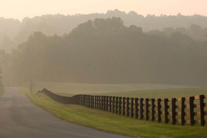
Some roads carry history the way old houses carry stories, quietly, in every corner. The Journey Through Hallowed Ground corridor runs from Charlottesville north to Leesburg through the Virginia Piedmont, and the landscape along this route reads like an outdoor history book with exceptionally good scenery on every page.
The Virginia portion passes through Albemarle, Orange, Madison, Culpeper, Fauquier, and Loudoun counties, connecting towns like Orange, Culpeper, and Middleburg along the way.
Montpelier and Monticello are both accessible from this corridor if you want to add stops.
The piedmont farms here are genuinely photogenic in every season. Rolling green in spring, gold and russet in fall, and starkly beautiful under a winter sky.
This route rewards slow driving and open windows more than almost any other road in Virginia. History never looked this good from a windshield.
8. James River Plantations Drive
Route 5 is one of those roads that feels like it belongs in a different century, and honestly, parts of it kind of do.
Running east from Richmond toward Williamsburg through Charles City County, Virginia, this two-lane highway passes some of the oldest and most storied plantation estates in the country, most of them sitting right along the James River with the kind of quiet grandeur that photographs cannot fully capture.
Shirley Plantation, Berkeley Plantation, and Westover Plantation all line this corridor, each one carrying its own complicated and significant piece of American history.
The road itself is narrow, tree-shaded, and mostly unhurried, which makes it ideal for slowing down and actually absorbing what you are looking at.
Spring is extraordinary here when the dogwoods bloom along the roadside. The James River peeks through the trees at various points, adding a silver shimmer to the green.
Route 5 is not flashy, but it has more layers than almost any other drive in the state.
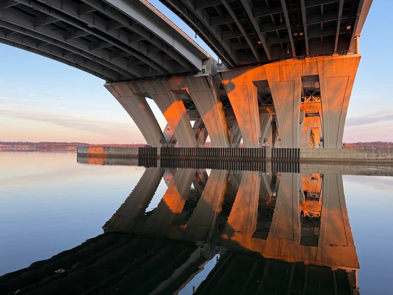
9. US 13 Plus The Chesapeake Bay Bridge-Tunnel Run
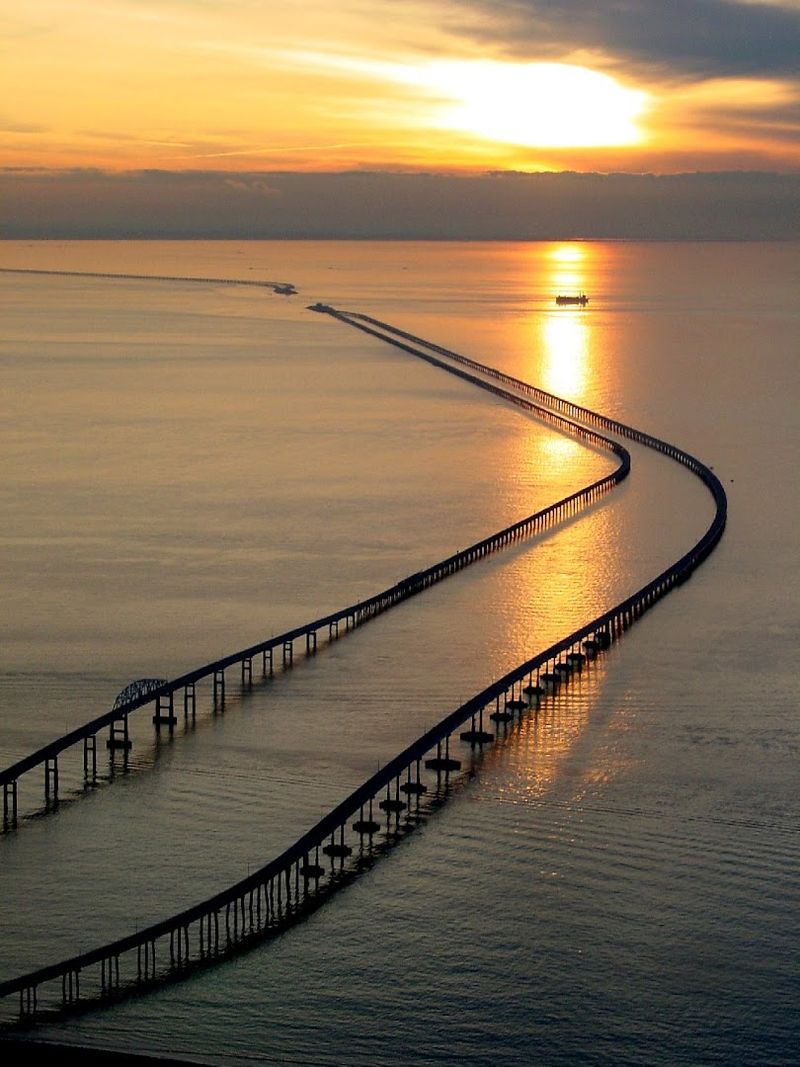
Crossing 17 miles of open water on a road that occasionally disappears into tunnels beneath the bay is an experience that sounds made up until you are actually doing it.
The Chesapeake Bay Bridge-Tunnel connects Virginia Beach to the Eastern Shore of Virginia, and the crossing itself is one of the most visually dramatic drives anywhere on the East Coast.
Starting from the Virginia Beach side and heading north on US 13 through Northampton and Accomack counties on the Eastern Shore, the whole run gives you open bay views, fishing boats, pelicans, and the kind of sky-meets-water horizon that makes everything feel enormous.
Stopping at the fishing pier midway across the bridge-tunnel adds a bonus perspective that most people miss.
Coming back across in the opposite direction at sunset is an entirely different and equally spectacular experience. The light on the water during golden hour here is the kind of thing that makes you put your phone away and just watch.
Pure, unfiltered coastal Virginia at its widest.
10. Cape Charles North Through Farmland
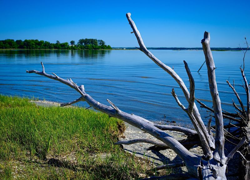
There is something deeply calming about driving through land this flat and this wide open. The Eastern Shore of Virginia runs north from Cape Charles along US 13 through Northampton and Accomack counties, and the scenery here is completely different from anything else in the state.
No mountains, no ridgelines, just sky, farmland, water towers, and small towns that time seems to have treated gently.
The road passes through Eastville, Nassawadox, Onley, and Accomac before eventually reaching the access roads toward Chincoteague Island, home to the famous wild ponies of Assateague.
The Eastern Shore feels agricultural and coastal simultaneously, with produce stands, fishing docks, and historic courthouses appearing at regular intervals.
Chincoteague access roads add a marshy, wildlife-rich finale to the drive that feels like a completely different world from the open farmland further south.
The Eastern Shore rewards curiosity and patience. Pull over when something looks interesting because on this road, something almost always does.
11. Route 16 Between Marion And Tazewell
While Deals Gap gets all the national attention for twisty mountain roads, Virginia has been quietly sitting on its own jaw-dropping version.
Back of the Dragon runs along Virginia Route 16 between Marion in Smyth County and Tazewell in Tazewell County, covering roughly 32 miles of curves, elevation changes, and ridgeline scenery that keeps your eyes genuinely busy the entire time.
The road passes through Jefferson National Forest territory, winding through hollows and over gaps with the kind of rhythm that makes driving feel athletic.
There are reportedly over 400 curves on this route, which sounds exhausting until you are actually on it and realize each turn reveals something new worth looking at.
Motorcyclists know this road well and have for years, but it is equally spectacular in a car with the windows down.
The forest canopy closes overhead in sections, then opens suddenly onto ridgeline views that stretch for miles. Back of the Dragon is Southwest Virginia’s best-kept open secret, and it absolutely earns every curve.
12. Southwest Virginia Music Country Drive
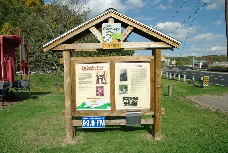
Not every great Virginia drive is about the view out the windshield. The Crooked Road is a 330-mile heritage music trail that winds through the mountains and valleys of Southwest Virginia, connecting towns that gave birth to old-time and bluegrass music long before Nashville had a skyline to speak of.
The trail runs through communities including Bristol, Floyd, Galax, Clintwood, and Breaks in counties spanning from Patrick to Dickenson, and you can tackle it in segments across multiple days or focus on a single stretch depending on how much time you have.
The Crooked Road was officially designated a Virginia Scenic Byway, which means the drive itself is worth the trip even if you never stop.
Floyd, in particular, is worth a slow cruise through on a Friday night when the music spills out of storefronts onto the sidewalk.
The whole trail has a living, breathing quality that most scenic drives cannot claim. Music, mountains, and miles of genuine Appalachian character rolled into one unforgettable route.
13. Route 231
Route 231 is the kind of road that wine country photographers dream about and most GPS systems ignore entirely.
Running from Gordonsville through Orange and Madison County up toward the Sperryville area in Rappahannock County, this stretch of the old Blue Ridge Turnpike moves through some of the most quietly beautiful piedmont landscape in all of Virginia.
The Blue Ridge Mountains line the western horizon for most of the drive, and the foreground is filled with rolling farmland, stone walls, historic barns, and the occasional vineyard tucked into the hillside.
The road curves gently, never aggressively, which gives the whole experience a relaxed, Sunday-afternoon quality that feels almost therapeutic.
Sperryville at the northern end of the drive is a charming small town worth stopping in before turning around or continuing north into Rappahannock County. Route 231 does not shout.
It does not need to.
The scenery along this corridor speaks with enough quiet confidence to make you want to drive it twice just to make sure you caught everything.
14. Blue Ridge Parkway Mabry Mill Day Route
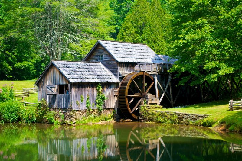
Mabry Mill might be the most photographed spot on the entire Blue Ridge Parkway, and the first time you see it in person you completely understand why. The old grist mill and its reflection in the pond hit different from any photo you have ever scrolled past, especially on a misty morning when the mountains are still waking up around it.
Located at milepost 176.1 on the Blue Ridge Parkway in Floyd County, Virginia, near the town of Meadows of Dan, Mabry Mill makes for a perfect turnaround point on a day drive.
Head south on the Parkway from Roanoke or Floyd, stop at multiple overlooks along the way, and let Mabry Mill be the satisfying destination that anchors the whole outing.
The surrounding area in Patrick and Floyd counties has its own laid-back Appalachian character that rewards a slow pace. Fall foliage here is legendary, but even summer mornings carry a cool, foggy quality that makes the whole drive feel like a reward.
Mabry Mill is a destination that actually lives up to every version of its reputation.
15. Colonial Parkway Plus Yorktown Riverfront Loop Finish
Ending a drive well matters just as much as starting one right. The Colonial Parkway already delivers one of the most graceful road experiences in Virginia, but adding a slow loop around Yorktown’s riverfront before heading back turns a good drive into a genuinely complete one.
The riverfront area in Yorktown, located in York County along the York River, has a quiet, unhurried energy that feels like the natural exhale at the end of a long scenic inhale.
The bluff overlooking the York River offers a wide, unobstructed view across the water that is especially beautiful in the late afternoon when the light goes warm and low.
The town itself is small enough to walk but layered enough to reward attention, with historic markers, river access points, and a shoreline that looks almost unchanged from century-old photographs.
Driving the Colonial Parkway and finishing with this Yorktown loop is the kind of afternoon that reminds you Virginia has been quietly doing scenic drives better than most places for a very long time.
So when is your next open Saturday?