This Spot Lets You Stand In Michigan, Indiana, And Ohio All At Once
Out on the quiet seam where Michigan, Indiana, and Ohio finally shake hands, the landscape doesn’t shout for your attention.
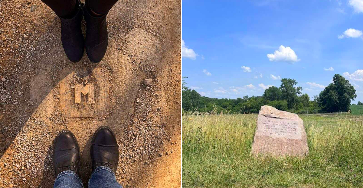
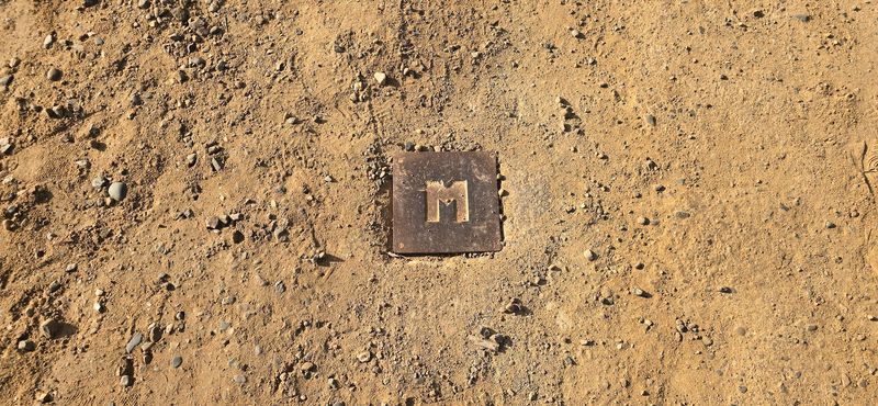
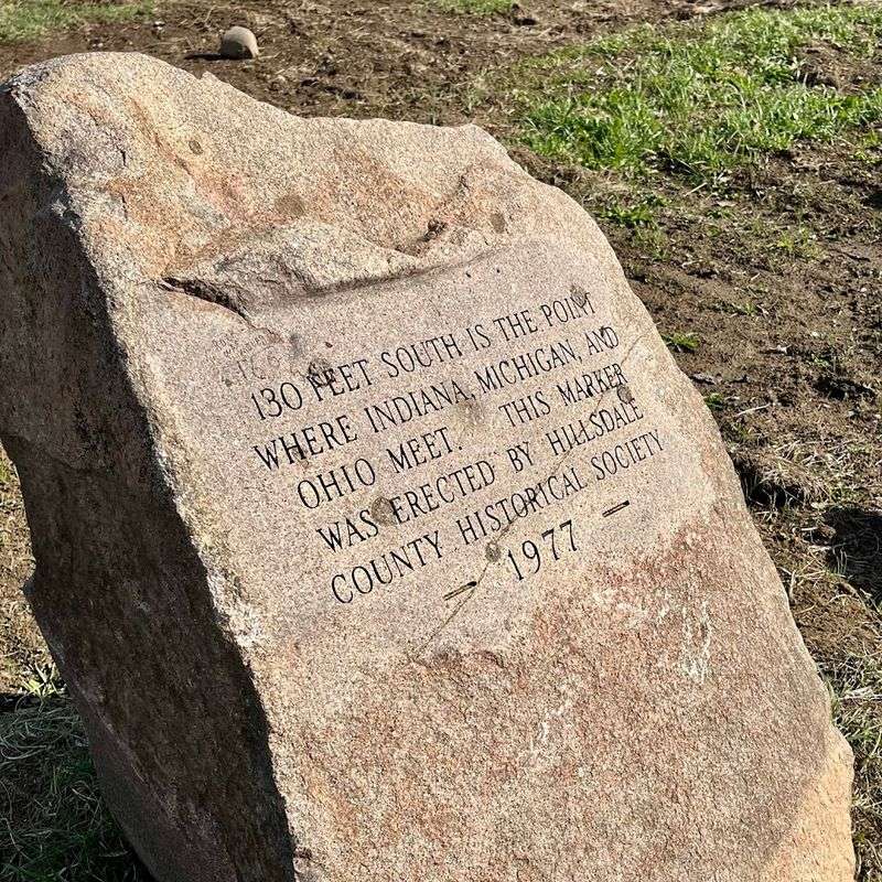
There is a specific, nerdy thrill in standing at the exact intersection of three states, especially when the “monument” is a modest granite marker and the actual tripoint is a brass disk hiding in the pavement like a cartographic Easter egg.
I think there’s something deeply satisfying about these small, exact places that make a map feel tangible under your boots. It’s understated, surveyor-made magic at its finest.
Visit the unique Michigan-Indiana-Ohio tripoint marker for a quirky tri-state photo op and a peaceful drive through the rural tri-state corner.
If you’re the type of traveler who finds beauty in a gravel-meets-asphalt crossroads and a job well done by 19th-century engineers, this spot rewards your curiosity. Bring your camera, lace up your good shoes, and get ready to stand in three places at once.
First Footing At The Seam
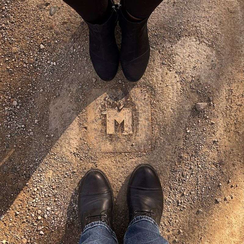
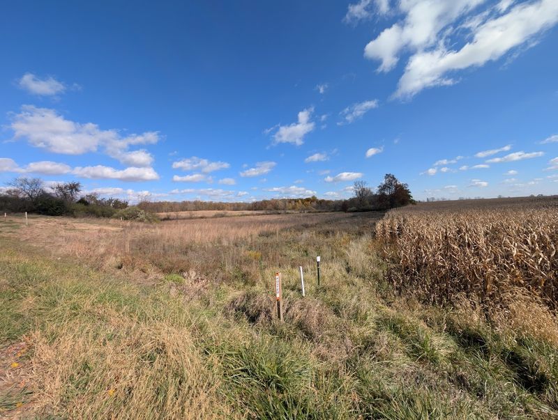
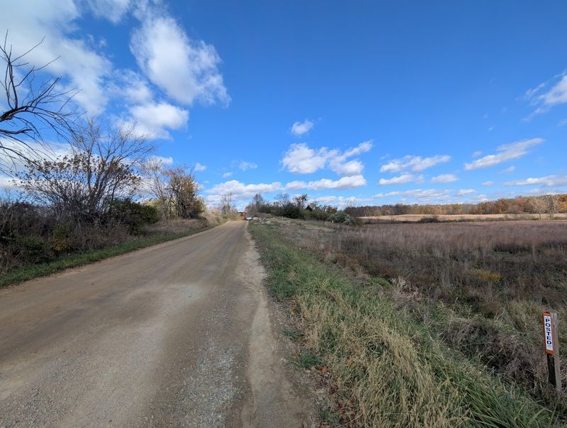
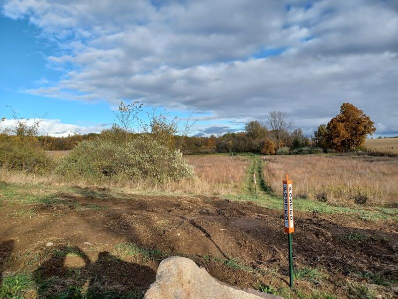
Start with your toes bridging boundaries. The recessed marker sits in the roadway where County Road 1 meets a dirt stretch, and the granite monument rests a walk north along the Michigan side ditch. Stand carefully, because infrequent trucks and farm pickups pass, and the mud can swallow shoes after rain.
I touched the metal, then shuffled until each foot claimed a different state, feeling the calm of precision under sky.
Listen for wind combing corn or the clink of gravel under tires. You are from a visitor center, so moment feels unproduced, which is part of the appeal. Angle your body for a photo showing three directions at once, then step back to let others try the balancing act.
The Triple-State Pivot
Connecting three states at once means a slow, deliberate drive through the quiet, flat grid of the Great Lakes’ agricultural heartland. I think the best approach is to follow M-49 south out of Camden for about four miles before hanging a right onto Territorial Road, where the landscape opens up into a sea of corn and soybean fields.
The drive is defined by the steady rhythm of gravel under your tires and the sight of distant silos, signaling that you’ve left the main highways behind for a corner of the map where the borders are more of a shared agreement than a visible wall.
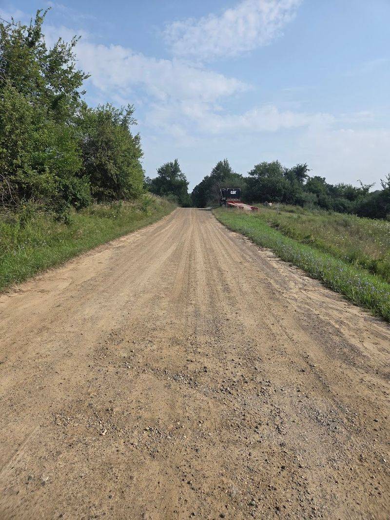
The final stretch leads you to the intersection of County Road 1 and State Line Road, south of Camden, Michigan, where the pavement eventually gives way to a well-maintained dirt path. You’ll know you’re on the right track when the horizon narrows into a small, wooded clearing at the edge of a field, marking the precise spot where the surveyors’ lines finally meet.
Approach Routes That Work
Reaching the spot is straightforward if you trust simple roads. From Camden, take M-49 south, turn west on Territorial Road, then head south on Cope Road toward the state line. From Indiana, roll north on County Road N1000E toward the Ohio boundary, which aligns with County Road 1.
Ohio travelers can navigate north via Highway 49, then U.S. 20, and turn onto County Road South before angling to County Road 1.
These lanes are lightly traveled and can be dusty or rutted after storms. Check conditions, drive slow, and pull over only in established dirt shoulders. A paper map or offline download helps if signal fades.
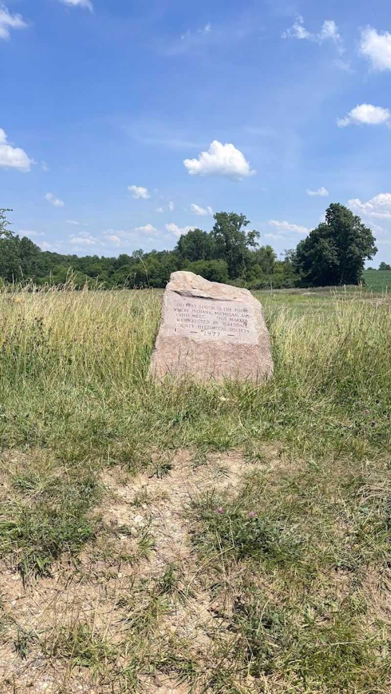
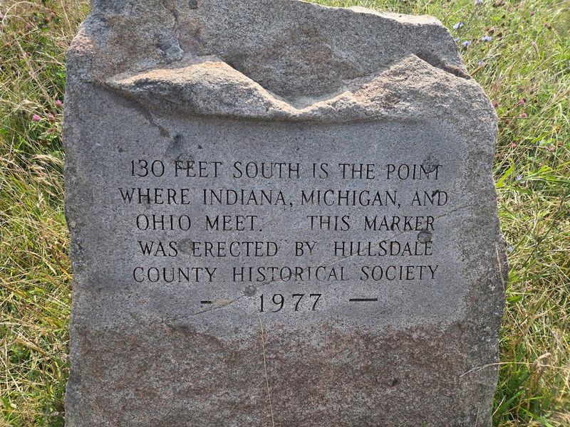
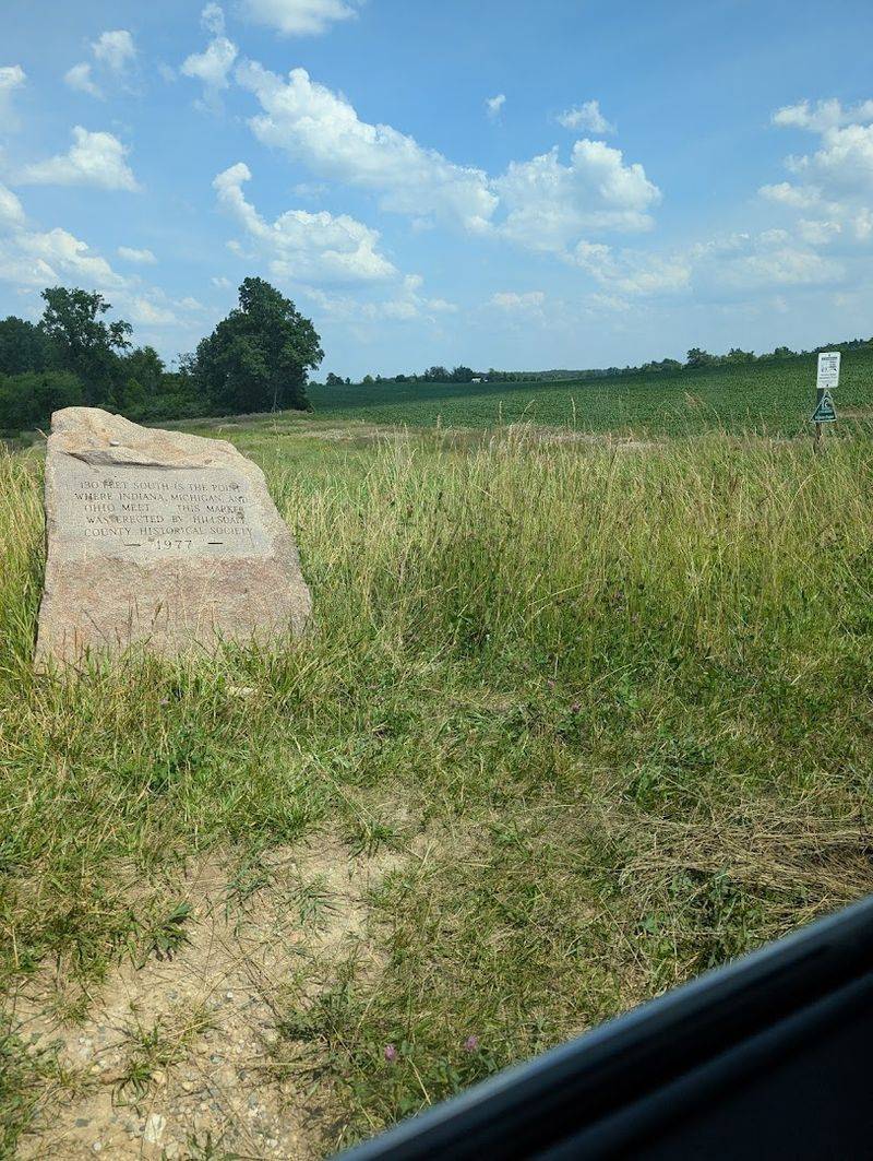
Granite Monument, Plain And True
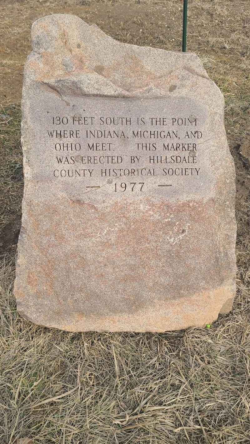
The granite monument is not theatrical, which feels right for a boundary born of surveys and patience. Chiseled text explains you are near, not precisely at, the convergence. The stone sits along the Michigan side ditch, visible from the road shoulder, slightly elevated by grass and occasional wildflowers.
I read the inscription slowly, appreciating how a practical marker still manages to summon a sense of arrival.
Because it rests off the pavement, the monument photographs cleanly without stepping into traffic. Frame it with the road receding to suggest direction. If roadside grass is tall, watch footing and check for soggy edges after rain. Respect adjacent private property lines.
Quiet Vibe, Big Sky
Silence carries here, broken by wind, insects, and the far rattle of a pickup. The openness magnifies small details, like the crisp seam where pavement turns to gravel and the way ditch water reflects sky. Nothing competes for attention, so the idea of three governments meeting becomes oddly human sized.
The place encourages lingering without saying much. Embrace the slow rhythm. Step away from the markers and look outward to understand how ordinary land holds precise meaning.
Bring layers, since breeze over fields cools faster than towns. If a car appears, offer space, wave, and return to the shoulder. The best souvenir might be a calmer pulse.
Toledo War Echoes
Long before this quiet intersection, boundary lines stirred tempers in the Toledo War, a 19th century dispute between Michigan Territory and Ohio. The conflict resolved with Michigan gaining the Upper Peninsula and Ohio retaining the Toledo Strip, a cartographic bargain that reshaped maps.
Standing at the tripoint, history feels condensed into a tidy corner of road and ditch, an echo without fanfare.
Read a brief primer before visiting, then let the landscape ground the timeline. Imagining surveyors staking claims adds weight to the modest hardware underfoot. Share the context with companions for a richer photo caption. Accuracy matters here, so avoid embellishment and stick to verified sources.
Photography Without Fuss
Light changes fast across open fields, so plan a short list of shots. Start wide to show the lane, the ditch, and the granite stone together, then move in for the recessed marker where surfaces meet. Kneel to let the road line lead toward horizon.
I framed my shoes at the seam, then stepped aside to capture an empty frame for context. Golden hour softens the gravel and pulls detail from engravings.
Midday can work if you lean into shadows and textures. Keep one eye on approaching vehicles, and do not block the narrow track. A microfiber cloth saves every frame from dust.
Respecting The Setting
No turnstiles, no fences, and also no invitation to wander beyond the road edge. Fields and ditches adjacent to the marker adjoin private land. Treat the shoulder as your gallery and the line in the pavement as your exhibit. Wave to locals, keep voices low, and pack out anything you bring.
This place stays accessible because visitors act like neighbors. Park only in obvious pull-offs and never block farm access.
If conditions are sloppy, choose a different day rather than chewing ruts into the verge. The absence of signage is not a loophole. It is a quiet contract to tread lightly and leave the seam as you found it.
Seasonal Quirks To Know
Spring turns the shoulder into sponge cake, so waterproof boots pay off and tires deserve kindness. Summer hides ditches behind tall grass and corn, narrowing sightlines and adding buzz to the soundtrack. Autumn trades green walls for gold and red, with crisp air that flatters photographs.
Light snow in winter sketches the line work, but ice can slick the gentle crown of the road. Check forecasts, especially after extended rain. Short daylight in winter compresses the visit, so arrive early.
Bug spray helps in July, and a hat is worth packing any month. If wind is high, step back from the exact spot and work safely from the shoulder.
Navigation And Coordinates
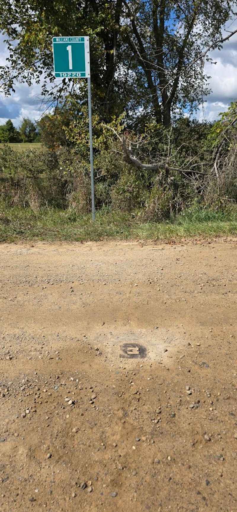
Cell signal fades in pockets, so download offline maps before you roll. A reliable pin floats near 41.6961111, -84.8059722, close to County Road 1 by the state line south of Camden. GPS confirms you are near the seam, but your eyes and the pavement tell the final truth.
Keep navigation simple and avoid overthinking detours that add dust, not clarity. Mark a return route in case weather worsens. Paper backup lives happily in a glove box for days like that.
Screenshot the approach instructions so you are not coaxing bars from thin air. When your arrow meets the road transition, trust the ground more than the screen.
Parking, Safety, And Shoulders
There is no formal lot, only dirt pull-offs and widened shoulders. Park straight, as far off the travel lane as ground allows, and switch on hazards if visibility dips. Watch for farm equipment, which is wide and purposeful. Step out on the ditch side, not into the lane, and scan in both directions.
I kept keys in a zipped pocket and phone in airplane mode to save battery. If the shoulder is soupy, do not risk a tow. Move on to firmer gravel or return another day.
Avoid standing on blind rises, and guide kids to the monument area rather than the centerline. Simple caution preserves the charm.
Nearby Basics And Detours
Stock up in Camden, Michigan or Fremont, Indiana before you aim for the line. Fuel, restrooms, and snacks fade with the pavement, and there is no kiosk at the marker.
The site is open all hours, but daylight treats you better than headlights. If time allows, small town main streets nearby reward slow strolls and a coffee break, adding context to the rural scene.
Consider pairing the tripoint with a short drive to Butler or Angola for niche museums and public art. Keep expectations realistic: the seam is the show. Pack water and a spare tire, and tell someone your plan when roaming back roads.