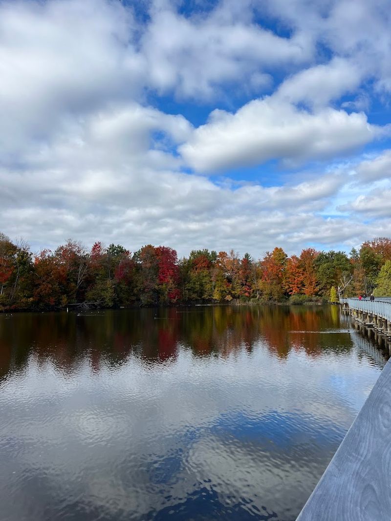
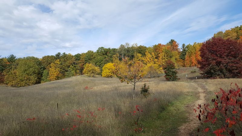
11 Gorgeous Hikes Around Traverse City You Need To Explore
Traverse City has this uncanny ability to make me feel like a pioneer without ever being more than ten minutes from a world-class latte. The trails here don’t just wander; they slide from the deep, cool hush of ancient cedar shade into that blinding Great Lakes shimmer in a matter of mere steps.
I’ve spent countless unplanned afternoons letting my feet decide the itinerary, crossing from springy needle-strewn paths to weathered boardwalks that overlook restless, birdy wetlands.
Whether I’m huffing my way up a glacial hill for a bluff-top gasp at the open water or just taking a slow, pine-scented spin with a steaming cup in hand, the variety feels like a collection of small, perfectly paced expeditions.
Discover the best scenic hiking trails and nature walks near Traverse City for a perfect Northern Michigan adventure. Lace up your boots and take a quick check of the wind coming off the bay before you head out.
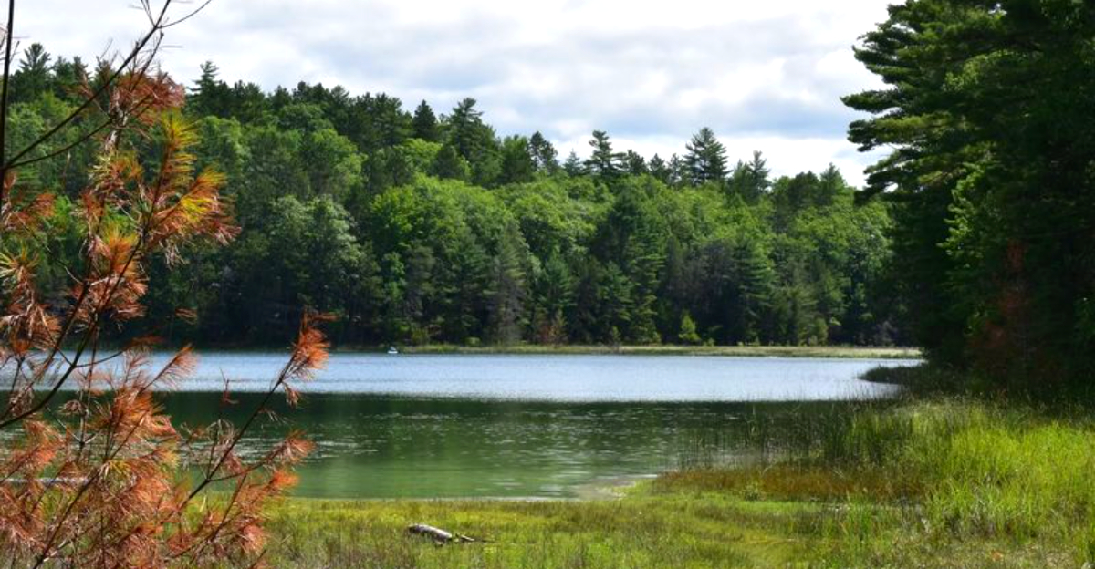
1. Boardman Lake Loop Trail, Traverse City
Morning light freckles Boardman Lake while bikes hum past on the paved edge and gulls argue over breakfast. The loop threads through neighborhood trees, bridges, and a softened slice of industry.
It always keeps water within arm’s reach. Benches appear just when you want to watch paddlers slip by.
The library deck feels like a quiet grandstand. It is the kind of trail that reminds you why this city is so beloved.
It is functional, beautiful, and deeply integrated into the daily rhythm of life.
Expect an easy 4.2 mile circuit with wide surfaces and clear signage, shared by strollers, runners, and anglers. To get the best experience, you should park at Hull Park or the library lot.
Then move clockwise to catch the sun glittering ahead of you rather than squinting into it. After a heavy Northern Michigan rain, the unpaved segments near the south end can develop a few puddles.
The history of the lake itself is a bit of a comeback story. Once a hub for the lumber industry that built this town, it has transformed into a recreational crown jewel.
2. Old Mission Point Park Trail, Traverse City
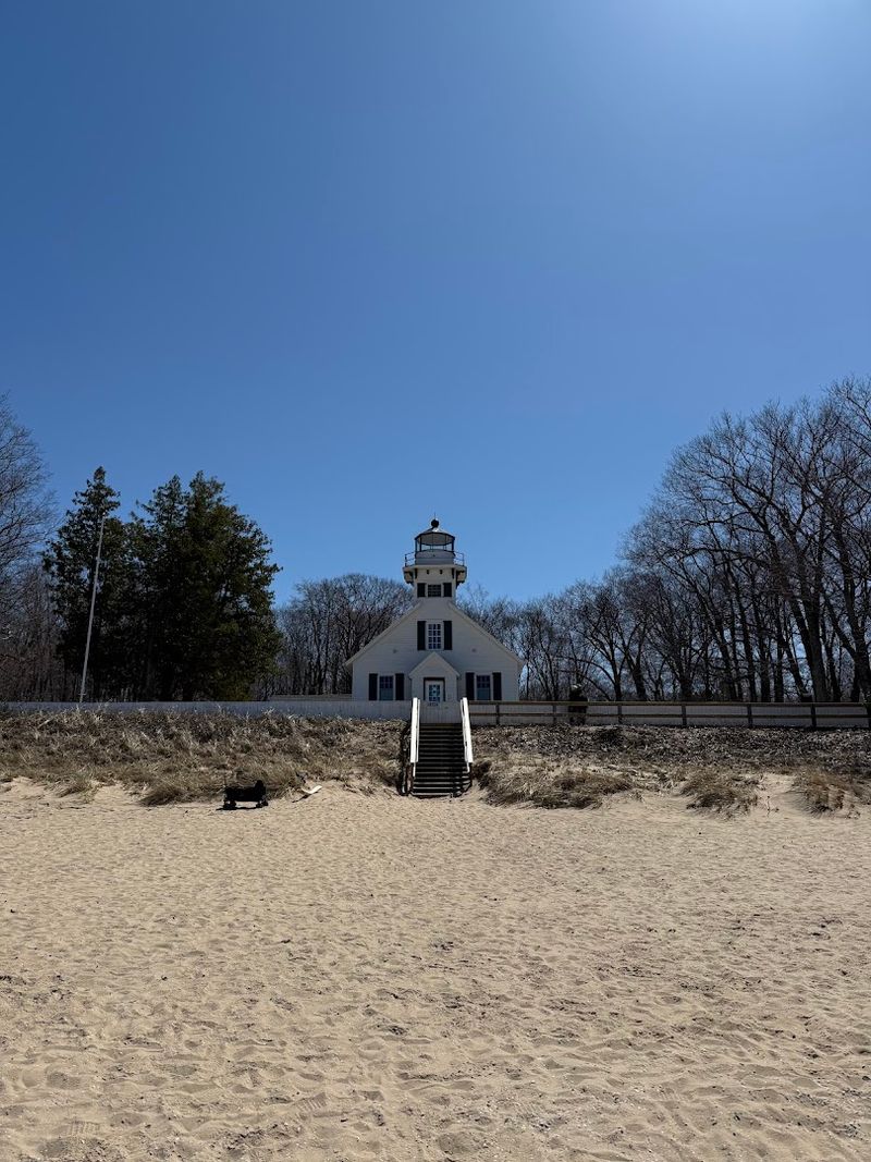
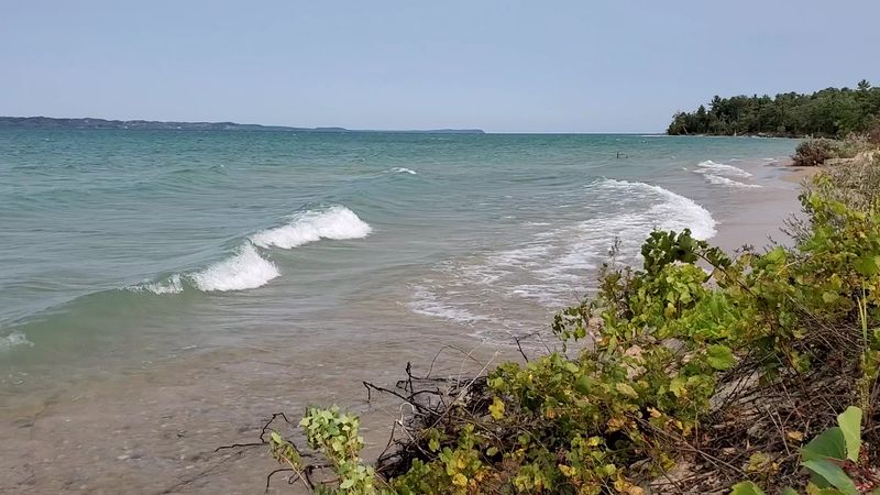
Pine scent deepens as the path narrows toward the Old Mission Point Lighthouse, and Lake Michigan flashes between trunks like tin. The terrain rolls gently, alternating sandy beach cuts with cathedral-quiet forest.
Wind changes the script by the minute, ringing the rigging at the harbor and carrying gull chatter through the needles. This is the 45th parallel, halfway between the equator and the North Pole.
There is a certain magic in knowing you are standing right on that invisible line.
This moderate route can stretch past six miles if you decide to stitch various spurs together. So be sure to budget enough daylight and bring along a few snacks.
Start your trek from the park lot near the historic lighthouse. Be careful to respect the posted dune restoration signs that protect the fragile ecosystem.
I like to pause on the north beach to search for Petoskey Stones. They are ancient, fossilized rugose corals striped with distinctive hexagonal patterns.
Winter brings a firm snowpack that is perfect for microspikes or snowshoes. The lush summer months demand a good coating of bug spray and a wide-brimmed hat.
3. Pelizzari Natural Area, Traverse City
A quiet mosaic of old fields and second-growth woods, Pelizzari trades spectacle for small, intricate textures. Chickadees scold from sumac bushes, and boardwalks lift you over soggy seams where sedges gleam in the shadows.
The trails crisscross like a neighborhood chat. Mowed edges open to the wide Michigan sky before tucking back into the deep shade of old maples.
It is a fantastic spot for those days when you want to get lost in thought without actually getting lost in the woods.
The history of this land hides in the farmstead geometry. Stone piles and split-rail echoes mark a century of agricultural labor.
Wayfinding is remarkably simple via color-coded posts. The various loops let you tailor your distance for kids or quick lunch breaks.
You can find parking along Eastern Avenue. Just remember to step gently during the spring when the vernal pools are teeming with translucent salamander eggs.
Evenings here invite the rhythmic pulse of crickets and a soft, gold light that filters through the leaves. That makes it the perfect setting for breathing a little slower without actually leaving the city limits.
4. Maple Bay Park And Natural Area, Williamsburg
Waves lace the Maple Bay shoreline with bright foamy threads, while dune grass clicks like beads in the wind. Inland, a tall maple corridor glows in October, and the air smells faintly of apples from nearby farms.
Trails switch between soft beach sand and firm two-track. That gives your calves and soles alternating chores throughout the hike.
It is a bit of a hidden gem. It is located just far enough from the downtown core to keep the crowds thin even on a sunny Saturday.
This property reflects years of careful restoration, with signed protected dunes and essential grassland bird habitat. You will want to start at the parking area off US 31.
Then follow the spur directly to the bay before looping back along the farmland edges. Summer swimmers usually hug the north cove when the breeze turns chilly.
The land provides a bit of a windbreak there. Spring birders often scan the hedgerows for bobolinks. Their metallic songs sound like R2-D2 having a good day.
5. VASA Pathway, Williamsburg

Waves lace the Maple Bay shoreline with bright foamy threads, while dune grass clicks like beads in the wind. Inland, a tall maple corridor glows in October, and the air smells faintly of apples from nearby farms.
Trails switch between soft beach sand and firm two-track. That gives your calves and soles alternating chores throughout the hike.
It is a bit of a hidden gem. It is located just far enough from the downtown core to keep the crowds thin even on a sunny Saturday.
This property reflects years of careful restoration, with signed protected dunes and essential grassland bird habitat. You will want to start at the parking area off US 31.
Then follow the spur directly to the bay before looping back along the farmland edges. Summer swimmers usually hug the north cove when the breeze turns chilly.
The land provides a bit of a windbreak there. Spring birders often scan the hedgerows for bobolinks. Their metallic songs sound like R2-D2 having a good day.
6. Natural Education Reserve, Traverse City
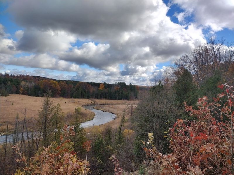
Water writes a constant story here as the Boardman River unwinds through oxbows, with old dams removed and new wetlands stitching themselves together in vibrant shades of green. You will likely hear the trill of red-winged blackbirds before you actually see them.
If you look closely, you will notice painted turtle heads periscoping in the still backwaters. The boardwalks give you an intimate, front-row look at the river’s rebirth.
They do it without the penalty of muddy ankles.
This reserve is a premier showcase of ecological restoration in progress. After the Sabin and Boardman dams were removed, the river returned to its ancient channels for the first time in a century.
Trailheads located at Cass Road and the YMCA connect a lattice of easy loops. They are perfect for families or quick midday breaks.
You should definitely bring a pair of binoculars to scan the snags for bald eagles. Be sure to keep dogs leashed when near the sensitive, newly formed banks.
Spring floods can lift the river surprisingly high. So it is always a good idea to check local conditions before heading out.
The interpretive signs along the path are well worth an unhurried reading. They explain the incredible engineering required to let a river go wild again.
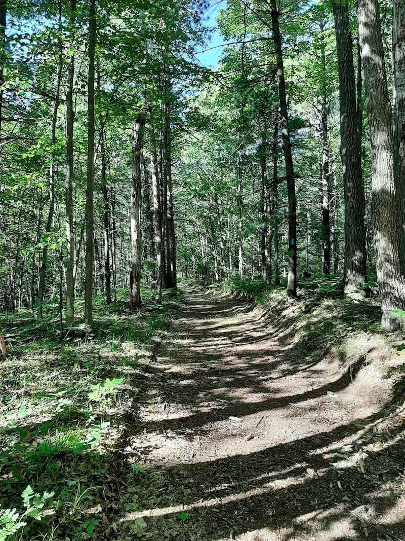
7. Brown Bridge Quiet Area, Garfield Township
A profound hush settles quickly over the former reservoir basin at Brown Bridge, which is now a broad, sweeping meadow sliced by the cold, renewed waters of the Boardman. Hills rise like massive shoulders on both sides of the valley.
The sand banks show the river’s restless, shifting handwriting. Dragonflies patrol the sunny clearings while towering white pines outline the sky with tidy, needle-sharp geometry.
The Quiet Area is a living chapter of the dam removal story. Overlooks still mark the old water levels from the days when a massive pond covered this valley before the project ended in 2012.
Multiple loops branch out from the Hobbs Road trailhead. They range from quick rambles to half-day explorations that will leave your legs pleasantly tired.
Expect very few amenities out here. So it is essential to carry your own water and perhaps a paper map in case your phone battery decides to fade in the cold.
Autumn colors pool beautifully along the valley floor. They turn the river into a silver ribbon through a sea of crimson and gold.
8. Miller Creek Nature Preserve, Traverse City
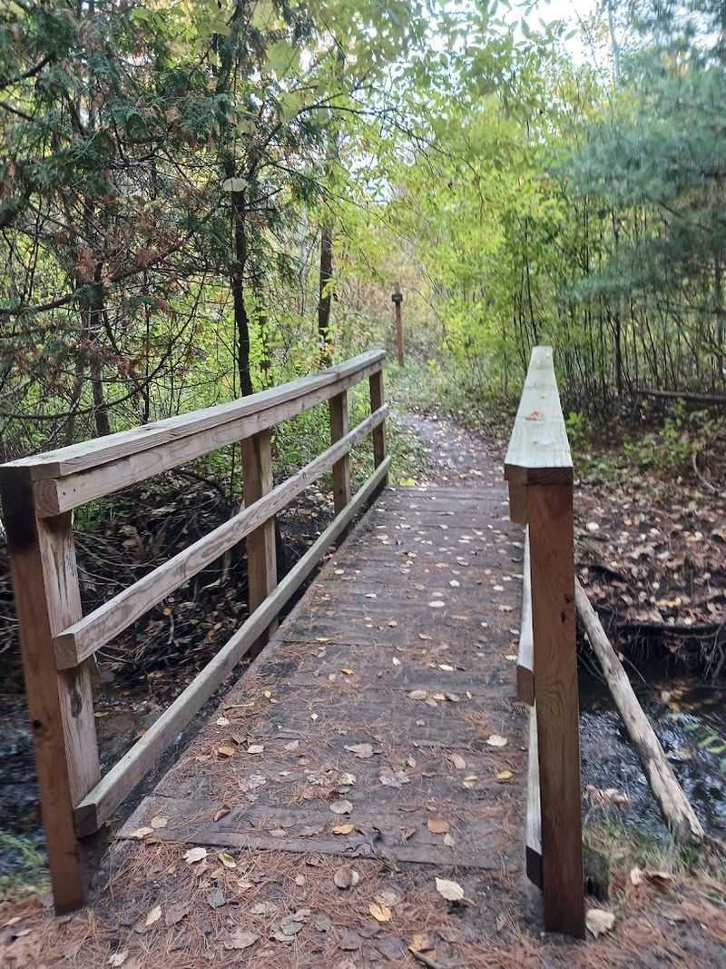
City noise thins to a faint hush as Miller Creek threads beneath dark cedar bows and hidden culverts near the busy big-box shopping corridors. The contrast here is absolutely striking.
The roar of traffic is just a few hundred yards away. Yet the water whispers to itself and ferns busy themselves along the mossy banks.
Small footbridges hop-scotch the stream. They bring a surprising, welcome burst of cool air on humid Michigan days.
Protected by the Grand Traverse Regional Land Conservancy, the preserve is a pocket-sized refuge featuring short, layered trails that feel much deeper than they are. Sturdy boardwalks keep your feet dry even during the wettest seasons.
Helpful interpretive signs point out the ongoing creek restoration projects aimed at keeping the water cold and clean for trout.
I especially like this spot for lunch breaks. You can slip in from South Airport Road and return to your car feeling significantly calmer.
It is important to stay strictly on the trail to spare the fragile, silty banks from erosion. If you are lucky, you might spot the tiny, five-fingered prints of a mink pressed into the fine mud.
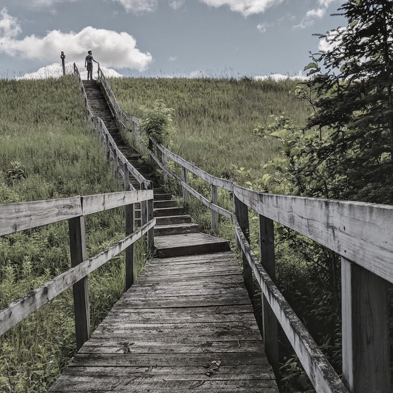
9. Empire Bluff Trail, Empire
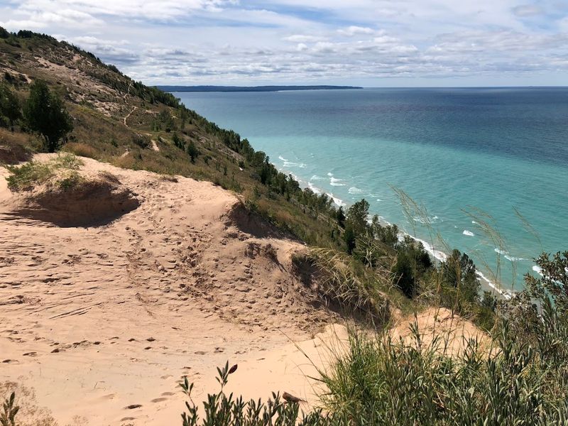
Steps rise steeply through a dense forest of beech and maple before the trees suddenly loosen their grip and Lake Michigan explodes into view, a vast expanse of teal stretching to the horizon. Sandstone-tinted bluffs hold the winds steady.
Tiger swallowtails tilt like small kites over the beach grass. The long boardwalk spur leading to the main overlook feels like a cinematic drumroll.
Each wooden plank carries a bit more anticipation.
Short but incredibly rewarding at roughly 1.5 miles round trip, this Sleeping Bear Dunes National Lakeshore classic is one of the most photographed spots in the state. To avoid the heaviest crowds, you will want to arrive very early on summer weekends.
Or perhaps just before sunset to secure a parking spot and catch the softest light.
Always stay behind the split-rail fencing to protect the eroding edges and the rare Pitcher’s Thistle plants that cling to the sand. Much cooler air often lingers on top of the bluff, even in July.
So it is wise to add a light layer to your pack and stay a while to savor the lingering colors of the water. Waves echo faintly beneath the bluff today.
10. Pyramid Point Trail, Maple City Area
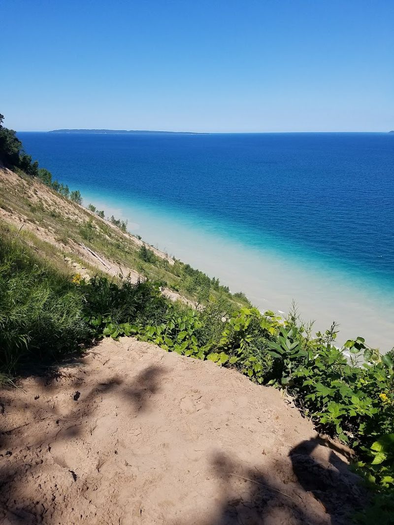
Sandy steps pull you upward through thickets of hawthorn and sugar maples, and then the world cracks wide open at Pyramid Point with layers of blue stacked upon more blue. The dune face drops steep and dramatic to the crashing surf of Lake Michigan.
The distant Manitou Islands hover on the horizon like patient, prehistoric ships. The wind braids the sounds of the shore into a thin, constant roar.
It feels much older than the roads you took to get here.
The full loop options tally up to about 2.7 miles, beginning at the trailhead on Basch Road. It is absolutely vital to respect the signs warning against descending the bluff.
The erosion is significant, and a rescue from the bottom is both expensive and dangerous. I prefer to follow the forest loop back after visiting the overlook.
That lets me enjoy the deep shade and hunt for colorful mushrooms while my heart rate settles after the climb.
11. Sand Lakes Quiet Area, Williamsburg
Trail dust smells like warm pine and wild blueberries as the Sand Lakes loops weave through dry ridges between a series of crystal-clear kettle ponds. Silence sits very comfortably in this corner of the woods.
It is broken only by the spring peepers, the dip of a paddle, or the occasional whirr of a mountain bike on a distant piece of singletrack. Sun spatter hits the path through the jack pines.
It looks like a handful of coins tossed from above.
Created within the Pere Marquette State Forest, this area offers several well-signed loops on sandy two-track and winding footpaths. You can park at the Guernsey Lake Road access.
Then choose a distance that matches your remaining daylight. Always remember that the sandy soil makes progress a bit slower than on paved paths.
Swimmers often favor the shallow, sun-warmed margins of the lakes in late summer. The haunting call of a loon will sometimes stitch its way across the water as evening falls.
It is a good idea to carry a small towel and a reliable headlamp. That ensures you can exit the woods with enough light to dodge the stubborn roots.