These Colorado Trails Somehow Stay Off Tourist Radars And That Is A Shame
Colorado gets plenty of attention for its famous peaks, major ski towns, and postcard worthy national park views, but some of its best hiking lives well outside the usual spotlight. Far from the busiest trailheads, these lesser known paths wind through sweeping grasslands, rugged canyons, quiet forests, and wild backcountry that still feels wonderfully undisturbed.
The beauty of these hikes is not just the scenery, though there is plenty of that. It is the feeling that you have stumbled onto something special without needing to compete for it.
No crowded overlooks, no packed parking lots, no long line of strangers marching toward the same viewpoint. Just open space, fresh air, and the kind of silence that makes every step feel a little more meaningful.
Many travelers see only one version of Colorado, but these trails reveal a wilder, calmer side. What makes Colorado truly unforgettable is how easily it can still surprise you when you leave the obvious route behind.
1. Vogel Canyon Trails – Near La Junta
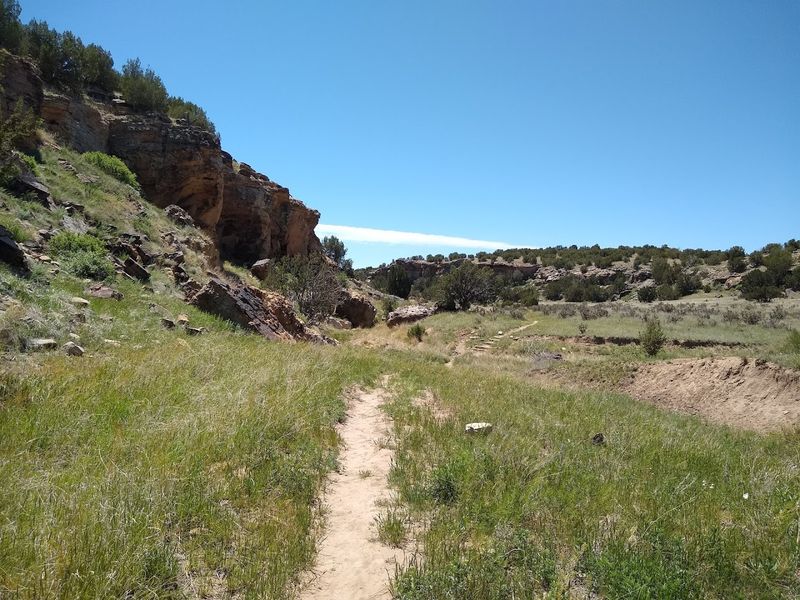
Most people blow past La Junta without a second thought, and that is their loss. Vogel Canyon sits quietly in the Comanche National Grassland, offering four distinct trails, the Overlook, Canyon, Prairie, and Mesa trails, each one revealing a different personality of this surprisingly dramatic landscape.
The canyon walls hold petroglyphs and pictographs left by people who passed through here long before any road existed. Walking beside those rock art panels feels genuinely humbling, like flipping through a history book written in stone.
The Overlook Trail rewards you with sweeping views across the shortgrass prairie that stretch so far your eyes need a moment to adjust.
What makes Vogel Canyon special is its layered experience. You get geology, wildlife, history, and big sky scenery all folded into one compact visit.
Birding is excellent here too, particularly for raptors riding thermals above the canyon rim. Bring plenty of water because southeastern Colorado can get seriously warm, and shade is a luxury rather than a guarantee.
Plan your visit for spring or fall to enjoy the most comfortable temperatures. This canyon rewards the curious traveler who bothers to look beyond Colorado’s mountain headlines.
2. Arch Rock Trail, Picture Canyon – Comanche National Grassland
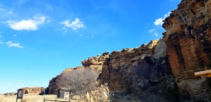
Picture Canyon earns its name honestly. The Forest Service’s Arch Rock Trail winds eight miles through a sandstone canyon so visually striking that you will stop every few minutes just to confirm you are still in Colorado and not somewhere in the American Southwest’s greatest hits reel.
Unique rock formations rise from the canyon floor like natural sculptures, and the canyon walls are etched with petroglyphs that date back thousands of years. There is something almost meditative about walking through a place where human presence stretches back that far.
The trail is long enough to feel like a genuine commitment, which probably explains why casual day-trippers tend to skip it entirely.
Reaching Picture Canyon requires a real drive into the remote southeastern corner of the state, and that distance alone filters out a huge portion of potential visitors. Pack a proper lunch, lace up real hiking boots, and give yourself the full day.
The canyon scenery shifts dramatically as you move deeper in, with the sandstone walls narrowing and the light playing tricks in the most photogenic ways. This trail is the kind of find you text friends about and then immediately feel slightly protective of.
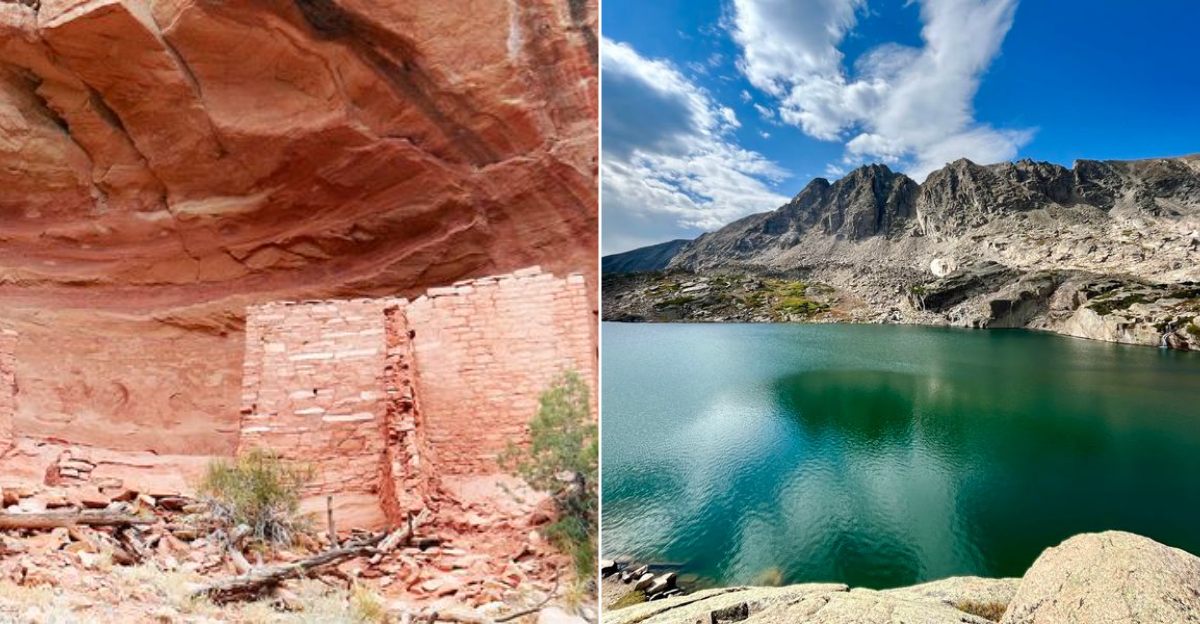
3. Sand Canyon Trail – Canyons of the Ancients National Monument, Near Cortez
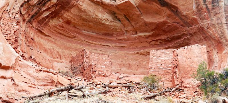
Everyone knows Mesa Verde, but Sand Canyon Trail in Canyons of the Ancients National Monument is the kind of archaeological experience that makes Mesa Verde feel almost crowded by comparison. The BLM-designated trail winds through a canyon system packed with Ancestral Puebloan sites, tower ruins, kivas, and cliff dwellings that you can approach on your own schedule without a tour group forming around you.
The trail covers serious ground, and the archaeological density along the route is genuinely staggering. You are walking through one of the highest concentrations of ancient sites anywhere in North America, which makes every bend in the canyon feel like an unexpected discovery.
Sand Canyon rewards hikers who move slowly and look carefully rather than those just ticking off mileage.
Cortez is a practical base, and the drive to the trailhead is straightforward. Spring and fall offer the most pleasant hiking conditions, and early morning visits give you the best chance of having the canyon mostly to yourself.
Bring a printed map because cell service out here is unreliable at best. The experience here is patient, quiet, and deeply satisfying in a way that the big-name archaeological parks simply cannot replicate.
Consider it Mesa Verde’s thoughtful, understated sibling.
4. No Thoroughfare Canyon Trail – Colorado National Monument, Near Grand Junction
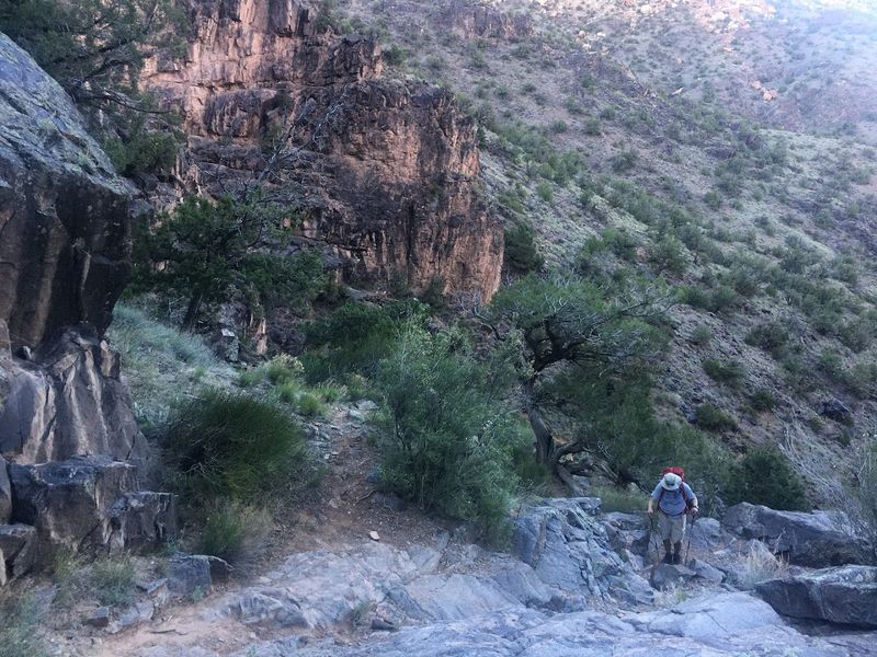
Colorado National Monument attracts road-trippers who cruise Rim Rock Drive, snap photos, and move on. What most of them never discover is that the monument’s most remote canyon trail starts just below that scenic road and leads somewhere those drive-through visitors will never see.
No Thoroughfare Canyon Trail earns its dramatic name. The NPS describes it as the monument’s most remote canyon route and a genuine all-day commitment.
The trail follows a wash into a narrowing red rock canyon, scrambling over boulders, crossing seasonal stream beds, and requiring the kind of route-finding that keeps casual hikers at the trailhead. That is not a criticism; it is a feature.
Grand Junction is a comfortable base with good food and easy access, but once you drop into this canyon, the city feels like a rumor. The canyon walls close in as you go deeper, and the scale of the sandstone formations becomes almost surreal.
Water can flow through sections of the route, so waterproof boots are worth considering. Go on a weekday if possible, and tell someone your plan before you head in.
This trail delivers the kind of raw, unscripted Colorado experience that no overlook pullout can replicate.
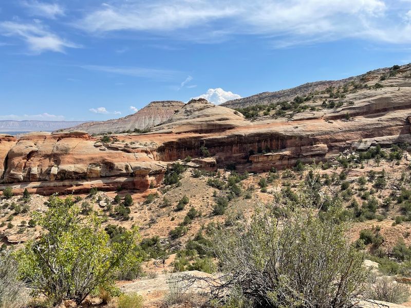
5. Big Dominguez Trail – Dominguez Canyon Wilderness, Delta and Mesa County
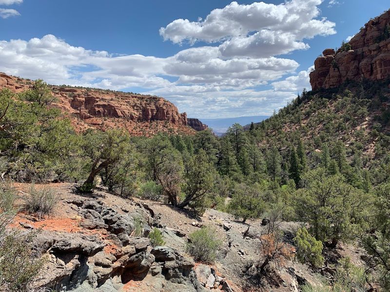
The Western Slope of Colorado has a quiet confidence about it, and Big Dominguez Trail captures that spirit perfectly. The BLM’s Dominguez-Escalante National Conservation Area is not exactly a household name, which means the Dominguez Canyon Wilderness still feels genuinely wild and unhurried even on a busy weekend elsewhere in the state.
Big Dominguez Trail is one of the main wilderness routes, threading through a deep canyon that rewards hikers with rock art panels, seasonal waterfalls, and the kind of geological drama that makes you feel very small in the best possible way. The canyon walls display layers of sandstone that read like pages from the earth’s autobiography, and the petroglyphs scattered along the route add a human dimension that is quietly moving.
Delta and Mesa counties are not traditional Colorado tourism hotspots, which works entirely in your favor here. The trailhead access is manageable, and the canyon environment shifts character as you move deeper into the wilderness.
Mornings are particularly beautiful when the canyon catches the first light. Pack enough water for a long day and resist the urge to rush.
Big Dominguez rewards the hiker who arrives without a rigid agenda and leaves with a completely unexpected favorite Colorado memory.
6. McKee Draw Hiking Trails – Burn Canyon Trail System, Near Norwood
Norwood sits in a part of southwest Colorado that most GPS units seem reluctant to acknowledge, and the Burn Canyon Trail System near town operates in that same spirit of cheerful obscurity. McKee Draw hiking trails offer canyon views and mesa-top panoramas that would be famous if they existed anywhere closer to a major highway.
The BLM-managed system delivers a satisfying combination of open ridgeline walking and canyon-edge exploration. From the mesa top, the views roll out in every direction with a generosity that feels almost impolite given how few people show up to appreciate them.
The trails are not technically demanding in a way that requires specialized gear, but they do reward hikers who pay attention to the landscape rather than just logging steps on a fitness tracker.
Norwood itself is a small agricultural community with a genuine, unhurried feel that pairs well with a trail system that has not been discovered by the outdoor recreation industry. Plan to make a day of it, pack a real lunch, and give yourself time to sit on a canyon rim and do absolutely nothing for twenty minutes.
That combination, good trail, honest town, zero crowds, is increasingly rare in Colorado, which makes McKee Draw feel like a small, wonderful secret worth keeping just long enough to visit first.
7. Penitente Canyon Trail System – Near Del Norte
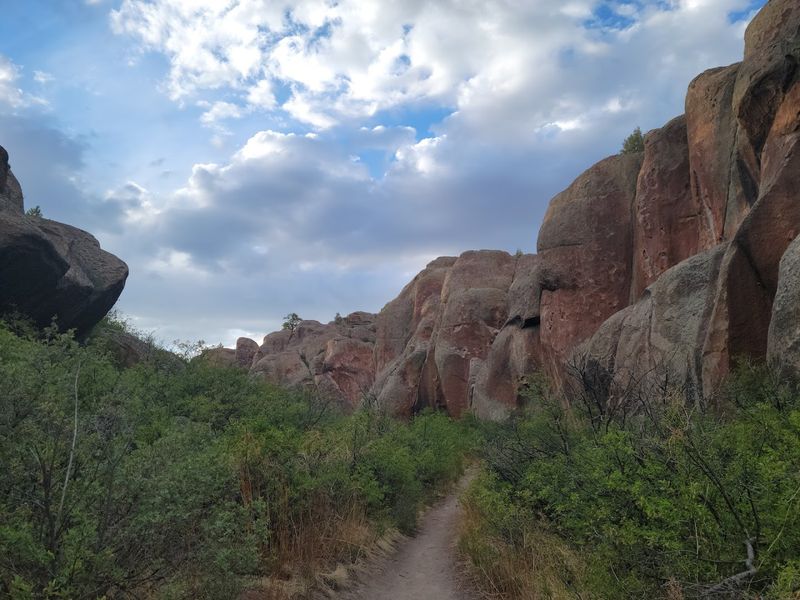
Penitente Canyon has a devoted following among rock climbers and mountain bikers, but somehow that devoted following has never grown large enough to put it on the mainstream Colorado travel map. Near Del Norte in the San Luis Valley, the BLM-managed site offers an extensive nonmotorized trail system that weaves through a landscape of volcanic rock formations and hidden canyon corridors that feel genuinely otherworldly.
The trail network is more intricate than most visitors expect, branching into side canyons and climbing above the main formation for views across the broad San Luis Valley floor. Hikers who are not there for the technical climbing routes will find plenty to explore on foot, and the rock itself has a texture and color that photographers find irresistible at golden hour.
The canyon’s name carries historical weight connected to Penitente religious traditions in the region, which adds cultural context worth reading about before you visit.
Del Norte is a straightforward base with a relaxed, valley-town character. Spring and fall are the sweet spots for visiting, when temperatures are comfortable and the light is particularly flattering on the canyon walls.
The trail system is well enough maintained to navigate confidently, but the crowds never materialize in the way you might expect from a location this rewarding. That remains one of Colorado’s better mysteries.
8. Blue Lake Trail – Rawah Wilderness, Northwest of Fort Collins
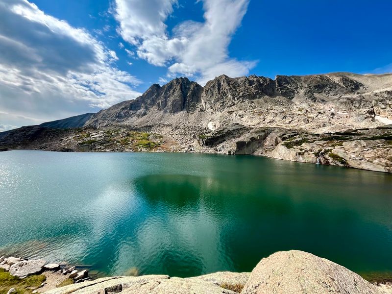
Fort Collins gets plenty of attention as a college town and craft beer destination, but the wilderness northwest of the city is where things get genuinely spectacular. The Rawah Wilderness holds mountain scenery that competes with anything in the state, and Blue Lake Trail reaches an alpine lake roughly five miles from the trailhead that earns every step of the approach.
The Forest Service trail climbs through dense conifer forest before opening into the kind of high-elevation landscape that makes you exhale slowly and reach for your camera. Blue Lake itself sits in a rocky cirque with the kind of reflective clarity that makes you want to sit beside it for an hour without speaking.
Compared with the heavily trafficked wilderness areas closer to Rocky Mountain National Park, the Rawah feels refreshingly uncrowded even during peak summer weekends.
The drive from Fort Collins takes some time but follows scenic roads that make the journey feel like part of the experience. Start early if you want the trailhead to yourself, and pack layers because the weather above treeline shifts quickly and without much warning.
Wildflower season in July and August turns the meadows along the route into something extraordinary. Blue Lake Trail is one of those northern Colorado experiences that locals quietly treasure while the tourists queue up somewhere else entirely.
9. Hermosa Creek Trail – North of Durango
Durango is one of those Colorado towns that does everything right: great food, a historic railroad, mountain scenery, and enough personality to fill a long weekend. But the trail that arguably deserves the most attention in the area is the one that gets the least: Hermosa Creek Trail, a 19-mile one-way route through the Hermosa Creek watershed that the Forest Service lists as a genuine long-distance backcountry experience.
The trail follows the creek through a forested valley that feels tucked away from the region’s more celebrated attractions. The combination of water sound, dense tree cover, and the occasional wildlife sighting gives the route a completely different character from the high-alpine experiences Durango is typically associated with.
Hikers, mountain bikers, and equestrians share the corridor, which keeps the trail lively without ever feeling overcrowded.
Current Forest Service information includes notes about access and trail damage from recent events, so checking conditions before you go is genuinely important rather than just a formality. Point-to-point logistics require a shuttle or a willing driver, which filters out some visitors and keeps the experience quieter than it might otherwise be.
The payoff for that minor logistical effort is nineteen miles of Colorado wilderness that feels earned, unhurried, and completely worth every step. Durango’s dining scene handles the recovery portion beautifully.
10. Venable Trail and Comanche Trail Area – Near Westcliffe
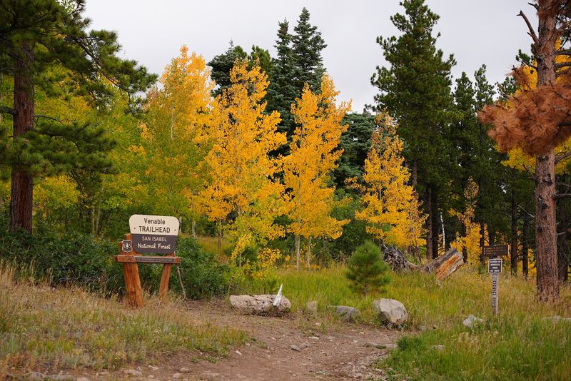
The Sangre de Cristo range has a brooding, almost theatrical quality that sets it apart from other Colorado mountain landscapes. Near Westcliffe, the Alvarado and Comanche-Venable access area gives hikers a loop trail that Colorado.com has quietly called a hidden gem, and for once that label is completely accurate rather than marketing optimism.
The Forest Service lists both Venable and Comanche trails from the same access area, and the loop they form together climbs through aspen groves, crosses high-altitude passes, and delivers views of the Wet Mountain Valley below that are genuinely jaw-dropping. The nearby fourteeners pull most hikers in a different direction, which leaves this loop surprisingly uncrowded for a trail of this quality.
That is the range’s odd gift to the observant traveler.
Westcliffe is a small, unhurried town with a character that feels authentically western rather than curated for tourism, and the surrounding Wet Mountain Valley is one of Colorado’s genuinely underappreciated scenic corridors. Plan for a full day on the loop, start early enough to clear the high passes before any afternoon storms build, and bring a proper lunch worth eating at elevation.
Wildflower season from mid-July through early August transforms the upper meadows into something that feels almost unreasonably beautiful for a trail this overlooked.