The 12,000-Acre Arizona National Monument That Most People Don’t Even Know Exists
Arizona is full of famous scenery, but the places that surprise me most are usually the ones people somehow overlook. This 12,000-acre national monument near Willcox is one of those rare finds, packed with towering stone columns, quiet trails, and views that feel almost unreal.
I like that it does not need a big flashy reputation to make an impression.
The moment the landscape starts opening up, it becomes clear that this is not just another desert stop. It feels ancient, rugged, and beautifully removed from the noise of busier parks. There is room to wander, breathe, and take in formations that look like nature spent extra time shaping them.
For an Arizona trip that feels both peaceful and dramatic, this spot deserves far more attention.
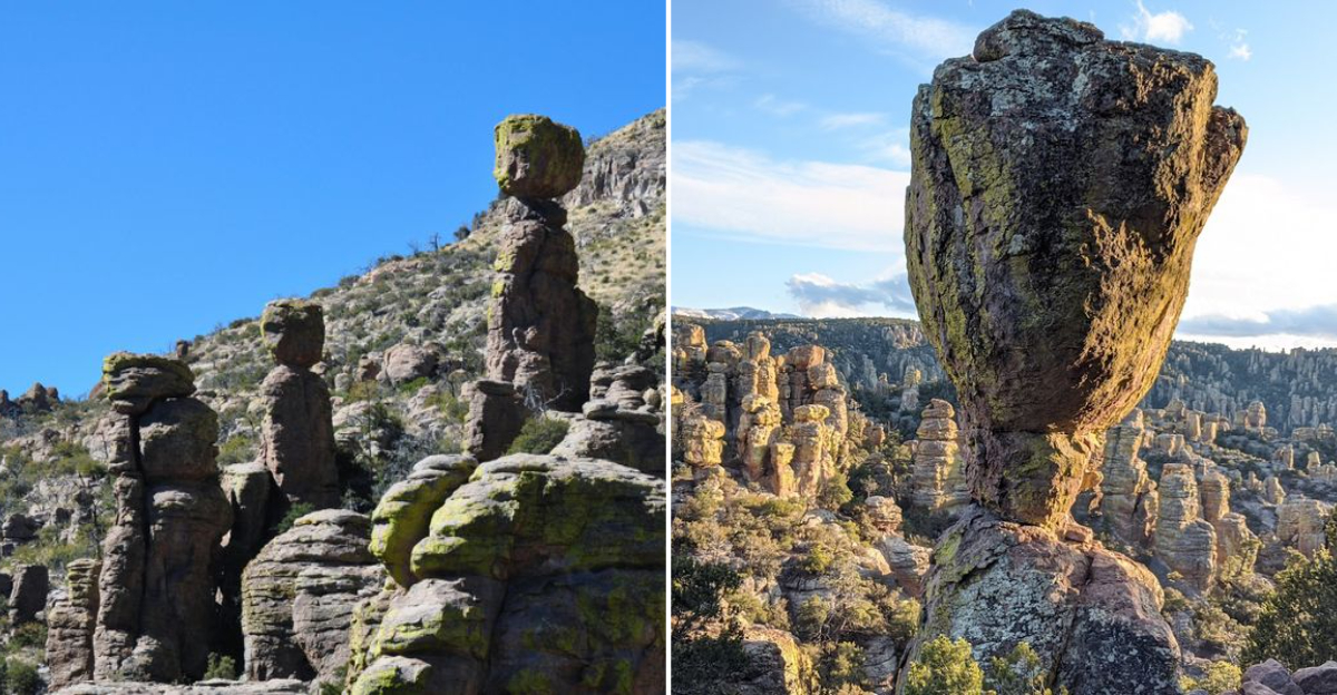
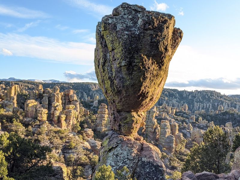
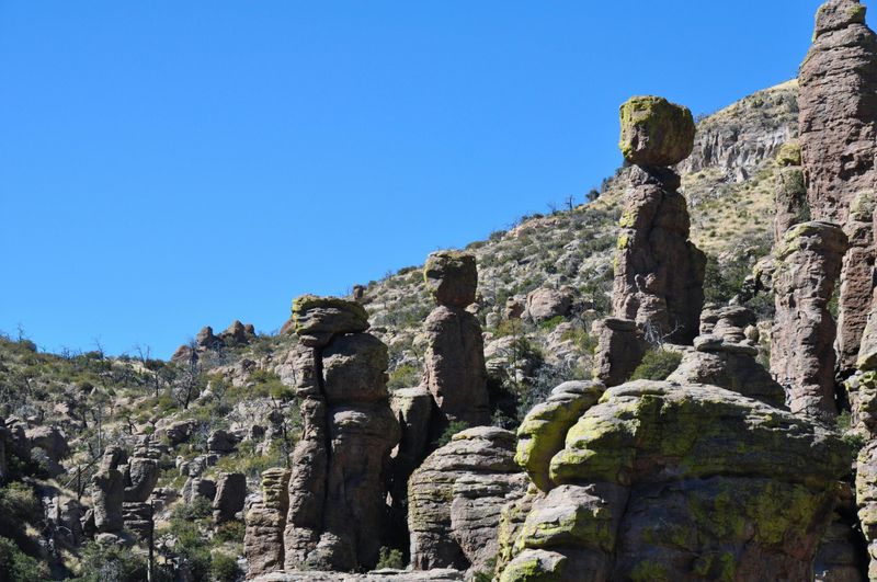
Volcanic Origins And The Wonderland Of Rocks
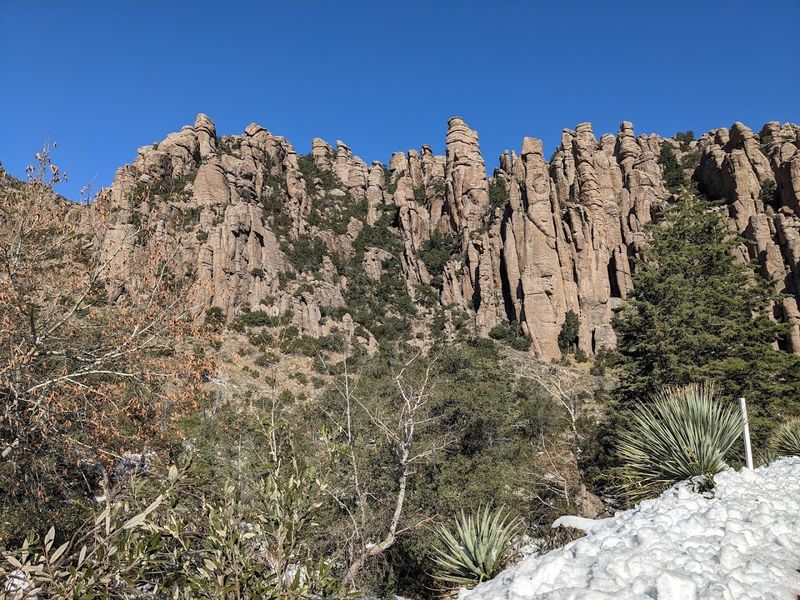
Twenty-seven million years ago, a volcanic eruption so massive it defies imagination blasted out of the Turkey Creek Caldera and buried this entire region in superheated ash. That ash cooled into rhyolitic tuff, and then time went to work.
Wind, water, and millions of years of patient erosion carved the tuff into what locals now call the Wonderland of Rocks. Walking among these formations felt surreal to me, like wandering through a gallery where nature itself is the sculptor.
The towering pinnacles, balanced rocks, and spires create shapes that your mind struggles to accept as natural. Some columns stand over 100 feet tall, defying gravity in ways that seem impossible.
I found myself constantly stopping to photograph these geological marvels from every angle. President Calvin Coolidge recognized their uniqueness when he established the monument on April 18, 1924.
The formations continue changing today, though imperceptibly, as erosion continues its endless work. Standing beneath these ancient stone giants reminded me how temporary we really are.
Sky Island Ecosystem And Biodiversity Hotspot
Four major biomes converge at Chiricahua, creating one of North America’s most biodiverse regions. The Sierra Madre, Rocky Mountain, Chihuahuan Desert, and Sonoran Desert ecosystems all meet here in what scientists call a sky island.
These isolated mountain ranges rising from desert lowlands act like biological laboratories. Species from different regions intermingle in ways you won’t find anywhere else on Earth.
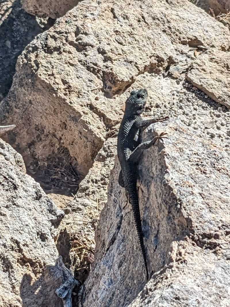
I watched Mexican jays squabbling in the trees while desert plants clung to rocky outcrops below. The elevation changes dramatically across the monument, creating distinct climate zones within just a few miles.
Bird watchers consider this area sacred ground, with species found nowhere else in the United States. I’m not an expert birder, but even I could appreciate the incredible variety of songs filling the air.
The monument protects over 10,000 acres of designated wilderness where these ecosystems thrive undisturbed. Walking through different elevation zones felt like traveling through multiple states in a single afternoon, each with its own character and inhabitants.
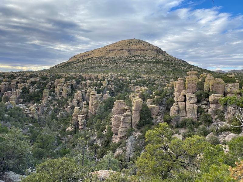
Bonita Canyon Scenic Drive And Trail Network
An eight-mile paved road winds through the heart of the monument, climbing from the visitor center to Massai Point at 6,870 feet. Every curve revealed new perspectives on the rock formations that I hadn’t anticipated.
The scenic drive alone justifies the trip, but parking at various pullouts and exploring the trails takes the experience to another level. Over 17 miles of maintained trails crisscross the monument, ranging from easy strolls to challenging scrambles.
I tackled the Echo Canyon Loop Trail, which threads between towering rock walls and under balanced rocks that look ready to topple. The trail builders, mostly Civilian Conservation Corps workers in the 1930s, did remarkable work.
Stone steps and careful routing make even steep sections manageable for moderately fit hikers. Some trails connect to create longer routes for serious backpackers seeking solitude.
Cell service is essentially nonexistent here, so I downloaded offline maps before arriving. The isolation felt refreshing rather than concerning, though planning ahead made the experience much smoother for navigation and safety.
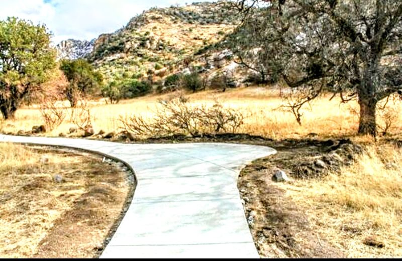
Faraway Ranch And Human History
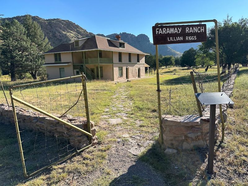
Swedish immigrants Neil and Emma Erickson established Faraway Ranch in the late 1800s, transforming this remote canyon into a working cattle operation and eventually a guest ranch. Their daughter Lillian grew up here and later ran the property as a destination for travelers seeking authentic Western experiences.
Walking through the preserved ranch buildings, I could almost hear echoes of guests from decades past. The structures remain remarkably intact, offering windows into frontier life that history books can’t quite capture.
Long before the Ericksons arrived, this land belonged to the Chiricahua Apache, whose homeland encompassed these mountains. The monument preserves layers of human history stretching back thousands of years.
Rangers offer tours of the ranch buildings during peak seasons, sharing stories about the families who called this isolated place home. I visited on a quiet weekday and had the entire ranch area to myself.
The juxtaposition of human perseverance against this harsh landscape impressed me deeply. These settlers chose one of the most remote, challenging places imaginable to build their lives.
Stargazing And Dark Sky Designation
Chiricahua boasts some of the darkest night skies remaining in the continental United States, a rarity in our increasingly light-polluted world. Miles from any significant town, the monument offers views of the cosmos that most Americans have never experienced.
I stayed until well after sunset one evening, and the transformation was breathtaking. Stars emerged not by the dozens or hundreds, but by the thousands, carpeting the sky in ways city dwellers can scarcely imagine.
The Milky Way stretched overhead like a river of light, and I spotted satellites tracking across the darkness. Without moon interference, even faint nebulae became visible to my naked eyes.
Photographers come specifically for astrophotography opportunities here, capturing the rock formations silhouetted against star fields. The monument occasionally hosts astronomy programs where rangers and volunteers set up telescopes for public viewing.
Bring warm layers even in summer, as temperatures drop significantly after sunset at this elevation. The combination of geological wonders and celestial displays creates an experience that engages both earthbound and cosmic perspectives simultaneously.
Seasonal Considerations And Visitor Patterns
July and August see the fewest visitors, sometimes averaging just 60 people per day across 12,000 acres. Monsoon rains arrive during these months, bringing afternoon thunderstorms that can be spectacular but also dangerous on exposed trails.
I visited in October and found the weather absolutely perfect for hiking, with cool mornings and comfortable afternoons. Spring brings wildflowers and migrating birds, while winter occasionally dusts the high peaks with snow.
The monument charges no entrance fee, making it accessible regardless of budget constraints. Bonita Canyon Campground offers 25 sites on a first-come, first-served basis, though they rarely fill except on holiday weekends.
Summer heat at lower elevations can be intense, but the higher trails remain relatively comfortable. Winter closes some facilities but leaves the monument open for hardy visitors willing to brave occasional cold snaps.
I appreciated having the trails nearly to myself, a luxury impossible at more famous parks. The low visitation numbers mean you can experience the monument almost as early explorers did, with solitude and silence as constant companions throughout your visit.
Practical Information And Access
Getting to Chiricahua requires commitment, as it sits roughly 35 to 45 miles southeast of Willcox, Arizona, along increasingly rural roads. The final stretch on Rhyolite Creek Road is paved but winding, climbing steadily into the mountains.
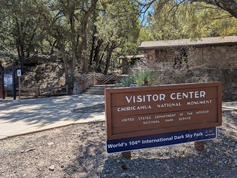
I filled my gas tank in Willcox and packed extra water, as services are nonexistent once you leave town. The visitor center near the monument entrance provides maps, restrooms, and ranger expertise for trip planning.
Cell phone reception disappears shortly after entering the monument, making downloaded maps essential for navigation. I used offline maps on my phone and carried paper backups just in case.
The nearest lodging and restaurants are back in Willcox, so plan accordingly if you’re not camping. Most visitors need at least half a day to experience the scenic drive and a short hike.
Serious hikers and photographers often spend multiple days exploring the extensive trail network. Water is available at the campground and visitor center but not along trails, so carry plenty during your explorations and always inform someone of your plans before heading out alone.
Apache Heritage And Geronimo’s Stronghold
The Chiricahua Mountains hold profound significance as the ancestral homeland of the Chiricahua Apache, who called these rock formations their fortress for centuries. Geronimo himself led his band through these canyons in the 1880s, using the landscape as natural defense.
The Apache knew every hidden spring and passage.
You can walk trails that follow ancient Apache routes today, though the monument focuses primarily on geology rather than indigenous history. The Chiricahua Apache were eventually forced from these lands, but their legacy remains in every canyon. Their intimate knowledge of this Land of Standing-Up Rocks allowed them to resist far longer than seemed possible.
That history adds real weight to the landscape, turning the rock formations into something far more meaningful than scenery alone.
Every overlook feels different when you remember that these canyons once served as shelter, strategy, and home. It is a place where natural beauty and difficult history sit side by side, and both deserve attention.