This South Carolina Mountain Was Shaped By Ancient Volcanoes Millions Of Years Ago
Most people see a mountain.
Scientists see the remains of an ancient volcanic world.
That is what makes Table Rock State Park so fascinating.
The cliffs are massive. The views are spectacular.
The hiking is some of the best in South Carolina.
But the real story began hundreds of millions of years ago.
Long before roads.
Long before towns.
Long before humans.
Volcanoes erupted across the region. Mountains rose.
Continents collided. The landscape changed again and again until the scenery visitors admire today finally took shape.
Now those ancient forces are hiding in plain sight.
Every trail passes through a landscape shaped by fire, pressure, and time.
Most visitors come for the waterfalls and mountain views.
They leave realizing they just walked through one of South Carolina’s oldest stories.
Ancient Volcanic Origins Shape Table Rock’s Granite Summit

Geologists trace Table Rock’s granite back to the Paleozoic Era, when volcanic activity and tectonic plate collisions helped shape what is now one of the most remarkable landscapes in South Carolina. The massive pluton that forms the mountain’s core cooled slowly beneath the earth’s surface roughly 300 million years ago, crystallizing into the coarse-grained granite that now defines some of South Carolina’s most dramatic natural features.
Hiking to the summit, I noticed how the rock face reveals layers of this ancient volcanic history. The granite’s distinctive texture comes from minerals that had time to grow large as magma cooled deep underground, creating a stone that resists erosion far better than surrounding softer rocks.
This differential weathering explains why Table Rock stands so prominently above the surrounding landscape. The volcanic granite proved tougher than neighboring metamorphic rocks, leaving behind the steep cliffs and flat summit that give the mountain its table-like appearance and unforgettable name.
It is one of the many geological wonders that make South Carolina far more diverse than most visitors expect.
Metamorphic Rock Reveals Continental Collision Forces

Walking the trails around Table Rock, I kept spotting rocks with wavy, folded layers that looked nothing like the granite summit. These metamorphic stones formed when the ancient supercontinent Pangaea assembled, squeezing and heating existing rocks under tremendous pressure during the Alleghanian orogeny.
The schist and gneiss scattered throughout the park started as sedimentary layers or volcanic ash deposits. Continental collision transformed them through heat and pressure into the striped, crystalline rocks visible along creek beds and lower elevation trails.
I found it remarkable that rocks showing such dramatic deformation sit right beside the more uniform granite. This geological patchwork demonstrates how volcanic intrusions and mountain-building events worked together, creating the complex landscape we hike through today.
Each rock type preserves a different chapter of the region’s violent tectonic past, offering clues about forces that operated when this area sat at the heart of a forming supercontinent.
Pinnacle Mountain’s Volcanic Twin Towers Over Landscape

Just north of Table Rock, Pinnacle Mountain rises as another testament to the region’s volcanic past. Its summit reaches 3,425 feet, formed from the same plutonic event that created Table Rock’s granite core, and the two peaks share remarkably similar geological stories.
Together, they form one of the most fascinating geological landscapes in South Carolina.
I hiked the connecting trail between these volcanic siblings and noticed how both mountains display the same resistant granite that withstood millions of years of erosion. The Pinnacle’s sharper profile comes from slightly different weathering patterns, but the rock composition remains nearly identical to its more famous neighbor.
Standing between these two ancient volcanic remnants, I could visualize the enormous underground magma chamber that once fed both formations. The granite exposed at both summits represents just a fraction of the massive pluton that extends deep beneath the surface, connecting these peaks through solid stone forged in subterranean heat long before the Appalachian Mountains even existed.
Today, these towering peaks remain among the most impressive natural landmarks in South Carolina, offering visitors a rare chance to explore a landscape shaped by forces that transformed South Carolina hundreds of millions of years ago.
Igneous Dikes Cut Through Older Rock Layers

Sharp-eyed hikers sometimes spot narrow bands of darker rock slicing vertically through the park’s metamorphic formations. These igneous dikes formed when magma squeezed into cracks in existing rock, cooling quickly to create fine-grained stone that contrasts sharply with surrounding materials.
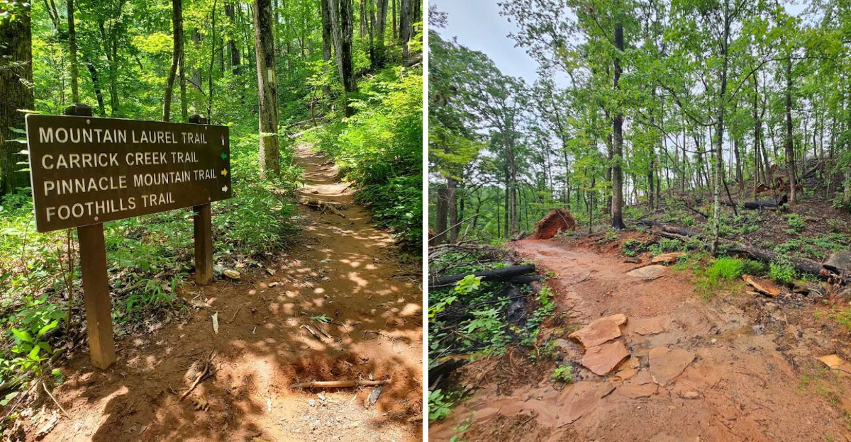
I discovered several of these features along the Carrick Creek trail, where erosion has exposed the boundaries between intruding magma and host rock. The dikes typically measure just inches to a few feet wide, but they extend for considerable distances, marking pathways that molten rock followed during the region’s volcanic period.
What fascinates me most is how these features demonstrate multiple episodes of volcanic activity. The dikes cut through metamorphic rocks that had already formed, proving that magma continued moving through the region long after the initial mountain-building events.
Each dike represents a distinct injection event, adding another layer to the park’s complex geological timeline.
Quartz Veins Mark Hydrothermal Activity Zones

Brilliant white streaks of quartz zigzag across many rock faces throughout Table Rock State Park, marking where superheated fluids once flowed through fractured stone. These hydrothermal veins formed during the final stages of volcanic activity, when mineral-rich water escaped from cooling magma chambers and deposited quartz in surrounding cracks.
I traced one particularly thick vein along an exposed cliff near the summit trail, following its irregular path across the granite. The quartz stands out dramatically against darker rock, sometimes reaching several inches thick where fluids had more space to deposit minerals.
These features connect directly to the park’s volcanic past because hydrothermal activity requires heat from magma or recently cooled igneous rocks. The abundance of quartz veins throughout the area indicates extensive fluid circulation during and after the pluton’s emplacement, when the cooling granite released water and dissolved minerals that crystallized in fractures throughout the surrounding rock mass.
Columnar Jointing Patterns Show Cooling Magma Behavior

Though less prominent than at some volcanic sites, careful observers can find hints of columnar jointing in Table Rock’s granite. These geometric fracture patterns develop when magma cools and contracts, creating polygonal columns that reflect the physics of heat loss from solidifying rock.
I spotted subtle examples of this phenomenon on the mountain’s north face, where weathering has emphasized natural fracture planes. The patterns appear less regular than classic columnar basalt because granite cools more slowly at greater depths, but the underlying process remains the same.
Understanding these features helped me visualize the mountain’s formation differently. The cooling magma didn’t solidify uniformly but instead contracted in organized patterns dictated by heat flow and stress distribution.
Each fracture records a moment in the pluton’s transformation from liquid to solid, preserving evidence of thermal gradients that existed deep underground hundreds of millions of years ago, long before erosion exposed these rocks to sunlight.
Xenoliths Preserve Evidence of Assimilated Country Rock

Scattered throughout Table Rock’s granite, darker blobs and angular fragments stand out like raisins in bread. These xenoliths represent pieces of older rock that broke off surrounding formations and became trapped in rising magma, offering direct samples of what existed before the pluton intruded.
I found several excellent examples along the summit trail, where erosion has created fresh rock surfaces. Some xenoliths show partial melting around their edges, proving they were hot enough to begin incorporating into the magma, while others remain relatively intact, indicating they were captured late in the intrusion process.
These inclusions provide geologists with valuable information about the rocks that once surrounded the magma chamber. By studying xenolith composition, scientists can reconstruct what the region looked like before volcanic activity, essentially using these trapped fragments as windows into even older geological periods.
Each xenolith tells a story of violent incorporation, where solid rock met molten magma thousands of feet underground.
Pegmatite Deposits Reveal Final Magma Chamber Stages

Near some trail sections, I encountered rocks with crystals so large I could easily identify individual minerals with my naked eye. These pegmatites formed from the last remaining magma in the cooling chamber, where water and rare elements concentrated to create conditions perfect for growing enormous crystals.
The pegmatite patches at Table Rock sometimes contain feldspar crystals several inches long, along with quartz and mica in unusually large grains. This coarse texture indicates extremely slow cooling under water-rich conditions, typically occurring in the final stages of pluton solidification.
I find pegmatites particularly interesting because they represent the magma chamber’s grand finale. After most of the molten rock had crystallized into regular granite, these residual pockets of mineral-rich fluid remained, eventually cooling to create rock with dramatically different texture despite similar overall composition.
Each pegmatite deposit marks a small reservoir where the volcanic system’s last liquid dregs finally solidified into stone.
Foliation Patterns Document Regional Tectonic Stress

Many rocks in Table Rock’s lower elevations display a distinctive striped or layered appearance called foliation. This texture develops when tectonic forces squeeze rocks under high pressure, causing minerals to reorient and align perpendicular to the direction of maximum stress during metamorphism.
Examining foliated rocks along Carrick Creek, I noticed how the mineral layers sometimes fold into complex curves and waves. These contortions record multiple deformation events, showing how rocks responded to changing stress directions as continents collided and mountains formed during the region’s volcanic and mountain-building period.
The foliation angle and intensity vary throughout the park, providing clues about how tectonic forces varied across the landscape. Rocks closer to major fault zones often show more intense foliation, while those farther away display gentler alignment.
This pattern helps geologists reconstruct the ancient stress fields that accompanied volcanic activity, revealing how plate collision and magma intrusion worked together to reshape the entire region’s geology.
Erosion-Resistant Granite Creates Dramatic Cliff Formations

The reason Table Rock stands so dramatically above surrounding terrain comes down to simple durability. Volcanic granite resists weathering far better than the metamorphic rocks that surround it, creating the spectacular cliffs and steep faces that define the park’s character and challenge hikers.
I noticed this differential erosion most clearly from overlook points, where I could see how the granite forms bold outcrops while softer rocks have worn into gentler slopes. Over millions of years, this process has carved away surrounding material, leaving the resistant pluton standing high as an erosional remnant.
The vertical cliffs that make Table Rock so photogenic exist because granite tends to fracture along joint planes, creating natural vertical weaknesses. As weathering attacks these joints, entire slabs sometimes detach, maintaining the steep profile rather than gradually rounding.
This process continues today, meaning the mountain’s dramatic appearance results from ongoing interaction between ancient volcanic rock and modern erosion, a geological conversation spanning hundreds of millions of years.