
In The Arizona Desert, A Massive Concrete Ruin Marks One Of The State’s Most Fascinating Forgotten Sites
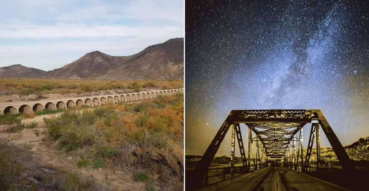
Standing at the edge of the Sonoran Desert, roughly 40 miles southwest of Phoenix near the quiet community of Arlington, Arizona, the ruins of Gillespie Dam feel less like a historical footnote and more like a conversation the landscape is trying to have with you.
Built between 1919 and 1921, this once-mighty concrete diversion dam stretched nearly 1,800 feet across the Gila River and stood 56 feet tall, making it the longest privately financed concrete irrigation dam in Arizona history.
A catastrophic 1993 flood tore a 120-foot section from its body, and the dam was never rebuilt, leaving behind one of the most hauntingly beautiful industrial ruins in the American Southwest.
If you have ever wanted to explore a place where desert silence, ancient petroglyphs, wildlife, and crumbling concrete all share the same stretch of river, this forgotten giant is calling your name.
The Visionary Behind The Dam
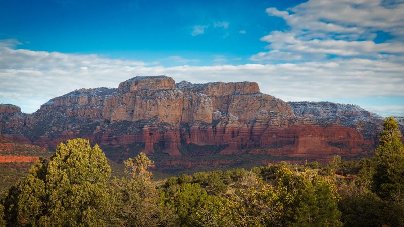
Frank A. Gillespie was not the type of man who looked at a wild, unpredictable river and decided to walk away. In the early 1900s, the Gila River in southwestern Arizona had already swallowed several attempts at water control, washing away earthen and timber structures like they were made of paper.
Gillespie saw those failures and raised the stakes, financing a massive concrete dam entirely out of his own pocket.
His goal was straightforward but ambitious: bring reliable irrigation water to the dry farmlands stretching between Arlington and Gila Bend.
That vision became reality between 1919 and 1921, when crews completed what would become the longest privately financed concrete irrigation diversion dam in Arizona. The project was a financial and engineering gamble of the highest order.
Gillespie’s name lives on in the dam, the bridge, and the surrounding area, a quiet tribute to a man whose bold agricultural dream reshaped the desert landscape for more than seven decades before nature had its final say.
Construction Of A Desert Colossus
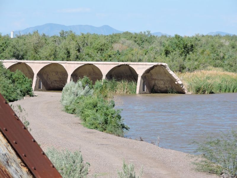
Pouring concrete across a living, breathing river in the middle of the Arizona desert is no small feat, and the crews who built Gillespie Dam between 1919 and 1921 knew it better than anyone.
The construction project demanded enormous quantities of materials, coordinated labor, and an almost stubborn refusal to let the Gila River’s temperamental nature derail progress.
When completed, the structure stood 56 feet tall and stretched approximately 1,800 feet from bank to bank, a genuinely staggering achievement for the era.
Workers relied on early 20th-century engineering techniques and sheer determination to anchor the dam firmly into the riverbed, creating a structure built to last generations.
The dam featured a series of concrete bays designed to divert water into irrigation canals that would feed surrounding farmland.
For a region that had long struggled with water scarcity, those canals represented the difference between crop failure and prosperity. The finished structure was celebrated as a triumph of private enterprise and desert ingenuity, drawing admiration from engineers and farmers alike.
The Gila River
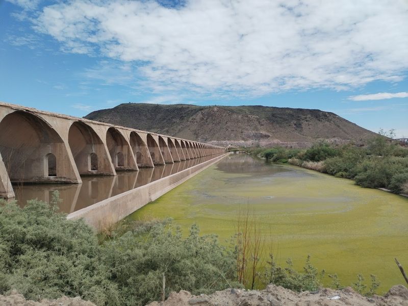
The Gila River has a personality all its own, and patience is not one of its defining characteristics.
Running roughly 649 miles from New Mexico westward through Arizona before joining the Colorado River, the Gila swings between long stretches of near-dryness and sudden violent floods that have humbled engineers for over a century.
Before Gillespie Dam was built, previous structures on this same stretch of river had been swept away by the Gila’s periodic rages. The river’s floodwaters can rise with startling speed, carrying enormous volumes of water, sediment, and debris downstream with destructive momentum.
It was precisely this behavior that made a permanent concrete structure seem so necessary in the early 1900s. Even after the dam was completed, the Gila continued to test its boundaries year after year.
The river’s character shaped everything about the dam’s story, from its construction to its eventual collapse. Today, with the breach allowing free flow once again, the Gila moves through the ruins on its own terms, as it always intended to.
How The Dam Transformed The Desert
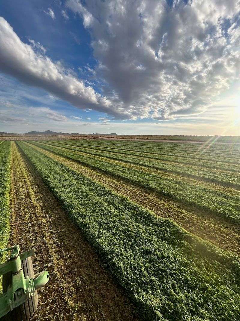
Turn desert into farmland and you change everything: the economy, the community, the very identity of a region. That transformation is exactly what Gillespie Dam was designed to achieve.
By diverting Gila River water into a network of irrigation canals, the dam unlocked thousands of acres of otherwise unworkable land between Arlington and Gila Bend.
Farmers in this stretch of southwestern Arizona could suddenly grow cotton, alfalfa, and other crops in a landscape that had previously offered little agricultural promise.
Communities grew around the reliable water supply, and the local economy strengthened with each productive harvest season. The dam became the backbone of an entire agricultural system that depended on its steady function.
For more than seven decades, that system held, and the surrounding region flourished in ways Frank Gillespie had originally imagined.
The dam’s role as an agricultural lifeline is easy to overlook when you are standing among its broken concrete ruins today, but those fragments once carried water that fed families, sustained businesses, and kept a corner of the Arizona desert green and productive.
The 1993 Flood: When Nature Rewrote The Story
January 9, 1993 is the date that changed Gillespie Dam forever. Heavy winter rains and accumulated runoff pushed the Gila River to levels that the aging concrete structure simply could not withstand.
The hydraulic forces building against the dam that day were extraordinary, and when the breaking point arrived, a 120-foot section of concrete gave way and collapsed into the surging water below.
The collapse was not a slow crumbling but a sudden, dramatic failure that sent concrete chunks tumbling into the river and left a gaping wound in what had once been a seamless barrier.
Floodwaters rushed through the breach with tremendous force, and the surrounding area bore the full impact of the event. After the waters receded, the decision was made not to rebuild.
The cost of restoration, combined with changing water management priorities in the region, meant the dam would remain as it fell.
That choice, as difficult as it may have been, gave the site a second life as one of Arizona’s most atmospheric and thought-provoking historic ruins, visited by curious travelers ever since.
The Ruins Today
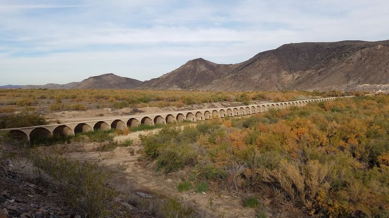
There is something quietly extraordinary about standing at the edge of the Gillespie Dam ruins and letting the scale of the structure sink in. Even in its broken state, the dam commands respect.
Massive concrete arches and thick walls stretch along the riverbank, their surfaces weathered and cracked but still imposing after more than a century of desert exposure.
The 120-foot breach in the center is the most dramatic feature, a raw opening where the river now flows freely, framed by jagged concrete edges that look almost sculptural against the desert sky.
Climbing onto the dam’s apron gives you a closer perspective that photographs simply cannot capture, with the sound of the river below and the vast Sonoran Desert spreading out in every direction.
Visitors often describe the ruins as feeling both melancholy and strangely alive, a place where the industrial past and the natural present have reached an uneasy but beautiful truce.
The site is open year-round with no admission fee, making it an accessible adventure for anyone willing to make the drive along Old Highway 80.
Survivor’s Story
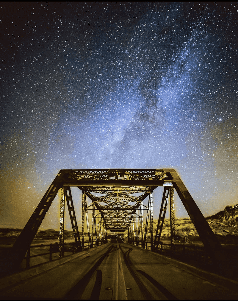
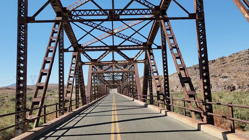
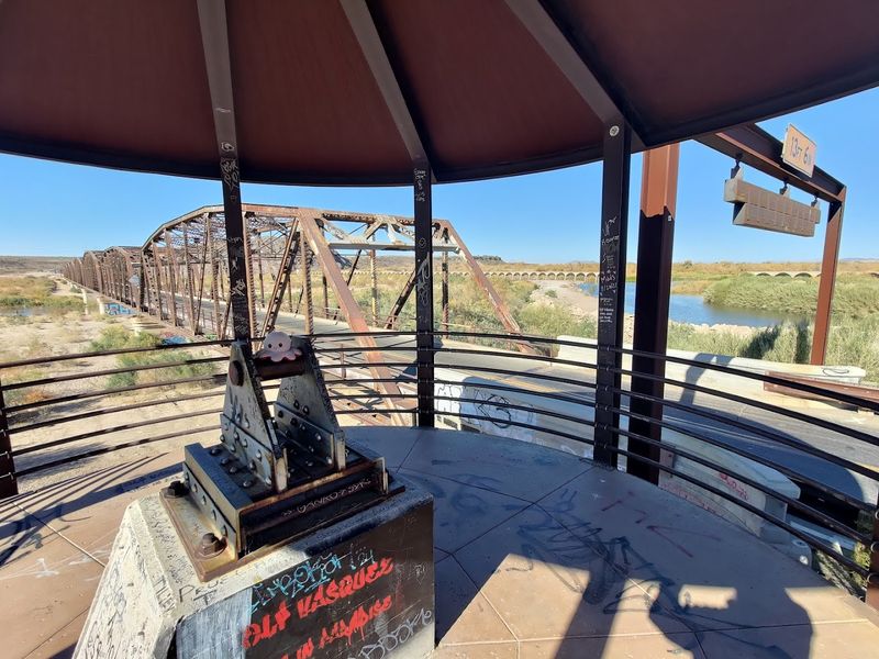
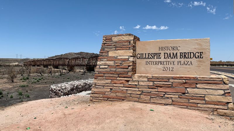
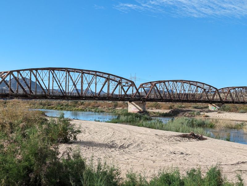
Right next to the ruined dam stands a structure that refused to fall. The Gillespie Dam Bridge, a steel truss design completed in 1927, stretches nearly 1,700 feet across the Gila River and once carried traffic along the transcontinental U.S. Route 80, later known as Old Highway 80.
When the 1993 flood tore through the dam, the bridge held firm, earning its place as one of the more resilient engineering achievements in Arizona history.
At the time of its construction, the bridge was among the longest steel structures of its kind in the state, a significant engineering accomplishment that reflected the growing importance of automobile travel across the American Southwest in the 1920s.
Its latticed steel framework has a visual elegance that contrasts beautifully with the raw, broken concrete of the dam beside it.
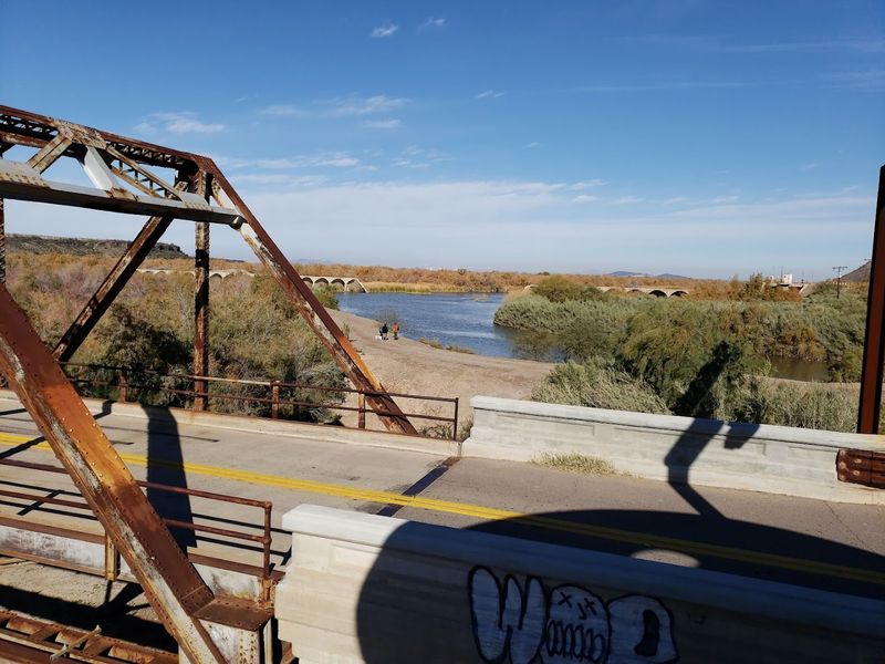
Walking across the bridge today, you get a sweeping view of both the dam ruins and the river below, a perspective that makes the scale of the entire site click into place.
The bridge and the dam together tell a two-part story of construction, endurance, and the different ways that human-made structures respond when nature pushes back hard enough.
Ancient Voices In Stone
Long before Frank Gillespie ever set eyes on the Gila River, other people called this landscape home, and they left their marks in the most enduring way possible.
On the rocky bluffs overlooking the dam, a remarkable collection of Native American petroglyphs covers the stone surfaces, offering a window into cultures that thrived here centuries before concrete was ever poured.
These carvings include spirals, animal figures, and geometric designs that have fascinated archaeologists and casual visitors alike. The petroglyphs are best accessed by parking on top of the mesa, where both the north and south petroglyph areas are within easy walking distance.
Taking time to move slowly among the rocks and look carefully pays off with discoveries that a quick glance would miss entirely.
Standing between the ancient carvings and the modern ruins below creates a layered sense of time that is genuinely hard to find anywhere else in the American Southwest.
The petroglyphs remind you that this stretch of the Gila River has been a meaningful place for human beings across vastly different eras, each leaving something behind for future visitors to find and wonder about.
Wildlife And Wetlands
Nobody planned for Gillespie Dam to become a wildlife sanctuary, but that is essentially what happened after the 1993 breach.
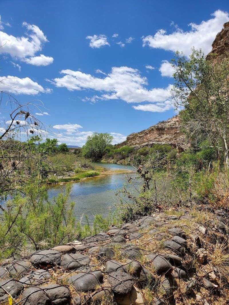
With the river flowing freely through the gap, a lush riparian wetland developed downstream, creating a habitat that draws an impressive variety of birds and other wildlife to what was once a purely industrial site.
Birdwatchers who make the trip to the dam in winter months are regularly rewarded with sightings of Ospreys, American White Pelicans, and Belted Kingfishers working the river.
Rarer visitors like the Roseate Spoonbill have also been spotted here, making the site a legitimate destination for serious birders with a checklist to fill. Fishing in the river below the dam adds another recreational dimension that surprises first-time visitors.
The contrast between the crumbling industrial structure and the thriving natural ecosystem growing up around it gives the site an unexpected warmth.
The ruins are not just a monument to what was built and lost; they are also proof that ecosystems can recover and flourish in the most unlikely places when given the space and water to do so.
Navigating To A Forgotten Corner Of Arizona
Getting to Gillespie Dam is genuinely straightforward, which makes the sense of remoteness you feel upon arrival all the more satisfying.
The site sits along Old Highway 80, between the towns of Buckeye and Gila Bend in Maricopa County, roughly 40 to 55 miles southwest of Phoenix. Most GPS systems will recognize a search for Gillespie Dam, though some devices may route you to the base of the hill rather than the most useful parking area.
For the best experience, use the coordinates 33.22951, -112.77448 to reach a large open mesa at the top of the hill. From there, you can walk easily to the dam overlook, cross down to the bridge, and access both the north and south petroglyph areas without any complicated navigation.
The terrain is uneven in places, so sturdy footwear is a smart choice. There are no entrance fees and no formal visitor center, which keeps the experience feeling genuinely off the beaten path.
Cell service can be spotty in the area, so downloading an offline map before you leave is a practical step that will save you frustration and let you focus on exploring.
Best Times To Visit
Arizona’s desert climate means that timing your visit to Gillespie Dam can make a real difference in how much you enjoy the experience.
The cooler months from October through April are by far the most comfortable window, with mild temperatures that make walking the ruins and exploring the petroglyph areas genuinely pleasant.
Winter visits also coincide with peak birdwatching season, adding extra incentive for early-morning arrivals.
Summer trips are possible but demand serious preparation. Temperatures regularly exceed 110 degrees Fahrenheit in the Sonoran Desert during June, July, and August, and the exposed concrete surfaces amplify the heat considerably.
If a summer visit is your only option, arrive at sunrise and plan to be back in your car well before midday. Regardless of the season, bring more water than you think you need, apply sunscreen generously, and wear a hat with a real brim.
The site has no shade structures, no restrooms, and no vendors, so self-sufficiency is the name of the game. A camera with a good zoom lens will serve you well for both the petroglyphs and the wildlife that frequents the riverbanks.
Arizona Bucket List
Some places earn their way onto a travel list by being polished and promoted, and others earn it simply by being genuinely unforgettable. Gillespie Dam falls firmly in the second category.
It asks nothing of you except your curiosity and a willingness to drive a little off the main road, and in return it delivers a layered, atmospheric experience that stacks history, archaeology, ecology, and engineering into a single remarkable site.
The combination of the dam ruins, the surviving steel bridge, the ancient petroglyphs, and the thriving wildlife corridor along the Gila River means there is something new to notice every time you visit.
Photographers find the golden hour light on the concrete ruins particularly rewarding, while history enthusiasts can spend hours piecing together the timeline of construction, use, and collapse that defines the dam’s story.
For anyone who has grown tired of crowded tourist attractions and velvet ropes, Gillespie Dam offers something refreshingly different: a place where you can wander freely, think slowly, and connect with a corner of Arizona that most people drive right past without ever knowing what they are missing.