
In The Illinois Wilderness, A Massive Historic Ruin Tells One Of The State’s Most Haunting Stories
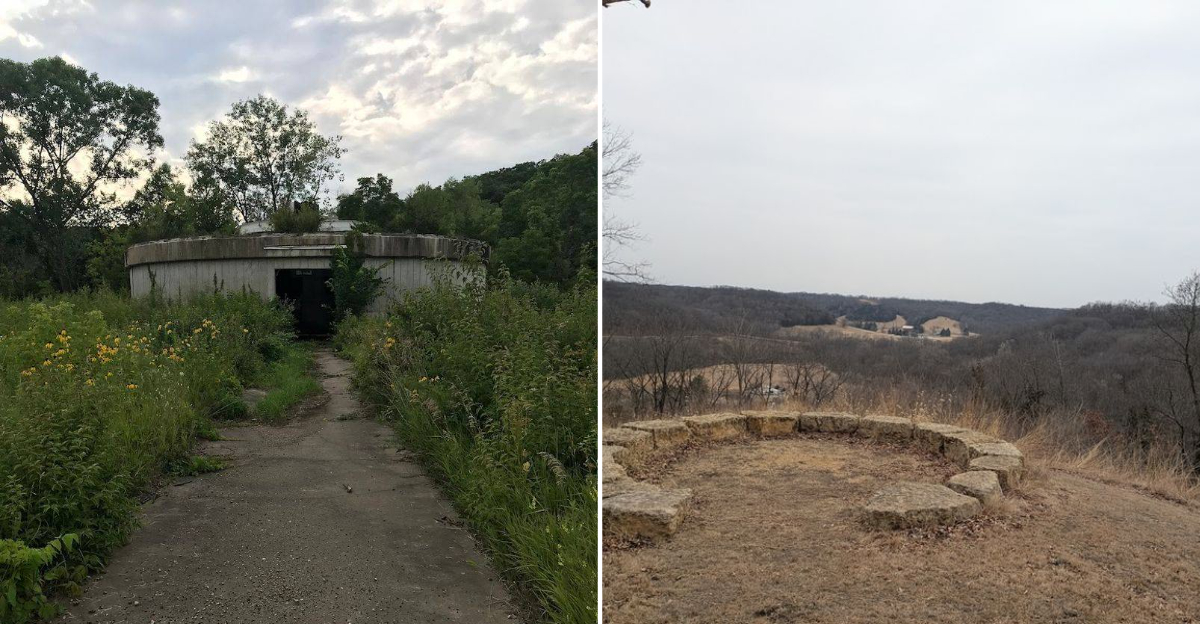
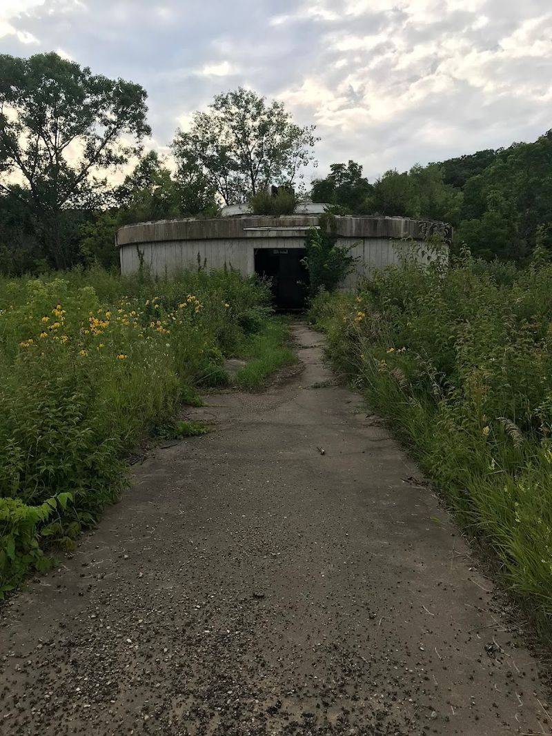
Some places in Illinois surprise you in the best way, and this one feels almost unreal the first time you see it. Out in the rolling hills of northwestern Illinois, hikers can come across massive concrete ruins rising out of the trees like something left behind by an old science fiction movie.
These are the remains of a former satellite communications site inside Witkowsky State Wildlife Area near Hanover. What was once part of a bold new era in long-distance communication now sits quiet among the woods, weathered by time and wrapped in moss.
That mix of nature, technology, and abandonment gives the place a strange kind of pull. It feels historic, eerie, and oddly beautiful all at once.
For anyone who likes hikes with a story behind them, this is one Illinois trail that leaves a real impression.
A Satellite Ghost In The Woods
Before digital communication became routine, satellite ground stations played a major role in long-distance telecommunications. The Hanover Earth Station was part of a 1970s AT&T/GTE satellite network that used technology developed by Bell Labs.
The station used enormous parabolic dish antennas to send and receive signals bounced off satellites orbiting high above the Earth. At the time, this kind of technology was genuinely revolutionary, connecting continents in ways that had never been possible before.
Located at what is now the Witkowsky State Wildlife Area at 7351 W Blackjack Rd, Hanover, Illinois, the facility was chosen for its remote location and relatively flat signal horizon. The site operated for about a decade before rapid changes in communications technology left facilities like this behind.
Today, the concrete foundations and partial structures remain, frozen in time and slowly being reclaimed by the surrounding woodland.
The Era That Made It Possible
The 1960s were a fascinating and tense time for global communications technology. The United States and the Soviet Union were locked in a space race, and controlling satellite communications was considered strategically important as well as commercially valuable.
Commercial ventures like Comsat, formed under the Communications Satellite Act of 1962, pushed American companies to build ground stations capable of linking up with early satellites like Telstar and Intelsat.
Illinois Bell was among the companies that invested in this infrastructure, and the Hanover site was part of that broader national push.
Building a ground station in rural Jo Daviess County, Illinois, was not an accident. The area offered low radio frequency interference, open sightlines toward the sky, and enough distance from urban noise to make precise satellite tracking possible.
Understanding that Cold War backdrop makes standing among the ruins feel like touching a piece of a much larger, more urgent chapter of American history.
Nature Took The Place Back
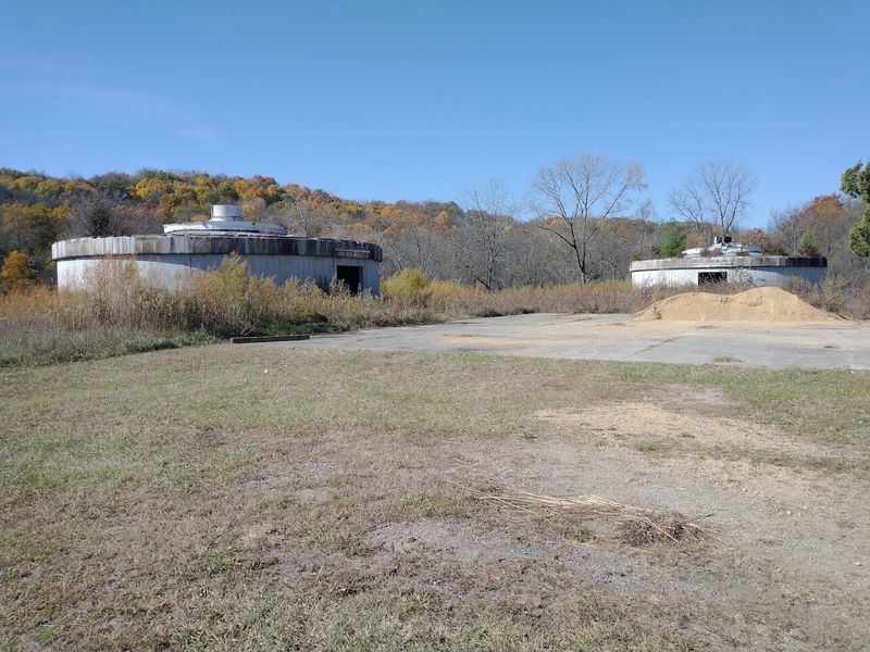
Walking up to the ruins for the first time produces a genuine double-take. Two enormous concrete pedestals, the bases that once held the giant dish antennas, still stand in the forest clearing with surprising solidity.
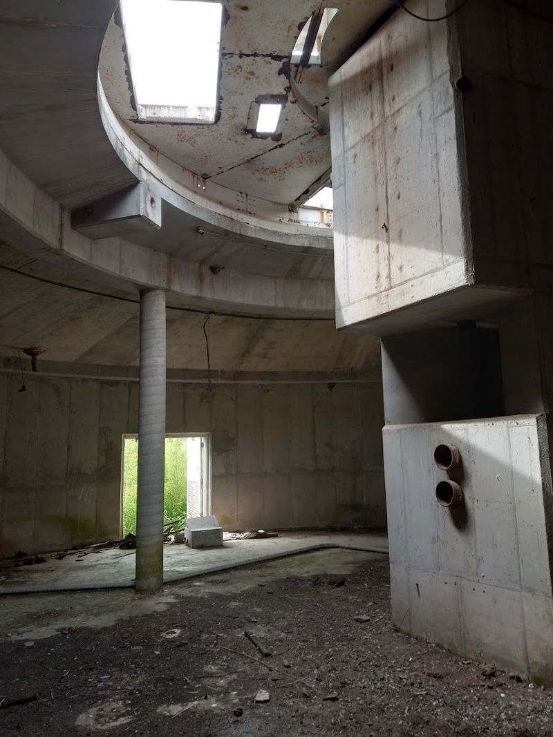
Smaller support buildings and mechanical rooms, now roofless and open to the sky, cluster around them.
Thick vegetation has pushed through every crack and joint. Trees grow from the floors of former equipment rooms, and moss carpets the exterior walls in shades of deep green.
The overall effect is somewhere between an ancient temple and an abandoned space program, which is exactly what makes it so visually striking.
Sound behaves oddly inside the partially enclosed concrete shells, producing hollow echoes that can feel genuinely unsettling when you are the only person around.
The structures are large enough to feel impressive but deteriorated enough to feel authentically abandoned, which is a combination that photographers and history enthusiasts find almost irresistible to capture.
The Trail To The Satellite Ruins
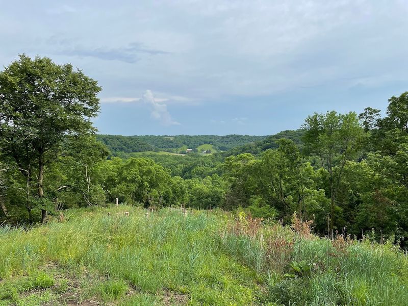
The ruins do not exist in isolation. They sit within the Witkowsky State Wildlife Area, a nature preserve managed in partnership with the Jo Daviess Conservation Foundation.
The preserve covers a varied landscape of prairie grasslands, wooded ridges, and creek valleys that make it genuinely beautiful independent of its historic centerpiece.
The wildlife area supports a healthy mix of native plant species, migratory birds, white-tailed deer, wild turkey, and other animals typical of northwestern Illinois.
Restoration efforts have helped return sections of the land to native prairie, which creates a striking visual contrast between open golden grasslands and dense timber patches.
Protecting the land around the ruins ensures that the site remains accessible to hikers and nature enthusiasts without being overdeveloped or commercialized.
The preserve functions as both a natural sanctuary and an informal outdoor museum, and that dual identity gives it a character that most state parks simply cannot match. The combination keeps every visit feeling layered and worth your time.
The Overlook Before The Ruins
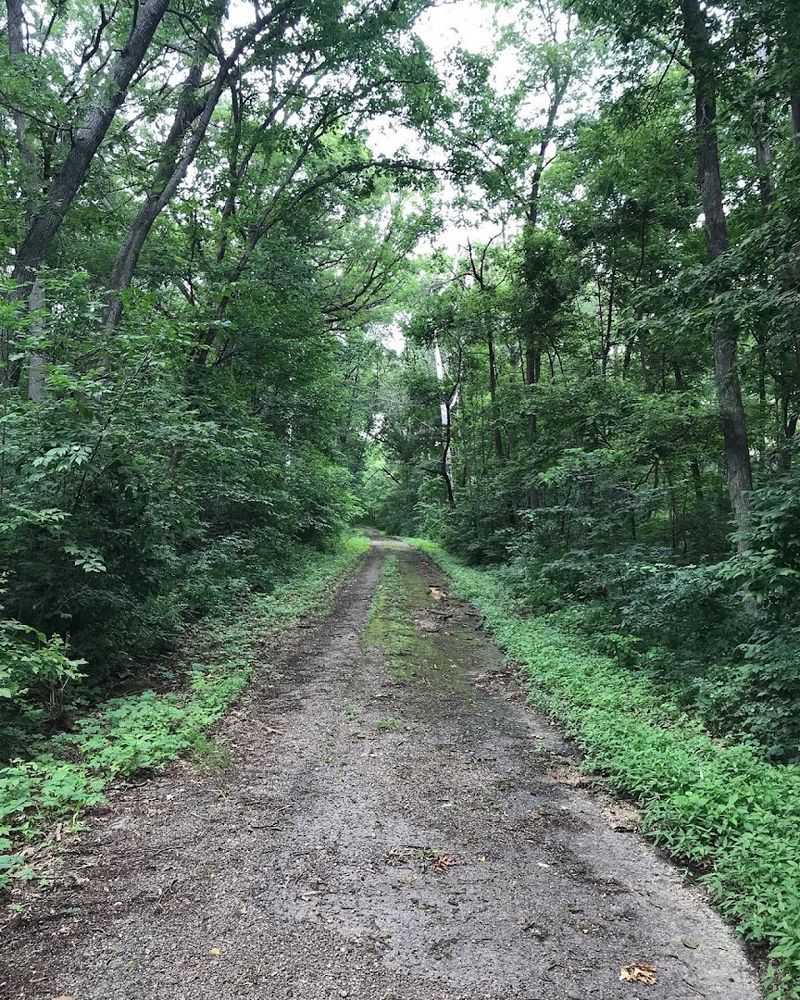
Reaching the Hanover Earth Station requires a hike, and that journey is part of what makes the destination feel earned. The Earth Station Trail is the most direct route to the ruins, while longer routes such as the Walnut Trail can turn the visit into a broader hike through the preserve.
The trail winds through a mix of open prairie sections and shaded timber areas, offering a pleasant variety of terrain.
The difficulty level sits comfortably in the light to moderate range. There are some rolling hills and uneven ground, but nothing that requires specialized gear or advanced fitness.
A pair of sturdy walking shoes and a water bottle are really all you need for a standard visit.
The trail is well-maintained and reasonably easy to follow, though some junctions can feel slightly ambiguous, so paying attention to trail markers helps.
The full trail system at Witkowsky can take well over three hours to explore completely, but the route to the earth station ruins is manageable for most hikers in a shorter outing.
The Views Along The Way
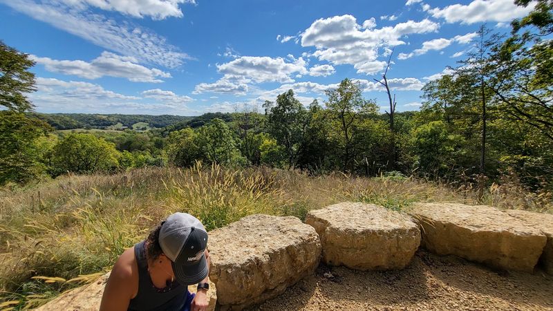
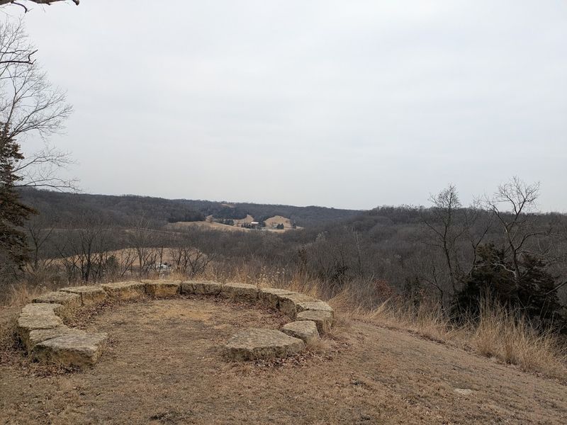
Not every highlight at Witkowsky involves concrete and Cold War history. Prairie Point is one of the trail system’s most rewarding stops, offering an elevated viewpoint that looks out over the surrounding Jo Daviess County landscape in a way that genuinely earns the word breathtaking.
From Prairie Point, the surrounding Driftless Area hills, prairie, woods, and countryside spread out in a wide, rewarding view that feels quintessentially Midwestern in the best possible way.
The contrast between that wide-open vista and the enclosed, shadowy ruin site makes the overall hike feel like a journey through two completely different moods.
Spending a few minutes at Prairie Point before or after visiting the earth station ruins adds real depth to the trip.
The natural beauty of the overlook reminds you that this place was worth preserving long before anyone thought about what to do with the abandoned satellite infrastructure sitting in the trees below.
Where Every Footstep Echoes
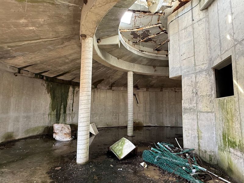
One of the strangest and most memorable features of the Hanover Earth Station ruins is something you cannot photograph: the sound.
Standing inside the partially enclosed concrete rooms and calling out produces hollow, resonant echoes that bounce around in unexpected directions and linger longer than feels comfortable.
The curved and angular concrete surfaces, originally designed to house sensitive electronic equipment, now function as accidental acoustic chambers.
The effect is subtle but persistent, and it contributes significantly to the atmosphere that makes the site feel genuinely eerie rather than just visually interesting.
For visitors who arrive expecting a simple nature hike and instead find themselves standing inside a roofless concrete room listening to their own footsteps echo back at them from three directions, the experience tends to leave a lasting impression.
It is the kind of sensory detail that photographs cannot capture, which is probably why people who visit the ruins tend to talk about it long after they have returned home.
The Signal That Went Silent
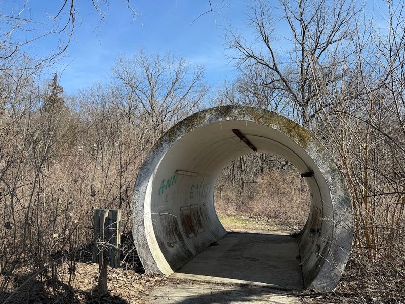
Technology does not wait for anyone, and the Hanover Earth Station learned that lesson the hard way. By the late 1970s and into the 1980s, transoceanic fiber optic cables were rapidly becoming the preferred method for carrying high-volume international telecommunications traffic.
Fiber optic systems offered greater bandwidth, lower latency, and significantly reduced operating costs compared to satellite ground stations. As the fiber network expanded, the economic case for maintaining large rural satellite facilities like the one in Hanover simply collapsed.
Illinois Bell decommissioned the station, and the land eventually transitioned into public conservation ownership.
The buildings were cleared of their equipment but the heavy concrete infrastructure was left in place, partly because demolishing massive reinforced concrete structures in a remote rural location would have been expensive and logistically complicated.
That practical decision by engineers and accountants decades ago is the reason hikers today get to walk through one of the most unexpectedly cinematic ruins in the state of Illinois.
Best Times To Visit
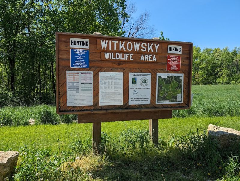
Witkowsky State Wildlife Area is open year-round, but the experience changes dramatically with the seasons.
Spring brings wildflowers and migrating birds that make the prairie sections feel alive with activity. Autumn transforms the wooded sections into a gallery of orange, red, and gold, and the ruins look particularly atmospheric surrounded by fallen leaves.
Summer visits are perfectly enjoyable, though the full leaf canopy means the ruins are more enclosed and shaded, which actually enhances the moody atmosphere. Winter visits are possible and surprisingly peaceful, with bare trees opening up views through the forest that are invisible during warmer months.
Regardless of season, wearing sturdy footwear with ankle support is a smart move given the uneven terrain around the ruin site. Bringing water is essential since there are no facilities on the trail.
The area is generally free to visit, and dogs are allowed where permitted as long as they are leashed, making it an accessible outing for visitors who want something more memorable than a standard nature walk.
Illinois’ Strangest Walk Through History
Most people driving through Jo Daviess County, Illinois, have no idea that a set of Cold War-era satellite ruins is waiting in the woods off Blackjack Road. That obscurity is part of the appeal, but it also means the site is genuinely underappreciated as a piece of American technological and industrial history.
Few states can offer a hiking experience that combines native prairie restoration, panoramic river valley views, and the surreal discovery of massive telecommunications ruins all in a single free outing. The combination is unusual enough that it really should be on more travel itineraries for the Midwest.
The Hanover Earth Station ruins represent a specific moment in time when humans were racing to connect the world through satellites, and the concrete evidence of that ambition is still standing in the Illinois wilderness, patient and quietly impressive.
Visiting puts you in direct physical contact with that history in a way that no museum exhibit can fully replicate, and that is worth the drive from anywhere in the region.