
10 Scenic Arkansas Hikes With Waterfalls And Jaw-Dropping Views
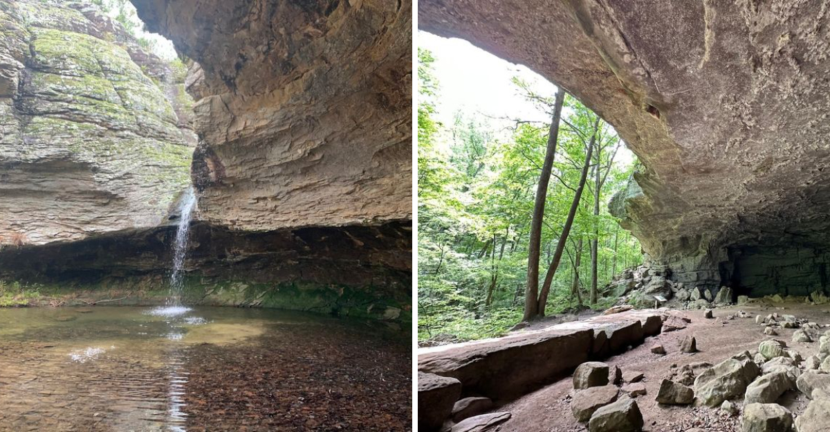
Arkansas trails have a way of turning a regular day outside into a story you want to tell. The hike starts with dirt under your shoes and trees overhead.
Then you hear water. A bluff edge appears.
The view opens so wide that everyone gets quiet for a second. That is the feeling behind this list.
These hikes are for people who want more than a simple walk in the woods. They want that little rush when the trail finally reveals why it was worth the drive.
Waterfalls show up stronger after rain, rocky overlooks catch the light just right, and old paths carry pieces of history you can still feel. Some routes are family-friendly, while others ask for steady legs and patience.
The reward is the same kind of moment every time: a scene that makes you reach for your camera before saying anything out loud every single time.
1. Bear Hollow Trail, Paris Mount Magazine State Park
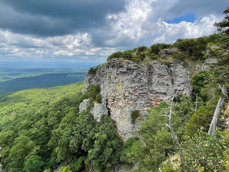
Mount Magazine is Arkansas’s highest mountain, and the Bear Hollow Trail makes sure you feel every inch of that elevation in the best possible way.
Located at 16878 AR-309, Paris, AR 72855, this moderate path winds along the upper rim of Bear Hollow, opening up wide, breathtaking views of the Ouachita Mountains and the lush Petit Jean River Valley far below.
After a solid rain, wet-weather creeks transform into delicate waterfalls that appear almost out of nowhere, adding a lively soundtrack to the hike.
One of the most remarkable things about this trail is that it passes through one of the last remaining stretches of virgin hardwood forest in the state, a rare and humbling experience.
Historic WPA-era stone steps lead you to landmarks like Sunrise Rock and Inspiration Point, where the views demand a long, quiet pause.
I remember standing at Inspiration Point on a clear October morning, watching the valley glow in amber and crimson below me, and thinking no photograph could ever do it justice.
Fall is the ideal season for this trail, when the trees put on a show that feels almost theatrical in its brilliance.
2. Bench Trail, Dardanelle Mount Nebo State Park
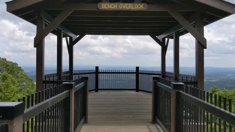
There is a quiet charm to the Bench Trail at Mount Nebo State Park that sneaks up on you long before you realize how much ground you have covered.
Found at 16728 W State Hwy 155, Dardanelle, AR 72834, this path traces a natural terrace that wraps around the entire mountain, following what locals once called Bench Boulevard back in the early resort days of the 1900s.
Old springs with names like Darling Spring and Gum Springs dot the route, and stone steps hand-carved by the Civilian Conservation Corps in the 1930s give the trail a wonderfully layered sense of history.
Wildlife sightings are common here, with white-tailed deer and woodland birds making regular appearances just off the path.
The views open up most dramatically from late fall through early spring, when bare branches allow long, sweeping sightlines across the valley that summer greenery hides entirely.
Hikers, mountain bikers, and horseback riders all share this trail, which gives it an easygoing, communal energy that most solo forest hikes do not have.
By the time you complete the loop, the mix of history, wildlife, and quiet mountain scenery leaves you feeling like you found something most visitors completely miss.
3. Rim Trail, Dardanelle Mount Nebo State Park
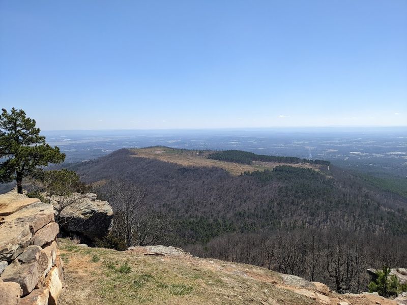
Few trails in the entire state deliver the kind of non-stop panoramic payoff that the Rim Trail at Mount Nebo State Park provides from start to finish.
Also located at 16728 W State Hwy 155, Dardanelle, AR 72834, this moderate loop circles the mountain’s summit, hugging rocky bluffs that drop away into vast, open sky on one side.
On a clear day, the Arkansas River snakes through the valley below and Lake Dardanelle glimmers in the distance, creating a landscape that feels almost too big to take in at once.
After periods of rain, seasonal waterfalls appear along the rock faces, sending thin white ribbons of water down the bluffs in a quietly dramatic display.
The trail’s origins stretch back to the mountain’s earliest residents in the late 1800s, and the Civilian Conservation Corps later refined it into the well-worn path hikers enjoy today.
Spring and fall offer the most comfortable temperatures and the most visually rewarding conditions, with wildflowers in one season and fiery foliage in the other.
Every bend on this trail feels like the trail is showing off, and honestly, it has every right to.
4. Yellow Rock Trail, West Fork Devil’s Den State Park
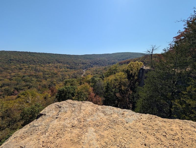
The reward waiting at the end of the Yellow Rock Trail is the kind of view that makes your legs forget they were ever tired.
Tucked inside Devil’s Den State Park at 11333 W Arkansas Hwy 74, West Fork, AR 72774, this semi-loop hike winds through a geological playground of massive rock slabs, deep crevices, and overhanging cliffs that reveal the ancient bones of the Ozarks.
The trail builds anticipation with every twist until it delivers you to the Yellow Rock bluff, where the full sweep of the Lee Creek Valley and the surrounding mountains unfolds in every direction.
Heavy rains coax ephemeral waterfalls out of the bluffs, and watching them appear mid-hike feels like a bonus scene added just for the lucky visitors who showed up on the right day.
A historic Civilian Conservation Corps overlook pavilion sits near the summit, a sturdy stone structure from the 1930s that adds a sense of timeless character to the already dramatic setting.
Spring wildflowers carpet the forest floor in a riot of color, and fall transforms the canopy into a blazing mosaic of orange, red, and gold.
Yellow Rock Trail earns its reputation as one of the Ozarks’ finest hikes with very little argument from anyone who walks it.
5. Magnesia Springs Trail, Magnolia Logoly State Park
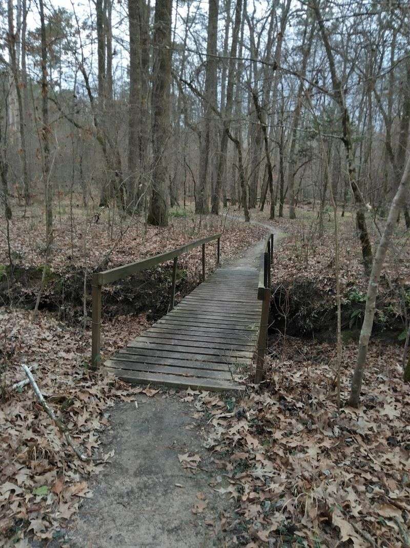
Logoly State Park in Magnolia, Arkansas carries a distinction that most people do not know about until they arrive: it was the state’s first environmental education park, and it wears that title with pride.
Located at 131 Columbia Road 459, Magnolia, AR 71753, the park sits within the Coastal Plain region, where the landscape shifts into something noticeably different from the mountains and valleys that dominate most of the state.
The Magnesia Springs Trail leads visitors to one of the park’s best-known mineral spring areas, making it a strong fit for anyone who wants a short walk with a clear point of interest.
Tall loblolly pines rise above a mixed understory of oak, hickory, and American beech, and the forest floor stays cool and shaded even on warm afternoons.
The park’s natural mineral springs once drew visitors from across the region, and exploring the spring areas today still carries a faint sense of old-fashioned pilgrimage.
Woodland streams wind through shallow ravines, creating a gentle, rolling character to the terrain that feels unhurried and restorative.
The trails here reward patient walkers who keep their eyes open, as the plant communities shift noticeably from one section to the next in ways that feel almost educational without ever feeling like a lecture.
Logoly is the kind of place that grows on you slowly and then stays with you long after you have driven home.
6. Falls Branch Trail, Hot Springs Lake Catherine State Park
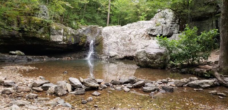
There is a particular kind of joy that comes from rounding a bend on a forest trail and suddenly hearing the rush of falling water before you can even see it.
The Falls Branch Trail at Lake Catherine State Park, located at 1200 Catherine Park Road, Hot Springs, AR 71913, delivers that moment with satisfying reliability every single time.
The path winds through fragrant pine forest and follows Little Canyon Creek, crossing it several times on wooden footbridges that feel charming in a storybook sort of way.
The centerpiece of the whole experience is Falls Creek Falls, a ten-foot cascade that drops into a brilliantly clear pool with the kind of blue-green color that makes you want to sit beside it for an hour.
After heavy rain, the waterfall runs with extra energy, and the surrounding forest fills with the sound of moving water from every direction.
Glimpses of serene Lake Catherine appear through the trees at various points along the route, adding a second layer of scenic beauty to an already photogenic hike.
This easy to moderate trail suits families and casual hikers perfectly, and a fall visit turns the whole forest into a warm, glowing tunnel of color that frames the waterfall beautifully.
7. Lake Dunn Trail, Wynne Village Creek State Park
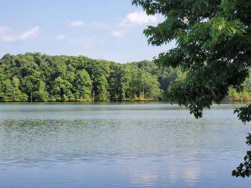
Village Creek State Park in Wynne sits on Crowley’s Ridge, a narrow spine of forested hills that rises unexpectedly from the flat Delta landscape and creates one of the most ecologically unique environments in the region.
The Lake Dunn Trail, at 201 County Road 754, Wynne, AR 72396, curves along the peaceful shoreline of Lake Dunn before weaving into dense hardwood forest where the light filters down in long, lazy shafts.
What makes this trail feel especially layered is the history woven into the land beneath your feet: a segment of the historic Trail of Tears passes through the park’s trail system, lending the walk a quiet, reflective weight.
The park’s network connects to multi-use paths popular with mountain bikers and horseback riders, so the trails here buzz with a variety of outdoor energy rather than the hushed solitude of more remote hikes.
Solo and tandem kayak rentals are available at the Lake Dunn boat dock kiosk for those who want to experience the lake from the water after finishing the trail on foot.
Sunset from the lake’s edge is the kind of scene that earns its own slow appreciation, with the water turning gold and the treeline going dark in silhouette.
Lake Dunn Trail rewards visitors who take their time and let the landscape speak at its own pace.
8. River Corridor Trail, Wickes Cossatot River State Park-Natural Area
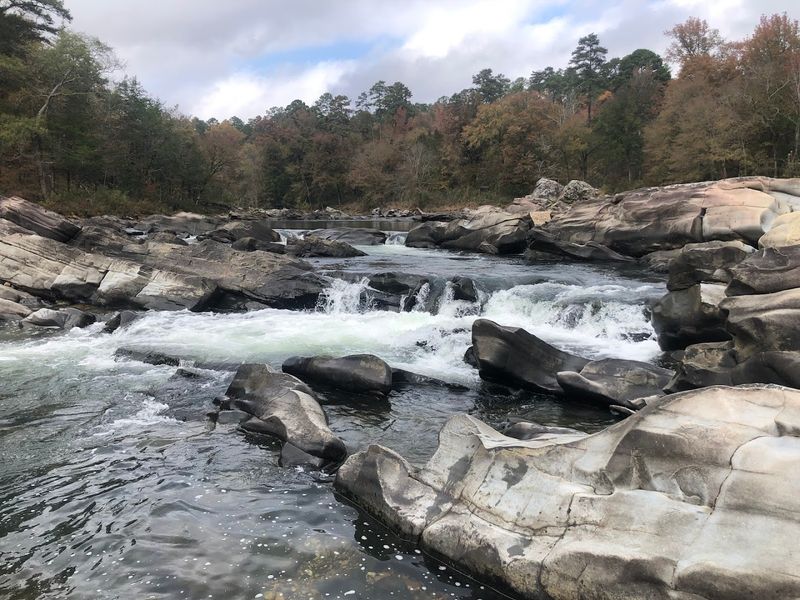
Cossatot Falls is one of the most dramatic natural features in Cossatot River State Park-Natural Area, and hiking the River Corridor Trail nearby makes it very easy to understand why this river gets so much attention.
Located at 1980 Hwy 278 W, Wickes, AR 71973, this linear trail runs through Cossatot River State Park-Natural Area, placing you right alongside one of the most geologically dramatic rivers in the Ouachita Mountains.
The river carves through ancient rock with relentless force, creating a series of powerful rapids, exposed ledges, and churning pools that command your full attention at every viewpoint.
The surrounding forest is dense and largely undisturbed, giving the whole corridor a raw, remote quality even when you are not far from the trailhead.
Designated camping areas at spots like Ed Banks, Sandbar, and Cossatot Falls make this an excellent backpacking destination for those who want to spend a night listening to the river instead of just passing through.
The terrain is challenging enough to keep casual walkers on their toes, but the continuous visual reward of the river keeps energy levels surprisingly high throughout.
Leaving this trail, I felt the particular satisfaction that only a wild place can produce, the kind that lingers for days.
9. Indian Rockhouse Trail, Yellville Buffalo National River
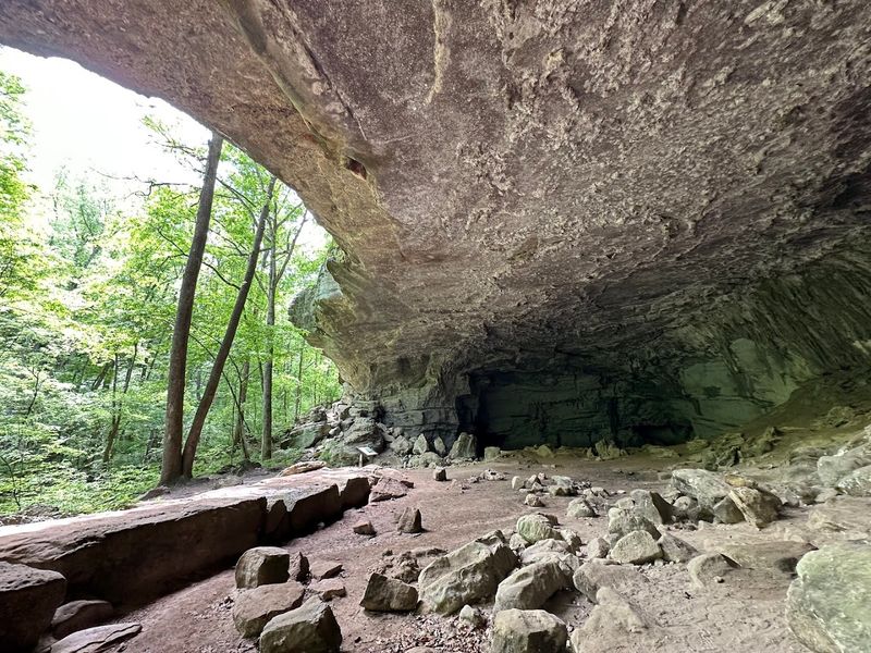
Stepping onto the Indian Rockhouse Trail near Yellville, Arkansas, feels less like starting a hike and more like opening a very old book that has been waiting patiently on the shelf.
Found along Buffalo Point Road, Yellville, AR 72687, this moderate to strenuous loop moves through a karst landscape full of sinkholes, sculpted bedrock, and seasonal waterfalls that shift from quiet trickles to impressive cascades depending on recent rainfall.
Panther Creek runs through sections of the trail, and the water has carved the bedrock into smooth, flowing shapes that look almost intentional, like something a sculptor spent years perfecting.
The trail’s undeniable centerpiece is the Indian Rockhouse Cave, a massive bluff shelter where Native Americans sought refuge thousands of years ago, with excavations uncovering tools and basketry that connect the present moment to a remarkably distant past.
Additional features like the Small Cave with its natural skylight and the curiously named Natural Bathtub add a sense of playful discovery to what is already a historically rich route.
Remnants of an abandoned zinc mine appear along the path, adding yet another chapter to the landscape’s long and layered story.
This trail packs more human history and geological wonder into a single loop than most parks offer across their entire network.
10. Seven Hollows Trail, Morrilton Petit Jean State Park
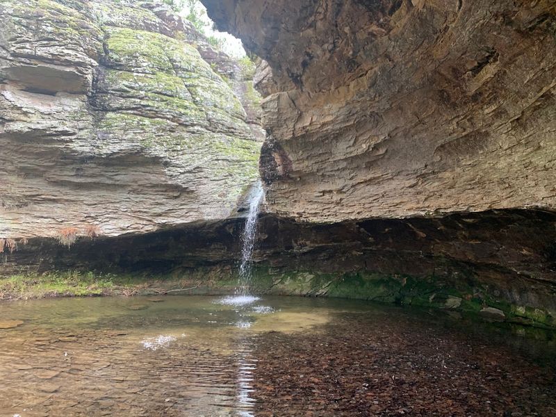
Petit Jean State Park holds a special place in Arkansas history as the state’s very first state park, and the Seven Hollows Trail is arguably its most captivating hike.
Trailhead access begins at 1285 Petit Jean Mountain Road, Morrilton, AR 72110, where this moderate to challenging loop drops into a series of small, stream-carved canyons sheltered beneath a thick canopy of hardwood trees.
The sandstone bluffs here are dramatic and varied, with overhanging walls, narrow passages, and formations like the famous Turtle Rocks that invite you to slow down and really look at the geology around you.
A natural stone arch appears along the route with no fanfare, tucked into the forest as if it has been there so long it stopped expecting applause, which somehow makes it even more impressive.
The grotto is the emotional high point of the hike, a hushed, mossy alcove where a seasonal waterfall trickles into a shallow pool and the outside world feels very far away.
Seven Hollows rewards every step of effort with a view or a story worth carrying home.