
This Illinois Cave Trail Winds Past Waterfalls And Sandstone Bluffs You Can Walk Right Through
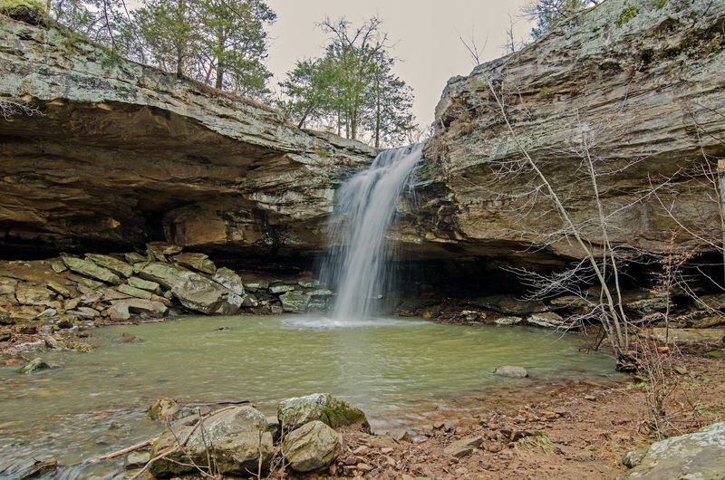
Southern Illinois holds some genuinely striking geology, and Ferne Clyffe State Park near Goreville puts two of its best features within reach of a single afternoon. The park is home to Hawk’s Cave, a roughly 150-foot-long sandstone shelter bluff you can walk beneath, and a separate trail leading to a 100-foot intermittent waterfall.
Before you pack your hiking boots, though, it helps to know exactly what to expect from each route, because the two features sit on different trails rather than one continuous path.
Ferne Clyffe Replaces the One-Trail Promise with Two Short Hikes
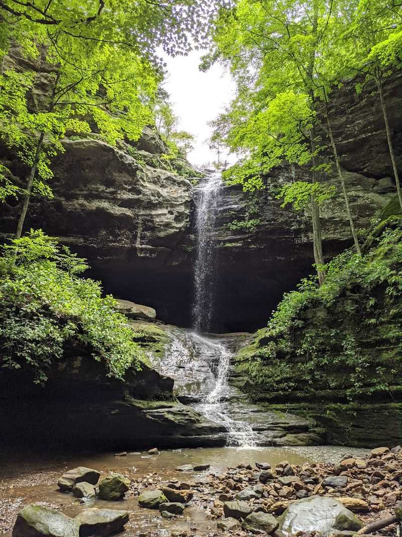
Ferne Clyffe State Park sits in Johnson County near Goreville, roughly 12 miles south of Marion in the heart of southern Illinois. The park covers approximately 2,430 acres and draws visitors for two headline geological attractions: Hawk’s Cave, a massive sandstone shelter bluff, and a tall intermittent waterfall reached by a separate trail.
Those two features together capture the spirit of the title’s promise, but they are not connected by one continuous route.
The Illinois Department of Natural Resources overview of Ferne Clyffe describes both Hawk’s Cave and the waterfall as park highlights, yet the official trail guide presents them as distinct hikes. Hawk’s Cave Trail is listed as an easy 0.5-mile route, while Big Rocky Hollow Trail is a separately listed easy 0.75-mile round trip that leads to the waterfall.
Treating the outing as a two-stop visit rather than a single winding cave trail is not a disappointment; it is simply the accurate, practical way to plan the day.
The good news is that both routes are short enough to complete in a single morning or afternoon, leaving time to explore additional park trails if you want more mileage. The IDNR trail guide for Ferne Clyffe lists 18 named trails in total, ranging from easy flat loops to moderately difficult climbs with steep slopes.
Understanding the layout up front means you arrive with the right expectations and leave with the full experience the park actually delivers.
Sandstone, Ravines, and Erosion Explain the Park’s Shape
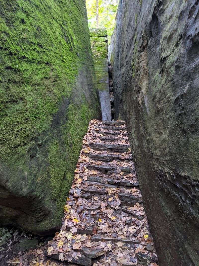
The cliffs, ravines, canyon-like corridors, and shelter bluffs at Ferne Clyffe did not appear overnight. Southern Illinois sits within the Shawnee Hills, a landscape defined by sandstone outcrops, rocky stream corridors, shelves, and steps carved by processes operating across enormous stretches of geologic time.
The Illinois Natural History Survey’s description of the state’s natural divisions notes that clear, rocky streams have widened and deepened ravines throughout this region, contributing to the rugged terrain hikers encounter today.
The shelter bluffs and overhangs that define places like Hawk’s Cave have a more specific origin. Illinois State Geological Survey literature on southern Illinois geomorphology explains that many shelter bluffs formed where weaker, more easily eroded material beneath a cap of massive sandstone was gradually removed.
Once that softer layer disappeared, the harder sandstone above was left projecting outward as an overhang. Over additional time, roof collapse could further enlarge the recess, and streams flowing at the base of some cliffs contributed to undercutting.
Calling any of this formation “carved by centuries of water” would misrepresent both the timescale and the process. These features reflect differential weathering across millions of years, not a single erosional force working over a few hundred.
The result is a layered landscape where massive sandstone caps sit above recessed walls, creating the sheltered alcoves and dramatic cliff faces that make southern Illinois feel unlike anywhere else in the state. Recognizing that geology at Ferne Clyffe means you are not just walking past scenery; you are reading a record of deep time written in rock.
Hawk’s Cave Is a Massive Shelter Bluff
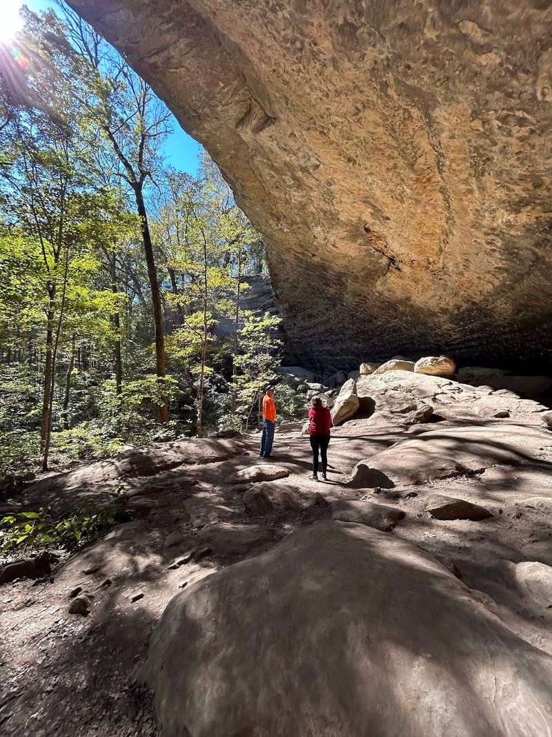
Standing beneath Hawk’s Cave for the first time reframes what the word “cave” can mean. Rather than a dark underground passage, this feature is a sandstone shelter bluff: a long, curving overhang where the ceiling of rock stretches roughly 150 feet from end to end and arches above your head while you walk the trail beneath it.
The scale is genuinely impressive, and the sense of being sheltered inside the earth’s own architecture is real, even though you remain in open air the entire time.
IDNR’s Ferne Clyffe park page identifies Hawk’s Cave as one of the park’s best-known geological features and describes it as a 150-foot-long shelter bluff. The official trail guide classifies Hawk’s Cave Trail as easy and 0.5 miles long, making it one of the more accessible routes in the park.
Hikers pass beneath or alongside the overhang rather than entering an underground chamber, so the experience is less spelunking and more walking through a room with one very large wall.
The walls of the shelter bluff often show moisture seeping through the rock, and the recessed surface can display textures left behind by long-term weathering. Ferns, mosses, and other shade-tolerant plants frequently colonize the damp lower sections, adding color and life to the stone.
What the trail does not offer is a verified statewide ranking or a guaranteed superlative: IDNR’s language describes the shelter as a major feature, but the park’s own materials stop short of calling it the largest or oldest in Illinois. The formation stands well on its own merits without needing that comparison.
The Intermittent Waterfall Has Its Own Trail
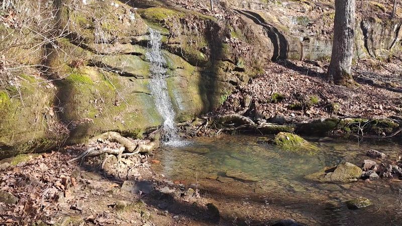
Reaching the waterfall at Ferne Clyffe requires a different trailhead than Hawk’s Cave. Big Rocky Hollow Trail is the park’s easiest route to the falls, listed as an easy 0.75-mile round trip.
IDNR’s park overview describes the waterfall as approximately 100 feet tall, which makes it a visually striking destination when conditions are right. That qualifier matters: the falls are explicitly described as intermittent, meaning flow is not guaranteed on every visit.
The IDNR trail guide also lists a separately named Waterfall Trail, rated moderately difficult at 0.75 miles, and Bork’s Waterfall Trail, a 0.5-mile route leading to the base of a different waterfall. These are distinct routes with different difficulty levels, so checking the trail map before you go helps you choose the right approach for your ability and the time you have.
Mixing up Big Rocky Hollow Trail with the moderately difficult Waterfall Trail could mean a steeper climb than you planned for.
Whether the main falls are flowing depends heavily on recent rainfall, the season, and local conditions. IDNR guidance for Illinois canyon-and-waterfall terrain notes that waterfalls at comparable parks are rain dependent and can dry out during drier periods.
Arriving after a prolonged dry stretch may mean standing in front of a wet rock face rather than a cascade, which is still a geologically interesting sight but a different one. Checking recent rainfall totals or local park conditions before the drive south gives you a realistic sense of what to expect at the base of that 100-foot bluff.
Plan the Visit as a Two-Stop Park Outing
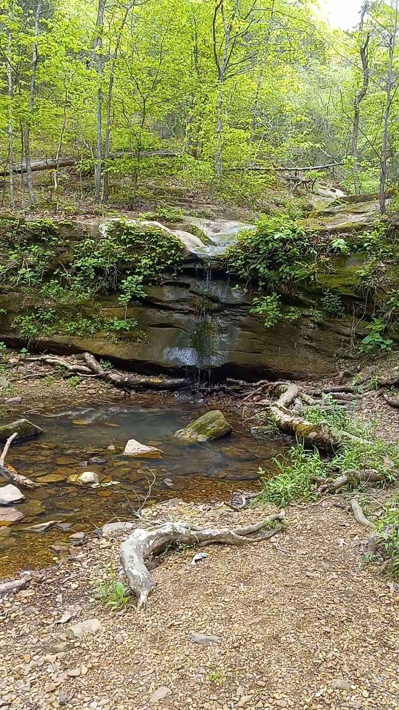
Combining Hawk’s Cave and the waterfall into one outing is entirely practical, provided you treat them as two separate stops rather than one looping path. Hawk’s Cave Trail covers 0.5 miles at an easy grade, and Big Rocky Hollow Trail adds another 0.75-mile round trip at the same difficulty level.
Together those two routes account for roughly 1.25 miles of walking, a manageable total for most hikers, though the trails do not connect directly, so factor in some walking between trailheads or a short drive within the park.
The IDNR trail guide shows 18 named trails at Ferne Clyffe, so hikers who want more mileage after the two short routes have plenty of options. Round Bluff Nature Preserve Trail, rated moderately difficult at 1 mile, adds steep slopes and rock formations for those with more time and energy.
The park activities page notes that equestrian trails are also available, though those are separate from the hiking network and closed to horses from November 1 through April 30.
A downloadable park map from IDNR helps orient you to the trail layout before you arrive, which is especially useful given the number of named routes. Picking a start time that gives you flexibility if the waterfall trail takes longer than expected, or if you decide to add a third route, keeps the day from feeling rushed.
For most visitors, the two headline hikes plus some time to take in the scenery at each feature make for a full and satisfying half-day outing.
Stay on Marked Trails Around Bluffs and Water
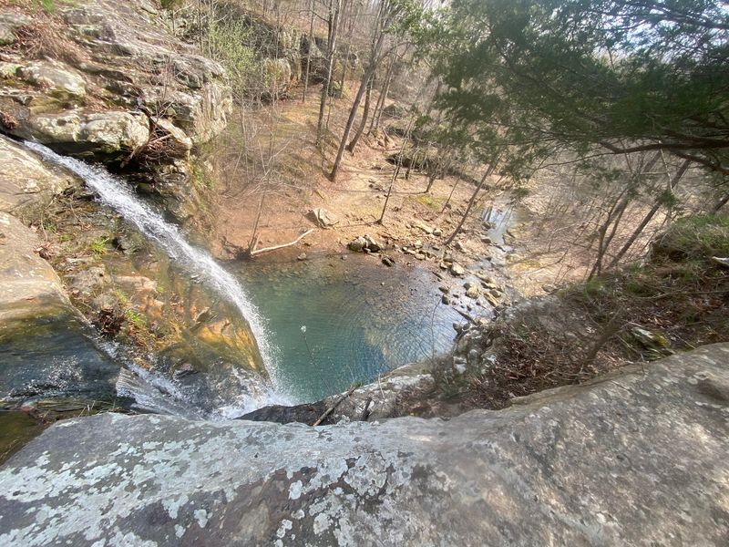
Ferne Clyffe’s landscape is genuinely rugged, and that beauty comes with real physical hazards. IDNR’s activities and rules page for the park states directly that naturally dangerous areas occur within the park and that hikers should remain on designated trails.
Climbing bluff faces, scrambling onto shelter roofs, approaching waterfall edges, or exploring unstable rock recesses off-trail puts you in terrain where loose rock, uneven footing, and sudden drop-offs are real possibilities.
Rain that might improve waterfall flow also makes the park’s rock surfaces, wooden steps, creek crossings, and sloped trail sections significantly more slippery. Sturdy, closed-toe footwear with good grip is the right choice for any visit, and it becomes essential after recent precipitation.
Checking current park conditions through IDNR before you leave home takes only a few minutes and can prevent a wasted trip if a trail is temporarily closed or flooded.
The official trail guide also notes that motorized vehicles and bicycles are not permitted on hiking trails. Round Bluff Nature Preserve, one of the park’s more demanding areas, carries an additional requirement: hiking is restricted to marked trails, and plants and animals within the preserve are protected by law.
Taking photographs from the trail rather than stepping off it to get closer to the bluff face or waterfall base is the safest and most responsible approach. The formations are large enough to be impressive from the designated path, and staying on that path keeps both you and the park intact for the next visitor.
The Accurate Takeaway: Rock Shelter, Waterfall, Separate Routes
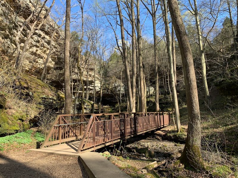
Ferne Clyffe State Park delivers the visual drama that the title’s premise suggests, but it does so across two distinct short hikes rather than one unbroken cave trail. IDNR’s official park overview confirms that Hawk’s Cave is a roughly 150-foot-long sandstone shelter bluff and that the park also features a 100-foot intermittent waterfall, yet the IDNR trail guide lists the routes to each feature separately.
Walking beneath Hawk’s Cave means passing under a massive sandstone overhang, not entering an underground passage. The waterfall may be flowing strongly after recent rain, trickling after a dry stretch, or temporarily absent depending on seasonal and local conditions.
Both possibilities are worth knowing before you make the drive to Goreville. The geological record behind southern Illinois shelter bluffs spans millions of years of erosion, differential weathering, and roof collapse, which puts the landscape in a perspective no single visit can fully absorb.
The corrected version of the outing is still a compelling reason to head south: two easy short hikes, a shelter bluff of genuine scale, a tall intermittent waterfall, and the rugged canyon terrain of the Shawnee Hills all within the same park boundary. Arriving with accurate expectations means you can focus on what the park actually offers rather than searching for a single trail that does not exist.
That honest version of Ferne Clyffe is worth the trip on its own terms.