
This Illinois Rail-Trail Follows An Old Railroad Line Past Prairie, Woods, And Quiet Small Towns
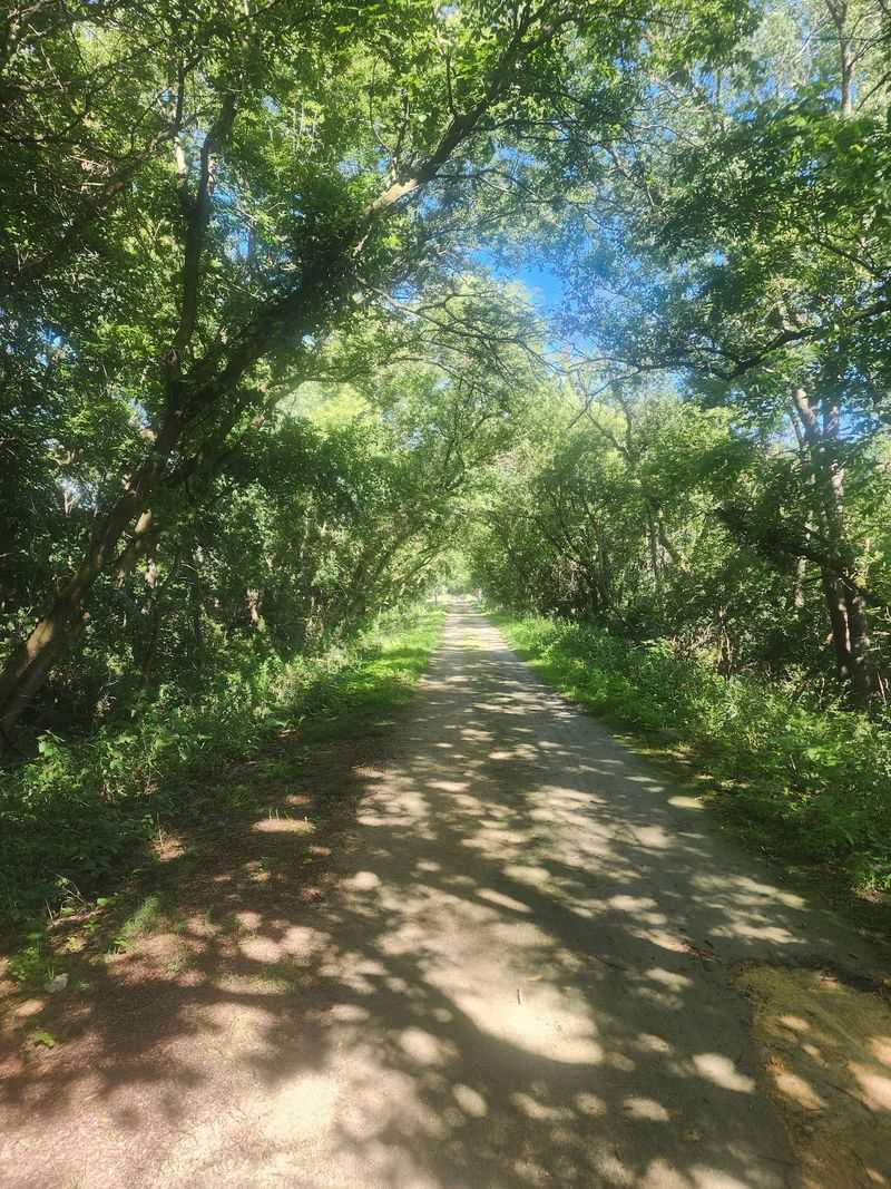
A former railroad corridor in northern Illinois has been reimagined as a long-distance trail that takes walkers and cyclists through open farmland, patches of native prairie, and small agricultural communities. The Long Prairie Trail stretches 14.2 miles across Boone County and into Winnebago County, following the old Chicago and Northwestern railroad bed.
Knowing what to expect before you go, including variable surface conditions and limited amenities, makes all the difference between a rewarding outing and a frustrating one.
Long Prairie Trail Turns a Railroad Bed Into a Long Rural Outing
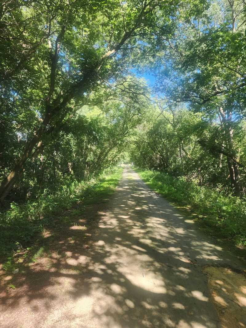
Stretching 14.2 miles east to west across northern Illinois, the Long Prairie Trail gives walkers and cyclists a sustained route through genuinely rural country. The Boone County Conservation District, which manages the trail, identifies it as a hiking and biking path that runs from the Boone and McHenry County line on the east end to McMichael Road in Winnebago County on the west.
That span covers open agricultural land, scattered woodlands, and several small communities, making it one of the longer continuous trail experiences available in the region.
The route sits on the former Chicago and Northwestern railroad bed, a corridor that once carried freight and passengers through this part of the state. Converting a railroad right-of-way into a shared-use path gives the trail its defining character: a relatively straight alignment that cuts across the landscape rather than winding around it.
That said, following a former railroad bed does not automatically guarantee a completely level or effortless ride, and the reviewed official sources do not provide a detailed elevation profile to confirm one way or the other.
What the trail does offer is real distance. For visitors who want to cover ground rather than loop through a small park, 14.2 miles is a meaningful commitment that rewards those who plan ahead.
Published mileage figures vary slightly depending on the source, with some tourism listings citing 14.6 miles, so using the trail manager’s 14.2-mile figure is the most reliable starting point.
The appeal of the Long Prairie Trail is straightforward: a long former-railroad corridor through rural northern Illinois with fields, woods, prairie remnants, and small communities along the way. That concept is well supported.
The practical side, including surface conditions and infrastructure limitations, needs equal attention before you set out, and the sections that follow address both.
Prairie Remnants, Woods, and Fields Define the Corridor
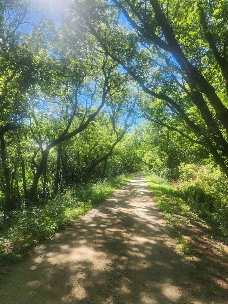
Moving along the Long Prairie Trail means passing through several distinct landscape types rather than a single uniform setting. The Boone County Conservation District describes the corridor as containing woodlands, cultivated fields, and native prairie features, and notes that the route provides ecological value for both plants and animals.
These elements shift as you travel the trail’s length, giving the outing a varied character that a short loop in a developed park would not.
The prairie component deserves an honest description. What the trail manager documents are remnant native prairie features, meaning patches of original or native prairie vegetation that have survived along the corridor, not a continuous landscape of restored tallgrass prairie stretching from one end to the other.
Remnant prairie is genuinely significant from a conservation standpoint, because native prairie is one of the most reduced ecosystems in North America, but visitors expecting sweeping prairie vistas across most of the route will find that cultivated fields and wooded sections make up much of the scenery.
Woodlands along the corridor offer shade and a change in atmosphere, particularly welcome on warm days when the open agricultural sections offer little cover. The cultivated fields that border much of the trail reflect the working agricultural landscape of northern Boone County, and that context is part of what makes the route feel authentically rural rather than curated.
Wildlife presence along a corridor like this is plausible given the mix of habitats, but the trail manager’s description focuses on ecological function rather than promising specific sightings. Visitors should treat any wildlife encounter as a bonus rather than a scheduled attraction.
The combination of remnant prairie patches, tree cover, and open farmland gives the trail genuine ecological interest without requiring any exaggeration of what is actually documented there.
The Towns Add Small-Community Context
Three communities give the Long Prairie Trail its small-town dimension: Capron, Poplar Grove, and Caledonia. The trail passes through or alongside each of them as it crosses northern Boone County, and each one adds a layer of context to the outing that purely natural corridors cannot provide.
None of these are large towns, and the trail manager’s description does not promise shops, restaurants, or services at each stop, so visitors should plan accordingly.
Poplar Grove’s official village website describes the community as located beside the Long Prairie Trail and surrounded by a farming community. That framing captures the relationship well: the trail and the village exist alongside each other in an agricultural setting, and the village’s identity is tied to that rural context.
Cyclists and walkers passing through Poplar Grove get a brief encounter with a working small town rather than a trail-specific destination built around visitor services.
Caledonia offers the most documented railroad history of the three communities. The village’s official history page confirms that a railroad once ran through Caledonia and that the trail now occupies that original corridor.
It also notes that the village once supported a train depot, a hotel, and a general store, giving the trail’s railroad heritage a specific, named anchor. That history connects the current trail to the commercial activity the railroad once generated in this part of Illinois.
Capron rounds out the trio, though the authoritative sources reviewed do not provide equivalent depot or railroad documentation for it that matches the detail available for Caledonia. Treating each town as having an identical or fully documented railroad past would go beyond what the sources support.
What all three communities share is their agricultural setting and their position along a former railroad corridor that now serves as a public trail, and that shared context is reason enough to notice them as you pass through.
Check the Surface Before Committing to the Full Distance
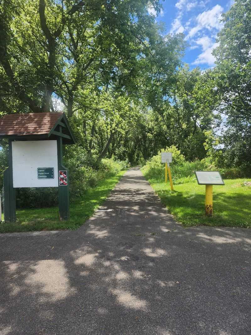
Surface conditions on the Long Prairie Trail are the most important practical consideration for anyone planning a visit. State materials, including the Illinois Department of Natural Resources bike trails publication, classify the route as paved, and the Illinois Office of Tourism describes it similarly.
Those descriptions reflect a general classification rather than a current inspection report, and the picture on the ground is more complicated.
The Boone County Conservation District, which manages the trail, states directly that the surface is failing and needs many upgrades. The agency also identifies 12 former railroad bridges along the route that require replacement.
That is a significant infrastructure gap for a 14.2-mile trail, and it means that conditions can vary considerably depending on where you are on the route and what work has or has not been completed since any given description was written.
Choosing the right bicycle matters more here than on a trail with a uniformly maintained surface. A hybrid bike or a model with slightly wider tires will handle variable pavement and rougher sections better than a road bike with narrow, high-pressure tires.
Riders who show up expecting a smooth, consistent surface may find sections that require slowing down, dismounting, or navigating around deteriorated pavement near bridge approaches.
Before committing to the full 14.2 miles, check the trail manager’s current information at the Boone County Conservation District’s Long Prairie Trail page for any updates on surface work, bridge closures, or detours. Conditions can change between seasons, and what was rideable in one year may have deteriorated further or, conversely, been repaired.
Planning a shorter out-and-back from a known parking area is a reasonable strategy for a first visit, letting you assess conditions before extending your distance.
Parking and Preparation Shape the Day
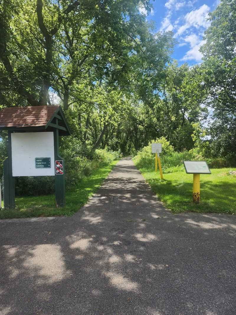
Getting to the Long Prairie Trail is straightforward if you know where the access points are. The Boone County Conservation District lists parking areas in four locations: Caledonia, Poplar Grove, Capron, and at County Line Road.
These access points are spread across the trail’s length, which means you can choose a starting point based on which section of the route interests you most or which end of the trail you want to explore first.
What the official trail page does not provide is a detailed amenities inventory. Drinking fountains, restrooms, food vendors, and bicycle repair facilities are not confirmed along the entire route, and promising those services without location-specific verification would set visitors up for a difficult outing.
The practical approach is to treat the trail as a self-supported experience and pack accordingly. Bring enough water for the full distance you plan to cover, carry food, and include a basic repair kit with a spare tube, tire levers, and a pump or CO2 inflator.
Sun protection is worth taking seriously on a route that crosses open agricultural land for significant stretches. A hat, sunscreen, and sunglasses add little weight and matter considerably on a warm, clear day when shade is limited.
Layering options are useful in spring and fall, when temperatures in northern Illinois can shift noticeably between morning and midday.
Trail hours follow the Boone County Conservation District’s general policy for publicly accessible conservation areas, which are typically open from one-half hour before sunrise to one-half hour after sunset. That schedule is subject to posted exceptions, hunting-season restrictions, and winter closures, so the posted hours at each access point should be treated as the authoritative guidance for that specific location and time of year.
Checking the trail manager’s current information before your visit is the most reliable way to avoid a wasted trip.
Share the Trail and Prepare for Outdoor Conditions
The Long Prairie Trail is a shared-use path, which means cyclists, walkers, and other users occupy the same corridor. Illinois transportation guidance on active-use paths recommends maintaining safe speeds, signaling clearly before passing other users, and giving consideration to pedestrians and people with disabilities.
Those practices matter more on a trail with variable surface conditions, because a rough section or a bridge approach that requires a sudden slowdown is easier to handle safely when everyone is moving at a reasonable pace.
Bridge crossings and road intersections deserve particular attention. The 12 former railroad bridges identified as needing replacement are points where the surface may be uneven, the width may narrow, or visibility may be limited.
Slowing down before reaching a bridge, checking for oncoming users, and crossing at a controlled speed reduces the risk for everyone on the path. The same applies to road crossings, where trail users must yield to vehicle traffic and make eye contact with drivers before proceeding.
Weather preparation is a standard part of any outdoor outing in northern Illinois. The Illinois Department of Natural Resources emergency preparedness guidance identifies extreme heat, severe thunderstorms, lightning, tornadoes, and strong winds as potential hazards during outdoor recreation.
Checking a reliable forecast before you leave and turning back if conditions deteriorate is straightforward risk management, not an overreaction.
Tick exposure is a realistic concern on a trail that passes through native vegetation, woodland edges, and tall grass. Illinois Department of Public Health guidance on tickborne illnesses recommends using repellent, staying on the center of the path where possible, and doing a thorough tick check after any time in vegetation.
Wearing light-colored clothing makes ticks easier to spot, and checking promptly after the outing reduces the risk of transmission if a tick has attached.
Plan for Distance, Rural Scenery, and Imperfect Infrastructure
The Long Prairie Trail is a good fit for visitors who want a long former-railroad corridor through agricultural northern Illinois, with fields, scattered woodlands, native prairie remnants, and small-town context along the way. At 14.2 miles, as documented by the Boone County Conservation District, it offers real distance for walkers and cyclists who want to cover ground rather than circle a short loop.
That length also means the surface conditions and bridge infrastructure issues matter: a deteriorating section near one of the 12 bridges that need replacement can affect your day in ways that a shorter outing would not.
The honest decision rule is simple. If you are willing to carry your own water and food, check current conditions before you go, choose a bicycle suited to variable pavement, and adjust your route based on what you find, the Long Prairie Trail rewards the effort with a genuinely rural experience that is hard to replicate closer to the Chicago suburbs.
If you need guaranteed smooth pavement, confirmed restrooms, and on-trail services, this route is not the right match right now.
Communities like Caledonia, with its documented railroad history, give the trail a sense of place that goes beyond the scenery alone. A former railroad bed running through farm country, connecting small towns that once depended on that same line, is its own kind of story worth following at a measured pace.