
This Mississippi River Town Is A Short Drive From A Covered Bridge You Can Still Walk Across
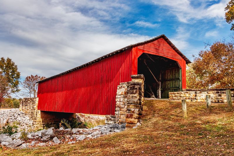
Chester, Illinois, sits on a bluff above the Mississippi River, and most visitors come for the riverfront views or the local Popeye connection. What fewer people know is that a short drive northeast of town leads to one of southern Illinois’ rarest surviving structures: a 19th-century covered bridge still open to foot traffic.
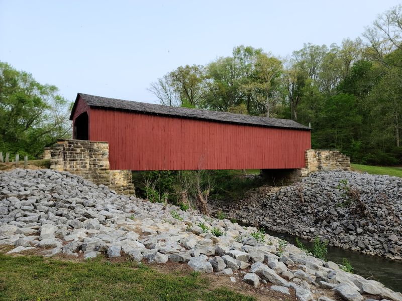
The Little Marys River Covered Bridge has been standing since 1854, and after a major restoration it welcomed visitors back in the fall of 2025. Pair the bridge stop with a walk around Chester’s riverfront, and you have a genuinely memorable southern Illinois day trip.
The covered bridge is near Chester, not in its downtown
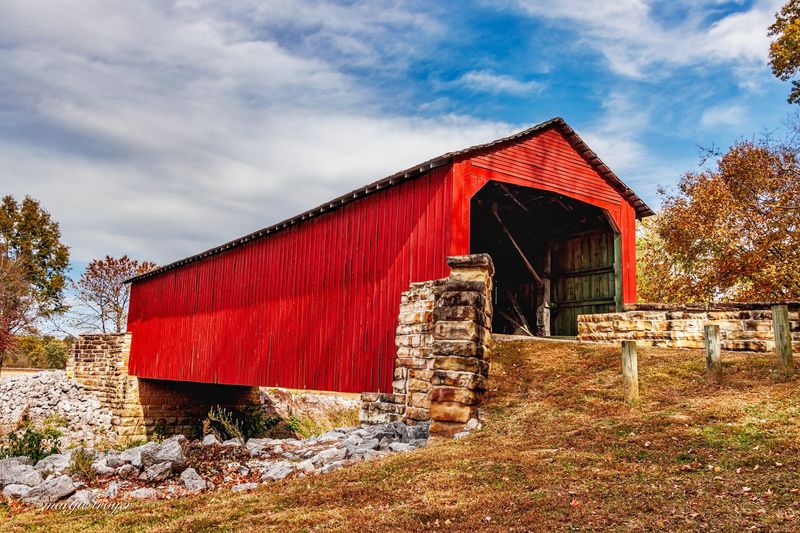
Chester, Illinois, earns its place on the map as a Mississippi River town, perched above the wide water on the state’s southwestern edge. The Little Marys River Covered Bridge, however, sits about four miles northeast of Chester, crossing an entirely separate waterway called the Little Marys River.
These two stops are linked by a short drive rather than a stroll, and understanding that geography upfront makes the outing much easier to plan.
According to the Illinois Department of Transportation’s 2025 restoration announcement, the bridge sits off Illinois Route 150, northeast of Chester, preserved as a pedestrian-only structure. The Mississippi River defines Chester’s identity, while the Little Marys River gave the covered bridge its name and its quiet rural setting.
Treating them as two separate destinations that happen to share a zip code is the clearest way to think about the trip.
Chester’s riverfront, welcome center, and historic downtown give the outing its town anchor and its amenities. The bridge supplies the rare, off-the-beaten-path moment that most day trips in this part of Illinois can’t offer.
Together, they create a loop that covers river bluffs, working-class history, and a piece of 19th-century construction that has outlasted almost everything built around it.
The Chester Welcome Center is a practical first stop for maps and orientation before heading northeast to the bridge. Randolph County’s historic sites page lists the bridge alongside other regional landmarks, making it easy to see how the two stops fit into a broader picture of the area.
What makes Little Marys River Bridge worth the drive?
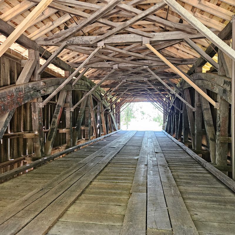
Built in 1854, the Little Marys River Covered Bridge uses a Burr-arch design, a structural method that combines a long timber arch with a multiple kingpost truss to distribute weight efficiently across the span. That combination made Burr-arch bridges both strong and relatively economical to build during the mid-1800s, which is why the design spread across the rural Midwest.
Seeing the full system of beams and arches inside the bridge is one of the quieter pleasures of walking through it.
The structure originally carried the old roadbed of Illinois Route 150 over the Little Marys River, serving as a working transportation link for the region. IDOT’s records, reflected in the Illinois historic bridge structure list, identify it as an IDOT-owned pedestrian structure dating to 1854.
That shift from active roadway to preserved footpath is part of what makes the bridge feel like a genuine survivor rather than a reconstruction.
The National Park Service’s Illinois National Register listings include Mary’s River Covered Bridge as a Chester, Illinois, entry added in 1974. That listing reflects the bridge’s recognized architectural and historical significance at a national level.
IDOT has also described it as Illinois’ oldest covered bridge, though other sources more carefully call it the only surviving covered bridge in southern Illinois, so that ranking is worth treating as IDOT’s characterization rather than a settled fact.
What is not in dispute is that the bridge’s surviving historic character, original Burr-arch framing, and documented pedestrian access provide the central payoff of the outing. Rare surviving historic covered bridges of this age are not common anywhere in the Midwest, and walking through one that has been carefully maintained rather than replaced gives the stop a weight that a simple scenic overlook cannot match.
The bridge reopened after major storm damage
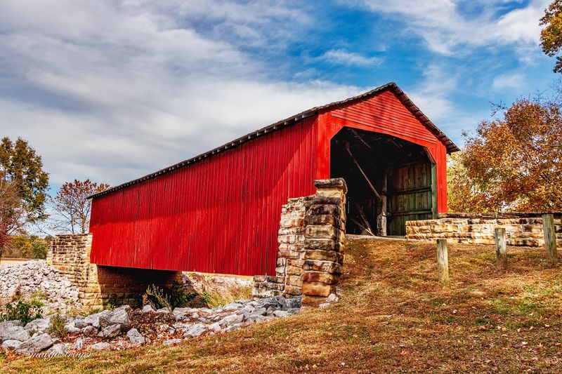
A severe windstorm in early July 2023 tore the roof off the Little Marys River Covered Bridge, forcing its closure and leaving the 170-year-old timber frame exposed to the elements. Travelers who visited before the storm or who found older travel articles and photographs may have seen the bridge in a very different condition.
Any undated or pre-2023 source should be treated with caution, because the storm fundamentally changed the bridge’s appearance and access status for nearly two years.
The restoration that followed was extensive. IDOT’s official reopening announcement describes roof repairs, fire-suppression improvements, video monitoring systems, and structural tie-downs as part of the work.
Those additions reflect a broader effort to protect the bridge not just from weather but from the kind of slow deterioration and potential vandalism that has ended the life of similar structures elsewhere.
The bridge reopened to pedestrians on September 22, 2025, after a nearly yearlong restoration process. As of the latest available data from early 2026, the structure is listed as open to pedestrians only, with no vehicle access permitted.
That reopening is genuinely good news for anyone who had the bridge on a travel list and set it aside after the storm.
Restoration, however, does not guarantee permanent or uninterrupted access. Storms, maintenance needs, or security concerns could change conditions without much public notice.
The bridge has no published regular visitor hours, so the responsible approach is to verify current access with local authorities or IDOT before making the drive. The September 2025 reopening is the most recent confirmed access date, and that date-qualified status is the honest way to describe the bridge’s current situation.
How should you plan the bridge stop?
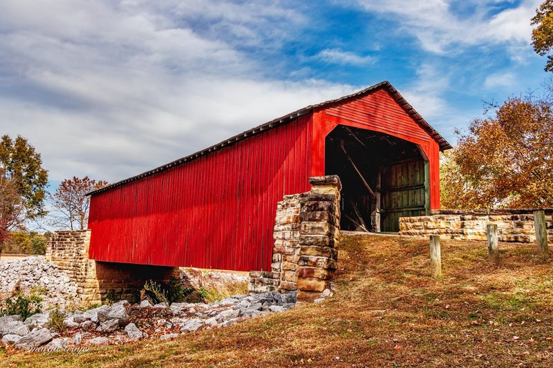
Getting to the bridge means driving northeast from Chester on Illinois Route 150, roughly four miles from town. There is no safe, continuous pedestrian route from Chester’s center to the bridge site, so plan to use a vehicle.
Once you arrive at the designated site access, follow posted guidance and use the access area rather than stopping along the active roadway.
The site includes a picnic area, as documented by Randolph County’s historic sites listing. That makes the stop genuinely comfortable for a short rest, a meal, and photographs, even if the surrounding area is relatively modest.
Do not expect a large developed park, extensive trail systems, or confirmed public parking beyond what the designated access provides. If the site access area is full or unavailable, do not park along Illinois Route 150 or linger in active travel lanes.
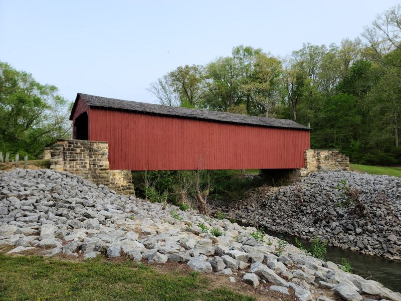
Walking through the bridge itself is the main event. HistoricBridges.org’s entry for the Little Marys River Bridge confirms its status as open to pedestrians only, which means the bridge functions as a footpath across the Little Marys River, not as a current vehicle crossing.
Never attempt to drive across it. The timber framing, the Burr-arch structure overhead, and the filtered light through the wooden siding are best appreciated on foot at a relaxed pace.
Photography is one of the most rewarding parts of the stop, but keep safety in mind. Shoot from within the designated access area and the bridge itself, not from the Route 150 roadway.
Allow 30 to 45 minutes at the site to walk through, take photographs, and use the picnic area without feeling rushed.
Before you leave home, check with Randolph County or IDOT for the latest access status. The bridge carries no published regular hours, and the IDOT reopening information does not promise uninterrupted access going forward.
A quick call or web check before departure takes a minute and could save a wasted trip.
Chester’s Mississippi River setting supplies the second half of the outing
After the bridge stop, the drive back toward Chester delivers a completely different kind of scenery. The Mississippi River bluffs that frame the town are among the more dramatic natural features in southern Illinois, and the Chester Welcome Center puts visitors right at the edge of that landscape.
Sitting adjacent to the Chester Bridge above the river, the welcome center offers parking, restrooms, historical exhibits, and a viewing deck with an unobstructed look at the Mississippi.
The National Park Service’s Chester Welcome Center page confirms those amenities and describes the facility’s role as an orientation point for the area’s history and natural setting. For travelers arriving from the covered bridge, the welcome center functions as a practical transition: a place to stretch, use facilities, and shift mentally from rural bridge site to river town exploration.
The viewing deck alone is worth a few minutes, especially on a clear afternoon when the river traffic is visible from the bluff.
Chester also sits along the Lewis and Clark National Historic Trail, and the town’s riverfront reflects that chapter of American exploration. The Lewis and Clark Trail’s Chester listing points to the town’s place in the broader story of the expedition’s passage through this stretch of the Mississippi.
That interpretive layer adds depth to what might otherwise feel like a simple river overlook, connecting the bluff view to a much larger historical arc.
The contrast between the intimate, shaded covered bridge and the wide-open river panorama at Chester is part of what makes the pairing work as a day trip. Both stops reward attention, but they reward it differently, and that variety keeps the outing from feeling one-note.
Add Chester’s local history at your own pace
Chester has a local history that goes well beyond its river setting, and the Popeye connection is the most recognizable thread. Elzie Crisler Segar, the cartoonist who created Popeye, was born in Chester in 1894, and the town has embraced that legacy with a Popeye Character Trail featuring bronze statues of characters from the comic strip placed around the area.
Stopping to find a few of them makes for an easy, low-pressure way to see more of town without committing to a rigid schedule.
Randolph County’s historic sites listings and tourism pages describe the character trail alongside other local landmarks, including the Randolph County Courthouse and various sites tied to the region’s French colonial and American frontier periods. These are genuine points of interest, but they are spread across different parts of Chester rather than forming a single, fully walkable downtown circuit.
Driving between a few of them, or selecting two or three based on your available time, is a more realistic approach than attempting to cover everything on foot.
The courthouse is worth a look for its architecture and its elevated position within the town’s grid, offering another angle on how Chester sits within its bluff-and-river geography. Regional historic sites related to Randolph County’s longer European settlement history, including Fort de Chartres a short distance away, can extend the day for travelers with extra time and interest.
The Chester Welcome Center is a sensible place to pick up a current map and narrow down which stops fit your group’s pace. Choosing three or four attractions rather than rushing through a dozen leaves room to actually enjoy what you find instead of treating each stop as a checkbox.
A simple bridge-and-river-town day trip
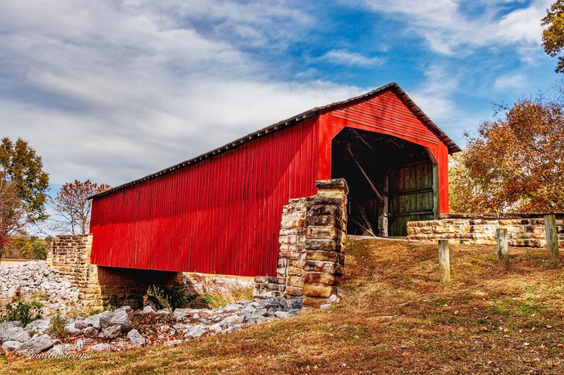
The most practical way to structure the day is to start at the covered bridge and finish in Chester, or reverse the order if you prefer to orient yourself in town before heading out to the rural site. Either sequence works, but the bridge stop benefits from morning light and cooler temperatures, so an early start at the Little Marys River site followed by an afternoon in Chester tends to flow naturally.
Keep the bridge’s requirements in mind throughout. The IDOT reopening confirmation establishes pedestrian access as of September 22, 2025, but no regular hours are published and conditions can change.
Verify access before you leave home, drive to the designated site rather than walking from Chester, and treat the bridge as a pedestrian-only crossing throughout your visit.
Chester’s riverfront, welcome center, and local attractions fill the rest of the day without requiring a precise itinerary. The Chester Welcome Center provides parking and restrooms, and Randolph County’s historic sites resources can help you choose a few companion stops that match your pace.
Two distinct landscapes, one preserved 19th-century bridge and one wide Mississippi River bluff, make for a day that feels both grounded in history and genuinely easy to pull off.