
This Illinois Riverside State Park Lets You Paddle the Illinois River and Hike to Cliff-Top Overlooks
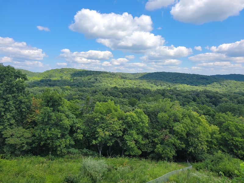
Pere Marquette State Park near Grafton, Illinois, sits where the Illinois River meets the Mississippi, and it packs two very different outdoor experiences into one full day. You can launch a canoe or kayak from the park’s boat ramp and paddle the Illinois River, then swap your paddle for hiking boots and climb bluff-country trails to scenic overlooks.
The catch is that the river is not always calm, the trails are not all easy, and the overlooks are not all sandstone, so knowing what you’re getting into before you go makes the whole trip better.
Pere Marquette Matches the River-and-Overlook Idea—With One Important Correction

Pere Marquette State Park sits in Jersey County near Grafton, Illinois, along the Illinois River and close to the point where that river meets the Mississippi. The Illinois Natural Areas Preservation Commission identifies the park’s location as one of the state’s most ecologically significant river-bluff corridors, combining river access with forested ridges and cliff communities.
Reaching the park from Grafton means following Illinois Route 100 west along the river, and the drive itself previews the landscape you’ll spend the day exploring.
The park genuinely supports the combination of water access and elevated viewpoints. The Illinois Department of Natural Resources describes boating facilities, views of the Illinois River and its backwaters from bluff-top points, and roughly 12 miles of marked hiking trails that reach documented scenic overlooks including McAdams Peak and Twin Mounds.
That combination, river access plus ridge-top views, is real and worth the trip.
One correction matters before you pack the car, though. Official sources verify that visitors can launch boats and look out over the river’s backwaters from the bluffs, but they do not establish a designated quiet backwater paddle route running directly from the park.
The distinction is practical: you’re paddling the Illinois River, not a sheltered side channel set aside for calm-water outings. Similarly, the overlooks are not uniformly sandstone.
IDNR’s activity page for Pere Marquette describes the park’s mixed terrain, and the regional geology includes limestone, dolomite, shale, and loess alongside sandstone. Understanding both corrections before arrival lets you plan a trip that matches what the park actually delivers.
The Park Has a Launch, but Water Conditions Still Matter
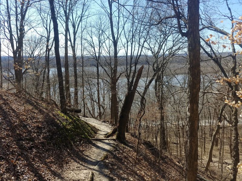
Pere Marquette’s activity page confirms a boat ramp, harbor, launching ramps, parking, and courtesy docks when weather conditions and river levels allow. That infrastructure is genuinely useful.
Having a paved ramp, designated parking, and a harbor in one location removes a lot of the logistical friction that complicates paddling trips at less-developed sites.
What those facilities do not do is change the character of the water in front of them. The Illinois River at Grafton is a navigable commercial and recreational waterway, not a protected pond.
Current speed, wind direction, motorized boat traffic, seasonal water levels, and visibility all vary, and none of those variables are controlled by the presence of a launch ramp. Courtesy docks, specifically, are conditional: IDNR makes clear they are available only when weather and river levels permit, so a dock that was in place on a friend’s visit may not be there on yours.
Paddlers who have experience on moving water and who check conditions ahead of time will find the launch genuinely convenient. Those who have paddled only flatwater lakes or slow creeks should treat the Illinois River as a meaningful step up in complexity, not an equivalent experience with a different backdrop.
The USGS water monitoring station near Grafton reports current river stage and flow data, and reviewing that information the morning of your trip takes about two minutes and can meaningfully change your plan. A high-water period with strong current is a different outing than a calm midsummer morning at normal stage, and the ramp is the same concrete slab either way.
Kayak rentals at the park are not verified by the sources reviewed here. If renting equipment on-site is part of your plan, contact the park directly before traveling to confirm availability rather than assuming a rental concession is operating.
Prepare for the Paddle Before You Reach the Ramp
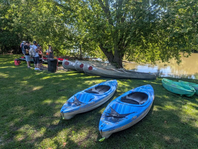
Illinois law requires at least one properly sized, U.S. Coast Guard-approved wearable personal flotation device for every person aboard a watercraft.
The Illinois Boating Laws and Responsibilities digest specifies that children under 13 must wear a PFD while on the deck of or in an open watercraft when it is underway, subject to statutory exceptions. Adults are required to have a PFD on board and accessible; wearing it is the safer choice on a river with variable current and boat traffic.
Registration rules differ depending on your watercraft. IDNR’s watercraft FAQ confirms that unpowered canoes and kayaks are not required to be registered in Illinois, which simplifies the paperwork for most day-trippers.
Any watercraft powered by machinery, including a trolling motor, must carry current Illinois registration. If you’re renting or borrowing a boat, confirm its power source and registration status before launching.
Beyond the legal minimums, practical gear makes a real difference. Bring more drinking water than you think you’ll need, because sun and exertion on open water add up faster than they do on a shaded trail.
Sun protection, including a hat, sunscreen, and UV-rated clothing, matters on the river where shade is limited. A dry bag or a waterproof phone case protects your navigation tools and emergency contact options if the boat takes on water or tips.
Matching your route to your experience is the most important preparation step. Review current river conditions using the USGS gauge near Grafton before leaving home, and be honest about your paddling background.
A trip on the Illinois River when stage is normal and wind is light is a very different outing from the same route during a spring high-water event. Neither the title of this article nor the presence of a launch ramp tells you which kind of day you’ll face, and only a current conditions check can answer that question.
Use the Trail Ratings to Match the Hike to Your Day
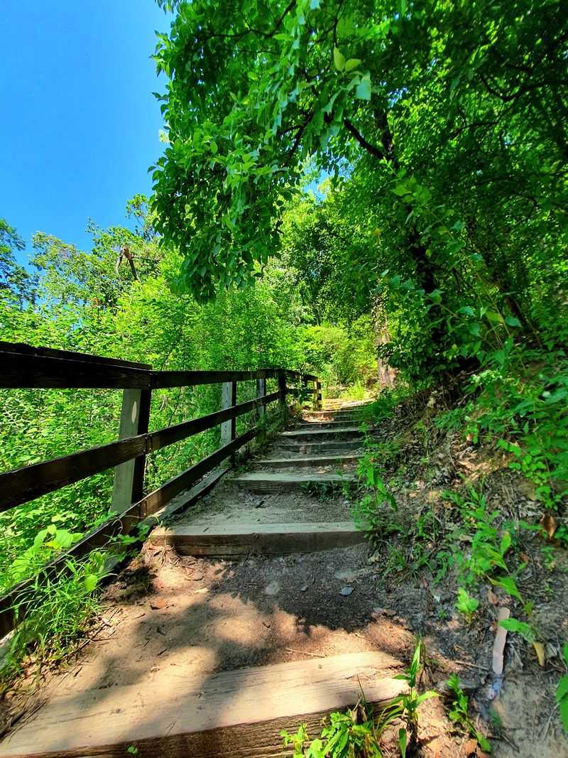
About 12 miles of marked trails cover the park, and the range in difficulty is wide enough that two people in the same group might reasonably choose different routes. The official Pere Marquette hiking trail map lists named routes including Goat Cliff, Hickory, Ravine, Ridge, Hickory North, Hickory South, Fern Hollow, Dogwood, Rattlesnake, and Oak.
Each trail carries an official difficulty rating, and using those ratings rather than guessing based on mileage alone will help you choose wisely.
The Hickory Trail is the park’s easiest option at 0.5 miles, rated easy on the official map. For a group that has already spent a few hours paddling, or for visitors who want a short walk with a view and a predictable return, the Hickory Trail is a reasonable anchor.
It is short enough to complete in a single afternoon hour even at a relaxed pace.
Goat Cliff Trail runs 1.5 miles and carries a moderate rating. Moderate at Pere Marquette means wooded, hilly terrain with elevation change, not a flat gravel path.
Several other trails on the official map also carry moderate ratings, so the idea that all of the park’s hiking is easy does not hold up. If you’re planning to paddle first and hike second, factor in the fatigue from time on the water before committing to a longer moderate route late in the day.
The park’s main IDNR page notes that trail access can change with weather and seasonal conditions, so confirming that your chosen route is open before you drive out is worth a quick call or a check of the current conditions page. Building flexibility into your hiking plan, knowing both a primary and a backup trail, means a closed section doesn’t end the afternoon.
McAdams Peak and Twin Mounds Provide the Viewpoints
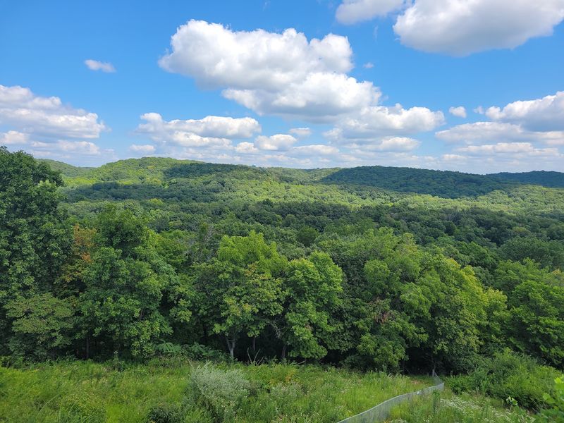
McAdams Peak and Twin Mounds are both marked as scenic overlooks on the park’s official trail map, which makes them the most clearly documented destinations for visitors who want a view after the water portion of the day. Reaching them requires hiking through the park’s wooded bluff terrain rather than walking a paved path to a platform, so plan your energy and time accordingly.
The Illinois Natural Areas Preservation Commission documents McAdams Peak as a limestone cliff community and loess hill-prairie site overlooking the Illinois River. That geological description matters for managing expectations: McAdams Peak is primarily a limestone and loess feature, not a sandstone formation.
Calling it a sandstone overlook would be inaccurate. The view of the river from the peak is real and documented, but the rock beneath your feet at that specific point is limestone and windblown loess soil, not sandstone.
Twin Mounds appears on the same official trail map as a second scenic overlook, offering an alternative destination for visitors who want a different vantage point or who are combining multiple trail segments. The two overlooks give the day a pair of achievable targets rather than a vague promise of scenery somewhere on the ridge.
The Illinois Geological Survey’s guide to the geology of the Pere Marquette and Alton area describes the regional bedrock as a complex mix of limestone, dolomite, shale, and sandstone, with thick loess deposits covering much of the upland surface. IDNR educational material does reference sandstone bluffs and canyons in the broader park area, so sandstone is present in the landscape.
The accurate framing is bluff-country terrain with mixed geology, not a uniform sandstone canyon rim. The overlooks are genuine and worth the climb; they just don’t all look the same, and the sources don’t describe a continuous exposed rim trail or dramatic sheer drops at every viewpoint.
Build a Flexible River-and-Ridge Day Plan

A practical sequence for the day starts before you leave home. Check the IDNR’s current Pere Marquette park page for access updates, then look at the USGS gauge for river stage and the weather forecast.
If the river is running high or fast, or if a storm is forecast for midday, adjust the paddle portion or skip it entirely and focus the day on hiking. No view from McAdams Peak requires a boat ride first.
When conditions support paddling, launch early. Morning hours on the Illinois River tend to have lighter wind than afternoon, and starting on the water while you’re fresh lets you save the hiking for when you’re back on solid ground.
IDNR’s activity page confirms the boat ramp, harbor, and parking are among the park’s open facilities, though courtesy docks remain conditional on weather and river levels. After returning the boat to the vehicle, a short break and a meal at the park lodge or a packed lunch at a picnic area transitions the day from water to trail mode without a long drive in between.
Choose your trail based on how much energy and daylight remain after the paddle. The Hickory Trail works as a shorter option for tired legs; Goat Cliff or a longer moderate route suits visitors who feel strong and want the fuller ridge experience.
The official park site map and the hiking trail map together show trailhead locations relative to the parking areas, which helps you avoid unnecessary backtracking at the end of the day. Reversing the order, hiking first and paddling second, is a reasonable alternative if an afternoon breeze is expected to die down or if you simply prefer to earn the view before the float.
Expect a Planned River-and-Bluff Outing, Not a Guaranteed Easy Escape
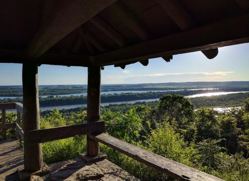
Pere Marquette State Park genuinely delivers what draws people to it: Illinois River access, views of the river’s backwaters from forested bluffs, marked trails through bluff-country terrain, and documented scenic overlooks at McAdams Peak and Twin Mounds. The park’s IDNR page and its activity listings confirm those features are real and currently open, subject to conditions.
What the evidence does not support is calling the paddle quiet, secluded, or suitable for beginners without a current conditions check, or describing the overlooks as uniformly sandstone. The official trail map rates multiple routes as moderate, and the Illinois River is a navigable waterway that demands honest self-assessment from every paddler.
The park is also not a hidden gem: it has a lodge, campground, equestrian use, a scenic drive, and organized events, and it draws visitors from across the Midwest.
The decision rule is simple: verify conditions before you go, carry required safety gear including a properly fitted PFD for every person on the water, and choose your water and trail plans based on what the day actually offers rather than what the title of an article promised. A trip built on accurate information tends to be a better trip than one built on assumptions, and Pere Marquette rewards visitors who show up prepared.