
This Illinois State Park Hides A Fern-Lined Gorge You Can Hike Down Into By The River
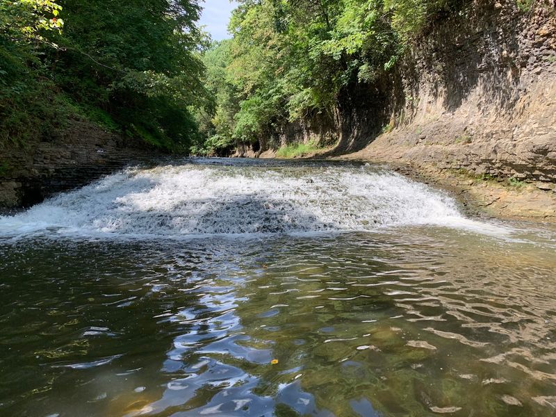
Tucked inside Kankakee River State Park, a dolomite gorge carved by Rock Creek offers one of Illinois’s most rewarding summer hikes. Steep canyon walls, a frothy waterfall, and slopes rich with ferns make this route feel like a world apart from the flat, sun-baked landscape most people picture when they think of the state.
The approximately 3-mile Rock Creek route near Bourbonnais gives day hikers and road-trippers a genuinely shaded, geologically fascinating outing without driving far from the Chicago metro area. If you are planning an August trip and want a trail that trades open-sky heat for canyon cool, this is worth your attention.
Find the Rock Creek Gorge at Kankakee River State Park
Kankakee River State Park sits about six miles northwest of the city of Kankakee, addressed at 5314 W. Route 102 in Bourbonnais, Illinois.
The park covers roughly 4,000 acres and stretches along both sides of the Kankakee River for approximately 11 miles, making it one of the larger natural areas in the northeastern part of the state. Most visitors come for the river scenery, but the park holds a second route that deserves equal attention.
That route follows Rock Creek, a tributary that feeds into the Kankakee River after cutting its own dramatic path through the landscape. The Illinois Department of Natural Resources describes this as an approximately 3-mile trail passing through limestone canyons and ending near a frothy waterfall.
The creek itself, not the main river, is the star of this particular hike, and the trail follows Rock Creek rather than running directly alongside the Kankakee for its entire length.
Calling this a fern-lined gorge captures something real about the experience. Fern-rich slopes and shaded canyon habitat do define stretches of the route.
A more precise description, though, is a gorge route with fern-filled slopes and canyon scenery, since the evidence does not confirm that every yard of the trail is continuously blanketed in a single layer of ferns. The park overview confirms the setting and the access point near Bourbonnais, so hikers can plan a straightforward drive from the Chicago area and be on the trail within a couple of hours.
Rock Creek Carved a Dolomite Canyon
Rock Creek did not carve its gorge quickly. Over thousands of years, the creek eroded downward through layers of Silurian-age dolomite, specifically the Sugar Run and Joliet Formations, as it worked its way toward the lower Kankakee River valley.
Dolomite is a carbonate rock similar to limestone, and both dissolve gradually under slightly acidic water, allowing creeks to widen cracks, deepen channels, and eventually produce the vertical walls visible in the gorge today.
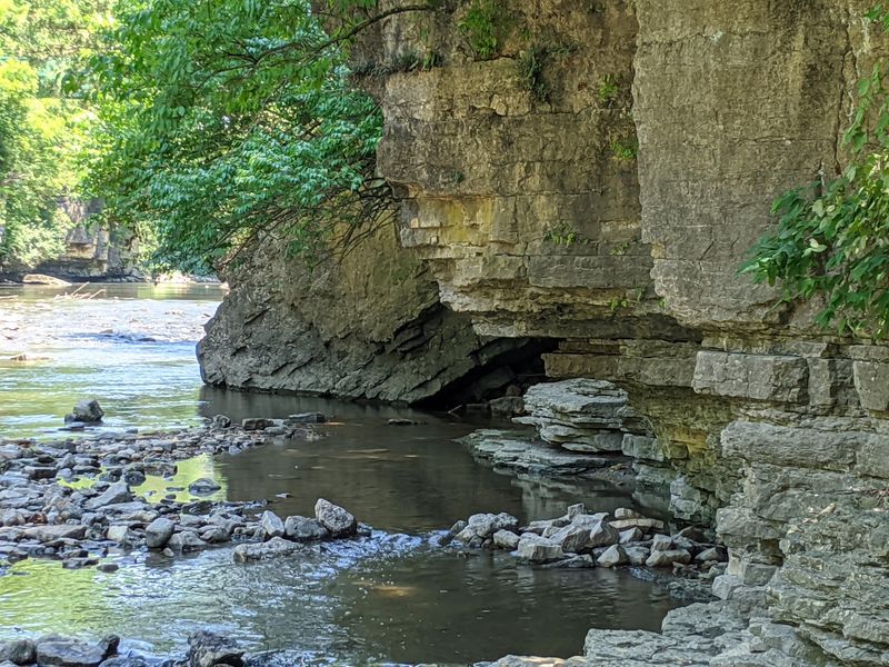
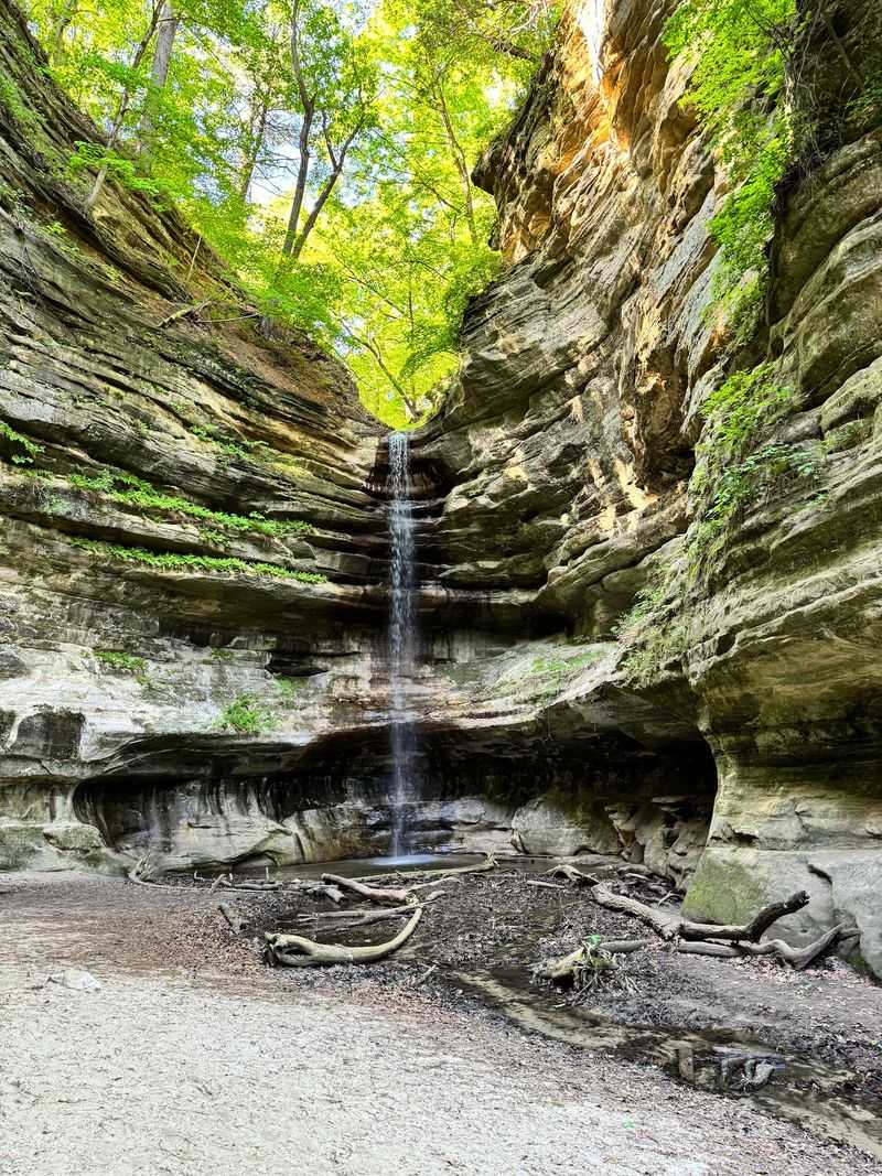
The Illinois State Geological Survey documents steep cliffs, small caves, an arch, riffles, rock formations, and a waterfall near the creek’s mouth, all products of that long erosional process. Rock Creek has a steeper gradient than the nearby Kankakee River, and that steeper drop is a key reason the tributary cut a gorge while the larger river carved a broader, flatter valley.
Where the creek loses elevation quickly, water moves faster, carries more erosive energy, and cuts more aggressively into the bedrock below.
The small caves and overhanging walls that give the gorge its drama are products of differential erosion, where softer or more fractured rock layers wore away faster than the surrounding stone. Riffles, the shallow, broken-water sections visible along the creek, form where resistant rock creates natural steps in the streambed.
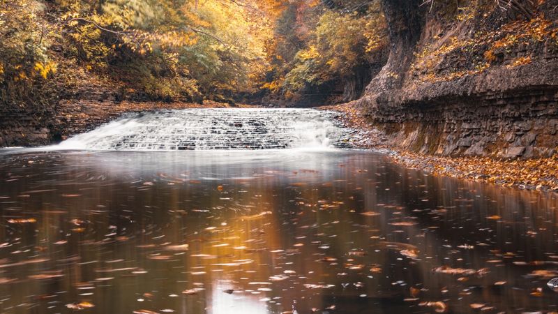
The waterfall near the creek’s mouth represents the most dramatic of these steps, a point where the creek drops sharply before joining the Kankakee.
All of these features are worth observing from the trail. The caves, cliffs, and riprap areas are geological features to appreciate visually rather than formations to enter or scramble across.
The survey documents them as field-trip observations, and that spirit of looking rather than climbing is the right frame for a safe and rewarding visit.
Fern-Rich Slopes Shape the Summer Experience
Walk into the Rock Creek canyon on an August afternoon and the air feels different almost immediately. The canyon walls block direct sun, the vegetation overhead closes in, and the sound of moving water adds to the sense of stepping out of summer’s full intensity.
That sensory shift is real, even if it cannot be pinned to a specific number of degrees.
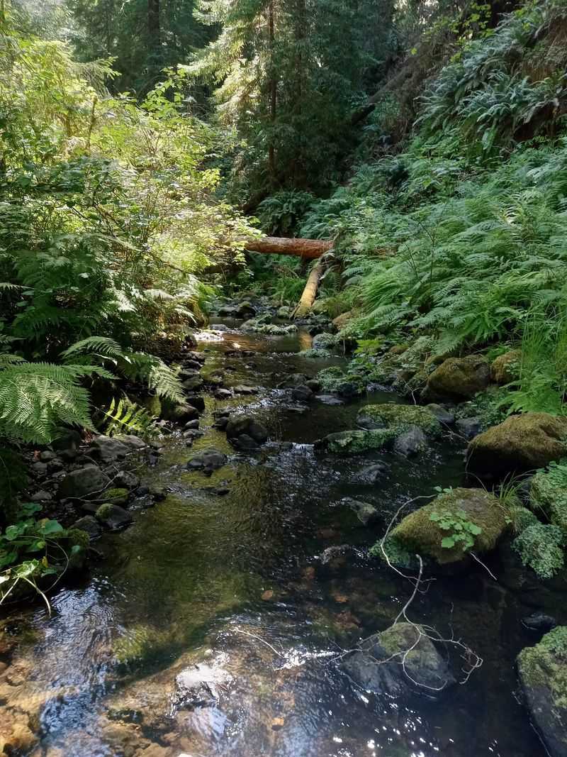
The habitat responsible for much of that feeling is well documented. The Kankakee River Nature Preserve within the park features north-facing slopes and terraces with an understory rich in wildflowers and ferns, including bracken fern and bulblet fern recorded at the site.
North-facing slopes receive less direct sun than south-facing ones, which keeps the soil moister and the air closer to the ground noticeably cooler on hot days. Bracken fern grows in large, arching colonies that can cover wide sections of a forest floor, while bulblet fern tends to cling to shaded rock faces and moist ledges, exactly the kind of microhabitat that canyon walls provide.
The Natural Areas Inventory of Department Properties supports fern-rich scenery along the park’s river bluffs and slopes, though it does not establish that every section of the Rock Creek route is continuously dominated by a single fern species. What hikers can reasonably expect is a route where ferns appear regularly on slopes, ledges, and shaded terraces, giving the canyon a lush, verdant character that stands out sharply against an Illinois summer.
Shade, creekside moisture, rock walls that hold the cool of the previous night, and the absence of direct overhead sun all work together to make the hike feel refreshing. That combination is genuine.
Calling it a natural air conditioner or claiming a precise temperature drop would overstate what the evidence supports, but the cool-feeling atmosphere is one of the route’s most appealing real qualities.
Set Realistic Expectations for the Route
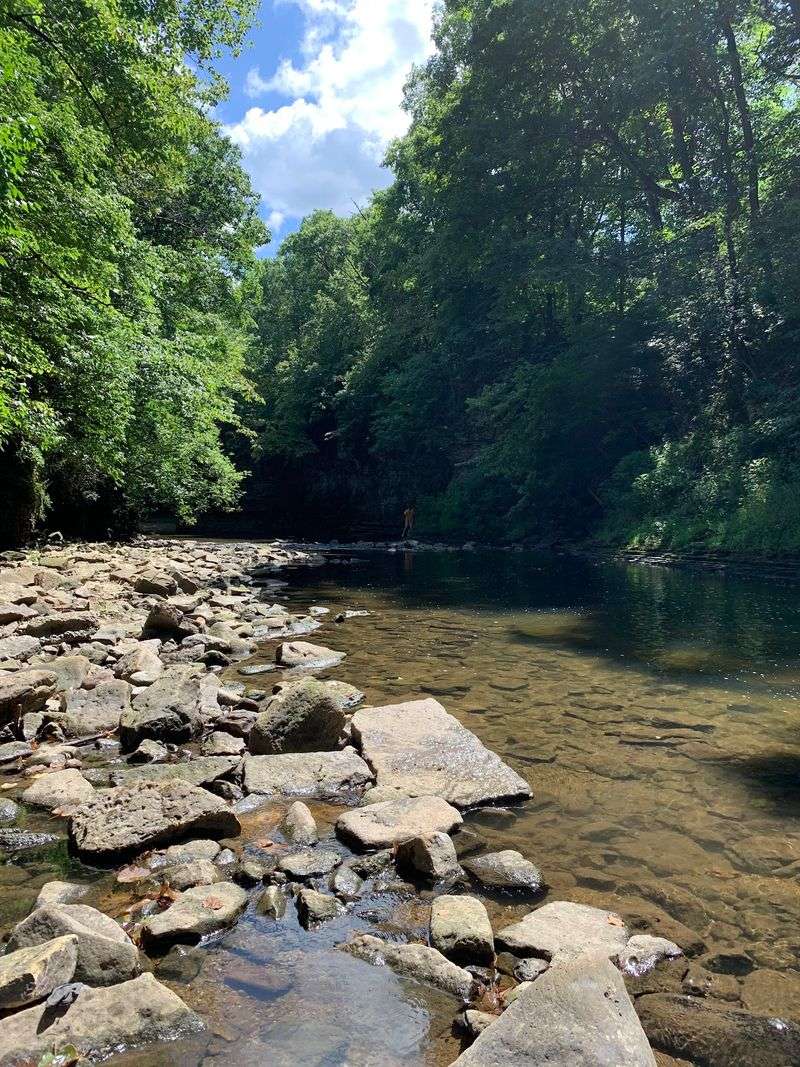
Getting oriented at Kankakee River State Park is straightforward with a little preparation. The Illinois State Geological Survey’s field guide places Rock Creek trail access near a middle parking lot, with the trail heading west toward the creek.
Directional signs are posted along the route, and the park office stocks trail maps, so picking one up before heading out is a practical first step rather than an optional extra.
The phrase “hike down into” in descriptions of this gorge captures the canyon atmosphere accurately but should not be read as a guarantee that a maintained, graded path descends all the way to the creek bottom at every point. The trail runs through canyon terrain with the gorge as its defining feature, and that immersive, below-the-rim feeling is exactly what makes the route memorable.
The IDNR activity page confirms the canyon-and-waterfall character of the route without specifying a difficulty rating or universal trail-surface standard, which means conditions underfoot can vary by season and recent weather.
One detail worth clarifying: the geological survey mentions that the bottom of the gorge can be reached by carefully climbing down a riprap spillway near the suspension bridge. That description comes from a geology field-trip guide written for researchers, not a recommendation that recreational visitors descend the spillway.
Riprap, the angular rock used to stabilize slopes and channel banks, is uneven and can be slippery when wet. Treating that passage as a standard trail feature would be a misreading of what the source actually says.
The practical takeaway is to plan for a route with natural, variable terrain. Wear sturdy footwear with good traction, check conditions before you go, and let the canyon scenery reward you from the maintained trail rather than pushing toward the creek bottom at unimproved spots.
The gorge is impressive enough from the path itself.
Manage August Heat Without Entering the Water
August in northeastern Illinois can be genuinely punishing, with heat and humidity combining to make even a shaded trail feel demanding. The best strategy is to start early.
Morning hours offer lower temperatures, lower humidity, and softer light inside the canyon. If an early start is not possible, late afternoon after the peak heat passes is a better choice than midday.
CDC guidance on extreme heat recommends scheduling outdoor activity during cooler parts of the day, seeking shade regularly, staying hydrated, and taking breaks before fatigue sets in. Carry more water than you think you will need.
A canyon hike feels cooler than an exposed trail, but your body is still working, especially on climbs back out of the gorge. Headache, nausea, dizziness, weakness, and heavy sweating are heat-illness warning signs that mean it is time to stop, find shade, drink water, and rest.
Fainting is an urgent warning sign rather than a routine symptom, and anyone who loses consciousness on the trail needs prompt medical attention. Do not wait to see if the person improves on their own.
One boundary that applies throughout the park, including Rock Creek, is the no-swimming rule. IDNR prohibits swimming anywhere in the park because of fast currents, drop-offs, and rocky bottoms in both the Kankakee River and Rock Creek.
Wading or entering the creek to cool down is not a safe alternative, even in shallow-looking sections. The rocky bottom and variable currents make footing unpredictable.
Shade, water breaks, and a well-timed start are the tools that make an August visit enjoyable and safe.
Visit the Gorge With Current Information
Kankakee River State Park’s Rock Creek route delivers what the best version of its reputation promises: a genuine dolomite gorge, a waterfall, fern-rich shaded slopes, and canyon scenery that feels like a different Illinois than the one most visitors know. What it does not deliver, and does not need to deliver, is a verified 20-degree temperature drop or a safe scramble to the creek bottom.
The real thing is compelling enough on its own terms.
IDNR advises visitors to contact the park before arriving because weather and natural events can close roads or facilities without much warning. Trail conditions, parking access, and facility availability can all shift between seasons or after heavy rain.
Checking current information directly with the park office before your trip takes a few minutes and prevents a wasted drive.
The geological survey’s field guide remains a useful companion for understanding what shaped the canyon walls, caves, and waterfall you will see along the route. Pair it with a current park map and you have both the scientific backstory and the practical navigation covered.
The gorge has been forming for thousands of years; a little advance planning makes sure your single afternoon inside it goes exactly as it should.