
Starved Rock State Park Hides A Chain Of Sandstone Canyons You Reach On Foot Along The Illinois River
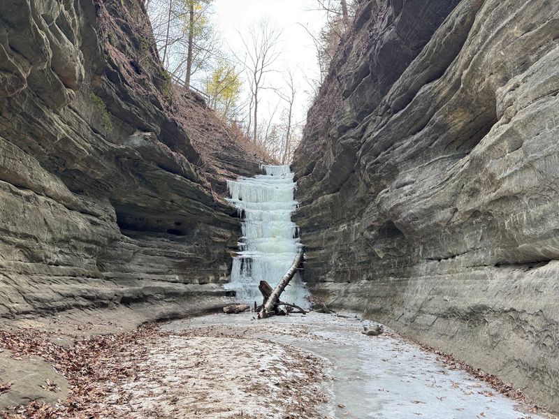
Starved Rock State Park sits along the Illinois River near Utica, and inside its boundaries lie 18 sandstone canyons carved by forces most people never connect to Illinois. You do not need a boat or a ferry to reach them.
Visitors walk in from road-accessible trailheads, and what waits inside those rock corridors is genuinely worth the trip.
Correct the ferry premise before planning the visit
Before packing your hiking boots for Starved Rock, there is one thing worth clearing up: no ferry currently crosses the Illinois River to deliver visitors to the park’s canyons. Modern access comes entirely by road, through parking areas and trailheads connected to a trail network that spreads across more than 13 miles of canyon terrain.
IDNR’s visitor and trail information describes access from the visitor center, the lodge, Route 71, and Route 178, with no mention of a river crossing by boat.
A historical account on Wikipedia notes that early visitors reached the area by rail and ferry around 1904, during a resort era that predated modern roads. That detail is worth knowing as context, but it describes a different time and a different kind of visit.
It should not be read as a current instruction, and the specifics of that early ferry’s route or exact role are not independently corroborated by official park sources.
If you have heard of Illinois ferries on the Illinois River, those are separate services. IDOT’s current ferry listings identify the Kampsville Ferry and the Brussels Ferry as the state’s Illinois River crossings, both located far south of Starved Rock and neither serving as a route to the park.
Cave-in-Rock State Park, in far southern Illinois, is reached by a ferry across the Ohio River, but its signature feature is a riverside cave, not a chain of sandstone canyons like the ones at Starved Rock.
The real discovery at Starved Rock is not finding a hidden park by boat. It is stepping off a parking lot and walking into an enclosed rock corridor where the walls close in, the temperature drops, and the noise of the highway disappears entirely.
That experience begins on foot, a few hundred yards from your car.
Eighteen canyons reveal a glacially shaped sandstone landscape
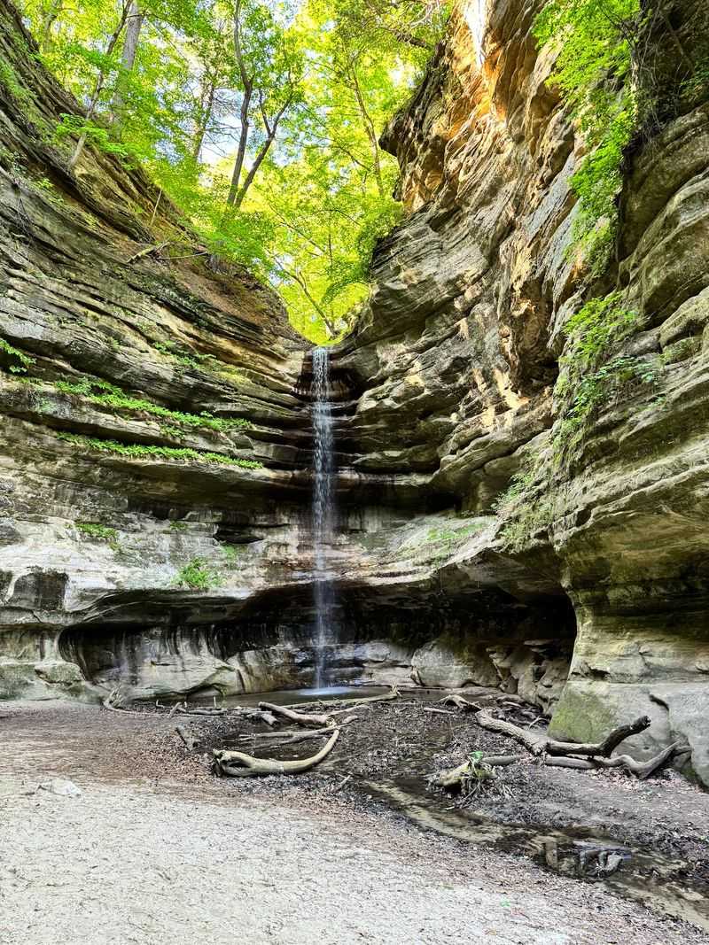
Starved Rock State Park contains 18 named canyons along a stretch of the Illinois River in LaSalle County. The park was established as Illinois’ second state park in 1911, and its canyon walls are composed primarily of St. Peter Sandstone, a porous, fine-grained rock that gives the corridors their warm amber and cream tones.
IDNR’s official park overview places the trail network at more than 13 miles, connecting overlooks, bluffs, and canyon floors across the property.
The geology behind those walls is older and more dramatic than the scenery alone suggests. Illinois State Geological Survey research attributes canyon formation in significant part to glacial-meltwater floods that swept through the region roughly 18,800 to 15,100 years ago.
As massive volumes of meltwater drained across the landscape, they cut into the sandstone bedrock, leaving the narrow corridors, steep walls, and overhanging ledges that hikers walk through today.
IDNR and geological sources use the terms canyons, bluffs, dells, and sandstone overhangs to describe these features. The phrase “box canyon” sometimes appears in travel writing as a descriptive comparison, but it is not an official geological classification for Starved Rock’s formations.
What the official language captures accurately is the enclosed quality of the spaces: some canyons narrow to just a few yards across, with walls rising 50 feet or more on either side.
Moss clings to the shaded faces of the rock, and seeping groundwater leaves dark stain lines across the sandstone where moisture works through the stone over decades. The visual result is a layered surface that reads like a slow record of water moving through rock, which is essentially what it is.
Road-accessible trailheads connect visitors to the canyon network
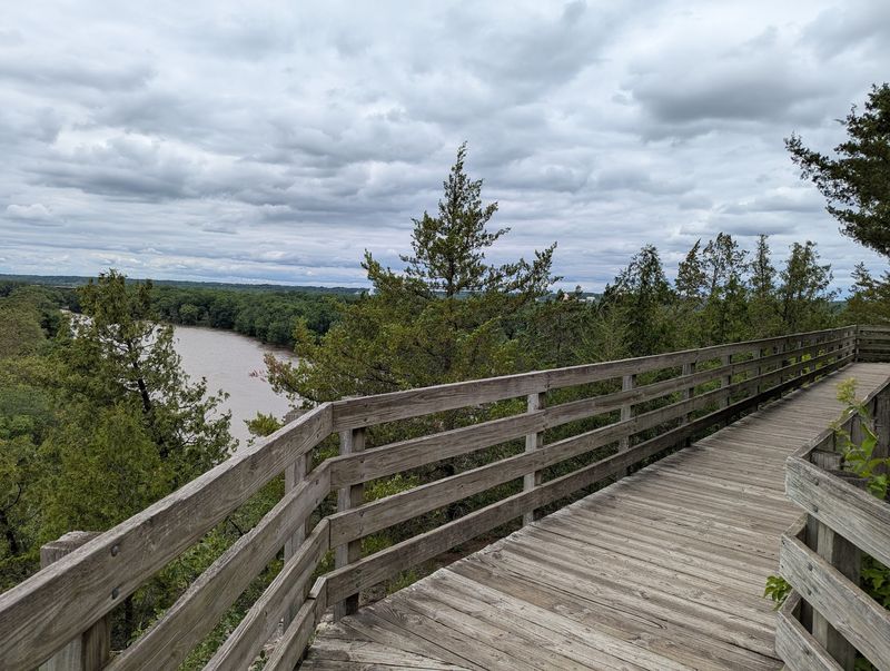
Getting into the canyon network at Starved Rock starts with choosing a trailhead, not a dock. Visitors park at several locations tied to different sections of the trail system, including the main visitor center, the lodge, and roadside access points along Route 71 and Route 178.
Brown directional signs mark the routes once you are on foot, and the trail system is designed so that most canyon entrances are reachable within a short walk from a parking area.
IDNR’s trail and activity page lists representative hike distances that help with planning. The Starved Rock overlook loop runs approximately 0.6 miles round trip.
French Canyon is about 0.8 miles. Wildcat Canyon extends to roughly 2 miles, and the Aurora and St. Louis Canyon route reaches approximately 3 miles round trip.
Those figures give a useful sense of scale, but they should be treated as planning estimates rather than fixed measurements, because construction and seasonal conditions can alter access points and connector routes between canyons.
The trail connections between canyons are part of what makes a longer visit worthwhile. Rather than driving between separate destinations, hikers can link multiple canyon entrances in a single outing by following the connector paths along the river bluffs.
Each canyon has its own character: some open wide at the mouth before narrowing, others stay tight from the start, and a few feature overhanging walls that create a near-ceiling of sandstone above the canyon floor.
Because a major trail improvement project is underway through 2026, the connections between specific canyons may be interrupted or rerouted at any given time. Checking current access before you set a route is not optional during this period.
It is the practical first step that determines which canyons you can actually reach on the day you visit.
Rain determines whether the waterfalls appear
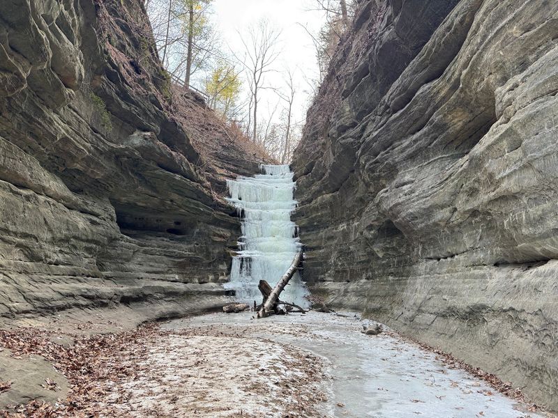
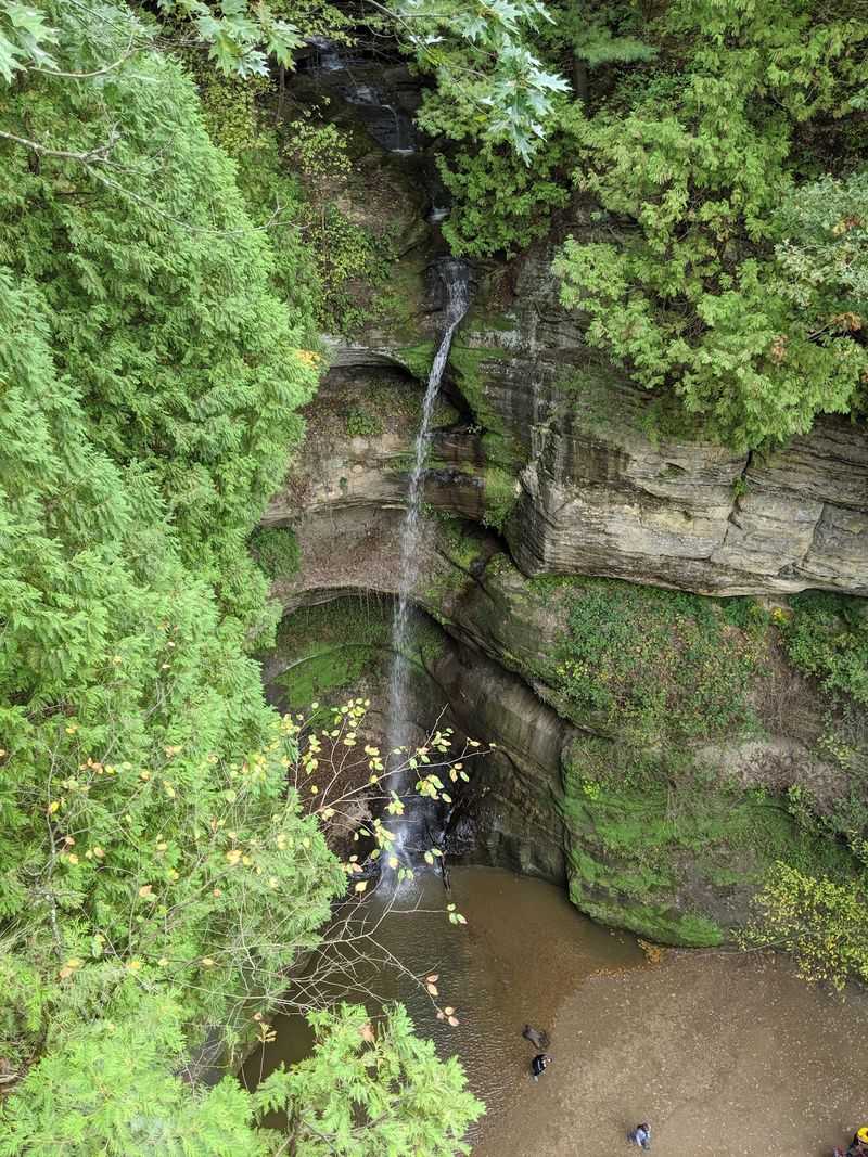
Starved Rock has waterfalls, but whether you see them depends almost entirely on how much rain has fallen in the days before your visit. IDNR describes the waterfalls as rain dependent and notes that many canyons typically dry out by the end of June, depending on local rainfall patterns.
A visit in late July after a dry stretch may yield bare rock where photos from spring showed curtains of falling water.
That variability is not a flaw in the park. The canyon atmosphere shifts with conditions in ways that are worth experiencing across seasons.
Tree cover and the enclosed geometry of the sandstone corridors can create noticeably cooler and shadier conditions than the surrounding upland, though the degree of shade varies by canyon, by the angle of the sun, and by how much leaf cover remains on the trees. Moss-covered walls, seeping rock faces, and the sound of dripping water after a rain are present even when the main falls have slowed to a trickle.
A dry-season visit still delivers the sandstone walls, the overhanging bluffs, the narrow corridor geometry, and the canyon floor underfoot. Treating absent water as a failed outing misses the point.
The rock itself tells the story of how the water moved through here over thousands of years, and that story does not disappear when the falls run low.
For visitors who care most about flowing water, checking recent local rainfall before the trip is a reasonable planning step. Spring visits, particularly after wet weather, offer the strongest chance of active falls.
But no visit can be guaranteed a specific visual payoff, and articles or social media posts showing dramatic waterfalls may reflect conditions that existed on one particular day after significant rain.
Uneven trails and fragile sandstone require restraint
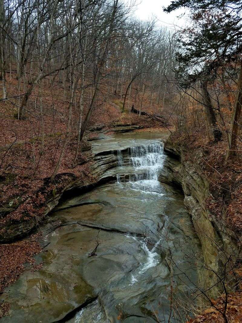
Canyon hiking at Starved Rock is not a stroll on a paved path. IDNR’s accessibility information describes canyon and overlook routes as commonly involving stairs, uneven surfaces, and a mix of materials including wood, concrete, gravel, dirt, sand, and creek crossings.
The terrain shifts underfoot depending on which section of trail you are on, and the transitions between surface types can happen quickly.
Illinois Canyon is identified by IDNR as the only canyon trail system in the park without stairs, which makes it a useful option for visitors who need to avoid step climbing. Even so, it is not obstacle-free: the route still requires a creek crossing, and the canyon floor can be uneven and sandy.
Describing it as easy or flat would not be accurate.
The sandstone itself adds a safety consideration that is easy to underestimate. St. Peter Sandstone can crumble when handled and becomes slippery when wet.
IDNR’s activity guidelines prohibit climbing canyon walls, rappelling, and defacing rock surfaces. Visitors should also stay off the canyon walls even at low heights, because what looks like solid footing on sandstone can give way without warning, especially after rain.
Water in the park carries its own set of rules. Swimming, wading, and sliding in the Illinois River, canyon creeks, waterfalls, and other park waters are all prohibited.
IDNR safety guidance reinforces that visitors should remain on designated trails at all times and follow the brown directional signs posted throughout the trail system. Boats are not permitted within 600 feet of the dam because of strong currents and undertows in that stretch of the river.
Wearing sturdy footwear with good grip, checking trail conditions before entering a canyon after rain, and staying on marked paths are the three habits that make a canyon visit both safer and more enjoyable.
Verify closures and services before setting out
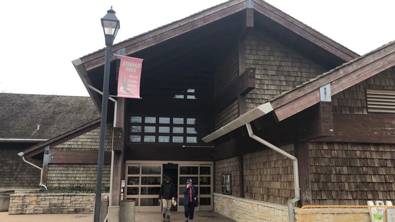
Trails at Starved Rock are open year-round from 7 a.m. to sunset, but that general schedule does not mean every trail or canyon is accessible on any given day. A major improvement project has been reshaping trail access through 2026, and the specific closures have shifted over time as work progresses through different sections of the park.
The most recent update available at the time this article was prepared is dated July 23, 2026. As of that date, the IDNR trail improvement closure page reported that French Canyon and Wildcat Canyon remained accessible from the visitor center and lodge area, while LaSalle Canyon, Tonti Canyon, and certain connecting trails were closed for improvement work.
The visitor center, lodge, and campground were open. That is a dated snapshot of one moment in a long project, not a permanent description of what you will find.
Conditions may have changed by the time you read this, which is exactly why the live IDNR closure page is the right place to check immediately before you travel.
On the water side, visitors who want to paddle the Illinois River can bring their own kayak or canoe. IDNR confirms that kayak and canoe rentals are not available at the park, and the recommended launch area is near Lone Point Shelter along Route 71, where the river widens.
That is a self-supported outing requiring your own equipment and planning.
Starved Rock Lodge offers paid river cruises and combined canyon-hike and boat-ride tours. Those lodge excursions are sightseeing and tour products, not ferry transportation across the Illinois River to reach the canyons.
The distinction matters for planning: you cannot substitute a river cruise for a hiking route and expect to reach the canyon interiors. The canyons are land-based destinations, and the only way into them is on foot from a trailhead.
Plan for a canyon hike, not a secret crossing
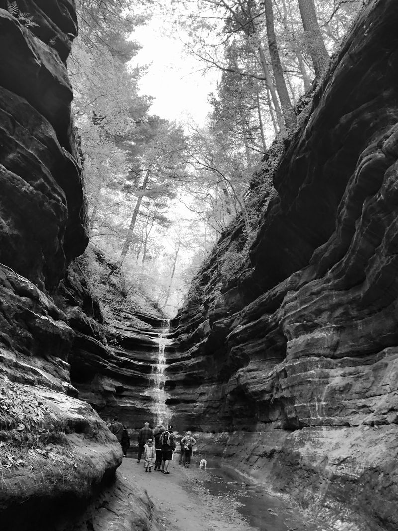
Starved Rock is not a hidden park. It is one of Illinois’ most visited state parks, and its main overlooks and canyon entrances near the lodge draw steady crowds, particularly on spring weekends.
What the 18-canyon network does offer is variety: some outlying routes may feel less prominent or potentially quieter on an individual visit, depending on the day and season, though that impression cannot be presented as a measured fact about visitation patterns across the park.
The contrast that makes Starved Rock genuinely interesting is not between a secret place and a crowded one. It is between the open, wide Illinois River visible from the bluffs and the enclosed sandstone corridors just a short walk below.
The park’s 18 canyons range from short, accessible loops near the main facilities to longer routes that require more planning and physical readiness. That range makes it possible for most visitors to find a hike that fits their ability and their available time.
Three decisions will shape how the visit goes. First, check the current IDNR closure page before leaving home, because the 2026 construction project makes static directions unreliable.
Second, choose a trail that honestly matches the distance and terrain you are ready for, using IDNR’s trail distances as a starting framework. Third, if flowing waterfalls are part of the reason you are going, check recent local rainfall and consider timing the trip after a wet stretch rather than during a dry one.
The sandstone corridors at Starved Rock were shaped by forces far larger than any single visit, and they will be there regardless of water levels or trail reroutes. Walking into one of those canyons for the first time tends to reframe what Illinois looks like from the inside.