
This Illinois Ravine Preserve Lets You Hike A Wooded Bluff Down To A Scenic Lake Michigan Beach
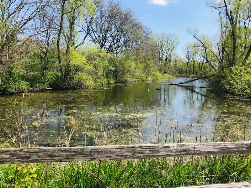
A wooded bluff dropping through restored ravines to a sandy Great Lakes shoreline sounds almost too good to be true for a day trip from Chicago. The description most closely matches Openlands Lakeshore Preserve at Fort Sheridan Forest Preserve, a roughly 72-acre site in the Highland Park area where forested ridgelines give way to Lake Michigan, not the Mississippi River as some coverage has suggested.
Getting the geography right matters, because the two bodies of water are hundreds of miles apart and the rules, landscape, and access at this preserve are specific to its Lake Michigan setting. Read on for a corrected, practical guide to what this preserve actually offers and how to visit it well.
The description points to Lake Michigan, not the Mississippi River
Some travel articles describing an Illinois ravine preserve with a bluff descent to a sandy beach have attached the label “Mississippi River” to the destination. Based on the available evidence, that label is wrong.
No verified Illinois preserve on the Mississippi River matches all the features in that description: wooded ravines, a blufftop trail system, and a sandy, publicly accessible beach at the base. The landscape described most closely fits a Lake Michigan shoreline site in the northern suburbs of Chicago.
The likely destination is Openlands Lakeshore Preserve at Fort Sheridan Forest Preserve, located near Highland Park and Highwood, Illinois. That said, this identification is a feature-based match rather than a confirmed statement of the original author’s intent.
The preserve sits on the Lake Michigan shoreline, not the Mississippi, and every practical detail about visiting it flows from that Lake Michigan location.
Ownership of the property shifted in August 2023, when Openlands completed a transfer donating the preserve to the Lake County Forest Preserves. That transfer was finalized on August 30, 2023, and the site reopened the very next day as part of Fort Sheridan Forest Preserve under Lake County management.
The Lake County Forest Preserves is now the managing authority, and its website carries current visitor information.
Readers who search for this preserve may still find older articles and web pages listing Openlands as the owner, or referring to the property simply as Openlands Lakeshore Preserve. Those sources reflect how the site was managed before the 2023 transfer.
For trip planning purposes, the Illinois Nature Preserves Commission record and the Lake County Forest Preserves website are the most reliable current references.
Three restored ravines lead through a blufftop landscape
Spread across approximately 71.55 to 72 acres, the preserve packs a surprising variety of terrain into a relatively compact footprint. Three restored ravines cut through the property, each one channeling seasonal water flow and supporting a layered woodland community of trees, shrubs, and ground-level plants.
Above the ravines, wooded blufftops offer elevated vantage points where the canopy opens enough to reveal glimpses of open water in the distance.
The trail system that connects these features is designed rather than purely natural. According to Openlands’ account of the preserve’s development, the site includes constructed bridges, staircases, overlooks, and accessible routes built to move visitors safely through the ravine and bluff terrain.
Thinking of the experience as a single uninterrupted natural descent from forest to shore would misrepresent what the trails actually are: a thoughtfully built network that accommodates different mobility levels while protecting fragile slopes.
Art installations placed within the preserve add an unexpected element to the walk. These works sit within the natural setting rather than competing with it, giving visitors something to pause over between stretches of wooded trail.
The combination of restored ecology, built infrastructure, and integrated art reflects the years of planning and investment that preceded the 2023 transfer to public ownership.
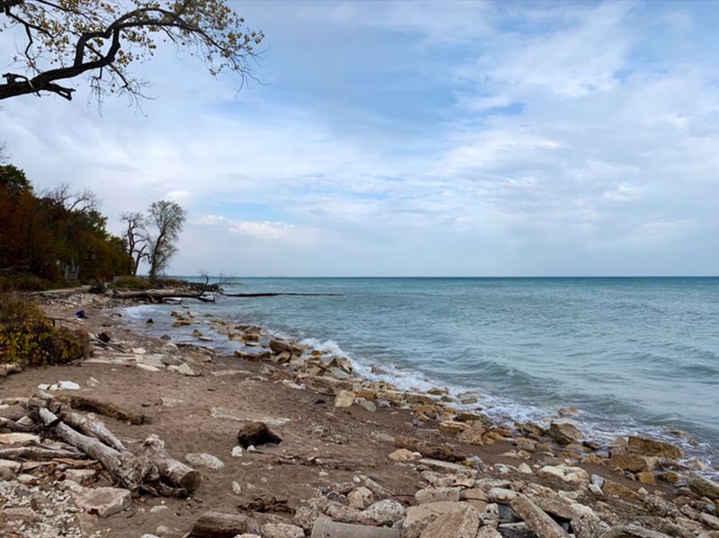
At the end of the ravine and bluff system, the landscape opens onto roughly one mile of sandy Lake Michigan shoreline. That stretch of beach is the payoff the title promises, and it is real.
The shore is publicly accessible and sandy, though conditions along it can shift with lake levels, storm activity, and ongoing erosion, topics covered in a later section. The visual progression from shaded woodland to open water is one of the more distinctive experiences available to a day-tripper on the North Shore.
Follow marked trails toward the public shoreline
Planning a visit starts with choosing an entrance. The Lake County Forest Preserves lists two access points: the main parking area at 24256 N.
Patten Road in Highwood, and a south parking option at 31 Walker Avenue in Highland Park. Both are tied to the same preserve, so the choice comes down to which end of the property suits your intended route.
From either entrance, the path leads through the bluff and ravine landscape on marked trails. Following the signage matters here, both for your own navigation and for the protection of the habitat on either side of the path.
The ravine slopes and blufftop edges are sensitive areas where foot traffic off-trail can accelerate erosion and damage the plant communities that the preserve’s restoration work has spent years rebuilding.
Once the trail system brings you toward the lake, the shoreline opens up for several activities that the preserve’s official materials specifically support: walking the beach, fishing, birding, picnicking, and simply sitting with a view of the water. Migratory birds use this stretch of shoreline as a stopover point, making it a reliable spot for birders during spring and fall passages.
Anglers can work the shoreline legally, and the sandy surface is stable enough for a blanket and a packed lunch.
What the shoreline visit cannot promise is a particular mileage figure for the hike, a guaranteed crowd level, or an unbroken sense of solitude. The preserve is publicly accessible, and on warm weekends the beach and trails do see visitors.
The experience on a quiet Tuesday morning in October will feel different from a Saturday afternoon in July. Arriving with realistic expectations, following the marked trail system, and treating the site as a managed public preserve rather than a hidden wilderness will make the visit more satisfying.
The state designation protects a fragile ravine and bluff habitat
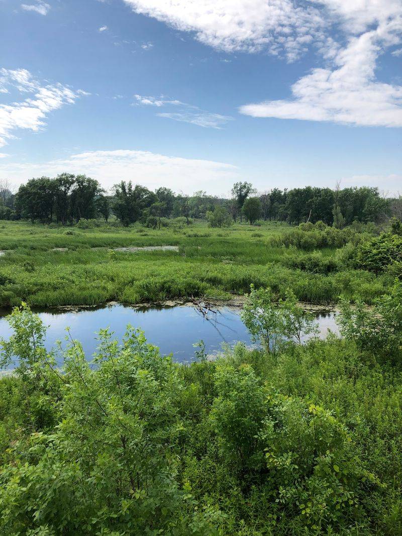
Calling a property a “nature preserve” can mean different things depending on context. At this site, two related but distinct designations apply.
The broader public property is managed by the Lake County Forest Preserves as part of Fort Sheridan Forest Preserve. Within that property, a specific area carries a formal state designation: the Illinois Nature Preserves Commission identifies the protected unit as containing bluffs, beach, ravines, mesic upland forest, and dry-mesic upland forest.
Those two layers of protection, the public forest preserve and the state nature preserve designation, overlap but are not the same administrative category.
The Illinois Nature Preserve dedication occurred in May 2013. To earn that designation, the site had to demonstrate the presence of high-quality natural communities and rare species.
The Illinois Nature Preserves Commission dedication record identifies eight state-listed plant species associated with the preserve. These are plants uncommon enough across Illinois that their presence here carries conservation significance well beyond what a casual visitor might notice on a trail.
The ravine slopes and blufftop edges are where much of that sensitive habitat lives. Eroding bluff faces and the beach community at the base of the bluffs are themselves recognized natural community types under the state designation.
That context explains why the managing agency asks visitors to remain on marked trails: stepping off the path on a ravine slope does not just create a muddy shortcut, it can damage the root systems, soil structure, and plant communities that the dedication was meant to protect.
For visitors, the practical takeaway is straightforward. Stay on the marked trail network, resist the temptation to scramble down ravine walls for a better view or a shortcut to the beach, and treat the plant life along the path as part of what makes this place worth visiting in the first place.
Treat the beach as a place to linger, not enter the water
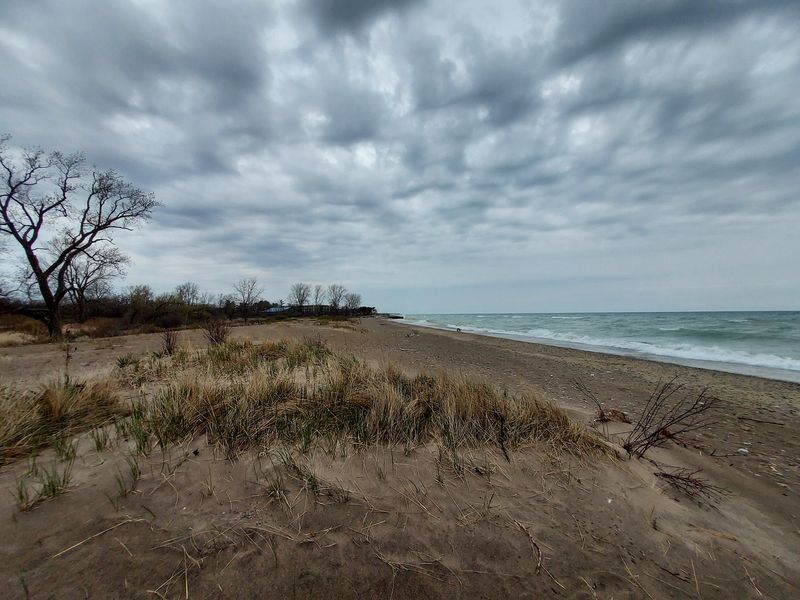
Standing at the edge of the water after walking through the ravines and blufftop forest, the lake looks inviting. The rule at this preserve, however, is clear: swimming, wading, and boating are all prohibited.
The Lake County Forest Preserves explicitly lists these as prohibited activities at the site. Entering the water here is not a gray area or a matter of informal local custom; it is against the preserve’s rules.
That restriction still leaves a meaningful range of things to do at the shoreline. Walking the sandy stretch, watching for shorebirds and migratory waterfowl, fishing from the beach, spreading out for a picnic, or simply sitting with an unobstructed view of Lake Michigan are all activities the official visitor information supports.
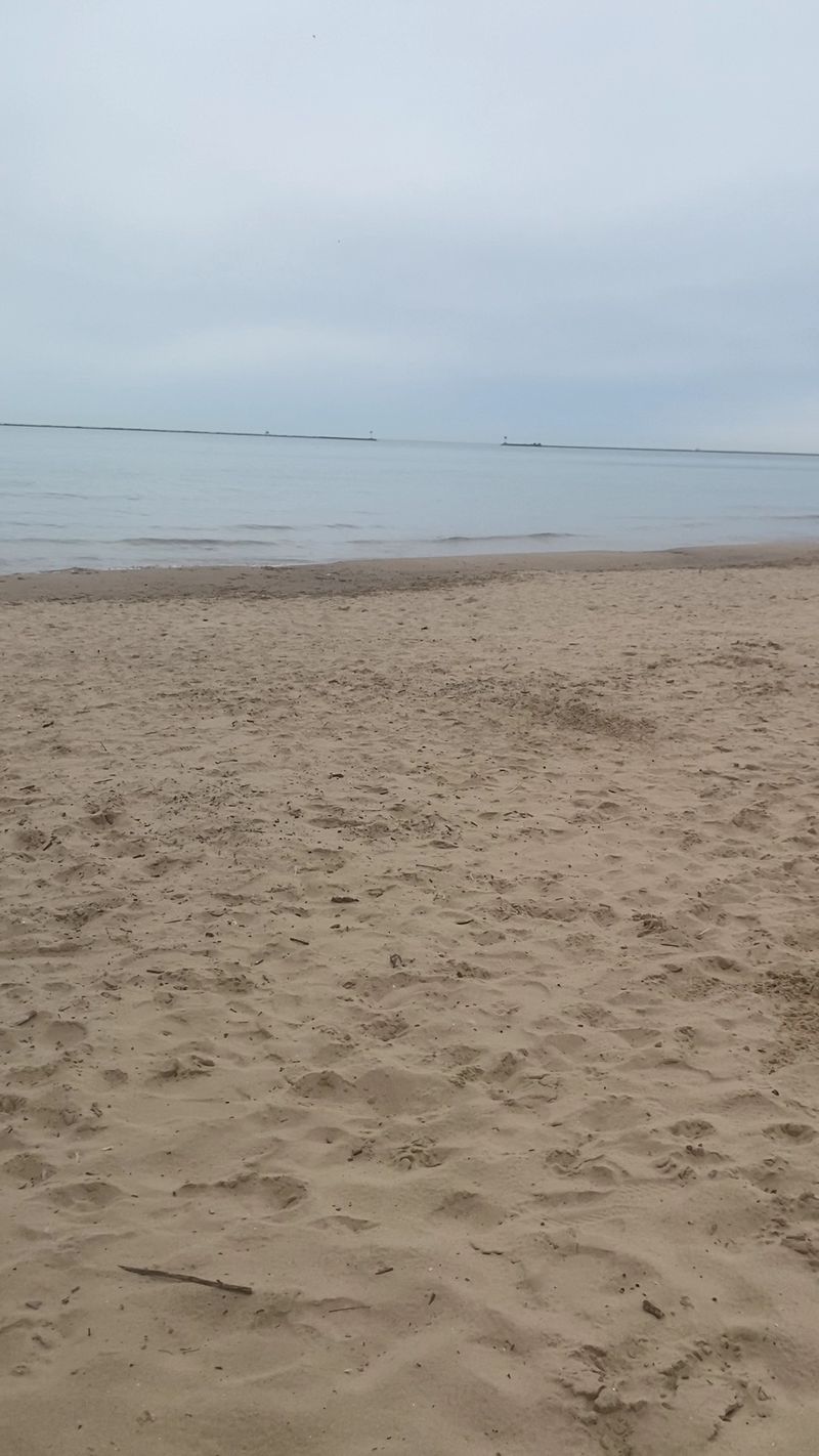
The shoreline itself, approximately one mile of sandy beach below the bluffs, gives visitors enough room to spread out without feeling crowded into a single spot, though conditions vary by season and day.
The beach configuration at this preserve is not fixed. Openlands has documented significant shoreline erosion and the effects of changing Lake Michigan water levels on this specific stretch of bluff and beach.
High lake levels can narrow or temporarily submerge sandy sections. Erosion can alter the blufftop edge and affect how trails connect to the shore.
What a visitor finds on any given day may look different from photographs taken in another season or year.
Before heading out, checking the Lake County Forest Preserves website for any trail closures or access changes is a practical step, not an overabundance of caution. Shoreline conditions at this preserve are genuinely variable, and arriving with current information makes for a better visit than discovering a closed trail or a washed-out beach access point after the drive.
Check current hours, entrances, and safety rules
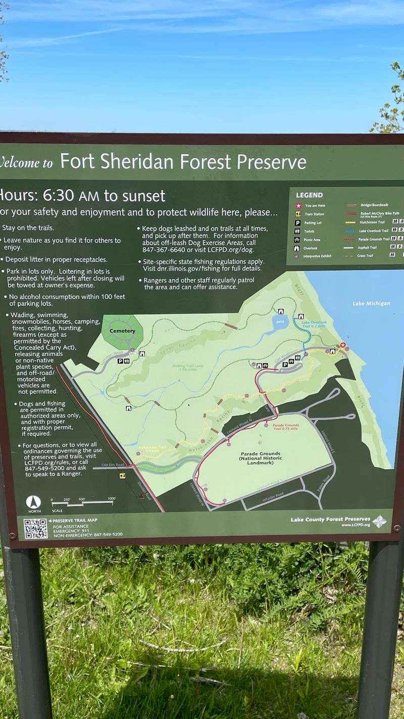
Getting the logistics right before you leave home saves the kind of frustration that turns a pleasant day trip into a wasted drive. The preserve is open daily from 6:30 a.m. to sunset.
The Lake County Forest Preserves confirms that the entire site, including the shoreline, closes at night. Arriving close to sunset without a plan to exit means leaving in the dark on a trail system that closes; plan accordingly.
Two parking locations serve the preserve. The main parking area is at 24256 N.
Patten Road in Highwood, Illinois. The south parking option is at 31 Walker Avenue in Highland Park, Illinois.
Both addresses connect to the same property, and your choice of entrance may shape which part of the trail network you encounter first. Using a mapping app to confirm current driving directions to whichever address you choose is a reasonable precaution, since road access near former military properties can occasionally shift.
Dogs are welcome on a leash. The leash rule is not optional, and the requirement to pick up after your pet applies throughout the preserve, including on the shoreline.
Leaving waste on a ravine trail or beach in an Illinois Nature Preserve is both a rule violation and a real problem for the sensitive plant communities the preserve protects.
One safety consideration at this site has no equivalent at most forest preserves. Fort Sheridan was an active U.S.
Army installation for decades, and the Lake County Forest Preserves warns that historic munitions may remain in parts of the property. If you see a suspicious object, a piece of metal hardware, an unusual shell, or anything that looks like it could be military ordnance, do not touch it, do not move it, and do not attempt to identify it yourself.
Back away and report it to preserve staff or local authorities. This is not a hypothetical risk invented for legal caution; it is a documented condition of the former military land that the preserve management takes seriously, and visitors should too.
Expect a public Lake Michigan preserve, not a guaranteed secret beach
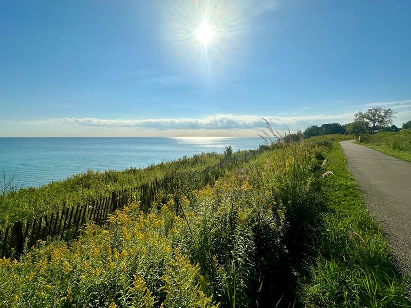
Framing this preserve as a secret or secluded beach sets visitors up for disappointment and misrepresents what the site actually is. What the evidence supports is more specific and, honestly, more interesting: a publicly managed forest preserve where three restored ravines and a wooded blufftop trail system connect to roughly one mile of sandy Lake Michigan shoreline.
That combination is genuinely uncommon in the Chicago area, and it does not need exaggeration to be worth a day trip.
Crowd levels, beach width, and trail conditions all depend on the season, the weather, and lake levels at the time of your visit. Documented shoreline erosion at this site means the beach visitors find today may look different next year.
The state nature preserve designation adds a layer of habitat protection that shapes how you are expected to move through the property. None of those factors diminish the visit; they just mean arriving informed produces a better experience than arriving with fixed assumptions.
Use the marked trails, follow the current preserve rules posted by the Lake County Forest Preserves, and confirm conditions before setting out. A ravine forest descending to a sandy Great Lakes shore is a rare thing to find an hour from Chicago.
That is the accurate promise, and it is enough.