
This Illinois Canyon Park Hides A Cool Wooded Trail Along The Vermilion River You Can Walk In An Afternoon
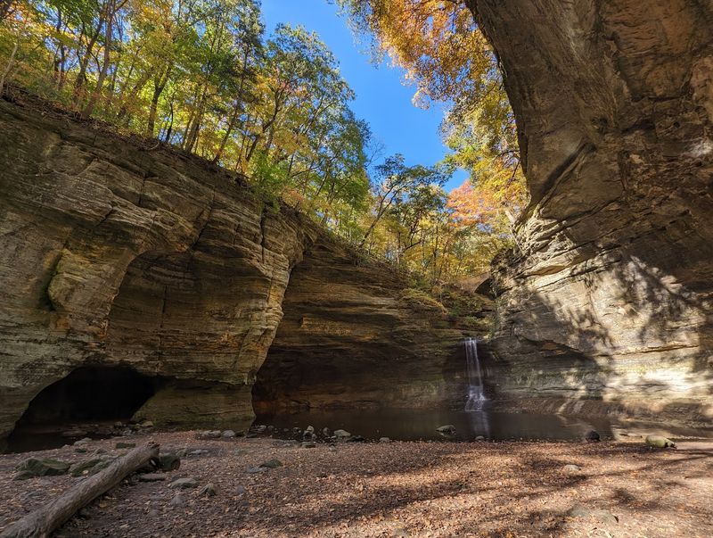
Tucked into LaSalle County about four miles south of Utica, Matthiessen State Park offers something different from the typical Illinois day trip: a sandstone canyon carved by water erosion, shaded by forest, and connected to the Vermilion River. Visitors who know Starved Rock often overlook Matthiessen, even though the two parks sit just a short drive apart.
A half-day here can take you past cascading waterfalls, moss-covered canyon walls, and wooded bluff-top paths, but the experience depends heavily on conditions, trail choice, and how early you arrive.
A practical alternative to Starved Rock, not a hidden escape
Matthiessen State Park sits in LaSalle County, approximately four miles south of Utica and three miles east of Oglesby, placing it within easy reach of anyone already planning a trip to Starved Rock. The two parks are often mentioned together, and for good reason: they share a similar sandstone canyon landscape, but they draw very different crowd sizes.
Illinois Nature Preserves Commission attendance figures show Matthiessen drawing roughly 450,000 visitors annually compared with more than 2.5 million at Starved Rock, a gap wide enough to make Matthiessen feel noticeably calmer on many visits.
That comparison comes with an important qualifier. Lower overall attendance does not guarantee a quiet afternoon on any particular day or trail.
The same commission materials note that Matthiessen receives spillover visitors when Starved Rock fills its parking areas, and the park’s own notices confirm that the Dells and Vermilion River areas can reach capacity on busy weekends. Calling Matthiessen a hidden or crowd-free escape would misrepresent what visitors actually find there.
What the park does offer is a focused outing built around a roughly one-mile sandstone canyon system, shaded forest, waterfalls, and a trail network that connects to the Vermilion River. IDNR’s park page lists the experience as suitable for a half-day visit, though terrain difficulty, current closures, and water levels shape how much of that canyon system is actually reachable on a given day.
Understanding those variables before leaving home is what separates a satisfying afternoon from a frustrating one.
The sandstone canyon leads toward the Vermilion River
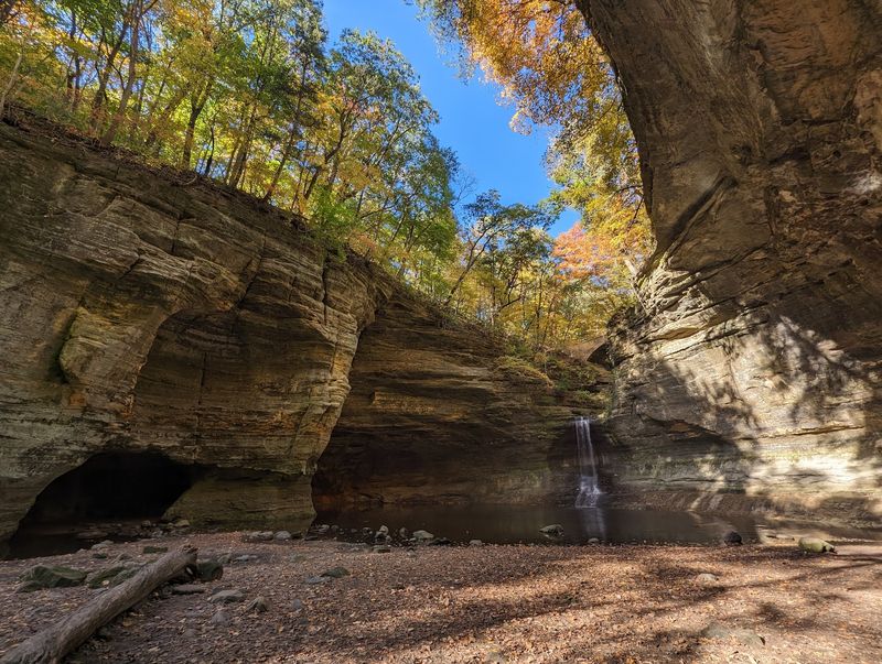
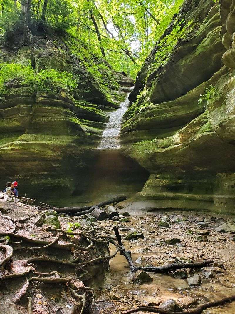
The park’s defining landscape is a canyon system that runs approximately one mile from Deer Park Lake through the Upper Dells and Lower Dells before reaching the Vermilion River. Water erosion shaped this corridor over time, cutting through St. Peter Sandstone and leaving behind canyon walls that display potholes, seeps, and mineral staining as visible evidence of that long-running process.
IDNR’s geology and ecology packet for the park identifies the St. Peter Sandstone formation as the primary rock type and documents these eroded features as characteristic of the canyon environment.
Walking the dells means moving through a narrow, enclosed landscape where the canyon walls rise on both sides and the trail follows the watercourse between them. The Upper Dell section leads to Cascade Falls, where the canyon drops roughly 45 feet and transitions into the Lower Dell.
From there, the canyon continues toward the Vermilion River, where a separate Vermilion River Area provides additional trail access along the riverbank.
Readers expecting one continuous, level path running alongside the Vermilion River will find the reality more layered than that. IDNR’s Matthiessen about page describes the park as containing distinct areas, and the official trail map separates the Dells Area from the Vermilion River Area with their own trailheads and connections.
The canyon leads toward the river rather than running parallel to it as a single riverside walk. Consulting the current official map before choosing a starting point helps visitors understand how these areas connect and what terrain each involves.
The sandstone surfaces, damp canyon walls, and exposed rock faces make the interior dells visually striking, but they also create conditions that change quickly after rainfall. Wet sandstone becomes slippery, seeps increase, and water levels in the canyon floor can rise.
Those physical realities affect both footing and access, which is why the geology that makes the place interesting is also the geology that demands attention.
A half-day visit requires choosing the right trail area
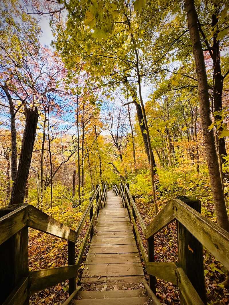
Five miles of marked, surfaced hiking trails cover the park, but those miles are not interchangeable. IDNR’s trails page for Matthiessen distinguishes between the upper areas and bluff-top paths, which are relatively easier, and the interior dell trails, which can be difficult.
That distinction matters when planning a half-day outing because the two types of terrain call for different footwear, fitness levels, and time estimates.
Bluff-top routes give visitors views down into the canyon without requiring them to descend into it. These paths tend to involve less uneven ground and fewer abrupt changes in elevation, making them a reasonable starting point for visitors who want scenery without committing to steep stair sections or narrow canyon footing.
The Lake Shelter Area near the main parking lot also includes a short accessible trail, which IDNR identifies separately from the more demanding interior routes.
Heading into the dells means accepting a different set of conditions. Stairs, uneven rock surfaces, wet or mossy footing, and sections of narrow canyon terrain are all part of the interior trail experience, particularly in spring and early summer when water levels and ground moisture tend to be highest.
Visitors with limited mobility, young children, or anyone wearing casual footwear should think carefully before committing to the canyon floor.
The official Matthiessen trail map shows how the Dells Area, the bluff-top paths, and the Vermilion River Area connect, including parking locations, overlook points, waterfall access, and trail designations. Using the current version of that map, rather than a route found on social media or an older travel article, is the most reliable way to understand what is open, where each trail begins, and how to build a realistic afternoon route from the options available on that particular day.
Shaded habitat and waterfalls create the visual payoff
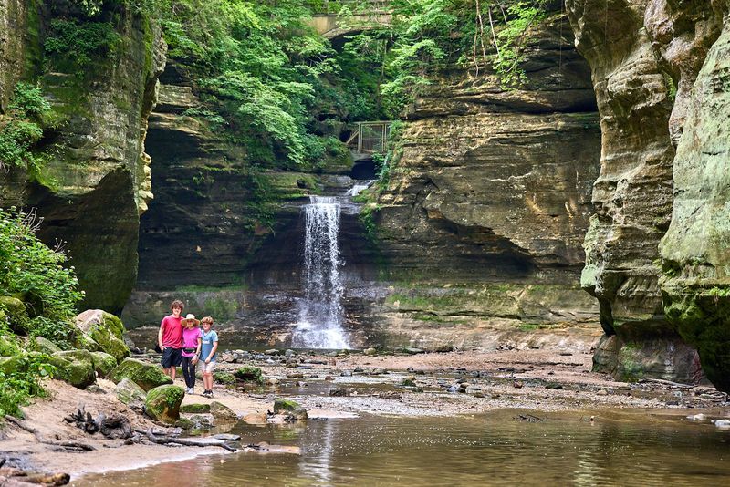
Step into the canyon and the atmosphere shifts noticeably. The walls close in, the tree canopy overhead filters the light, and moisture from seeps and waterfalls keeps the rock surfaces and vegetation perpetually damp.
IDNR describes the canyon walls as supporting mosses, liverworts, and ferns, plant communities that depend on the shady, damp conditions the enclosed canyon provides. Forest and bluff-top vegetation add to the wooded character of the surrounding landscape.
That shaded, wooded quality is genuine and well-documented, but no source reviewed for this article establishes a specific temperature difference between the canyon interior and the surrounding uplands. Describing the canyon as shaded or damp is accurate; claiming it is measurably cooler than the open bluff tops is not supported by available data.
Visitors seeking relief from summer heat will find the canopy and moisture welcome, but the experience is better understood as a change in atmosphere than a guaranteed drop in temperature.
Cascade Falls is the park’s most prominent waterfall and marks the transition between the Upper Dell and the Lower Dell. The geology and ecology packet documents the falls as dropping approximately 45 feet, making it the most dramatic single drop in the canyon system.
Lake Falls and Middle Falls are additional features along the route, each shaped by the same water-eroded sandstone landscape.
Waterfall access, however, is not guaranteed. Current IDNR park notices have reported restrictions affecting interior waterfall areas, including Lake Falls, Middle Falls, and Cascade Falls, tied to storm water and rising river levels.
Water flow at the falls can be dramatic after heavy rain, but those same conditions often close the trails that lead to them. Treat the waterfalls as a possible highlight of the outing rather than a guaranteed destination, and check current conditions before building an itinerary around them.
Check capacity and closures before setting out
Matthiessen is open from 7 a.m. to sunset daily, and that early window matters more than it might seem. IDNR’s park page states that the Dells Area and the Vermilion River Area can reach capacity on weekends between May and October, with closures sometimes beginning around 11 a.m. and parking areas remaining closed until roughly 3 p.m. as visitors cycle out.
Arriving close to opening time is the most reliable way to secure a parking spot and access the canyon before crowds build.
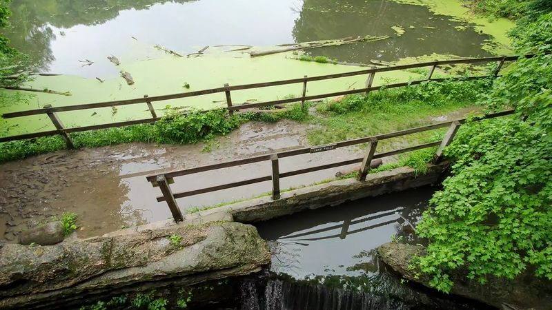
Beyond capacity, closures tied to specific trails and structures can limit the outing further. As of the most recent IDNR information available for this article, the Lake Falls bridge and associated trail sections are closed, with a detour posted.
The park page also reports restrictions affecting interior waterfall areas, including Lake Falls, Middle Falls, and Cascade Falls, linked to storm water and rising river levels. These conditions are not attributed here to construction or repair work because no current IDNR notice reviewed for this article specifies that cause.
Checking two sources immediately before travel gives the most complete picture. The IDNR current closures page lists active closures across all state parks, including Matthiessen-specific entries for bridge and trail status.
The park’s own page provides additional detail on waterfall access and capacity notices. Reading both, not just one, catches conditions that may be reported on one page but not the other.
The official trail map also helps with closure planning because it shows alternate route options and how the Dells Area connects to bluff-top paths and the Vermilion River Area. When a closure removes one section of the canyon route, the map makes it easier to identify whether a bluff-top alternative or a different trailhead still provides a worthwhile outing.
Printing or downloading the current map before leaving home takes only a moment and prevents a lot of guesswork at the trailhead.
Let terrain and weather set the day’s limits
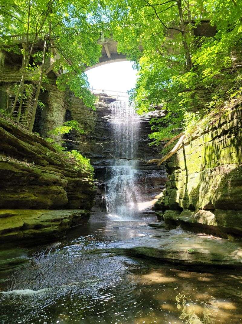
The canyon’s beauty comes with physical conditions that require straightforward decisions. IDNR warns that steep cliffs and deep canyons can be dangerous, and both the park page and the trails page prohibit off-trail travel and the creation of new paths.
Staying on marked trails is not a suggestion to be weighed against a better view from an unmarked ledge; it is the rule that keeps visitors away from edges where a slip has serious consequences.
IDNR’s park rules also prohibit swimming in waterfalls, creeks, and the river, as well as rock climbing and rappelling. These bans apply regardless of water conditions, trail access, or how tempting a waterfall pool looks after a warm hike.
The sandstone surfaces that make the canyon walls photogenic are also the surfaces that become dangerously slick when wet, and the canyon floor can carry fast-moving water after rain.
Weather deserves particular attention before and during the visit. IDNR’s emergency preparedness guidance notes that heavy rainfall can rapidly flood trails, roads, riverbanks, and streams.
Visitors should check forecasts before leaving home, monitor park notices during the trip, avoid any floodwater on or near the trail, and leave the area promptly if flood warnings are issued. Rain that falls miles upstream can raise water levels in the canyon before it reaches the park.
Accessibility at Matthiessen is partial, not complete. IDNR’s accessibility page for the park identifies accessible facilities and a short trail near the Lake Shelter Area, but the interior dell trails are separately described as difficult and are not part of the accessible route.
Visitors who need level, paved, or otherwise accessible terrain should plan around the Lake Shelter Area and bluff-top options rather than expecting the canyon floor to accommodate all mobility levels.
Pets are welcome in the park but must be kept on a leash at all times. The IDNR park guide confirms the leash requirement, and the trails page notes additional restrictions that apply to specific trail areas.
A leashed dog on a bluff-top path is a manageable situation; the same dog on a narrow, wet canyon staircase is a safety concern for both the animal and other hikers sharing the trail.
Build a flexible afternoon around the conditions
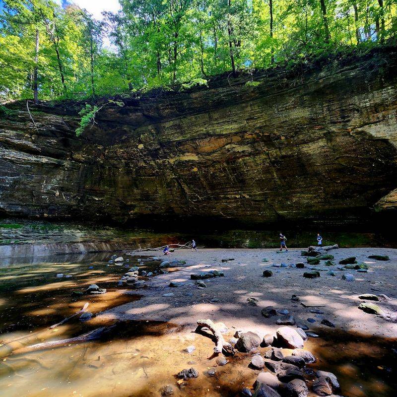
Matthiessen State Park suits visitors who want sandstone canyon walls, shaded wooded paths, cascading waterfalls, and a river-connected landscape in a setting that tends to draw fewer people than Starved Rock overall. The park’s roughly 1,938 acres hold enough variety to fill a half-day without requiring visitors to rush, but that half-day works best when it is built around what is actually accessible rather than what an article or social-media post suggested the trail would look like.
Before heading out, check the current IDNR park page and the statewide closures list for any active restrictions. Download the official trail information and the current map so you can adapt the route if a section is closed.
Aim to arrive by 8 or 9 a.m. on any weekend between May and October, because the canyon parking areas can close to new arrivals by mid-morning.
Accept that the terrain will vary, the waterfalls may or may not be accessible, and the canyon atmosphere is shaded and damp rather than a reliably temperate escape. A flexible plan, solid footwear, and current information turn Matthiessen from a gamble into a genuinely rewarding afternoon in one of Illinois’s most visually distinctive state parks.