
This Illinois State Park Hides A Canyon With Waterfalls You’d Swear Belong Out West
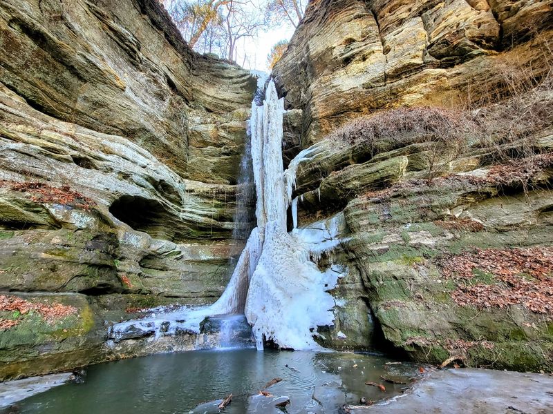
Tucked into the rolling river country of north-central Illinois, Starved Rock State Park holds a secret that stops first-time visitors cold: steep sandstone canyon walls, mossy ravines, and seasonal waterfalls that look like they belong somewhere in Utah or New Mexico. Most people picture Illinois as flat and unremarkable, so the visual punch of 18 canyons dropping into narrow gorges feels almost impossible.
The waterfalls are the payoff, but they depend on rain and snowmelt rather than running on a fixed schedule. Knowing when to go and what to expect makes the difference between a memorable hike and a dry canyon walk.
The landscape makes Illinois look unexpectedly western
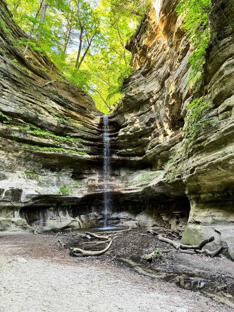
Standing at the mouth of one of Starved Rock’s canyons, a first-time visitor could be forgiven for doing a double take. The walls rise sharply on both sides, exposing bands of buff and rust-colored sandstone streaked with moisture and draped in fern and moss.
Overhead, the sky narrows to a ribbon of blue, and the sound of dripping water echoes off rock that looks more like southern Utah than northern Illinois.
That visual surprise is real, and it holds up under scrutiny. Illinois DNR confirms that the park contains 18 sandstone canyons and more than 13 miles of trails winding through terrain that feels nothing like the surrounding farmland.
The canyon walls expose St. Peter Sandstone, a formation ancient enough to predate the glacial events that shaped the modern landscape, and the combination of steep ravines, overhanging ledges, and episodic waterfalls produces a setting that genuinely reads as western at a glance.
The comparison works as a visual shorthand, not as a geological or climatic equation. Starved Rock sits in a humid Midwestern forest and river corridor along the Illinois River.
Its canyons stay green and damp for much of the year, nothing like the sun-baked arroyos of the desert Southwest. The exposed sandstone, the narrow slot-like passages, and the occasional waterfall dropping through a mossy opening are what create the resemblance, and those features depend on precipitation rather than aridity.
That central tension is worth keeping in mind from the start. The scenery can look cinematic and almost arid from a distance, with bare rock faces and dramatic shadows, but the waterfalls that complete the western illusion are powered entirely by Midwestern rain and snowmelt.
The park delivers the visual payoff reliably in wet conditions and offers a quieter, still-striking canyon experience when the falls run low.
Glacial floodwater carved the canyon country
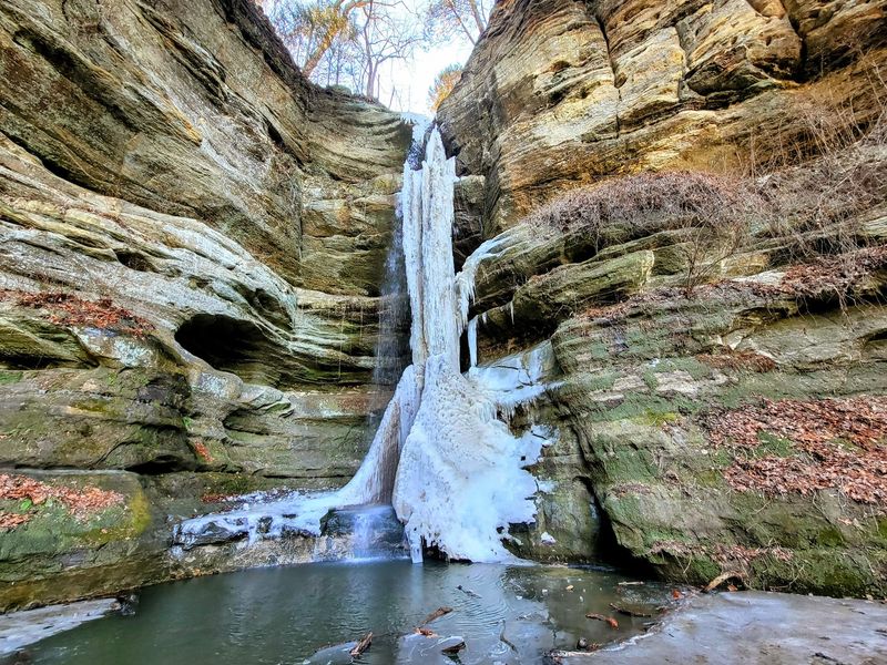
The canyon walls at Starved Rock are made of St. Peter Sandstone, a geological formation so old it predates the dinosaurs. But the steep ravines visitors walk through today were not carved by ancient seas or slow erosion alone.
The shapes that make the park look western came largely from catastrophic events at the end of the last Ice Age.
Illinois State Geological Survey research places the relevant glacial-meltwater flooding between approximately 18,800 and 15,100 years ago. As the Laurentide Ice Sheet retreated, enormous volumes of meltwater roared through the Illinois River valley, and the runoff that poured into side drainages cut rapidly through the soft sandstone, gouging the narrow canyon forms that exist today.
The rock was already there; the floods gave it its dramatic shape.
St. Peter Sandstone itself formed hundreds of millions of years earlier, during the Ordovician period, when a shallow sea covered much of North America. It is a quartz-rich, relatively soft stone that erodes readily under moving water, which is exactly why the glacial floods could carve such sharp, deep ravines in a geologically short time.
The canyon walls you see now are essentially a record of two very different chapters: an ancient seabed and a violent Ice Age finale.
None of that history involves a desert climate. The canyons look southwestern because exposed sandstone, vertical walls, and narrow passages share visual characteristics across very different environments.
Starved Rock’s formations are the product of a cold, wet glacial period followed by a humid Midwestern climate, not the dry conditions that shaped the Colorado Plateau. Understanding that distinction helps explain why the waterfalls here are seasonal gifts from rainfall rather than permanent features carved into an arid landscape.
The waterfalls arrive with spring’s water
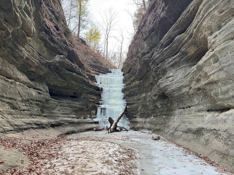
Rainfall and snowmelt are the engine behind every waterfall in the park, and the calendar is only a rough guide to when they run. DNR’s own guidance describes the waterfalls as generally occurring from March through June, with many weakening or drying out from late June into October.
Heavy rain or a late snowmelt can revive them outside that window, but a dry spring can leave the same canyons nearly silent.
The practical implication is that March through May tends to be the strongest general viewing window, as Starved Rock Lodge’s trail guide also suggests. Snowmelt feeds the falls early in the season, and spring rain keeps them running into late May and early June.
A visit after a multi-day rain in late April is often more rewarding than a dry morning in mid-March, so recent precipitation matters more than the specific date on the calendar.
A common misconception is that all 18 canyons contain waterfalls. DNR identifies eight visitor-accessible canyon waterfalls by name: French, Wildcat, LaSalle, Ottawa, Kaskaskia, Illinois, St. Louis, and Aurora.
That list already comes with an important qualifier: not all eight will be flowing on any given visit. The distinction between 18 total canyons and eight waterfall canyons matters when planning a route, because hiking to a dry canyon is still a beautiful experience, but it is a different one than the dramatic drop of water over sandstone that most visitors picture.
A later-season visit after a substantial storm can absolutely outperform a dry spring morning. The best strategy is to watch the Utica weather forecast in the days before a trip rather than relying solely on the month.
If the area has received meaningful rain or snowmelt within the previous 48 to 72 hours, the odds of finding active falls improve significantly across multiple canyons.
Choose a route by distance, flow, and current access
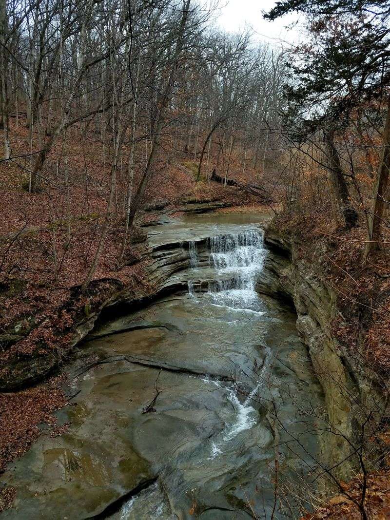
Matching a canyon to your group’s energy level and the day’s conditions is the most practical planning step after confirming that the falls are likely running. DNR’s activity page lists French Canyon at approximately 0.8 miles round trip, making it the shortest dedicated waterfall hike in the park and a reasonable starting point for families or anyone short on time.
Wildcat Canyon comes in at about 2 miles round trip and rewards the extra distance with a wider canyon floor and a falls that can reach impressive height in peak flow.
Aurora and St. Louis canyons are each listed at roughly 3 miles round trip, which pushes them into a half-day category for most hikers. St. Louis Canyon draws particular interest because its water source has a spring-fed component that can help it hold flow a bit longer into the season than purely rain-fed canyons.
Even so, the canyon’s own description makes clear that its waterfall still depends partly on rainfall and is not guaranteed to be running strongly on every visit. Treat the spring-fed character as a favorable factor, not a promise.
Construction is actively reshaping access during the 2026 trail-improvement project, and distances or approach routes listed on older maps may not reflect current conditions. The official DNR closure page is the only reliable source for which canyons are open, which parking areas serve them, and whether a planned route has been rerouted.
As of the most recent 2026 update before this article’s publication, LaSalle and Tonti canyons were closed for improvements, while French and Wildcat had reopened through specified routes. That situation can change, so check the closure page immediately before traveling rather than weeks in advance.
Parking areas are tied to specific canyon access points, and arriving at a closed lot can add significant distance to a planned outing. Confirming the correct parking area for your chosen canyon is as important as confirming the trail is open.
Check weather and closures before leaving home
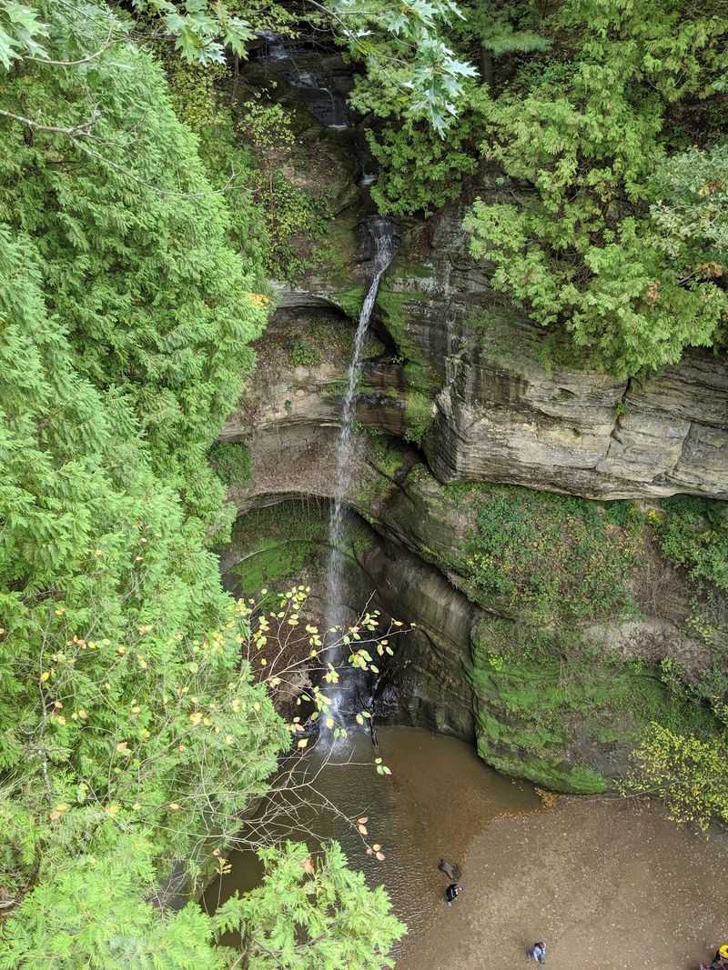
A short pre-trip routine can save hours of frustration on the day of a visit. Start with the Utica, Illinois weather forecast, specifically looking at rainfall totals from the previous two to three days and any precipitation expected around your visit.
Waterfall flow is directly tied to recent moisture, and DNR notes clearly that the park office cannot provide frequent waterfall-condition updates, so the forecast is the most useful real-time tool available.
Next, visit the official DNR closure page for the 2026 trail-improvement project to confirm which canyons and approaches are currently accessible. Closures can shift without much public notice, and a route that was open last weekend may be temporarily blocked this weekend.
Check the page within a day or two of your planned visit rather than relying on information from a prior trip or a travel blog with an older publication date.
Once you confirm open routes, note the correct parking areas for each canyon and plan your arrival accordingly. Trails are open from 7 a.m. until sunset, and no calendar date or season alone guarantees strong waterfall flow.
Arriving early gives you better light for photography, a quieter experience in the canyons, and more time to adjust your route if a primary canyon turns out to be dry or busier than expected. Pack layers, waterproof footwear, and enough water for your planned mileage, since canyon floors can be cool and damp even on warm days.
Plan for stairs, creek crossings, and fragile sandstone
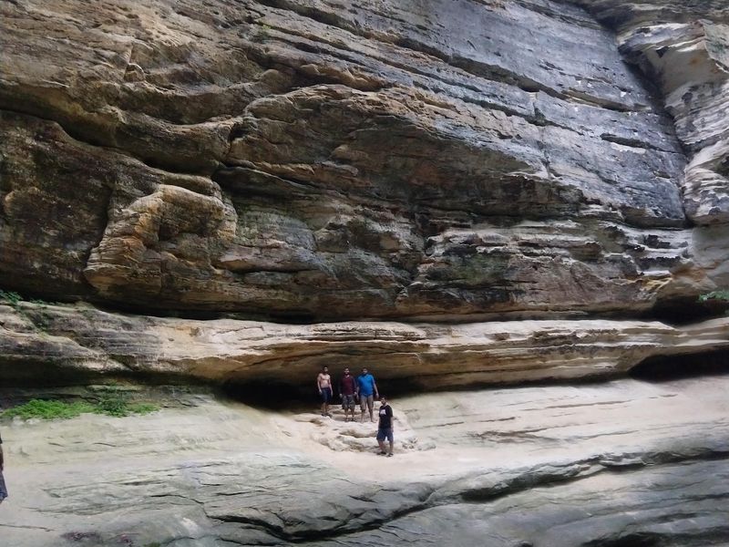
The canyon scenery at Starved Rock is genuinely accessible to a wide range of hikers, but several physical features of the trails deserve honest attention before a group heads out. Many of the canyon and overlook routes include major staircases, sometimes steep and sometimes slick with moisture.
DNR’s activity page is explicit that no canyon or overlook trail is wheelchair-accessible, and the staircase sections make most routes unsuitable for mobility devices or strollers as well.
The one exception is Illinois Canyon, which has no steps along its trail system. However, DNR’s accessibility page notes that the Illinois Canyon route includes a creek crossing, which introduces its own footing challenge, particularly in wet conditions or after snowmelt.
Visitors who need a step-free option should read the current accessibility details carefully rather than assuming Illinois Canyon is universally easier.
The sandstone walls that make the canyons beautiful are also genuinely fragile. St. Peter Sandstone can crumble under pressure and becomes especially slippery when wet.
A DNR press release on canyon safety warns against rock climbing, rappelling, scrambling on rock features, and any off-trail approaches, and the prohibition is backed by fines starting at $195 for swimming, wading, or sliding in canyon water. Those rules are not bureaucratic caution; they reflect the real instability of wet sandstone surfaces where a handhold or foothold can give way without warning.
Staying on marked Brown, Green, or Red designated trails keeps visitors on surfaces that have been evaluated for safety and keeps the canyon walls intact for future visitors. The best photographs of the waterfalls come from the designated viewing areas, which are positioned to give a clear sightline without requiring anyone to scramble toward the base of the falls.
Wet sandstone at the canyon floor is exactly where the most serious slip hazards concentrate.
The western illusion depends on timing
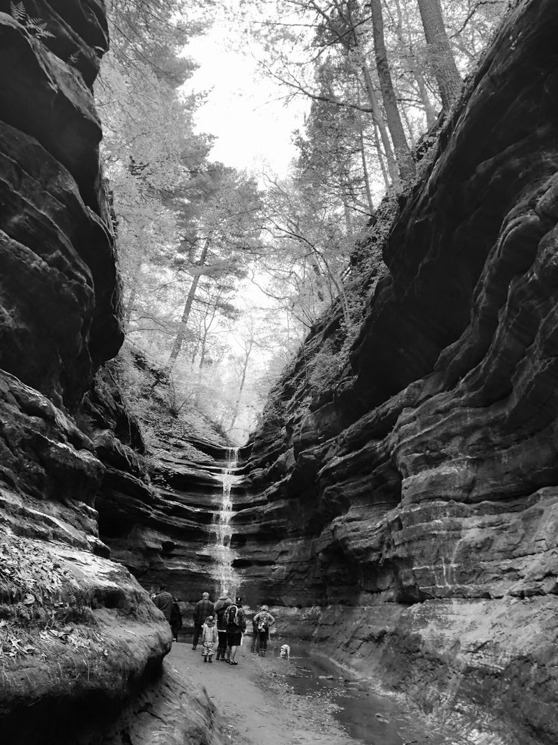
Ancient sandstone and a violent glacial history built the canyon forms at Starved Rock, but Midwestern precipitation decides whether the waterfalls show up for your visit. Those two facts together explain both the park’s visual drama and its practical unpredictability.
DNR’s seasonal guidance puts the general waterfall window from March through June, with flow dependent on recent rain or snowmelt rather than the date alone.
The geological record behind the canyons spans hundreds of millions of years, but the practical planning window is much shorter: check the Utica forecast, confirm open routes on the DNR closure page, and arrive prepared for stairs, creek crossings, and variable conditions. A precipitation-rich spring visit gives the best odds of seeing multiple active falls, but a dry canyon still offers the sandstone walls, overlooks, and quiet that make the park worth the drive.
Starved Rock can genuinely look like a slice of the American West on the right day, with water threading through narrow sandstone passages and light cutting across moss-covered walls. How much of that waterfall scenery a visitor actually sees comes down to weather, timing, and a few minutes of pre-trip research.