
This Illinois Nature Preserve Hides A Waterfall Canyon Most Locals Have Never Even Heard Of
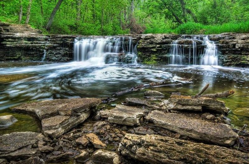
Tucked inside a large DuPage County forest preserve near Darien and Lemont, a little-known natural waterfall sits along a creek ravine that many weekend hikers walk right past. Canyon Creek Falls is a real, officially recognized feature, yet it does not appear on the preserve’s public trail map, which helps explain why even regular visitors can miss it entirely.
Waterfall Glen Forest Preserve is worth exploring on its own merits, but knowing what to look for, and what to realistically expect, makes the trip far more rewarding.
The little-known waterfall is real—but the headline needs a correction
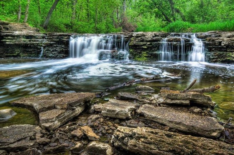
Canyon Creek Falls is a genuine natural waterfall located inside Waterfall Glen Forest Preserve in DuPage County, near the communities of Darien and Lemont. The feature is easy to overlook, and a 2014 local news report described it as little known even among area residents at the time the U.S.
Board on Geographic Names officially recognized its name. That account captures something real about the waterfall’s low profile, but it is not population-level survey data, so the stronger claim that most locals have never heard of it goes beyond what the evidence supports.
Framing the site more accurately still makes for a compelling story. An officially recognized natural waterfall that does not appear on the preserve’s public trail map, sitting inside one of DuPage County’s busiest outdoor destinations, is genuinely surprising.
The waterfall is easy to miss, not because it is guarded or hidden behind a fence, but because nothing on the standard visitor map points you toward it.
One more correction matters before exploring further. The DuPage Forest Preserve District manages this land as a county forest preserve, not as an officially dedicated Illinois Nature Preserve.
The Illinois Nature Preserves Commission maintains a separate list of formally dedicated sites, and Waterfall Glen does not appear on it in that capacity. The preserve is listed in the Illinois Natural Areas Inventory, which is a different and less restrictive recognition.
Keeping that distinction clear matters for readers who want accurate information about what protections and rules apply to the land they are visiting.
Waterfall Glen is a large, popular forest preserve
Covering 2,503 acres, Waterfall Glen Forest Preserve offers nearly 11 miles of mapped trails winding through a varied landscape that includes prairies, savannas, oak-maple woodlands, bluffs, ravines, and creek corridors. The terrain ranges from gently rolling to noticeably hilly, with some sections steep enough that the DuPage Forest Preserve District flags them specifically on its materials.
For a preserve in the Chicago suburbs, that kind of topographic variety is part of what draws consistent crowds.
The District itself describes Waterfall Glen as one of its most popular forest preserves, and the evidence backs that up. Visitor demand grew significant enough that the District expanded the Bluff Road parking lot to handle overflow.
A preserve this well attended can still contain features that casual visitors never encounter, simply because the trail network is large and most people follow the same main loop without venturing toward the creek ravines.
Before going further, two common misconceptions deserve a direct correction. First, the preserve is not an officially dedicated Illinois Nature Preserve.
It appears in the Illinois Natural Areas Inventory, which documents ecologically significant sites across the state, but that listing is separate from the formal dedication process overseen by the Illinois Nature Preserves Commission. Dedicated nature preserves carry specific legal protections; an INAI listing does not automatically confer those same protections.
Second, the preserve’s name has nothing to do with its waterfalls. DuPage County records confirm that Waterfall Glen was named for Seymour “Bud” Waterfall, an early president of the Forest Preserve District board.
The name is a coincidence that turns out to be a happy one, given that the preserve does contain real waterfall features worth knowing about.
The preserve’s named waterfall features tell different stories
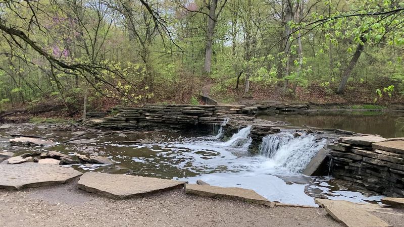
Waterfall Glen contains more than one named waterfall feature, and treating them as interchangeable leads to real confusion on the trail. Rocky Glen Waterfall is the feature most visitors encounter first.
It is a small, tiered waterfall constructed by the Civilian Conservation Corps during the 1930s, making it a piece of Depression-era public works history rather than a natural formation. The DuPage Forest Preserve District identifies it on the official preserve map, and the nearby Bluff Road parking lot is sometimes referred to informally as the waterfall lot precisely because Rocky Glen is the waterfall most visitors are directed toward.
Canyon Creek Falls is an entirely different feature. A naturally occurring waterfall along East Branch Canyon Creek, it received official recognition from the U.S.
Board on Geographic Names in 2014 following what local reporting described as a somewhat informal naming process prompted by local interest. The USGS Board on Geographic Names review lists it at approximately 8 feet high.
That is a modest but genuine waterfall, and the creek-and-ravine setting gives it a character quite different from the constructed stone tiers of Rocky Glen.
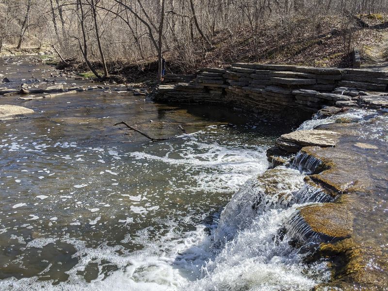
A third feature, Canyon Creek Cascade, is listed separately at approximately 3 feet high. The cascade, the falls, and the constructed waterfall each occupy their own location within the preserve and should not be treated as the same spot under different names.
Knowing which feature you are looking for before you head out will save a good deal of frustration, especially because only Rocky Glen Waterfall appears on the standard trail map that most visitors carry.
Why Canyon Creek Falls remains easy to overlook
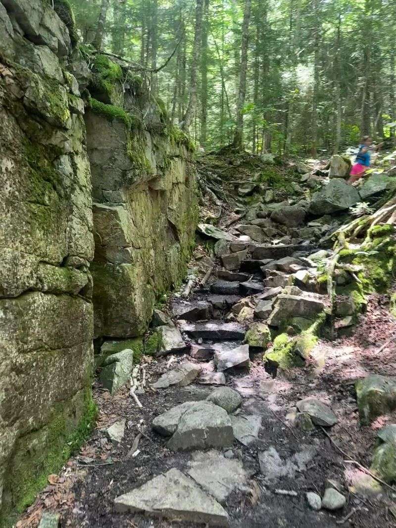
The most straightforward reason Canyon Creek Falls stays under the radar is simple cartography. The official Waterfall Glen trail map marks Rocky Glen Waterfall clearly, but Canyon Creek Falls does not appear on it at all.
For the majority of visitors who plan a hike using that map, the natural waterfall simply does not exist as a named destination. There is no marker, no trailhead sign, and no listed route pointing toward it.
The size of the preserve compounds this. Nearly 11 miles of mapped trails spread across more than 2,500 acres means that even frequent visitors tend to settle into familiar loops.
The creek ravines where Canyon Creek Falls sits are not on the main circuit that most people walk, so a hiker could visit Waterfall Glen a dozen times and never wander close enough to notice the feature.
The DuPage Forest Preserve District’s preserve page acknowledges that narrow, unmarked footpaths exist within the preserve, but it also warns that those paths may not connect with mapped trails. That is an important distinction.
An unmarked path that appears to lead somewhere useful on a hiking blog or social media post may dead-end, loop back, or pass through terrain that is harder to navigate than it looks in a photo. Official materials do not confirm or endorse any specific unmarked route to Canyon Creek Falls.
When the 2014 naming story brought the falls a brief moment of local attention, the coverage itself noted that the feature was largely unknown. That coverage has not translated into a maintained, signed, or officially sanctioned route.
Visitors curious about Canyon Creek Falls should contact the DuPage Forest Preserve District directly for current guidance rather than relying on directions posted online by other hikers.
Recent rain may matter more than the calendar
Checking the weather forecast before visiting Canyon Creek Falls is not just practical advice, it may be the single factor that determines whether you see any water at all. Sources such as Trail Run Project’s Waterfall Glen entry and photographic documentation on Flickr associate the falls with wet conditions, suggesting it flows most reliably after significant rainfall.
No official source reviewed for this article provides a dependable seasonal schedule or confirms that Canyon Creek Falls runs year-round.
Spring visits after a wet week offer a reasonable chance of seeing active flow, but that is not a guarantee. A dry stretch in late summer or fall could leave the creek bed nearly empty.
Planning around recent rainfall rather than a fixed date on the calendar gives you a much better shot at the experience you are hoping for. Checking local weather records for the preceding week and looking at current trail condition reports from the DuPage Forest Preserve District before you leave is a straightforward step that most visitors skip.
Wet conditions also introduce a safety consideration that the official trail map addresses by flagging steep terrain. Heavy rain that makes the falls more photogenic also makes ravine banks slippery and creek crossings unpredictable.
Climbing down steep banks, scrambling into the ravine, or approaching the water’s edge during or shortly after heavy rain carries real risk. A 2022 District flood report documented infrastructure damage at the preserve, a reminder that the creek corridor can change quickly.
The falls are worth seeking out, but not at the cost of putting yourself on unstable ground.
Plan a preserve visit without relying on a secret shortcut
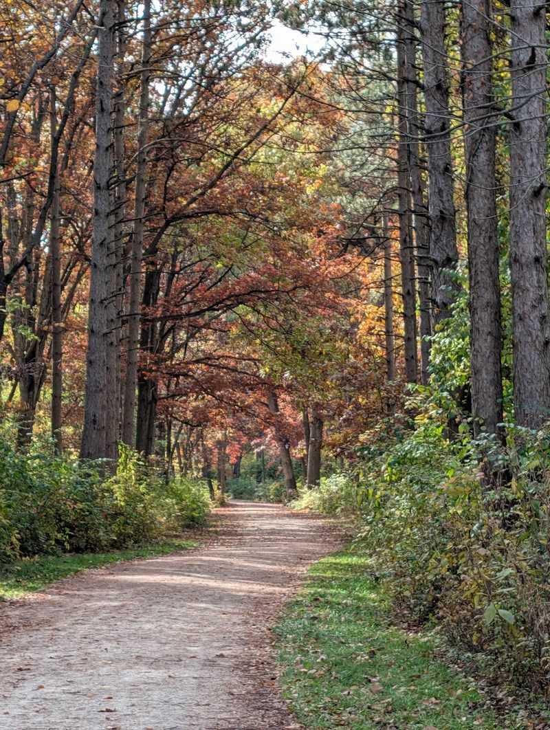
Getting to Waterfall Glen is straightforward. The main entrance is on Northgate Road, 0.25 mile west of Cass Avenue.
A second lot, sometimes called the waterfall parking area, sits on Bluff Road, 0.3 mile east of Cass Avenue, and is the closest starting point for visitors heading toward Rocky Glen Waterfall. A third option is the lot on Lemont Road at 101st Street.
The DuPage Forest Preserve District’s preserve page lists all three locations and is the best place to confirm current access before your visit.
Preserve hours run from one hour after sunrise to one hour after sunset. Dogs are welcome but must stay on a leash no longer than 10 feet.
Bicycles are restricted to designated bike trails, meaning the narrower footpaths in the ravine areas are not open to cyclists. Alcohol is prohibited throughout the preserve.
These rules are consistent with standard DuPage Forest Preserve District policy and are worth reviewing on the official site before you go, since details can change.
The official trail map is the most reliable navigation tool for a first visit. Following mapped trails and using the map to orient yourself in the ravine sections of the preserve is a safer approach than following directions sourced from hiking forums or social media posts.
The Bluff Road lot has been expanded due to visitor demand, as noted in the District’s parking improvement project page, which reflects how popular the preserve has become.
Unmarked paths exist in the preserve, but the District’s own materials describe them as potentially disconnected from the mapped trail network. Treating those paths as unconfirmed and potentially confusing, rather than as a reliable shortcut to Canyon Creek Falls, is the practical approach.
If you want current information about whether any access to the natural waterfall is available, calling or emailing the DuPage Forest Preserve District directly is more reliable than any secondhand online source.
The appeal is a modest natural feature in a familiar place
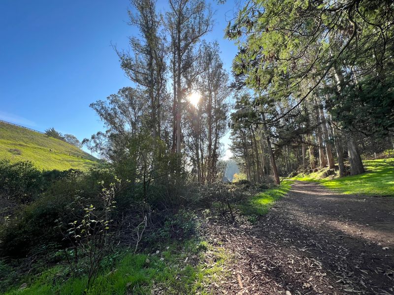
Canyon Creek Falls is not a towering spectacle. The USGS Board on Geographic Names review puts it at approximately 8 feet high along East Branch Canyon Creek, which makes it a genuine waterfall by any reasonable definition but a modest one by any dramatic standard.
The appeal is not the scale; it is the fact that a formally recognized natural waterfall sits inside a busy suburban forest preserve and still manages to stay off most visitors’ radar.
Waterfall Glen rewards the kind of visitor who checks conditions before leaving, follows the official preserve guidance, and pays attention to the landscape rather than rushing toward a social-media pin. The preserve’s prairies, savannas, bluffs, and creek ravines are worth exploring even on a visit where Canyon Creek Falls turns out to be dry or inaccessible.
There is enough terrain here to make any outing feel productive.
The real discovery at Waterfall Glen is not a secret canyon. It is the realization that a familiar, well-attended place can still hold something you have not noticed before, if you slow down and look carefully enough.