
These Michigan Towns Stay Cool In Summer Without Even Trying
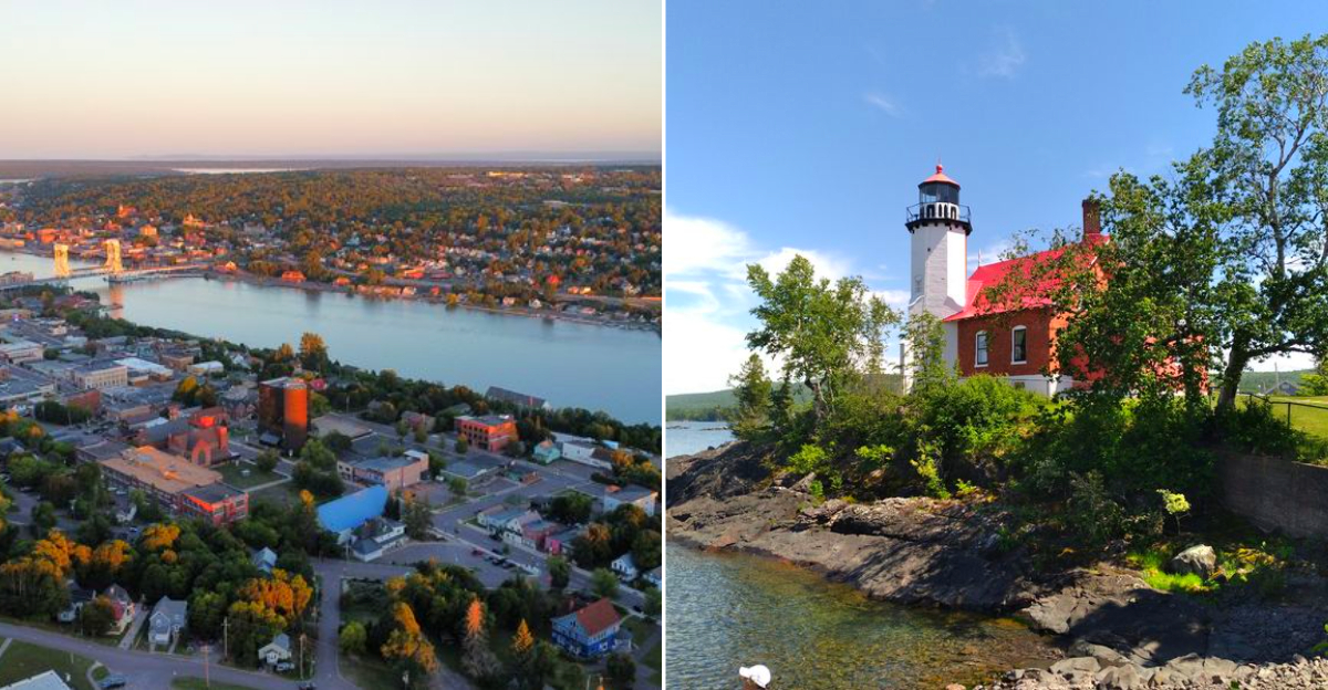
July in the Midwest is usually a punishment. The air hangs thick, the car steering wheel burns your hands, and the only relief comes from air conditioning. But there are towns along the Great Lakes where something different happens.
The breeze off the water cuts the heat like a knife. I have stood on a dock in August, wearing a light jacket, watching the fog roll in while my phone shows ninety degrees back home. It is not magic. It is geography.
These towns sit close enough to enormous bodies of cold water that the air stays ten or fifteen degrees cooler than anywhere inland. The list includes remote harbors, college towns, and fishing villages that most people drive past.
My advice: stop driving past. While everyone else in the Midwest is sweating through July, twelve towns in Michigan stay cool just by being near the water.
12. Copper Harbor
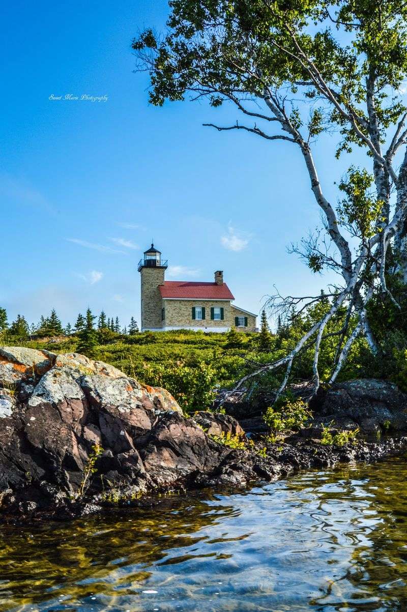
At the literal end of US-41, summer feels like it has run out of mainland and nowhere left to heat up. Copper Harbor occupies the northern tip of the Keweenaw Peninsula, with Lake Superior surrounding the area and cool water exerting a strong influence whenever the wind comes ashore.
Use Fort Wilkins Historic State Park, 15223 U.S. Highway 41, Copper Harbor, MI 49918, as an easy arrival anchor.
The restored 1844 military post has historic buildings, trails, camping, Lake Fanny Hooe, and access to the rugged shoreline.
From there, head up Brockway Mountain Drive for a 9.5-mile scenic route with huge views across Lake Superior and the forested Keweenaw. Mountain bikers have another reason to stay: Copper Harbor has become a serious trail destination, while hikers can disappear into the old forest at Estivant Pines.
The important summer packing advice is simple: do not trust the afternoon temperature when choosing evening clothes. A clear, pleasant day can become breezy and sharply cooler near the water after sunset.
Lodging and dining are limited compared with larger towns, so reservations matter on popular weekends. The remoteness is not an inconvenience here.
It is most of the reason Copper Harbor still feels this good in July.
11. Eagle Harbor
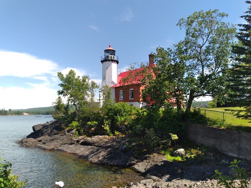
Fog rolling into the harbor can turn a bright summer afternoon into sweatshirt weather remarkably quickly. Eagle Harbor sits on the north side of the Keweenaw Peninsula, facing directly into Lake Superior and wrapped around one of the prettiest little bays on this entire stretch of Michigan.
A good first stop is the Eagle Harbor Lighthouse complex in Eagle Harbor, MI 49950, where the lighthouse and lifesaving museum tell the maritime story of a community shaped first by copper shipping and then by the lake itself. Michigan tourism officials also highlight the sandy village beach and nearby rugged shoreline for agate hunting.
The town is tiny enough that the water remains the main attraction. Pack something to eat, walk the shoreline, then work nearby stops such as Great Sand Bay and Jacob’s Falls into the drive between Eagle Harbor and Eagle River.
Lake Superior deserves more respect than its freshwater label sometimes receives. Water temperatures can remain cold in summer, waves can change quickly, and even strong swimmers should treat rough conditions seriously.
That same cold water is part of what makes the town such an appealing heat escape.
10. Eagle River
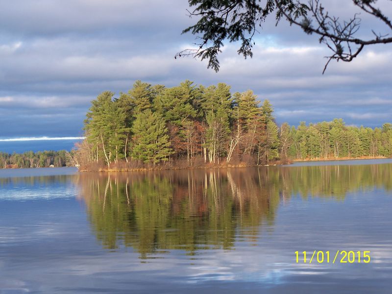
A waterfall beside the highway is a fairly dramatic way for a town this small to introduce itself. Eagle River sits along M-26 on the western Keweenaw shore, where the river drops over dark rock before reaching Lake Superior only a short distance away.
The most practical arrival anchor is Eagle River Falls along M-26 in Eagle River, MI 49950. From the roadside viewing area and pedestrian bridge, visitors get an easy look at the falls without committing to a long hike.
Pure Michigan also highlights Eagle River Beach and the nearby Jampot as the community’s signature stops.
The beach gives the day a completely different texture. Smooth stones, driftwood, and open Lake Superior replace the dark rock and rushing river upstream.
Rock hunters can spend an embarrassing amount of time staring at the ground here and consider the afternoon well spent.
A few miles away, the Jampot adds one of Michigan’s strangest and best-loved food detours, with baked goods and preserves produced by monks near the Holy Protection Monastery. Seasonal hours make checking ahead worthwhile.
Summer temperatures may be comfortable, but the shoreline can turn windy fast. Keep a windbreaker close.
Eagle River is not trying to entertain you for twelve straight hours. Waterfall, beach, bakery, cool air.
That is enough.
9. Houghton
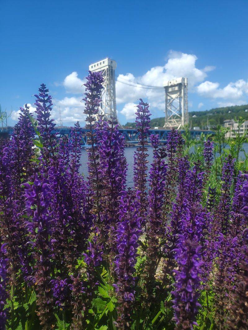
Summer energy is noticeably higher here than in the tiny villages farther up the Keweenaw, but the water still refuses to let the city feel completely inland. Houghton climbs steeply above the Keweenaw Waterway, with Michigan Tech, downtown restaurants, boats, and cyclists all sharing a surprisingly compact stretch of shoreline.
For an easy starting point, head to the A.E. Seaman Mineral Museum, 1404 E.
Sharon Avenue, Houghton, MI 49931. It houses an extraordinary Great Lakes mineral collection and offers a useful indoor escape if the weather turns rainy instead of merely cool.
Afterward, drop back toward downtown and the waterfront. Houghton’s paved trail follows the water through the city, connecting parks and giving walkers and cyclists long views toward Hancock and the Portage Lake Lift Bridge.
Kestner Waterfront Park also adds paddling, picnic space, and a protected swim area.
Unlike remote Copper Harbor, Houghton has enough restaurants, shops, hotels, and coffee stops to make a longer stay easy. The steep streets provide the only reminder that walking around town is technically exercise.
8. Hancock
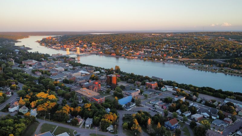
Across the lift bridge from Houghton, the pace changes before the temperature does. Hancock rises sharply from the Keweenaw Waterway and carries one of Michigan’s strongest visible connections to Finnish immigration, from bilingual cultural traces to food, architecture, and the region’s famous sauna tradition.
Start at the Finnish American Heritage Center, 435 Quincy Street, Hancock, MI 49930. The center preserves Finnish-American history through archives, exhibits, events, and cultural programming, while the surrounding blocks make an easy introduction to downtown.
Then go underground.
Quincy Mine, at 49750 U.S. Highway 41, sits above town and interprets the copper industry that drew thousands of immigrants into the Keweenaw.
Mine tours provide an entirely different definition of summer cooling, since underground temperatures can feel downright chilly even when the sun is bright outside.
Back at water level, Hancock Beach provides swimming and picnic space along the Portage Canal. The water remains cool enough to make a cautious first step preferable to a theatrical leap.
Hancock works especially well paired with Houghton because the two cities feel distinct despite sharing the same waterway.
Comfortable shoes matter on the hills, and so does a jacket after sunset.
7. Marquette
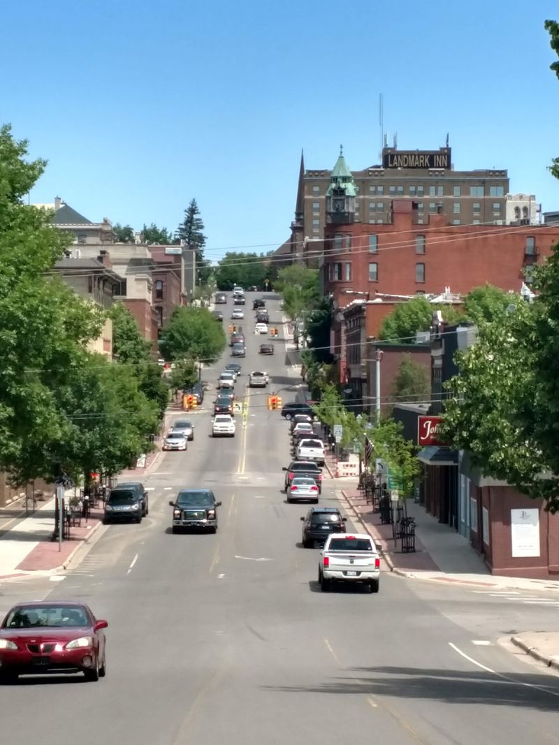
Orange sandstone, blue water, and a sudden wall of cool fog can all occupy the same afternoon here. Marquette is the largest city in Michigan’s Upper Peninsula, but Lake Superior sits so prominently against downtown that the city’s size never completely overwhelms its shoreline character.
A strong first stop is Presque Isle Park on Peter White Drive, Marquette, MI 49855. The 323-acre forested peninsula extends into Lake Superior with trails, rocky overlooks, and some of the area’s most recognizable water views.
Black Rocks sits within the same park and has become famous for cliff jumping, although watching from shore is the wiser choice whenever waves, wind, or cold water make conditions questionable. Lake Superior can remain dangerously cold even on beautiful days.
Downtown provides the comforts missing from more remote places on this list: breweries, restaurants, shops, coffee, galleries, and plenty of lodging. The old ore dock and Marquette Harbor Lighthouse keep the industrial and maritime history visible along the water.
For another high view, drive north toward Sugarloaf Mountain, about six miles from downtown, where a short climb opens onto a panorama of forest and Lake Superior.
6. Munising
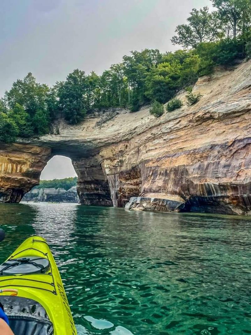
Mist is part of the landscape before Lake Superior even gets involved. Munising sits at the western gateway to Pictured Rocks National Lakeshore, surrounded by waterfalls, forest, cliffs, and enough cold water to make summer feel noticeably different from lower Michigan.
Use the Munising Falls area near Sand Point Road in Munising, MI 49862 as an easy introduction to the national lakeshore. The short trail leads through a shaded canyon toward the waterfall, making it a gentle first stop before tackling longer hikes.
Pictured Rocks stretches east from Munising toward Grand Marais with beaches, dunes, waterfalls, forest, and sandstone cliffs rising as much as 200 feet above Lake Superior.
The most complete cliff view comes from the water. The National Park Service specifically recommends commercial boat tours for seeing the famous formations, and those open-water trips can feel much cooler than conditions in town.
Bring a jacket even when boarding under full sun.
Sand Point provides an easier shoreline afternoon, while waterfalls around town create plenty of alternatives when the lake is rough.
Munising becomes extremely busy in summer, so lodging and boat reservations deserve advance planning.
5. Grand Marais
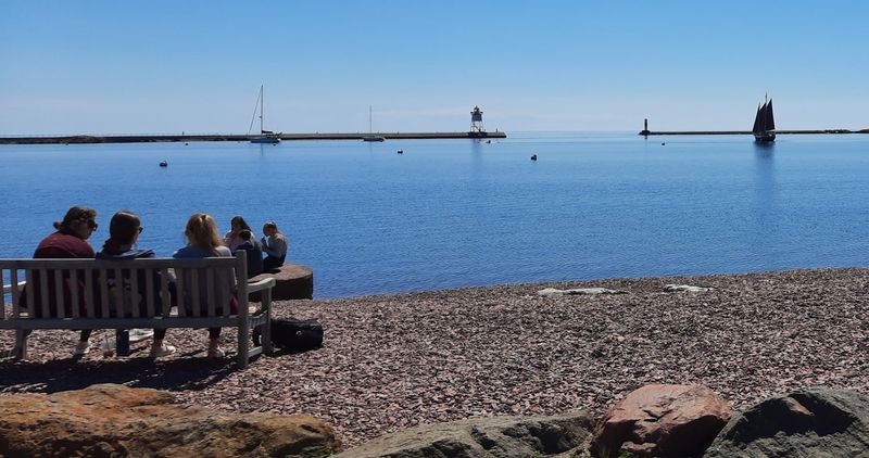
At the eastern edge of Pictured Rocks, the crowds thin and Lake Superior seems to regain control. Grand Marais is a small harbor village where sandy streets, beach walks, old maritime buildings, and the massive Grand Sable Dunes create a much quieter counterpart to busy Munising.
A useful arrival point is the Grand Marais harbor area in Grand Marais, MI 49839, then continue west about a mile on H-58 to Sable Falls. The waterfall drops roughly 75 feet on its way toward Lake Superior, with a staircase of 168 steps leading to the best lower viewpoint.
From there, the national lakeshore keeps unfolding. Grand Sable Dunes, Log Slide, Au Sable Light Station, beaches, and forest roads make this an excellent base for exploring the eastern half of Pictured Rocks without commuting back to Munising every night.
Services are more limited, so fuel, dinner, and lodging deserve more thought than they would in a larger town. Cell coverage can become inconsistent once you start exploring away from the village.
4. Ontonagon
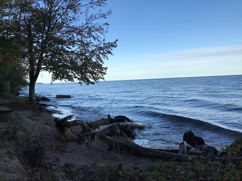
Westward along Lake Superior, towns begin feeling less like destinations arranged for visitors and more like settlements that happen to occupy spectacular geography. Ontonagon sits where the Ontonagon River meets the lake, with broad shoreline and the Porcupine Mountains looming as the obvious reason to stay longer.
The best practical excursion anchor is Porcupine Mountains Wilderness State Park, 33303 Headquarters Road, Ontonagon, MI 49953. Michigan’s largest state park protects roughly 60,000 acres of forest, waterfalls, rivers, ridges, trails, and Lake Superior shoreline.
Lake of the Clouds gets most of the photographs, but spending an entire day chasing only famous viewpoints undersells the park. The Presque Isle River corridor, Summit Peak, quieter trails, and Lake Superior beaches show how large the landscape really is.
Back in Ontonagon, the pace is considerably simpler. The town provides supplies, local history, riverfront scenery, and access to beaches without the summer intensity of Munising or Marquette.
Pure Michigan describes the wider county as a destination for hiking, waterfalls, fishing, hunting, and uncrowded Superior shoreline.
Bring rain gear, insect repellent, a paper or offline map, and layers. Distances around the Porkies are larger than they first appear.
3. Paradise
Whitefish Bay gives the name a little more credibility than expected. Paradise sits on the southeastern shore of Lake Superior, positioned almost perfectly between Tahquamenon Falls and Whitefish Point, with cold water and frequent lake breezes keeping summer conditions unpredictable in the best way.
For a memorable first destination, drive north to the Great Lakes Shipwreck Museum, 18335 N. Whitefish Point Road, Paradise, MI 49768.
Whitefish Point is one of the great maritime landmarks on Lake Superior and sits along a stretch of coast notorious for shipwrecks. The area is also an important migration corridor for birds.
Then turn inland.
Tahquamenon Falls State Park lies west of Paradise and covers nearly 50,000 acres, with more than 35 miles of trails and overlooks around the Upper and Lower falls.
The combination makes Paradise unusually useful as a base. One day can involve cold Superior wind and shipwreck history; the next can be spent beneath forest canopy beside amber-colored waterfalls.
Do not read “cooler” as “cold all day.” Sunny inland trails can still become warm. The trick is keeping a jacket in the car for the return toward Whitefish Bay.
2. Sault Ste. Marie
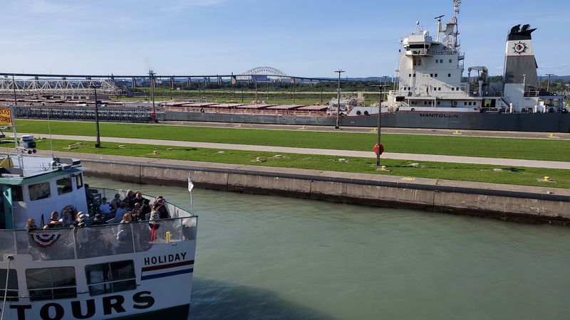
A thousand-foot freighter can make almost everything else happening downtown seem temporarily irrelevant. Sault Ste.
Marie sits on the St. Marys River between Lake Superior and Lake Huron, where moving water, passing ships, and northern latitude give summer a distinctly maritime rhythm.
Start at the Soo Locks along Portage Avenue, Sault Ste. Marie, MI 49783.
The viewing area lets visitors watch large vessels rise or descend through the locks to overcome the roughly 21-foot elevation difference between Lake Superior and the lower Great Lakes. The visitors center operates seasonally, with long daily hours during the main summer period.
Just downriver, the Museum Ship Valley Camp, 501 E. Water Street, puts visitors aboard a retired Great Lakes freighter containing more than 100 exhibits, including lifeboats from the Edmund Fitzgerald.
Boat tours offer the closest look at the engineering, but even midsummer passengers should bring a windbreaker. Moving across exposed water can feel considerably cooler than walking through downtown a few minutes earlier.
There is enough history, dining, shopping, and waterfront activity here to justify several days rather than a quick locks stop.
1. Baraga
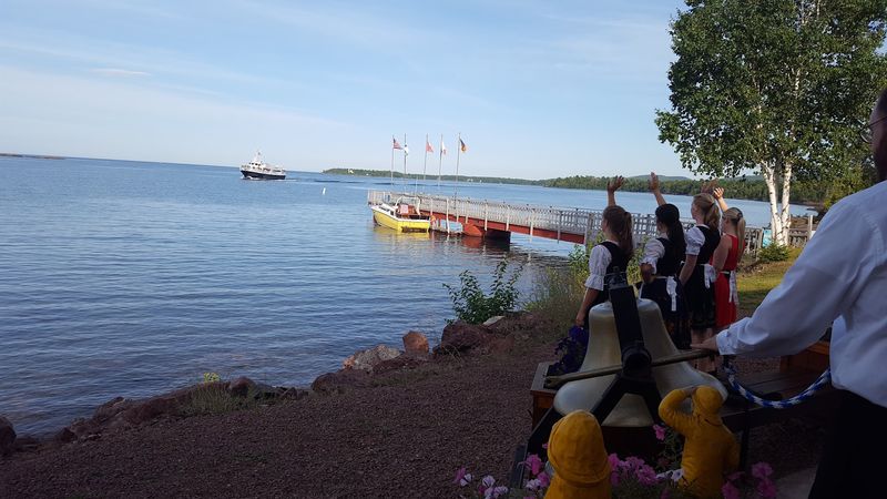
Keweenaw Bay curves around the landscape like a giant natural air conditioner. Baraga sits on the bay’s western shore along US-41, about 40 minutes south of Houghton, and makes a quieter base for exploring one of the Upper Peninsula’s most overlooked stretches of Lake Superior.
A useful landmark is the Bishop Baraga Shrine, 17570 U.S. Highway 41, L’Anse, MI 49946, on the stretch between Baraga and L’Anse.
The enormous figure of Frederic Baraga stands above the bay holding snowshoes, creating one of the region’s strangest and most recognizable roadside sights.
Baraga and neighboring L’Anse also work as jumping-off points for Canyon Falls, Silver Mountain, the Abbaye Peninsula, and Mount Arvon, Michigan’s highest point. Visit Keweenaw specifically recommends the two bay communities as a base for those outdoor trips.
The village itself is within the L’Anse Indian Reservation and the homeland of the Keweenaw Bay Indian Community, an important part of the area’s living identity rather than merely its history.
Spend the hottest part of the day near the bay, then head inland when temperatures soften.