
12 Michigan U.P. Hiking Trails Locals Avoid In Late Summer Because Of Active Black Bears
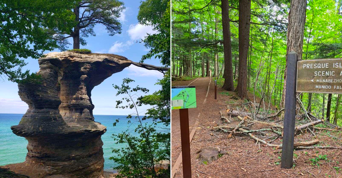
The trailhead looked peaceful enough. Sun filtering through hardwoods, the sound of water somewhere below, plus a parking lot with only three cars. Then I noticed the sign taped to the information board. Bear activity. Recent sightings.
Keep dogs leashed. I have hiked plenty of trails in this region, plus late summer changes everything. Berries ripen along the paths, bears forage closer to popular routes, plus what feels like a casual day hike can turn into a close encounter faster than you expect.
Twelve trails in this region carry enough bear history that locals plan around them from July through September. Some of the routes on this list are stunning, with waterfalls and overlooks that rival anything in the Midwest.
All of them require you to pay attention. Michigan hikers know that late summer on certain Upper Peninsula trails means sharing the path with black bears.
12. Chapel Loop And Chapel Falls Trail
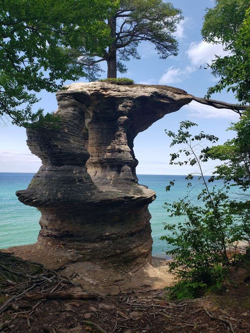
Turquoise water and rust-colored cliffs make Chapel Loop look almost too polished to be wild. Its roughly ten-mile route passes Chapel Falls, Chapel Beach, and Chapel Rock, where an old white pine clings to sandstone through exposed roots.
Late summer brings ripe berries and heavier bear feeding across Pictured Rocks National Lakeshore. Rather than treating every rustle as danger, watch for fresh tracks, scat, torn logs, or concentrated berry patches.
Talk at a normal volume, keep children close, and never approach wildlife for a photograph.
Backpackers must follow current park rules for storing food and scented supplies at campsites. Day hikers should keep snacks sealed and carry out every crumb.
If a black bear appears, stay calm, group together, avoid running, and slowly create distance. Check National Park Service alerts before tackling this long, sometimes isolated loop.
11. North Country Trail At Pictured Rocks
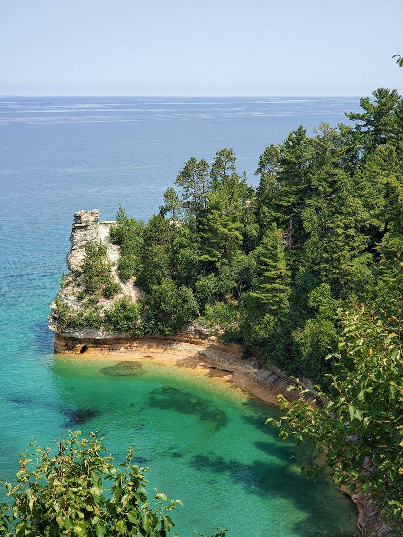
Lake Superior keeps appearing between the trees along this long section of the North Country National Scenic Trail. Within Pictured Rocks, the route follows more than forty miles of beaches, forest, sandstone cliffs, and remote backcountry camping areas.
Distance is the real trick here. A bear encounter miles from a road feels different from one near a crowded overlook, especially when food and cooking smells travel with backpackers.
Use park-provided food storage where available and confirm current requirements before departure. Never keep snacks, toothpaste, or scented toiletries inside a sleeping tent.
Late-summer hikers should make their presence known around blind bends, rushing streams, and thick vegetation. Keep dogs leashed under applicable park rules, because a loose pet can provoke wildlife and return with trouble behind it.
If conditions feel wrong, choose a shorter shoreline section and leave the deeper woods for another season.
10. O-Kun-De-Kun Falls Trail
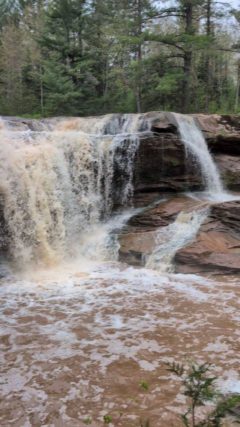
A curtain of water drops neatly from the sandstone ledge at O-Kun-De-Kun Falls, while a smaller cascade waits upstream. The forest route also overlaps the North Country Trail, giving this short outing a surprisingly remote personality.
Quiet surroundings are lovely, but silence can increase the chance of surprising an animal. Speak occasionally, clap near dense bends, and listen for movement beyond the river noise.
Black bears inhabit the Ottawa National Forest and spend late summer searching widely for berries, insects, nuts, and other calorie-rich foods.
Stay on the established path rather than pushing through fruiting shrubs for a better camera angle. Food scraps, including peels and seeds, belong back in your pack.
Walking behind the main waterfall may be possible during lower flow, but slick footing deserves attention too. Before visiting, check Ottawa National Forest notices and local weather, since road and trail conditions can change.
9. Porcupine Mountains Union Mine Trail
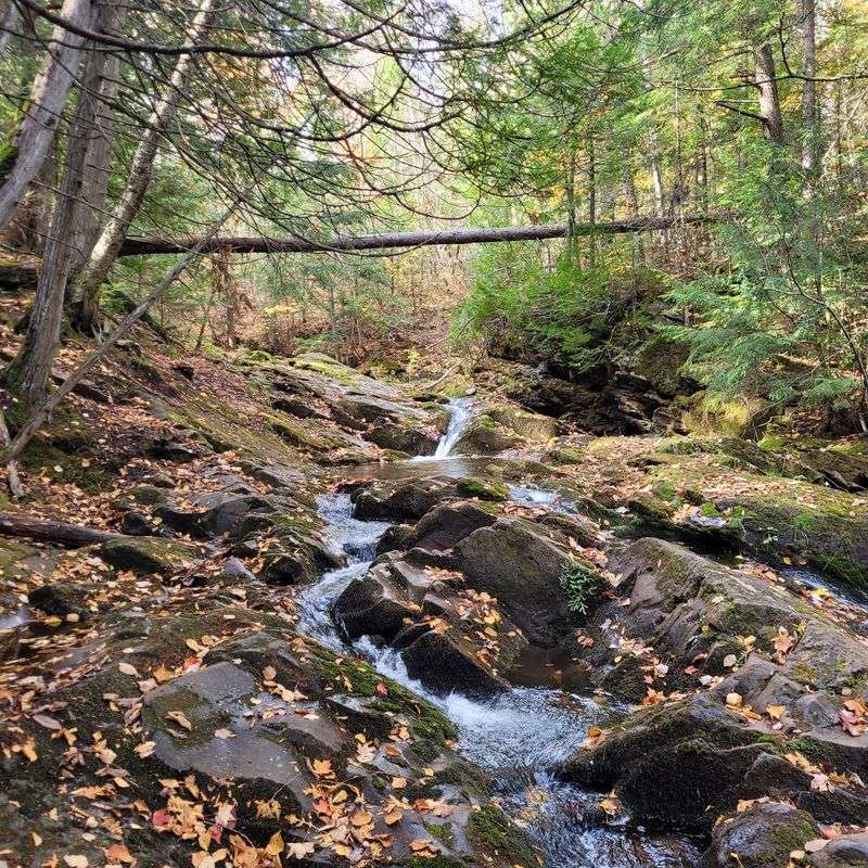
Copper dreams once pulled prospectors into these woods, but the forest reclaimed most signs of their brief rush. Union Mine Trail is a short interpretive loop beside the Union River, with cascades, old mining history, and shaded stretches that feel far removed from parking lots.
Its modest length should not lower anyone’s guard. Porcupine Mountains Wilderness State Park supports black bears, and late-summer feeding can bring them near berry growth, fallen timber, and river corridors.
Scan ahead, avoid wearing earbuds, and keep pets controlled according to park regulations. The river can also mask approaching sounds, so hikers should pause occasionally where visibility narrows and listen before rounding bends.
Even on this easy trail, carrying water, staying together, and keeping children close can make the outing calmer and predictable.
Historical markers make natural stopping points, though food should remain packed away rather than spread across a bench. Seeing a bear does not call for running or climbing a tree.
Face the animal, speak calmly, appear larger, and back away without blocking its escape. Ask park staff about recent activity before starting, because current field information beats rumor every time.
8. Grand Sable Dunes Trail
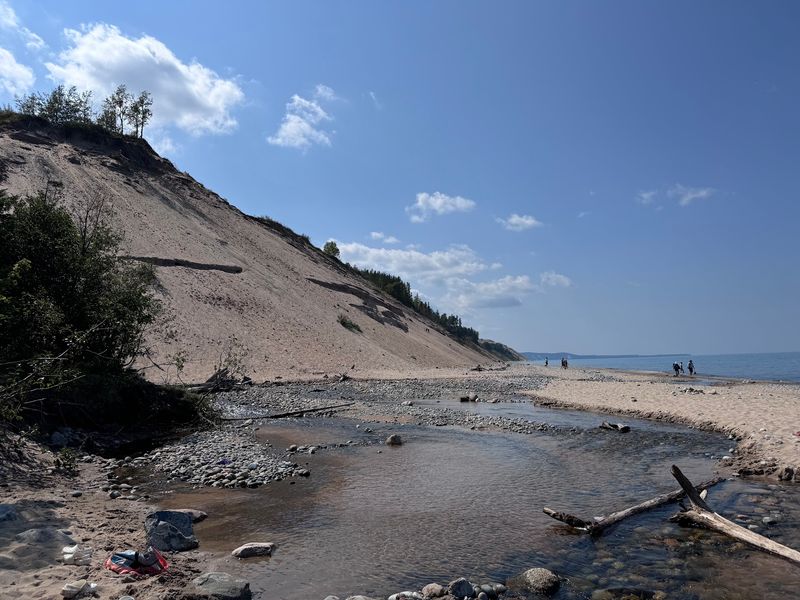
Wind rearranges Grand Sable’s sand grain by grain, yet the perched dunes still tower hundreds of feet above Lake Superior. The landscape looks open from a distance, while forest edges and sheltered hollows create cover for wildlife.
Black bears live throughout Pictured Rocks, although seeing one on exposed sand is not guaranteed. Greater caution makes sense where the route meets woods or berry-producing plants.
Stay on marked paths and overlooks, both for personal safety and to protect fragile dune vegetation from trampling.
Bright sun, loose sand, and limited shade can tire hikers before wildlife ever becomes a concern. Carry water, pack food in sealed containers, and avoid dawn or dusk if recent bear activity has been reported.
Never follow tracks or move closer to an animal. A wide view is best enjoyed from a wide distance, especially when a bear is busy feeding and focused on gaining weight.
7. Laughing Whitefish Falls Trail
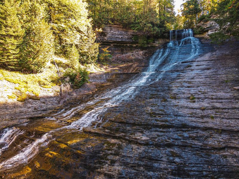
Laughing Whitefish Falls spreads across a pale limestone slope instead of making one clean plunge. Reaching the main view involves a short forest walk and a long staircase, where damp steps and rushing water demand steady attention.
The surrounding state forest is black bear habitat, even though trail-specific encounters are not a daily event. Early morning and evening provide quieter scenery, but they also overlap with active wildlife hours.
A midday visit may be the more comfortable choice when current reports suggest nearby activity.
Make conversation on the wooded approach and pause before rounding screened corners. Picnic food should stay secured until reaching a suitable developed area, and leftovers must leave with you.
If a bear notices your group, do not run or offer food. Gather together, speak firmly, and retreat slowly.
Check Michigan Department of Natural Resources updates, posted signs, and seasonal conditions before descending toward the falls.
6. Little Carp River Trail
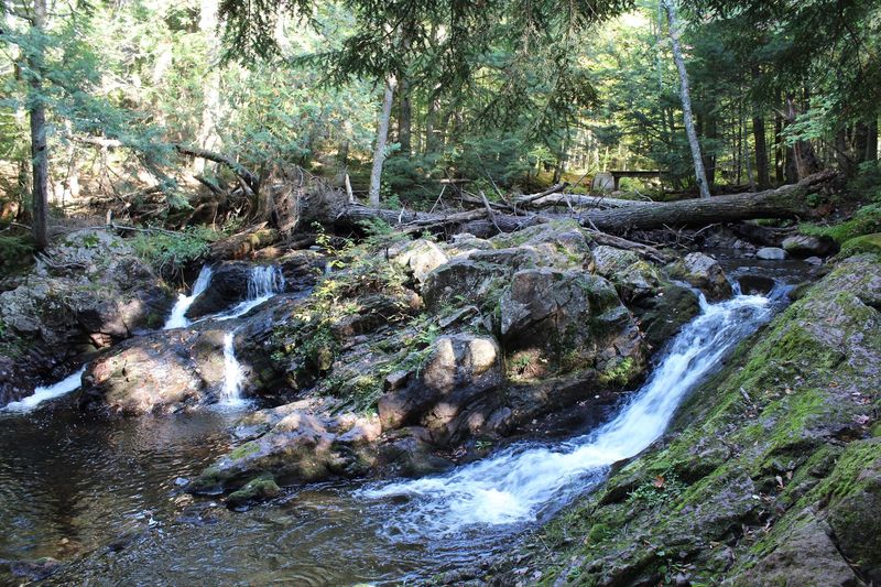
Water is the constant companion on Little Carp River Trail, tumbling past hemlocks, boulders, and waterfalls such as Greenstone and Overlooked Falls. Mud, wet roots, and river crossings can slow progress, which matters when daylight begins fading.
Deep forest and abundant natural food also make the corridor suitable bear habitat. Late in summer, give berry patches extra space and announce yourself near loud cascades, where flowing water can hide human footsteps.
Fresh scat or tracks are good reasons to turn around without embarrassment.
Backcountry travelers need a reliable food-storage plan that meets park rules, including scented items and cooking supplies. Keep a clean camp and prepare meals away from sleeping areas as directed.
Bear spray should remain quickly reachable, not buried beneath rain gear. Before committing to the route, ask rangers about crossings, closures, and recent wildlife reports.
Good information can save a wet, tense walk back.
5. Presque Isle River Trail
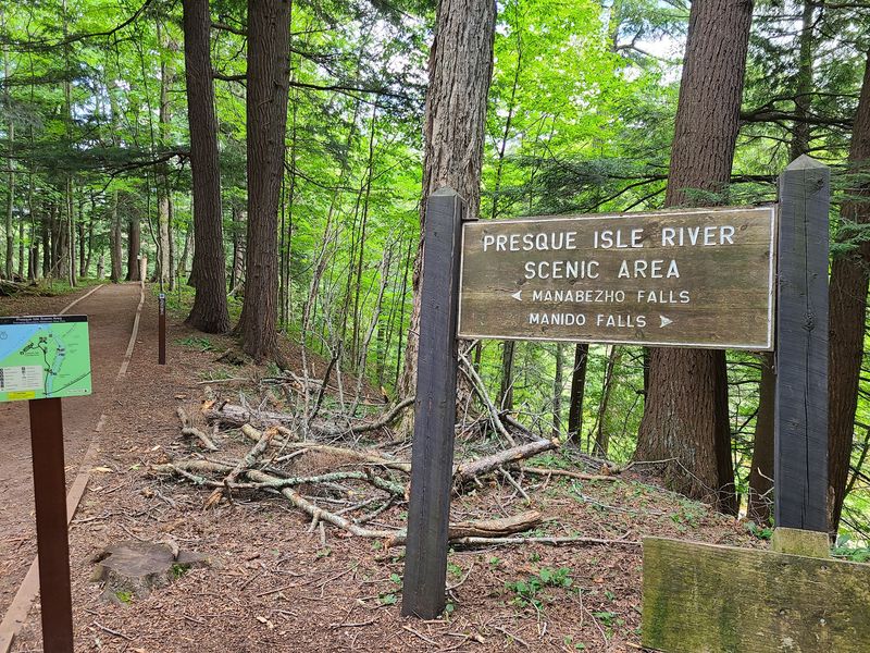
Dark bedrock gives the Presque Isle River an almost sculpted appearance, especially around Manabezho, Manido, and Nawadaha Falls. Wooden walkways and a suspension bridge connect views along the gorge, while spray keeps many surfaces slick.
Busy overlooks may feel reassuring, yet nearby woods remain part of a large wilderness park with resident black bears. Dense vegetation and the river’s roar can mask both hikers and animals.
Call out before entering screened sections, and do not step off trail to investigate movement.
Parking areas require care as well. Never leave food visible, toss scraps into vegetation, or assume a closed vehicle excuses a messy campsite.
Follow posted storage directions and keep coolers secured. Should a bear cross the route, stop, provide an open exit, and wait from a generous distance.
Park staff can share timely guidance, so checking at a contact station is smarter than relying on last year’s experience.
4. Wetmore Landing Trail
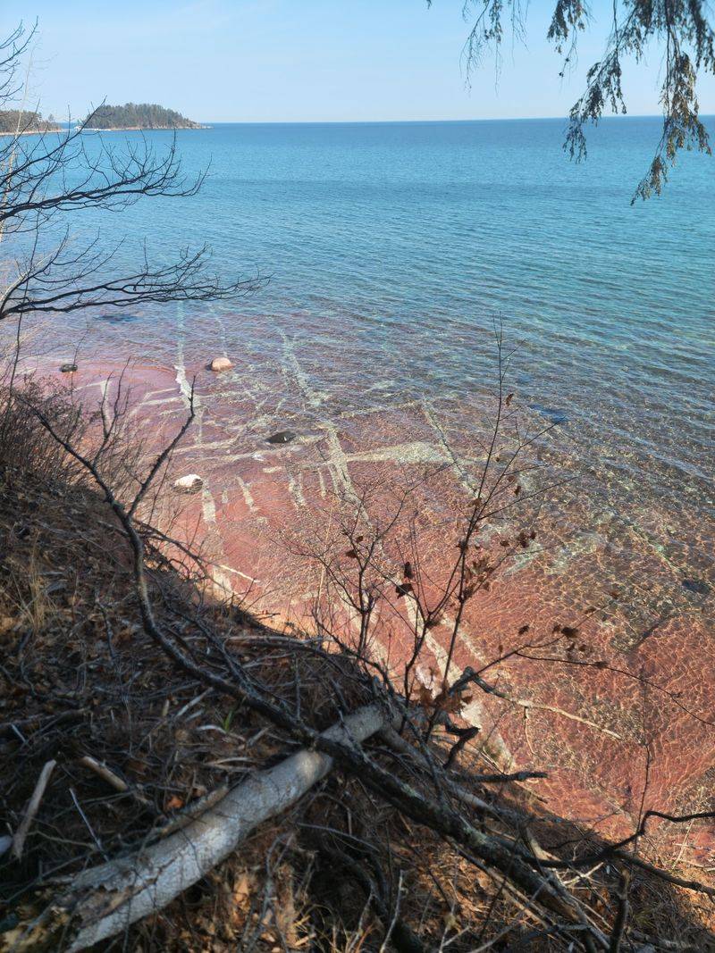
Lake Superior flashes blue through tall pines at Wetmore Landing, a popular shoreline access north of Marquette. One correction matters before driving: the site is reached from County Road 550, not H-58 near Munising, as some recycled listings incorrectly suggest.
Beach traffic can make the area seem less wild than it is. Forested sections connect with North Country Trail routes, and black bears occur across Marquette County.
Keep picnic baskets, wrappers, and dog food controlled from the moment the car door opens.
Climbs over roots and rocky ground can distract visitors, so scan ahead rather than watching only your boots. Leash pets, give berry shrubs a wide berth, and skip headphones in quiet stretches.
If recent bear activity is posted, enjoy the developed beach instead of continuing farther into cover. Confirm parking rules, trail conditions, and wildlife notices through reliable local land managers before visiting.
3. Au Sable Light Station Trail

An old Coast Guard road leads toward Au Sable Light Station, with Lake Superior keeping watch on one side and forest pressing close on the other. Pieces of historic shipwrecks may be visible along the shore when water conditions permit.
The mostly level route can encourage a relaxed pace, but Pictured Rocks remains bear country. Late-summer animals may forage near forest margins before winter.
Stay alert around vegetation, keep meals packed, and respect all closures protecting historic structures, wildlife, or unsafe shoreline areas.
Wind and waves sometimes make voices difficult to hear, so groups should remain together instead of spreading far apart. Never use shipwreck remains or the lighthouse grounds as picnic-trash stops.
If a bear appears, leave it a clear route and back away calmly without running. Check National Park Service alerts, tour schedules, and weather before setting out, since lighthouse access and lakeshore conditions may change seasonally.
2. Indian River Pathway Trail
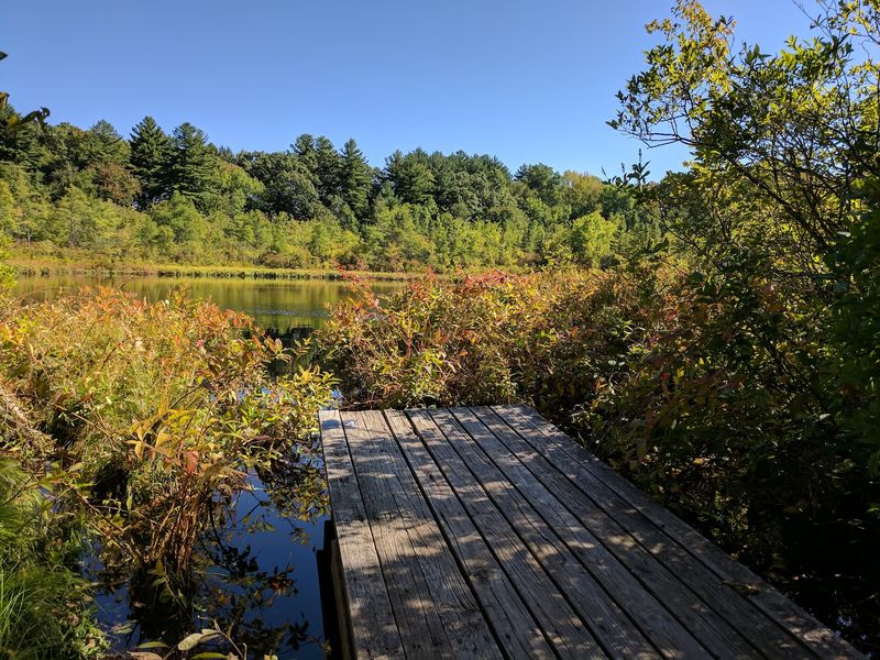
Marshy openings, hardwood forest, and quiet river bends give the Indian River area a softer mood than Lake Superior’s cliffs. Old logging traces add another layer, although vegetation has hidden much of the working landscape that once surrounded the waterway.
Hiawatha National Forest supports black bears across a broad area, and late summer is a major feeding period. Visibility can shrink near wetlands and thick brush, making steady conversation useful.
Avoid surprising wildlife by slowing down at bends and checking the trail ahead.
A canoe route and hiking path are not interchangeable, so confirm the intended trailhead and current map before traveling. Carry food in sturdy, sealed containers and keep scented items under control during every stop.
Anglers should secure bait and cleaned fish as carefully as lunch. When tracks, scat, or disturbed logs appear fresh, turn back or choose a busier recreation site rather than pressing deeper alone.
1. Valley Trail At Copper Peak
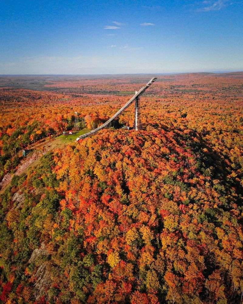
Copper Peak’s giant ski-flying structure rises above the forest like a machine from a different planet. Trails around the hill, including routes identified locally as Valley Trail, cross rugged western Upper Peninsula terrain beneath that unmistakable landmark.
Gogebic County holds extensive black bear habitat, and late-summer berries can draw feeding animals into wooded slopes. Trail names, permitted uses, and conditions may change, so obtain a current Copper Peak or local recreation map instead of depending on an old online track.
Make noise before tight turns and watch for cyclists where shared use is allowed. Keep bear spray accessible and know how to operate it before hiking.
Running from a black bear can trigger pursuit; stand together, speak firmly, and withdraw slowly instead. Attraction hours do not always match trail access, making a quick check with Copper Peak staff valuable before the drive south of Ironwood.