
12 Ohio Trails To Hike Before Summer Ends And The Leaves Change
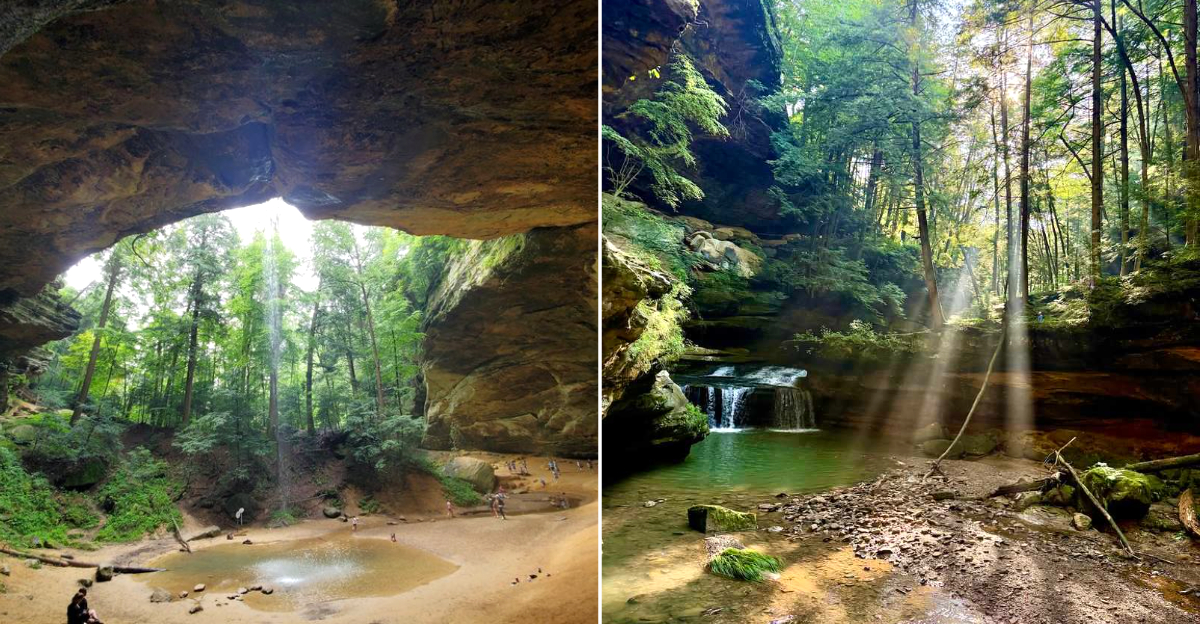
The shade feels different right before fall takes over. Creeks still run cool, sandstone walls hold onto the last bit of summer, and the forest starts looking like it knows a costume change is coming.
Across Ohio, these trails bring waterfalls, mossy ledges, deep gorges, paved river paths, shady hemlocks, rocky stairways, caves, overlooks, and just enough roots to remind you to watch your step.
Some hikes stay short and easy, while others make you earn the view with a little sweat and a much better camera roll.
This is the sort of hiking list that belongs in the final warm weekends of the season. Around here, green woods, cool stone, and one more trail before the leaves turn still know exactly how to make summer linger.
1. Ledges Trail, Peninsula
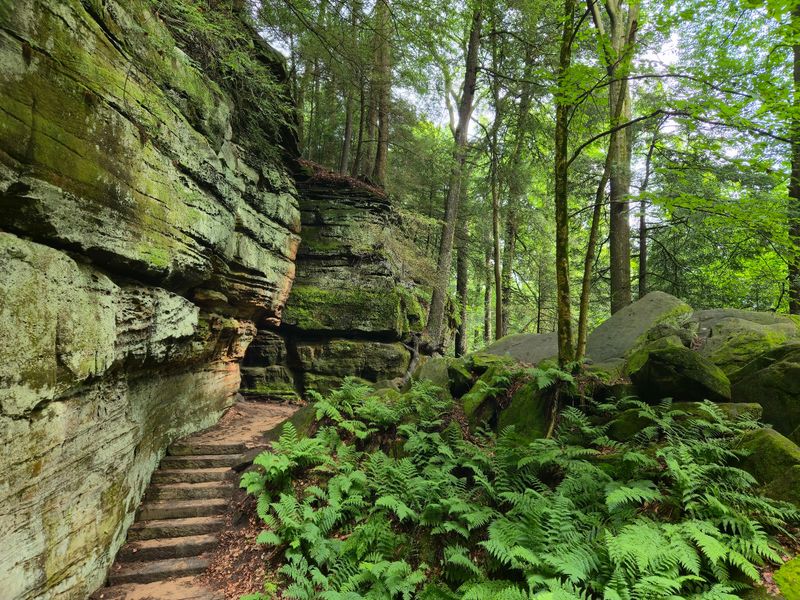
Towering rock walls covered in soft green moss make this loop feel like a secret world tucked inside Cuyahoga Valley National Park.
Located at 701 Truxell Rd in Peninsula, the path winds along sandstone ledges that were carved over thousands of years.
The 2.2 mile loop stays mostly flat, so families with kids can handle it without much fuss. Narrow passages between the boulders make the walk feel like a fun maze.
Summer is the ideal time here because the shade keeps things cool even on warm afternoons. The cracks in the rock stay chilly all day long.
Do not miss the popular overlook near the end, where you can watch the sun sink over the treetops. It is one of the best sunset spots in the whole park.
Wear shoes with good grip since the roots and rocks can get slippery. A small flashlight is handy if you want to peek into the shadowy crevices.
Come early on weekends because the parking lot fills up quickly with other hikers who love this place just as much.
2. Brandywine Gorge Trail, Sagamore Hills
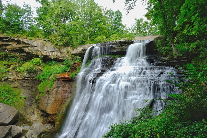
A thundering 60 foot waterfall is the star of this loop, and you can hear it long before you see it. Found at 8176 Brandywine Rd in Sagamore Hills, the trail rewards you with one of the tallest falls in the region.
The 1.4 mile loop takes most people less than an hour, making it a great choice when you want big views without a long trek.
A wooden boardwalk brings you right up to the falls for a close look at the rushing water. Mist floats up and cools your face on hot days.
After the waterfall, the path dips into a shady gorge filled with ferns and towering trees. The gentle creek beside you adds a peaceful soundtrack.
Late summer flows can slow down a bit, so visit after a good rain for the fullest show. The extra water makes those photos really pop.
Bring a small snack and take a break on one of the benches near the overlook. It is the perfect spot to soak up the scenery before heading back.
3. Old Man’s Cave Gorge Trail, Logan
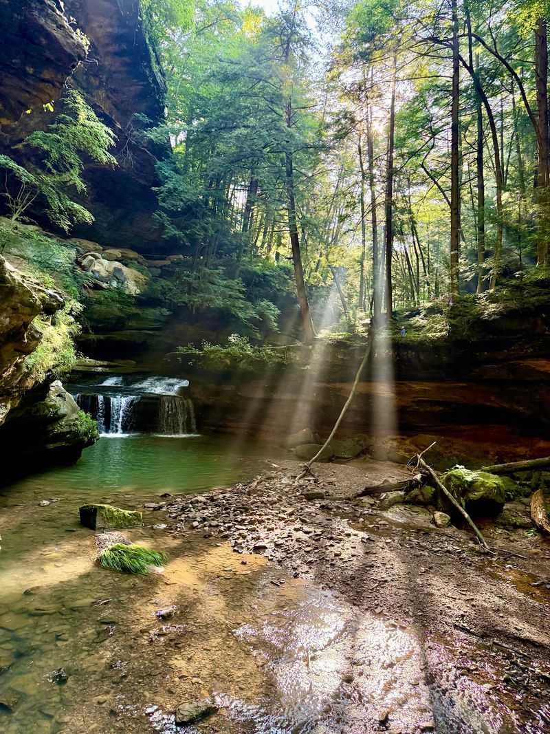
Few places in Ohio pack as much wonder into one walk as this famous gorge deep in Hocking Hills. You will find it at 19988 OH-664 Scenic in Logan, and it draws crowds for very good reasons.
The trail leads you past waterfalls, stone bridges, and a huge recess cave that gives the route its name. Every turn seems to reveal another postcard view.
Roughly one mile of winding path connects the upper falls to the lower falls. Steps carved into the rock make the journey feel like an adventure.
Summer keeps the gorge cool and green, with plenty of shade from the hemlock trees overhead. The temperature drops noticeably as you descend into the shadows.
Watch your footing near the water since the stones can be damp and slick. Handrails help in the trickier spots along the way.
Arrive early in the morning to beat the crowds and catch quiet moments by the falls. That golden light through the trees is truly unforgettable.
4. Ash Cave Gorge Trail, South Bloomingville
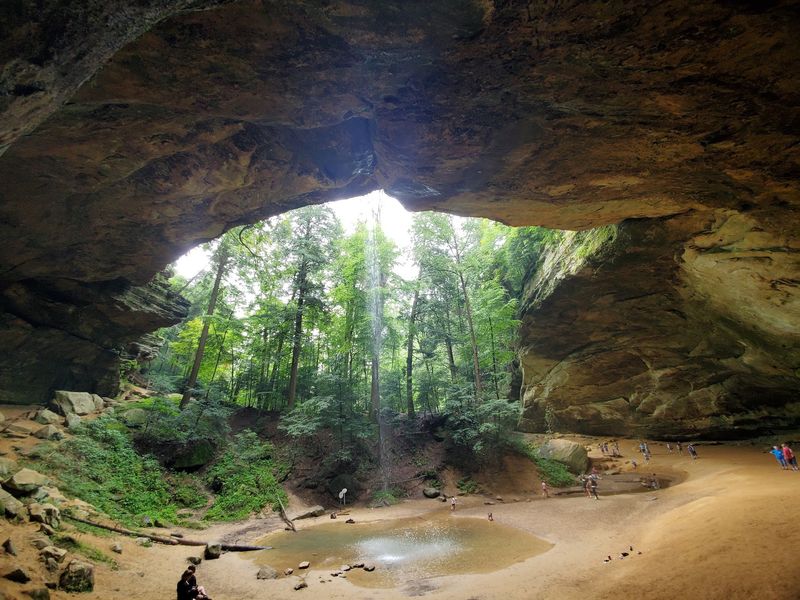
Standing beneath the giant horseshoe shaped rock shelter here will make you feel wonderfully small. The trail sits at 26400 OH-56 in South Bloomingville and leads to the largest recess cave in the state.
The main path is paved and flat, stretching about a quarter mile to the massive cave. That makes it friendly for strollers, wheelchairs, and tired little feet.
A thin ribbon of water spills over the rim and splashes into a pool below. The sound echoes softly against the curved stone walls.
Tall hemlocks line the gentle walk, filling the air with a fresh, woodsy scent. Summer keeps everything lush and shady the whole way in.
Look up to see how the ceiling arches high above your head. The scale of it all is genuinely jaw dropping.
If you want more of a workout, take the rim trail loop back for a different view from above. Pack your camera, because this spot deserves every photo you can take.
5. Conkles Hollow Gorge Trail, Rockbridge
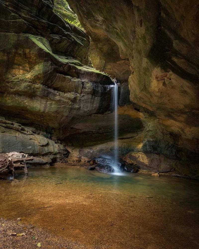
Deep and shadowy, this narrow gorge is often called one of the coolest spots in the region, and that is meant literally.
Located at 24858 Big Pine Rd in Rockbridge, it stays refreshingly cool beneath towering sandstone walls.
The lower Gorge Trail follows a paved, accessible path for about half a mile into the hollow. The smooth surface makes this the easier of the preserve’s two main hiking options.
Steep cliffs rise high on both sides, blocking much of the sunlight. Ferns and other cool-loving plants thrive along the gorge floor.
Families looking for the gentler experience can stick with the lower trail and enjoy the dramatic scenery without tackling exposed cliff edges.
More experienced hikers can climb to the rim trail for sweeping views above the gorge. That route is much more demanding and runs close to steep drop-offs.
Wear shoes with good traction and stay on the designated paths. This is a state nature preserve, and the terrain above the gorge deserves real caution.
6. Rock House Trail, Laurelville
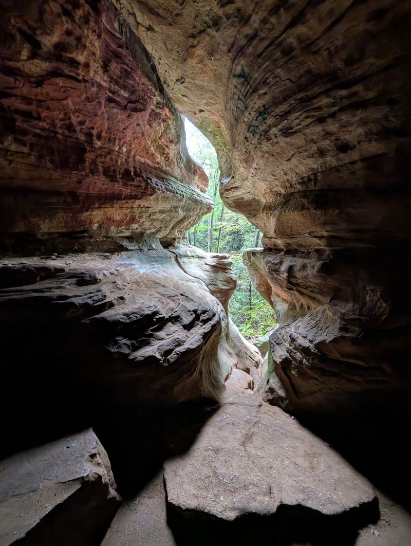
Imagine a cave that acts like a real house, complete with windows and a hallway carved right into the cliff. That is exactly what waits at 16350 OH-374 in Laurelville, and it is truly one of a kind.
The Rock House is the only true cave in Hocking Hills, tucked halfway up a sandstone wall. Natural openings let sunlight stream through in golden beams.
The trail is short, around half a mile, but includes a steady climb to reach the cave. Take your time on the stone steps leading up.
Inside, the ceiling arches high and the corridor stretches nearly 200 feet long. It stays cool and shady, offering a welcome break from summer heat.
Long ago, this natural shelter gave travelers a place to rest during storms. Standing inside, you can almost picture those early visitors.
Bring sturdy shoes since the ground can be uneven and dusty. Snap a photo through one of the rocky windows for a shot your friends will not believe.
7. Cantwell Cliffs Gorge Trail, Rockbridge
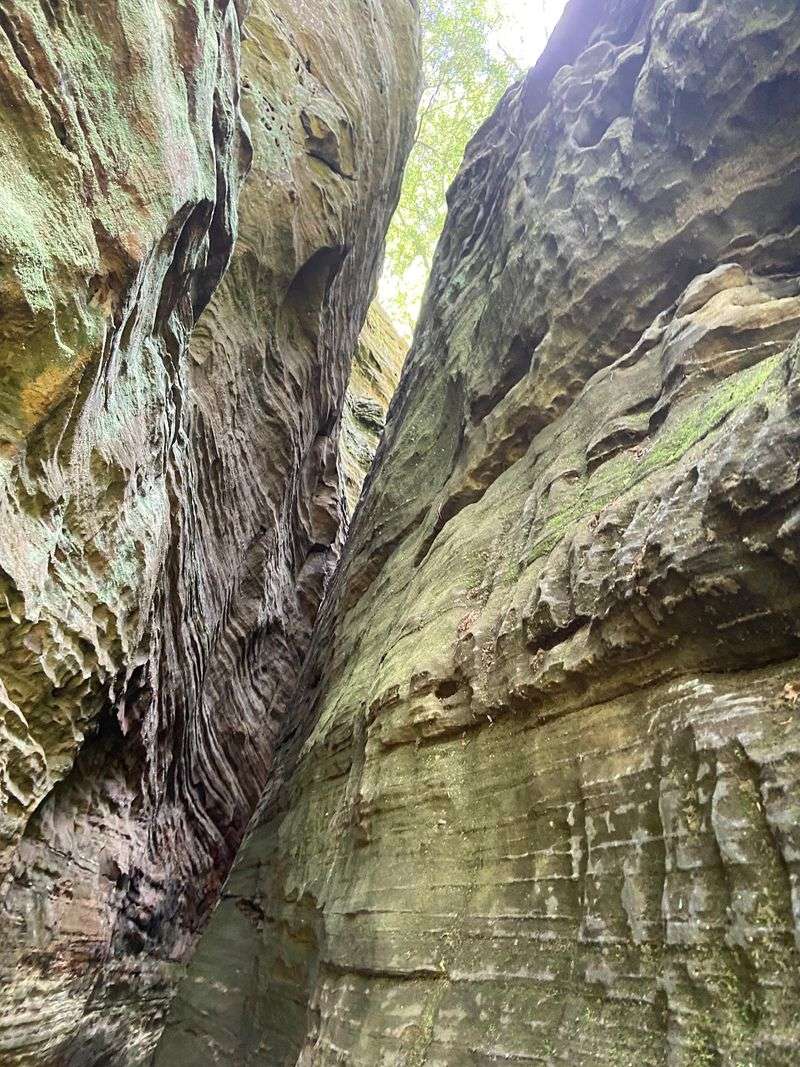
Tucked away in the quieter northern reaches of Hocking Hills, this rugged gorge rewards hikers willing to climb.
You will find it at 13640 OH-374 in Rockbridge, far enough from the busiest park areas to feel more remote.
Steep cliffs, stairs, and narrow passages make Cantwell Cliffs one of the more demanding hikes in Hocking Hills. The squeeze between large sandstone blocks is one of its signature features.
The main upper rim loop runs roughly one mile, with a shorter lower gorge section that lets hikers experience the cliffs from below.
The route packs a surprising amount of elevation change into a short distance. Rocky footing and repeated climbs make it feel longer than the mileage suggests.
Summer keeps the gorge floor cool and green, while overlooks along the rim open up wider views across the surrounding hills.
Wear shoes with solid grip, stay on the marked route, and take the stairs slowly. The scenery is dramatic enough that there is no reason to rush.
8. Hemlock Trail at Clear Creek Metro Park, Lancaster
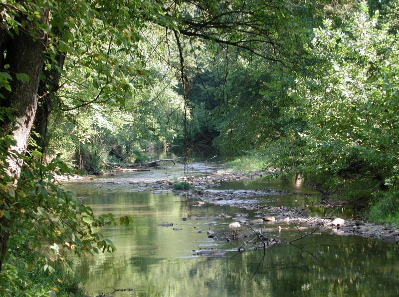
Peace and quiet come easily beneath the hemlocks at Clear Creek Metro Park, but this is not one of the park’s easy strolls. The park is located at 185 Clear Creek Rd in Lancaster.
The Hemlock Trail runs about 1.5 miles through shady groves, sandstone outcroppings, fern-covered slopes, and hardwood ridges.
Metro Parks officially rates the route difficult because it descends into a steep ravine and then climbs back out again.
That elevation change is part of the appeal. Dense hemlocks and rock formations make the trail feel wonderfully secluded once you leave the road behind.
Summer shade helps with the heat, but sturdy footwear and water are smart choices for the climbs.
Birdwatching is excellent throughout Clear Creek, so leave yourself enough time to slow down between the steeper sections.
This is a trail for hikers who want a short distance with a little more work behind it.
9. South Gorge Trail at John Bryan State Park, Yellow Springs
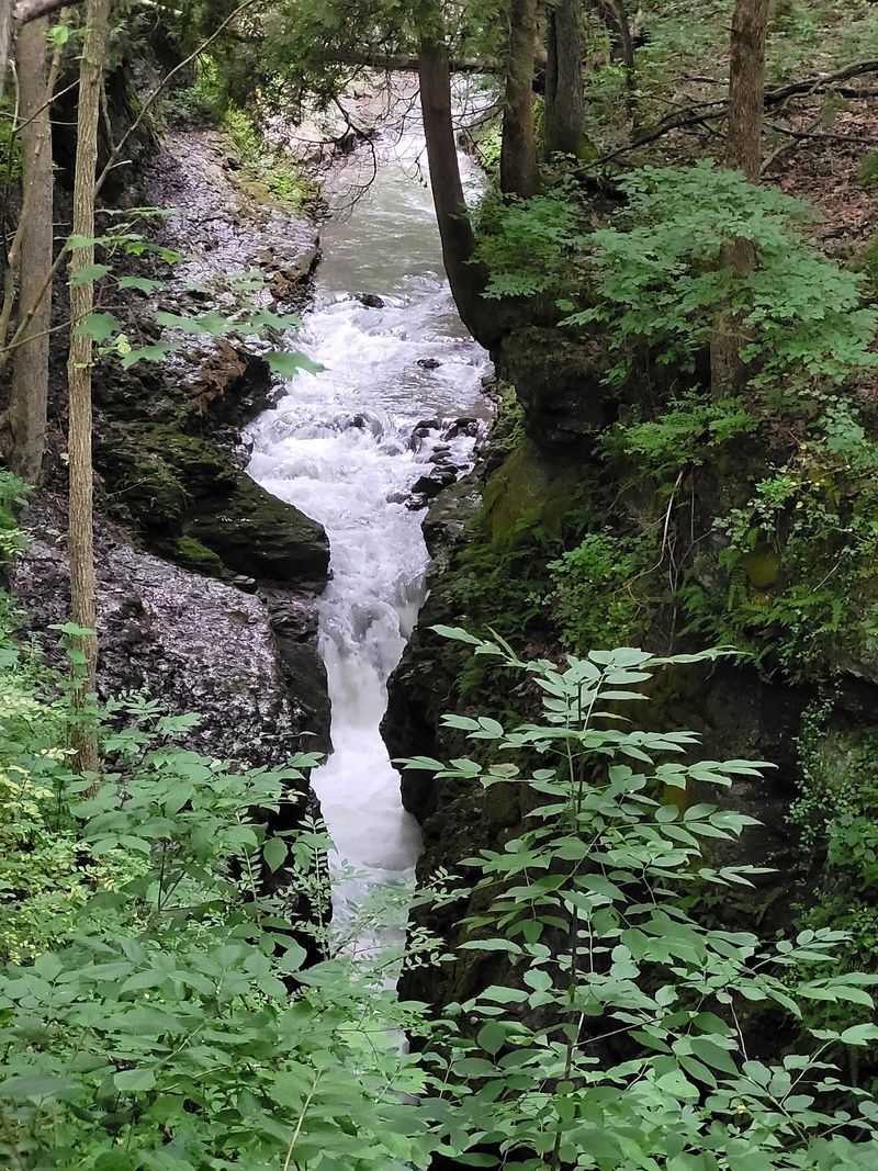
Carved by the Little Miami River, John Bryan State Park offers some of the prettiest gorge-side hiking in southwest Ohio. The park entrance is at 3790 OH-370 in Yellow Springs.
The South Gorge Trail runs roughly 1.2 miles along the southern side of the gorge and connects with other trails near the river.
You can combine it with the Pittsburgh-Cincinnati Stage Coach Trail or North Rim Trail to build a longer loop through the park.
The trail network also connects toward neighboring Clifton Gorge State Nature Preserve, making it easy to turn one hike into a much longer outing.
Summer brings lush greenery and the steady sound of the Little Miami River. Shade along the gorge helps on warmer afternoons.
Expect uneven dirt and rocky sections rather than a smooth paved walk. Proper hiking shoes make the route much more comfortable.
Take your time and enjoy the mix of forest, cliffs, and river views. The real advantage here is how easily one trail connects to the next.
10. Clifton Gorge Trail, Yellow Springs
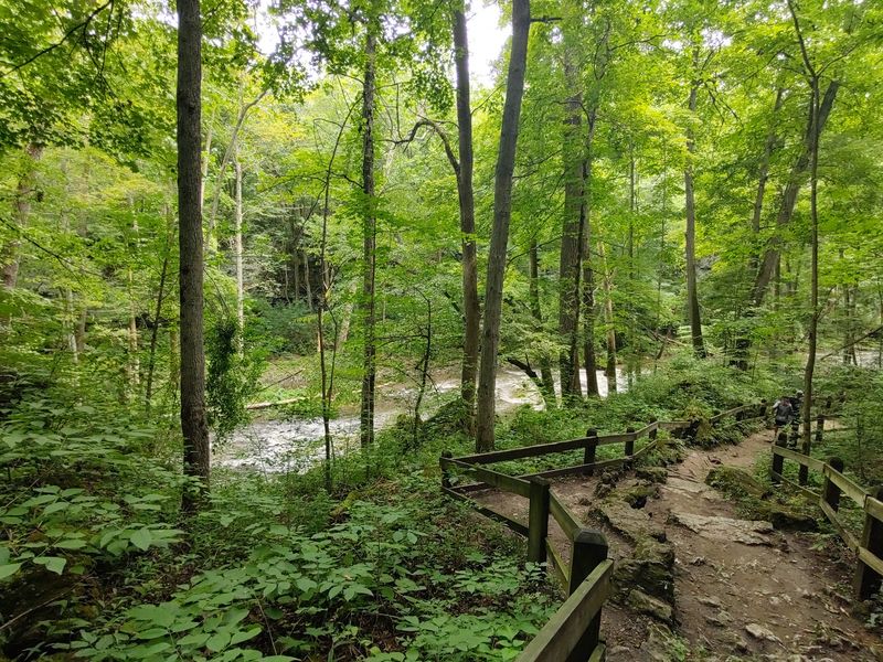
Dramatic rapids and steep limestone walls make this one of the most striking hikes in the whole area. The trail sits at 2381 OH-343 in Yellow Springs and protects a stunning stretch of the Little Miami River.
The narrow gorge squeezes the water into fast, churning rapids that roar past the rocks. The sound alone is worth the trip.
Well maintained paths and overlooks let you enjoy the views safely. Interpretive signs share the fascinating story of how the gorge formed.
Summer coats the cliffs in green, with delicate wildflowers tucked into the crevices. Birds flit between the trees while the river rushes below.
The route ranges from easy upper paths to a more rugged lower trail. You can pick the level that suits your energy that day.
Because it is a state nature preserve, staying on the marked path is important. Doing so keeps the fragile plants safe for everyone.
Bring your camera and plenty of curiosity. This gorge blends natural beauty and history into one unforgettable walk.
11. Nelson-Kennedy Ledges Trails, Garrettsville
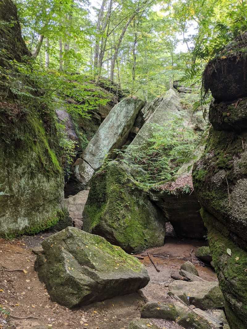
A playground of towering rock formations awaits at this compact trail system in northeast Ohio. You will find the ledges at 12440 OH-282 in Garrettsville.
Four color-coded trails weave through narrow passages, mossy cliffs, caves, and waterfalls, but their difficulty levels vary dramatically.
The Blue Trail is 0.8 mile and rated moderate. The White Trail is 0.4 mile and easy, while the Yellow Trail is a 0.2-mile moderate route.
The Red Trail is the serious one. It is only 0.2 mile long but officially rated extreme, with tight passages and much more demanding terrain.
Features such as Devil’s Icebox, Dwarf’s Pass, The Narrows, Cascade Falls, and Minnehaha Falls pack a remarkable amount of scenery into a small park.
The rocks can stay wet and slippery even when the weather is dry, so sturdy shoes with good grip are essential.
Stay on the marked trails and choose the color that matches your comfort level. The short mileage can be misleading here.
12. Blackhand Trail, Heath
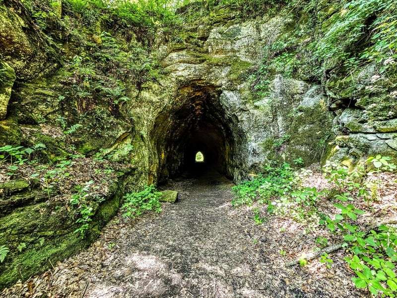
Easygoing and packed with history, this paved riverside route makes a relaxing finish to the list. The eastern trailhead is at 2200 Gratiot Rd SE in Heath.
The Blackhand Trail runs about 4.3 miles through Blackhand Gorge State Nature Preserve and follows the Licking River for much of its route.
The asphalt surface and gentle former-railroad grade make it popular with walkers, runners, cyclists, and families.
Tall sandstone walls and the famous Deep Cut add plenty of drama without requiring a rugged hiking surface.
The preserve’s historic interurban tunnel is worth knowing about, but it is not located on the paved Blackhand Trail. The tunnel is reached separately along the Canal Lock Trail.
The area’s name comes from a historic hand-shaped Indigenous petroglyph that once marked a sandstone cliff and was destroyed during canal construction.
One important 2026 note is that construction and slope-stabilization work can affect trail access. Check the latest ODNR conditions before making a long drive.
When access is clear, this paved gorge route is an easygoing way to close out the final warm weekends of the season.