
11 Missouri Trails Where Strange Rock Formations Make The Hike Worth It
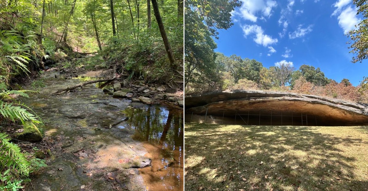
What if the best part of a Missouri hike isn’t the hike? Hear me out.
You can spend two hours following a trail, dodging roots, sweating through your shirt, and pretending that incline “isn’t that bad”, only to realize the payoff is a rock formation that looks like it wandered in from another planet.
That’s the fun here.
Some of these trails lead to boulders stacked like someone got a little too ambitious with Jenga, arches carved by time, and cliffs that seem wildly out of place in the middle of the woods.
And honestly, that’s way more interesting than another scenic overlook you’ll forget by Tuesday. So, where are these geological weirdos hiding?
We found the Missouri trails where the rocks aren’t just part of the scenery. They’re the reason you’ll want to keep walking.
1. Braille Trail At Elephant Rocks State Park
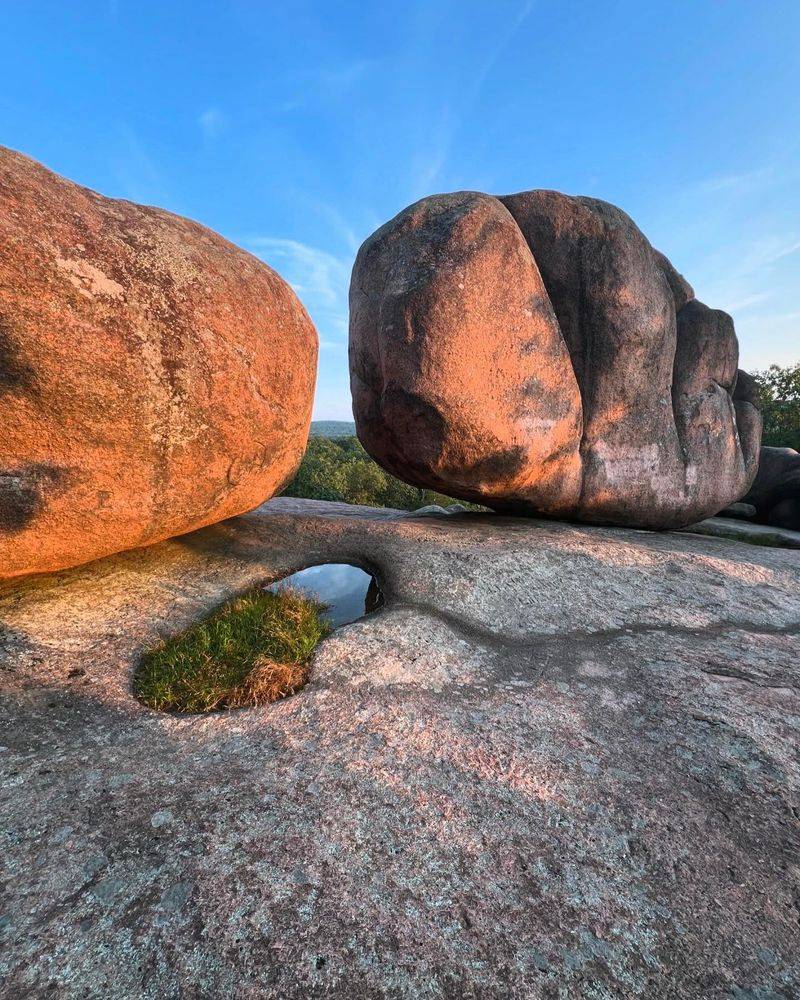
Some boulders do not just sit there looking pretty. They demand your full attention the moment you round the corner and realize they are as tall as a three-story building.
Located at 7406 Highway 21, Belleview, MO 63623, Elephant Rocks State Park gets its name from these colossal pink granite formations that genuinely resemble a parade of elephants frozen mid-stomp.
These rocks are around 1.5 billion years old, making them some of the oldest exposed granite in North America. Each boulder started as cooling magma deep underground, and erosion slowly revealed them over millions of years.
Some weigh up to 680 tons and stand 27 feet tall, which is the kind of scale that makes your brain do a little recalculation.
The Braille Trail is paved and fully accessible, winding right through the formations so you can touch the smooth, sun-warmed surfaces yourself. Look closely for solution pans on top of the granite, shallow basins carved by weathering that collect rainwater.
This trail proves that accessible paths can still deliver truly extraordinary geological experiences.
2. Trail Through Time At Pickle Springs Natural Area
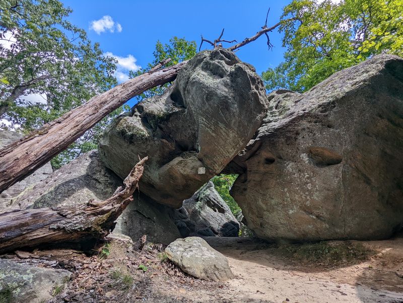
Pickle Springs Natural Area sounds like it should smell like a deli, but what it actually delivers is one of the most visually stunning geological hikes in the entire state.
The Trail Through Time, a two-mile loop just off Dorlac Road, Farmington, MO 63640, earns every bit of its dramatic name with features that feel almost theatrical.
The trail cuts through 500 million years of erosion history carved into ancient LaMotte sandstone. You will squeeze through a feature called The Slot, a narrow canyon passage where the walls press close and the light filters in from above like something out of a fantasy novel.
Then there is the Keyhole, another tight sandstone passage that frames the forest beyond it like a living painting.
Cauliflower Rocks, which are hoodoo-like pillars weathered into bumpy, organic shapes, dot the landscape in genuinely surreal ways. A double arch also appears along the route, offering one of the most photogenic moments on any Missouri trail.
The whole experience feels less like a hike and more like walking through a geology textbook that someone made incredibly beautiful.
3. Clifty Creek Natural Bridge Trail
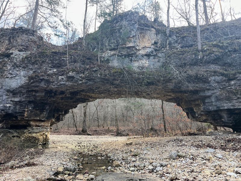
Not every treasure announces itself with a big sign and a gift shop. Some of the best geological wonders in Missouri require a little effort, and Clifty Creek Natural Bridge Trail is exactly that kind of reward.
Head out to County Road 511, Dixon, MO 65459, and prepare for a 2.7-mile loop that earns its highlight with every step.
The centerpiece is a 40-foot-long natural rock bridge formed by Clifty Creek slowly carving through Gasconade dolomite over an extraordinary stretch of time. Standing 13 feet high, the arch frames the creek below in a way that feels almost architectural, like nature hired a very patient sculptor.
The surrounding bluffs and rocky glades add layers of visual interest throughout the entire hike.
Here is a genuinely mind-bending detail: look carefully at the rock under and around the arch, and you may spot disc-shaped stromatolite fossils embedded in the dolomite. These are remnants of some of the earliest life forms on Earth, preserved in the very rock you are standing on.
Clifty Creek quietly hides billions of years of planetary history in a single afternoon hike.
4. Colosseum Trail At Ha Ha Tonka State Park
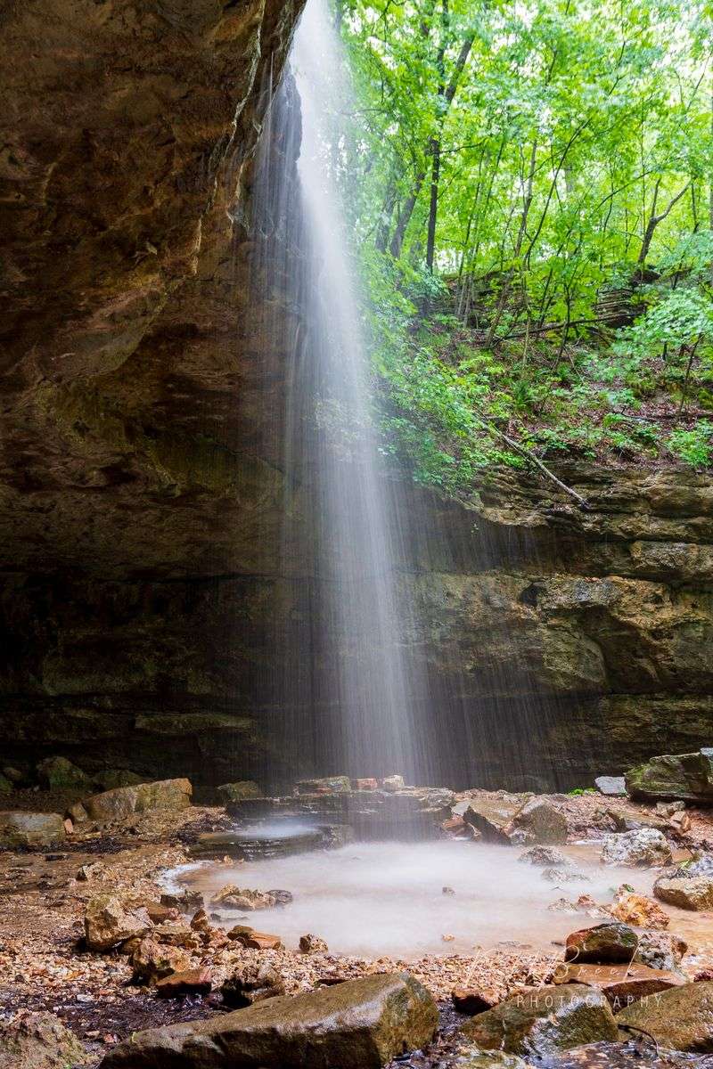
The name Ha Ha Tonka sounds playful, but the geology here is nothing short of epic. This is karst country, where water has spent millions of years dissolving limestone bedrock from the inside out, leaving behind some of the most dramatic formations in the Midwest.
The park sits at 1491 State Road D, Camdenton, MO 65020, right along the Lake of the Ozarks shoreline.
The Colosseum Trail takes you to a natural bridge spanning 60 feet wide and soaring over 100 feet into the air.
That alone would be enough, but then you reach the Colosseum itself: a massive theater-shaped sinkhole measuring 500 feet long and 300 feet wide, formed when a giant underground cavern simply gave way.
The scale of it stops you mid-sentence.
Sheer bluffs rising up to 250 feet line sections of the trail, and Balanced Rock formations perch along the edges. The park also features multiple caves and sinkholes scattered throughout, each one a chapter in the same long story of water reshaping stone.
Ha Ha Tonka is proof that Missouri’s landscape has serious dramatic range.
5. Natural Bridge Trail At Grand Gulf State Park
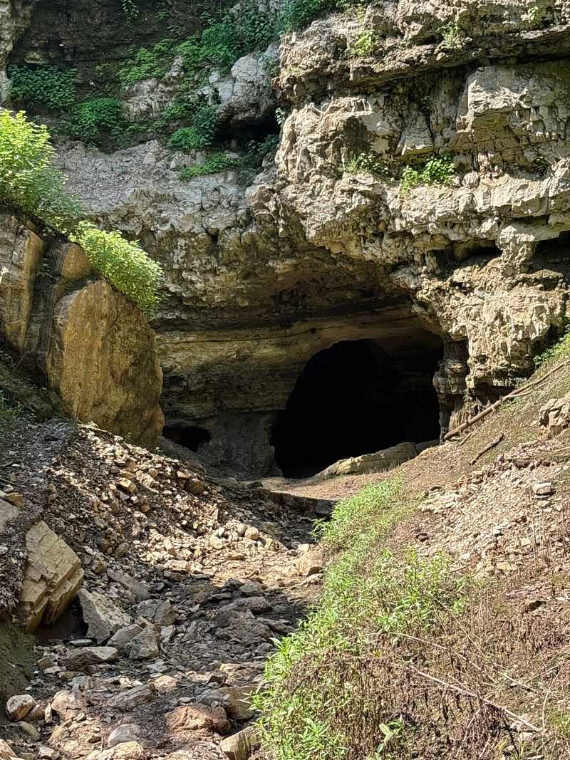
Missouri has its own version of a grand canyon, and most people have never heard of it. Grand Gulf State Park, found off Highway W, Thayer, MO 65791, protects a chasm that stretches nearly a mile long and plunges up to 130 feet deep into the Ozark bedrock.
The locals call it Missouri’s Little Grand Canyon, and that title is completely justified.
The star of the show is a 250-foot natural bridge, one of the largest in the United States, formed when the roof of a massive cave system collapsed roughly 10,000 years ago. What remains is a breathtaking remnant arch spanning the gorge, framing views of the vertical canyon walls below.
The entire landscape tells the story of acidic groundwater dissolving limestone and dolomite over geological timescales.
One of the most fascinating details here is that Bussell Branch, a surface creek, actually disappears into the chasm and travels underground for miles before re-emerging in Arkansas. Watching a creek vanish into the earth mid-hike is the kind of moment that makes you stop and genuinely reconsider everything you thought you knew about rivers.
Grand Gulf is spectacular in the most understated Missouri way.
6. Shut-Ins Trail At Johnson’s Shut-Ins State Park
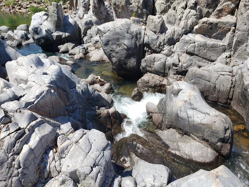
Imagine a natural water park carved by a river over 1.5 billion years, and you are starting to get the picture at Johnson’s Shut-Ins.
Located at 148 Taum Sauk Trail, Middle Brook, MO 63656, this park earns its unusual name from the geological term for a narrow gorge where a river gets squeezed between resistant rock walls.
The East Fork Black River has been grinding through ancient rhyolite and granite for an almost incomprehensible stretch of time, sculpting smooth potholes, rushing chutes, and cascading falls directly into the igneous rock.
The result is a series of natural slides and swirling pools that look like they were designed by someone who really understood fun.
The rock itself glows with warm pink and purple tones that photograph beautifully in afternoon light.
The Shut-Ins Trail winds through boulder fields and igneous glades, giving you the geological context for what the river has been quietly building. Every curve of the rock, every polished surface, represents countless years of sand-laden water doing its patient work.
Standing in the middle of those formations and feeling the current push around ancient stone is a genuinely humbling experience.
7. Mina Sauk Falls Trail At Taum Sauk Mountain State Park
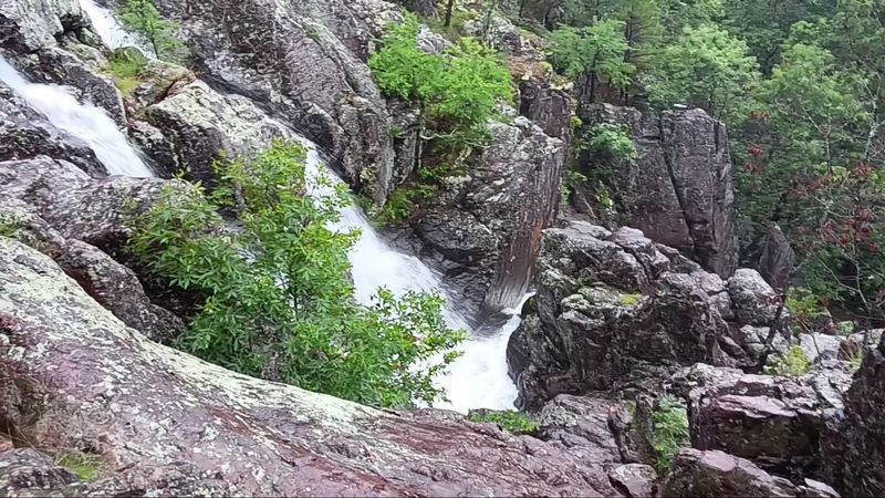
Standing on the highest point in Missouri feels like a reward all on its own. Taum Sauk Mountain State Park, off Highway CC, Ironton, MO 63656, sits atop the St. Francois Mountains, one of the oldest exposed igneous landscapes in North America, shaped by volcanic activity roughly 1.5 billion years ago.
The elevation reaches 1,772 feet, and the views match the ambition.
The Mina Sauk Falls Trail leads you across rocky volcanic terrain to Missouri’s tallest waterfall, a 132-foot cascade that drops over a series of layered rhyolite ledges in a series of dramatic stages. After a strong rain, the falls roar with enough force to feel it in your chest.
Even in drier conditions, the volcanic rock formations surrounding the falls are worth every step of the journey.
Along the trail, you will pass through Devil’s Tollgate, an 8-foot-wide slot cut through 50 feet of volcanic rhyolite standing 30 feet high on either side. It is the kind of geological feature that stops you completely and demands a moment of quiet appreciation.
Taum Sauk is where Missouri’s ancient volcanic past becomes something you can walk through with your own two feet.
8. Kaintuck Hollow Natural Bridge Trail
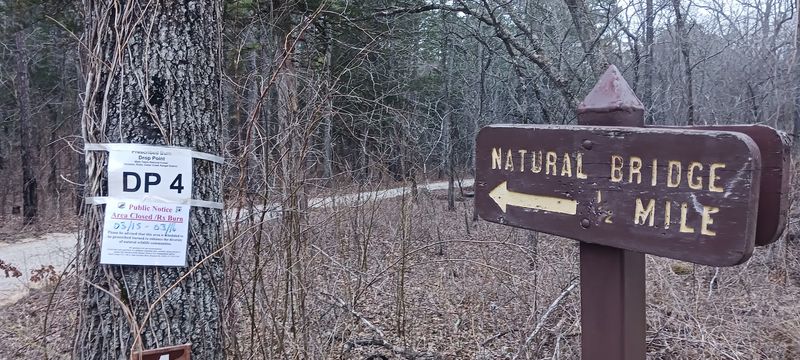
Mark Twain National Forest holds more geological secrets than most people realize, and Kaintuck Hollow is one of the best-kept ones.
Head out to Forest Service Road 1592, Newburg, MO 65550, and you will find a trail system that rewards curiosity with some genuinely remarkable rock formations tucked into deep Ozark valleys.
The centerpiece is a natural bridge formed when a waterfall eroded through Gasconade dolomite, carving an arch that nature spent a very long time perfecting. The surrounding landscape features sinkholes, rocky hollows, and dramatic valley walls that shift with every turn of the trail.
The area sits within a network of 16 looping miles, so there is plenty of terrain to explore beyond the main attraction.
A 175-foot natural tunnel also exists within the trail system, a remnant of a massive collapsed or eroded cavern system that once ran beneath the forest floor. The sheer scale of what water can accomplish underground becomes very real when you stand at its entrance and look into the dark.
Kaintuck Hollow is the kind of place that rewards hikers who are willing to venture a little further off the beaten path.
9. Allen Brohn Memorial Trail At Hickory Canyons Natural Area
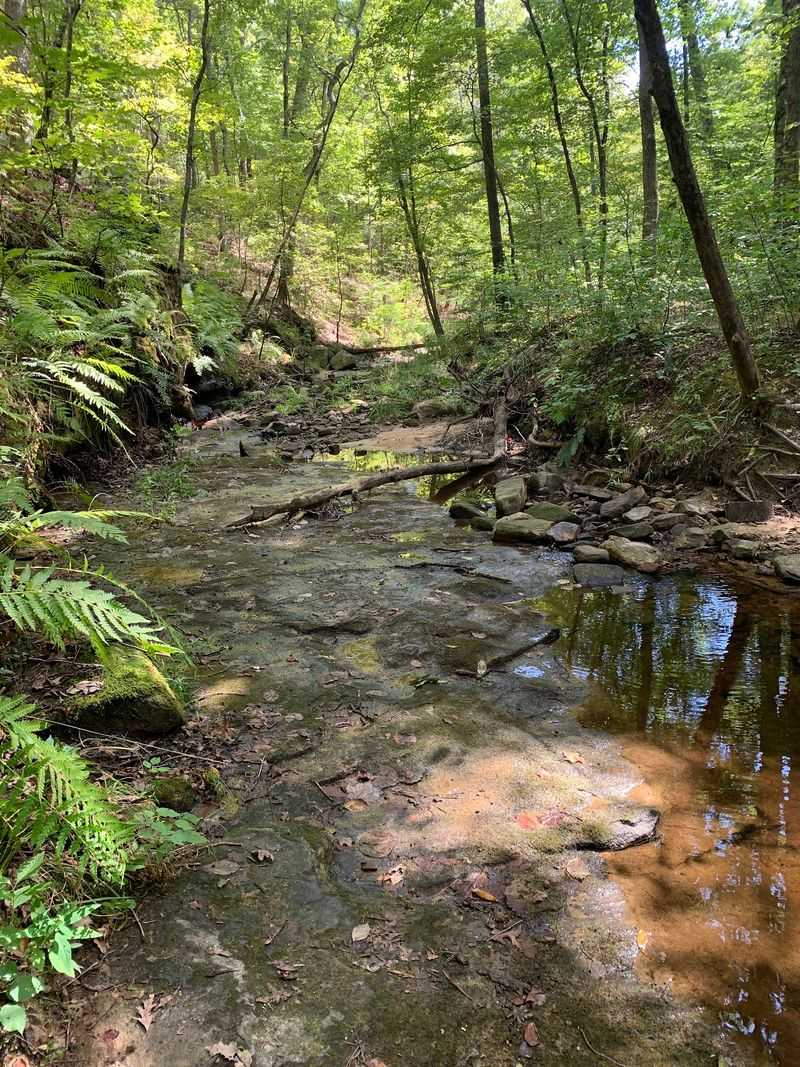
Five hundred million years ago, a shallow ocean covered what is now southeastern Missouri. The sandy beaches of that ancient sea compressed over time into LaMotte sandstone, and erosion has spent the last several million years revealing what that process left behind.
The Allen Brohn Memorial Trail at Hickory Canyons Natural Area, on Sprott Road, Ste. Genevieve, MO 63670, puts you right in the middle of that story.
Massive box canyons drop away from the forested ridgeline, their sandstone walls streaked with mineral stains and draped in ferns during warmer months. The trail descends into heavily shaded ravines where the air cools noticeably and the rock outcroppings seem to lean in from every direction.
Seasonal wet-weather waterfalls spill over the sandstone ledges after a good rain, turning an already beautiful hike into something genuinely cinematic.
Winter brings its own kind of magic here, when the bluff faces collect ice and transform into sparkling frozen curtains that catch whatever winter light filters through the bare trees. The contrast between the buff-colored sandstone and the ice formations is striking in a way that photographs struggle to capture.
Hickory Canyons earns its reputation as one of Missouri’s most underrated natural areas, full stop.
10. Sandstone Canyon Trail At Don Robinson State Park
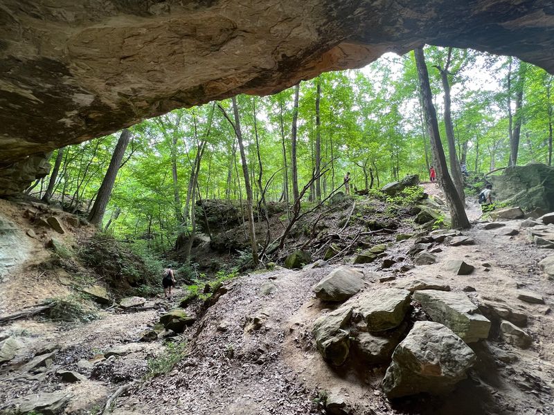
Don Robinson State Park is one of Missouri’s newer additions to the state park system, and it arrived with a seriously impressive geological resume.
Located at 9275 Byrnesville Road, Cedar Hill, MO 63016, the park protects a fascinating mosaic of limestone, dolomite, and St. Peter sandstone that has been shaped by millions of years of erosion from an ancient Paleozoic sea shoreline.
The Sandstone Canyon Trail guides you through dramatic box canyons with walls that rise in layered shelves, each stratum representing a different chapter of geological time.
Shelter caves appear along the route, carved into the cliff faces where softer rock eroded away beneath more resistant layers above.
The canyon floor stays shaded and cool even on warm days, making this one of the more comfortable summer hikes on the list.
Seasonal waterfalls add a dynamic element to the experience depending on recent rainfall, and the layered rock walls display a color palette that ranges from warm tan to deep gray. The glades scattered throughout the park offer open views that contrast beautifully with the enclosed canyon sections.
Don Robinson is still building its reputation, but the geology was already extraordinary long before anyone named a park after it.
11. Graham Cave Trail At Graham Cave State Park
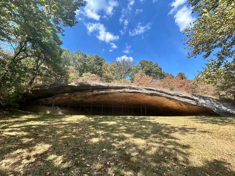
Graham Cave has a story that stretches back over 10,000 years, and the trail that leads you there feels appropriately timeless.
Located at 217 Highway TT, Danville, MO 63361, Graham Cave State Park centers on one of Missouri’s most historically significant geological features: a broad sandstone cave with an entrance spanning 120 feet wide and 16 feet high.
The cave formed at the contact zone between Jefferson City dolomite and St. Peter sandstone, where groundwater, wind, and freeze-thaw cycles worked together over millions of years to hollow out this remarkable shelter.
The arch-like opening frames the forest beyond it in a way that feels almost intentional, as if the rock arranged itself specifically for dramatic effect.
Ancient humans recognized quality shelter when they saw it, using this cave continuously for thousands of years.
The surrounding trail also passes through sandstone and dolomite glades, rocky hillsides, and seasonal wet-weather waterfalls that bring extra energy to the landscape after rainfall. The geological diversity packed into this relatively compact park is genuinely impressive.
Graham Cave is where Missouri’s deep human history and its even deeper geological history overlap in a single remarkable place. Have you ever stood somewhere and felt the full weight of time pressing in from every direction?