
12 Gorgeous Waterfalls Around Pictured Rocks Michigan You Don’t Want To Miss
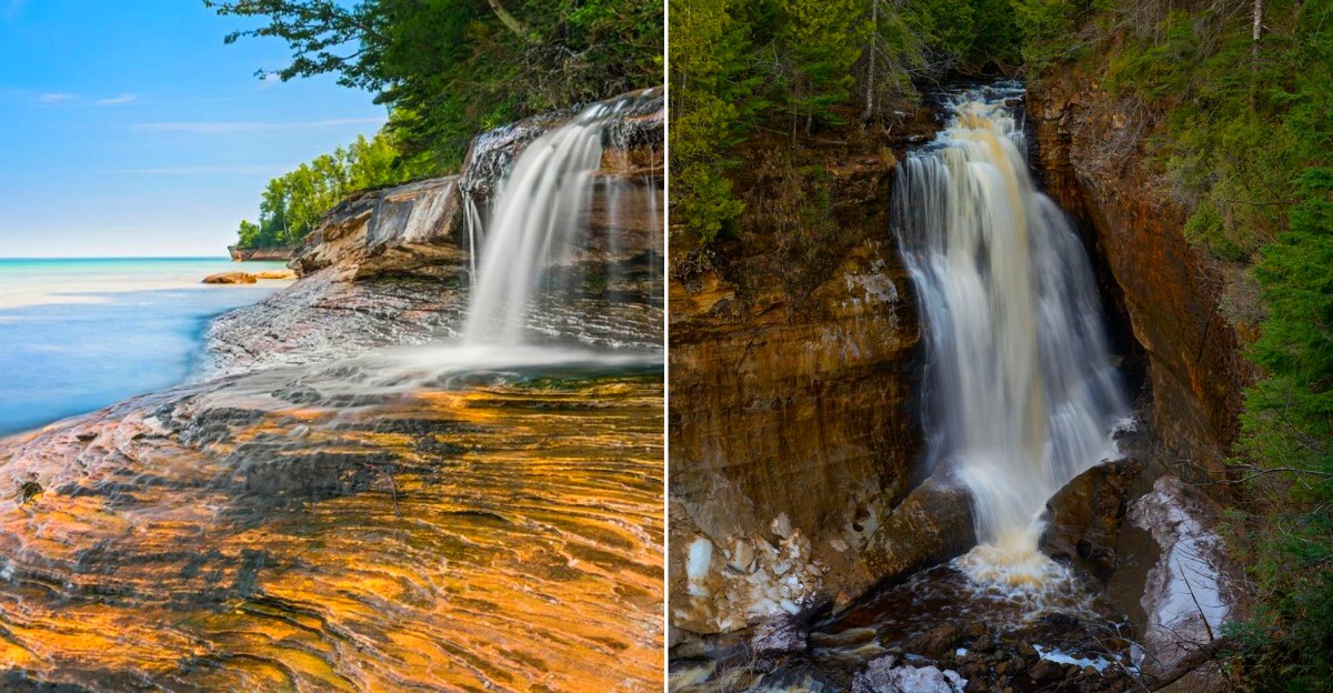
Water has a habit of showing off along this stretch of the Upper Peninsula. It tumbles through sandstone ravines, disappears behind trees, spills beside quiet trails, and sometimes skips the forest entirely before dropping straight into Lake Superior.
That variety is what makes waterfall hunting here feel less like checking landmarks off a list and more like following the landscape wherever it decides to lead.
From hidden forest cascades to dramatic drops into Lake Superior, Michigan’s Pictured Rocks region delivers some of the state’s most unforgettable waterfall scenery.
Each stop seems to come with its own mood. One waterfall might thunder beside a mossy trail, while another appears beyond a beach, historic site, or rocky shoreline.
Cool mist, deep green woods, and flashes of blue water keep the scenery constantly changing.
By the end, the waterfalls almost become an excuse to discover everything else hiding along this wonderfully wild coast.
12. Miners Falls
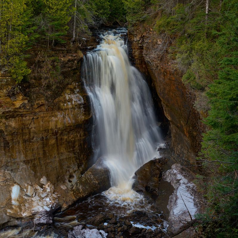
The rumble through the forest gives away what is coming before the waterfall itself appears.
About 50 feet of fast-moving Miners River water drops over a sandstone ledge here, creating what the National Park Service calls the most powerful waterfall inside Pictured Rocks National Lakeshore.
That force makes it particularly satisfying after rain, but the substantial river flow keeps this from feeling like one of the region’s fragile seasonal cascades.
Use Miners Falls Trailhead, Miners Castle Road, Munising Township, MI 49862 as the practical arrival point. From H-58, drive north on Miners Castle Road and then take the short spur to the parking area. Vehicles longer than 32 feet should not use the access road.
From the lot, the trail runs about 0.6 mile each way through northern hardwood forest. It is gently rolling rather than difficult, although exposed roots, damp gravel, and seasonal mud still make proper shoes worthwhile.
Two platforms give very different perspectives. The upper viewpoint provides the broader scene. Another 64 stairs lead down to the lower platform, where the roar becomes much more physical and spray hangs in the air.
11. Munsing Falls
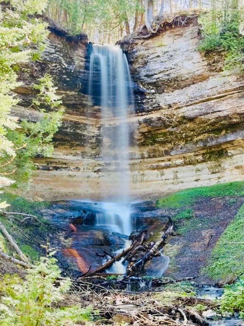
A narrow sandstone canyon hides remarkably close to downtown Munising, which is why this has traditionally been one of the easiest Pictured Rocks waterfalls to visit.
The usual walk begins at the Munising Falls Visitor Center at 1505 Sand Point Road, Munising, MI 49862. From there, an 800-foot paved trail follows Munising Creek through a cool ravine toward a 50-foot waterfall dropping over the sandstone cliff.
Ferns and wildflowers thrive in the damp canyon, and two stairways normally lead to additional viewing platforms.
There is one major 2026 catch: the waterfall trail is closed until further notice.
Heavy rain and snowmelt on April 28, 2025 washed out roughly 75 feet of the paved route, and the National Park Service still lists the closure as active. The visitor center and surrounding park access remain useful, but you cannot currently complete the normal walk to the falls.
That makes this an unusual entry on the list.
It is absolutely worth remembering, but not worth climbing around barriers to reach. The sandstone canyon is narrow, and unauthorized shortcuts risk both injury and further damage.
10. Elliot Falls
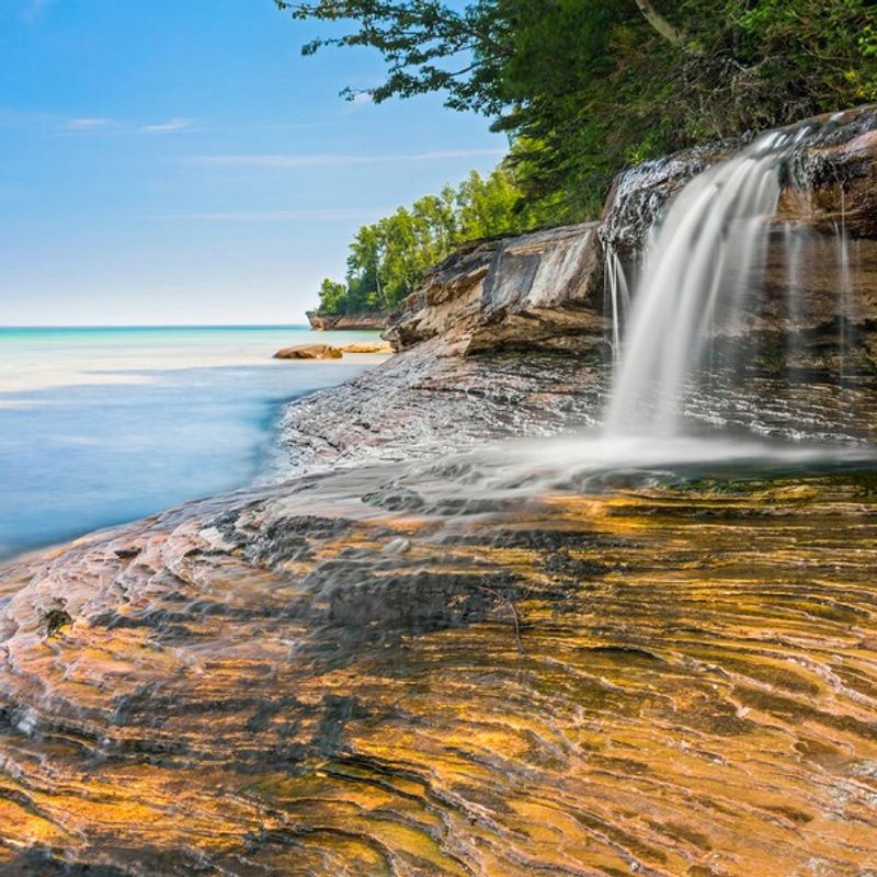
Lake Superior practically joins the waterfall here. At the eastern end of Miners Beach, a small stream drops over layered sandstone just before reaching the lake, creating one of the most photogenic little scenes in the national lakeshore.
The falls themselves are modest, but the combination of moving water, colorful rock, beach stones, and the huge blue horizon makes size almost irrelevant.
For navigation, use Miners Beach East parking area, Miners Beach Road, Munising, MI 49862. The National Park Service directs visitors to the small lot at the east end of the beach; from there, take the stairs down and walk a couple hundred yards to the right, where the cliffs meet the shoreline.
Timing changes this waterfall dramatically. Spring runoff and recent rainfall can produce a broad, lively flow. By late summer, the same feature may shrink into a much thinner ribbon, leaving the surrounding sandstone to carry more of the visual drama.
That does not ruin the stop. Sunset here can be exceptional, with warm light catching the cliffs while Lake Superior darkens behind the falling water.
Wear footwear that handles wet rock and shallow channels, and stay off unstable sandstone ledges.
9. Bridalveil Falls
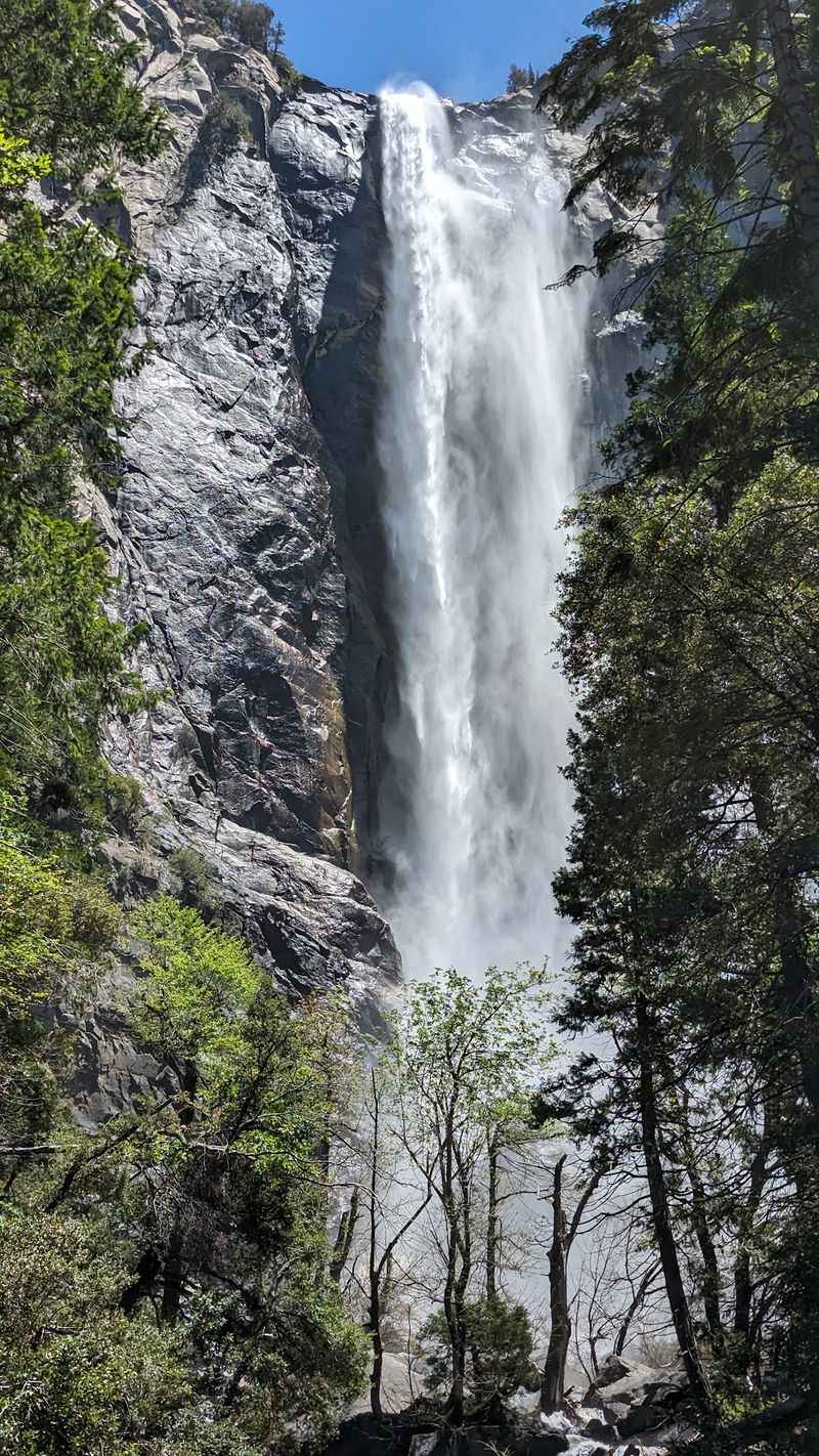
A thin white curtain sliding directly down a Pictured Rocks cliff looks almost impossible from the water.
This seasonal cascade sits about half a mile northeast of Miners Beach, where runoff pours over a hard sandstone cap and then follows softer rock down toward Lake Superior. Unlike inland falls, there is no forest trail leading to its base and no overlook perched directly above it.
The most useful land-based arrival point is Miners Castle, Miners Castle Road, Munising, MI 49862. From the lower overlook, you can sometimes see the falls at a distance.
Another partial view is possible from the western end of Miners Beach. The National Park Service specifically notes that Bridalveil cannot be seen from the North Country Trail or from directly above.
The better experience is from Lake Superior.
Pictured Rocks Cruises depart from 100 City Park Drive, Munising, MI 49862, and shoreline routes can provide a much clearer perspective when conditions and flow cooperate.
Spring is the star season because snowmelt and rain feed the cascade. During dry summer weather, the water can slow dramatically or nearly disappear.
That makes this one waterfall where checking the recent weather actually tells you more than checking a photograph.
8. Mosquito Falls
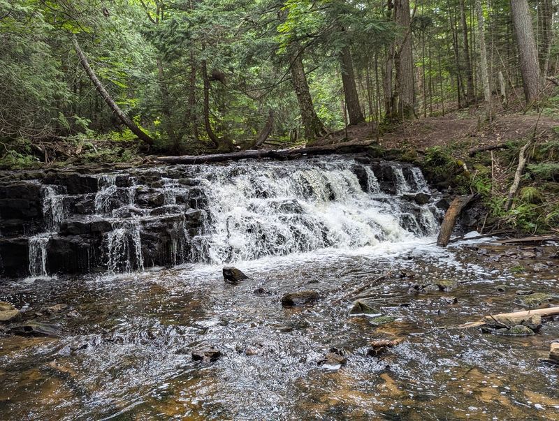
The name makes everyone reach for bug spray, but the waterfall itself is remarkably peaceful.
Instead of plunging from a tall cliff, the Mosquito River breaks across several low sandstone shelves, with the highest drop measuring about eight feet. Amber water moves through a shaded forest of hemlock and hardwoods, creating more of a layered woodland cascade than a single dramatic fall.
Use the Chapel/Mosquito Trailhead at the end of Chapel Road, Munising, MI 49862 as the arrival point. From H-58 about 15 miles east of Munising, turn onto Chapel Road and follow it roughly five miles to the parking area.
The road is rough, with potholes and washouts, and the lot commonly fills by around 9 a.m. in busy summer and early-fall periods.
The hike is about two miles round trip. Start toward Mosquito Beach, then take the signed spur leading to the falls.
Do not underestimate the trail just because the waterfall is small.
Mud, roots, wet ground, and uneven forest terrain can slow the walk considerably after rain. Pets are prohibited throughout the Chapel-Mosquito trail system.
I like this stop precisely because it does not demand a giant payoff.
You notice the tea-colored river, exposed roots, moss, and forest sounds instead.
7. Chapel Falls
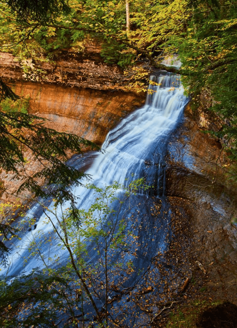
A flash of white through green forest is the first clue that the hike has reached something much larger.
About 60 feet of Chapel River water cascades toward Chapel Lake here, creating one of the more remote major waterfalls inside Pictured Rocks. The height is impressive, but the broad forested basin around it is what gives the scene scale.
Like Mosquito Falls, the practical address is the Chapel/Mosquito Trailhead, Chapel Road, Munising, MI 49862. Reach it by driving about 15 miles east of Munising on H-58 and then approximately five rough miles north on Chapel Road.
The final road is primitive and heavily potholed, so the drive itself takes longer than the distance suggests.
The walk to the falls is roughly 1.2 miles one way, or about 2.5 miles round trip. Most of the route follows an old roadbed through maple forest with modest hills rather than technical terrain.
The gorge edges are sandstone, vegetation protects fragile soils, and leaving the established viewpoints adds risk without improving the experience much.
Strong hikers can continue toward Chapel Rock and Chapel Beach, but that changes the outing from a short waterfall hike into a much longer Pictured Rocks day.
6. Spray Falls
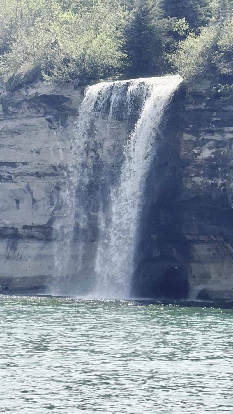
Few Michigan waterfalls get a backdrop this extravagant. About 70 feet of water drops directly from the Pictured Rocks cliffs into Lake Superior, with streaks of orange, tan, green, and brown sandstone spreading across the shoreline around it.
The remains of the steamer Superior, wrecked in 1856, lie beneath the water near the base, adding another layer to an already dramatic location.
There is no roadside address for the falls because the National Park Service says plainly that the view requires a boat.
The easiest practical starting point is Pictured Rocks Cruises, 100 City Park Drive, Munising, MI 49862. Their dedicated Spray Falls Cruise travels far enough east to reach the waterfall, while shorter cruise routes do not necessarily go that distance.
The 2026 cruise season runs from May 9 through October 18.
Experienced hikers can approach the area using the North Country Trail, but the outing is long and land views are less satisfying than the perspective from Lake Superior.
That is why I would save the walking energy for Chapel Basin and see this one from the water. The lake also reveals why the waterfall matters visually. From a trail, seventy feet sounds substantial.
5. Sable Falls
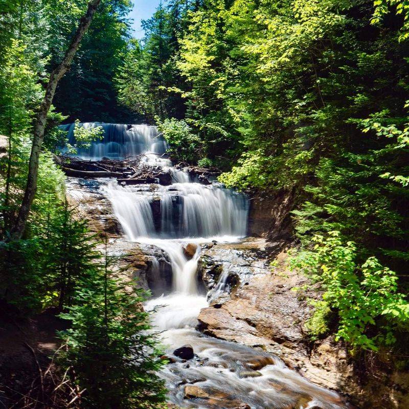
The first few stairs only hint at how far down this waterfall keeps going.
Sable Creek tumbles roughly 75 feet across a long staircase of Munising and Jacobsville sandstone, breaking repeatedly over shelves instead of making one clean plunge. Forest closes around both sides, while the wooden staircase follows the cascade toward its lower viewing area.
Use Sable Falls Parking Area, County Road H-58, Grand Marais, MI 49839 for navigation. The site is approximately one mile west of Grand Marais on H-58 and has parking near the top of the falls.
The famous number here is 168.
That is how many stairs lead toward the best waterfall view, and every one of them is waiting again on the return trip.
Continue beyond the cascade and the trail eventually reaches Lake Superior, where Sable Creek empties onto a mixed rock-and-sand beach beneath the massive Grand Sable landscape. The complete walk from the parking lot to the lake and back is only about 0.4 mile, but the stairs make it feel more substantial.
Seasonal restrooms and drinking water add a little convenience that several remote Pictured Rocks trailheads lack.
4. Wagner Falls
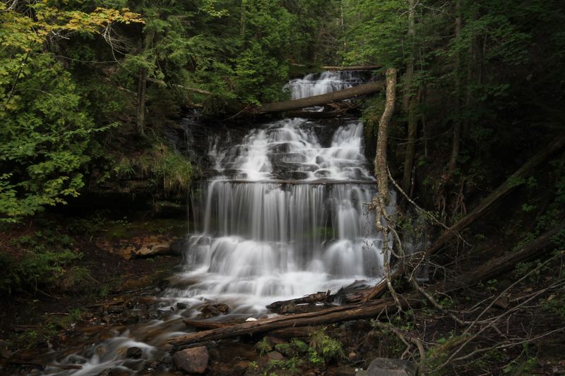
Old hemlocks make this little gorge feel darker and cooler than the roadside location suggests.
Wagner Creek moves over a sequence of resistant rock ledges before continuing toward the Anna River, creating a graceful multi-tiered waterfall surrounded by thick Upper Peninsula forest.
It is not particularly tall, but the layered flow and enclosed setting make it one of the easiest nearby cascades to photograph well.
The official navigation point is Wagner Falls Scenic Site, 46.387526, -86.646904, Munising, MI 49862. From Munising, follow M-28 east for about 1.2 miles, turn onto M-94 west, then continue roughly 0.3 mile to the small parking area.
It only holds around eight to ten vehicles.
From the lot, a packed-gravel trail and boardwalk cover only about 0.1 mile before reaching the observation platform.
That makes this one of the best choices around Munising for travelers who do not want a long hike. Easy access should not encourage shortcutting, though. The boardwalk protects soft stream banks and keeps visitors off slippery rock near the cascade.
3. Alger Falls
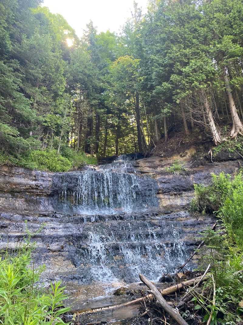
You can nearly experience this waterfall without interrupting the road trip.
A small creek tumbles across several rock shelves beside the junction of M-28 and M-94, producing a broad staircase of water that is visible almost directly from the highway.
During spring snowmelt or after heavy rain, the cascade becomes surprisingly lively; extended dry periods can reduce it substantially.
Use Junction of State Highway M-28 and M-94, Munising Township, MI 49862 as the arrival point. That is the location used by the Munising Visitors Bureau for the falls.
The convenience is also the biggest hazard.
This is a roadside waterfall beside active traffic, not a pedestrian attraction with a protected trail network. Pull completely into a legal turnout and keep children well away from the roadway.
Crossing M-28 or stepping into traffic for a photograph is an extraordinarily bad trade for a slightly different angle.
There is no reason to scramble toward the cascade either.
Water, mud, loose rock, and road embankments make the close approach considerably less pleasant than the simple roadside view.
I treat Alger as a bonus waterfall rather than the centerpiece of a day.
That makes it perfect beside Wagner Falls, which sits only a short drive away and offers the opposite experience.
2. Horseshoe Falls
Rainbow trout add an unexpected supporting cast to this waterfall stop.
The privately operated attraction centers on a spring-fed cascade surrounded by landscaped woodland paths, but the fish pond has become almost as memorable as the falls themselves. Visitors can feed the trout with approved food, giving families something to do besides pose in front of moving water.
The property is at 602 Bell Avenue, Munising, MI 49862. From M-28 on the south side of town, turn east onto Prospect Street and then left onto Bell Avenue.
A small admission fee applies because this is privately operated rather than part of Pictured Rocks National Lakeshore.
The spring-fed source gives Horseshoe an advantage over some of the area’s seasonal waterfalls.
Its flow generally remains more reliable during dry stretches when smaller creeks elsewhere can shrink considerably.
The atmosphere is also deliberately different.
Instead of a rough national park trail, expect maintained pathways, family-oriented features, picnic areas, and a more groomed setting. That makes it particularly useful after a morning of roots, mud, stairs, and rough backcountry roads.
1. Scott Falls
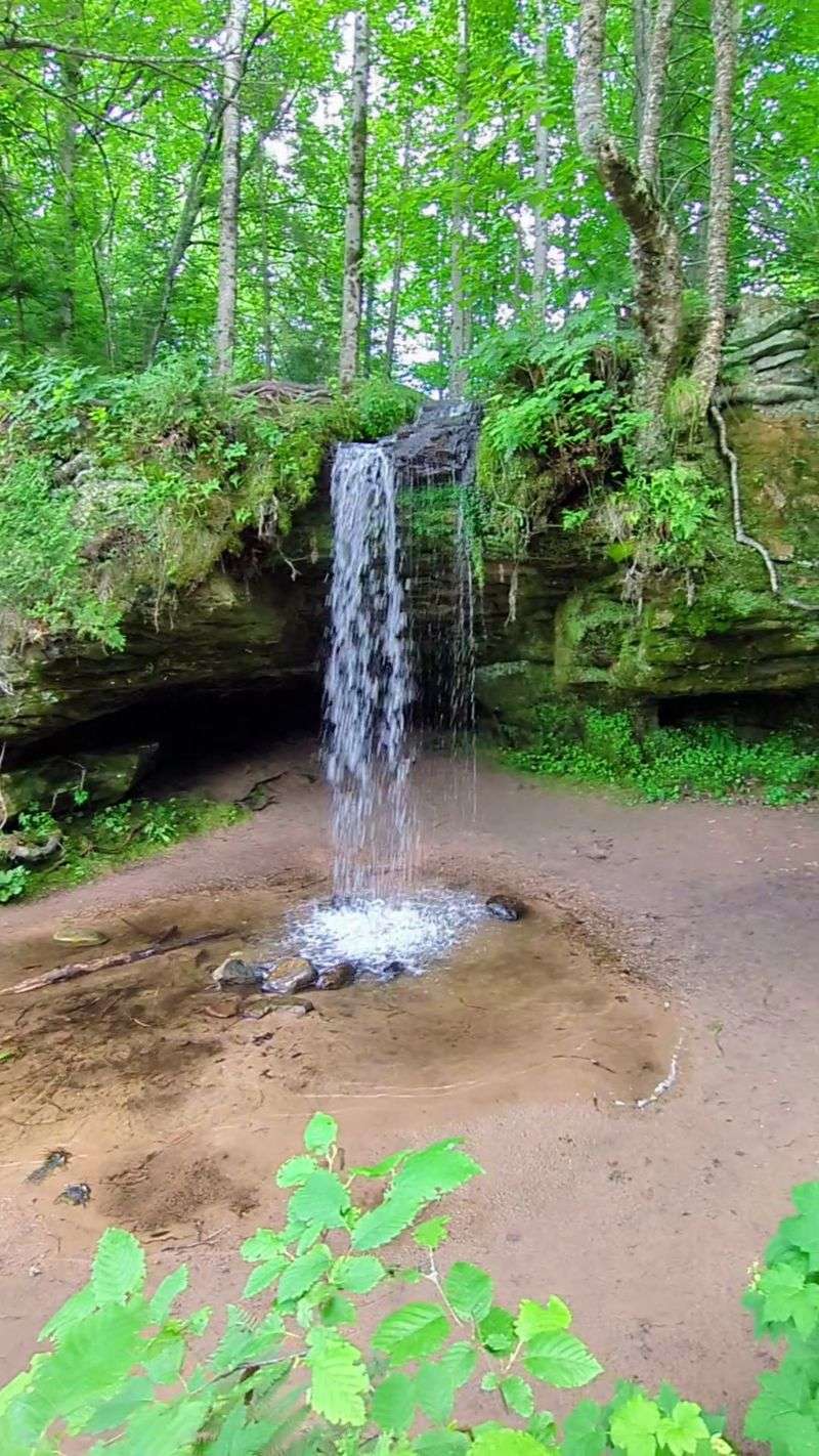
A sandstone overhang beside M-28 turns an ordinary highway drive into a remarkably easy waterfall stop.
Water drops roughly ten feet over the rock face, leaving a shallow recessed area beneath the ledge and creating a narrow curtain that can look surprisingly substantial after rain or snowmelt.
During dry weather, the flow becomes considerably thinner, so this is one of those waterfalls whose personality depends heavily on what the sky has been doing recently.
The safest practical arrival point is Scott Falls/Rathfoot Roadside Park, M-28, Au Train, MI 49806, about a mile east of Au Train. The roadside park sits across the highway from the waterfall and provides a legitimate place to stop rather than improvising on the shoulder.
M-28 traffic is the main thing to respect. The waterfall may look only a few steps away, but crossing a fast highway requires far more attention than the distance suggests. Never assume drivers have seen you.
Wet sandstone and loose rock add another reason not to climb around the recess behind the falls.
The better plan is to enjoy the cascade from a secure viewpoint and then use the roadside park for its Lake Superior access.