
9 Arkansas Hiking Trails Locals Watch Closely In September Because Copperheads Are Still Active
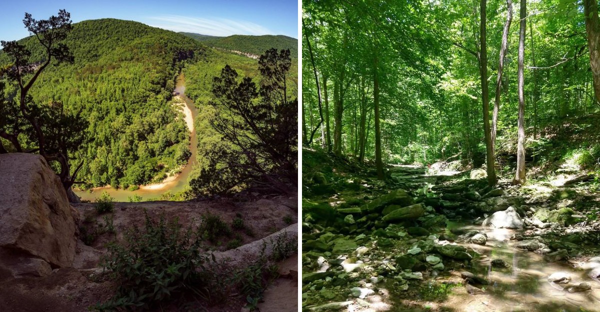
September has a way of pulling people back onto the trail. Cooler air makes the climbs more appealing, and the first signs of fall can change the look of a familiar path almost overnight.
Copperheads are part of that picture too. They may still be active, and their brown pattern can blend closely with leaves or stone along wooded routes.
So this is a month for watching where your boots land. Arkansas offers plenty of hikes where that habit matters, especially on routes with rocky stretches and shaded ground.
The payoff can be a waterfall ahead or a bluff view after a climb. Just do not let the scenery steal all of your attention.
Give any snake you see plenty of space and avoid reaching into places you cannot see. Keep moving carefully.
Fall is arriving, but the woods are still busy, which makes awareness part of a September hike.
1. Dancing Rabbit Trail, Paragould
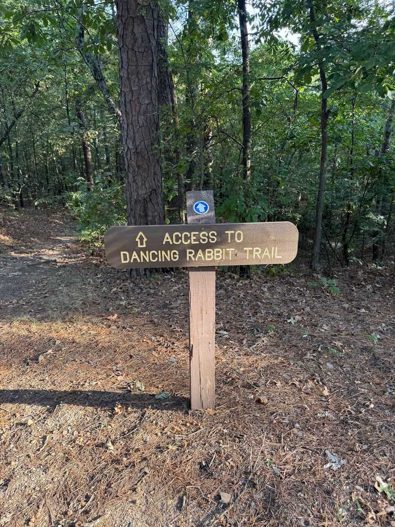
Located inside Crowley’s Ridge State Park at 2092 AR-168 in Paragould, Arkansas, this short loop packs a surprising amount of character into a little over a mile.
The path guides hikers along a deep gulley called an arroyo, then rewards them with a swinging bridge before curling back toward the visitor center. Most people finish in about an hour, which makes it a friendly choice for families or anyone easing into fall hiking.
History runs deep here. The park preserves the former homestead of Benjamin Crowley and shows off rustic structures built by the Civilian Conservation Corps, and Native Americans once used the area as a campground.
One reviewer joked about never spotting any actual dancing rabbits, which honestly made me smile.
September walkers should stay alert on the uneven ground and around leaf litter, since baby copperheads born this time of year hide easily in shaded, wooded spots. A slow pace and watchful eyes keep the outing pleasant.
Sturdy shoes help with the gulley sections, and the swinging bridge is a fun little highlight that kids tend to love crossing more than once. The forest canopy keeps things cool even on warmer afternoons.
Rustic charm, a bit of local lore, and an easy distance make this one an underrated pick in northeast Arkansas. Watch where you step, enjoy the breeze, and let the bridge bounce a little.
2. Lost Valley Trail, Kingston
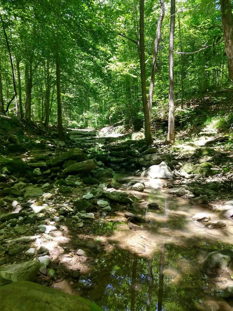
Few trails in the Natural State earn as much love as this one near Kingston, Arkansas, just outside the Boxley Valley Historic District along Lost Valley Road. Stretching about 2.3 miles out and back, the route is moderately challenging and famous for blue pools, tumbling waterfalls, and a natural stone arch.
It leads to Cob Cave, a massive bluff shelter, before continuing toward Eden Falls. Wildflowers and a wide mix of plants line the path, which explains why hikers and naturalists keep returning season after season.
Part of the Buffalo National River area, it consistently ranks among the most popular walks in the state, and I can see why people rave about it. A quick heads up on rules: pets are not permitted here, so plan accordingly before you arrive.
That policy helps protect the delicate scenery along the way. September brings extra reason for caution, since copperheads favor the wooded areas, rocky hillsides, and riverbanks throughout this region.
Step carefully near ledges and under overhanging brush where they blend in. Bring water, wear grippy shoes for the rockier stretches, and give yourself time to linger at the pools.
Morning light through the trees makes the whole valley glow. Scenery this rich rarely comes with such a manageable distance, making Lost Valley a bucket list stop worth every step.
3. Hemmed-In Hollow Trail, Compton
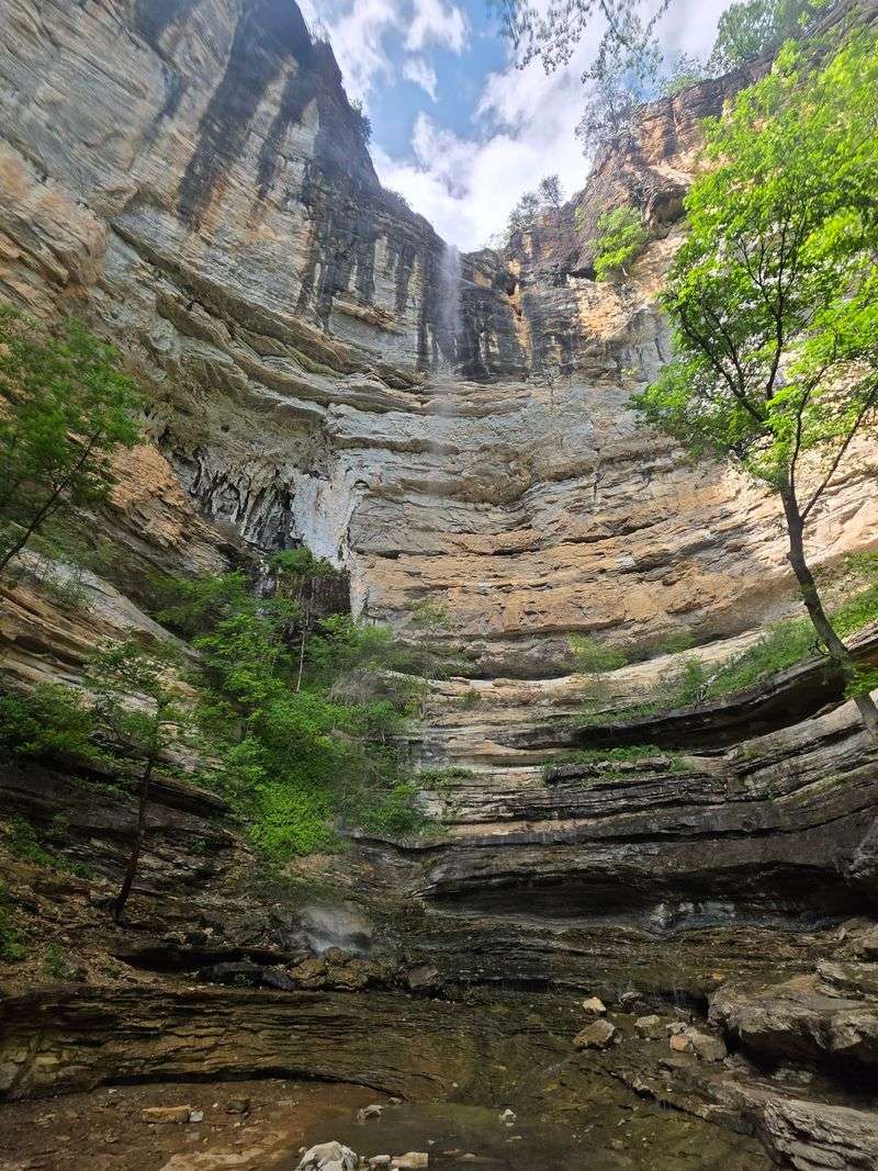
Waterfall chasers dream about this one. Starting from the Compton trailhead in Compton, Arkansas, the roughly 5.7 mile round trip drops into the Ponca Wilderness of the Buffalo National River.
The prize is Hemmed-in Hollow Falls, a slender ribbon spilling over a bluff that ranks among the tallest waterfalls between the Rockies and the Appalachians. Its flow depends on recent rain, so timing after a good storm makes the view far more dramatic.
Do not let the distance fool you into thinking it is easy. The hike is steep and demanding, especially on the return climb, with a solid elevation gain that will test your legs.
Views of the Buffalo River and surrounding Ozark Mountains help distract from the burn.
The trail connects with others in the wilderness, including Sneeds Creek and Centerpoint, so route options abound for ambitious hikers. Pets are not allowed on any trails in the Ponca Wilderness, which keeps things simple.
Come September, copperheads settle into the wooded slopes, rocky areas, and riverside spots common across this stretch of Arkansas. That steep, leaf covered ascent deserves careful footing.
Pack plenty of water, snacks, and patience for the uphill finish. Early starts beat both the heat and the crowds.
Effort like this earns a memory that sticks, and that soaring waterfall is the kind of sight you will talk about for weeks.
4. Centerpoint Trail To Big Bluff, Compton
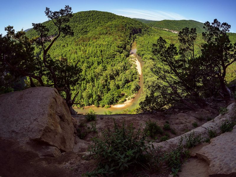
Adventure seekers with steady nerves put this route near Ponca and Compton, Arkansas, near the top of their list. The trailhead sits on Highway 43, and the round trip to Big Bluff runs close to six miles.
Rated moderate to strenuous, the path heads mostly downhill on the way out, which means the return is a long, honest climb. Most hikers spend several hours out here, following an old wagon road through dense forest before reaching the main event.
That event is the Goat Trail, a narrow ledge carved into the cliffside that leads to Big Bluff, the largest sheer bluff face between the Rockies and Appalachians. The views over the Buffalo River and Ozarks are enormous, though the ledge hugs a very high drop.
Because that stretch is so narrow, it is not recommended for young children or anyone uneasy with heights. I would call the payoff spectacular, but respect for the edge matters more than any photo.
Pets are not permitted in the Ponca Wilderness, so leave furry friends at home. September hikers should also watch for copperheads tucked into the rocky, wooded terrain here.
Wear reliable footwear, carry water, and move slowly along the cliff section. Take your time and stay well back from the edge.
Big Bluff rewards the cautious with one of the finest overlooks in the region.
5. Indian Rockhouse Trail, Yellville
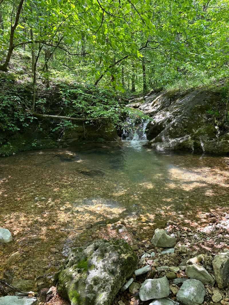
History and geology team up on this loop at Buffalo Point Campground near Yellville, in Marion County, Arkansas. Depending on the route, the trail runs three to four miles and can take several hours.
Classified moderate to strenuous, it winds across hillsides and follows a lovely stream toward the Indian Rockhouse Cave, a shelter that once protected prehistoric Native Americans. Archeological excavations at the shelter uncovered artifacts left by people who used the site thousands of years ago.
The list of features here is genuinely fun. Along the way you will pass Bat Cave, sculpted bedrock, small waterfalls, an abandoned zinc mine, the Sinkhole Icebox, and a spot known as the Natural Bathtub.
Each stop gives the walk a treasure hunt feel that keeps kids curious. Part of the Buffalo National River, this area shares the same copperhead reminders as its neighbors.
In September the snakes blend into rocky ledges, damp areas, and wooded stretches, so watch before reaching into shady crevices near the cave. Good shoes matter on the elevation changes, and a little extra time lets you actually explore the side features rather than rushing past.
Morning light filtering through the trees makes the stream sparkle. What sets this hike apart is how much it packs into one loop, blending ancient shelter, quirky landmarks, and quiet water.
It is the kind of trail that turns a simple outing into a small expedition.
6. Seven Hollows Trail, Morrilton
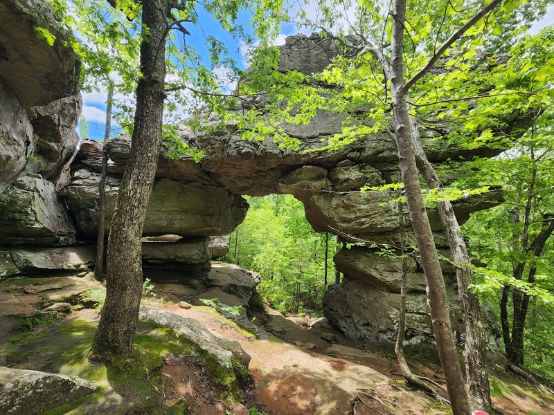
Canyon lovers gravitate toward this loop inside Petit Jean State Park near Morrilton, Arkansas, off Petit Jean Mountain Road. The route stretches roughly four and a half miles and takes a couple of hours to complete.
Considered a vigorous walk, it threads through several small canyons beneath a thick hardwood canopy. The highlights come thick and fast: a natural stone arch, rock shelters, a grotto with a seasonal waterfall, and a hidden box canyon.
Evidence of prehistoric bluff dwelling Native Americans adds a layer of quiet history to the scenery. The area’s untouched beauty actually helped inspire the creation of the very first state park in Arkansas, which gives every step a bit of legacy.
September visitors should keep an eye on shaded, rocky areas where copperheads camouflage among leaves and stone. Stepping carefully near overhangs and damp grottos keeps the hike relaxed.
Wear shoes with grip for the uneven canyon floors, and bring water for the longer stretches without shade breaks. The grotto is especially pretty when recent rain feeds the seasonal falls.
Between the arch, the shelters, and the tucked away canyons, this loop feels like wandering through a natural gallery carved by time.
7. Cedar Falls Trail, Morrilton
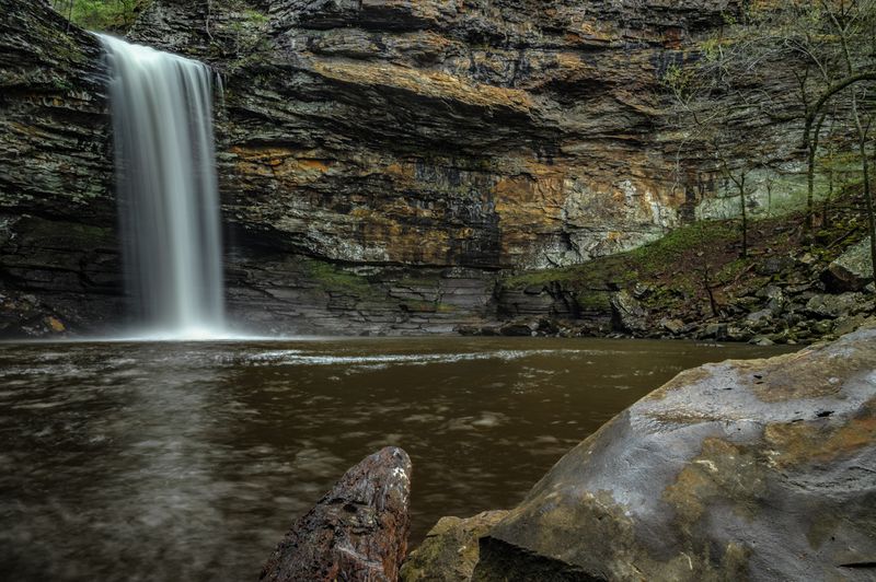
Behind Mather Lodge in Petit Jean State Park near Morrilton, Arkansas, this out and back drops steeply into a canyon and delivers one of the state’s most photographed waterfalls. Running roughly two miles round trip, the moderate to strenuous trail winds alongside Cedar Creek, squeezes around massive boulders, and ducks beneath rock overhangs.
It ends at Cedar Falls, a rainfall-dependent waterfall tumbling from a tall bluff. The steep descent is the easy part, so save some energy for the climb back up to the lodge.
For those who prefer a gentler view, an accessible boardwalk offers an overlook of the falls without the full canyon trek. Here is a welcome bit of news for pet owners.
Dogs are permitted on this trail as long as they stay leashed, which sets it apart from many nearby Buffalo River hikes. September hikers still need to stay watchful, since copperheads hide among the boulders, damp creek edges, and shaded rock overhangs.
Looking before you place a hand or foot goes a long way. Solid footwear helps on the slick, rocky sections near the water, and a rain jacket is smart if the falls are running strong.
The mist near the base feels wonderful on a warm day. After good rainfall, Cedar Falls can look powerful against the dramatic cliffs and rewards every downhill switchback.
8. Pigeon Roost Trail, Rogers
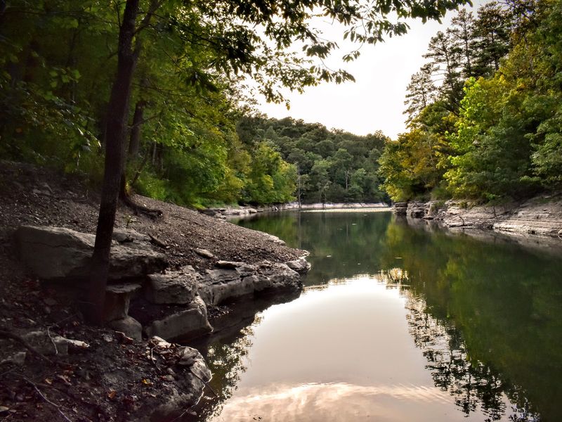
Named for a long gone bird, this figure eight route sits in Hobbs State Park Conservation Area about ten miles east of Rogers, in Benton County, Arkansas. The double stacked loops let you choose your challenge.
A shorter loop of around four miles suits a casual day hike, while the longer loop pushes past eight miles for those wanting more distance or an overnight campout. Total mileage lands somewhere in the eight to nine range depending on your path.
Rated moderate to strenuous, the trail winds through wooded hills and seasonal stream beds, with several hills that add to its difficulty. The standout moment is a lovely overlook of Beaver Lake that makes the rolling terrain feel rewarding.
The name honors the passenger pigeon, a bird that once roosted here in staggering numbers before vanishing. I find that little piece of history oddly haunting for such a peaceful walk.
The longer loop supports overnight camping at five designated reservable sites, which is a nice perk for anyone stringing up a hammock. Copperheads may be more active at night in warm weather, so a good headlamp and careful steps matter after dark in September.
Comfortable shoes handle the terrain easily, and the lake overlook is worth timing for softer evening light. Wooded quiet and open water views make this a mellow favorite in northwest Arkansas that never feels rushed.
9. Base Trail, Roland
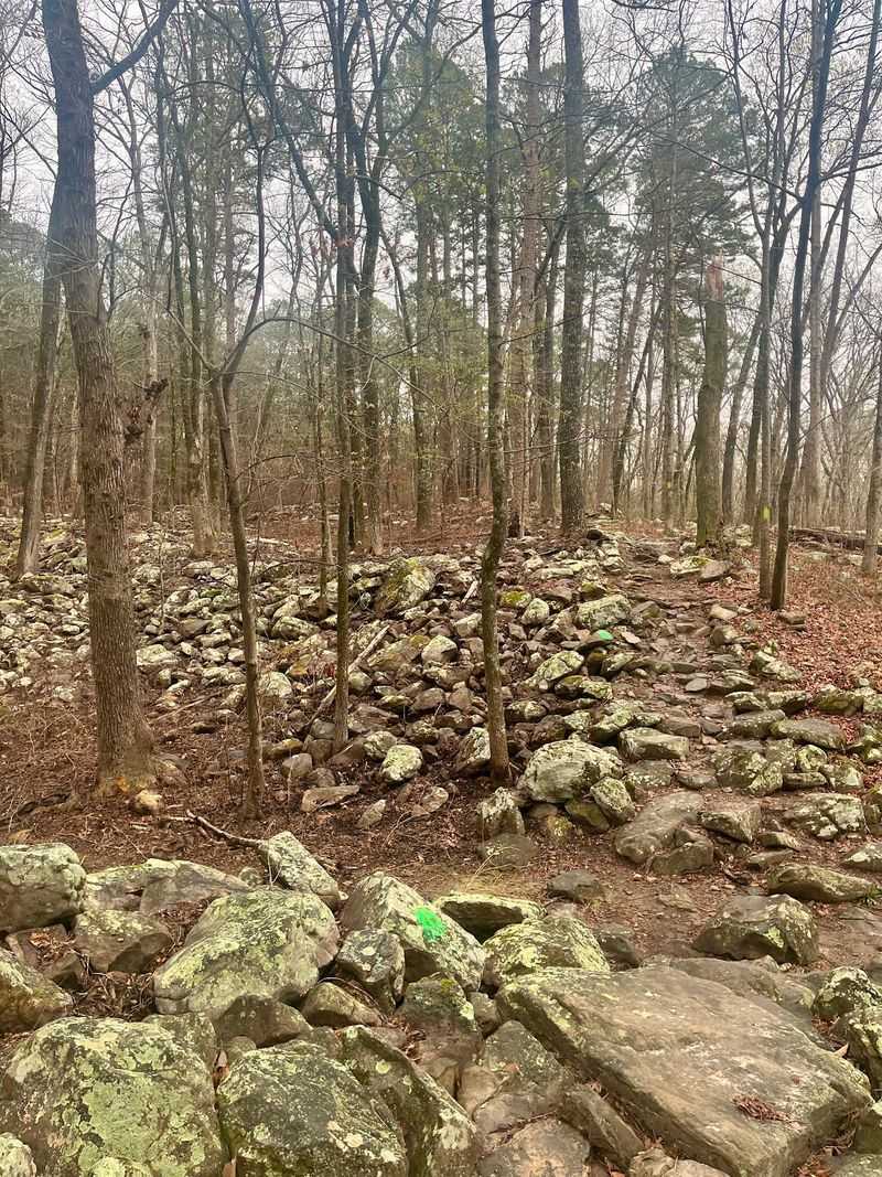
Circling the entire foot of Pinnacle Mountain, this three mile loop in Pinnacle Mountain State Park sits in Roland, Arkansas, off Highway 300 and typically takes about two hours.
Rated easy to moderate, the trail stays gently rolling to flat, which makes it welcoming for hikers who want scenery without a brutal climb. It connects the East Summit and West Summit trails, so ambitious walkers can stitch together a base loop plus a summit ascent for a bigger day.
Portions follow the Little Maumelle River and pass through boulder strewn stretches that give the walk texture and pretty river views. Those rocky, shaded slopes are exactly the kind of spot copperheads favor.
Since the park sits within their preferred rocky, forest edge habitat, September hikers should watch around boulders and shaded ground where the snakes tuck away. A slow pace near the rock piles keeps things calm and safe.
The loop works well for a relaxed morning, and combining it with a summit trail turns an easy outing into a satisfying challenge. Water and decent shoes cover most of what you will need.
Being so close to Little Rock, this trail draws steady foot traffic, yet the river sections still feel peaceful. That accessibility rounds out a lineup of Arkansas hikes that reward both beginners and seasoned wanderers.
Watch your step, enjoy the water views, and let the mountain loom quietly overhead.