
8 Covered Bridge Road Trips In Ohio Worth Taking This Autumn
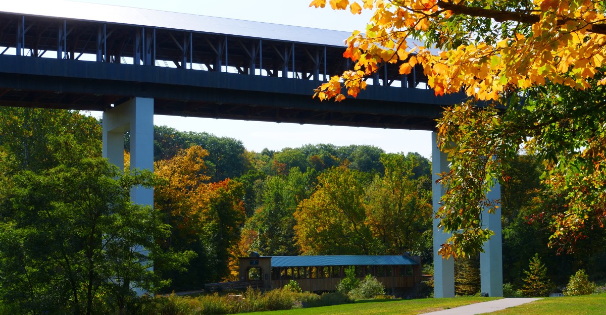
I have a weakness for Ohio roads that give me a reason to slow down. Covered bridges are especially good at that.
In fall, the drive becomes part of the attraction. A quiet county road bends through changing trees, a wooden bridge appears ahead, and suddenly pulling over for ten minutes feels completely justified.
I have learned not to rush these trips. Some of the best bridges sit far from the quickest route, and the roads between them often end up being just as memorable as the stops themselves.
These eight Ohio drives connect bridges, small towns, rivers, and plenty of autumn scenery along the way.
Pick a route, leave a little extra time in the schedule, and do not be surprised if a two-hour drive quietly turns into most of the day.
Fairfield County Covered Bridge Trail, Lancaster Area
Fifteen original covered bridges still stand in Fairfield County, and the tourism office maps them out as an official trail built for slow autumn driving. That kind of organization makes the day easy.
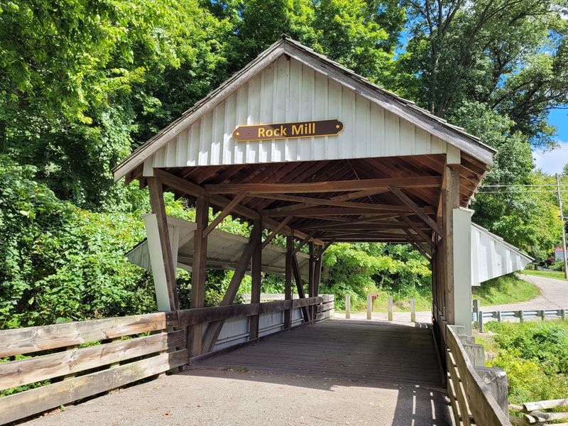
Rock Mill Covered Bridge, northwest of Lancaster, is where I would aim the car first.
It perches above the Hocking River gorge right beside a restored 1824 gristmill, and the two structures together create one of the most photographed scenes in central Ohio.
The gorge below is narrow and rocky, with water sliding through stone ledges. Peek over the edge and you will understand why early settlers chose this exact spot to build.
The mill itself opens on limited schedules, so check ahead if you want an interior tour. Even when it is closed, the park and bridge remain open for visitors.
Beyond Rock Mill, the current trail includes bridges like Hartman No. 2, Johnston, and Mink Hollow. Hartman No. 2 and Johnston sit in park settings where you can slow down and explore the spans on foot.
Lancaster works as the natural home base. Its downtown has a historic district, a glass museum, and enough coffee shops to refuel between stops.
Give yourself a full day if you want to see most of the trail, or pick five bridges for a relaxed half day.
A printed county map is useful out here, especially when hopping between rural bridge locations.
Late October often brings strong color around the gorge, although peak foliage changes a little from year to year.
Stick to the designated paths and overlooks when searching for photo angles around Rock Mill.
This is the sort of route that rewards a slower pace anyway.
Ashtabula County Covered Bridge Loop, Ashtabula And Geneva Area
Nineteen covered bridges sit inside one northeast Ohio county, and seventeen of them still carry real traffic all year long.
That is not a museum collection. That is a working road network made of wood.
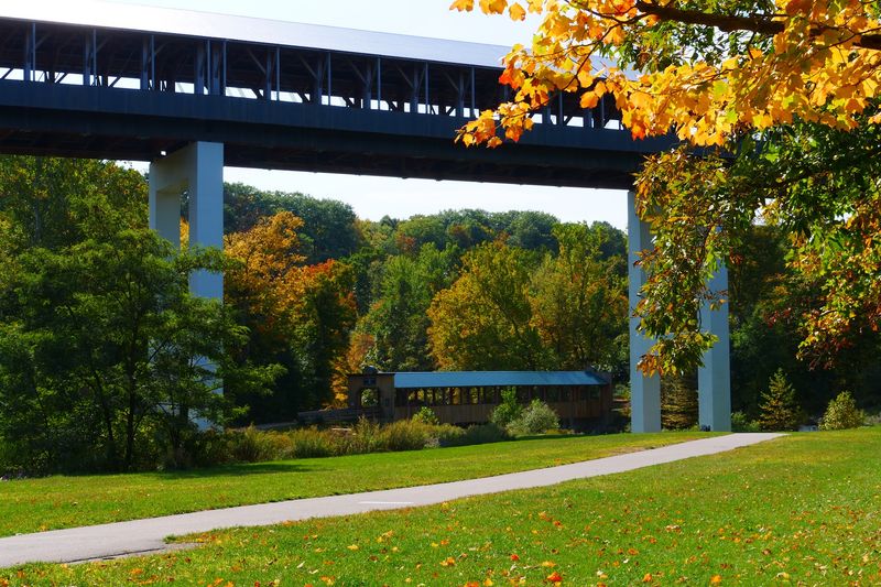
The headliner is the Smolen-Gulf Covered Bridge just south of Ashtabula, a towering span high above the Ashtabula River that ranks as the longest covered bridge in the United States.
Driving through it takes only a few seconds, but the view down into the gorge sticks with you much longer. There is a small parking area and a trail below if you want the classic photo looking up.
Harpersfield Covered Bridge near Geneva makes the strongest second stop. It crosses the Grand River, sits beside a dam and picnic area, and reopened to vehicle traffic after a recent renovation.
Bring a blanket, because the riverside grass here practically begs for a lunch break.
From there, Mechanicsville Road Bridge and Windsor Mills Bridge add older, quieter character to the day. Windsor Mills in particular feels tucked away, with a small cemetery and church nearby and almost no traffic.
The county puts on a covered bridge festival each October, so expect crowds that weekend and quieter roads on either side of it.
My advice is to plan roughly six to eight stops rather than trying to sweep up all nineteen in one afternoon. The roads between bridges are narrow, curvy, and slow, which is exactly the point.
Fill the tank in Ashtabula or Jefferson before you start, since gas stations thin out fast once you leave the main routes.
Mid to late October usually delivers the strongest color here thanks to the lake effect climate.
If you only have one weekend in Ohio this fall, this is the loop I would hand you without hesitation.
Union County 58-Mile Covered Bridge Tour, Marysville Area
Fifty-eight miles of mostly rural pavement make up this route, and the county promotes it as a single loop you can knock out in an afternoon. Farm fields, grain bins, and quiet crossroads fill the space between stops.
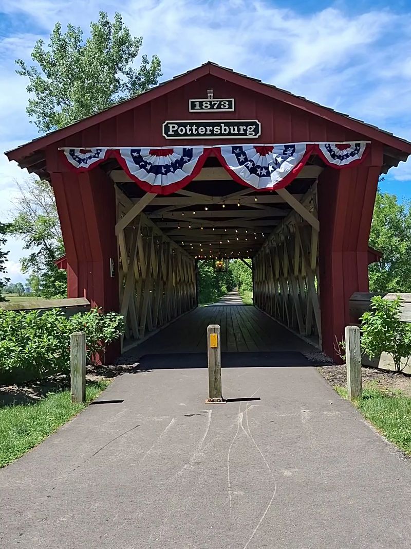
Pottersburg Covered Bridge is my favorite anchor point here. It sits along a paved multipurpose trail, which means you can park, stretch your legs, and walk right through the span without dodging cars.
Families love that detail. Kids can run the length of the bridge while you figure out the best light for photos.
Spain Creek Covered Bridge adds a second historic stop with a different feel, tucked into a shadier setting where the creek runs close underfoot.
One practical note worth planning around: Bigelow Covered Bridge is listed as indefinitely closed for repairs, so skip it.
The tour mixes restored 1800s structures with newer covered spans, which makes for an interesting side-by-side lesson in how bridge building changed over 150 years.
Marysville is the logical starting town, and it has plenty of parking, restrooms, and places to grab breakfast before you roll out.
Because so much of the route runs through open farmland, autumn here looks different than it does in the wooded hill counties. Expect wide golden fields, harvest equipment on the move, and long views instead of tunnels of color.
Drive patiently and give tractors room, especially during harvest season in October.
Sunset light across the fields turns the red bridge siding almost glowing, so timing your last stop for late afternoon pays off.
This is the loop I recommend to anyone who wants scenery without steep, white-knuckle roads.
Preble County Covered Bridge Drive, Eaton And Lewisburg Area
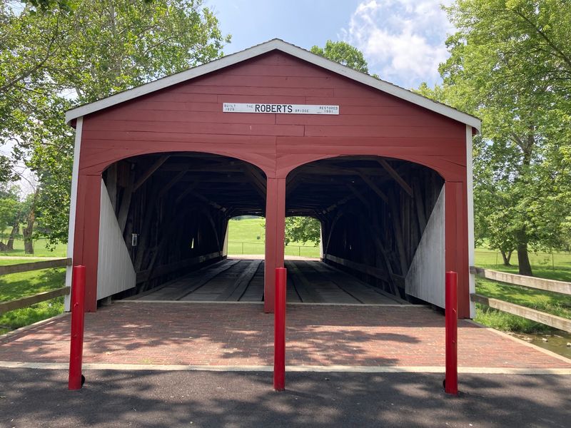
Built in 1829, Roberts Covered Bridge in Eaton holds the title of the oldest remaining covered bridge in Ohio according to the county tourism bureau. Standing in front of it feels like meeting a very stubborn survivor.
The bridge has a distinctive double-barrel design, meaning two lanes separated by a center wall of trusses. Walk through and you will notice the interior looks unlike almost any other bridge on this list.
Preble County preserves eight covered bridges in total, spread across farmland, shallow valleys, and rolling countryside in southwest Ohio.
Brubaker, Warnke, Christman, and Geeting fill out the route nicely, each with its own truss style and setting. Warnke in particular sits in a peaceful spot that rewards a longer stop.
The Hueston Woods bridge gives you an excuse to fold a state park into the day, with hiking trails, a lake, and one of the better fall color displays in this corner of the state.
Plan on three to four hours of driving time if you want all eight, or half that for the highlights.
Eaton makes a solid lunch stop, with a small downtown square and local diners that will not eat up your whole afternoon.
Roads here stay mostly paved and gentle, so this route works well for drivers who are nervous about steep grades or gravel.
Photographers should note that several of these bridges face open sky, which means harsh midday light. Morning or late afternoon gives you far better shadows and richer color on the wood siding.
Mid October is usually the sweet spot for foliage in this part of the state.
Eight bridges, one tank of gas, and a whole lot of history packed into a single county map.
Washington County Eastern Covered Bridge Trail, Marietta To Wingett Run
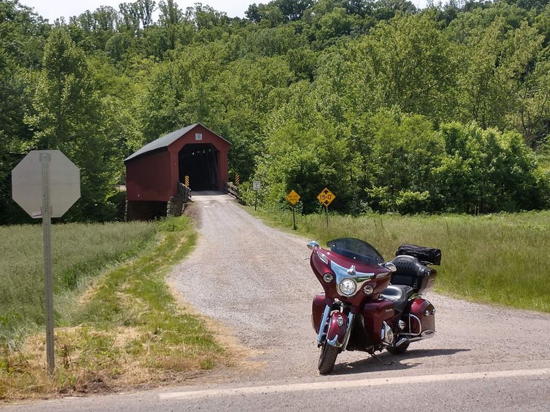
Steep, winding, and gorgeously green-turning-gold, the eastern trail out of Marietta is the closest thing this list has to a true mountain drive. The county publishes it as one of two official covered bridge routes.
State Route 26 does the heavy lifting, curling north through the hills near Wayne National Forest and leading toward Hills, Hune, and Rinard covered bridges along the way.
Hune Covered Bridge is the stop that requires the most planning right now. The historic span is currently closed while a major rehabilitation project moves forward, with plans calling for pedestrian access after the work is completed.
The nearby Hune Bridge Campground and trail access remain available, but drivers currently need to use the posted detour rather than crossing the bridge.
Hills Covered Bridge sits closer to Marietta and makes a good warm-up stop. Rinard, farther north near Wingett Run, rounds out the trio.
The main State Route 26 portion of the drive is paved, but the terrain is narrow and full of curves, so keep your speed down and give yourself plenty of time.
This corner of southeast Ohio holds some of the most dramatic hardwood forest in the state, and autumn color rolls across the hills in stages.
Marietta is worth building into the trip. The riverfront town has a sternwheeler history, brick streets, and museums covering early settlement along the Ohio River.
Pack snacks and water before heading out, because services along Route 26 are genuinely sparse.
Cell coverage can drop in the valleys, so downloading your route before leaving town is a sensible precaution.
Allow several hours, especially if you plan to explore trails or the recreation areas along the route.
Of all eight routes, this one feels the most like an actual journey rather than a checklist of photo stops.
Washington County Western Covered Bridge Loop, Barlow And Vincent Area
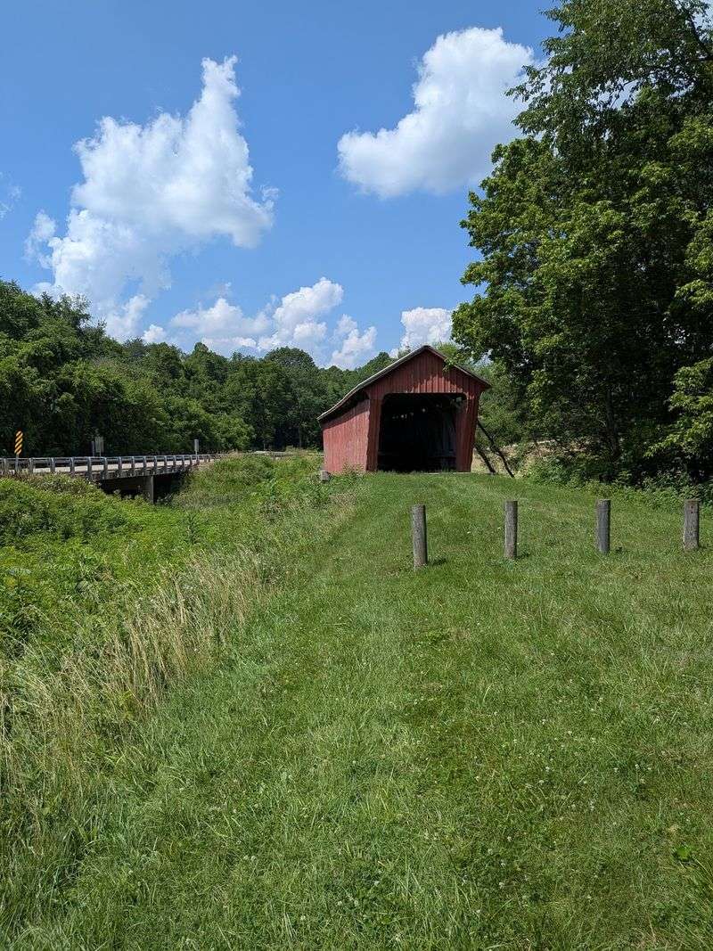
Here is the route that comes with a warning label, and honestly that is part of the fun.
Portions of the western loop run on dirt roads, and local tourism recommends traveling them only in favorable conditions, with four-wheel drive suggested for some travelers.
Six public covered bridges wait along the way, scattered through farms, tiny communities, and hill country on the western side of Washington County.
Bell Covered Bridge near Vincent is the most reliable stop and one of the easier landmarks to locate. Its rustic wood siding and creekside setting make it a favorite for photographers who like their bridges a little weathered.
Barlow serves as a decent starting point, and the loop from there winds through country that sees very few tourists.
What makes this drive special is the sense that you have wandered somewhere genuinely off the map. You will pass more hay bales than cars.
Check the forecast the day before. Wet weather can make the unpaved sections much more difficult, so conditions should determine whether you tackle the entire loop.
Follow the county’s current route guidance and use extra caution on the dirt-road portions rather than assuming every vehicle will be suited to them.
Autumn color arrives across these hills in waves, with hickories going yellow first and oaks holding on later in the season.
Fill your tank in Marietta or Belpre before starting, and carry an offline or paper map for the rural stretches.
Pair this loop with the eastern trail for a full weekend and you will have covered both halves of the county’s bridge tour.
Quiet roads and six wooden bridges make for a road trip story your friends probably will not have heard before.
Columbiana County Historic Covered Bridge Drive, Lisbon, Salem And East Liverpool Area
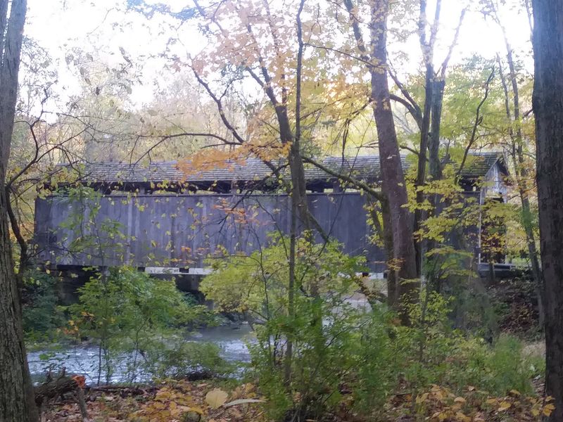
Most travelers skip Columbiana County entirely, which is exactly why I keep recommending it.
Five documented covered bridges are spread across the county, making an easy self-guided drive if you give yourself enough time.
The county tourism bureau tracks Sells Covered Bridge, Teegarden-Centennial Bridge, Church Hill Road Bridge, Thomas Malone Covered Bridge, and Jim McClellan Covered Bridge.
Three of those stops cluster around Lisbon, while Teegarden-Centennial sits near Salem. Thomas Malone is farther southeast at Beaver Creek State Park near East Liverpool, so seeing all five takes you beyond a simple Lisbon-to-Salem run.
Teegarden, near Salem, is the standout for first-time visitors. It sits in a leafy setting along the Greenway Bike Trail after being restored and relocated from its original road crossing.
Church Hill Road Bridge near Lisbon makes a strong second stop. At only 19 feet long, it is a tiny piece of county history that is easy to overlook if you are moving too quickly.
Sells and Jim McClellan add two more Lisbon-area stops, while Thomas Malone gives you a reason to extend the drive toward Beaver Creek State Park.
Lisbon happens to be one of the older settlements in the state, with a courthouse square and historic buildings worth a walk-around.
Salem offers more dining choices and a walkable downtown, while the East Liverpool side adds a different corner of the county to the route.
Give yourself at least half a day if you want to see several bridges without turning the trip into a race.
Weekday visits can be wonderfully quiet, which suits these tucked-away historic spans nicely.
Consider this the sleeper pick of the bunch, a low-key county drive with far more variety than its modest reputation suggests.
Mill Creek Park To Newton Falls Covered Bridge Drive, Youngstown To Newton Falls
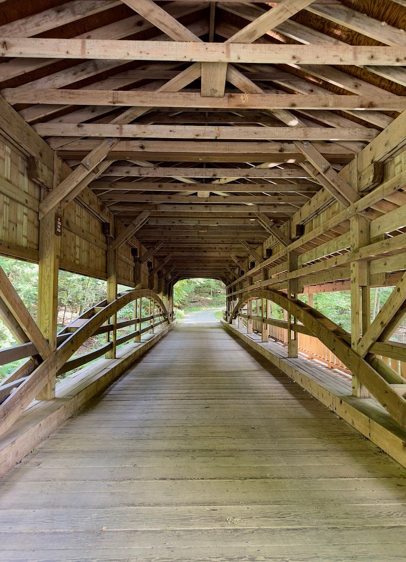
Call this one my custom invention rather than an official trail, because it links two very different bridges into a drive that works beautifully in October.
The starting point is the covered bridge beside Lanterman’s Mill in Mill Creek Park, right inside Youngstown. A wooded gorge, a waterfall, and a restored 1845 mill surround it, which makes the autumn setting unusually dramatic for a park inside a city.
Walking the boardwalk below the mill is the real treat here. Water tumbles over rock ledges while the canopy above burns orange and yellow.
The mill operates as a working grinding demonstration during the season and has a small shop, so check hours before you go.
From there, head northwest toward Newton Falls and its historic covered bridge, built in 1831 and still open to automobiles today.
That span holds the distinction of being the last remaining covered bridge in Trumbull County, which gives the stop a bit of weight beyond the pretty photo.
It also features a separate covered walkway alongside the road deck, a thoughtful touch for pedestrians that has been there for generations.
The drive between the two takes under an hour, leaving plenty of room to linger at either end.
Mill Creek Park deserves at least two hours on its own, with gardens, lakes, and miles of trails beyond the mill area.
Parking at both locations is free, and neither requires much walking if mobility is a concern.
Early to mid October usually hits peak color in the gorge, though the park stays scenic well past the leaves dropping.
Two bridges, one waterfall, and a very easy day trip make this the perfect finale for anyone chasing wooden spans across the Buckeye State.