
10 Maine Hiking Trails Locals Approach With Caution In Fall When Moose Are Especially Active
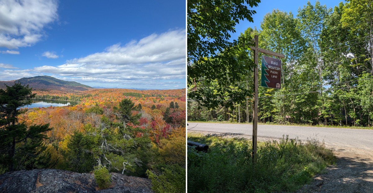
A moose can completely change the mood of an October hike in northern Maine. One moment the trail is all red leaves, frosty boardwalks, and quiet woods.
Then a huge set of antlers appears nearby and suddenly nobody is paying much attention to the scenery. Encounters like this are possible around ponds, wetlands, and other good moose habitat.
Rutting season usually peaks from late September into early October, and bulls can be more active and less predictable during that stretch. Smart hikers give them plenty of space and resist the temptation to move closer for a better photo.
The trails ahead wind through some of the state’s strongest moose country, but wildlife is only part of the appeal. There are peaceful pond walks, steep mountain routes, waterfall-filled gorges, and even one hike that starts with a boat ride.
Good preparation can make a fall wildlife encounter memorable for all the right reasons.
Sandy Stream Pond Trail, Baxter State Park
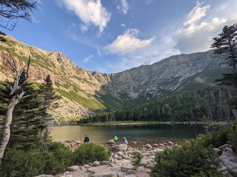
Ask any park ranger in Baxter State Park where to see a moose, and you will probably hear the same answer: Sandy Stream Pond. The short trail near Millinocket, Maine, is famous for moose wading in the shallows while Katahdin towers behind them.
The hike is only about 1.5 miles round trip, so it works well for kids and casual walkers. Start at Roaring Brook Campground, which you reach through the Togue Pond Gatehouse.
Blue blazes lead you through wet, boggy ground, and plenty of wooden bridging keeps your boots mostly dry.
About 0.6 miles in, look for Big Rock. It makes a great spot to sit, sip some cocoa, and watch the pond.
Late afternoon and early evening are prime moose hours, especially in fall.
During the rut, bulls can be jumpy, so locals stay on the trail and never walk toward an animal for a better photo. A zoom lens beats a zoom walk every time.
If a moose lays its ears back or stomps, back away slowly.
Bring layers, since the air cools fast near water. With a little patience and a lot of respect, this pond may give you the best wildlife memory of your year.
Bald Mountain Trail, Oquossoc / Rangeley
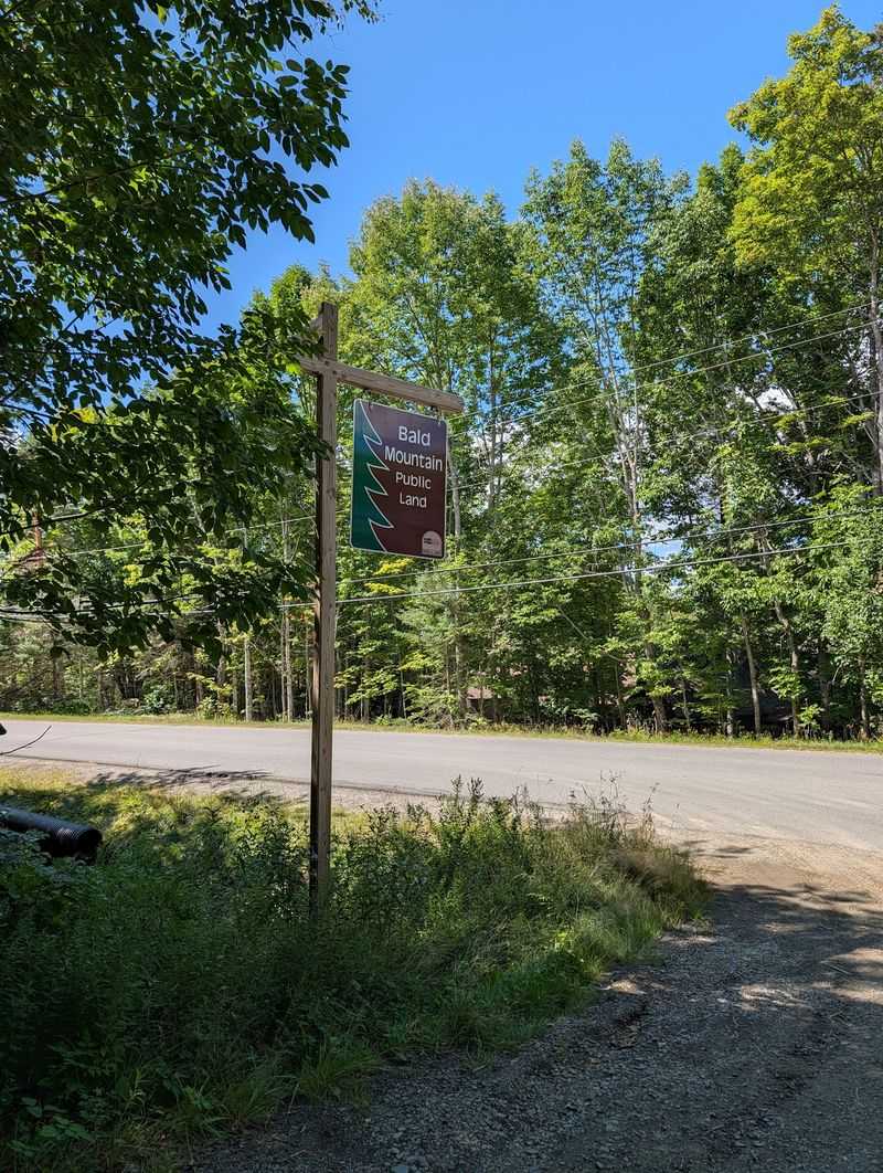
Two big lakes, one short climb, and a tower on top. That sums up Bald Mountain in Oquossoc, a small village in the Rangeley region of Franklin County, Maine.
It sits right between Rangeley Lake and Mooselookmeguntic Lake, which locals just call Mooselook to save their breath.
To find the trailhead, drive west on Maine Route 4 from Oquossoc Village and turn onto Bald Mountain Road. The path is about 1.3 miles to the summit, and it gets steeper as you go.
You start among sugar maples and white birch, then finish in scrubby red spruce.
The 2,443-foot summit has an observation tower with 360-degree views. On clear days you can see Rangeley, Cupsuptic, and Mooselook lakes, plus Saddleback Mountain and even Mount Washington in New Hampshire.
Fall paints these slopes in orange and gold, and it also brings moose and deer across the woods. Hikers often spot fresh tracks in the mud near the bottom.
Locals keep dogs leashed and chatter going so animals hear them coming.
Go on a weekday morning for quieter trails and softer light. You might leave with a camera full of foliage and a story about the moose that crossed your path.
Big Moose Mountain Trail, Greenville Junction
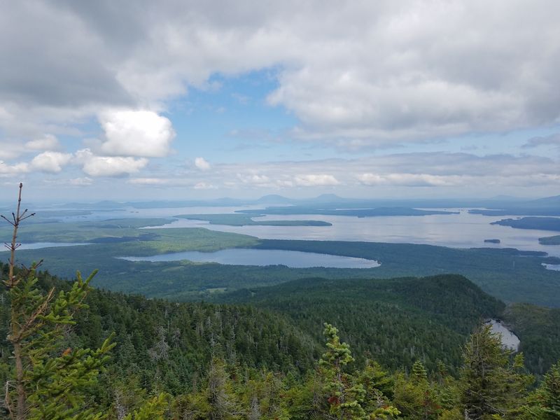
With a name like Big Moose Mountain, nobody should be shocked to meet the real thing here. The peak rises near Greenville Junction, Maine, just a short hop from the shores of Moosehead Lake, the largest lake in the state.
Access to this area generally comes off Route 15N in Greenville, leading toward the Little Moose Public Reserved Land. Trails in the region range from moderate to challenging, climbing through thick forest before opening up to wide views of Moosehead Lake and endless woods.
Autumn is a showstopper on this mountain. Cool air, crunchy leaves, and hillsides of red and yellow make every rest stop feel like a postcard.
The woods here are, as locals like to say, very moosey.
Hikers should use extra care during the late-September and early-October rut, when bulls may grunt, thrash vegetation with their antlers, or react more defensively. If you hear branches snapping nearby, pause and look around before pushing ahead.
Pack a map, since trails in this region connect with others and can get confusing. Carry water, snacks, and a warm hat.
Treat the mountain and its namesake residents kindly, and they will reward you with a truly big day.
Little Moose Mountain And Moose Ponds Trail, Greenville
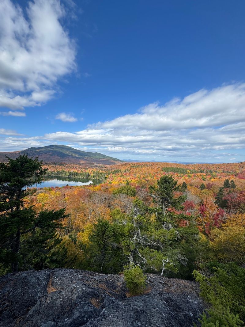
Some hikes feel like a whole vacation squeezed into one afternoon. The Little Moose Mountain and Moose Ponds Trail in Greenville, Maine, is one of them, with ridge views, quiet ponds, and a beach waiting at the end.
The loop sits in the Little Moose Public Reserved Land off Route 15N. It covers about 4.25 miles with a little under 700 feet of climbing.
Most people finish in two and a half to three hours.
Local hikers suggest going clockwise. That way you enjoy the big views first, looking over Little and Big Moose Ponds toward Big Moose Mountain, and then wrap up at a sandy spot beside Big Moose Pond.
Tired feet love a cool dip.
History buffs can look for leftovers from old logging days scattered along the route. The mountain also went by a different name in the past before being renamed Little Moose.
Moose love these ponds and wetlands, and fall makes them more active and less predictable. Keep at least the length of a school bus between you and any moose, and more if it is a bull.
Early mornings bring the most wildlife and the fewest people. Pack a lunch, take your time, and let the ponds work their calm magic.
Number Four Mountain Trail, North Of Greenville
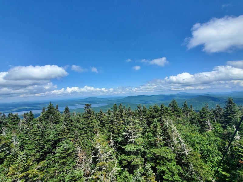
Plain name, fancy views. Number Four Mountain, north of Greenville in the Moosehead Lake region of Maine, proves you should never judge a peak by its label.
Getting there is half the fun. The trailhead sits off Meadow Brook Road, reached by dirt roads deep in the woods, so a sturdy car and a full gas tank are smart ideas.
Watch for logging trucks, which always have the right of way.
The out-and-back hike is about 4.2 miles and gains roughly 1,473 feet in elevation. The first mile rises gently through bogs and young forest, then things get steeper.
Newer switchbacks make the climb easier, and parts of the route follow old fire warden paths.
The 2,890-foot summit is wooded, but openings show off Moosehead Lake, Big Moose Mountain, and Mount Kineo. The old fire tower adds a wider view, even Katahdin on a clear day.
The tower has no platform, so be very careful on the ladder or simply enjoy the view from the ground.
Bogs near the bottom are classic moose hangouts. In fall, look for hoof prints and chewed branches, and talk calmly as you walk.
With luck, this humble mountain will earn a number one spot in your memory.
Mount Kineo Trails, Rockwood / Mount Kineo State Park
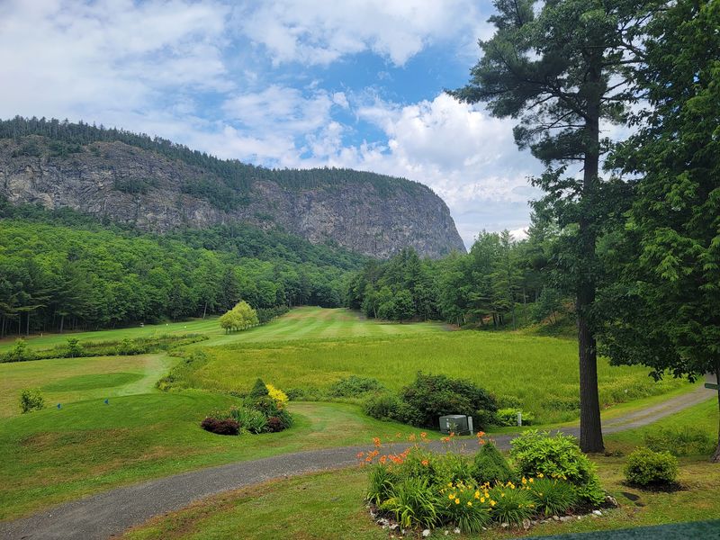
Few hikes in Maine start with a boat ride, but Mount Kineo does. A seasonal ferry carries hikers from Rockwood across Moosehead Lake to Mount Kineo State Park, where massive cliffs rise about 700 feet straight out of the water.
Once you land, pick your adventure. The Indian Trail climbs the cliff face on a rugged, direct route with lake views that make your knees wobble.
The Bridal Trail offers a gentler, winding climb, and a path around the base is great for easy strolling.
At the top, a fire tower gives 360-degree views of Moosehead Lake, rolling mountains, and huge stretches of forest. Kineo is made of rhyolite, a volcanic stone that Native peoples once used for tools, so the rock beneath your boots has a long story.
Moose often visit the shorelines and wet areas around the peninsula, especially during the fall rut. Stay alert near the water and give any animal space to move on its own.
Check the ferry schedule before you go, since service slows down after peak season and missing the last boat is no fun. Bring a jacket for the breezy crossing.
The views, and maybe a moose, will make the trip unforgettable.
Gulf Hagas Rim Trail, Katahdin Iron Works / Monson Area
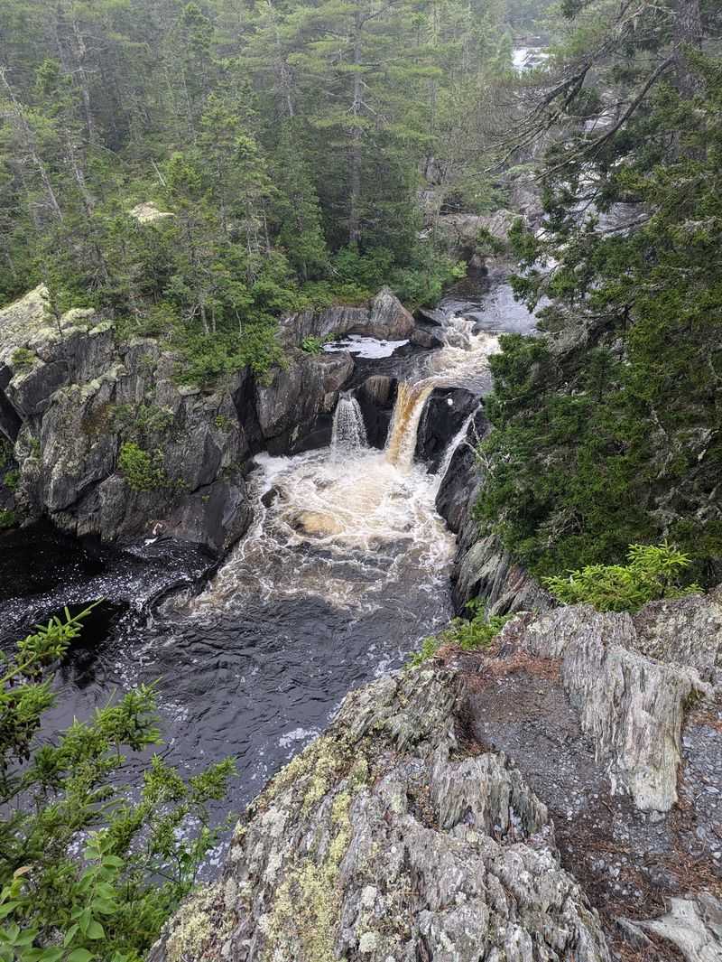
Folks call it the Grand Canyon of Maine, and one look at the gorge explains why. Gulf Hagas sits in the Katahdin Iron Works area near Monson, Maine, where the West Branch of the Pleasant River drops about 400 feet over roughly 4 miles.
The Rim Trail follows the edge with lookout after lookout. Highlights include Screw Auger Falls, Buttermilk Falls, Billings Falls, and Stair Falls, each louder and prettier than the last.
Slate walls and swirling pools keep your camera busy.
This hike asks for planning. You pass a checkpoint and pay a day-use fee at Katahdin Iron Works.
From the Gulf Hagas Parking Area, you must ford the river, which can reach your knees or higher after rain, so pack water shoes and a towel.
Right after the crossing, you enter the Hermitage, a National Natural Landmark with old-growth white pines over 130 feet tall. The trail is full of roots, loose rocks, and steep edges, so steady footing matters.
Remote woods and running water attract moose, especially in fall. Scan the riverbanks and move calmly if one appears.
Start early, since shorter autumn days end quickly, and you will want every minute in this rocky wonderland.
Borestone Mountain Summit Trail, Elliotsville Township
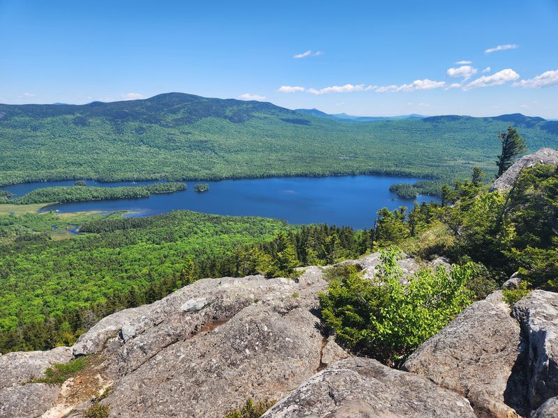
Believe it or not, this mountain once housed a fox ranch. Back in the early 1900s, Borestone Mountain in Elliotsville Township, Maine, was a fur farm, and Adirondack-style lodges built in 1909 still welcome guests today.
Now it is the Borestone Mountain Audubon Sanctuary, a preserve of nearly 1,600 acres. Hikers start at the Bodfish Valley Road entrance and take either the Base Trail or the access road to the Visitor Center at Sunrise Pond.
From there, the Summit Trail curves around the pond, then climbs steeply through spruce forest and over granite ledges. Stone steps and steel handholds help on exposed rock.
The hike to the East Peak, near 2,000 feet, is about 2 miles and moderately tough.
The payoff is huge. Lake Onawa shimmers below, and you can see Barren Mountain, the Lily Bay Range, Big Moose Mountain, and peaks stretching toward Quebec.
The sanctuary’s mature forest is fantastic moose habitat, and in fall they often feed in the ponds below. Pets are not allowed, which keeps wildlife calmer.
Stay quiet near the water, watch from a distance, and let the moose enjoy their snack in peace. Your patience might earn you the best view on the mountain.
Deboullie Mountain Trail, Deboullie Public Reserved Land
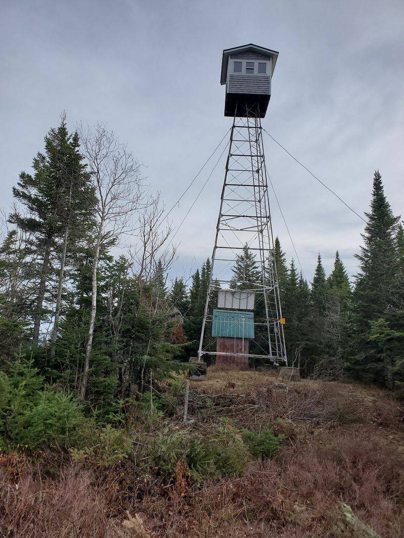
Rock slide might not sound like a great trail name, but that is roughly what Deboullie means, adapted from French. The Deboullie Mountain Trail lives in the Deboullie Public Reserved Land, about 30 miles southwest of Fort Kent in Aroostook County, Maine.
This remote area covers 21,871 acres with rugged low mountains and 17 clear trout ponds. Visitors enter through the North Maine Woods system, which means passing a checkpoint and paying a user fee that helps keep the backcountry in good shape.
The hike is about 4 miles round trip. It starts at a parking area on the east end of Deboullie Pond, follows the shore, crosses a big rock slide, then climbs steeply for about 0.7 mile to the 1,981-foot summit.
A former 48-foot fire tower offers sweeping views of forests and ponds.
Keep an eye out for ice caves, shady cracks where ice can last all year. Rare plants like arctic sandwort grow nearby.
Black bears, loons, and moose all call this place home, and moose get busy in the ponds during fall. Cell service is spotty, so tell someone your plans.
Out here, the quiet is thick, and every ripple on the pond could be a moose.
Moxie Mountain Trail, Caratunk
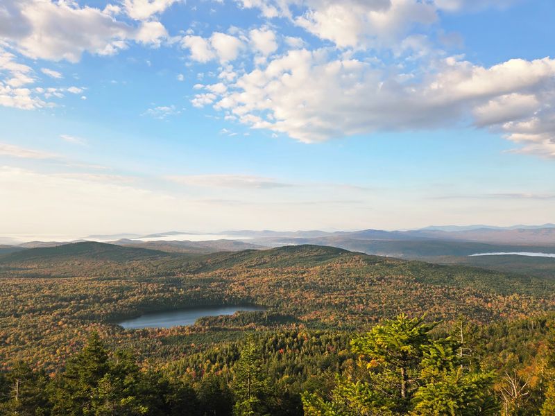
Moxie means courage, and this mountain asks for a bit of it. Moxie Mountain in Caratunk, Somerset County, Maine, stands just under 3,000 feet, yet it hikes bigger than its height suggests.
Both main trailheads require a drive down remote logging roads. The South Trail leaves from Heald Pond Road and runs about 1.6 miles to the top, known as the steeper option.
A slightly longer western route near Deer Bog climbs more gently.
Blue markers guide you as the path grows rockier and steeper. Near the peak, an open, dry rocky shelf feels almost like another planet, with wide views of nearby and faraway mountains.
Many hikers stop at a rocky outcrop just below the summit for lunch, and that sandwich will taste amazing.
The 2,933-foot summit holds a radio tower, solar panels, and a helipad, which surprises plenty of first-timers. Still, the scenery steals the spotlight.
Thick forest and boggy lowlands make this prime moose country, and fall is when they roam most. Drive slowly on the logging roads at dawn and dusk, since moose often stand right in the lane.
Show up with patience and good boots, and Moxie will happily test your own.