
8 Quiet Arkansas Towns With The Most Stunning Fall Foliage Drives
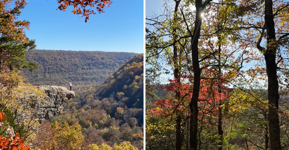
Picture a two-lane road curling over a ridge while maple leaves flutter across the hood of your car like loose confetti. Autumn in the Ozark and Ouachita Mountains turns quiet back roads into rolling paintings of red, orange, and gold.
Arkansas hides some of its best color around tiny towns where the gas station doubles as the gossip center and the traffic jam is usually a tractor. I find it charming that a whole region can feel this calm while looking this loud.
This guide follows eight small towns and the scenic highways that run through them. You will find mountaintop byways with long valley views, river roads shaded by sycamores, and twisty routes that test your steering and your patience in the best way.
Each stop comes with handy notes on what to see and when the leaves tend to peak. Grab a full tank and a good playlist, because these routes are worth every curve.
1. Jasper
Highway 7 earned its place as the first designated state scenic byway in Arkansas, and the stretch around Jasper shows why. The tiny town sits along the Buffalo National River in Newton County.
Ridges rise on every side, so the road climbs, dips, and twists like it cannot decide where to go.
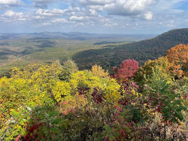
South of town, the route passes the Arkansas Grand Canyon overlook, a wide view across a huge valley in the Ozarks. In fall, the hills below turn into a patchwork of rust, gold, and deep red.
I love that a pull-off this simple delivers a view this big.
Jasper itself moves at an easy pace. The small town square has a historic courthouse, a few local cafes, and shops selling crafts and souvenirs.
Travelers often stop for a slice of pie before heading back onto the curves.
The Buffalo River runs close by, and it was the first national river in the country. During autumn, the water usually runs low and clear, which makes the riverbanks great for a quiet stroll.
Bluffs along the river glow when the afternoon sun hits the turning trees.
Leaf color in this area usually peaks in late October or early November, depending on rain and temperatures. Weekends can bring motorcycle groups and leaf watchers, so weekday trips feel calmer.
Keep an eye out for elk, since the nearby Boxley area hosts a wild herd.
Drivers should take the curves slowly and use the pull-offs rather than stopping on the road. Cell service can be spotty, so a paper map is handy.
Out here, the scenery does all the talking.
2. Mena
Ridge-top roads do not get much prettier than the Talimena Scenic Drive. Starting near Mena, in Polk County, this byway follows Highway 88 west into Oklahoma.
The route rides along the crests of the Ouachita Mountains, which run east to west instead of north to south.
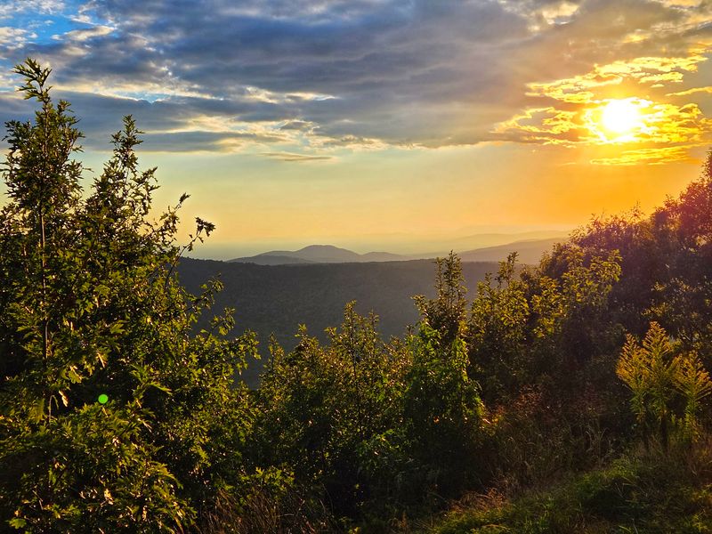
That unusual direction means drivers get long views on both sides of the car. Waves of hills fade into blue in the distance, while oaks, hickories, and maples blaze near the road.
Honestly, the word ridge feels too small for how high this drive seems.
Queen Wilhelmina State Park sits along the route, home to a historic lodge whose original building was named in honor of Dutch royalty who never actually came. The park also has a seasonal miniature train ride and hiking trails.
It makes a fun rest stop for families who need a break from the curves.
Back in Mena, the old train depot now serves as a visitor center and museum. Downtown has local diners, antique shops, and a friendly small-town pace.
The town also has a quirky link to an old radio comedy show, Lum and Abner, whose fans still gather nearby.
Fall color here typically peaks from late October into early November. Dozens of marked overlooks line the drive, each with signs explaining the view.
Morning fog sometimes fills the valleys, which looks magical once the sun burns through.
The road has steep grades and sharp curves, so larger vehicles should take extra care. Gas stations are rare once the climbing starts.
Up on this ridge, the leaves steal every scene.
3. Paris
Paris may share a name with a famous French city, but its best tower is a mountain. The town sits in Logan County.
From here, Highway 309 climbs south as the Mount Magazine Scenic Byway toward the highest point in the state.
The drive starts in farm country with pastures and old barns. Soon the road begins to wind and rise, and the trees close in around it.
By the time drivers reach the top, the valleys below look like a quilt stitched in orange and brown.
Mount Magazine State Park offers a lodge with huge windows, cabins, and several overlooks along the bluffs. Hikers can follow the Signal Hill Trail to the summit, which is a short, easy walk.
I find it funny that the peak of an entire state is reached with such a gentle stroll.
The mountaintop is also a hot spot for butterflies, with many species recorded there. Hang gliders sometimes launch from the bluffs on breezy days.
Rock climbers love the sandstone cliffs as well.
Paris itself has a historic downtown square, a coal miners memorial and museum, and a separate county museum housed in an old jail. The town has a strong mining past, and the coal miners museum explains it in a down-to-earth way.
A quick visit adds some history to a day of leaf peeping.
Because the summit sits higher than much of the region, colors here can turn a bit earlier. Late October is usually a good window.
Temperatures at the top feel cooler, so a jacket comes in handy on breezy afternoons.
4. Kingston
Blink while driving and Kingston might slip right past the windshield. The little town sits in Madison County, Arkansas.
Highway 21 runs through it and connects southward with the Ozark Highlands Scenic Byway in the Ozarks.
The road heads south toward the upper Buffalo River country, rolling through hollows and over ridges. Fall brings bright sugar maples and deep red sumac along the shoulders.
Hardwood forests stretch for miles, with hardly a billboard in sight.
Kingston has a small town square that feels pulled from an old postcard. The historic Bank of Kingston building remains a recognized landmark on the square.
I appreciate how this town keeps its old buildings instead of letting them fade.
Highway 21 also leads toward the Upper Buffalo Wilderness and trailheads near the headwaters of the river. The area is quiet, rugged, and full of creeks that tumble over rocks after autumn rains.
Waterfalls can appear in the hollows when the weather has been wet.
Travelers can link Highway 21 with nearby Highway 43 for a loop through more mountain scenery. That combination brings drivers past steep bluffs and wide valleys.
It works well as a full day of slow, curvy cruising.
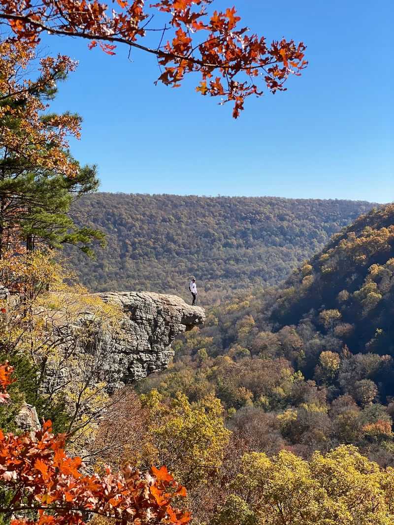
A detour toward Whitaker Point, also known as Hawksbill Crag, rewards hikers with one of the Ozarks’ most recognizable cliffside views. The overlook sits above a forested valley that becomes especially photogenic when the leaves change color.
Peak color usually arrives in late October or early November. Services in Kingston are limited, so packing snacks and filling up the tank in a larger town ahead of time makes sense.
The calm here feels almost like a secret kept by the hills.
5. Oark
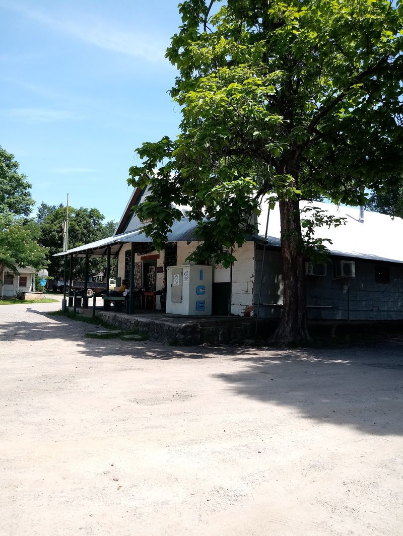
Some towns are so small that the general store is basically the whole downtown, and Oark proudly fits that description. Oark sits in Johnson County, deep in the Ozark National Forest.
Highway 215 runs nearby, following the Mulberry River through a winding valley.
The Oark General Store has operated for well over a century and is known as one of the oldest continuously running stores in the state. It serves burgers and pie to travelers passing through.
Stopping there feels like stepping back into an older, slower Arkansas.
Highway 215 hugs the Mulberry River for many miles. Sycamores along the water turn a pale gold, while oaks and hickories on the slopes shift to rust and amber.
The river is famous for spring floating, but autumn brings a calmer, quieter mood.
The road passes several Forest Service recreation areas, including spots near Wolf Pen and Redding. These sites offer picnic tables, campsites, and access to the river.
Low fall water often leaves smooth rock bars perfect for skipping stones.
Much of the drive is narrow, and some stretches turn to gravel. Drivers should slow down, especially around blind curves.
I like that the road almost forces travelers to take their time.
Colors along the river usually peak in late October to early November. Cell service fades quickly in the valley, so downloading maps beforehand helps.
With no rush and no crowds, this river road keeps its own easy rhythm.
6. Ozark
Hog fans and leaf lovers both know the name of this road. Highway 23 heads north from the town of Ozark, in Franklin County, toward the Pig Trail Scenic Byway in the Ozark National Forest.
Its nickname is partly associated with Razorback football fans who once used the route to reach games in Fayetteville.
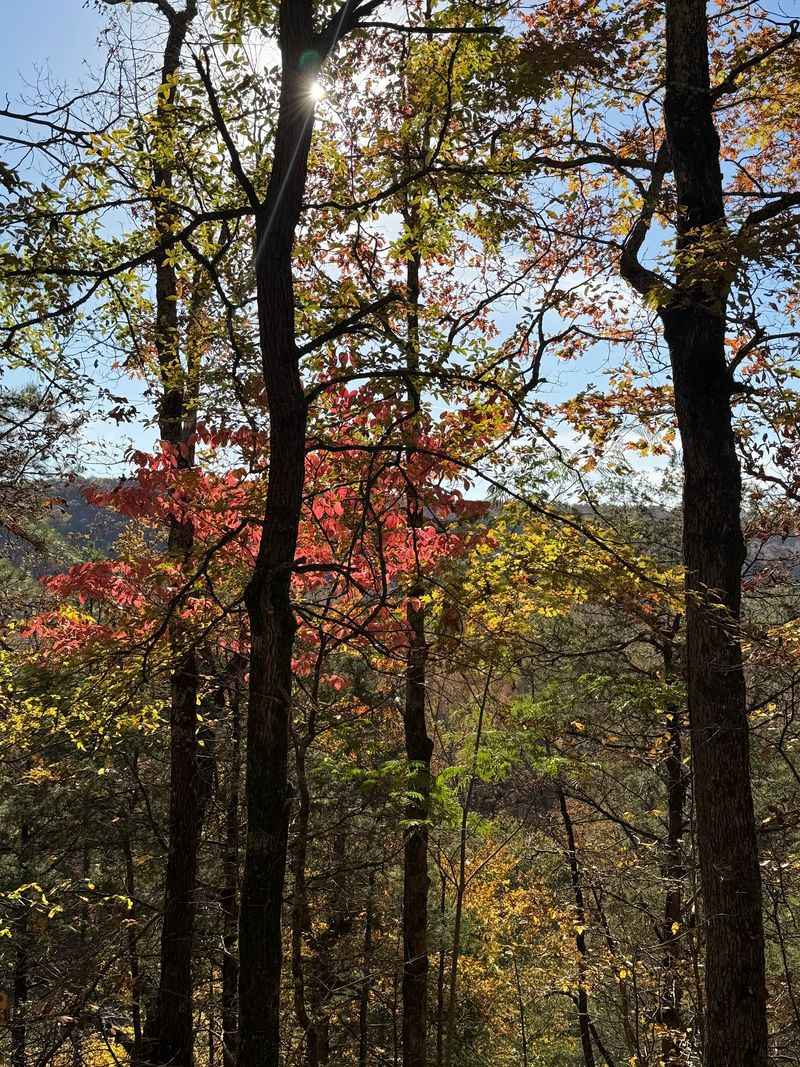
The byway is famous for its tunnel of trees. In fall, branches arch over the road and form a ceiling of scarlet and gold.
Sunlight drips through the leaves and paints the pavement with shifting patterns.
Ozark sits right on the Arkansas River, and its riverfront park makes a pleasant starting point. A historic bridge and walking paths offer a nice view of the water.
Downtown has a handful of local eateries and shops worth a short browse.
Heading north, the road crosses the Mulberry River and climbs into the Boston Mountains. Turnouts give drivers a chance to pause and take photos.
I have to admit, a road named after pigs has no business being this pretty.
The route is popular with motorcyclists thanks to its tight turns and steep grades. Weekends in peak season can feel busy.
Early morning drives tend to be calmer and feature softer light.
Color usually peaks in late October or early November. Leaf watchers should stay alert for slower vehicles and sharp switchbacks.
Few roads in the state can top this one for sheer leafy drama.
7. Winslow
Long before the interstate sliced through the mountains, travelers chugged along the curves of old Highway 71. Today that route forms part of the Boston Mountains Scenic Loop near Winslow, in Washington County, Arkansas, United States, zip code 72959.
The loop pairs the old road with the newer interstate, giving drivers a slow side and a fast side.
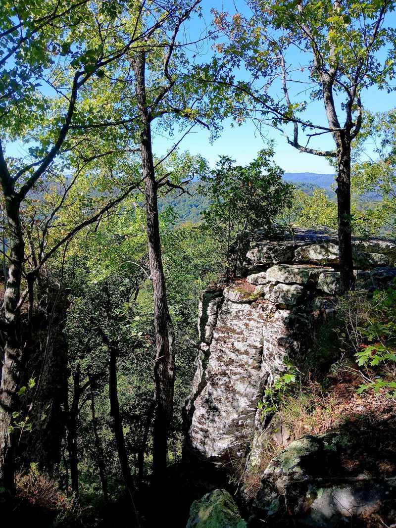
The vintage stretch is the star in autumn. It wraps around ridges covered in maples, oaks, and dogwoods, all turning shades of crimson and copper.
Old stone walls and quirky roadside relics remind travelers of the days when this was a main route.
Winslow itself is a quiet mountain town with an artsy feel. Small galleries and local events pop up throughout the year.
The town once served as a summer escape for folks seeking cooler mountain air.
Farther south along the old highway stands the historic Mount Gayler area, once known for a roadside gift shop and steel observation tower. The tower dates back to 1939, although the former attraction is no longer operating.
I enjoy how a road built for practical travel ended up being such a scenic treat.
Devil’s Den State Park is a short drive away and adds hiking trails, caves, and stone structures built by the Civilian Conservation Corps. Its valley turns brilliant during fall.
Many visitors pair the park with the loop for a full day out.
Peak colors usually show up in late October. The old road can be narrow, so slow speeds are wise.
Sometimes the scenic route really is the better route.
8. Ponca
Elk grazing in a misty meadow make a fine welcome committee. Ponca sits along the Buffalo National River in Newton County, Arkansas.
Highway 43 runs south from here through Boxley Valley, one of the most photographed spots in the Ozarks.
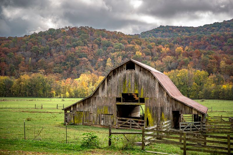
Boxley Valley is a historic district with old farmhouses, barns, and a pioneer-era church. Wide fields stretch between steep, wooded hills that blaze with color in autumn.
The mix of farmland and forest makes every curve feel like a new painting.
The valley is best known for its wild elk herd, which was reintroduced to the area decades ago. Early mornings and evenings are prime viewing times, when the animals wander into the open fields.
Fall is breeding season, so bulls bugle loudly across the valley.
Ponca is also a launch point for floating the upper Buffalo River. Nearby trails lead to Lost Valley, where hikers find a waterfall, a natural bridge, and a cave.
Hawksbill Crag, a famous rock ledge, sits not far away as well.
Visitors should stay in their vehicles or keep a safe distance from the elk. Pulling fully off the road prevents traffic trouble, since crowds gather during peak season.
I think the elk know they are the stars of the show.
Leaves here typically peak in late October or early November. Weekdays bring fewer cars and better parking at trailheads.
In Boxley Valley, even the quiet seems to glow.