
10 Utah Trails That Are More Challenging Than They Look
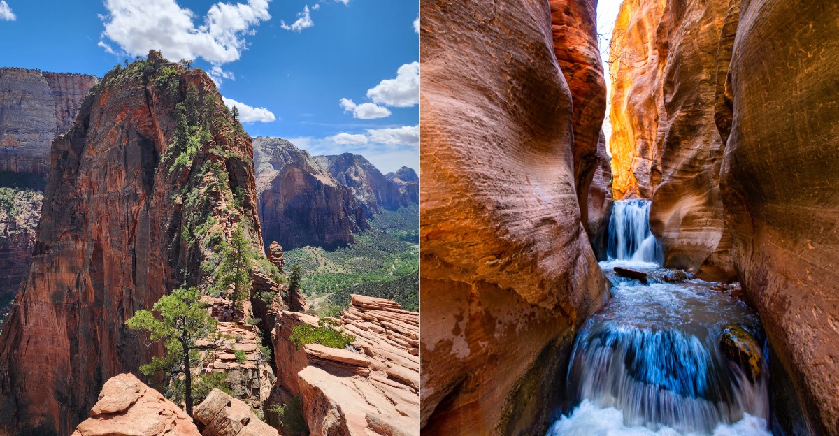
Utah has a talent for making difficult trails look suspiciously photogenic.
From the parking lot, everything can seem very reasonable. Red rock, blue sky, one neat little path disappearing around a bend.
Then the trail starts negotiating.
A gentle incline becomes a climb. A short scramble turns into a full-body problem-solving exercise.
Somewhere along the way, that “easy little viewpoint” begins feeling like it hired a personal trainer.
That is the sneaky part.
These routes are beautiful enough to distract from how much work they can demand, especially once elevation, exposed rock, steep grades, or desert heat join the conversation.
None of that makes them less worth doing. It just means Utah sometimes hides a serious workout inside scenery that looks like a postcard.
Very pretty postcard. Questionable cardio.
1. Lake Blanche Trail
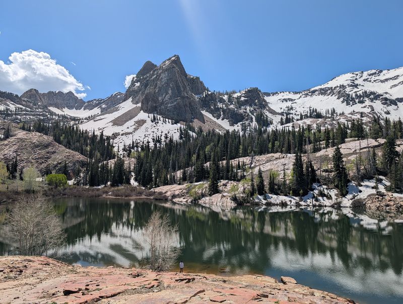
Think of a sparkling turquoise lake tucked under a jagged peak, and you have Lake Blanche in a nutshell. The trail starts in Big Cottonwood Canyon with a shady, friendly stroll along a creek.
It feels like a warm-up lap, and honestly, that is the trick.
Soon the path gets serious. The round trip runs roughly 6.8 to 7.8 miles, with about 2,700 feet of climbing packed inside.
That is a lot of uphill for a hike many folks call a quick morning outing.
The final 1.5 miles bring the steepest work, with rocky steps and steady grades that keep your heart drumming. Shade fades as you climb above the trees.
Bring more water than you think you need, plus snacks for a lakeside reward.
When you finally crest the last rise, the payoff is pure magic. Sundial Peak towers over the water, and smooth, glacier-carved rock surrounds the shore like a natural amphitheater.
Two smaller sister lakes, Florence and Lillian, sit just nearby for curious explorers.
Start early in summer to beat the crowds and afternoon heat. Lake Blanche proves that the prettiest postcards are usually stamped with a little sweat.
2. Bells Canyon Trail
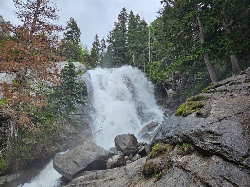
Think of Bells Canyon as a buffet where every dish is spicier than the menu says. Near Sandy, this trail lets you pick how far you go, but even the short options bring a kick.
The lower waterfall hike covers about 4.8 miles round trip with roughly 1,515 feet of gain. That already beats many casual walks by a wide margin.
The calm lower reservoir near the start makes everything feel deceptively easygoing.
Hungry for more? The route to Upper Bells Reservoir stretches to around 9.3 miles out and back.
Estimates for climbing range from 3,500 to over 4,200 feet, which turns your day into a full mountain mission.
Terrain changes quickly from smooth dirt to chunky granite and steep pitches. Some sections are tricky to follow, so a downloaded map is a smart buddy to bring.
Watch for cairns and stay patient on the rocky stretches.
The rewards stack up the higher you go. Waterfalls roar in early summer, wildflowers pop along the creek, and the upper basin feels wonderfully wild.
Bells Canyon rings loudest for hikers willing to keep climbing past the easy chapter.
3. Mount Olympus Trail
Ever wonder why ancient legends put the gods on top of Mount Olympus? Maybe it was so nobody could easily visit.
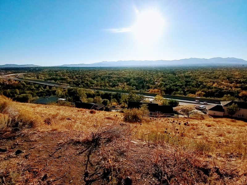
Utah’s version towers right above the Salt Lake Valley, looking close enough to touch.
Here is the catch. The hike packs about 4,100 to 4,200 feet of climbing into roughly 6.8 to 7.5 miles round trip.
That means the trail almost never takes a break.
Early on, you meet a famous stretch nicknamed Blister Hill. The name pretty much tells the story, so wear well-fitted boots and good socks.
Past that, the trail grows rockier and steeper with each switchback.
Things get really interesting near the top. The final push becomes a Class 3 scramble, where hands and feet both help you over big boulders.
Take your time here and test each hold before trusting it.
At 9,026 feet on the summit block, the reward is enormous. The whole valley spreads below like a map, with the Wasatch peaks marching off in every direction.
Start before sunrise in summer, since the west-facing slopes heat up fast. Mortals can absolutely reach Olympus, just not without earning it.
4. West Grandeur Peak Trail
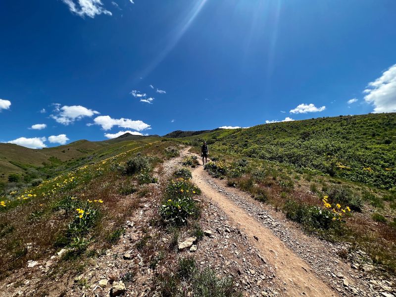
From the valley, Grandeur Peak’s west side looks like a polite little foothill. Do not be fooled for one second.
It might be one of the sneakiest climbs in the entire Wasatch.
The route runs only about 2.2 to 2.3 miles one way. Inside that short stretch, you gain somewhere around 3,300 feet.
Do the math, and you get a slope that feels like a never-ending staircase.
Many hikers rate it double black diamond, the same label skiers use for the toughest runs. The ground is a mix of loose gravel, dusty scree, and sand over hard dirt.
Trekking poles can be a real lifesaver for balance, especially on the way down.
Shade is hard to find, especially during the first mile. Summer mornings and cooler spring or fall days are the sweet spot here.
Pack plenty of water and a sun hat, because the slope soaks up sunshine.
The summit view is the grand finale the name promises. Salt Lake City stretches out below, and Church Fork’s greener side glows to the east.
Grandeur Peak teaches a simple lesson: never judge a mountain by its mileage.
5. Angels Landing Trail
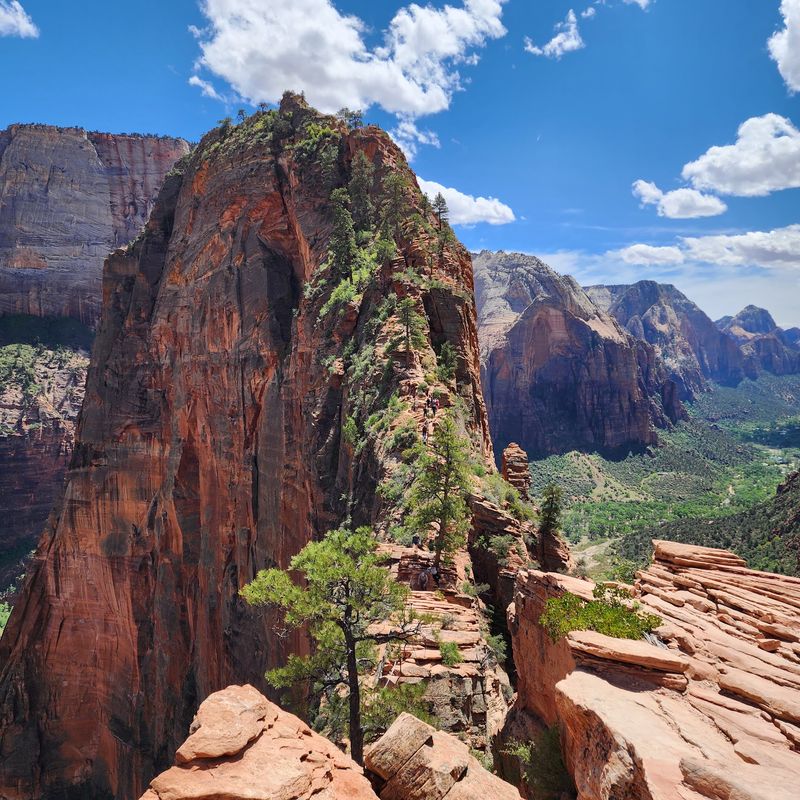
Few hikes on Earth have a reputation as famous as Angels Landing in Zion National Park. People travel from all over the world just to stand on its narrow sandstone fin.
The journey begins on the West Rim Trail, climbing gently through sandy and paved stretches. Then come Walter’s Wiggles, a set of 21 tight switchbacks stacked up a canyon wall.
They look cute in photos and feel very different on your calves.
After Scout Lookout, the real show begins. The last half-mile follows a skinny ridge with chains to grip and big open views on both sides.
Steady focus, good shoes, and a calm pace make all the difference.
The full hike runs about 5 miles round trip with roughly 1,500 feet of climbing. That sounds manageable, but the exposure adds a mental workout on top of the physical one.
Scout Lookout is a wonderful turnaround spot if the ridge feels like too much.
A permit is required for the chains section, so check the park lottery before your trip. At the top, the Virgin River winds through Zion Canyon like a green ribbon.
Angels Landing is where courage meets scenery in spectacular fashion.
6. Navajo Knobs Trail
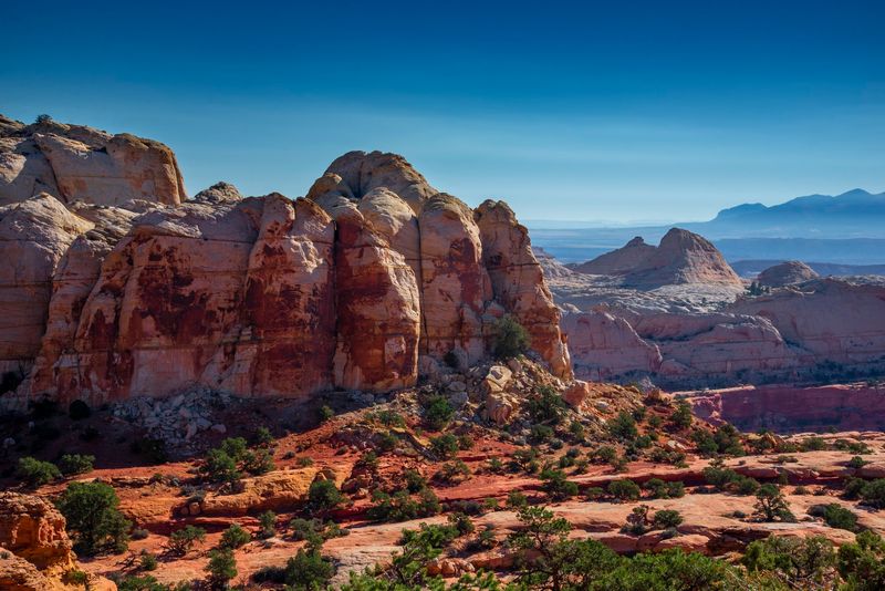
Capitol Reef often flies under the radar, and Navajo Knobs is its best-kept workout secret. The hike starts on the popular trail toward Rim Overlook, so it feels like a scenic group outing at first.
Keep walking, and the crowd thins quickly. The full out-and-back stretches around 9 to 9.5 miles, with climbing often listed near 2,000 feet or more.
That is a full day, not a quick detour.
The surface shifts from dirt paths to long ramps of smooth slickrock. Cairns guide the way, so keep your eyes peeled for those little rock piles.
Near the end, a steep push and light scrambling bring you to the knobs.
Heat can build fast on sun-baked stone, especially from June through August. Spring and fall offer cooler temperatures and softer light for photos.
Carry salty snacks along with lots of water.
Views get better every single mile, which keeps motivation high. You can spot Fruita’s green orchards far below and the giant wrinkle of the Waterpocket Fold.
From the top, Capitol Reef finally shows off its full personality, and it is a stunner.
7. Devils Garden Primitive Loop
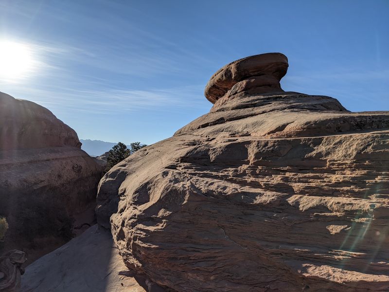
Most visitors to Devils Garden walk a smooth path to Landscape Arch, snap a photo, and head home happy. Those folks have no idea what lies beyond the sign marked primitive.
The first mile is wide, well-kept, and very friendly. After that, the loop transforms into a rugged route of roughly 7 to 8 miles total.
You will scramble up slickrock and balance across narrow sandstone fins.
Route-finding becomes part of the fun. Markers are fewer, so following cairns carefully keeps you on track.
Some spots have airy edges, and dry sandstone grips best, so skip this loop after rain or snow.
Along the way, you collect arches like trading cards. Navajo, Partition, and the double-decker Double O Arch all appear on the route.
A short side trip leads to Dark Angel, a tall dark rock tower standing alone.
Timed entry reservations may be needed during busy seasons, so check the park website first. Start early, since the desert sun gets intense by noon.
This loop turns a famous sightseeing stroll into a true desert expedition, and Arches has never looked cooler.
8. Peekaboo Loop Trail
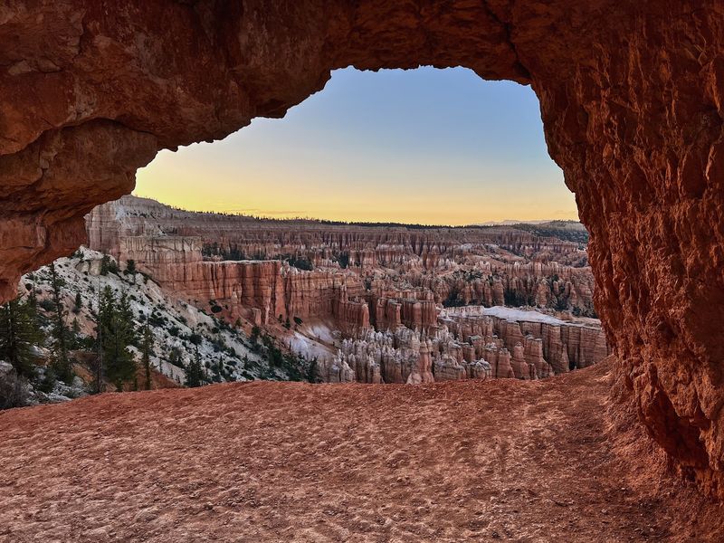
Peekaboo sounds like a game for toddlers, but Bryce Canyon’s version plays for keeps. Its winding path weaves through a forest of orange and pink hoodoos that look straight out of a fantasy film.
The loop usually runs between 5.5 and 6.6 miles, depending on your starting point. Begin at Bryce Point, and you drop about 670 feet before the real ride even starts.
Then come constant climbs and descents with barely any flat ground.
Grades can hit around 27 percent in spots, which feels wildly steep on loose dirt. Tight switchbacks and narrow passages keep you guessing around every corner.
A few tunnels carved through the rock add a playful touch.
Horses share parts of this trail, so step aside politely when they pass. Elevation sits above 8,000 feet, so pace yourself if you live closer to sea level.
The thin air sneaks up quickly.
Sights here are pure eye candy. The Wall of Windows and the Fairy Castle glow brilliantly in morning light.
Remember, every step down to the hoodoos means a step back up, so save some energy for the grand finale climb.
9. Kanarra Falls Trai
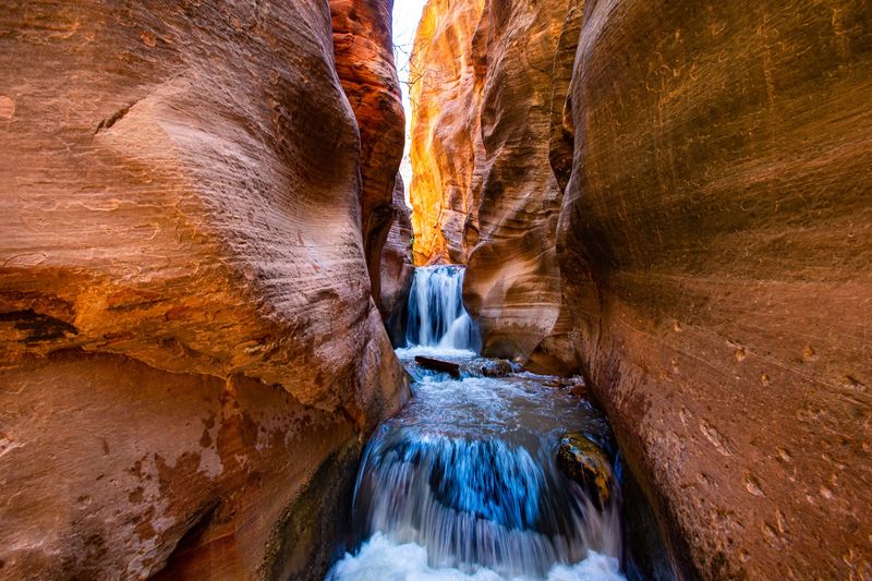
Splashing through a slot canyon to find a waterfall sounds like the ultimate summer daydream. Kanarra Falls delivers that dream, along with a few surprises tucked between its red walls.
Located near the small town of Kanarraville, the hike spans roughly 3 to 4.5 miles round trip. That sounds short and sweet.
Yet the first stretch climbs steadily on a dirt road before the creek walking even begins.
Once inside the canyon, your feet stay wet for most of the trip. The water can feel chilly, especially in spring, so sturdy water shoes and quick-dry clothes help a lot.
Slippery boulders keep balance skills sharp.
At the first waterfall, a metal ladder lifts you up and over the cascade. It is easily the most photographed spot on the trail.
Climbing it carefully adds a fun dose of adventure to the day.
Permits are required and limited daily, so reserve ahead through the town’s official site. Check the weather before going, since slot canyons are no place to be during storms.
10. Y Mountain Trail
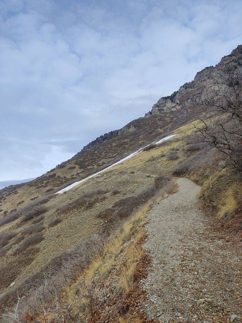
A giant white letter painted on a mountain is pretty hard to ignore. The Y above Provo has been a landmark since 1906, and it calls hikers up like a beacon.
Reaching the letter covers about 2.6 miles round trip. That distance sounds tiny, but you climb roughly 1,100 feet along the way.
The path stays steep almost the entire time.
Twelve switchbacks zigzag up the slope on gravel and dirt. Little signs help you count each turn, which is either motivating or slightly sneaky.
Shade is scarce, so morning or evening hikes feel much cooler.
Bonus points go to anyone who keeps climbing past the Y. Heading toward the true summit of Y Mountain pushes the climbing to well over 3,000 feet.
That route turns a quick fitness hike into a big mountain day.
Either way, the views are a delightful treat. Provo, Orem, and shimmering Utah Lake spread out below like a living map.
Sunset hikes paint the whole valley gold.