
Driving Creede’s Historic Mining Loop Is One Of Colorado’s Most Fascinating Scenic Drives
A whole town of nearly 1,200 people once lived up here, and now it’s mostly a meadow at 10,500 feet. That town had a jail, a city hall, two bakeries, and four hotels.
Today, wildflowers have the place to themselves.
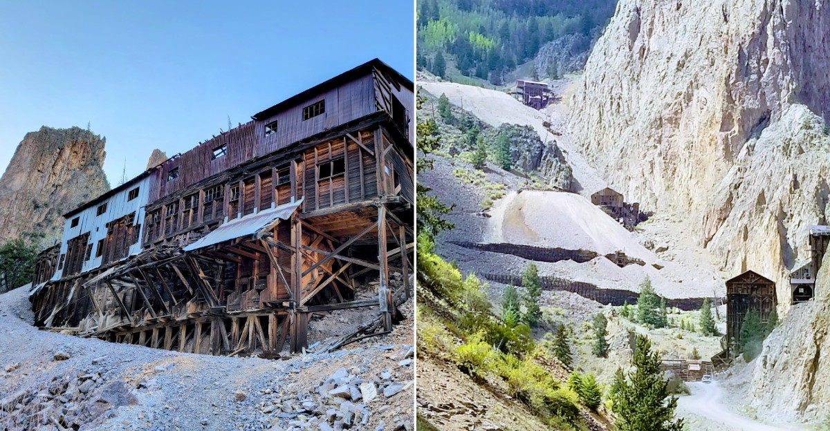
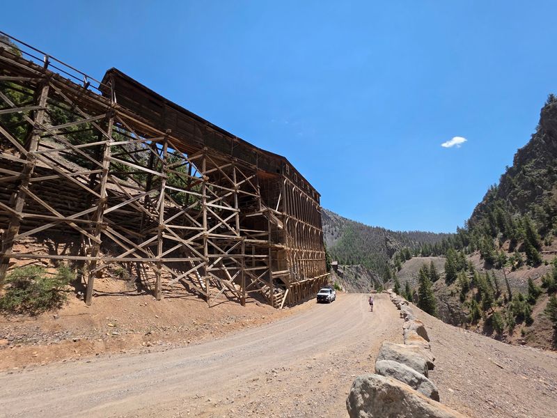
The road that takes you there is 17 miles of gravel. It climbs past wooden mine buildings clinging to cliffs.
One stretch is so steep it earned a nickname that still makes drivers grip the wheel. Colorado has no shortage of mountain roads, but few come with this many reminders of the people who once lived along them.
I like how this drive turns a quiet afternoon into a history lesson you can actually see. Nobody hands you a textbook.
You get numbered stops, old headframes, and mountain views across southern Colorado.
I can’t imagine a better way to meet the silver rush up close. So which direction should you drive it, and what’s waiting around each bend?
Grab The Guidebook Before You Turn A Single Wheel
Every good treasure hunt starts with a map. For the Bachelor Loop Historic Tour, that map waits at the Creede & Mineral County Visitor Center.
You’ll find it at 904 S Main Street, Creede, CO 81130. The staff there can also fill you in on current road conditions, which matters a lot up high.
The guidebook costs very little, and it explains each numbered stop along the route. Without it, you’re just staring at old buildings and guessing.
With it, those buildings suddenly have names, owners, and stories.
The loop itself is a self-guided 17-mile drive. It officially begins at the north end of Main Street and wraps up just south of downtown.
So you start and finish in town, which is handy for snacks and restrooms.
Plan on two to three hours if you want to stop and read. You could zip through in about an hour.
But rushing a silver-rush tour feels a little like skimming the last chapter of a mystery.
The tour runs seasonally in summer, usually until the first snow. Check before you go, especially if the weather turns.
Mountain roads in Colorado can change their mood quickly.
Your Car Will Have Opinions About Which Way You Go
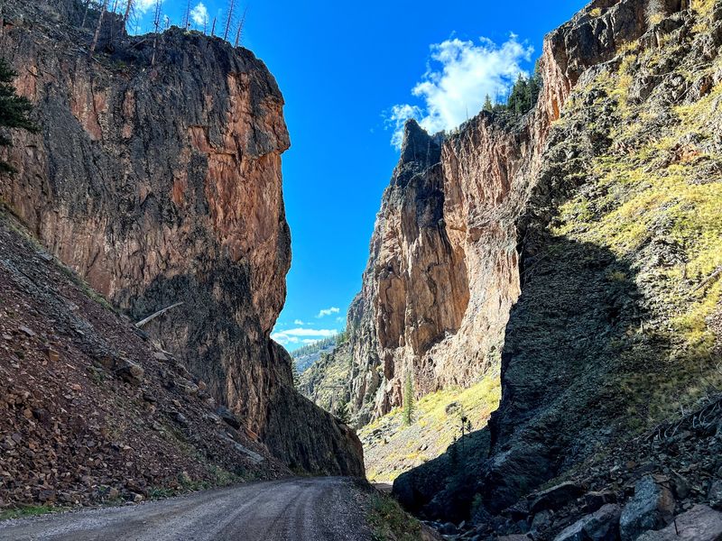
Direction matters more than you’d think on this drive. Most of the road is graded gravel that many vehicles can handle.
Still, some stretches get narrow and steep. Rough spots pop up too, especially after rain.
A high-clearance vehicle makes the whole trip calmer.
Driving a two-wheel-drive car? Many sources suggest going counter-clockwise, sometimes called driving it backward.
That way, you head down the steepest grade instead of crawling up it.
Think of it as letting gravity do the hard work. Your engine will appreciate the favor, and your nerves will too.
Bikers can tackle the loop as well. A counter-clockwise ride is suggested for an easier climb, though the altitude still gets a vote.
Elevations start near 8,850 feet and climb past 10,000 feet.
Several four-wheel-drive roads branch off the main tour route. An optional 4WD route even follows East Willow Creek.
Those side trips lead into rougher terrain, so know your vehicle before you wander.
One more tip: look for the large wooden timbers marked with tour numbers. A miner’s pick and shovel logo tells you you’re still on track.
Follow those, and you’ll avoid surprise detours.
Mine Buildings Perched Where No Building Should Be
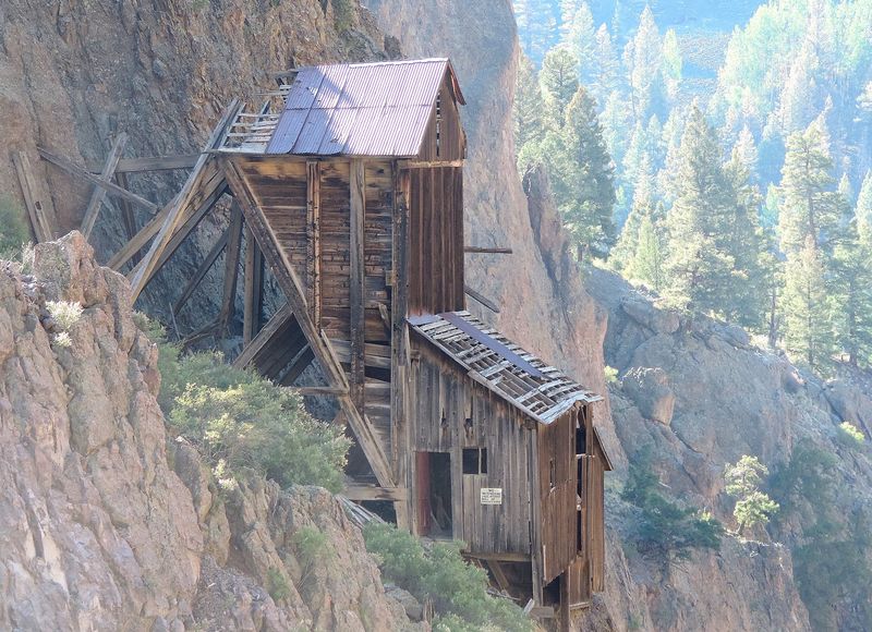
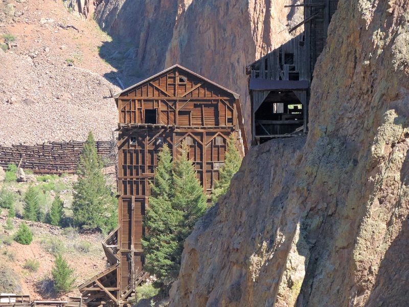
Cliffs rise sharply along West Willow Creek, and somehow miners built right on them. That’s the jaw-dropper of the early stretch.
The route follows the creek for a good while, climbing beneath rugged rock walls. Along the way, you’ll pass mine sites dating back to the 1890s.
Old wooden structures still stand at surprising heights. Some look like they were glued to the mountainside by stubborn determination.
In a way, they were.
The Commodore Mine is one of the big sights along the loop. It’s also an EPA Superfund cleanup site, a reminder that mining left more than buildings behind.
Stay on the road and admire it from a safe spot.
Each numbered pullout gives you a chance to stop and look. Use them generously.
The guidebook explains what you’re seeing, so the timbers and tunnels start to make sense.
Photographers, bring a full battery. The mix of gray rock, weathered wood, and blue sky is tough to resist.
You may find yourself pulling over far more than planned.
Just remember that old mine areas aren’t playgrounds. Look, learn, and snap pictures from the road.
The history is impressive enough from a respectful distance.
A Silver Strike So Big It Named The Town
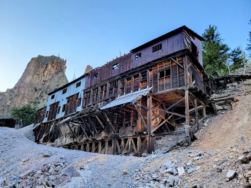
In 1889, Nicholas Creede hit a silver vein at the Holy Moses Mine. It was considered the largest silver strike in the West.
That’s quite a claim, and it put a whole town on the map. Creede was incorporated in 1892 and took his name.
Silver deposits had turned up in Willow Creek Canyon as early as 1883. But things really heated up in August 1891.
That’s when Theodore Renniger found a rich amethyst vein on Bachelor Hill.
Renniger’s find became the Last Chance Mine. Nicholas Creede then founded the Amethyst Mine nearby.
Neighbors with very good luck, apparently.
The boom pushed Creede’s population past 10,000 people. A federal law from 1890 required the government to buy huge amounts of silver each month.
That helped keep the good times rolling.
Then silver prices dropped sharply in 1893. Mines closed, and most people packed up and left.
Only about 400 stuck around.
Mining came and went for decades after that. A new silver vein sparked another boom in the late 1960s.
The mines finally closed for good in 1985, leaving the stories you’ll drive past today.
Hold On Tight When The Black Pitch Shows Up
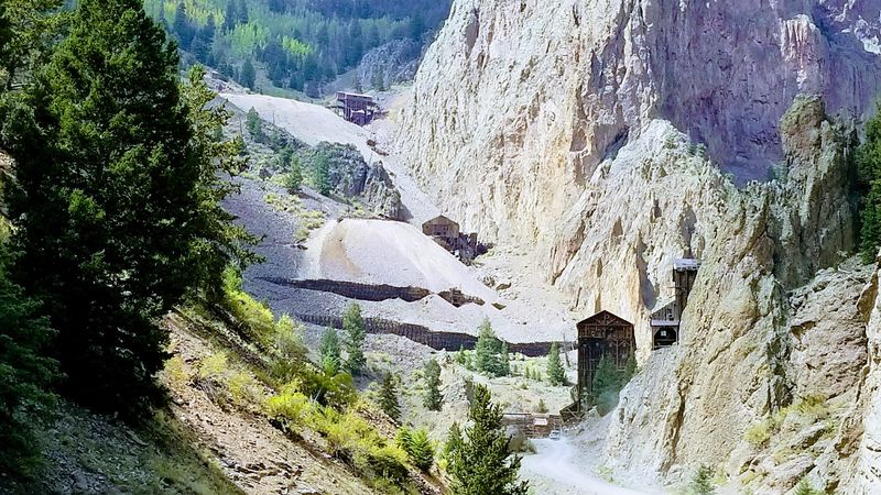
Some roads have names. This one has a reputation.
The Black Pitch is the loop’s famously steep section, and its history is a wild ride.
Long ago, ore traveled down this slope by mule and wagon. Steep ground, simple brakes, and ice made that trip very risky.
Wagons often wrecked at the bottom. The spot became known as the Bone Yard.
Eventually, a tramway was built to reduce the danger.
Today, you’ll face it in a modern vehicle, which is a huge upgrade. Still, the grade deserves respect.
Take it slowly and stay alert.
Here’s where your direction choice pays off. Going counter-clockwise lets two-wheel-drive cars descend the Black Pitch instead of climbing it.
Downhill in low gear beats spinning tires any day.
Wet weather makes this stretch trickier. Rain can leave gravel loose and muddy.
If clouds look grumpy, ask about conditions at the visitor center first.
Once you’re past it, take a breath and enjoy the bragging rights. You just handled the same slope that challenged miners more than a century ago.
Not bad for an afternoon drive.
Somewhere In That Meadow Stood A Whole City
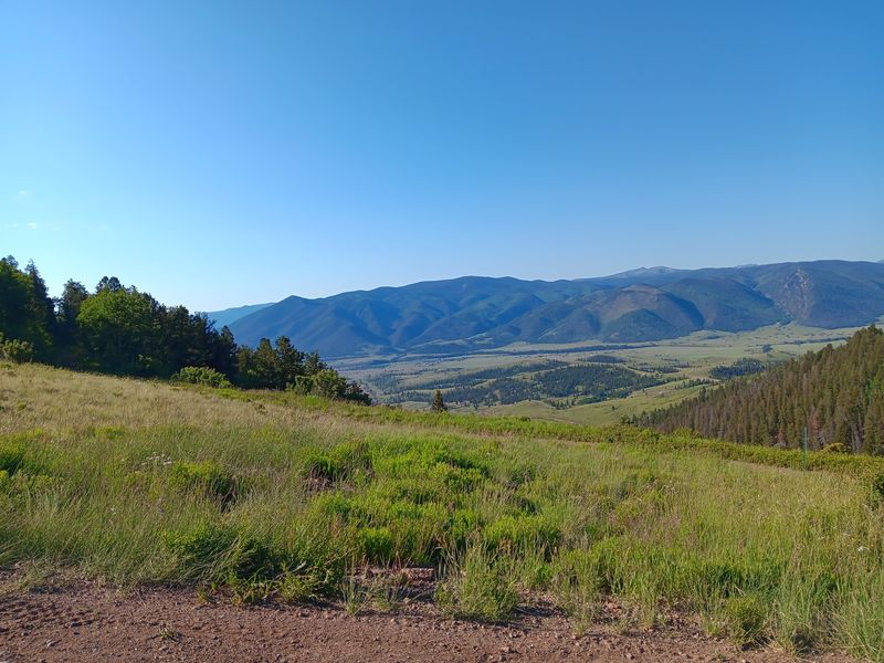
A dozen saloons, four hotels, and five grocery stores once crowded this hillside. Now it’s grass and sky.
Bachelor City sat high in the mountains at about 10,500 feet. Between 1892 and 1896, nearly 1,200 people lived here.
The town had two barber shops and two bakeries. It had restaurants, a school, a jail, and a city hall too.
That’s a busy place for a spot that now hosts mostly wildflowers.
Standing near the site, it’s tough to picture streets and storefronts. That gap between past and present is exactly what makes it fascinating.
Your imagination has to do some heavy lifting.
Bachelor City wasn’t the only ghost town up here. Stumptown is another abandoned settlement along the route.
Some of these mountain towns once rivaled Creede itself in size.
Kids especially tend to love this idea. A whole town that simply vanished?
That’s a story worth telling on the drive back.
Bring the guidebook out at this stop. Reading about the old businesses while looking at the open meadow makes the history feel real.
It also gives everyone in the car something to talk about.
Wildflowers, Bristlecones, And Views That Earn Their Altitude
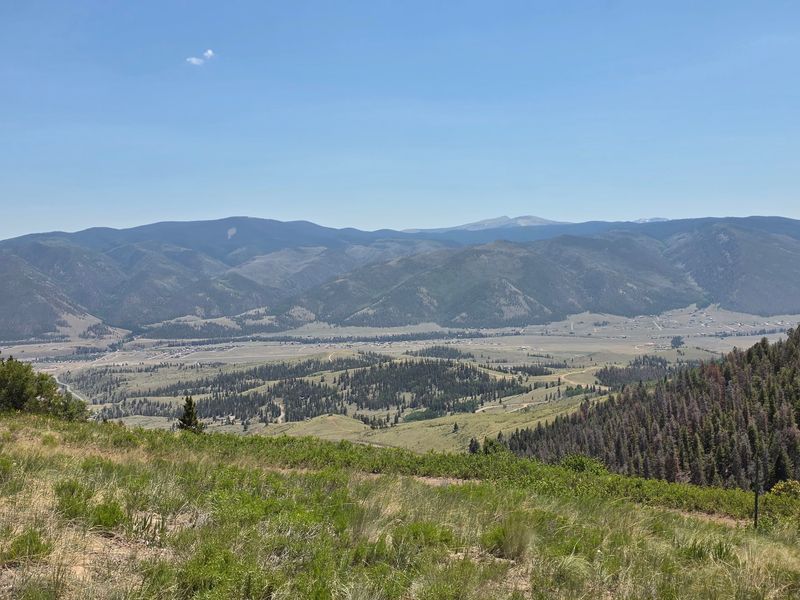
History grabs the headlines, but the scenery might steal the show. The loop winds through the San Juan Mountains high above Creede.
Summer brings wildflowers along the route. By late summer and early fall, the hillsides pick up bright, rich color.
As the road climbs, you’ll reach old forests of bristlecone pine trees. These hardy trees grow in tough mountain conditions.
They look a little twisted and wise, like they’ve seen a few things.
Some points on the route reach nearly 11,100 feet. At that height, the views stretch wide across canyons and peaks.
Your phone camera will get a serious workout.
Altitude can affect people, so pack water and take breaks. Short walks at pullouts feel harder up here.
That’s normal, so go easy.
Wildlife may show up along the route too. Keep your speed low and your eyes open.
Spotting an animal is a bonus, not a guarantee.
Layers are smart, even in summer. Mountain weather in Colorado shifts fast, and high spots can feel chilly.
A light jacket in the back seat costs nothing and could save the day.
Go Underground For An Amethyst-Sized Bonus
Ever wanted to see a real mine from the inside? The Last Chance Mine sits right along the loop and opens seasonally.
It runs from Memorial Day weekend through mid-October. Visitors can take underground tours and explore onsite museums.
Rock and mineral collecting is offered there too. Since this mine grew from that 1891 amethyst discovery, it’s a fitting stop.
Kids with a rock obsession will be thrilled.
Closer to town, the Creede Underground Mining Museum adds another layer. Three former miners began carving it from solid rock in 1990.
It shows real mining equipment and historic methods.
The museum offers audio and guided tours, and it’s open year-round. Hours shift between summer and the rest of the year.
Bring a jacket, since the whole thing is underground.
Nearby, Creede also has an underground firehouse built into a cave. The idea began in 1976 with Bob Louth.
A fire station inside a mountain is definitely a conversation starter.
Pairing these stops with the Bachelor Loop Historic Tour makes for a full day. You’ll understand what miners did, not just where they did it.
The Final Stretch Brings A Famous Name Into View
Near the end, the road eases back toward town with one more surprise. The Bachelor Loop Historic Tour includes a stop at Creede Cemetery.
This is where you’ll find the grave site of Bob Ford. His name is tied to Old West legend, which makes this stop a curious one.
Driving the loop counter-clockwise? Then the cemetery area comes early instead.
Either way, it adds a quiet, reflective note to the journey.
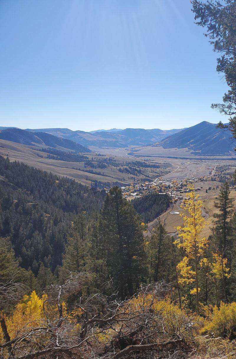
Views on the west side of the loop look down toward Creede. After hours of mines and meadows, seeing the town again feels like a neat ending.
You’ve basically traced its whole story in a circle.
Once back in Creede, swing by the Creede Historical Museum at the old depot. It holds artifacts and memorabilia from the area.
Seeing those items after the drive makes them click.
The loop wraps just south of downtown on Main Street. That means food, rest, and maybe a second look at your photos are close by.
It’s a short drive with a long reach. Few places in Colorado pack this much history into 17 miles of gravel.