
9 Beautiful Hiking Trails In Arkansas You Must Explore In 2027
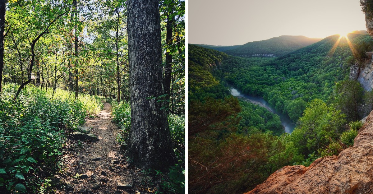
In one Arkansas park, any diamond you find in the dirt is yours to keep. You can even use screens to sift through the soil, so the only things you really need are patience and a little luck.
That fact alone sent me down a rabbit hole of places I’d somehow never planned around.
Then I learned about a chapel in the woods with 425 windows and a cave that’s still busy growing its own formations, one slow drip at a time. I love that none of these spots require a passport, a guide book, or a giant travel budget.
Some sit near quiet highway towns, and one waits inside a city park with waterfalls and bridges. The year keeps moving fast, though, and 2026 won’t politely hold the door open for anyone.
So which of these eight gets your first free weekend, and who’s riding shotgun?
1. Hawksbill Crag Trailhead
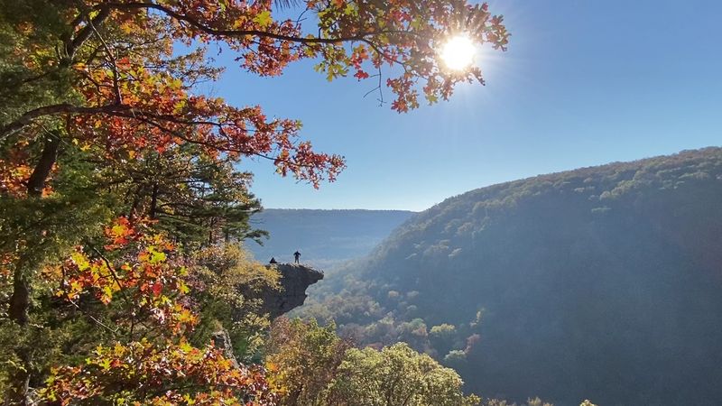
Few rocks in Arkansas get photographed more than the one waiting at the end of this trail. Hawksbill Crag, also called Whitaker Point, pokes out over the valley like it’s showing off.
You’ll reach it on a trail of roughly three miles round trip in the Ozark National Forest. Expect an up-and-down route rated moderate, with several cliffside spots along the way.
Big boulders line parts of the path, and seasonal waterfalls show up after wet weather. Spring also brings wildflowers, which makes the walk out feel like a bonus round.
Getting there takes some patience, since the drive includes dirt roads. Plan for that, and give yourself extra time instead of rushing the last few miles.
The trailhead has no restrooms or drinking water. Bring what you need, and pack it back out with you when you leave.
Parking is free, but space can fill up during popular times. An early start helps, and it also gives you a better shot at a quieter moment on the crag.
Dogs are welcome on a leash, so your four-legged hiking buddy can tag along. Just keep that leash short near the edges, because the drop is no joke.
Near the trailhead, a monument honors Senator Dale Bumpers for his work protecting wilderness areas in Arkansas. It’s a nice reminder of why places like this still look so wild.
Here’s a smart move for your photos. Find a safe spot along the trail with a clear view of the crag, and use the surrounding scenery to frame your shot without approaching the exposed edge.
Address: Hawksbill Crag Trailhead, Kingston, AR 72742
2. Lost Valley Trailhead
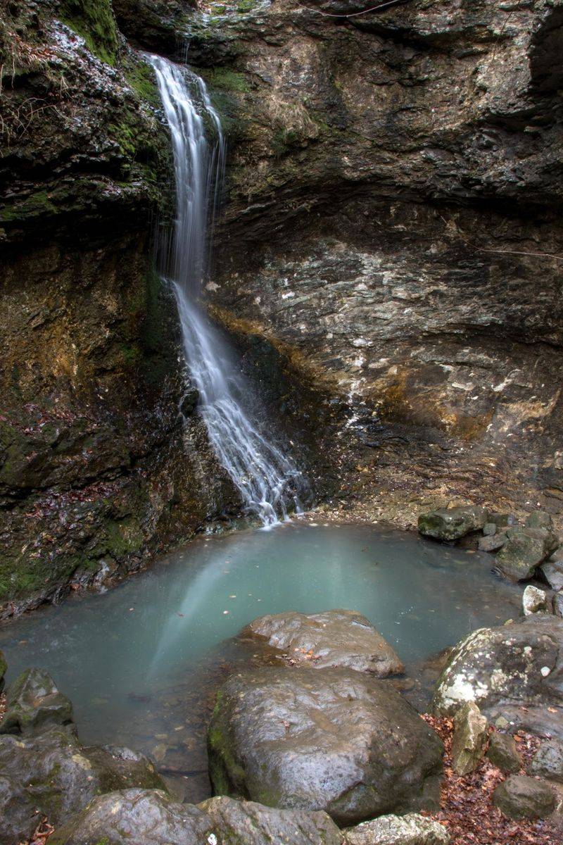
A waterfall inside a cave sounds like something from a video game. On the Lost Valley Trail, it’s simply part of the hike.
The trail sits in the Buffalo National River area, near the historic Boxley Valley. It’s known as a family-friendly route with a mostly flat path at the beginning, so younger hikers can keep up.
About 1.2 miles in, you’ll reach Eden Falls, which tumbles 53 feet over tall cliffs. Before that, watch for the Natural Bridge, where an 8-foot waterfall pours out of a bluff.
Then comes the fun part for explorers. Cob Cave forms a massive bluff shelter about 200 feet wide, while nearby Eden Falls Cave contains a 25-foot underground waterfall.
You’ll need multiple reliable light sources to explore the cave safely. Crawling and scrambling are involved too, so wear shoes with real grip.
The full out-and-back trip runs around 2.4 miles. Benches pop up along the first portion of the trail, which makes it easy to pause and look for wildlife.
The trailhead offers restrooms, and drinking water is available from March through October. That’s a nice perk compared to many backcountry spots in the Ozarks.
Pets aren’t permitted on Lost Valley Trail, except for qualifying service animals. You’ll also cross a creek, so expect a little splash and plan your footwear accordingly.
After a good rain, the waterfalls put on their best show. In drier months they slow down, but the bluffs and caves still make the trip worth it.
Address: Lost Valley Rd, Kingston, AR 72742
3. Cedar Falls Trailhead
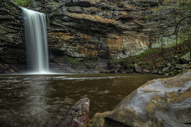
Going down is the easy part here, and your legs will remind you of that later. The Cedar Falls Trail drops into Cedar Creek Canyon toward a 95-foot waterfall.
You’ll find it in Petit Jean State Park, which became the first state park in Arkansas in 1923. Cedar Falls is often called the largest waterfall in the state you can reach by trail.
The hike runs about two miles round trip. Switchbacks, stone steps, and a bridge guide you down to the base of the falls.
Coming back up takes real effort. Take breaks, sip water, and don’t feel bad about stopping to catch your breath.
Not up for the climb? The Cedar Falls Overlook has a paved boardwalk leading to a viewing platform.
That overlook gives you the view without the steep steps. It works great for anyone with tired knees or a stroller in tow.
The trail starts near Mather Lodge, built by Civilian Conservation Corps workers in the 1930s. The lodge has a full-service restaurant, which feels like a well-earned reward after the hike.
Leashed pets are welcome on the trail year-round. The paths are well marked, so finding your way is pretty simple.
Timing matters with waterfalls. After heavy rain, the falls roar, while dry spells can leave them looking a bit shy.
Address: 1285 Petit Jean Mountain Rd, Morrilton, AR 72110
4. Yellow Rock Trailhead
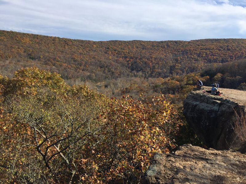
Three hundred feet is a long way down, and Yellow Rock lets you see every inch of it. The bluff rises above the Lee Creek Valley in Devil’s Den State Park.
Most folks hike it as a loop of around three miles. It’s fairly short but climbs uphill, so expect your heart rate to wake up.
The trail stays wide and well kept, which makes it a solid pick for families. Rock steps lead up near the overlook, adding a little adventure to the route.
Along the way, you’ll pass big boulders, cedar glades, and thick forest. The scenery changes often, so the miles go by quickly.
Keep an eye out for the CCC Overlook pavilion. It was the first structure built in the park, back in the 1930s.
There are two overlooks to enjoy on this hike. Still, Yellow Rock is the star, so save some energy and time for it.
Dogs are allowed on a leash, which makes this a nice outing with your pup. Keep them close at the bluff, since the edge is steep.
Fall is a lovely time to visit, when the valley trees change color. Spring and summer bring plenty of green, too.
The trail closes at dusk, so plan your start time with that in mind. Sunset chasers should keep a close eye on the clock.
Address: 354655 AR-74, West Fork, AR 72774
5. High Point Trailhead
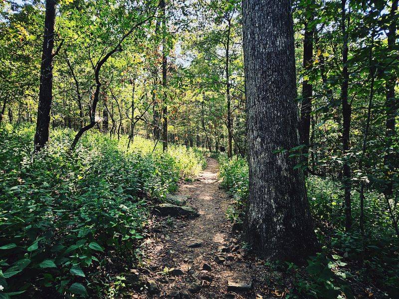
Standing on the tallest spot in the state sounds like it needs mountain gear. On Mount Magazine, a short and easy walk gets you there.
The High Point Trail leads to Signal Hill, the highest point in Arkansas at 2,753 feet. It’s a great hike for kids, since the path stays easy and friendly.
Here’s the fun twist at the top. Instead of a big lookout, you’ll find a stone map of Arkansas set into the ground.
Kids love finding their hometown on it. Adults usually do the same thing, just a little less loudly.
Don’t expect a sweeping view at the summit, since trees surround the top. The trail itself still has plenty of pretty sights to enjoy along the way.
Mount Magazine also carries lots of history. Take a moment at the top to think about how many people have made this same climb.
Parking is free at the trailhead lot. That makes it easy to pull in, hike, and still have time for other stops nearby.
High point collectors, this one is for you. Plenty of hikers aim to stand on the top spot of each state, and Arkansas makes it pretty painless.
Bring a camera for a photo with the stone map. It’s a quirky souvenir that proves you made it to the top of the state.
Address: Mt Magazine Rd, Paris, AR 72855
6. Big Bluff Goat Trail
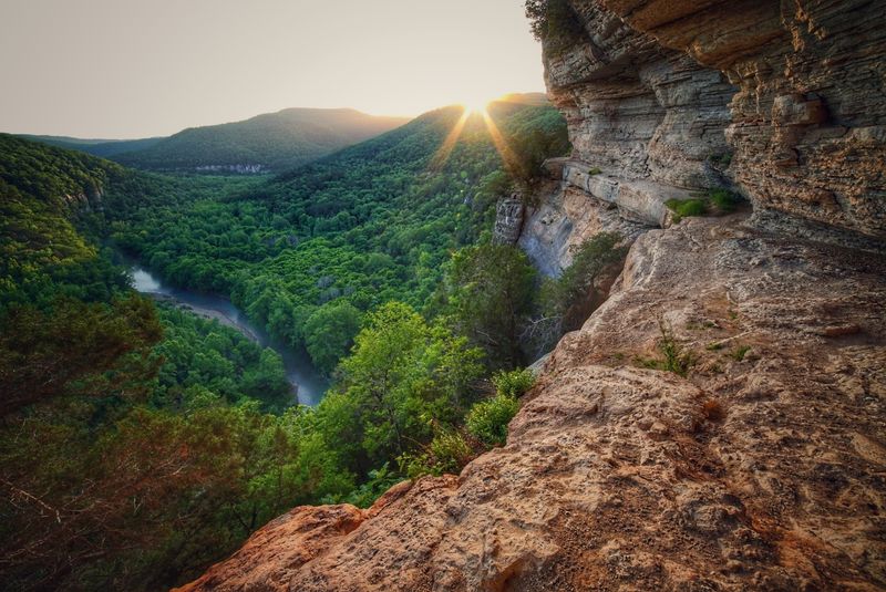
Goats know a thing or two about narrow ledges, and this trail earned its name honestly. The Goat Trail hugs the side of Big Bluff high above the Buffalo River.
Big Bluff is one of the tallest bluffs along the river. From the ledge, you get sweeping views of the water and the surrounding Ponca Wilderness below.
Most hikers start from Centerpoint Trailhead near Compton. Plan on about three miles to reach the bluff.
The hike is strenuous, and the narrow ledge follows a sheer cliff with a dangerous drop. Watch your footing, and skip the ledge if you’re nervous about heights.
The route isn’t recommended for children.
Bring plenty of water, more than you think. The hike back climbs, and the Arkansas sun can make it feel longer.
The ledge itself is narrow in places. Move slowly, let other hikers pass, and keep both hands free when you can.
Morning light works well for photos of the river bend. It also helps you dodge some of the afternoon heat in summer.
Sturdy shoes with good grip are a must. Loose rocks show up along the path, and sandals just won’t cut it.
The payoff is huge, though. The views of the Buffalo River winding through the wilderness are the kind you’ll talk about for weeks.
Admire them from a secure spot without approaching the exposed edge.
Address: Compton, AR 72624
7. Little Missouri Trailhead
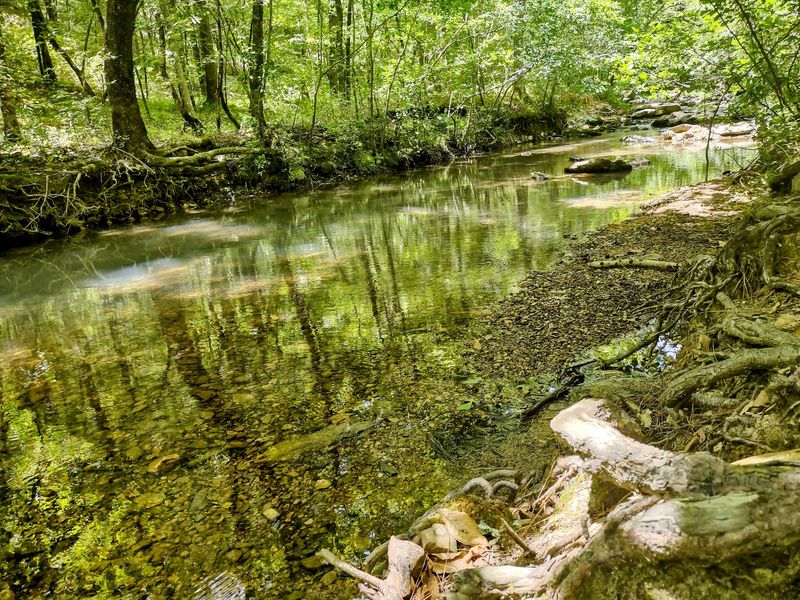
Some trailheads feel like a starting gun for adventure. The Little Missouri Trailhead near Mena is one of them, sending hikers into a beautiful corner of the Ouachita Mountains.
The trail follows the Little Missouri River through the Ouachita National Forest. It’s a favorite launching point for both day hikes and backpacking trips.
Families should choose their route carefully, since the full trail is rated more difficult and includes multiple river crossings. Shorter outings are possible, but trail conditions and water levels deserve close attention.
Want a bigger challenge? Pack your gear and keep going, because the trail stretches deeper into the forest for longer trips.
The river is the main attraction here. Clear water, rocky ledges, and shady trees make it a lovely place to slow down.
Plan for a remote feel and bring your own supplies. Water, snacks, and a map are smart picks for any trip out here.
Avoid river crossings during high water, especially after heavy rain.
Spring is a great time to visit when the river runs strong, though higher water can make crossings dangerous. Fall brings cooler air and changing leaves, which makes hiking much more pleasant.
The roads in this area can be winding. Give yourself plenty of time to drive, and enjoy the scenery on the way in.
Bring a camera and a little patience. The quiet bends of the Little Missouri are the kind of views that reward a slow pace.
Address: Mena, AR 71953
8. Lake Ouachita Vista Trail (LOViT)
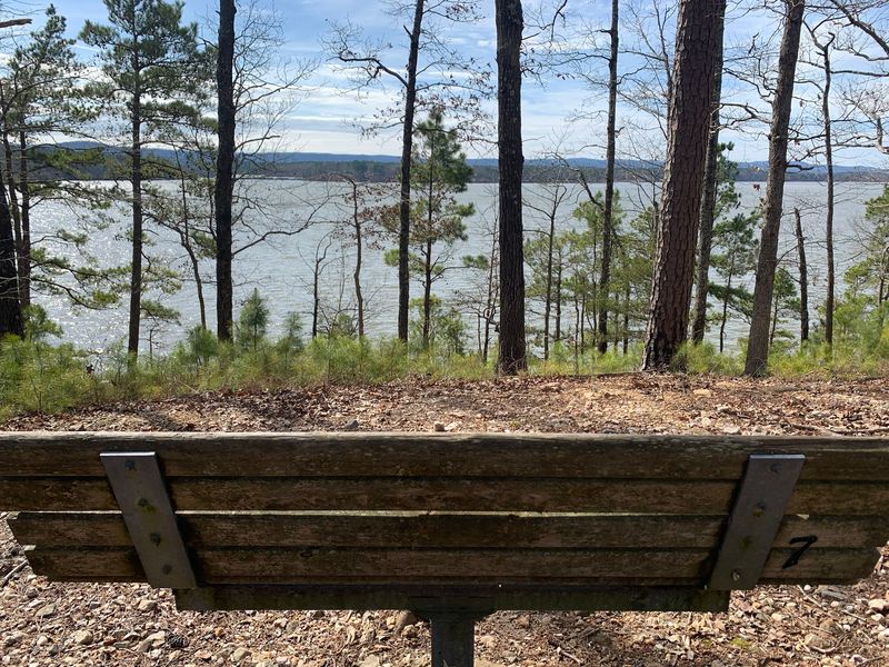
A 180-degree view of shining blue water is a pretty great reason to keep walking. That’s the prize at the end of this stretch of the Lake Ouachita Vista Trail.
Hikers often call it LOViT for short. The east end starts near Blakely Dam Road in Royal, close to the dam that formed Lake Ouachita.
Lake Ouachita is the largest lake located entirely within Arkansas. Seeing it spread out below you helps that fact really sink in.
The trail is kid-friendly, so it works well for a family outing. Roadside parking near the trailhead makes it simple to get started.
Along the route, streams cascade down into the valleys on their way to the lake. After rain, those little waterfalls add a soundtrack to your hike.
The vista at the end opens wide over the water and the forested hills. Pack a snack, find a rock, and soak it in for a while.
You can hike out and back for a manageable day trip. Longer stretches of the trail continue for hikers who want more miles.
The trail sits in the Ouachita National Forest. Respect the woods, stay on the path, and pack out your trash.
Bring sunscreen for the open vista. Shade can be scarce right where the view gets best.
Address: 1320-1338 Blakely Dam Rd, Royal, AR 71968
9. Cossatot River North Trail Head
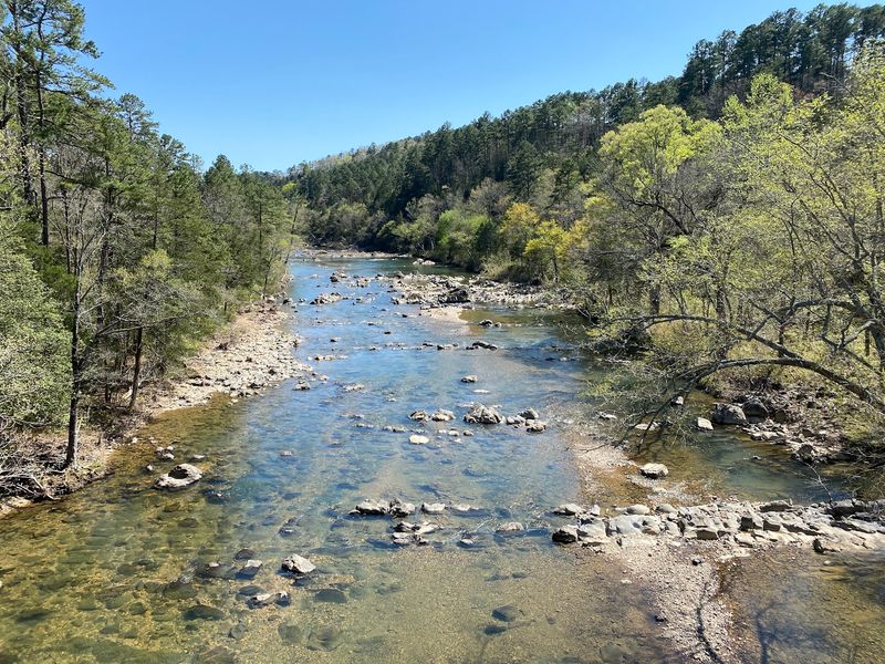
The name Cossatot is often linked to the phrase skull crusher, which is a bold label for a river. The park offers shorter walks as well as more demanding trails.
Cossatot River State Park-Natural Area sits in the southwest corner of Arkansas. The river is famous among paddlers for its rough rapids during high water.
Shorter walks offer opportunities to enjoy the scenery, but some trails in the park are rugged and strenuous. Choose a route that matches your experience.
A pedestrian bridge crosses the water at Brushy Creek Recreation Area, and it’s one of the coolest features here. Stop in the middle for a look up and down the river.
Families can enjoy shorter hikes in the park, including the easy Brushy Creek Trail. Dogs can accompany visitors where permitted, provided park rules are followed.
Picnic areas make it easy to turn the trip into a lunch outing. Check the facilities at your chosen trailhead before setting out.
Bring water shoes if you plan to explore near the river’s edge. The rocks can be slippery, so take each step slowly.
Spring often brings the strongest river flow. Summer is great for lazy picnics and short strolls in the shade.
It’s a lovely way to wrap up a hiking season in Arkansas. River scenery, a fun bridge, and a sandwich in the shade sound like a winning finish.
Address: 45 9th Ave, Vandervoort, AR 71972