
12 Colorado Scenic Drives Where October Colors Steal The Entire Show
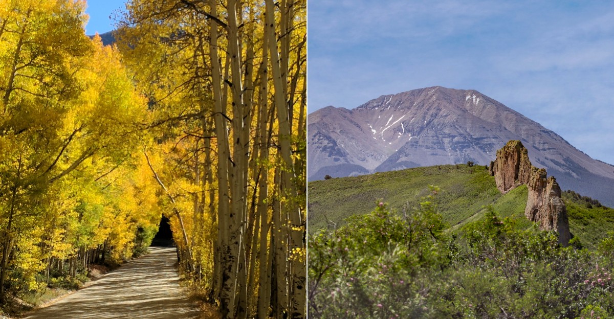
A road crew in Colorado once had its own bread oven, baking for 30 state prison inmates and their guards. It ran from April 1911 to July 1912, while they built a route toward a giant flat-topped mountain.
I love that detail so much.
Mountain roads here come packed with stories like that. One pass leads to a former railroad community near its summit.
Another one-way road rides the top of a skinny ridge, with dinosaur tracks close by. Colorado apparently thinks every scenic drive should come with a history lesson.
Then there are the views. Golden aspens, glassy lakes, and peaks over 14,000 feet line these routes like they are showing off.
A few climb above 12,000 feet, where the trees simply stop trying.
I can’t imagine a better way to see this state than through a windshield, with a full tank and snacks within reach. So which road gets your first free weekend?
1. Peak To Peak Scenic Byway
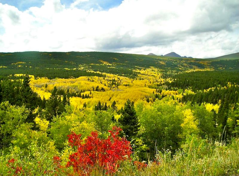
Fifty-five miles of mountain road, and somehow it skips the worst of the crowds. That alone makes this route feel like a clever little secret in plain sight.
The byway stretches from Estes Park down to Black Hawk and Central City. Along the way, it threads through the Front Range with Rocky Mountain National Park hovering nearby.
You get big peaks, rocky cliffs, and rushing streams without fighting park traffic. Long forested sections keep things shady and calm between the wide-open views.
History rides shotgun here too. The road passes old mining towns that once boomed, and they still give the trip a frontier flavor.
Plan for roughly two hours of driving if you keep stops short. Of course, keeping stops short is harder than it sounds once the scenery shows up.
Fall is when this byway really shows off. Aspen groves turn gold, and the mountainsides start looking like someone spilled a giant box of crayons.
Here’s a smart move. The road stays open year-round, so winter trips are possible when other high routes are locked up for the season.
Kids tend to do well on this drive since it’s not a white-knuckle climb. Bring snacks, though you can also find restaurants and cafés along the byway in Nederland.
A connection to St. Vrain Canyon also points you toward Boulder. That makes it easy to turn the byway into a loop instead of a straight shot.
Fill up before you start and pack a jacket. Mountain weather in Colorado loves a surprise.
Address: 72 CO-7, Estes Park, CO 80517
2. Kebler Pass
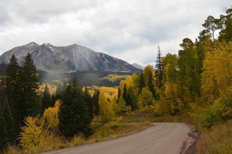
Gravel, gold leaves, and a sunset that looks almost unfair. Kebler Pass is the kind of road that makes you forgive it for not being paved.
Sitting above 10,000 feet, this route crosses the Gunnison National Forest west of Crested Butte. The views sweep across surrounding mountains in nearly every direction you turn.
Leaf peepers treat this pass like a holiday destination. Its aspen groves put on one of the boldest fall color shows in the state.
The first week of October often lands right in the color sweet spot. Still, timing can shift with weather, so check conditions before you commit.
Now for the honest part. Wet gravel can get slick and tricky, so slow down when rain rolls in.
A car with decent tires helps a lot here. So does patience, since you’ll probably want to pull over for photos anyway.
Golden hour is a big deal on Kebler. The low sun lights up the peaks and makes the aspen look like they’re glowing from inside.
Think of this as a slow drive rather than a shortcut. The whole point is soaking in the scenery, not racing to the other side.
Pack water, a camera, and a full tank before heading out. Services are thin on a remote mountain road like this one.
Do you need a reason to visit Colorado in autumn? This pass might just be it.
Address: Colorado 81230
3. Guanella Pass
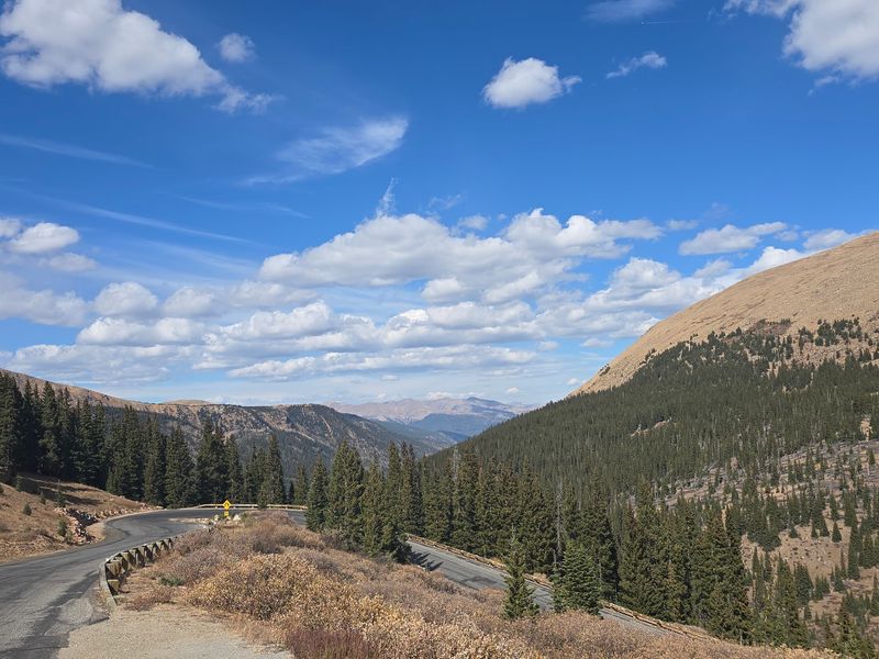
Want a fourteener without hiking all day just to see one? Guanella Pass parks you right next to 14,065-foot Mount Bierstadt.
The pass tops out at 11,670 feet between Georgetown and Grant. It packs a lot of scenery into one drive, from forests to lakes to open alpine slopes.
Trails branch off the road, including the popular route to Bierstadt’s summit. Even if you skip the big hike, shorter strolls give your legs a break.
Keep your eyes peeled for waterfalls along the way. Mountain goats also make appearances, which is way more exciting than spotting a squirrel.
Photo stops are everywhere you look. You’ll want your camera battery full before you leave town.
Fall brings golden color and, honestly, a lot of company. News stations love showing off this area, and traffic can get seriously jammed on peak weekends.
So here’s the trick. Go early in the morning or try a weekday if you can swing it.
Altitude is no joke this high up. Drink plenty of water and take it slow if you feel dizzy or tired.
Weather changes fast near the top, too. A sunny start can turn chilly before lunch, so pack a jacket.
Guanella is close enough to Denver for a day trip. That makes it an easy pick for a spur-of-the-moment mountain escape.
Address: Guanella Pass Scenic Byway, County Road 62, Grant, CO 80448.
4. Kenosha Pass
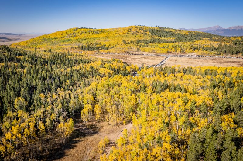
About an hour and a half from Denver, a mountain pass turns into a giant picnic spot each fall. Kenosha Pass knows how to throw a color party.
The pass sits around 10,000 feet on US 285 in rural Park County. It’s easy to reach, which helps explain its popularity with city folks craving fresh air.
The Colorado Trail crosses right here. That means you can hop out of the car and start walking through aspen groves within minutes.
Families love it for a reason. The hiking feels friendly, and the trees do most of the entertaining for you.
Leaf peeping is the headline act in autumn. The aspens turn gold and make the whole hillside shimmer when the wind kicks up.
Summer has its own perks, though. Wildflowers pop up along the trail, so the pass isn’t only a one-season wonder.
Pack a picnic and find a spot under the trees. It’s hard to beat a sandwich with a view like this.
Don’t forget that 10,000 feet is still pretty high. Layers, sunscreen, and water will keep everyone happier.
Since it’s on a main highway, you won’t need a rugged vehicle. A regular car handles the drive just fine.
Short on time but big on mountain dreams? Kenosha gives you a lot of reward for not much effort.
Address: Colorado 80456
5. Grand Mesa Scenic Byway
Bread ovens and road building rarely go together. Yet from April 1911 to July 1912, an oven baked for 30 state prison inmates and guards building a road in Plateau Canyon.
That road history belongs to the Grand Mesa Scenic Byway. The 63-mile route climbs from I-70 up onto the world’s largest flat-topped mountain.
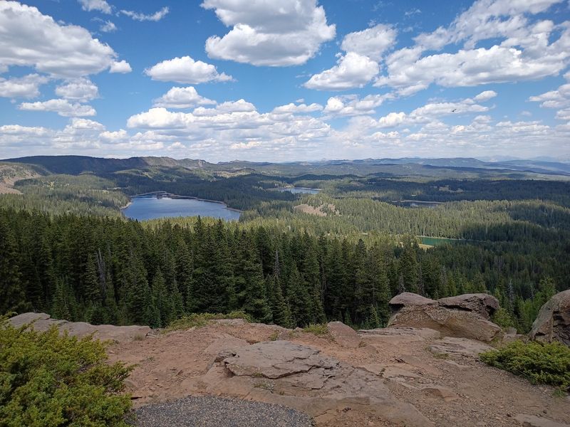
Up top, the scenery gets lake-crazy. More than 300 stream-fed lakes hold rainbow, cutthroat, and brook trout.
Don’t skip Lands End Overlook. It sits about 6,000 feet above the valley, with views stretching as far as the Sneffels Range.
Lands End Overlook is another must for big views. Its road can close in winter, so check before you go.
The drive passes old-growth forest, aspen groves, and wide meadows. Elk, deer, coyotes, red fox, and porcupines live here, so keep watch.
Towns like Cedaredge and Palisade sit along the route. They make easy stops for gas, snacks, and a stretch.
Powderhorn Mountain Resort adds even more to do. Winter means skiing, while summer and fall bring hiking, biking, and scenic chairlift rides.
The main byway stays open year-round. Snowshoeing and snowmobiling turn the mesa into a winter playground.
Fall color here can be spectacular. Who knew a flat mountain could look this good?
Address: CO-65, Cedaredge, CO 81413
6. Independence Pass
At 12,095 feet, Independence Pass sends your car higher than a lot of airplanes fly over small towns. Okay, maybe not quite, but it sure feels that way.
The road follows Colorado State Highway 82 across the Continental Divide. It links Twin Lakes on one side with Aspen on the other.
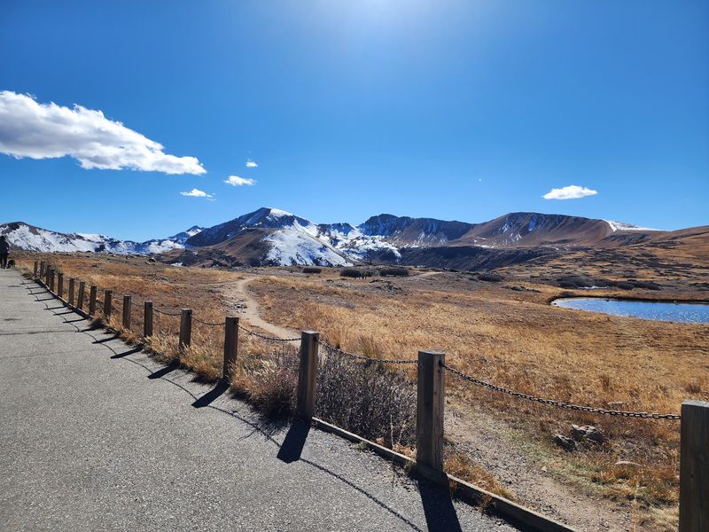
Thirteen-thousand-foot peaks surround the summit like a crowd at a concert. Snow often clings to them well into summer.
A vista point at the top lets you park and look around. Signs share history and preservation efforts, so you learn something while catching your breath.
Restrooms are available up there too. That’s a small detail, but after a long climb, it’s a big deal.
Independence Pass typically closes in late October or early November and reopens shortly before Memorial Day in May, depending on weather conditions. Plan your trip inside that window or you’ll be staring at a gate.
Fall can be stunning when the aspens light up the lower slopes. Sunsets and moonrises from the top are also worth sticking around for.
Parts of the road get narrow and twisty. Take your time and use pullouts to let faster drivers pass.
This pass is part of the Top of the Rockies National Scenic Byway. That route also showcases Mount Elbert, the tallest peak in the Rockies.
Bring a jacket even in July. Wind at 12,000 feet doesn’t care what the calendar says.
Address: Independence Pass, Colorado Highway 82, between Twin Lakes and Aspen, Colorado.
7. Cottonwood Pass

Curvy, windy, and a little bit show-offy, Cottonwood Pass climbs to 12,126 feet. That’s higher than Independence Pass, for anyone keeping score.
The road links Buena Vista with Almont through rugged mountain country. Each bend seems to reveal a new angle on the peaks.
Fall foliage makes this pass a favorite for color hunters. The aspens below the summit can look like they’re on fire, in the nicest way.
Up top, you’ll find a parking lot that’s well kept. Short trails start nearby, so you can stretch your legs without a big commitment.
Here’s a heads-up. Wind at the summit can be fierce, so hold onto your hat and your snack bag.
It also gets busy, especially on nice weekends. An early start gives you a better shot at a parking spot.
Beyond the views, the area offers camping, hiking, and fishing. Wildlife viewing is part of the fun if you keep your eyes open.
The pass closes during winter months. Check road status before you plan around it.
Driving this road takes focus, thanks to its twists and turns. Let a passenger handle photos while you handle the steering wheel.
Many drivers rank this among the best views in Colorado. After the first few switchbacks, you’ll probably see why.
Address: Colorado 81211
8. Boreas Pass
Old train cars waiting at the top of a mountain? Boreas Pass Road ends its climb with a history lesson you can actually touch.
This 22-mile road connects Breckenridge to Como. It follows the path of an old railroad, which explains the gentle grades and long curves.
Near the summit sits a former railroad community. Historic buildings and train cars help tell the story of mountain rail travel.
History buffs will want extra time up there. Kids usually get a kick out of the train cars too.
The valley views along the way are huge. You’ll catch long looks across the mountains as the road winds upward.
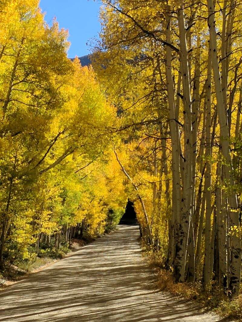
Mid-September can bring a fun surprise. Fall leaves and late wildflowers sometimes overlap, giving you two seasons in one trip.
Dispersed camping is available along the route. That makes it a solid pick for anyone wanting to sleep under the stars.
Much of the road is unpaved, so drive slowly. Dust and bumps come with the territory.
Fans of this road say it’s lovely in any season. Summer, fall, winter, and spring each bring their own look.
Breckenridge makes a handy starting point with plenty of places to grab supplies. Load up before you leave town.
Address: Colorado 80424
9. San Juan Skyway Scenic And Historic Byway
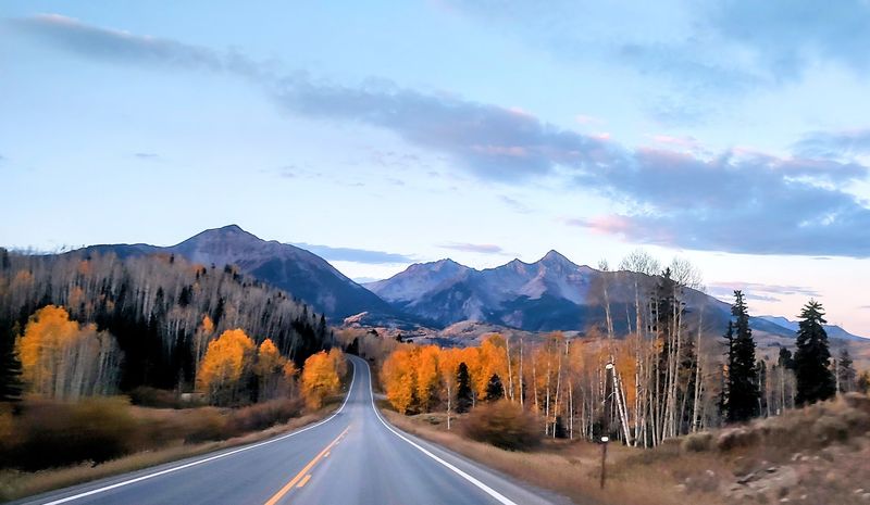
Two hundred thirty-six miles, four big mountain passes, and one stretch nicknamed the Million Dollar Highway. Ambitious?
Absolutely.
The San Juan Skyway loops through southwest Colorado. It links towns like Durango, Telluride, Ouray, Silverton, Rico, Dolores, and Cortez.
Along the way, you’ll cross Coal Bank, Molas, Red Mountain, and Lizard Head passes. Red Mountain is the tallest of the bunch at 11,018 feet.
The Million Dollar Highway runs between Ouray and Silverton. It’s carved into cliffs, it’s narrow, and guardrails are scarce.
That section deserves your full attention. In snow and ice, it can get hazardous, and crews run an avalanche control program.
Attractions along the loop could fill a whole vacation. Mesa Verde National Park and the Durango and Silverton Narrow Gauge Railroad are both nearby.
The Animas River and rugged San Juan peaks create nonstop scenery. Wilderness, lakes, and alpine views keep rolling past your windows.
The pavement is in good shape on most of the route. Still, this is real mountain driving, not a casual cruise.
Fall is a showstopper here. Yet the views stay strong in any season, which is rare for a high mountain road.
Give yourself more than one day if you can. Rushing this loop feels like skipping chapters in a great book.
Address: Ridgway, CO 81432
10. Highway Of Legends National Scenic Byway
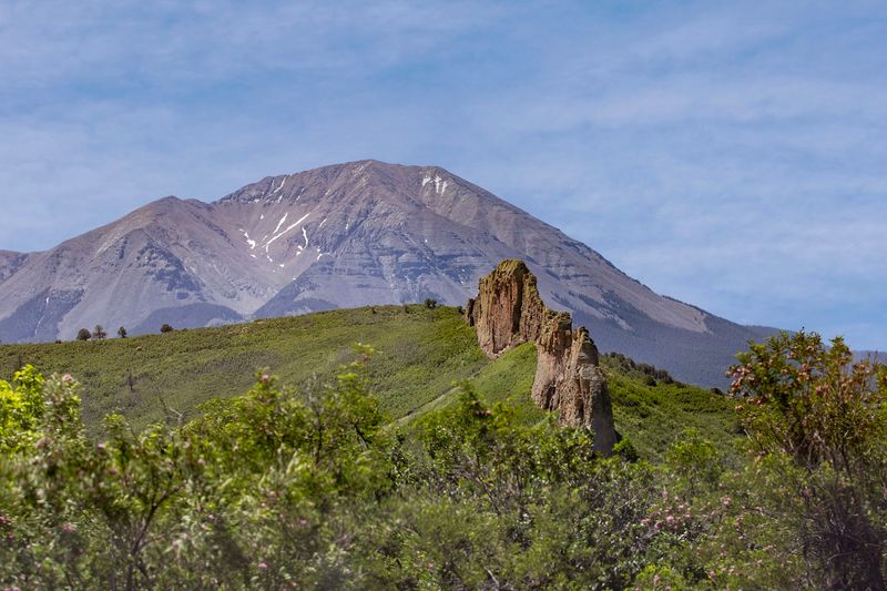
With a name like Highway of Legends, this road had better deliver some stories. Spoiler: it does, along with plenty of scenery.
The 82-mile byway runs through southern Colorado between Trinidad and Walsenburg. It earned National Scenic Byway status in 2021.
The twin Spanish Peaks steal the show. You’ll see them from the San Isabel National Forest, standing tall above the landscape.
Near Stonewall, giant sandstone walls rise beside the road. They look like nature built a fortress and then forgot about it.
Historic mining towns also line the route. Small towns along the way have gas and food, so you won’t run on fumes.
Want a tour guide without the extra passenger? An audio tour is available to download for the drive.
Cordova Pass adds a gravel section to the adventure. Skip it in bad weather, and know that it closes in winter.
Trinidad is packed with stops before or after your drive. The A.R.
Mitchell Museum of Western Art and the Trinidad History Museum are worth a look.
Trinidad Lake State Park is close by too. It’s a nice place to stretch out after hours in the car.
The legend of the Devil’s Stairs is said to come from this region. Who doesn’t love a road trip with a spooky tale?
Address: La Veta, CO 81055
11. Skyline Drive
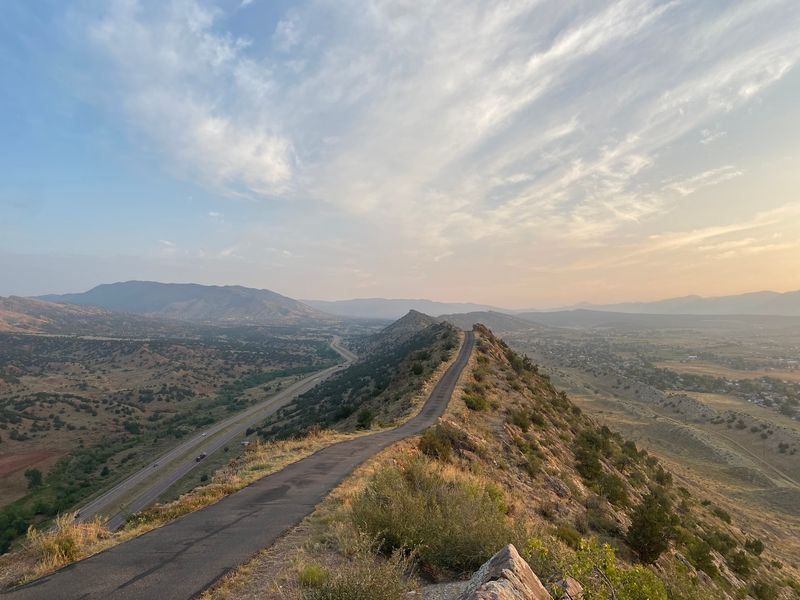
Imagine a road balanced on a ridge like a tightrope, and you’re close to Skyline Drive. Okay, it’s wider than a tightrope, but not by as much as you’d like.
This one-way road is carved along the top of a hogback ridge in Cañon City. Drop-offs fall away on both sides, which makes the ride a true adrenaline rush.
The payoff is a sweeping view. You’ll look out over Cañon City and the surrounding mountains from high above.
Dinosaur tracks add a wild bonus. Yes, you get prehistoric footprints and a thrilling drive in the same trip.
Some sections are narrow and winding. Go slow, stay focused, and let the views wait until you stop.
Thankfully, there are spots to pull over for photos. Use them, because taking pictures while steering here is a terrible idea.
The road is open from 5 a.m. to 11 p.m. daily. A free parking lot makes it easy to stop and explore.
Weekday mornings and afternoons can get busy, especially Thursdays. Evenings tend to be quieter if you want more elbow room.
Nervous drivers may want someone else behind the wheel. Thrill seekers, on the other hand, will probably ask to go twice.
For a short drive, this one packs a punch. Not bad for a road you can finish before your snacks run out.
Address: Skyline Dr, Cañon City, CO 81212
12. Mt Blue Sky Scenic Drive
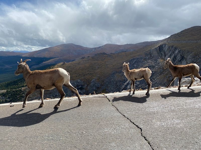
Seven thousand feet of climbing in just 28 miles. That’s the jaw-dropping math behind the highest paved road in North America.
The route starts in Idaho Springs and heads up Highway 103. It ends near the summit of Mount Blue Sky, which rises to 14,266 feet.
Longtime visitors might remember it as Mount Evans. The name changed, but the views are just as big.
Wildlife sightings happen often up here. Mountain goats and bighorn sheep roam the rocky slopes like they own the place, because they kind of do.
Pull-offs along the way let you stop and soak in the scenery. Take them, since the higher stretches have no guardrails.
Here’s a key tip. Reservations are required, so get your ticket in advance before heading up.
The summit portion of Mount Blue Sky Road typically opens around Memorial Day and closes around Labor Day, depending on conditions. In 2026, the summit section closed on September 8, and vehicle access to the remaining recreation area ended October 5.
Snow decides the exact dates, so check before you go.
Restrooms are available, but you won’t find a restaurant. Pack lunch, water, and maybe a backup granola bar.
At this altitude, the air gets thin fast. Move slowly, drink water, and head down if you feel sick.
Bring layers even in summer, because the summit can be cold and windy. Then enjoy one of the best views in Colorado, with your car doing most of the climbing.
Address: Mount Blue Sky Rd, Evergreen, CO 80439