
8 Gorgeous Arkansas Fall Road Trips With Views That Don’t Look Real
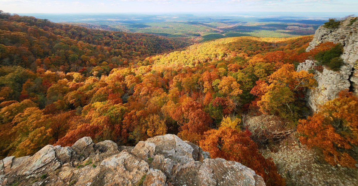
One of Arkansas’s mountain ranges runs east to west, which almost never happens in North America. That sideways direction means some ridgetop roads can show you long views off both sides of the car.
The state also has a peak topping 2,700 feet and the country’s first national river. Each fall, the slopes turn red, orange, and gold, and the color shows up at different times depending on elevation.
I like the idea of chasing that color with a full tank and a loose schedule. I’m all for winding curves, roomy overlooks, and pulling over just because the view asked nicely.
I can’t imagine a better excuse to skip the interstate. Well, mostly skip it, since one of these drives actually includes a tunnel.
So which road gets your first tank of gas?
1. Talimena National Scenic Byway
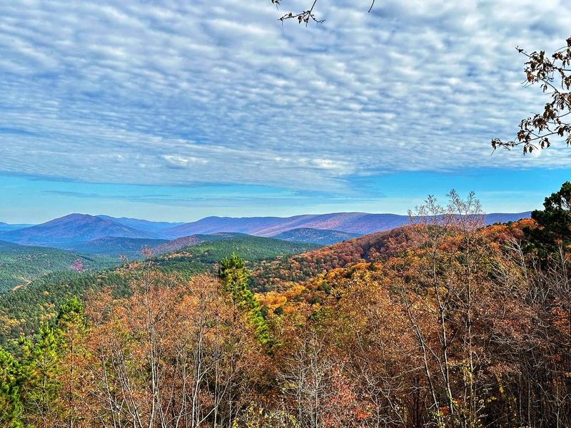
Most mountain ranges in North America run north to south, but the Ouachitas didn’t get the memo. They run east to west, and this byway rides right along their crests.
The drive stretches about 54 miles between Mena, Arkansas, and Talihina, Oklahoma. That means you get a two-state road trip without ever leaving the mountains.
Ridgetop roads are a big deal in fall. You’re not staring up at the color from a valley floor, you’re looking out across it from above.
The byway is known for its many overlooks, so you won’t need to fake a stretch break. Pull off, step out, and let the layers of ridges fade off into the distance.
On the Arkansas end, the road climbs Rich Mountain, the second-highest peak in the state. Up top sits Queen Wilhelmina State Park, a handy place to rest your driving hands.
Here’s a fun bit of history for the passenger seat. The original lodge on this mountain opened in 1898 and earned the nickname Castle in the Sky.
The park has its own lodge today, along with trails and picnic spots. It’s a great base if you’d like to see the ridges at sunrise instead of rushing through.
Plan for a slow pace, because the curves and grades deserve your attention. Also, keep your camera ready, since the best overlook is usually the one you almost passed.
Fall color here can shift with elevation, so higher spots may change at a different time than the towns below. Checking a foliage report before you go is a smart move.
Address: Queen Wilhelmina State Park, 3877 Highway 88 West, Mena, AR 71953
2. Arkansas Scenic 7 Byway
Some road trips need a full day, and some need a whole state. Highway 7 runs roughly 290 miles across Arkansas, from the Missouri line down to the Louisiana line.
You don’t have to drive the full stretch to get the good stuff. In fall, the northern half through the Ozarks tends to grab the spotlight.
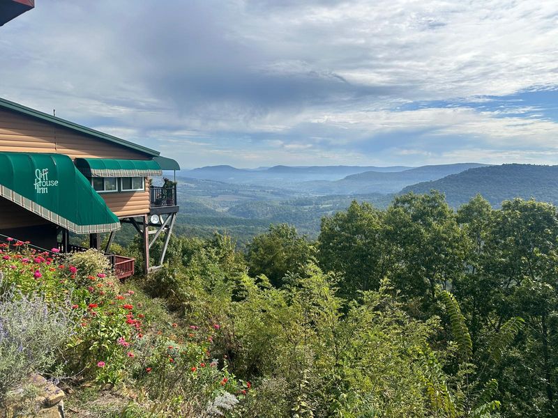
Near the little town of Jasper, the road skirts a big, deep valley nicknamed the Grand Canyon of the Ozarks. Yes, that’s a bold name, and the view mostly backs it up.
Picture rows of forested ridges dropping away in shades of red and gold. Okay, you don’t have to picture it, because the overlook does the work for you.
The Cliff House Inn sits right on the edge of that view along the highway. It’s a natural spot to stop, stretch, and take the photo your group chat will ask about.
Jasper also puts you close to the Buffalo National River area. That makes it easy to build a bigger loop if one scenic road just isn’t enough.
Farther south, the byway heads through the Ouachita Mountains toward Hot Springs. Different mountains, different curves, and a nice change of scenery for the second half.
A tip for first-timers: this road loves a tight curve. Give yourself extra time and don’t try to make it a speed run.
Gas up before the quieter mountain stretches. Pack snacks, too, because a hungry driver on a winding road is nobody’s favorite travel buddy.
Address: Cliff House Inn, 6177 AR-7, Jasper, AR 72641
3. Pig Trail Scenic Byway
A road named after hogs probably shouldn’t be this pretty. One explanation for the Pig Trail’s name is its longtime popularity with Razorback fans traveling toward Fayetteville for games.
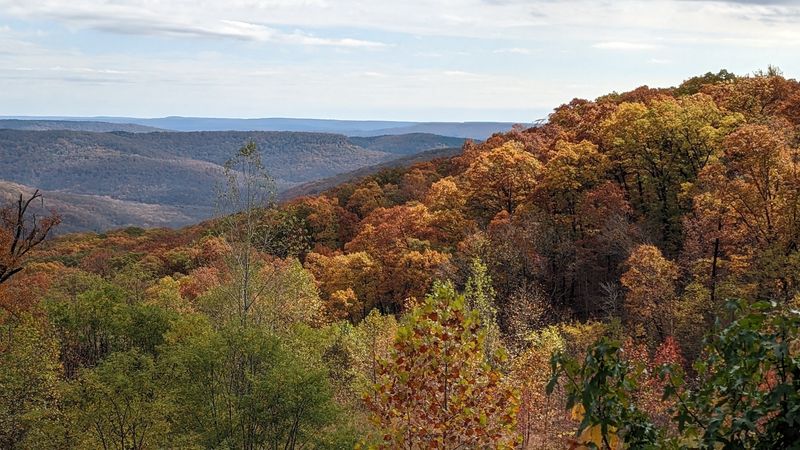
It follows parts of Arkansas Highways 23 and 16 through the Ozark National Forest. Expect steep grades, sharp curves, and trees that crowd right up to the pavement.
That last part is the magic trick. In fall, the branches can form a leafy tunnel overhead, so you feel like you’re driving through a painting.
The southern end starts near the town of Ozark. From there, Highway 23 climbs north into the mountains.
Along the way, you’ll cross the Mulberry River. It’s a popular spot for paddling and camping, and it gives you a reason to slow down and look around.
Turner Bend sits near the river crossing and works as a store and outfitter. It’s a handy stop for snacks, supplies, and a quick break from all those curves.
Speaking of curves, this road is not the place to rush. Use the pullouts, keep your eyes up, and let faster drivers go by.
Football weekends can bring more traffic heading toward Fayetteville. If you want a calmer ride, try a weekday or an early morning.
Bring a jacket, too. Mountain air can feel cooler than the valley, especially when you hop out for photos near the water.
The Pig Trail is short enough for a half-day trip. Still, the scenery makes it tempting to turn around and do it again in the other direction.
Address: Turner Bend Outfitter, 20034 N. Highway 23, Ozark, AR 72949
4. Boston Mountains Scenic Loop
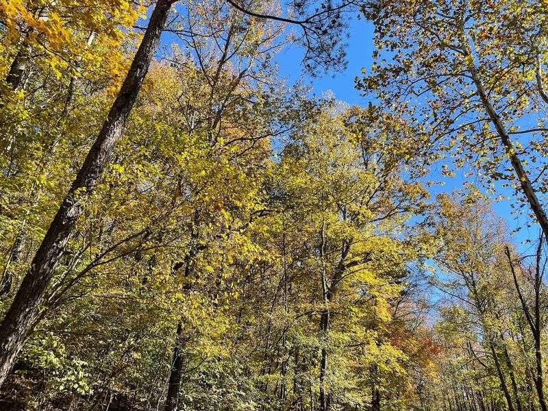
Here’s a scenic drive that starts on an interstate, which sounds like a joke until you see it. The Boston Mountains Scenic Loop pairs Interstate 49 with old U.S.
Highway 71.
The loop runs through the rugged Boston Mountains between Alma and Fayetteville. You can drive one road up and take the other back down.
The I-49 side is the fast, sweeping option. Big views open up as the highway rolls over high ridges and across deep hollows.
Watch for the Bobby Hopper Tunnel near Winslow. It’s the only highway tunnel in Arkansas, so yes, you’ll want someone to film it.
U.S. 71 is the slower, curvier sibling. It winds through small mountain towns like Mountainburg and Winslow.
That older road is where you’ll want to take your time. Fall color crowds the hillsides, and the twists make each bend feel like a fresh reveal.
Lake Fort Smith State Park sits along the U.S. 71 side near Mountainburg. It makes a nice stop for a walk, a picnic, or a look at the lake ringed by colorful hills.
A smart plan is to take I-49 one direction and U.S. 71 the other. You’ll get the wide views and the up-close scenery in a single trip.
This loop is also handy if you’re staying in Fayetteville or Fort Smith. You can fit it into an afternoon without needing a whole weekend.
Address: Lake Fort Smith State Park, 15458 Shepherd Springs Road, Mountainburg, AR 72946
5. Petit Jean State Park
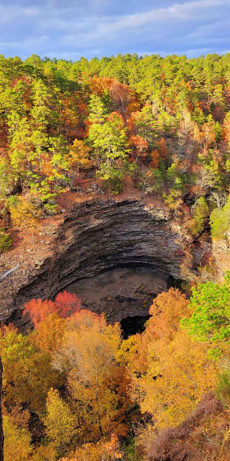
Back in 1923, Arkansas picked this mountain as the site of its very first state park. Good call, Arkansas.
Petit Jean sits high above the Arkansas River Valley near Morrilton. The drive up Highway 154 climbs from farmland to forested bluffs, which is a pretty fun warm-up act.
Once you’re on top, the scenery gets wilder. Sandstone cliffs, canyons, and rock formations mix with the fall leaves.
Cedar Falls is the big headliner. The waterfall drops about 95 feet into a canyon, and the trail down to it is a park favorite.
Want a quick payoff instead? The Cedar Falls Overlook lets you see the falls from above without the hike back up.
The Seven Hollows Trail is another fall pick. It passes a natural bridge, a grotto, and odd rock shapes known as turtle rocks.
Mather Lodge perches on the bluff edge near Cedar Falls. The Civilian Conservation Corps built it in the 1930s, and its rustic stone and timber fit the mountain nicely.
For a sunset stop, head to Stout’s Point. It looks out over the Arkansas River Valley, and it’s also where you’ll find Petit Jean’s Grave.
That grave ties to a local legend about a young woman who followed her love to the New World. Whether you believe it or not, it makes a great story for the drive home.
Wear real shoes if you plan to hike. Those rocky trails are gorgeous, but your flip-flops will not appreciate them.
Address: 1285 Petit Jean Mountain Road, Morrilton, AR 72110
6. Mount Magazine State Park
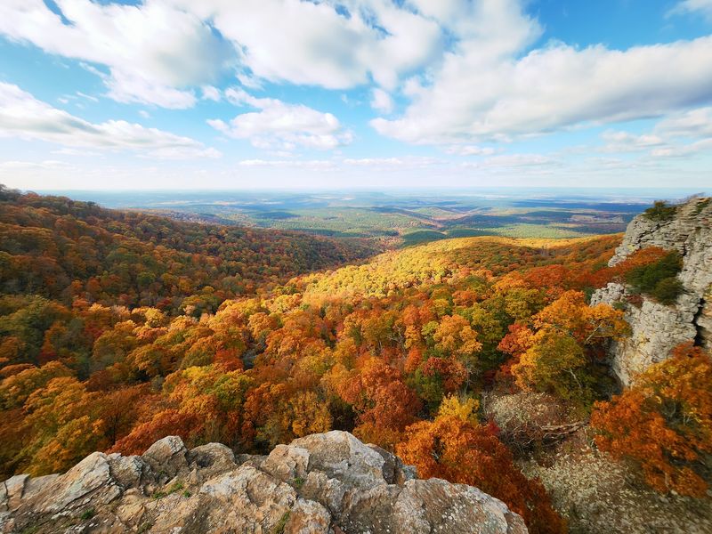
Want to stand on the roof of Arkansas? Mount Magazine reaches 2,753 feet, making it the highest point in the state.
That height matters in fall. Leaves up top can change earlier than in the lower valleys, so this is a smart early-season pick.
Getting there is half the fun. Scenic Highway 309 climbs the mountain between Paris and Havana, with curves and views along the way.
Inside the park, a short trail leads to Signal Hill, the actual high point. It’s an easy way to say you summited a state without needing climbing gear.
The bluffs on the south side deliver the jaw-dropping part. You’ll look out over the Petit Jean River Valley and Blue Mountain Lake far below.
Mount Magazine is also known for hang gliding. If you spot someone launching off the edge, don’t worry, that’s on purpose.
The Lodge at Mount Magazine sits along the bluff with big views of the valley. Even if you’re not staying the night, it’s worth a stop to soak in the scenery.
The visitor center is a good first stop, too. Its exhibits cover the mountain’s plants and wildlife, which helps explain why this place feels so different.
Fun fact for your passengers: the mountain’s high, cool top supports plants you might not expect in Arkansas. It’s like a little climate island in the sky.
Check the weather before you go. Fog can roll in up high, and you’ll want clear skies for the big views.
Address: 577 Lodge Drive, Paris, AR 72855
7. Eureka Springs
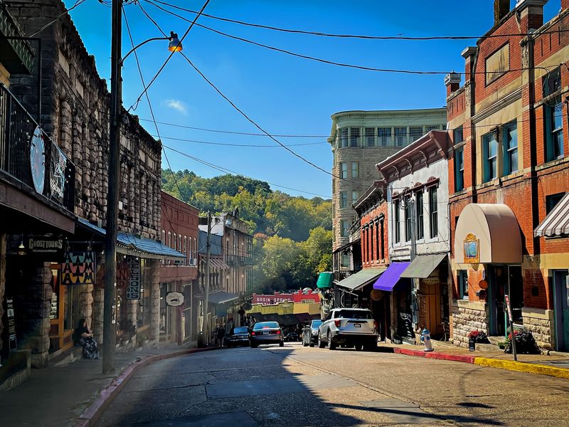
A whole downtown built into the side of a mountain sounds like something from a storybook. Eureka Springs pulls it off, with streets that twist and climb through the Ozarks.
The historic downtown is listed on the National Register of Historic Places. Victorian buildings, many made of stone, stack up along the hills.
In fall, that mix of old architecture and changing leaves is hard to beat. You get mountain color and charming storefronts in the same frame.
The town grew in the late 1800s around its natural springs. People came looking for healing waters, and the town has kept that old resort feel.
Driving here is a little different. The roads curve, rise, and loop back on themselves, so take it slow and enjoy the scenery.
Highway 62 winds through town and out into the hills. It’s a scenic way to arrive and an even better way to leave.
Just west of town, Thorncrown Chapel rises out of the woods. Its tall glass walls and wooden frame let the forest show through on all sides.
Designed by architect E. Fay Jones, the chapel has earned major architecture awards.
In fall, the colors outside make the glass feel like a living window.
Parking downtown can be tight, so consider leaving the car and using the town trolley. Your brakes will thank you.
Plan to wander a bit. The best views in Eureka Springs often pop up between buildings or at the top of a steep street.
Address: Thorncrown Chapel, 12968 Highway 62 West, Eureka Springs, AR 72632
8. Buffalo National River
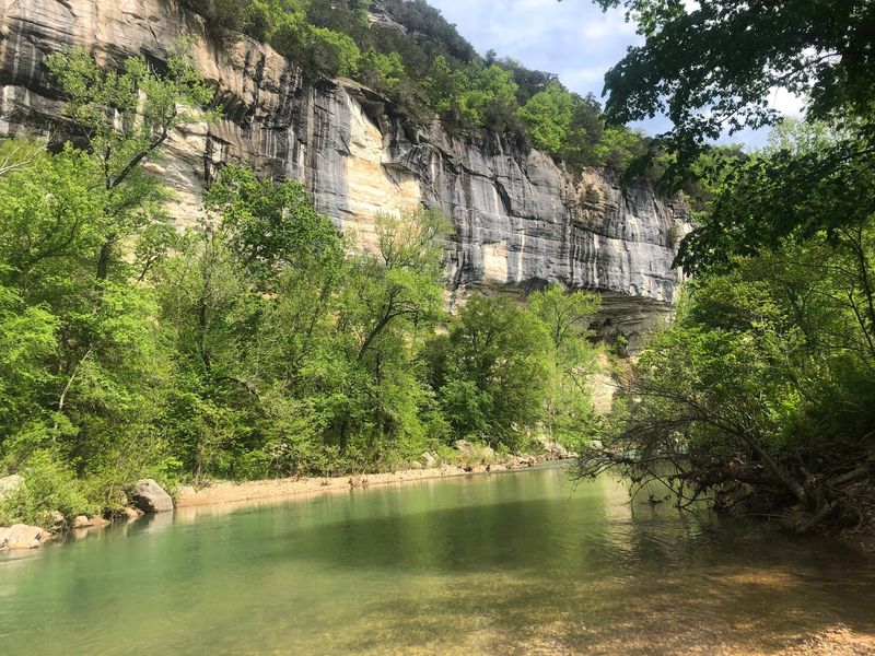
Buffalo National River
Congress named the Buffalo the first national river in the United States in 1972. It still flows freely for about 135 miles, with no dams to slow it down.
That wild streak shows in the scenery. Tall limestone bluffs rise above the water, and in fall they’re framed by red and gold trees.
On calm days, the river can mirror the colors like a polished window. It’s the kind of view that makes people check their photos twice.
Head to the upper river near Ponca for some of the best fall scenery. The roads around here, including Highways 43 and 21, wind through steep hills and quiet valleys.
Boxley Valley is a must-see stop. It’s known for its old farmsteads, open fields, and a herd of elk that often grazes nearby.
Elk are most active around early morning and evening. Bring binoculars, keep your distance, and enjoy the show from your car or a safe pullout.
Steel Creek is another favorite spot near Ponca. Its giant bluff towers over the river and makes a great backdrop for a fall picnic.
Want to see the river from the water? Fall can be a beautiful time to paddle, though river levels can drop, so check conditions first.
Cell service can be spotty in the river valleys. Download your maps before you go so you don’t end up lost in elk country.
Wrap your Arkansas fall trip here, and you’ll head home with a camera roll full of views your friends might not believe are real.
Destination: Steel Creek Campground, Buffalo National River, near Ponca, AR 72670