
A Nevada Town That Disappeared Beneath Lake Mead Is Emerging From The Desert Again
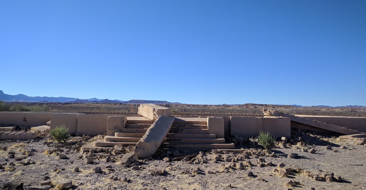
The last man to leave this Nevada town reportedly set his house on fire before rowing away. Not exactly a standard moving-day checklist.
For decades, the town sat beneath Lake Mead, hidden under as much as 60 feet of water. Then the lake began to retreat, and the old streets started reappearing in the desert sun.
Talk about an unexpected homecoming.
I find the idea of a town resurfacing after decades underwater far stranger than any ghost story. Old foundations and tree stumps are back in view, offering a glimpse of a place that time, and a whole lot of water, nearly erased.
Atlantis has officially lost its monopoly on sunken-city drama. But what happens when a drowned town comes back without the mermaids, the treasure, or even a decent patch of shade?
A Sunken Town Is Breathing Desert Air Again
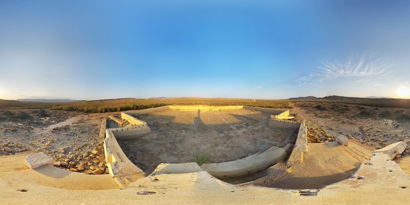
Old foundations now sit under open sky where fish once swam. St. Thomas Ghost Town is back, and it is one of the strangest sights in Nevada.
The town sits inside Lake Mead National Recreation Area in Clark County. It stood near the confluence of the Muddy and Virgin rivers.
For years, the ruins stayed hidden beneath the lake. Then severe drought and heavy demand on Colorado River water started shrinking Lake Mead.
Water levels have dropped a lot, especially since 2002. As the shoreline pulled back, the old town slowly showed itself again.
That makes this a rare kind of trip. You are not just visiting a ghost town.
You are visiting one that spent decades underwater first.
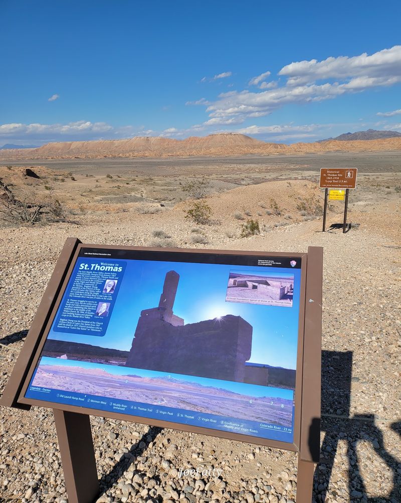
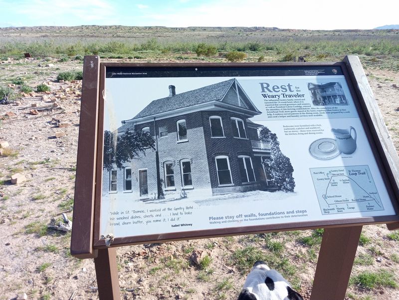
The National Park Service manages the site today. They have added signs along the trail to explain what used to stand on each spot.
I believe that’s what makes it hit so hard. Reading about a lost town is one thing, but standing on its streets is another story.
It also serves as a quiet reminder about water in the West. Few history lessons come with this much scenery.
Pioneers Planted Big Dreams In The Muddy River Valley
Back in 1865, a group of Mormon pioneers rolled into the Muddy River Valley with farming on their minds. Thomas Smith led the group, and the town took his name.
The valley had fertile ground, which is a big deal in the desert. Settlers hoped crops would grow well thanks to the nearby river.
Then came a plot twist nobody ordered. In 1871, settlers learned that St. Thomas was actually in Nevada, not Utah or Arizona Territory as they had believed.
Nevada officials demanded back taxes from the residents.
Talk about a surprise bill. Many of the Mormon settlers chose to leave rather than pay up.
That left the town mostly empty for a while. It is wild to think a map change could clear out a whole community.
When you stand among the ruins today, keep this early chapter in mind. The town had already faced one big exit long before the lake arrived.
It makes the place feel even more stubborn. St. Thomas just kept finding ways to come back, again and again.
Road Trippers Once Rolled Right Through Main Street
After 1880, new folks claimed the empty properties, and St. Thomas got a second life. Pioneers, miners, and ranchers all moved in.
The town grew into a solid farming community. It also worked as a freight stop for goods moving through the region.
Here’s a fun one for road trip fans. St. Thomas became a stop on the Arrowhead Trail, which linked Los Angeles and Salt Lake City.
Long before freeways and drive-thru coffee, travelers rattled through this little desert town. Some likely needed a meal and a bed after miles of dusty driving.
At its peak, around 500 people lived here. By 1918, the town had a school, a post office, a church, stores, a cafe, and a hotel.
Still, life was far from easy. Residents did not have electricity or indoor plumbing.
So picture the busy streets without a single light bulb. That’s real grit right there.
When you see the old road lines today, remember they once carried actual traffic. This ghost town used to be on the way to somewhere.
Hoover Dam Changed Everything For This Little Town
Big projects bring big changes, and Hoover Dam was about as big as it gets. Construction in the 1930s created Lake Mead behind the dam.
That was great news for water and power in the Southwest. For St. Thomas, though, it meant the end of the line.
The new lake would slowly cover the valley. Residents had to sell their land and move somewhere else.
Families packed up homes, businesses, and memories. The town cemetery was even moved to nearby Overton.
Can you blame anyone for holding on until the last minute? Leaving the only home you know is never simple.
The water didn’t rush in all at once. It crept upward bit by bit as the lake filled.
By 1938, the town was fully underwater. At times it sat beneath 50 to 70 feet of lake.
The tallest building once rested about 60 feet below the surface. That’s a lot of water stacked on top of somebody’s old neighborhood.
Knowing this backstory makes the ruins feel personal. You’re looking at what people gave up for progress.
The Last Resident Made An Exit Worthy Of A Movie
Hugh Lord had a flair for the dramatic. On June 11, 1938, he became the last person to leave St. Thomas.
By then, the water was climbing toward his home. So he set the house on fire and rowed away in a boat.
Yes, really. He rowed out of town instead of driving.
Honestly, Hollywood couldn’t script a better farewell. It sounds like the final scene of an old western, just with more water than usual.
His story sticks with people for a reason. It captures how final the moment felt for the whole community.
Everyone else had already gone. He held out until there was no ground left to stand on.
I like that one person’s choice still shapes how we remember this town. It gives the ruins a face and a name.
When you walk the trail, think about that rowboat drifting away. The streets under your boots were once the bottom of his escape route.
Few ghost towns have a goodbye this memorable. St. Thomas went out with a splash and a spark.
Bumpy Roads Lead To Some Seriously Cool Ruins
Getting there is half the adventure, and your car might agree. The site sits about 65 miles northeast of Las Vegas.
You reach it by a dirt road often called Old St. Thomas Road. It can be bumpy, but most vehicles usually handle it fine.
The location is in the northern part of Lake Mead National Recreation Area. It sits near the Overton Arm of the lake, close to Overton, Nevada 89040.
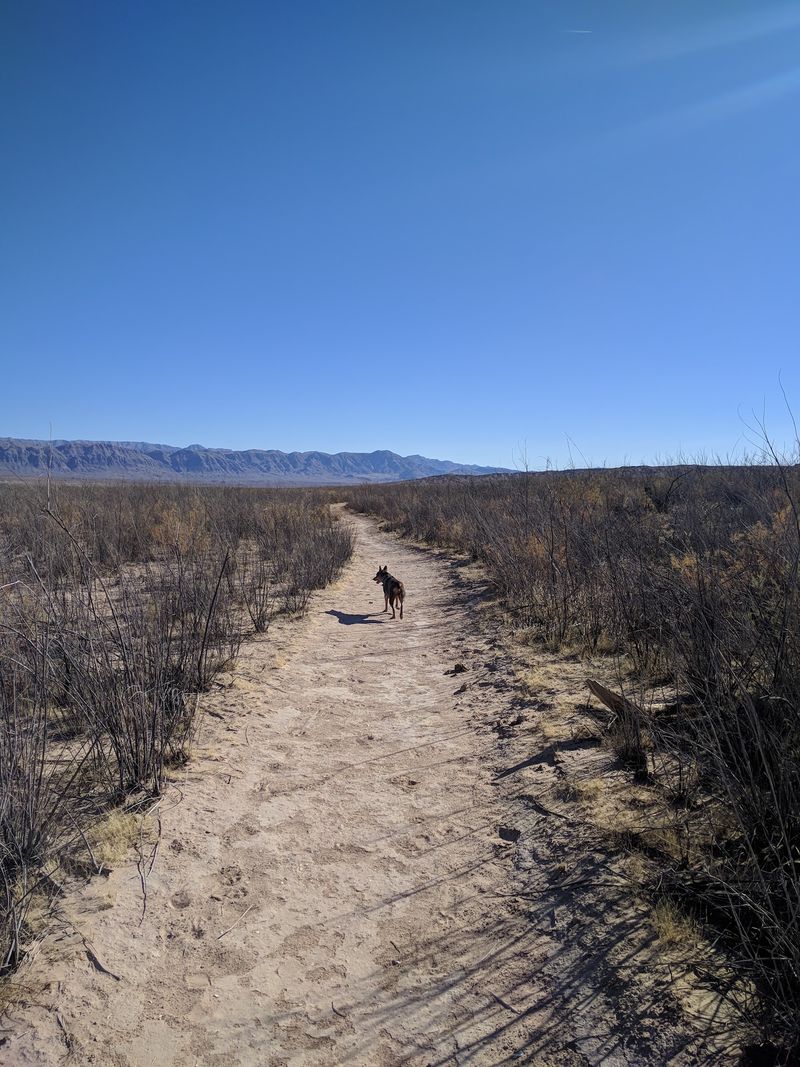
From the parking area, a dirt trail leads down to the town site. The walk lets you ease into the scenery before the ruins appear.
Plan ahead before you head out. This is open desert, so bring plenty of water, sun protection, and sturdy shoes.
Nevada heat is no joke, especially in summer. Cooler months tend to make the hike much more pleasant.
Since the site is inside a national recreation area, normal park entry rules apply. Checking with the National Park Service before your trip is a smart move.
Slow down on that dirt road too. The ruins waited decades for you, so a few extra minutes won’t hurt.
Foundations, Fence Lines, And Stumps Tell The Story
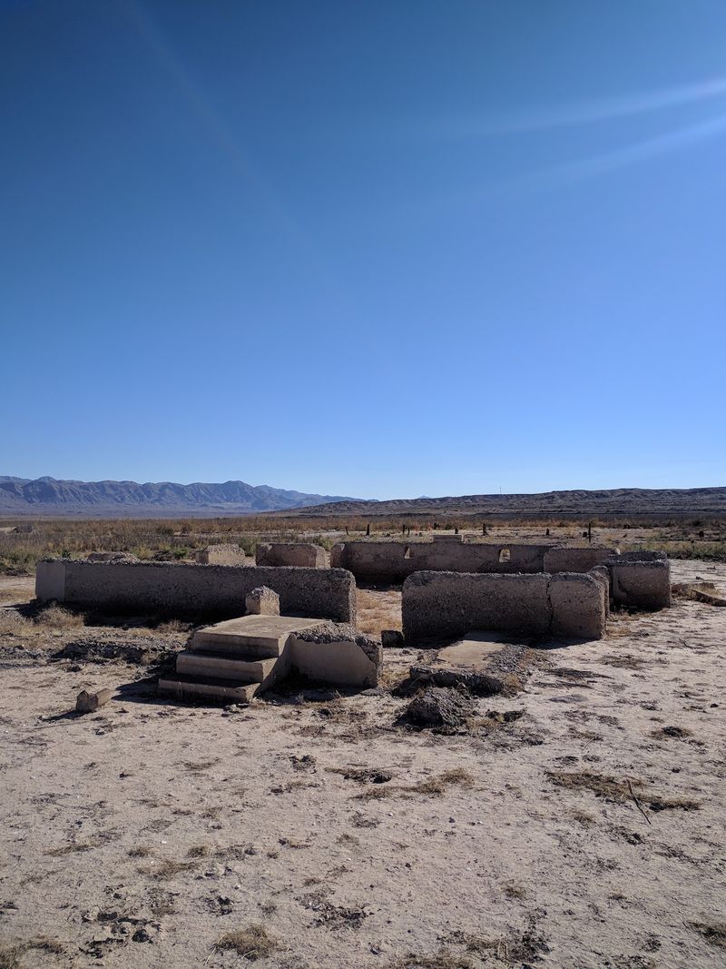
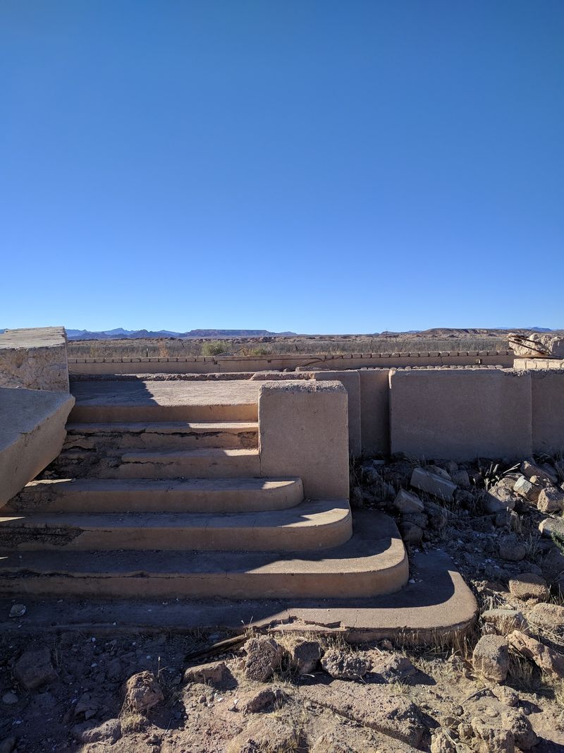
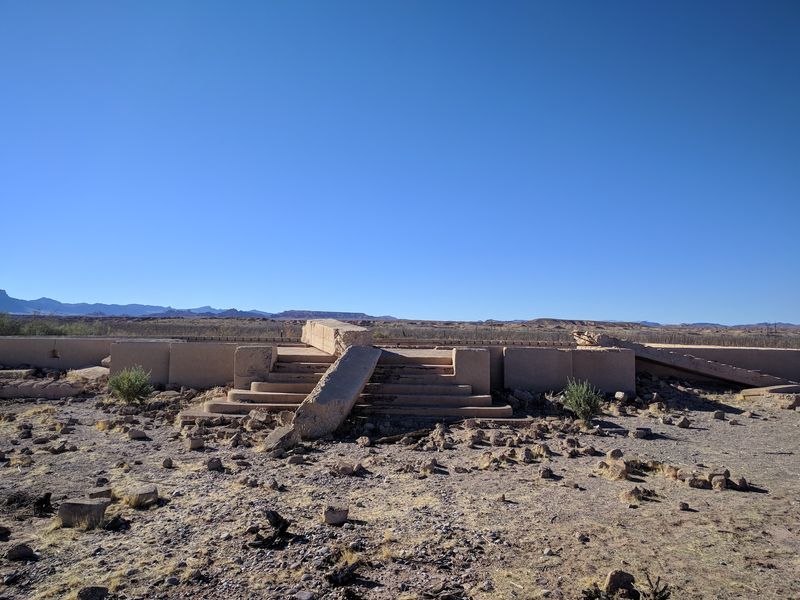
Concrete slabs, old steps, and broken walls pop up across the flat ground. These foundations show where homes and businesses once stood.
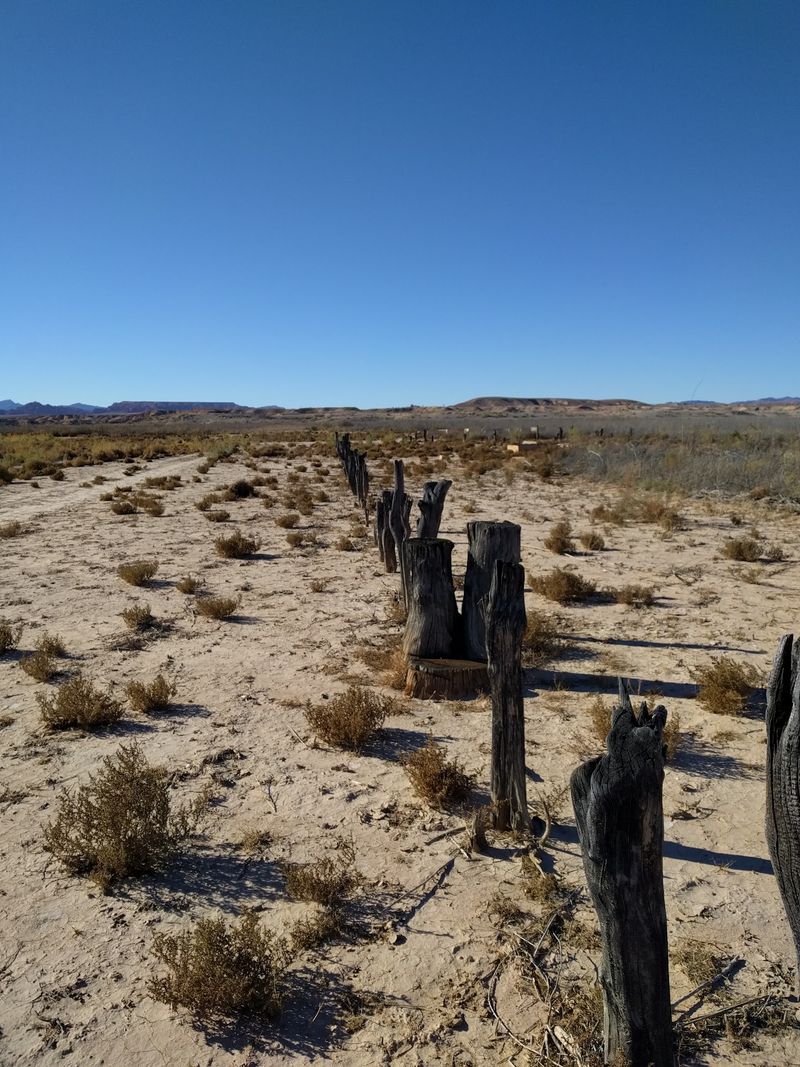
Look closely and you’ll spot more than buildings. Old fence lines and tree stumps still trace where streets once ran.
It works like a giant puzzle with missing pieces. You get the outline, and your brain fills in the rest.
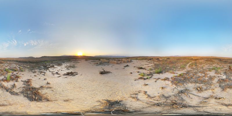
The ground itself has a strange look. It’s often described as salt-encrusted silt, left behind from all those years underwater.
That crusty surface makes the whole site feel otherworldly. Desert on top, old lakebed underneath.
National Park Service signs help you figure out what you’re seeing. They share history and point out specific spots along the way.
Take your time reading them. Each sign turns a random slab into a real place with a story.
Please leave everything exactly where it is. These remains are protected, and they’re part of a shared history.
Snap all the photos you want, though. Old roads fading into the desert make for some seriously moody shots.
Drought Turned The Lake Into A Time Machine
Lake Mead’s famous white bathtub ring tells you plenty about what happened here. The lake has dropped far below its old high marks.
Drought across the region plays a huge role. Growing demand for Colorado River water adds even more pressure.
As the water pulled back, St. Thomas Ghost Town crept into view. The decline picked up especially after 2002.
It’s a little bittersweet. A cool historic site came back, but only because the region faces serious water challenges.
That mix of wonder and worry makes a visit meaningful. You get history and a real-world science lesson in one stop.
Lake levels can rise and fall over time. Conditions at the site may change depending on how much water the lake holds.
That’s one more reason to check with the park before going. Nature runs this show, not us.
Kids especially might find this angle fascinating. Seeing a town pop out of a lake makes water use feel very real.
Who knew a ghost town could double as a giant measuring stick for the West?
Round Out Your Trip With An Even Older Lost City
St. Thomas wasn’t the first community in this valley to vanish. Ancestral Puebloan and Basketmaker people lived in the region for over a thousand years before the pioneers arrived.
Their communities were part of Pueblo Grande de Nevada, also known as the Lost City, a complex of ancient villages and archaeological sites. Much of this complex was also flooded by Lake Mead, leaving the region with layers of submerged history.
Head to nearby Overton to visit the Lost City Museum. It displays artifacts rescued from that ancient settlement.
It makes a perfect pairing with your ghost town hike. One stop covers the pioneer era, and the other reaches way further back.
Overton also connects back to St. Thomas in a quiet way. The town’s cemetery was moved there before the water rose.
That link makes the whole valley feel tied together. Layers of people, all shaped by the same river.
I believe a full day here gives you the best picture. You’ll leave with a much bigger view of Nevada history than most tourists get.
Not bad for a corner of the desert that spent decades underwater. Turns out the best stories really do resurface.