
10 Arkansas Bucket List Hikes For 2027 With Big Scenic Rewards And No Permit Needed
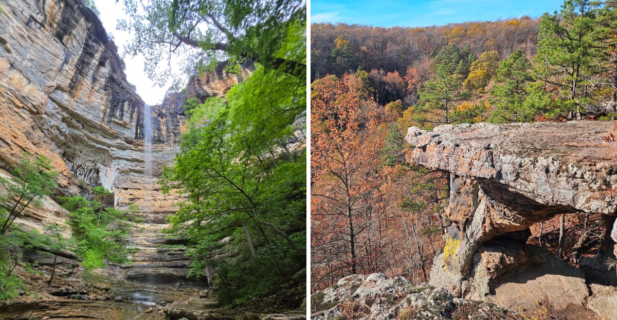
Your camera roll might need extra space in 2027. A single hike can take you past a shady creek and end with a view that makes you stop talking for a second.
Arkansas is full of those outdoor surprises, and you can enjoy these trails without securing a standard hiking permit. That makes planning a weekend escape a little easier.
Don’t mistake that freedom for an invitation to show up unprepared, though. Some of the routes involve serious climbs and exposed cliff edges.
Others suit a slower day when you just want to hear water moving over rocks. The right choice depends on the weather and how much walking you’re up for.
Bring comfortable shoes with traction and give yourself enough daylight for the return. There’s something satisfying about reaching an overlook on your own two feet.
Even better when the view is the sort you’ll keep talking about afterward.
1. Whitaker Point (Hawksbill Crag) Trail, Pettigrew
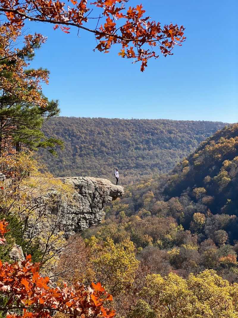
One flat slab of rock has launched a million phone wallpapers. Whitaker Point, also called Hawksbill Crag, sits off Cave Mountain Road (County Road 5) near Pettigrew, Arkansas 72752, deep in the Upper Buffalo Wilderness of the Ozark Mountains.
The trail is a fairly short out-and-back walk through hardwood forest. You head downhill on the way in, which feels great until you remember the climb back out.
Along the way, small seasonal waterfalls trickle over rocks after rain, and the trail hugs the edge of a bluff before the famous ledge comes into view.
I have to admit, the shape of that crag looks almost too perfect to be natural. It pokes out over the valley like a bird’s beak, and the view stretches across rolling ridges in every direction.
Sunrise is the most popular time, so the parking area can fill quickly on fall weekends. Cave Mountain Road is a gravel route with steep sections, and it can get rough after storms.
A vehicle with good clearance makes the drive less stressful.
Safety matters here. The ledge has no railings, and the drop is serious, so keep kids and pets close and stay back from the edge.
Fall color season turns the whole valley into a bright quilt of orange and red.
Just do not crag-gerate your snack supply, because the uphill return earns every bite.
2. Cedar Falls Trail, Morrilton
Rumor has it that Petit Jean State Park got its name from a legend about a young woman who disguised herself to sail to the New World. Whatever the truth, the park’s star attraction is no legend.
Cedar Falls Trail starts near 1285 Petit Jean Mountain Road in Morrilton, Arkansas 72110.
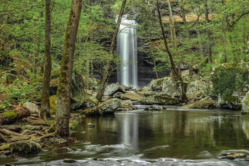
The hike drops down into Cedar Creek Canyon on a rocky path with steps and switchbacks. At the bottom, the trail follows the creek past boulders and shady trees before ending at a tall, slender waterfall that spills into a wide pool.
Going down is the easy part. The climb back up is steady and steep, so pace yourself and bring water, especially in summer.
Spring is when the falls really show off. After a good rain, the water roars, but in late summer it can slow to a gentle trickle.
For a dry-weather option, the Cedar Falls Overlook offers a view from above with almost no walking.
I love that the park pairs this hike with Mather Lodge, a classic stone and timber building built by the Civilian Conservation Corps. Its rustic style fits right into the mountain setting.
Wear shoes with good grip, since wet rocks near the pool can be slippery.
Few waterfalls make such a grand entrance after so modest a walk.
3. Lost Valley Trail, Ponca
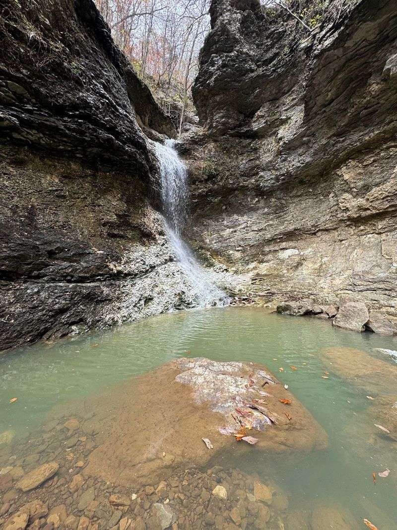
Lose your bearings in Lost Valley, and you will probably find a waterfall. This family favorite starts from Lost Valley Road, off Highway 43, near Ponca, Arkansas 72670, inside the Buffalo National River area.
The trail follows Clark Creek up a narrow valley lined with tall limestone bluffs. It packs a lot of surprises into a short distance.
First comes the Natural Bridge, where water flows through an opening in the rock. Then the trail continues past Cob Cave, a massive bluff shelter, before reaching Eden Falls.
A steep spur trail leads toward Eden Falls Cave above the waterfall. Exploring the cave requires crawling through a dark, wet passage, so the National Park Service recommends multiple light sources and protective equipment.
The waterfall itself makes a rewarding destination without entering the cave.
I think the variety here is what makes it so charming. Ferns, mossy rocks, and huge boulders keep the scenery changing every few minutes.
The area around Ponca is also famous for elk. Herds often graze in the Boxley Valley fields nearby, especially early in the morning and near sunset.
Keep a respectful distance and enjoy them from your car or the roadside pullouts.
Spring and early summer bring the strongest water flow and green leaves. The trailhead lot is small, so weekends can get crowded.
A valley this easy to love deserves a much less gloomy name.
4. West Summit Trail, Roland
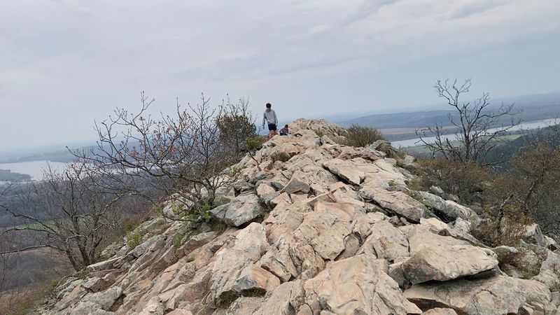
Ask Little Rock locals where to get a workout with a view, and Pinnacle Mountain usually comes up first. The West Summit Trail begins at Pinnacle Mountain State Park, 9600 Highway 300, Roland, Arkansas 72135.
Short but tough, this route climbs straight up the mountain’s western side. The lower part is a regular forest path, but the top section turns into a boulder scramble.
You will use your hands as much as your feet in places, so leave the flip-flops at home.
The reward at the summit is a wide view of the Arkansas River, Lake Maumelle, and miles of rolling green hills. On clear days, the city skyline shows up in the distance.
Personally, I find it impressive that such a wild-feeling climb sits so close to a city. It makes an easy half-day trip for anyone staying in the Little Rock area.
The park also offers plenty of other things to do. The Arkansas Arboretum has a flat, paved loop with native plants, and the visitor center has exhibits about local wildlife.
Summer heat can be intense on the exposed rocks, so morning starts are smart. Winter and fall bring cooler air and clearer views once the leaves drop.
Some hikes are a walk in the park. This one is a climb in the park.
5. Hemmed-in Hollow Trail, Compton
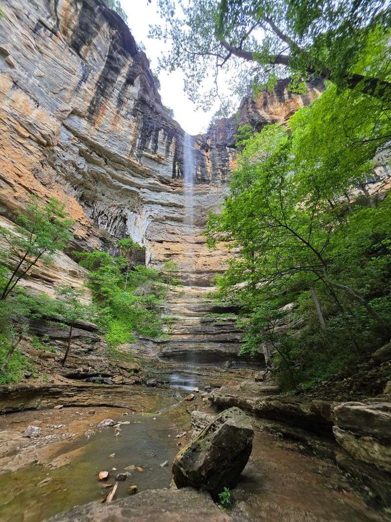
Tall cliffs wrap around this hollow like a giant stone bowl, and after substantial rainfall, a waterfall pours down the middle. Hemmed-in Hollow Trail starts at the Compton Trailhead near Compton, Arkansas 72624.
Known as the tallest waterfall between the Rockies and the Appalachians, Hemmed-in Hollow Falls drops nearly 210 feet down a sheer bluff into a box canyon. When conditions are right, wind can turn the falling water into a fine mist before it reaches the ground.
Getting there takes real effort. The trail drops steeply through the Ponca Wilderness on the way down, which means the return is a long, hard climb.
Plan for an entire day, pack plenty of water, and bring snacks with some staying power.
I can see why so many hikers call this the toughest bucket list trail in the state. The views of the Buffalo River valley along the way help take your mind off sore legs.
Late winter and spring can offer better waterfall conditions, especially following considerable rainfall. During dry periods, the waterfall may have little or no flow.
Fall brings cooler weather and changing leaves.
The trailhead is reached by gravel roads, so check conditions after heavy rain.
Hemmed in, yes, but the feeling at the bottom is pure wide-open wonder.
6. Yellow Rock Trail, West Fork
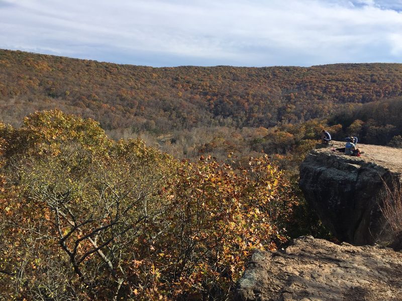
Golden sandstone gives this overlook its name, and the color really pops in afternoon light. Yellow Rock Trail is found in Devil’s Den State Park at 11333 West Arkansas Highway 74, West Fork, AR 72774.
The loop climbs through oak and hickory forest before reaching a wide bluff that looks out over Lee Creek Valley. The rock ledge offers plenty of room to sit, snack, and soak in the view of the surrounding Ozark ridges.
Moderate in difficulty, the trail has some uphill stretches and rocky footing. Most families with older kids can handle it without much trouble.
The park itself has a fun backstory. Much of it was built by the Civilian Conservation Corps, and the stone cabins, bridges, and dam still show off that classic rustic craftsmanship.
Lee Creek even has a small lake made by the old stone dam, where visitors can rent a canoe or paddleboat in warmer months.
I always enjoy how the name Devil’s Den sounds spooky, while the scenery feels so peaceful. The park also has crevices and small caves to explore on other trails nearby.
October is a top pick, when the valley below fills with red and orange leaves. Spring wildflowers are a close second.
Call it a golden opportunity for a picnic with a view.
7. Kings Bluff Loop Trail, Pelsor
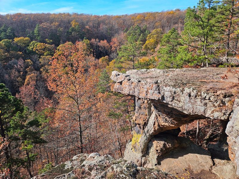
Picture a waterfall that tips right over the edge of a cliff while you stand on top of it. That scene waits at Kings Bluff, inside the Pedestal Rocks Scenic Area on Highway 16 near Pelsor, Arkansas 72856, in the Ozark National Forest.
The Kings Bluff Loop is short and fairly easy, winding through pine and hardwood forest to a long sandstone bluff. After rain, a seasonal creek pours off the edge, creating a waterfall you can see from above and from nearby viewpoints along the rim.
The bluff edge is high and has no railings, so careful footing is a must. Kids should stay close, and dogs should stay on a leash.
A second loop at the same trailhead leads to the pedestal rocks themselves. These odd stone pillars were shaped over a long time by wind and water, and they look like giant mushrooms made of rock.
I find them delightfully weird, in the best way.
Spring is the best time for falls, since the creek can dry up by summer. Winter offers clear views through the bare trees, and fall brings great color along Highway 16, a scenic drive all on its own.
Combining both loops makes a satisfying half-day outing.
Royalty seems like a fair title for a bluff this dramatic.
8. North Rim Trail, Paris
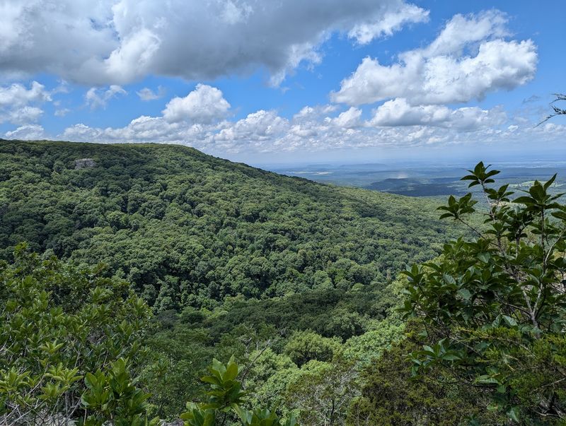
High points come in many forms, but only one marks the top of the whole state. Mount Magazine State Park, at 16878 Highway 309 near Paris, AR 72855, holds the tallest peak in Arkansas, and the North Rim Trail shows off its northern side.
The trail runs along the edge of the mountain, passing rock outcrops and wooded stretches with views over the valley below. On clear days, Blue Mountain Lake and the rolling hills of the river valley spread out like a map.
The path has some ups and downs plus rocky sections, but it is a manageable hike for most people in decent shape. Because it is a point-to-point route, many hikers turn around partway or plan a shuttle.
Mount Magazine is famous for butterflies, too. The park hosts a large number of butterfly species, and summer brings plenty of color fluttering along the trails.
Up top, the air often feels noticeably cooler than the valley. That makes summer hikes more comfortable than you might expect.
The Lodge at Mount Magazine sits right on the bluff with big windows facing the valley. Honestly, few hotel views impress me quite as much on paper.
Rock climbers and hang gliders also use the mountain, so the park feels lively.
Bragging rights come free with every step here.
9. Falls Branch Trail, Hot Springs
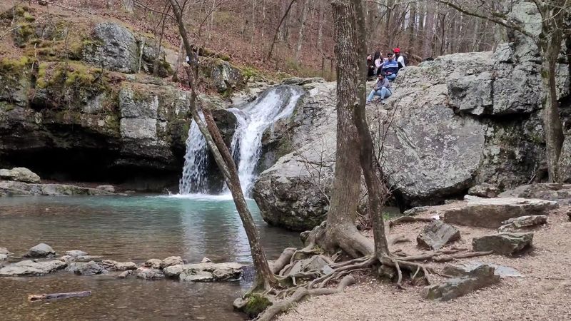
Hot Springs gets plenty of attention for its bathhouses, but a quieter treat sits just outside town. Lake Catherine State Park, at 1200 Catherine Park Road, Hot Springs, AR 71913, is home to the Falls Branch Trail.
This loop winds through pine and hardwood forest in the Ouachita Mountains, following a rocky creek. The highlight is a pretty waterfall that cascades over stone ledges into a small pool.
After spring rain, the falls get lively and loud.
The trail has some rocky climbs and creek crossings, so sturdy shoes help. It is moderate overall and works well for families who like a bit of challenge.
Along the way, the path passes views of Lake Catherine and some interesting rock formations. Novaculite, a hard stone found in this region, has been prized for sharpening tools for a very long time.
After the hike, the lake offers swimming, fishing, and boat rentals in warmer months. The park also has cabins built by the Civilian Conservation Corps, which give the shoreline a cozy, old-fashioned feel.
I appreciate a trail that pairs a waterfall with a lake. It makes the day feel like two outings in one.
Fall brings bright leaves and cooler temperatures.
Spa town by name, but the woods here are the real relaxation.
10. Brushy Creek Nature Trail, Wickes
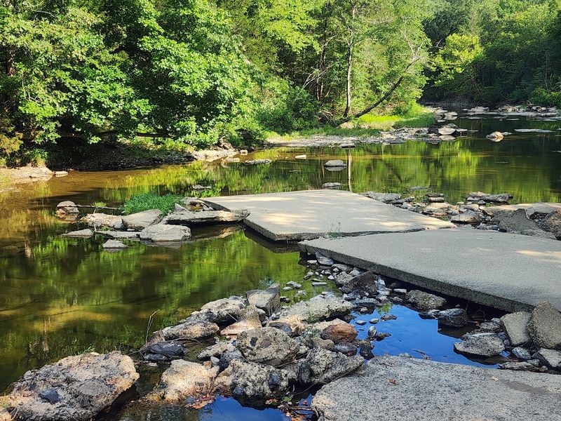
Not every great hike needs a grueling climb. Brushy Creek Nature Trail offers a slower pace at the Brushy Creek Recreation Area on Highway 246 near Wickes, Arkansas 71973, within Cossatot River State Park-Natural Area.
The three-quarter-mile trail winds through pine and hardwood forest along a ridge overlooking the meeting point of Brushy Creek and the Cossatot River. Interpretive tree markers help visitors learn about native species found throughout the area.
Water is still a big part of the attraction. A steel pedestrian walkway spans the river, connecting the recreation area’s parking areas and providing access toward picnic grounds and a swimming area.
Birdwatchers will find plenty to enjoy, too. Songbirds are active in spring, and the quieter stretches offer opportunities to listen for them.
To me, this trail feels like the calm closing chapter after a year of big bluffs and steep climbs. The ridge views offer a different perspective on the river below, while the shorter distance makes the outing manageable for visitors seeking an easier walk.
The recreation area sits in a rural part of the state, so services are limited nearby. Pack snacks and water before heading out.
Spring and fall offer comfortable conditions for exploring the trail.
Brushy by name, but the scenery gives you plenty of reasons to stop and look around.