9 Arkansas Hikes To Do This March With Big Payoffs For Just A Few Miles
March always pulls me back onto Arkansas trails before the heat settles in. The woods feel awake again, and every mile promises something new without demanding an all-day commitment.
Cool air makes the climbs easier, and the first wildflowers start showing up along the edges of the path. I like this window between winter and spring, when the trails feel open and quiet.
Arkansas hides remarkable scenery along surprisingly short routes, so you do not need expert skills to reach something memorable. A couple of miles can lead to a waterfall, a bluff-top view, or a strange rock formation that feels miles from civilization.
These hikes deliver big scenery for modest effort. Each one offers a quick adventure that still feels like a real escape into the landscape.
They are perfect for stretching your legs and coming home with a story worth telling.
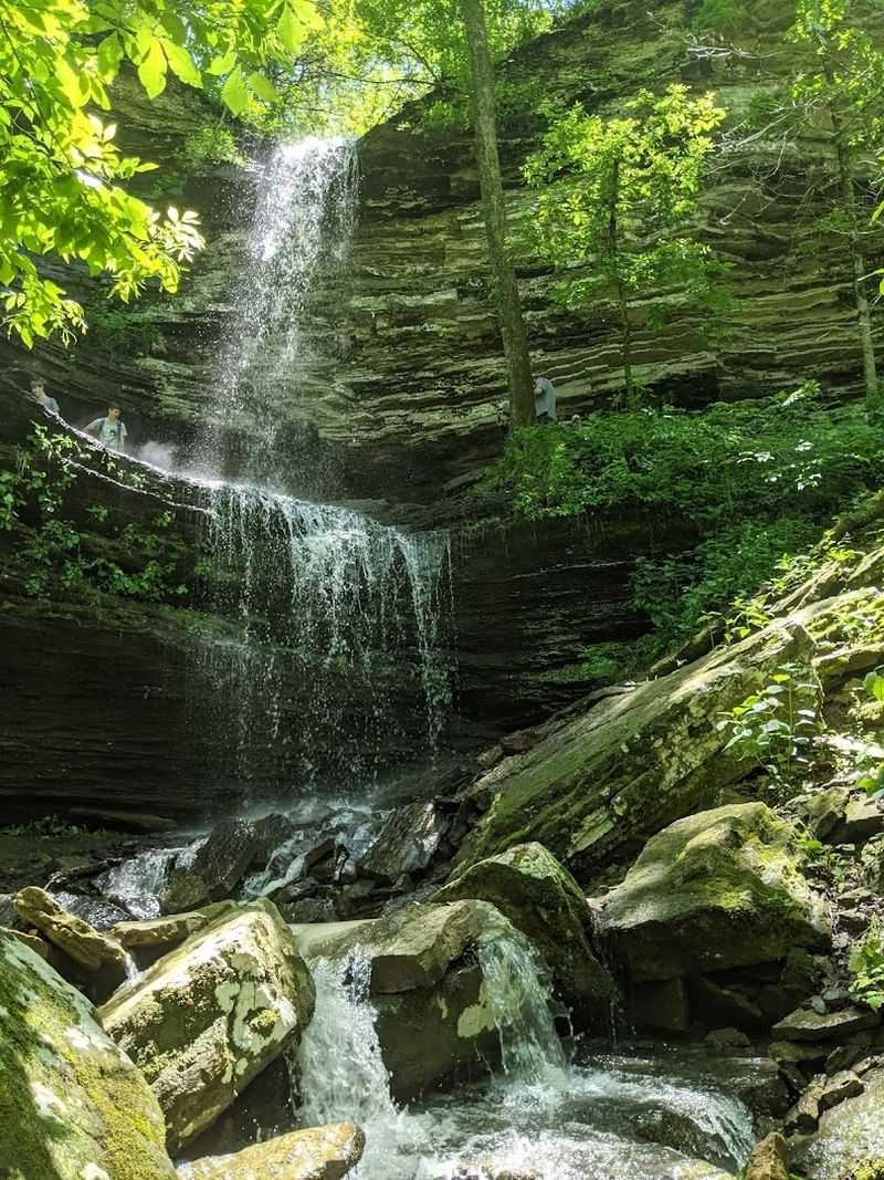
Cedar Falls Trail, Morrilton
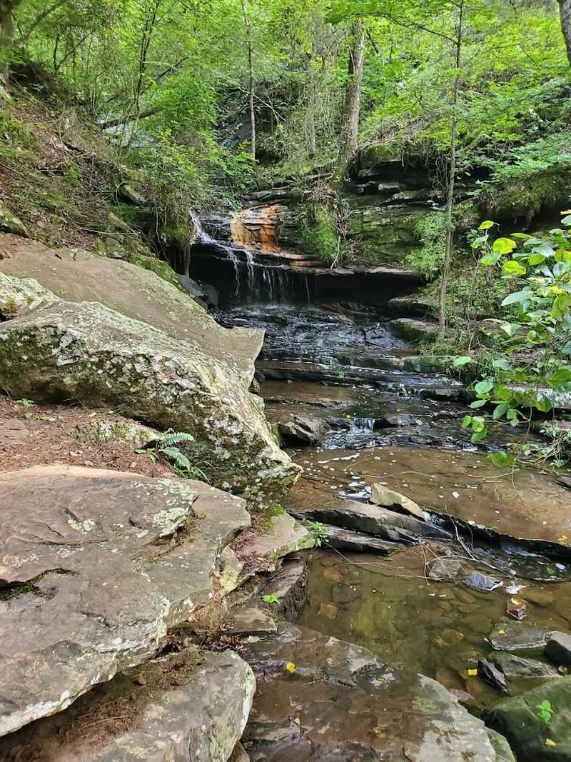
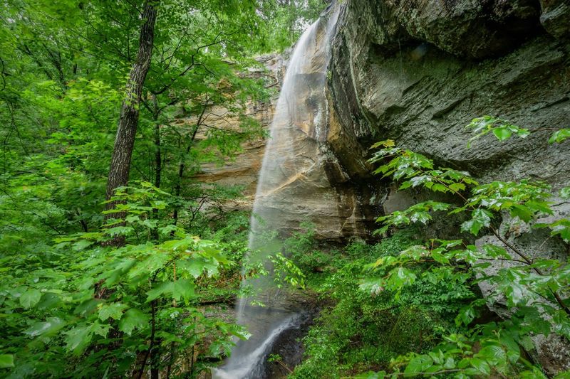
Standing at the base of Cedar Falls for the first time felt like stumbling into a postcard. This trail is located at 1285 Petit Jean Mountain Rd, Morrilton, AR 72110.
Inside Petit Jean State Park, the Cedar Falls Trail leads hikers to one of Arkansas’s most celebrated waterfalls in about 2 miles round trip. The payoff is absolutely worth lacing up your boots.
The trail winds through cedar glades and along a creek before dropping into a canyon where Cedar Falls plunges nearly 95 feet into a rocky pool below. In March, snowmelt and spring rains push the falls to their fullest, creating a thundering curtain of white water that you can feel from yards away.
I remember standing on the viewing platform just soaking it in.
The path is well-maintained but does include some rocky sections and wooden staircases, so sturdy shoes are a good call. Families with kids do this trail regularly, and it rarely takes more than two hours total.
Bring a light jacket because the canyon creates its own cool microclimate, even on warmer March afternoons. This one earns its reputation every single time.
Whitaker Point (Hawksbill Crag) Trail, Kingston
Hawksbill Crag is probably the most photographed rock formation in all of Arkansas, and once you see it in person, you completely understand why. The trailhead sits off County Rd 9560, Kingston, AR 72742, set within the Ozark National Forest near the Buffalo National River where the Ozark hills roll endlessly in every direction.
The hike itself is about 2.8 miles round trip, manageable for most fitness levels.
I did this trail on a cool March morning when a light mist was still hanging in the valleys below, and the views from the crag were otherworldly. The rock juts out dramatically over a deep forested canyon, giving you a 270-degree panorama that stops conversation cold.
People often just stand there quietly for a few minutes taking it all in.
The trail has some uneven terrain and exposed roots, so watch your footing as you approach the overlook. March is a wonderful time to visit because the bare trees actually open up more of the long-distance views compared to summer.
Arrive early if you can, because parking fills up fast even on weekdays during the spring season. Bring a camera and plan to linger.
Alum Cove Natural Bridge Trail, Deer
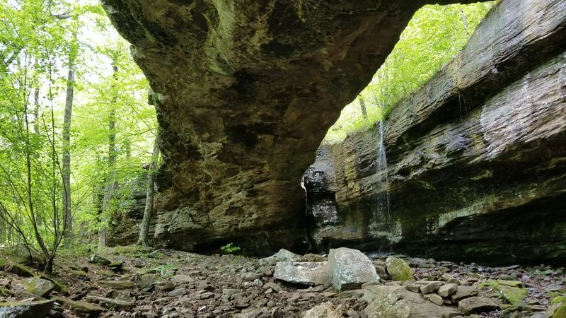
Natural bridges carved by centuries of erosion have a way of making you feel very small in the best possible sense. Alum Cove Natural Bridge Trail is located off AR-16 near Deer, AR 72628, inside the Ozark National Forest, and it delivers one of the most unique geological features in the state within a short 1.2-mile loop.
The span of the natural bridge stretches about 130 feet, making it one of the largest natural bridges in the Ozarks.
Walking under that arch for the first time genuinely gave me chills. The hollow beneath it stays shaded and cool, with mosses and ferns covering the rocky ground even in early spring.
The trail itself is relatively gentle with just a moderate descent into the hollow, making it accessible for most hikers including older adults and older children.
March brings early wildflowers to this area, and the filtered light through the bare canopy adds a soft, almost painterly quality to the whole experience. The loop trail passes through a hardwood forest before circling back to the trailhead, so you get variety throughout the walk.
Pack a snack and take your time exploring the rocks and small creek near the bridge base.
Pedestal Rocks Scenic Area (King’s Bluff Trail), Pelsor
Few short hikes in the state pack in as much geological drama as the trails at Pedestal Rocks Scenic Area. Located on AR-16 about 6 miles east of Pelsor in the Ozark National Forest, the area features two loop options, Pedestal Rocks (2.2 miles) and King’s Bluff (1.7 miles), with canyon-like overlooks and striking rock formations along the way.
The pedestal formations themselves are genuinely striking, rising from the canyon floor like ancient stone sculptures. King’s Bluff adds dramatic canyon rim views where you can peer down into a forested hollow hundreds of feet below.
I walked this loop on a clear March afternoon and the light was hitting the bluff edges in a way that made everything look golden.
The terrain is moderate with some rocky sections near the canyon edges, so stay aware of your footing especially if the trail is damp from recent rain. March moisture actually enhances the colors here, making the orange and tan sandstone pop against the green of emerging vegetation.
This hike is a local favorite for good reason, and it rarely gets the national attention it deserves. Go soon before the crowds figure that out.
Grand Promenade Trail, Hot Springs
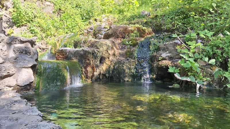
Hot Springs National Park holds a kind of old-world elegance that surprises many first-time visitors. An entrance to the Grand Promenade trail is located near 369 Central Ave, Hot Springs, AR 71901.
The path runs behind the famous Bathhouse Row and features a half-mile elevated brick walkway along a forested hillside right in the heart of the city. It is a genuinely pleasant and easy stroll that connects history with nature in a way few urban trails manage.
Walking the promenade on a quiet March morning felt almost like stepping back in time. The historic architecture of the bathhouses peeks through the tree line as you walk, and interpretive signs along the route share the fascinating story of how Hot Springs became one of the most visited resort destinations in early 20th-century America.
The path is paved and flat, making it ideal for all ages and fitness levels.
Spring in Hot Springs means blooming trees and warming temperatures that make this short walk especially enjoyable. The trail connects to longer forest paths on the hillside if you want to extend your outing.
Even on its own, the Grand Promenade delivers a satisfying mix of history, greenery, and city views that feels like a complete experience rather than just a warm-up walk.
Goat Rock Trail, Hot Springs
Right inside Hot Springs National Park, Goat Rock offers a rewarding overlook experience that many visitors miss. The Goat Rock Trail begins at the Goat Rock Trailhead off North Mountain Drive and winds through forested slopes before reaching a rocky viewpoint with wide views over Hot Springs and the surrounding hills.
The trail is 1.1 miles one way, or about 2.2 miles out and back, making it a high-payoff hike for relatively little mileage.
The trail winds upward at a moderate pace through a mix of oak and hickory before opening onto exposed quartz and novaculite rock outcroppings near the top. March is an ideal time because the bare trees keep sight lines open across the hillside, and the cool temperatures make the climb comfortable rather than sweaty.
I reached the summit just as the morning clouds were clearing and the view was genuinely rewarding.
Hot Springs sits in a natural bowl surrounded by low mountains, and from Goat Rock you can see how the city fits snugly into that landscape. The park has several connecting trails if you want to add distance, but Goat Rock alone is satisfying enough to justify the trip.
Bring water and wear shoes with some grip because the quartz rock can be slippery when wet.
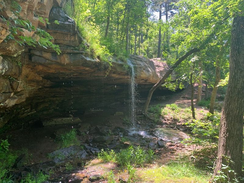
Lost Valley Trail, Ponca
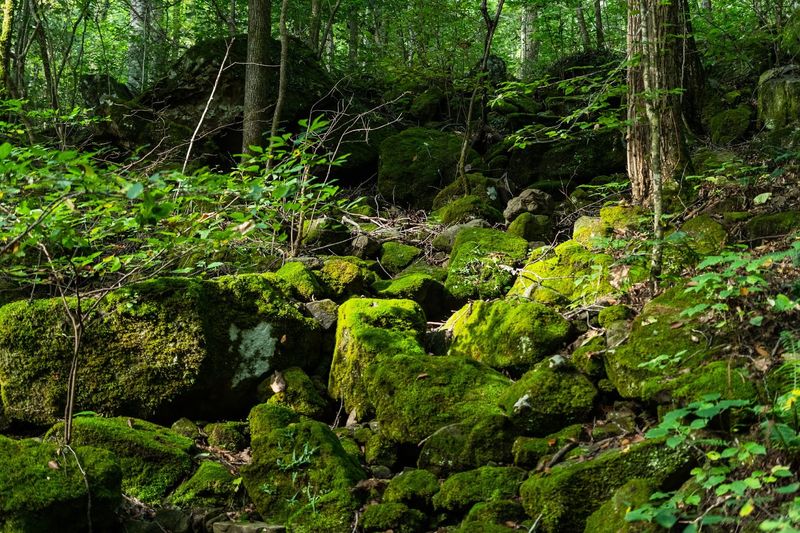
Lost Valley might be the most complete short hike in Arkansas. Located off Hwy 43 near Ponca, Arkansas, in the Buffalo National River area, this roughly 2.2–2.3 mile round-trip trail delivers a creekside walk, towering bluffs, a natural bridge, and the 53-foot Eden Falls.
The route winds up a box canyon along Clark Creek and passes the massive bluff shelter known as Cob Cave. Near the end, a spur leads toward Eden Falls, and visitors can also continue to a large cave where a waterfall can be viewed inside with a flashlight and some agility.
Each turn in the trail seems to reveal another surprise, making the miles pass quickly without feeling rushed. Early spring is an especially rewarding time to visit, when the canyon is lush and the flowing water brings the landscape to life.
The enclosed canyon gives the hike a peaceful feeling even on busier days. It is the kind of place where you naturally slow your pace just to take in the scenery.
Creek crossings can be wet in early spring, so footwear that can handle water is a smart choice.
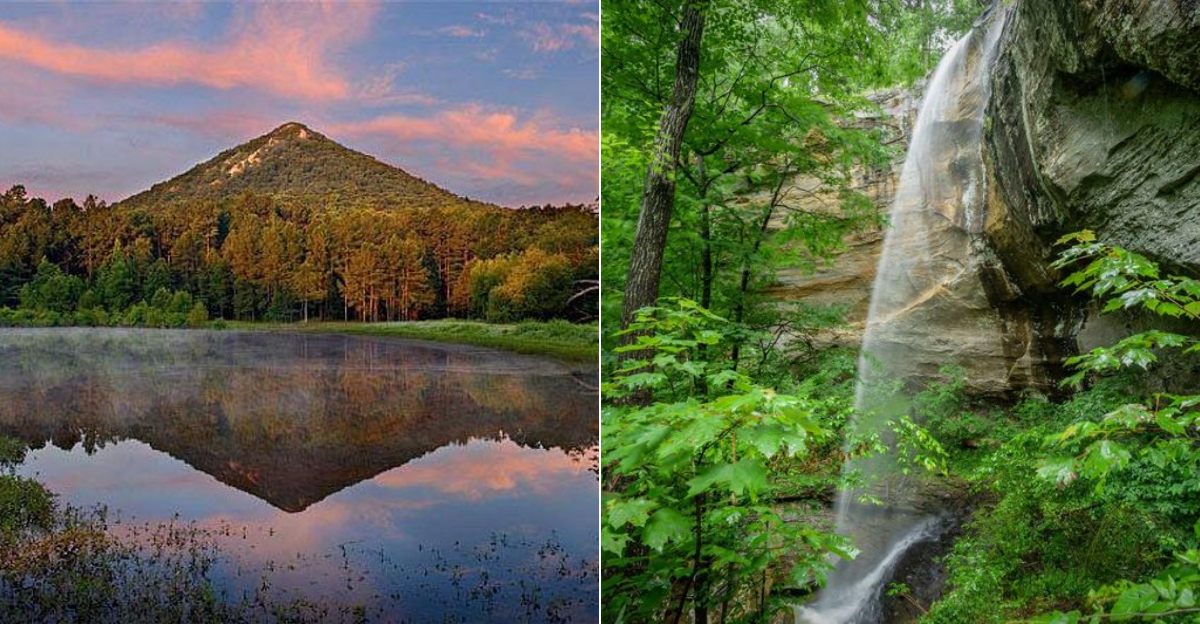
West Summit Trail (Pinnacle Mountain State Park), Roland
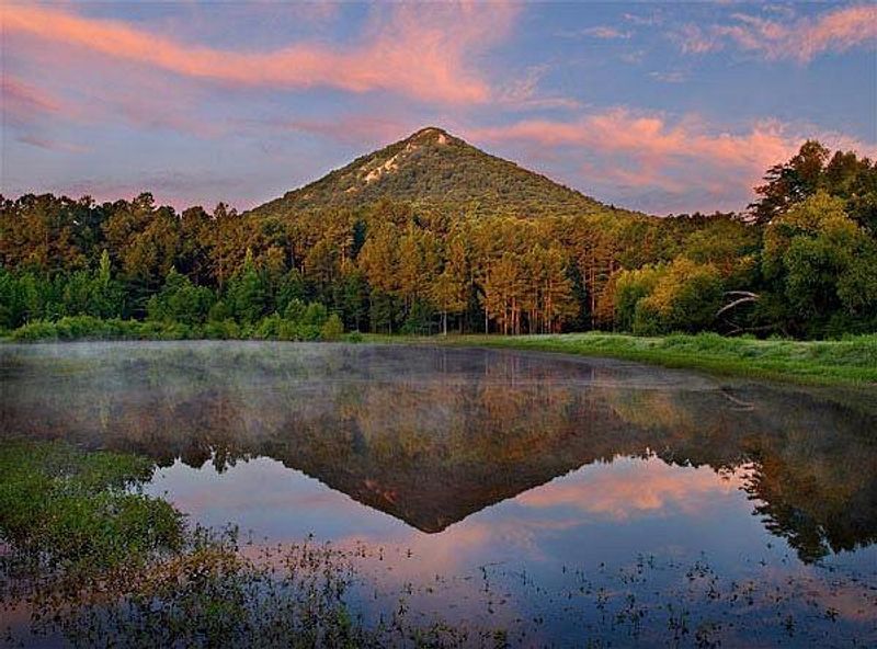
Pinnacle Mountain rises like a cone above the Arkansas River valley just west of Little Rock, and its summit trail is one of the most satisfying short climbs in the state. The park entrance is at 11901 Pinnacle Valley Rd, Roland, AR 72135, and the West Summit Trail climbs about 1.5 miles to the summit, with most hikers returning via the Base Trail for a round trip of roughly 2.5 miles.
The rocky route leads to the 1,011-foot summit, where sweeping views make the climb well worth the effort.
The upper section of this trail is genuinely rocky and requires some hands-on scrambling, which adds a fun adventure element that sets it apart from most short hikes in the region. March temperatures make the climb much more enjoyable than the humid summer months, and the open rocky summit means you get the full benefit of any clear spring day.
I sat up top for nearly half an hour just watching hawks circle below me.
The Arkansas River glints in the distance, and on clear days you can see downtown Little Rock on the horizon. The East Summit Trail offers a gentler alternative if the rocky scramble feels like too much.
Either way, Pinnacle Mountain delivers a genuine sense of accomplishment in a relatively short distance, making it a go-to destination for hikers of many experience levels visiting central Arkansas.
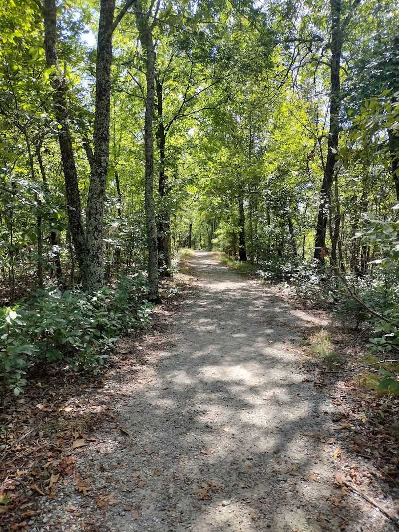
CCC Interpretive Trail (Devil’s Den State Park), West Fork
Devil’s Den State Park has a personality all its own, shaped in large part by the remarkable stonework left behind by the Civilian Conservation Corps in the 1930s. CCC Interpretive Trail (Devil’s Den State Park) in West Fork is a short 0.25-mile loop located at 11333 W Arkansas Hwy 74, West Fork, AR 72774.
The easy path winds through the rugged Lee Creek Valley in the Ozark Mountains and highlights the craftsmanship and history that helped define one of Arkansas’s best-known state parks. Interpretive signs along the route explain how CCC crews built many of the park’s enduring features using native stone and hand tools, creating structures that still blend naturally into the surrounding landscape today.
Although the trail itself is short and gentle, it provides a meaningful introduction to the park’s character and history. Devil’s Den State Park is known for its sandstone bluffs and crevice caves, and the forested valley setting gives the walk a quiet, secluded feel even when the park is busy.
Spring is an especially pleasant time to visit, when mild temperatures and early blooms bring color back to the woods. The park also features an 8-acre lake and an extensive trail system, making the CCC Interpretive Trail an ideal starting point for a longer day of exploring.