
Colorado’s Tick Map Reveals The Counties Around These 12 Wooded Getaways
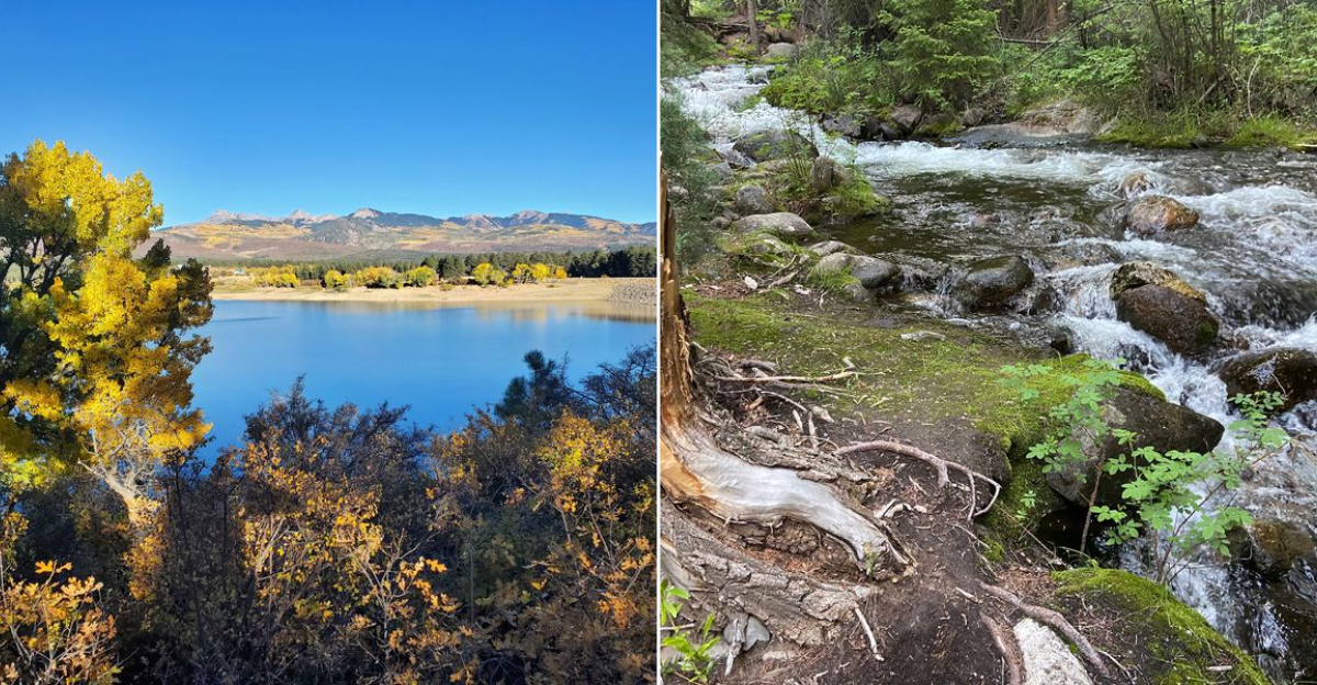
Forests look peaceful enough to make planning feel optional, which is exactly why a little preparation matters. Wooded campgrounds, creekside trails, and lake country across Colorado can still come with ticks, shifting fire conditions, and health advisories that deserve attention before the cooler is packed.
A tick map is not there to ruin the mood. It is there to help you enjoy the trip without turning every patch of tall grass into a guessing game.
Check county updates, bring repellent, know the route, and save the improvising for snack stops. The best part is that none of this takes much effort.
A few smart checks can leave more room for swimming, hiking, fishing, and wandering under the trees. When summer sends you toward quieter corners of Colorado, good preparation does not make the trip less spontaneous.
It simply keeps the focus where it belongs: on the outdoors all day long.
1. State Forest State Park, Jackson County
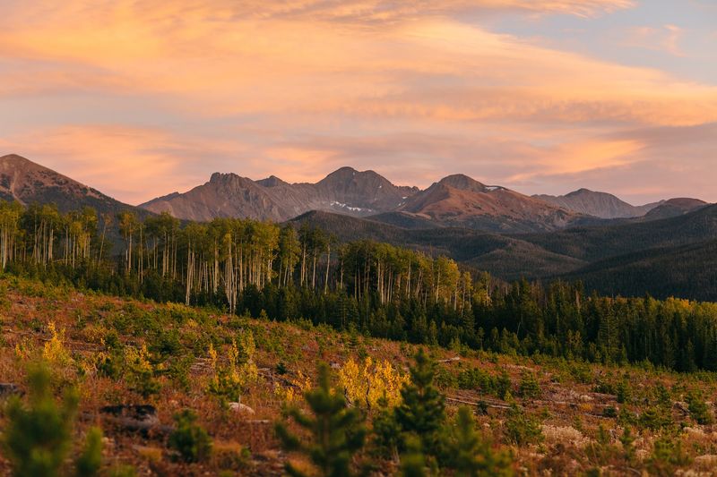
Big parks can feel oddly simple: road, trees, sky, then suddenly a moose-sized reminder that humans are not in charge. State Forest State Park covers more than 70,000 acres in Jackson County, with pine and aspen woods, alpine lakes, established trails, and campgrounds spread across the North Park landscape.
For travelers reading Colorado tick maps, the county matters as much as the scenery. State Forest State Park sits near Walden and Gould, away from Front Range bustle, so planning should include fuel, weather, fire rules, and the usual tick-aware habits: stay on trail, use repellent, and check clothing after grassy or brushy stops.
The park is operating in August 2026, but Jackson County has Stage Two fire restrictions. Portions of the Michigan Ditch and American Lakes trails are temporarily closed, which is exactly the kind of detail that separates a smooth outing from a parking-lot conference over bad cell service.
Check Colorado Parks and Wildlife updates before leaving, then let the county map do its quiet, practical job.
2. Pearl Lake State Park, Routt County
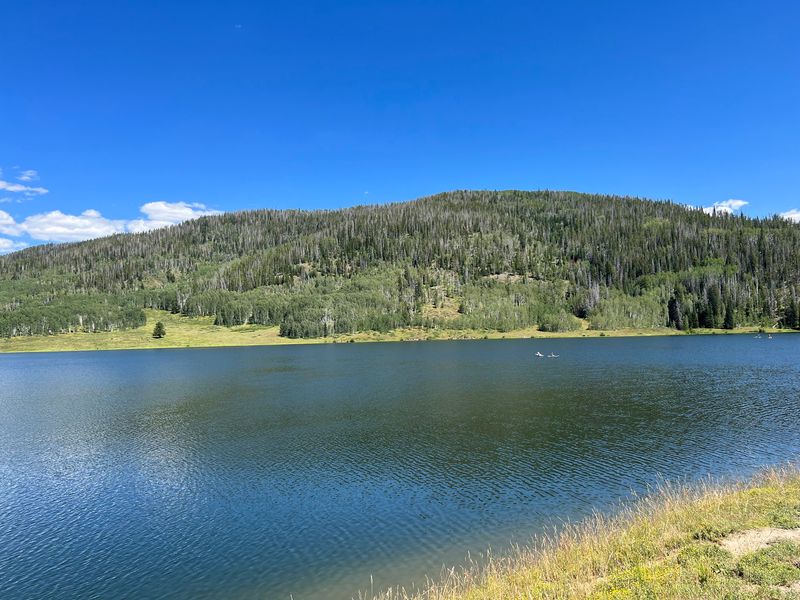
Pearl Lake State Park has the feel of a place that did not hire a publicist, which is part of its appeal. Near Clark in Routt County, north of Steamboat Springs, the park centers on a mountain lake bordered by forested slopes and campsites close enough to make morning coffee feel like an outdoor planning meeting.
Visitors come for paddling, lakeside camping, hiking, and the quieter northern Colorado setting. Pearl Lake State Park is smaller and less famous than many Routt County names, so it works well for people who want a wooded base without turning the trip into a resort production.
From a tick-map point of view, Routt County is the detail to notice before packing. The park is open daily with no park closures listed, but the county is under Stage Two fire restrictions, so campfires and charcoal rules deserve attention.
Add insect repellent, long socks, and a post-hike check to the same list as paddles and marshmallows. Nature rarely objects to good organization, though it may still hide your sunscreen under the seat.
3. Sylvan Lake State Park, Eagle County
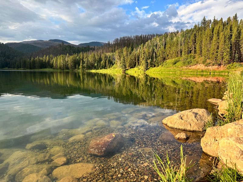
Some places make the title do very little work. Colorado Parks and Wildlife describes Sylvan Lake State Park as a serene wooded escape surrounded by White River National Forest, and that official description fits the scene better than any overstuffed brochure language could.
South of Eagle in Eagle County, Sylvan Lake State Park wraps around a mountain lake with forested campsites, trails, and access to a wider national forest setting. It is the kind of stop where families can anchor a trip around the lake, while couples or solo travelers can keep the plan pleasingly uncluttered.
The practical notes are not small print here. The park remains open daily in 2026, but campground water facilities are limited because of drought, and Eagle County has Stage Two fire restrictions.
Anyone using Colorado county tick information should pair it with current park alerts, because conditions change faster than a group text about who brought the cooler. Pack water with care, follow fire rules, use tick repellent in brushy areas, and check yourself after time around grass, leaf litter, or trail edges.
4. Rifle Mountain Park, Garfield County
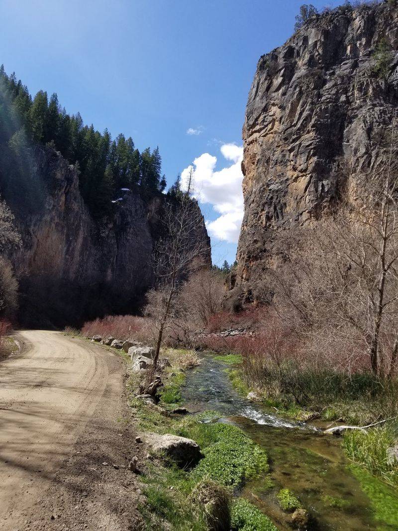
Rifle Mountain Park is city-owned, which sounds modest until the canyon walls show up and quietly steal the meeting. North of Rifle in Garfield County, the park is known for its mountain canyon setting, primitive campsites, hiking trails, forest pockets, and cliffs that attract climbers as well as campers.
Compared with larger state parks, Rifle Mountain Park has less polish and more of a self-reliant feel. That can be refreshing for road trippers who prefer a canyon road, a campsite, and a clear plan over gift-shop choreography.
Selected campsites moved to online reservations in May 2026, while other sites remain first come, first served, confirming active use this season.
Garfield County on a tick map should nudge visitors toward basic outdoor habits rather than worry. Wear repellent, keep dogs protected as advised by a veterinarian, and do a careful check after hiking or sitting near vegetation.
Also confirm campsite rules before arrival, because discovering the reservation system at the canyon entrance is a travel comedy best enjoyed by other people, preferably in a fictional movie.
5. Vega State Park, Mesa County
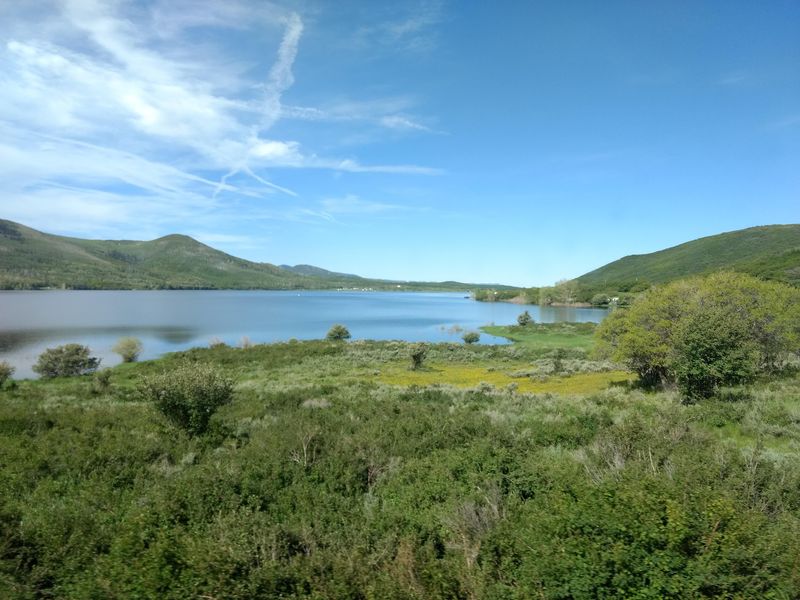
Vega State Park sits high above the Grand Valley, which gives it a different mood from Mesa County’s hotter, lower country. Near Collbran, on the northeastern edge of Grand Mesa National Forest, the park is surrounded by aspens, montane meadows, and wooded slopes around Vega Reservoir.
That mix makes Vega State Park useful for travelers who want a forested Western Slope stop without defaulting to the busiest names. Camping, hiking, hand launching, and land-based recreation remain available, and the park is open daily.
The wrinkle for 2026 is water level: both boat ramps are closed because of low water.
For tick-map readers, the county label is a planning cue, not a reason to stay home. Bring repellent, avoid brushing through tall grass when a trail will do, and check yourself, children, and pets after time near vegetation.
Low water can change how people use a park, so confirm conditions before hauling boat gear across Colorado like a very expensive roof ornament. Vega rewards the prepared traveler with forest, open meadow, and reservoir country in one compact mountain setting.
6. Paonia State Park, Gunnison County
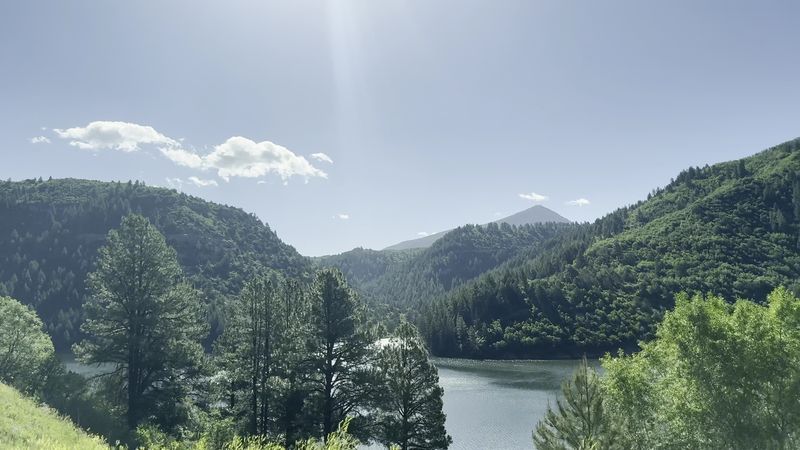
Paonia State Park does not sprawl; it slips into a narrow mountain setting and lets the surrounding forest do the heavy lifting. Northeast of Paonia in Gunnison County, the park is bordered by Gunnison National Forest and the Ragged Mountains, with a reservoir stretched through the valley.
The standout camping detail is Spruce Campground, which sits beside a stream among tall blue spruce. That gives Paonia State Park a more wooded feel than many open reservoir parks, where shade can become the most discussed member of the travel party.
Camping is available during the May-through-September season, and the park is currently open.
The boat ramp is presently closed, so visitors should check current conditions before building a trip around motorized boating. For the tick-map angle, Gunnison County reminds travelers to treat creekside grass, brush, and forest edges with practical respect.
Use repellent, tuck pants if you are moving through vegetation, and do a tick check before settling into camp. Paonia’s strongest feature is not a long activity menu; it is the focused combination of spruce, water, and mountain walls in a compact state park setting.
7. Ridgway State Park, Pa-Co-Chu-Puk Area, Ouray County
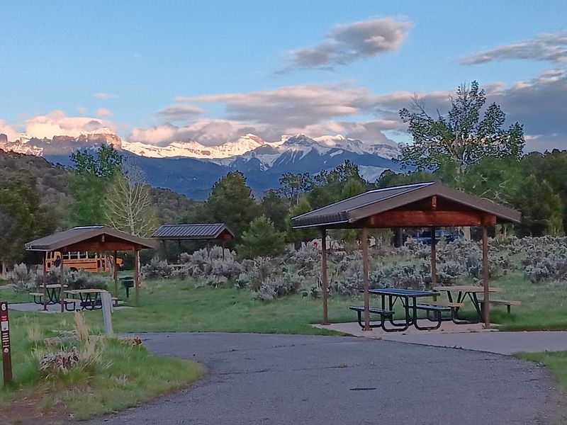
Choosing Pa-Co-Chu-Puk changes the whole Ridgway conversation. Instead of treating Ridgway State Park as one broad reservoir stop, this northern area focuses attention on the Uncompahgre River, trees, trails, campsites, and the lower foothills leading toward the San Juan Mountains.
North of Ridgway in Ouray County, the Pa-Co-Chu-Puk Area is known for river access and a quieter campground setting within the larger park. It is a smart fit for travelers who like their wooded getaways with defined facilities rather than a complicated backcountry puzzle.
Ridgway State Park is open daily and operating in 2026.
Ouray County currently has Stage Two fire restrictions, so check the latest rules before packing anything that assumes flames are part of dinner. A tick map adds another layer of common sense: stay aware around grassy riverbanks and trail edges, use repellent, and check socks, waistbands, and pets after being outside.
Pa-Co-Chu-Puk proves that a specific area within a familiar park can change the trip, especially when the river, trees, and county conditions all matter.
8. Mancos State Park, Montezuma County
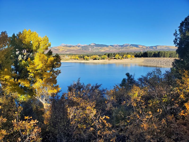
Mesa Verde gets the famous-name treatment in southwest Colorado, while Mancos State Park quietly handles the forest-and-water assignment nearby. Near the town of Mancos in Montezuma County, the park surrounds Jackson Gulch Reservoir and includes wooded camping, trails, fishing, and mountain scenery.
The setting makes Mancos State Park a useful pause for travelers who want a less complicated outdoor base in the Four Corners region. It is open daily, but the boat ramp is closed for the rest of the season because of low water.
Hand-launched vessels and the rest of the park remain available, so the trip does not have to collapse just because the ramp is taking a year off.
Montezuma County’s place on a tick map should encourage the normal forest checklist. Use insect repellent, avoid wandering through brush when established routes are available, and check skin and clothing after hikes or time near camp.
The park’s appeal is refreshingly concrete: a named reservoir, actual wooded sites, and a location that pairs mountain recreation with the broader southwest Colorado landscape without needing a dramatic speech.
9. Lake Isabel Recreation Area, La Vista Side, Custer County
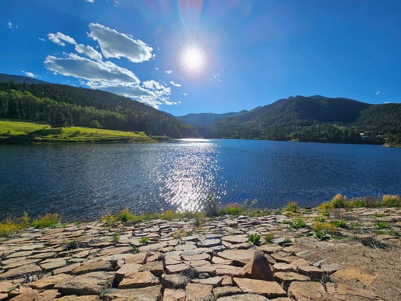
Lake Isabel can be confusing on a map because county lines and campground names matter. For this list, the La Vista side is the clean Custer County match, placing visitors in the Wet Mountains at an elevation above 8,000 feet with pine and aspen around the mountain lake setting.
La Vista Campground is the useful anchor here. Current Recreation.gov records show it operating for the 2026 season, and nearby forest trails lead deeper into the Wet Mountains.
The area works best for planners who read details before reserving, because choosing the correct side of a recreation area is less glamorous than choosing snacks, but far more important.
Custer County on a Colorado tick map adds a practical reminder for wooded lake days. Repellent, long socks, and a post-walk check are sensible around grass, shrubs, and forest edges.
Visitors should also confirm campground dates, water availability, and local fire rules before leaving home. The La Vista side of Lake Isabel Recreation Area earns its place because it is specific, forested, and county-clear, three qualities that make both travel writing and trip planning less wobbly.
10. Trappers Lake and Shepherds Rim Campground, Rio Blanco County
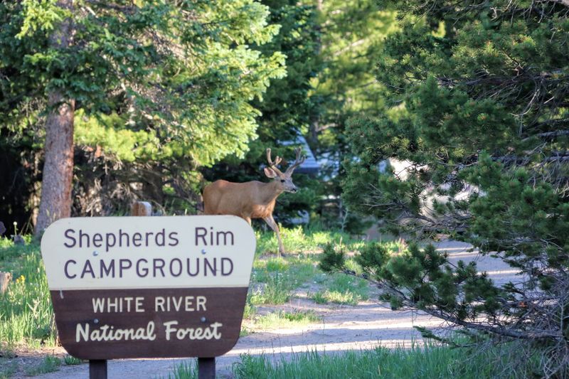
Remote places have a way of editing your packing list. Trappers Lake in Rio Blanco County sits beside the Flat Tops Wilderness and is reached by a long drive from Meeker, with forest, mountain lakes, hiking, fishing, and very limited development shaping the experience.
Shepherds Rim Campground gives this stop a practical base rather than just a dot on a wilderness map. The campground is active in 2026, and the broader area is managed within the White River National Forest setting.
Anyone planning a visit should check road, weather, and campground information before committing, because remote Colorado rewards preparation more than optimism.
White River National Forest is under Stage Two fire restrictions, so campfires and charcoal are prohibited. Add tick-aware habits to that same serious-but-useful list: use repellent, keep to established routes when possible, and check clothing and skin after brushing against vegetation.
Trappers Lake and Shepherds Rim Campground suit travelers who want distance from the usual circuit, but distance also means fewer easy fixes if someone forgets fuel, rain gear, or the only working flashlight.
11. Mogote Campground, Conejos County
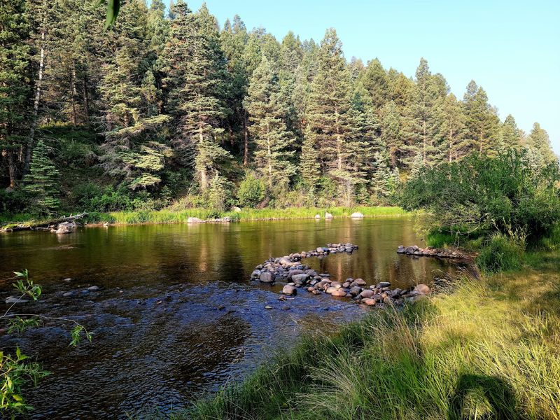
Mogote Campground has a wonderfully practical kind of beauty: river, shade, trees, repeat as needed. In Conejos County near Antonito and La Jara, the campground sits directly along the Conejos River in a wooded valley with ponderosa pine, cottonwood, spruce, willow, and aspen.
That tree list is not decoration; it explains why Mogote Campground belongs among Colorado’s wooded getaways. Current Recreation.gov information shows sites operating in 2026, making it a real option for travelers looking south instead of following the usual mountain-park reflex north and west.
The river corridor gives the campground a clear identity, not just a place to park a tent.
Stage Two fire restrictions are presently in force, so visitors should confirm what is allowed before planning meals or campsite routines around flames. Conejos County’s tick-map context is another reason to be methodical around riverside vegetation.
Use repellent, keep gear out of brush when possible, and check ankles, waistbands, and dogs after walking near grass or shrubs. Mogote is straightforward in the best way: a named campground, a real river, and enough trees to make shade feel like part of the reservation.
12. North Crestone Creek Campground, Saguache County
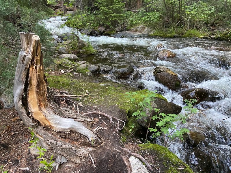
A thirteen-site campground asks visitors to scale down their ambitions in a healthy way. North Crestone Creek Campground near Crestone in Saguache County follows its namesake creek through a shaded mountain corridor at the base of the Sangre de Cristo Mountains.
The vegetation gives the place its character: aspen, fir, juniper, and riparian growth line the corridor. Current 2026 campground information lists North Crestone Creek Campground open for the season, and the National Park Service continues to identify it as a Forest Service camping option near the northern side of Great Sand Dunes country.
That makes it useful without turning it into a national-park substitute.
Saguache County’s tick-map note belongs beside normal mountain planning, not in a panic file. Use repellent, check after creekside walks, and keep pets protected according to veterinary guidance.
Because the campground is small, confirm availability and access before building a whole itinerary around it. North Crestone Creek Campground closes the list on a fittingly modest note: fewer sites, a clear creek corridor, and a reminder that in Colorado, small places can still require careful planning.