Discover The Colorado Canyon Drives That Locals Say Offer The Best Views
You want views that glue your eyes to the horizon and your jaw to the floor, and Colorado delivers them by the mile.
I chased these canyon drives with a camera, a thermos, and an absurd grin, and every curve made me slow down just to soak in the drama.
Consider this your friendly, firsthand roadmap to the routes that turned my quick detours into full day adventures.
Buckle up, because the scenery goes big, the roads go twisty, and your playlist might run out before the wow does. Red rock cliffs rise like sculpted monuments, their colors shifting with every passing cloud.
Small pull-offs and overlooks tempt you to pause, stretch, and let the landscape sink in fully.
By the time the sun dips low, the canyons glow like molten gold, and even the rearview mirror can’t capture the magic.
1. Peak To Peak Scenic Byway, Boulder To Estes Park
First came the byway that set the mood like a perfect opening chord, the Peak to Peak Scenic Byway from Boulder to Estes Park along CO 7 and CO 72.
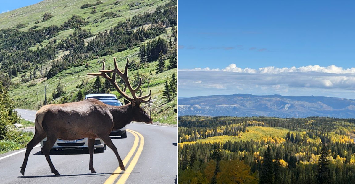
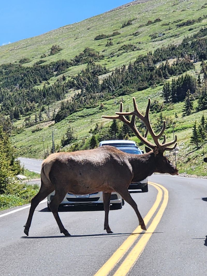
The road threads foothills and firs, tipping into glimpses of canyons and meadows where elk graze like living punctuation.
I rolled windows down and let the mountain air edit my thoughts into fewer words and bigger smiles.
Expect gentle curves, short pullouts with sweeping views, and pockets of aspen that sparkle in fall. Boulder’s casual bustle fades to alpine quiet, and St. Malo Chapel of the Transfiguration pops into view like a postcard surprise.
If you are headed to Estes Park, the approach heightens anticipation with every bend.
Bring layers, a thermos, and time to linger, because the scenery refuses to be rushed, and neither should you.
2. San Juan Skyway, Durango → Telluride → Silverton → Ouray → Ridgway
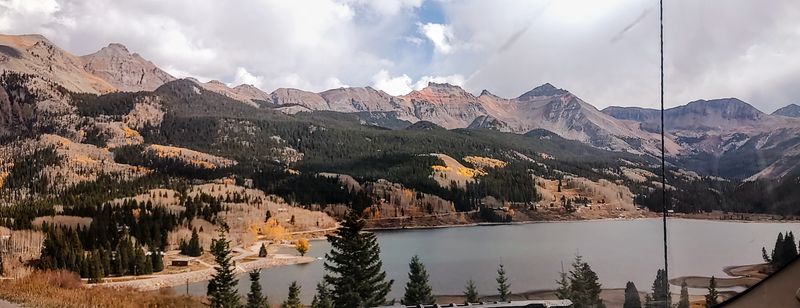
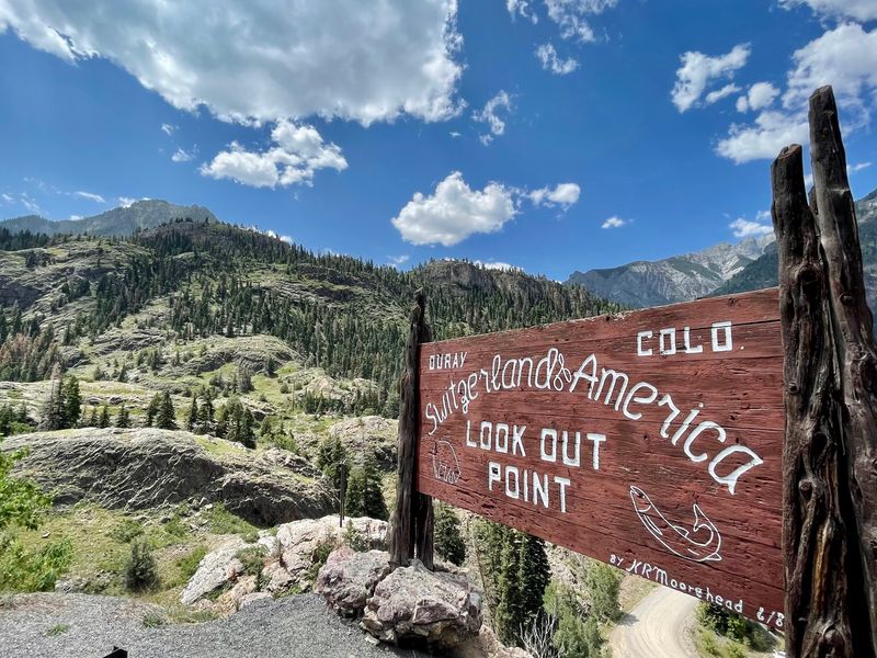
The San Juan Skyway felt like a greatest hits album where every track is a mountain anthem, looping from Durango through Silverton, Ouray, Telluride, and Ridgway on US 550 and CO 145.
I traced river cut canyons, crossed high passes, and coasted into historic streets where colorful facades meet craggy skylines.
Each segment swung between whisper quiet valleys and drumroll cliffs.
Durango’s warm welcome eases you toward Silverton’s mining bones, and Ouray’s amphitheater of peaks cradles hot springs and trailheads.
Telluride arrives tucked in a box canyon like a secret worth keeping.
Ridgway steadies the tempo with wide meadows and cinematic light.
Weather changes quickly at altitude, so pack layers, snacks, and sensible shoes.
I planned photo stops at Molas Pass and Dallas Divide, then added more because the vistas kept voting themselves in.
3. Mount Evans Scenic Byway, near Idaho Springs
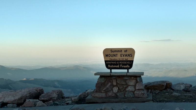
Nothing humbles your schedule like the Mount Evans Scenic Byway near Idaho Springs, the highest paved road in North America topping 14,130 feet.
The climb leaps from forested canyon curves to windswept tundra where lakes shine like coins tossed onto granite.
I parked often because the sky felt close enough to high five.
Watch for mountain goats browsing like white punctuation marks on black rock, and breathe slowly when the altitude edits your energy.
Echo Lake is a calm preface, Summit Lake a dramatic middle chapter, and the summit itself reads like a bold exclamation.
Hand warmers became my best friends on a surprisingly brisk August morning.
Go early for calmer winds and easier parking, carry water, and check seasonal closures.
The views sprawl forever, but your steps should stay sure footed along those airy edges.
4. Trail Ridge Road, Rocky Mountain National Park, Estes Park → Grand Lake
Trail Ridge Road made me feel like driving the spine of the continent, stretching from Estes Park to Grand Lake through Rocky Mountain National Park.
One moment the highway hides in forested canyons, the next it floats above treeline where the tundra looks like a living mosaic.
I paused at Forest Canyon Overlook and felt the silence press gently against my ears.
Elk browse roadside meadows with the kind of confidence earned by centuries of residency.
Pullouts arrive often, and weather flips like a coin, so a hat and patience are priceless.
Tucked between hairpins, the views layer valleys, cirques, and sawtooth ridges into a deep time panorama.
Drive slowly, sip water, and savor that high altitude hush.
5. Glenwood Canyon Scenic Byway, I 70 corridor, Glenwood Springs
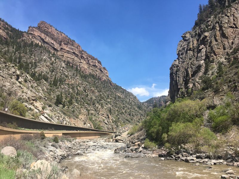
Glenwood Canyon turns a normal interstate run into a rock cathedral tour along I 70 near Glenwood Springs, shadowing the Colorado River through sheer walls.
Ledges, tunnels, and bridges play architectural tag while rafters trace white lines below.
I turned down the music because canyon acoustics deserve center stage.
Rest areas like Grizzly Creek, No Name, and Hanging Lake provide trail access and picnic tables tucked under stone sentinels.
In spring, waterfalls comb the cliffs and mist the air, turning sunlight into sequins.
Traffic can ebb and flow, so patience pairs nicely with curiosity.
Here is a tiny memory: a raven surfed the thermals above my hood, then vanished behind a buttress like an old magician.
Fuel up in Glenwood Springs, check for closures, and keep your camera ready for those dramatic rock profiles.
6. Million Dollar Highway (US 550), Durango → Silverton → Ouray
If a road could wink, the Million Dollar Highway between Durango, Silverton, and Ouray would do it halfway around every hairpin.
Cliffs plunge, shoulders narrow, and views drop straight into deep cut canyons sharp enough to sharpen your focus.
I gripped the wheel and grinned like a cartoon.
Coal Bank, Molas, and Red Mountain Pass each deliver their own flavor of grandeur.
Silverton’s grid unfolds below rugged peaks, and Ouray’s box canyon feels like a theater where geology curated the seating chart.
Guardrails are scarce in spots, so this is a slow dance, not a sprint.
A sudden hailburst cleaned the windshield just as a rainbow bridged the valley, applause from the sky.
Start with a full tank in Durango, watch weather forecasts, and use pullouts for photos instead of improvising.
7. Grand Mesa Scenic Byway, Cedaredge → Grand Mesa
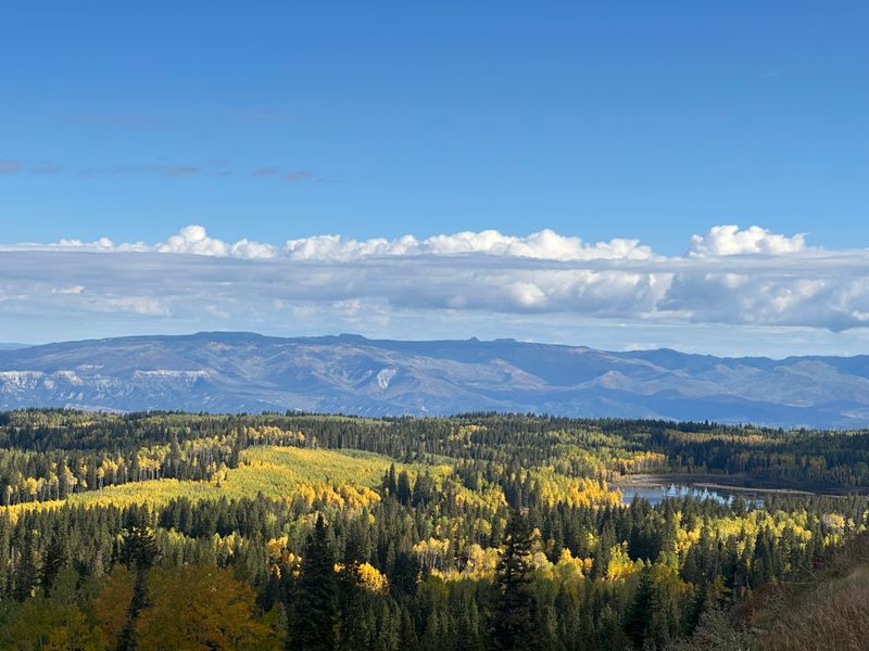
Grand Mesa feels like someone lifted a giant table and set it between sky and canyon, and the byway from Cedaredge to Grand Mesa runs right across it.
Lakes sparkle between spruce and aspen while distant valleys peel open like folded maps.
I stopped at Island Lake and listened to wind doodle across the water.
Pullouts reveal slashes of canyon country beyond the forested rim, a surprise peek behind the mountain curtain. In summer, wildflowers color the shoulders, and in fall, aspens flip their golden coins.
The grade is steady, the vibe unhurried, and the air smells like clean pages.
Here is a small moment: a curious fox trotted across the road, looked back once, then disappeared into brushes like a punctuation mark.
Bring layers, sunscreen, and a snack for leisurely shoreline strolls.
8. Red Canyon Scenic Byway, Near Gunnison And Crested Butte
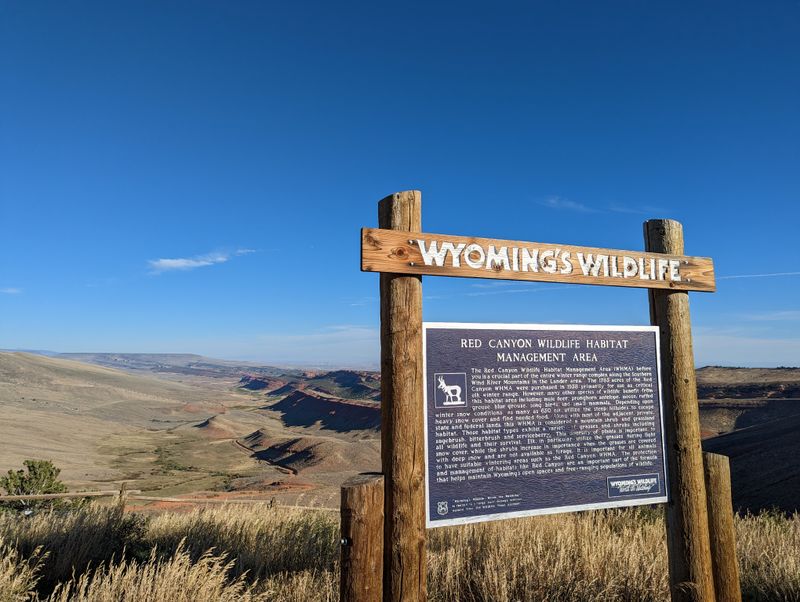
Short and sweet wins the day on the Red Canyon Scenic Byway near Gunnison and Crested Butte, where red rock fins glow like embers against sage and pinyon.
The drive is compact, the drama oversized, and the traffic blissfully light.
I rolled slowly just to hear gravel whisper under the tires.
Color bands stripe the cliffs, and pullouts reveal quiet views you can have mostly to yourself.
The scale feels intimate, like nature whispering instead of shouting, and the light changes every minute.
It is an easy detour that pays generous scenic dividends.
My quick tale: a jackrabbit flashed across the road, ears back like aerodynamic sails, then paused on a rock to judge my parking skills.
Bring water, respect private property signs, and watch for soft shoulders along those photogenic bends.
9. Royal Gorge Route, Cañon City
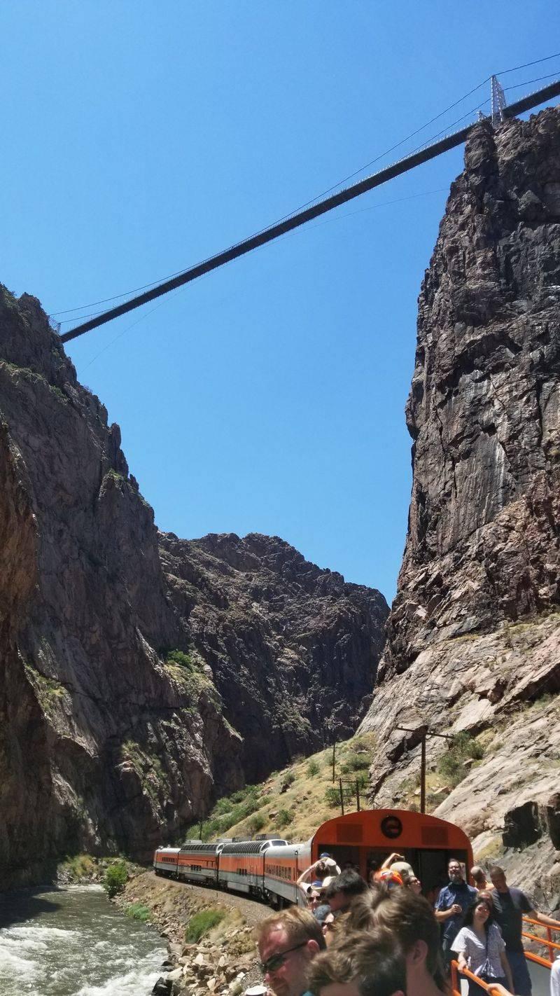
The Royal Gorge Route near Cañon City clings to the Arkansas River like a determined signature, tracing steep walls toward the iconic Royal Gorge Bridge at 42195 US 50, Cañon City, Colorado.
Canyon shadows slide across the asphalt while the river chatters a mile a minute.
I timed my drive to catch sunlight piercing the chasm like a spotlight.
Pull over at Park Avenue of the Royal Gorge or the visitor areas for sweeping perspectives.
The bridge spans the sky with theatrical flair, and the surrounding trails offer alternate angles on the drama.
Traffic is manageable, but curves reward attentive pacing.
Here is a tiny recollection: a kayaker grinned up from the rapids, and for a second it felt like we traded roles, me the audience, them the show.
Pack binoculars, water, and a flexible schedule.
10. Black Canyon Of The Gunnison Scenic Drive, Near Montrose
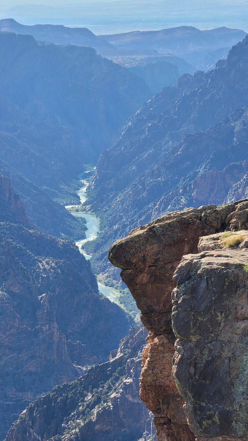
The Black Canyon of the Gunnison near Montrose delivers depth so dramatic it steals full seconds from your day, especially along South Rim Drive and North Rim Drive.
The cliffs are ink dark, the river is a silver thread, and the drop feels like punctuation without mercy.
I moved from Tomichi Point to Painted Wall Overlook with hushed steps.
Each stop reveals a different angle on abyss and light, with signage that keeps geology readable.
Roads are narrow with tight bends, so patience pays in calm shoulders and good photos.
Morning and late afternoon light sculpt textures into high relief.
One more memory: a breeze pushed my hat toward the railing at Chasm View, and reflexes proved very motivated.
Bring water, sturdy shoes, and a camera that respects contrast, because this canyon writes its own bold narrative.