Explore Vanishing Streams, Hidden Caverns And Massive Sinkholes On This Surreal 5-Mile Colorado Trail
Some hikes impress you with pretty views, then one like this comes along and makes the ground itself feel unpredictable. Near Vallecito Lake, this forested route trades postcard simplicity for disappearing streams, limestone caverns, strange depressions, and the thrilling sense that something unusual is happening beneath your boots.
In Colorado, dramatic scenery usually means peaks, cliffs, or alpine lakes, but this trail pulls attention downward into a landscape shaped by water, rock, time, and hidden underground movement. The result feels part hike, part science lesson, part woodland mystery.
You are not just walking through trees. You are crossing a karst world filled with features that seem almost too odd to be real, from vanishing water channels to massive sinkholes tucked into the forest floor.
For hikers craving a Colorado outing with more than standard mountain beauty, this route delivers a rare, brain-tingling kind of adventure.
The Cave Basin Trailhead: Where The Strangeness Begins

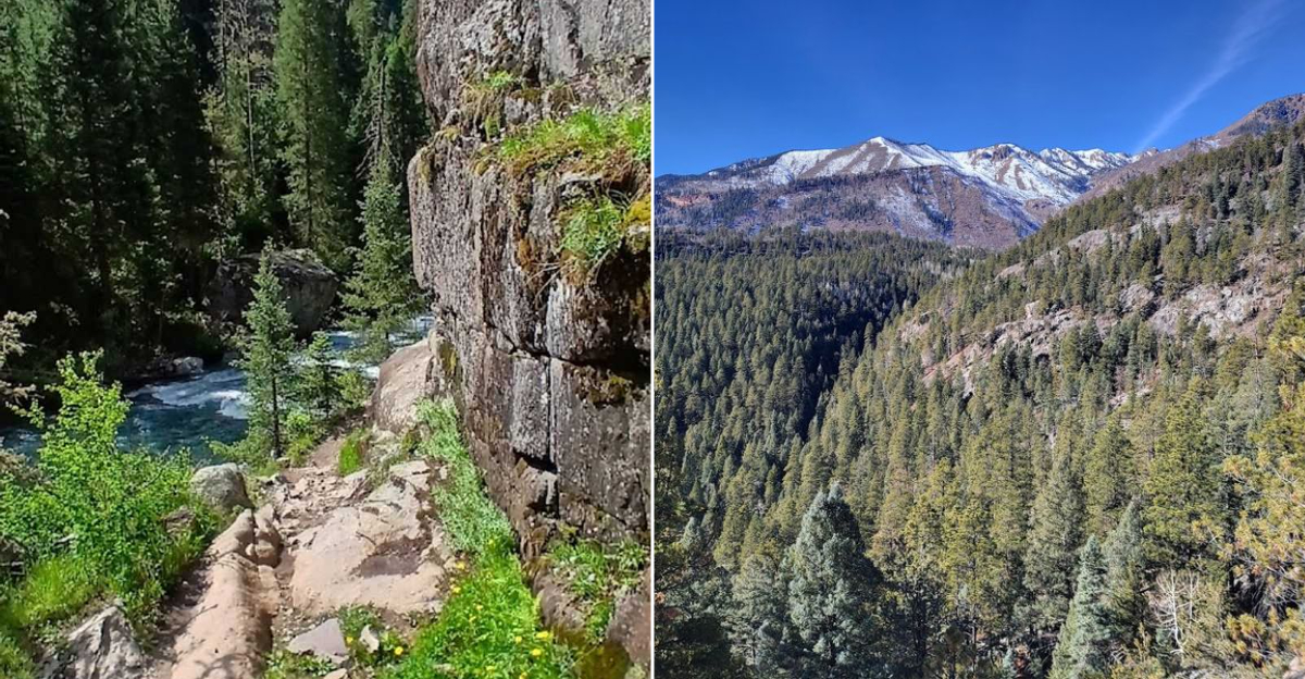
There is a particular kind of quiet that greets you at the Cave Basin Trailhead, the sort that makes you double-check whether you took the right turn off Middle Mountain Road / Forest Road 724. You did.
The trailhead sits in the San Juan National Forest near Vallecito Lake, and the parking area is modest, unpaved, and completely no-frills, which is exactly the right introduction for a trail that rewards curiosity over comfort.
A bulletin board at the start posts basic information about the route, and it is worth pausing here before you charge ahead. The trail ahead covers roughly 5 miles through karst terrain, a landscape shaped by dissolving limestone over thousands of years.
That means the ground itself is full of surprises, not all of them visible from above.
Pro Tip: Arrive early on weekends, especially in summer, as the limited parking fills faster than you might expect. Bring a printed or downloaded offline map because cell service along Forest Road 724 is unreliable at best and nonexistent at worst.
Sturdy footwear with ankle support is not optional here; it is the smartest decision you will make all morning.
Vanishing Streams: The Creek That Plays Disappearing Act

Picture a perfectly healthy creek, burbling along, minding its own business, and then simply gone. No waterfall, no dramatic exit, just gone.
That is exactly what happens along the Cave Basin Trail, where seasonal streams sink into the porous limestone bedrock as if the earth decided it needed a drink and helped itself.
This phenomenon is called a sinking stream or losing stream, and it is one of the defining features of karst landscapes. Water that flows on the surface finds cracks and openings in the rock, follows them downward, and continues its journey underground through a network of passages that took millennia to carve.
What you see on the surface is only part of the story.
Why It Matters: These vanishing streams are not just visually strange; they are ecologically significant. The water reappears elsewhere as springs, feeding the broader watershed around Vallecito Lake.
Watching a stream disappear mid-flow is one of those moments that stops even the most distracted hiker cold. Best For: Science-curious adults, kids who ask too many questions in the best possible way, and anyone who wants a conversation starter that will last the entire drive home.
Hidden Caverns: Limestone Rooms The Forest Kept Secret

Stumbling across a cavern entrance in the middle of a pine forest is one of those experiences that briefly makes you question whether you are still on the right planet. The Cave Basin Trail earns its name honestly, with cavern openings tucked into the limestone hillsides along the route.
These are not Carlsbad Caverns-scale chambers with gift shops and guided tours; they are raw, unlit, and genuinely wild spaces.
The caverns formed through a process called speleogenesis, where slightly acidic groundwater slowly dissolved the limestone over vast stretches of time, leaving hollow chambers and passages behind.
Some openings are small enough to require crouching; others are large enough to step inside and feel the temperature drop immediately.
Insider Tip: Do not enter any cavern without a reliable headlamp and a companion. The footing inside is uneven, and the darkness is complete once you move past the entrance.
Going in just a few feet with a light is enough to appreciate the scale without taking unnecessary risks. Who This Is For: Adventurous families, geology enthusiasts, and anyone who has ever watched a cave documentary and thought, that looks manageable in real life.
Massive Sinkholes: The Ground That Decided To Quit

Nothing recalibrates your relationship with solid ground quite like standing at the edge of a sinkhole the size of a living room and realizing the earth just… stopped being there.
The Cave Basin Trail passes near several of these depressions, some shallow and bowl-shaped, others dramatically steep-sided and deep enough to make your stomach register a quiet complaint.
Sinkholes in karst terrain form when underground cavern roofs collapse, leaving a surface depression that can range from a few feet across to genuinely enormous. The ones along this trail are forested around the edges, which gives them an almost theatrical quality, a ring of pines framing a sudden void in the landscape.
Common Mistakes to Avoid: Do not approach the edges of sinkholes for a closer look without being aware of your footing. The rim soil can be loose and unstable, and the drop can be steeper than it appears from a few steps back.
Admire them from a safe distance, take the photo, and move on. Quick Verdict: The sinkholes alone are worth the drive up Forest Road 724.
They are the kind of geological feature that photographs beautifully and stays in your memory long after the trail dust washes off.
The Karst Landscape: A Geology Lesson You Actually Want To Attend

Most people drive through the San Juan National Forest looking for mountain peaks and river views. The Cave Basin Trail offers something less obvious and arguably more fascinating: a living geology lesson written directly into the ground beneath your feet.
Karst terrain forms when water slowly dissolves soluble rock, primarily limestone, over thousands of years, creating a landscape full of holes, caves, and underground drainage that operates completely independently from the surface world.
The Cave Basin area is one of the more accessible examples of this landform type in Colorado, which makes it genuinely unusual. You do not need a geology degree to appreciate what you are seeing, but knowing the basics makes every strange depression and hollow hillside click into place with satisfying logic.
Planning Advice: Download a brief overview of karst terrain before your visit. Even five minutes of reading will transform what might otherwise look like random holes in the ground into a coherent and impressive natural system.
Best Strategy: Hike slowly and look around rather than powering through for mileage. The details here reward attention: the texture of the rock, the placement of the depressions, the way the forest changes near cavern openings.
Speed is the enemy of appreciation on this particular trail.
Trail Conditions And What To Actually Pack

The Cave Basin Trail runs approximately 5 miles and sits within the San Juan National Forest near Vallecito Lake. The terrain is uneven by nature, because karst landscapes are not designed with smooth walking surfaces in mind.
Expect rocky stretches, root-crossed sections, and the occasional patch of loose soil near sinkhole rims and cavern entrances. The elevation gain is moderate, but the ground itself demands consistent attention.
Summer brings heat and afternoon thunderstorms, both of which arrive faster at elevation than most visitors anticipate. Mornings are the most reliable window for comfortable hiking.
Bugs, particularly mosquitoes, can be present near wetter sections of the trail, so insect repellent earns its place in the pack.
Quick Tip: Pack at minimum two liters of water per person, a headlamp even for a daytime hike (cavern curiosity is almost guaranteed), trekking poles if you own them, and a first aid kit. Sunscreen matters even in forested sections because Colorado UV levels at altitude are no joke.
Who This Is Not For: Very young toddlers in carriers on uneven karst ground will find this trail challenging for the carrier parent. Visitors with significant mobility limitations may find the rocky terrain difficult to navigate safely beyond the first mile.
Making The Most Of Your Cave Basin Visit: The Full Picture

The Cave Basin Trail near Vallecito Lake is the kind of place that works best when you go in without a rigid agenda. Plan for a half-day minimum if you want to explore the karst features properly rather than just tick off mileage.
The trail is open year-round, though winter conditions on Forest Road 724 can make access difficult without a high-clearance vehicle, so late spring through early fall is the most reliable window for most visitors.
Bayfield is a small, friendly town roughly 20 miles to the west, and it is a natural bookend for the outing. A stop in town after the hike covers the post-trail basics without requiring much planning energy.
The drive along Middle Mountain Road itself is scenic, with views of the lake and surrounding forest that set the mood long before you reach the trailhead.
Best For:Insider Tip: Couples looking for something genuinely different from a standard Colorado hike, families with older kids who can handle uneven terrain, and solo hikers who appreciate a trail that asks you to think as well as walk. If you can manage a weekday visit, the trail feels almost entirely your own, which is the best possible setting for a landscape this quietly spectacular.
That is a recommendation worth texting to someone right now.