
Hiking Echo Canyon Trail at Chiricahua National Monument Near Willcox, Arizona: Why an Early Start Matters
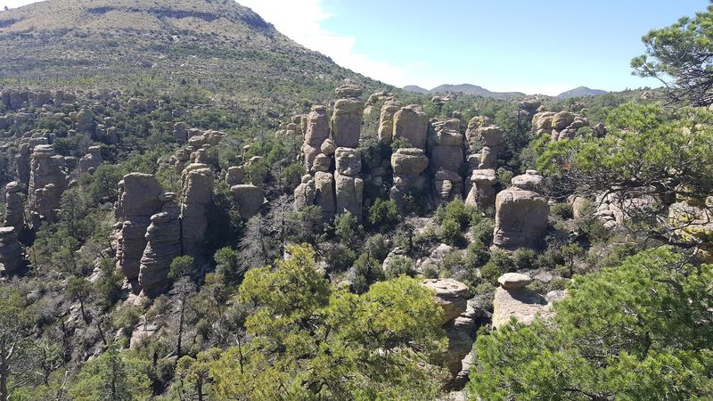
A loop trail in southeastern Arizona squeezes hikers through a narrow stone passage nicknamed Wallstreet. The walls are volcanic rock, and the whole route runs about 3.3 miles.
Those rocks came from a massive eruption roughly 27 million years ago. Wind, water, and ice then slowly carved the ash into spires, grottoes, and balanced boulders that look ready to tumble.
They never seem to, which I find oddly comforting.
I believe timing is the secret ingredient here. Morning light hits the stone first, the air stays cooler, and summer storms usually wait until afternoon.
I can’t imagine a better trade for an early alarm.
The best part? Getting in won’t cost you a single dollar.
So why do so many hikers still show up at noon? Let’s fix that, starting before sunrise.
Your Trailhead Waits Inside a Real Wonderland of Rocks
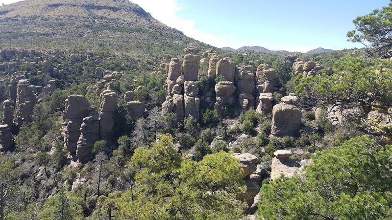
Echo Canyon Trail sits inside Chiricahua National Monument, a high, rocky preserve in the Chiricahua Mountains of southeastern Arizona. Most hikers reach it from the town of Willcox, roughly a 40-minute drive away.
The trail begins at the Echo Canyon parking area along Bonita Canyon Drive. That scenic road climbs through the monument, so the drive itself works like a warm-up act.
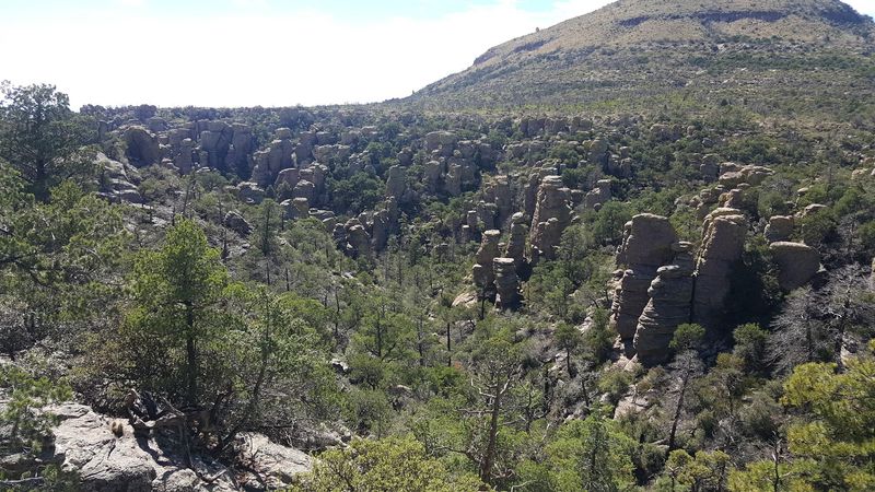
People have long called this landscape the Wonderland of Rocks. Once the first stone columns appear through the trees, the nickname stops sounding like marketing and starts sounding accurate.
Echo Canyon Trail is usually hiked as part of a loop with the Hailstone and Ed Riggs Trails. Together they make one of the most popular short hikes in Chiricahua National Monument, and it is easy to see why.
The setting feels remote, yet the route is very manageable for most reasonably fit hikers. Short distance, huge scenery, and a little scramble of adventure make a pretty great combination.
Plan on giving yourself two to four hours for the loop. That leaves room for photos, snacks, and plenty of staring upward with your mouth slightly open.
An Ancient Eruption Built Every Spire You Pass
Around 27 million years ago, a huge volcanic eruption blasted out of the nearby Turkey Creek Caldera. Ash settled across the area in thick layers and fused into a rock called rhyolite tuff.
Nature was not finished there, of course. Cracks formed in the hardened rock, and water, frost, and wind went to work widening them over millions of years.
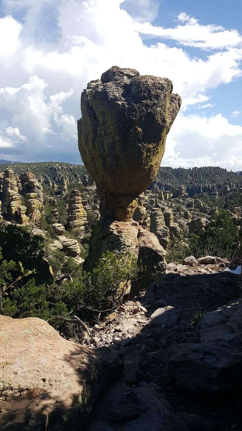
The result is a forest of stone pillars, some skinny and some chunky, many topped with wobbly-looking caps. Balanced rocks perch on narrow bases like they forgot to read the rules of gravity.
Along Echo Canyon, you get an up-close look at that slow sculpting job. You can see the layers, the fractures, and the rounded edges where weather has smoothed the stone.
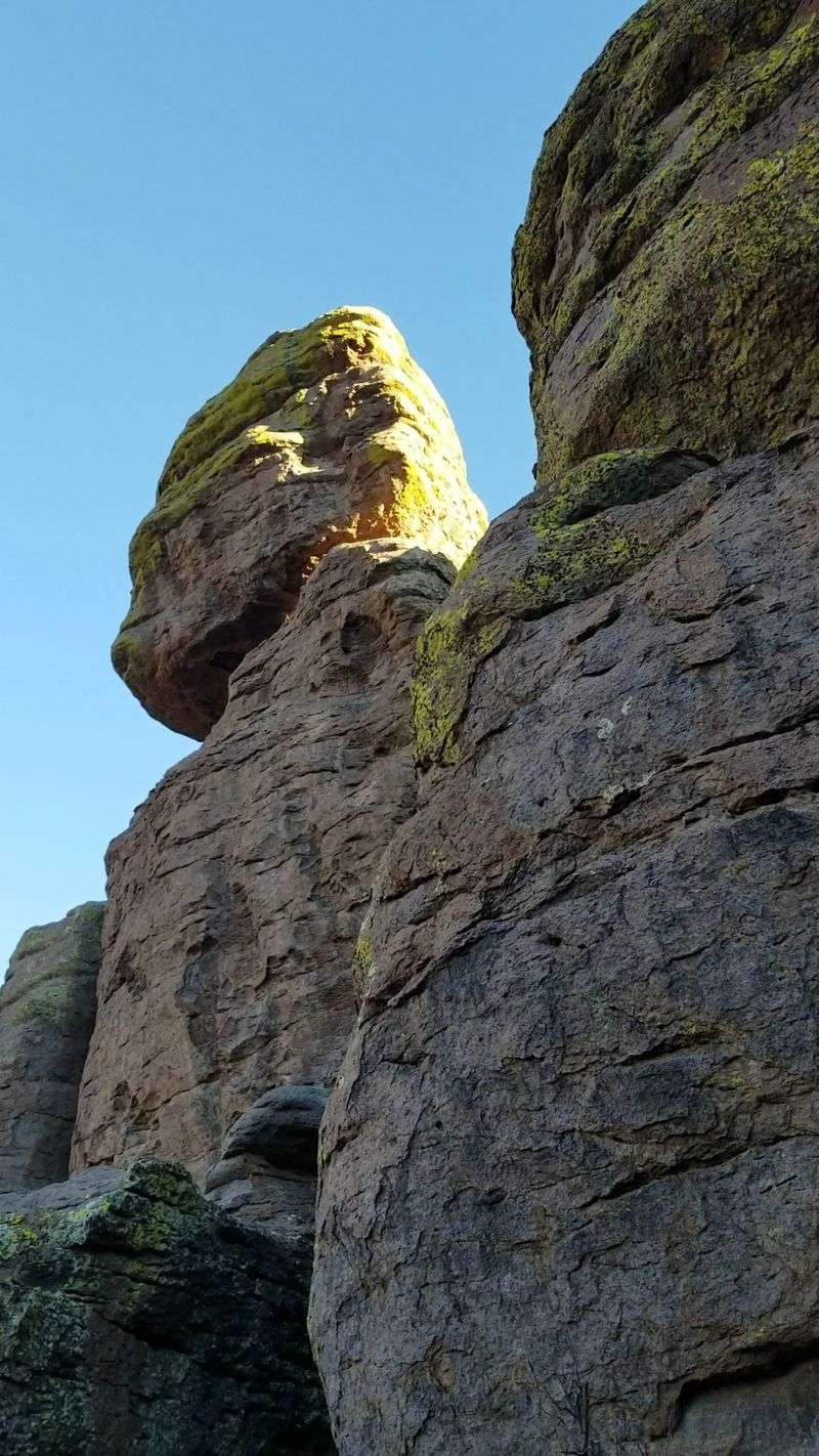
Lichen adds bright green and gold patches to many rock faces. Those colors pop beautifully in low morning light, which is one more reason to arrive early.
Geology rarely feels this personal. Here, the story of a volcano is not on a sign somewhere, it is literally the wall you are touching on the way through.
Beat the Heat and the Afternoon Storms With a Sunrise Start
Summer in southeastern Arizona can turn toasty fast. June temperatures in the area often climb into the 90s, and some days push past 100 degrees.
An early start keeps you in the cooler hours while the canyon still holds its shade. Your water lasts longer, your legs feel fresher, and nobody gets cranky by mile two.
Then comes monsoon season, typically in July and August. Afternoon thunderstorms can roll in with strong winds, lightning, and even flash flooding.
A rocky ridge is not where you want to be when thunder starts rumbling. Finishing the loop by late morning gives you a comfortable buffer before storms usually build.
Morning also brings a quieter trail. Fewer hikers means more space to pause in narrow passages and enjoy the hush between the spires.
And let’s talk about that light. Sunrise warms the rock faces with soft color, while long shadows add depth that midday sun flattens out.
So yes, the alarm clock might feel rude. Still, trading a little sleep for cool air, calm skies, and glowing stone feels like the best deal in the whole Chiricahua Mountains.
Squeezing Through Wallstreet and the Grottoes
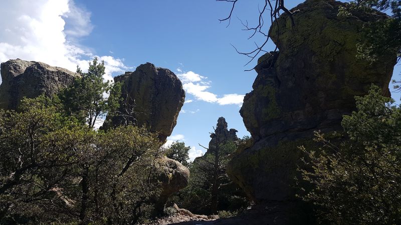
Counter-clockwise is the move here. The National Park Service suggests starting on Echo Canyon Trail, then returning by the Hailstone and Ed Riggs Trails.
That direction tends to deliver the big views first and an easier climb at the end. It is a small choice that pays off in both scenery and stamina.
The full loop runs about 3.3 miles with roughly 500 feet of elevation change. Moderate is the honest word, with rocky footing and some steady grades along the way.
Early on, the trail threads through the Echo Canyon Grottoes. Stone overhangs and little rock rooms create shady pockets that feel like natural hideouts.
Then you reach Wallstreet, a narrow passage between towering walls of rock. It is one of those spots where everyone instinctively lowers their voice.
Beyond the tight squeeze, the canyon opens into wooded sections with oak, pine, and cypress. The contrast between stone hallway and green forest keeps every stretch interesting.
Bring a camera, though the photos rarely capture the scale. Standing between those walls is something you simply have to feel for yourself.
Stonework Left Behind by the Civilian Conservation Corps
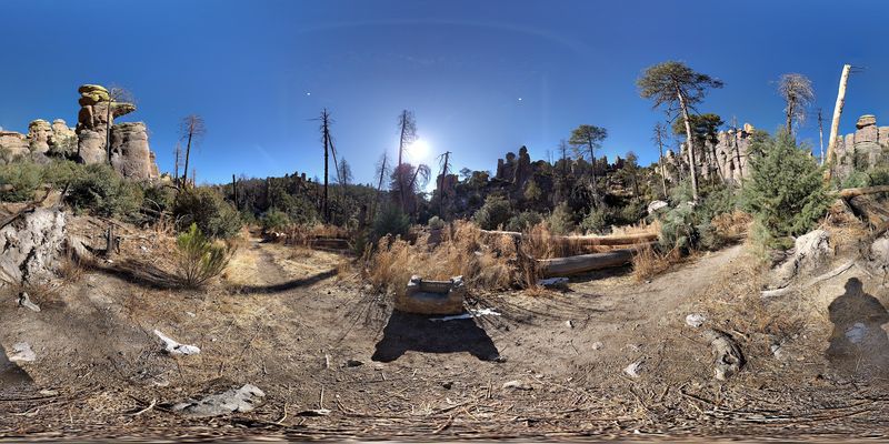
Credit where it is due. Much of the trail system you enjoy today was built by the Civilian Conservation Corps between 1934 and 1940.
Those crews created miles of paths through some very tricky terrain. Their rock steps, retaining walls, and careful grades still guide hikers through the spires decades later.
Look closely as you walk the Echo Canyon loop. The stonework blends so neatly with the landscape that it can be easy to miss how much effort it took.
The CCC also left its mark elsewhere in Chiricahua National Monument. The visitor center itself sits in a historic building made by CCC stone masons in the late 1930s.
Human history here runs far deeper than the 1930s, too. The land is part of the ancestral homeland of the Chokonen Band of Chiricahua Apache.
Later, pioneer and ranching families settled nearby. Their story is preserved at the Faraway Ranch Historic District inside the monument.
Knowing all this adds a nice layer to every step. You are hiking through volcanic history, cultural history, and some seriously impressive handiwork at the same time.
Keep an Eye Out for Coatis, Jays, and Maybe a Trogon
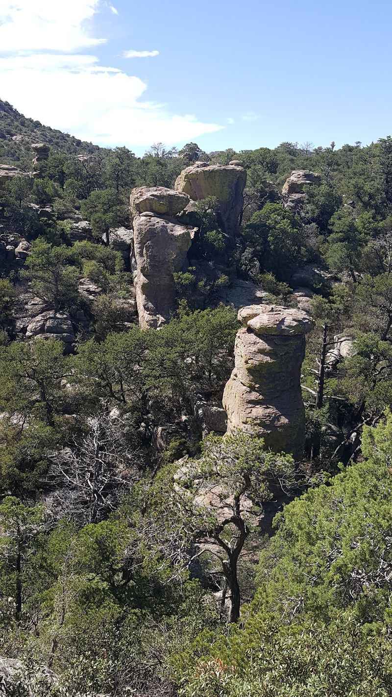
Chiricahua is what scientists call a sky island. These isolated mountain ranges rise above the surrounding desert and grasslands like islands in a sea.
Four big regions meet here: the Rocky Mountains, the Sierra Madre, and the Sonoran and Chihuahuan Deserts. That mix creates a remarkable range of plants and animals in a fairly small area.
White-tailed deer and javelina show up in the monument. Coatis, the long-tailed cousins of raccoons, are a fun bonus if they happen to wander past.
Black bears and bobcats live in the region too. They are seen far less often, which is probably fine for most of us.
Birders, this one is for you. Nearly 200 bird species have been documented in the area, including Mexican jays, Montezuma quail, hummingbirds, and the elegant trogon.
Early hours tend to be lively for birds, another quiet perk of that sunrise start. Bring binoculars and listen for chatter in the oaks.
Please give all wildlife plenty of space. Admiring a coati from a respectful distance makes the moment better for everyone involved, especially the coati.
What to Pack, Where to Park, and What Costs Nothing
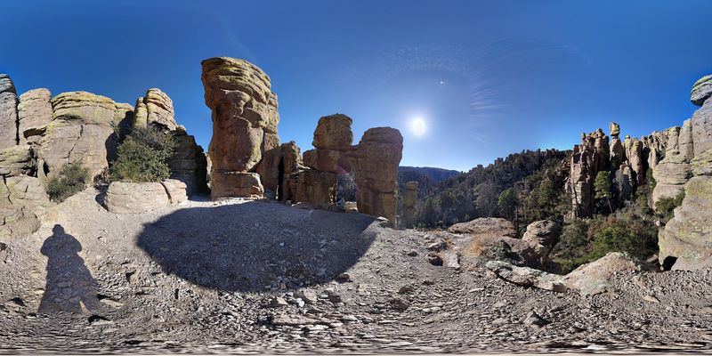
Good news first: Chiricahua National Monument does not charge an entrance fee. For a place this striking, that might be the best bargain in Arizona.
For your GPS, the monument address is 12856 E Rhyolite Creek Rd, Willcox, AZ 85643. From there, follow Bonita Canyon Drive up to the Echo Canyon parking area.
There is no drinking water along the Echo Canyon Trail. Carry at least two to three liters per person, even on a mild morning.
Sturdy shoes are a smart call because the footing is rocky and sometimes loose. Layers help too, since conditions can change quickly at these elevations.
Pets are not allowed on the wilderness trails, including this loop. Leave furry hiking buddies at home for this one.
Stop by the visitor center before heading up. You can grab free trail maps, check current conditions, use restrooms, and refill water bottles.
Cell coverage can be spotty in the park, though Wi-Fi is available at the visitor center. Hours may vary by season, so check ahead before planning that sunrise arrival.
Stay for the View, the Campfire Glow, and a Sky Full of Stars
Finished the loop by midmorning? Perfect, because the day is far from over.
Drive the rest of Bonita Canyon Drive up to Massai Point at 6,870 feet. The overlook gives sweeping views across the Wonderland of Rocks you just hiked through.
Hungry for more miles another day? The Heart of Rocks Loop runs much longer and visits famous formations like Big Balanced Rock and Punch and Judy.
Bonita Canyon Campground offers 25 sites with running water, flush toilets, and picnic tables. Spring is popular, so reserving ahead makes a lot of sense, and RVs over 29 feet cannot drive past the visitor center area.
Staying overnight unlocks another treat. Chiricahua National Monument is certified as an International Dark Sky Park, with skies far from big-city glow.
After a sunrise hike and a starry night, the whole place feels complete. Few spots in Arizona deliver that much wonder for so little cost.
My verdict is simple. Set the alarm early, pack plenty of water, and let Echo Canyon show you its best side before the rest of the world wakes up.