10 Illinois Countryside Drives With Rolling Green Views In Spring
Spring in Illinois just hits differently. One week everything looks dull and quiet, and the next the fields are glowing green and every backroad feels alive again.
Driving along those slower county roads, you start noticing the little things, wildflowers popping up along the edges, trees just starting to leaf out, and stretches of open land that seem to roll on forever.
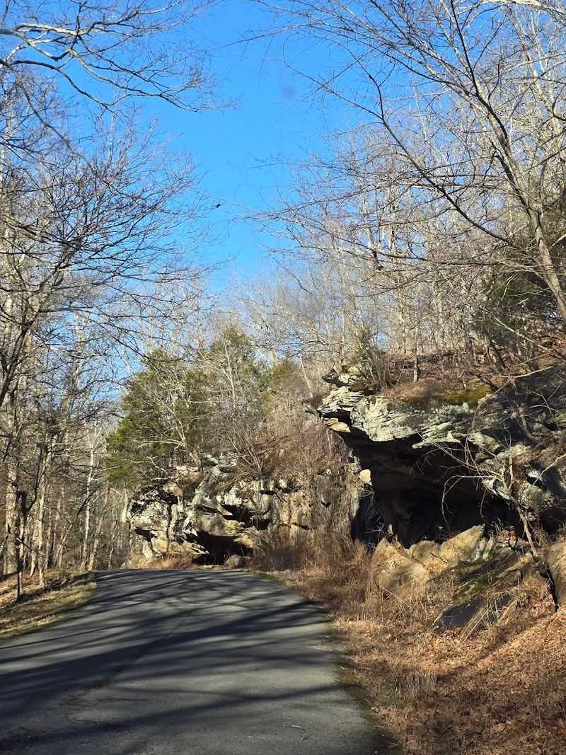
Up north, you get those big limestone bluffs rising above the river, while farther south the land turns hillier, with forests and rocky outcrops tucked into the landscape.
The air feels fresh, the colors are softer, and it all moves at a slower pace. These drives are less about getting somewhere and more about enjoying what’s right in front of you.
1. Great River Road To Pere Marquette State Park
Few roads in Illinois hit quite the same way as the Great River Road heading south toward Pere Marquette State Park.
Running along the eastern bank of the Mississippi River, this stretch of Illinois Route 100 in Calhoun and Jersey counties offers some of the most jaw-dropping bluff scenery you will find anywhere in the Midwest. In spring, those bluffs explode with fresh green growth, and the contrast against the wide silver river below is genuinely stunning.
Pere Marquette State Park is one of the largest state parks in Illinois, and it earns that reputation. The park sits at the confluence of the Illinois and Mississippi rivers, giving you sweeping views from multiple overlooks that practically beg you to stop and stare.
Wildflowers line the roadsides in April and May, and the park trails let you stretch your legs after the scenic drive.
The drive from Grafton up to the park is short, but plan to take at least an hour. You will want to stop at every overlook, and the town of Grafton at the start of the route has a lovely riverfront worth a short walk.
2. Savanna Stretch Of The Great River Road To Mississippi Palisades State Park
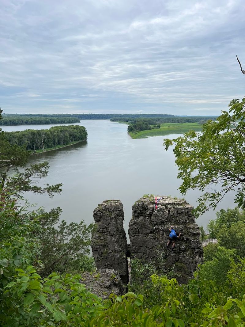
Up in the northwest corner of Illinois, the Great River Road takes on a wilder, more dramatic character near the town of Savanna.
This stretch of road winds alongside the Mississippi River through Carroll County, and the scenery shifts from gentle farmland to towering limestone palisades that rise sharply from the riverbank. It is the kind of landscape that makes you feel like you have crossed into a different state entirely.
Mississippi Palisades State Park anchors this drive beautifully. The park features over 2,500 acres of rugged terrain with trails that climb to cliff-top viewpoints offering panoramic views of the river and the green floodplain below.
In spring, the forest floor fills with trillium, bloodroot, and wild ginger, making the hiking trails as rewarding as the overlooks.
Savanna itself is a charming small town worth a quick stop before or after the park. The drive north from Savanna along Route 84 is best enjoyed on a weekday morning when traffic is light and the mist is still hanging over the river.
Bald eagles are frequently spotted along this corridor in early spring, which adds a pretty unforgettable bonus to an already remarkable drive.
3. Galena Backroads To Apple River Canyon State Park
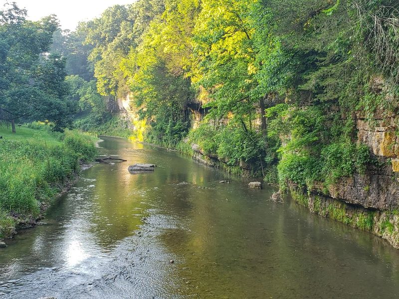
The rolling hills around Galena, Illinois, already feel like a postcard on their own, but the backroad drive east toward Apple River Canyon State Park turns the scenery up a notch.
Jo Daviess County is part of Illinois’ Driftless-style hill country, and the result is a genuinely hilly, rugged landscape that looks nothing like the flat farmland most people associate with the state. Spring amplifies everything, coating the hillsides in varying shades of green.
Apple River Canyon State Park sits about 18 miles east of Galena and protects a deep, narrow canyon carved by the Apple River.
The canyon walls rise steeply above the clear stream, and in May the park is alive with spring ephemerals and nesting songbirds. The trails here are short but steep, rewarding hikers with canyon-rim views that feel almost out of place in Illinois.
Taking the county roads rather than the highway between Galena and the park is the real secret to this drive.
Roads like Stagecoach Trail and Blackjack Road wind through farms, wooded hollows, and past historic stone fences. Budget extra time for the drive itself, because the views along the way are every bit as satisfying as the destination.
4. Rock River Valley Drive To Lowden State Park Near Oregon
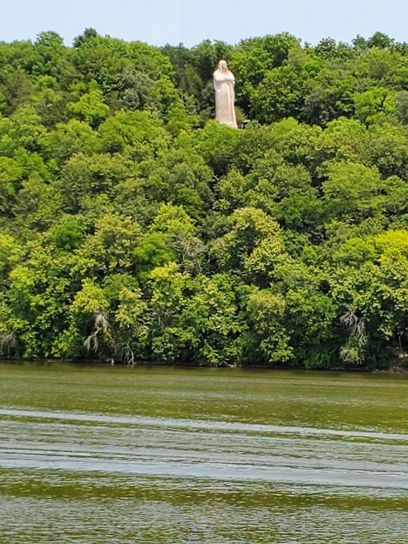
Oregon, Illinois, sits in Ogle County along the Rock River, and the drive through the Rock River valley in spring is one of those routes that feels like it was designed specifically for a Sunday afternoon with no agenda.
The road follows the river through a corridor of green bluffs, working farms, and patches of hardwood forest that are particularly beautiful when the new leaves are still that bright, almost electric green of early May.
Lowden State Park is the crown jewel of this drive. The park is home to the famous Black Hawk statue, a 50-foot concrete monument associated with the Sauk leader that stands on a bluff overlooking the Rock River.
The view from that bluff, especially in spring when the valley is lush and the river is running full, is one of the most photographed scenes in northern Illinois for good reason.
The stretch of Illinois Route 2 between Dixon and Oregon follows the river closely enough that you can see the water through the trees for much of the drive. Castle Rock State Park nearby makes an easy add-on to the itinerary.
Pack a picnic and plan to spend most of the day exploring the valley at an unhurried pace.
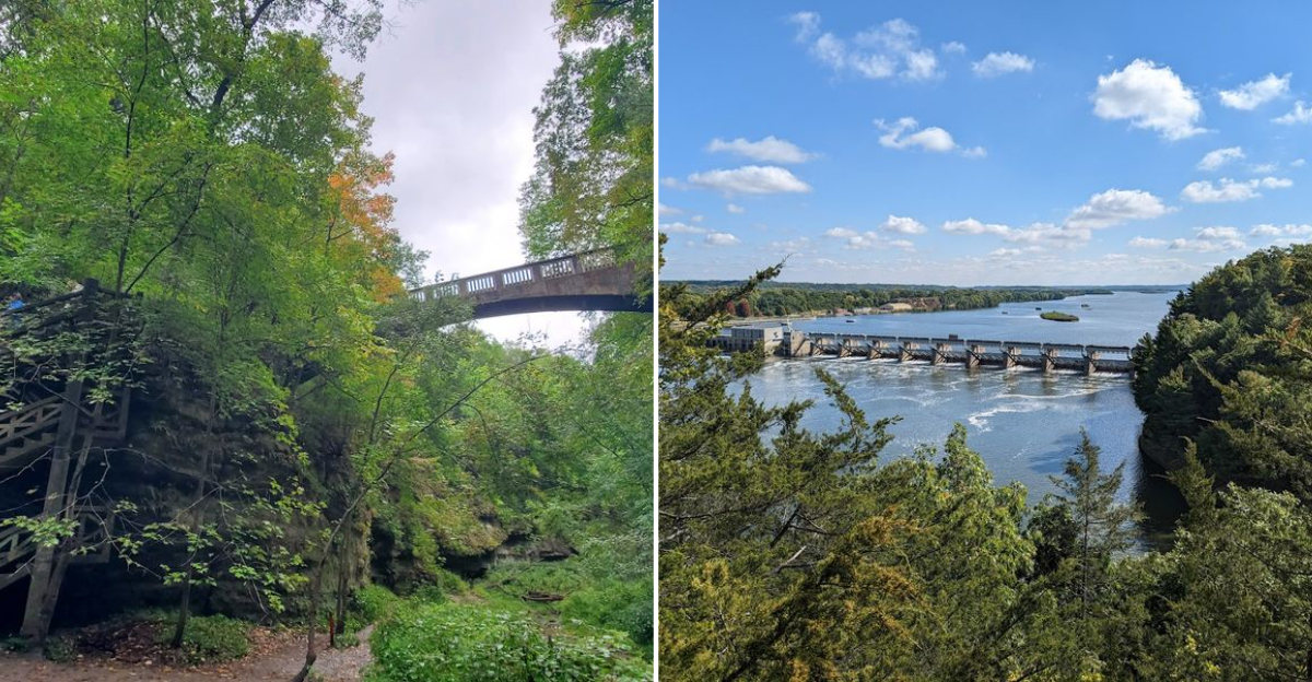
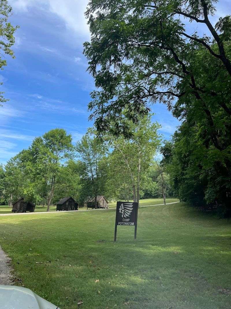
5. Illinois River Road To Starved Rock State Park
Starved Rock State Park needs very little introduction to anyone who has grown up in Illinois, but the drive along the Illinois River Road leading to it deserves just as much attention as the park itself.
Running through LaSalle and Bureau counties, this corridor follows the Illinois River through a wide, green floodplain flanked by wooded bluffs. In spring, the route is lined with blooming redbuds and white serviceberry trees that make the drive feel almost festive.
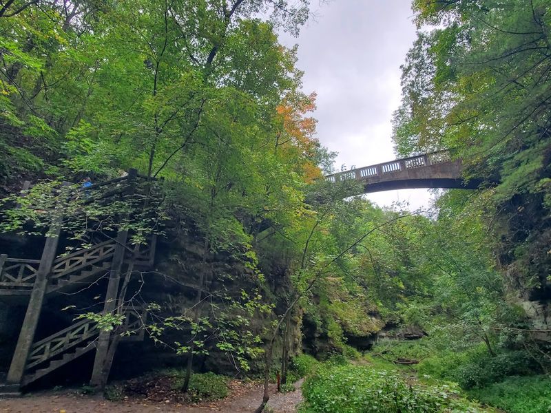
The park itself is built around 18 canyons carved into sandstone bedrock, and spring is genuinely the best time to visit.
Snowmelt and spring rains fill the canyon waterfalls to their peak flow, and the canyon walls are draped in vivid green moss and ferns. The main canyons like St. Louis and French canyons are especially dramatic in April when the water is high.
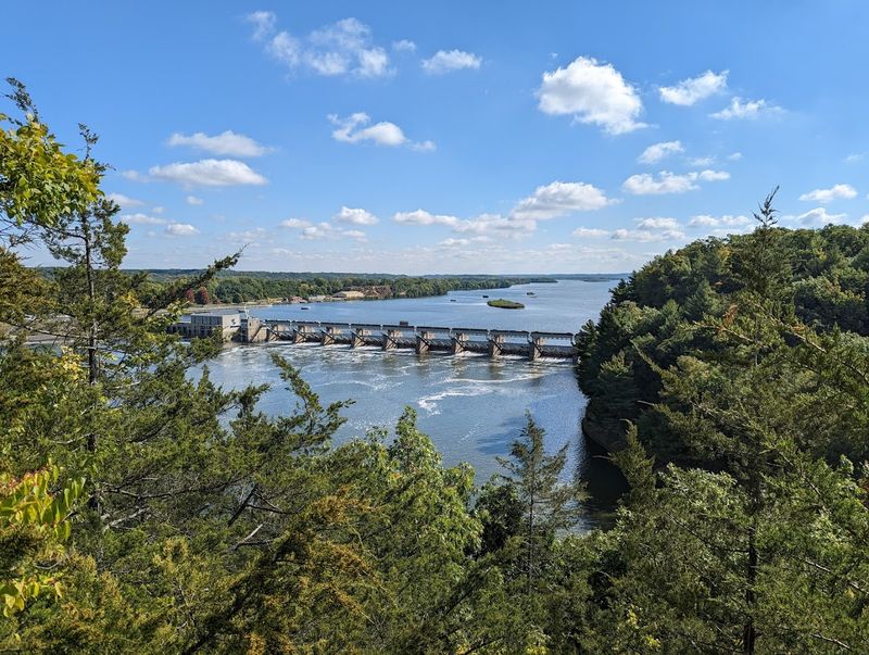
Utica is the nearest town and serves as a great base for the visit. The Illinois Waterway Visitor Center nearby is worth a 30-minute stop if you are curious about the river’s history and the lock-and-dam system.
Arrive early on weekends, as the park draws large spring crowds and parking fills up quickly at the main trailheads.
6. Utica-Oglesby Loop To Matthiessen State Park
Starved Rock gets most of the spotlight in LaSalle County, but nearby Matthiessen State Park is where locals go when they want the same canyon scenery without the shoulder-to-shoulder crowds.
The Utica-to-Oglesby loop connects both parks through a network of county roads and state routes that pass through farmland, river lowlands, and forested ridge tops. In spring, this loop is an absolute treat.
Matthiessen is divided into two sections, the Dells Area and the Lake Area, both of which offer tiered waterfalls, canyon trails, and wildflower displays that rival anything in the region.
The lower dells section features a stunning canyon carved by Matthiessen Creek, with a series of falls that cascade through layered sandstone in a way that feels almost theatrical. Spring ephemerals like Dutchman’s breeches and spring beauty carpet the canyon floors in April.
The loop drive itself passes through Oglesby, a small city with a friendly downtown, before winding back through the rural landscape toward Utica. Combining Matthiessen with a quick stop at Starved Rock makes for a full and satisfying day.
Arrive at Matthiessen in the morning when the canyon light is softest and the trails are quieter, especially on spring weekends.
7. Shawnee Hills Drive To Giant City State Park
Southern Illinois has a completely different personality from the rest of the state, and nowhere is that more obvious than on the drive through the Shawnee Hills toward Giant City State Park near Makanda.
The landscape shifts from flat agricultural plains to a rumpled, forested terrain of sandstone ridges and wooded hollows as you head south on Route 51 and then into the Shawnee National Forest corridor. Spring turns the whole region a deep, saturated green that feels almost tropical.
Giant City State Park takes its name from the massive sandstone bluffs and boulders that create a series of narrow passageways resembling city streets.
The Giant City Trail winds through these formations, which are covered in moss and lichen and framed by towering oaks and hickories that are just leafing out in spring. The park also has a historic stone lodge built by the Civilian Conservation Corps in the 1930s that is worth a visit on its own.
The drive down from Carbondale through the rural Shawnee Hills adds considerable charm. Small farms, roadside fruit stands, and scenic overlooks pop up regularly along the county roads.
Makanda is a quirky little arts community at the park entrance and is worth a short wander before or after the trails.
8. Shawnee National Forest Drive To Garden Of The Gods Recreation Area
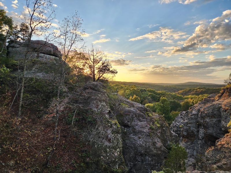
If you have never heard of the Garden of the Gods Recreation Area in southern Illinois, you are in for a genuine surprise.
Sitting deep within the Shawnee National Forest in far southern Illinois, this spot features some of the most dramatic sandstone formations in the entire Midwest, with names like Camel Rock, Anvil Rock, and Devil’s Smokestack that hint at their unusual shapes. The drive to get there is half the reward.
Coming in from Harrisburg on Route 34 and then winding south on forest roads, the drive passes through unbroken stretches of oak-hickory forest that are brilliantly green in May.
The forest understory is full of blooming dogwood and redbud in April, creating layers of pink, white, and green that make the drive through the trees feel genuinely magical. Pulling up to the trailhead parking area and catching your first glimpse of the rock formations above the treeline is a moment that never gets old.
The Observation Trail at the Garden of the Gods is less than a mile long but delivers views that stretch for miles across the forested Shawnee Hills.
Spring mornings here are particularly peaceful, with birdsong echoing off the sandstone and soft light warming the rust-colored rock faces. Combine this drive with a stop at Bell Smith Springs for a full southern Illinois adventure.
9. Karbers Ridge And Bell Smith Springs Drive
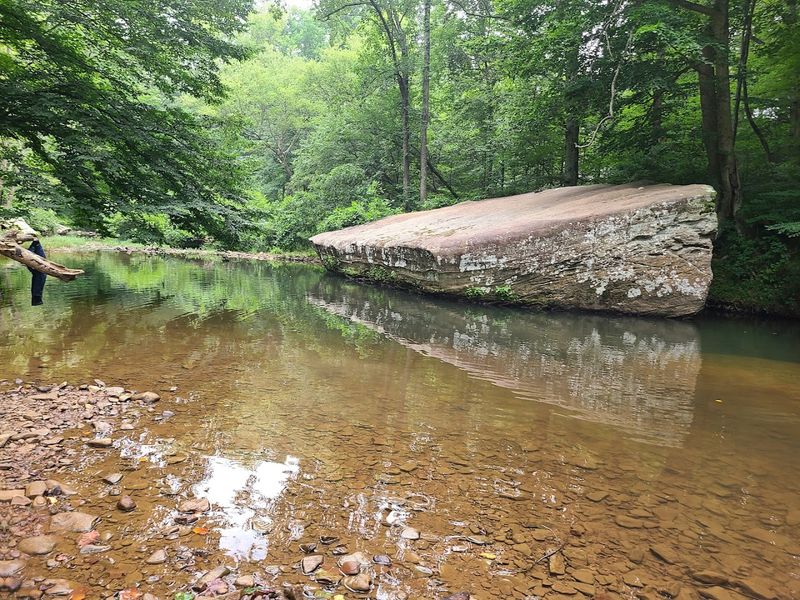
The Karbers Ridge area of Pope County in southern Illinois is one of those places that rewards the traveler who is willing to follow a narrow road past a few hand-painted signs and trust that something worthwhile is waiting at the end.
Bell Smith Springs, tucked within the Shawnee National Forest, is exactly that kind of reward. The drive along Karbers Ridge Road itself is a highlight, running along a forested ridgetop with occasional openings that reveal sweeping views of the surrounding forest.
Bell Smith Springs is named for a series of natural springs that feed a clear, rocky creek winding through a sandstone canyon. The site features a natural arch, multiple waterfalls, and a canyon floor covered in spring wildflowers and lush ferns.
In April and May, the creek runs clear and cold, and the canyon walls are draped in vivid green growth that makes the whole place feel like a secret garden.
The trail system here is moderate and well-marked, with several loops ranging from one to five miles. Combining this stop with the Garden of the Gods, which is only about 12 miles away, makes a spectacular full-day drive through some of the most underrated landscape in Illinois.
Pack sturdy shoes, a picnic lunch, and plenty of time to explore at a relaxed pace.
10. Goreville-Glendale-Rim Rock Drive
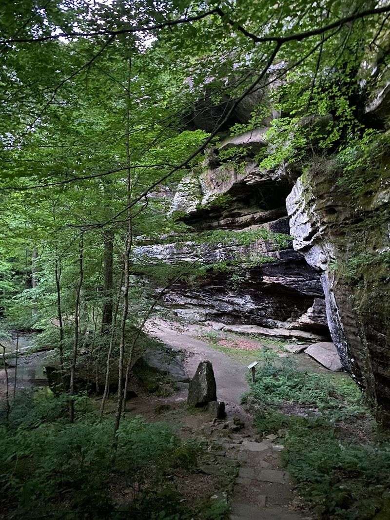
The Goreville-to-Rim Rock drive in Johnson and Pope counties is one of those southern Illinois routes that feels like a reward for knowing where to look.
Starting in Goreville, a small town near Ferne Clyffe State Park, the route winds east through the Shawnee National Forest toward the Glendale area and ultimately to the Rim Rock National Recreation Trail.
The roads here are narrow, tree-lined, and entirely free of the traffic you would find in more popular parts of the state.
Rim Rock is a sandstone escarpment that rises above the surrounding forest and offers a trail that combines canyon hiking with bluff-top views. The Pounds Hollow Recreation Area nearby adds a scenic lake and picnic grounds to the mix.
In spring, the entire corridor between Goreville and Rim Rock is alive with wildflowers, migrating warblers, and the fresh green haze of new leaves on the oaks and maples.
Ferne Clyffe State Park near Goreville is an excellent first stop on this route, with its own impressive canyon system and a large waterfall that flows strongly in spring.
The combination of Ferne Clyffe, Pounds Hollow, and Rim Rock creates a full and varied day of driving and hiking through some of the most scenically rich terrain in all of Illinois.