14 Little Known Florida Rivers And Runs That Turn Kayak Trips Into Escapes
Florida’s famous springs tend to steal the spotlight, but I’ve found that the quieter water between them is where the state really exhales, in stretches that don’t announce themselves and don’t need to.
These are the rivers and runs that ask for patience rather than speed, rewarding steady paddling with limestone windows just below the surface, tea-colored currents that shift with the light, and birds that barely look up because you’ve become part of the furniture.
Moving through them feels less like sightseeing and more like listening, noticing how a tide flicks sunlight across the water at exactly the right angle, or how a cypress leans toward the channel as if it’s been paying attention for decades.
What I love is how distinct each stretch feels, even when they’re only a short drive apart, one slow and enclosed, another wide and breathing, each offering its own version of calm.
You don’t rush these places without missing the point, and they quietly encourage you to put the phone away, pack a dry bag, and let curiosity do the navigating.
Think of this list as a gentle invitation to slow down enough to notice where Florida’s wild water still sets the pace, and where the South seems to breathe most clearly when you move through it without hurry.
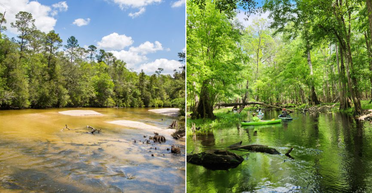
1. Chassahowitzka River
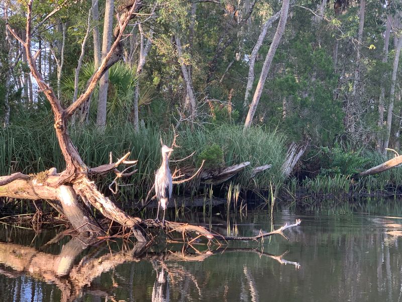
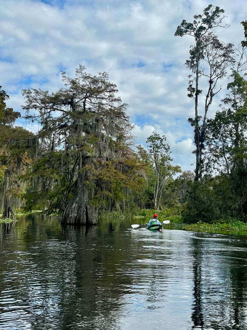
Brackish water moves slowly between marsh grass and cabbage palms, carrying reflections of low clouds and passing birds in a way that makes the river feel wider and calmer than it really is.
Manatees browse eelgrass during cooler months while mullet scatter ahead of kayaks, creating brief flashes of motion that remind you this waterway is actively lived in, not staged.
The blending of spring fed clarity with tidal influence gives the river a layered personality, where salinity, light, and depth shift subtly with every bend.
Local lore often centers on Seven Sisters Spring and nearby underwater caves, reinforcing the sense that much of this river’s story unfolds below the surface.
Occasional homes, docks, and fishing skiffs appear along the banks, offering a neighborly presence that coexists easily with long stretches of quiet wildness.
Most paddlers launch from Chassahowitzka River Campground at 8600 W Miss Maggie Dr, Homosassa, FL 34448, where access is straightforward and well used.
Paying attention to tide charts before setting out can mean the difference between an effortless glide and a slow, grinding return against water that never rushes but never yields easily.
2. Santa Fe River And Springs Corridor
The transition between dark, tannin rich water and brilliant spring flow is so abrupt that it looks deliberately drawn, as if someone poured ink beside glass.
Limestone banks swallow and release water through hidden vents that subtly pull at your kayak, making the river feel active even when the surface appears still.
This corridor functioned as a travel and settlement route long before recreational paddling, shaping human movement across north Florida for centuries.
Springs such as Poe, Rum Island, and Ginnie remain central to the river’s identity, protected today within a mosaic of public parks and conservation lands.
Fossils embedded in exposed rock faces hint at ancient seas and shifting landscapes that predate the river’s current course.
A common access point is Santa Fe River Park at 203 SE Riverside Dr, Fort White, FL 32038, which provides reliable entry without resort amenities.
Choosing a weekday outside peak summer allows the river’s contrasts to register clearly, without the distraction of crowds clustering at popular springs.
3. Ichetucknee River
Cold, exceptionally clear water reveals every blade of grass, fish movement, and shadowed log beneath your kayak, giving the river an almost magnified quality.
The steady current carries boats gently forward while still demanding careful strokes, making paddling feel cooperative rather than passive.
Historically used by Indigenous peoples and later by settlers and industry, the river now reflects decades of deliberate protection and management.
Its fame as a tubing destination often overshadows the quieter character of the upper stretches during early morning hours.
Underwater grasses sway continuously, creating a visual rhythm that makes time feel stretched and unhurried.
Most paddlers enter from the North Entrance of Ichetucknee Springs State Park at 12087 SW US Highway 27, Fort White, FL 32038, before downstream traffic builds.
Arriving at opening time allows the river’s natural sounds and movement to set the tone, before recreational noise compresses the experience into something more hurried.
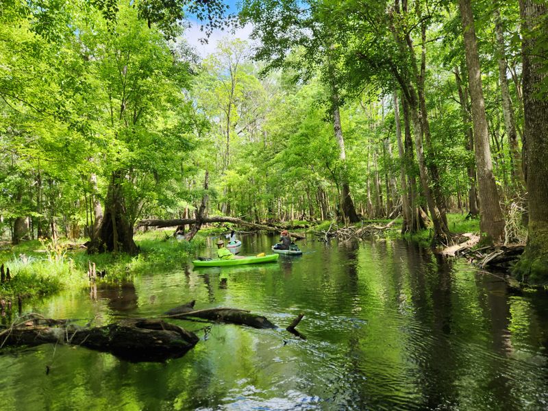
4. Rock Springs Run
What first registers is the way sunlight refracts through astonishingly clear water over pale sand before the channel tightens and the canopy closes in, creating a flickering pattern of light and shadow that keeps shifting with every slow bend of the run.
The water itself alternates between spring clarity and tea-stained darkness, revealing submerged grasses, fallen branches, and occasional fish while also hiding enough to keep your attention forward and alert.
This run links Kelly Park and Wekiwa Springs State Park, carrying decades of central Florida recreation history shaped by early conservation efforts and Civilian Conservation Corps projects.
Old fish camp names and sandy landings still echo along the route, subtle reminders that people have been floating and working these waters long before modern permits and reservations.
Wildlife remains comfortable here, with otters surfacing briefly and deer sometimes pausing at the banks as if deciding whether you belong.
Most paddlers start near Kelly Park at 400 E Kelly Park Rd, Apopka, FL 32712, where access is regulated to protect the narrow waterway.
Planning for tight turns, low branches, and afternoon storms turns this paddle into a focused, immersive experience rather than a casual float.
5. Juniper Run
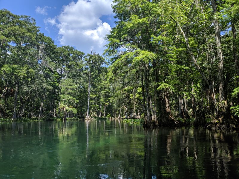
The narrowness of the channel becomes immediately apparent, forcing your kayak into an intimate relationship with banks lined by palms, magnolia, and oak that seem close enough to touch at every turn.
Clear, fast moving spring water threads through Ocala National Forest with a speed that keeps paddlers alert while still allowing time to absorb the scent of bay leaves and wet limestone.
Designated as part of the National Wild and Scenic River system, this run reflects decades of intentional restraint rather than development.
Civilian Conservation Corps work at the Juniper Springs headwaters helped establish a framework that prioritized preservation over convenience.
Minimal signage and enforced paddling etiquette keep the banks from eroding into chaos, even during busy seasons.
Most trips begin at Juniper Springs Recreation Area, located at 26701 E County Rd 40, Silver Springs, FL 34488, where rentals and shuttles are managed tightly.
Choosing a shorter boat and keeping strokes precise makes the difference between a controlled descent and a tiring series of corrections through this fast, winding corridor.
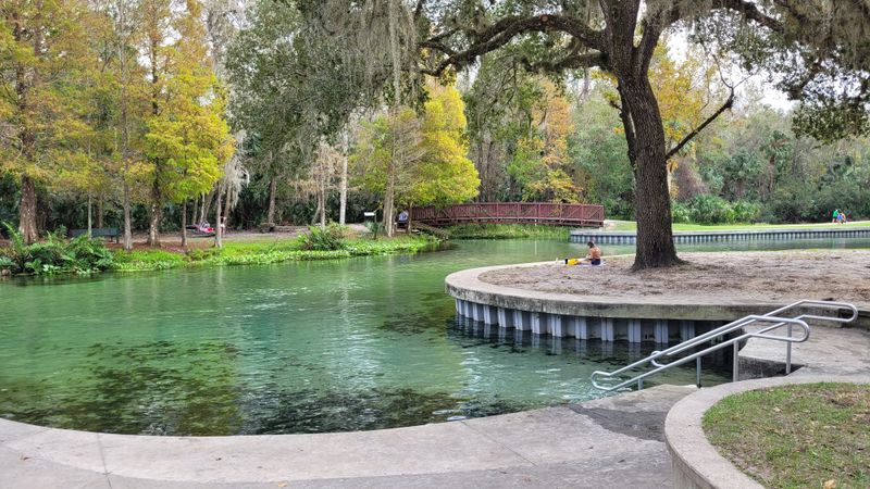
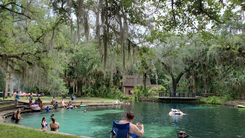
6. Silver River
The river opens wide and luminous, with glass-clear water revealing fish, vegetation, and submerged objects so distinctly that it feels like floating above a living display case.
Herons, egrets, and turtles move along the edges with practiced calm, seemingly accustomed to quiet boats but uninterested in interaction.
Silver Springs became one of Florida’s earliest tourist attractions, turning underwater visibility into spectacle long before theme parks existed.
Remnants of that era linger beneath the surface and along the banks, blending amusement history with a still functioning natural system.
The presence of wild rhesus macaques, introduced in the 1930s, adds a complicated layer that requires respectful distance and awareness.
Many paddlers launch from Ray Wayside Park at 9565 NE 28th Ln, Silver Springs, FL 34488, heading upstream first for an easier return.
Early mornings reduce motor traffic and glare, allowing the river’s scale and clarity to register fully before the day tightens around it.
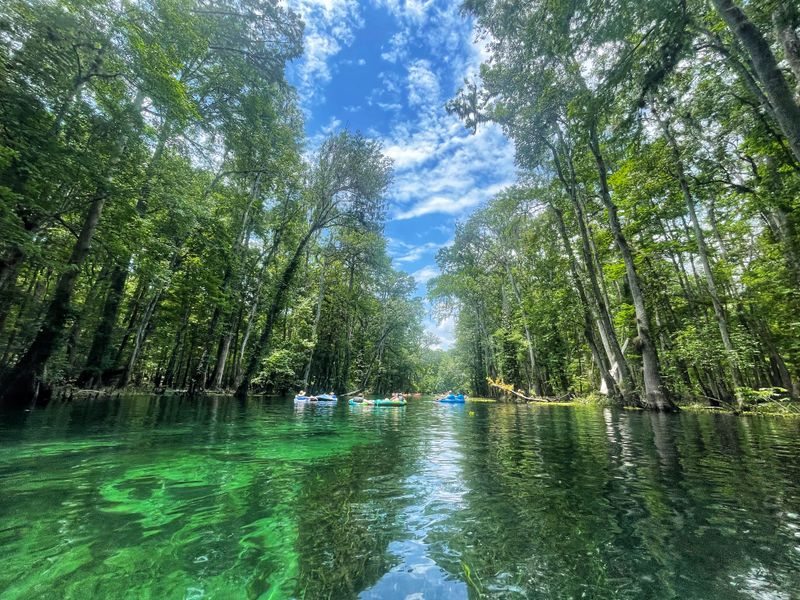
7. Rainbow River
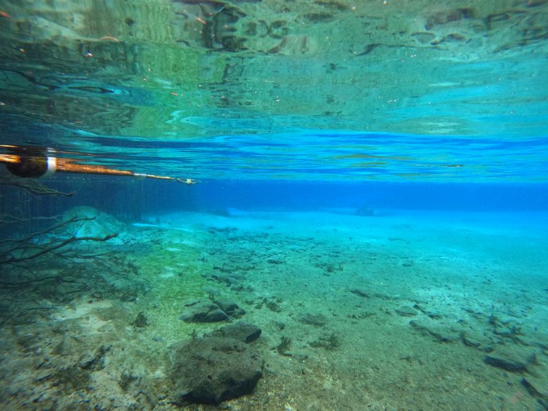
The first impression comes from the intensity of color, as sunlight refracts through exceptionally clear water into layered blues and greens that feel almost unreal until you watch grasses and snails moving naturally beneath your kayak.
The river flows at a steady, gentle pace, wide enough to feel open yet controlled enough that every sound, from dipping paddles to distant birds, seems softened by the surrounding vegetation.
Once heavily altered by phosphate mining, this waterway underwent extensive restoration before becoming Rainbow Springs State Park, reshaping its identity around conservation rather than extraction.
The headwaters maintain a constant temperature year round, supporting fish, aquatic plants, and occasional wintering manatees that depend on that stability.
Homes and docks line parts of the river, but strict idle zones and community norms help preserve the clarity and calm that define the experience.
Most paddlers put in at KP Hole County Park, 9435 SW 190th Ave Rd, Dunnellon, FL 34432, and paddle upstream toward the springs before drifting back.
Avoiding weekends allows the river’s visual depth and unhurried rhythm to come forward, rather than being compressed by heavy recreational traffic.
8. Gum Slough Creek
Tea dark water curls quietly through gum trees and cypress knees, broken occasionally by pale patches of spring seepage that reveal fine sand and small fish holding still in the current.
The narrow channels feel enclosed and intimate, with dragonflies hovering at eye level and long stretches where the only sound comes from paddle drips and distant bird calls.
Part of the broader Withlacoochee River system, this slough escaped heavy development largely because it was inconvenient rather than intentionally protected.
Old logging routes and subtle human traces appear only if you know how to read the banks, otherwise blending back into the vegetation.
The creek’s braided layout shifts with seasonal water levels, changing the route enough that repeat trips never feel identical.
Launch access is commonly found near Turner Camp Road, close to 3267 S Turner Camp Rd, Inverness, FL 34450, where the entry is informal but reliable.
Checking recent conditions and carrying navigation aids helps turn what could feel confusing into a slow, exploratory paddle rather than a frustrating search for the main channel.
9. Dora Canal
Spanish moss drapes low over the water, brushing shoulders and decks as the canal narrows and curves, creating a tunnel effect that feels deliberately composed despite its natural growth.
Boat wakes echo briefly off cypress knees before settling again, restoring a calm surface that reflects filtered light and the dark wood of historic shoreline structures.
Long promoted as one of the most beautiful short waterways in Florida, the canal links Lake Dora and Lake Eustis through a corridor shaped by early leisure boating culture.
Old boathouses and fish camps remain visible along the edges, their continued presence grounding the canal’s beauty in lived, working history rather than nostalgia alone.
Birdlife thrives here, taking advantage of the sheltered water and abundant cover created by overhanging vegetation.
Most paddlers enter from public access near Lake Dora, often using the ramp at 501 Lakeshore Dr, Mount Dora, FL 32757, and time their trip carefully.
Starting early in the morning keeps tour boats and wind from dominating the experience, allowing the canal’s layered textures and quiet movement to unfold gradually.
10. Blackwater River
The blinding whiteness of the sandbanks contrasts sharply with the dark, tannin stained water, creating a visual effect that feels almost alpine when the midday sun reflects off the river’s wide, open bends.
Longleaf pines rise above high bluffs, and after rain their resinous scent drifts down to the water, mixing with the mineral smell of wet sand and slow moving current.
Protected within Blackwater River State Park, this is one of the Southeast’s purest sand bottom rivers, long valued for its clarity and relatively undisturbed flow.
Logging once shaped access points and place names throughout the surrounding forest, leaving a network of roads now repurposed by paddlers and anglers.
The river’s breadth allows space for tubing and fishing, yet quiet stretches remain where the only movement comes from shadows sliding across the bottom.
Common launch points include Kennedy Bridge and Deaton Bridge, with Kennedy Bridge at 9929 Deaton Bridge Rd, Milton, FL 32570, being especially popular for day trips.
Monitoring river gauges before you go helps avoid surprises, since higher water transforms this gentle paddle into a faster, more demanding run.
11. Arbuckle Creek

The soundscape shifts quickly here, from birds and wind through cypress to the distant lowing of cattle grazing near open banks that feel unmistakably rural.
This creek winds south of Avon Park through working ranchland, where kingfishers dart ahead of your bow and long stretches pass without another boat in sight.
Unlike heavily protected rivers, Arbuckle Creek remains shaped primarily by agricultural use rather than formal conservation designations.
Nearby Avon Park Air Force Range adds another layer, with training flights occasionally crossing overhead and briefly breaking the illusion of isolation.
Old Florida Cracker ranching traditions remain visible in fences, bridges, and water crossings that define the creek’s meandering course.
Most paddlers launch at the Arbuckle Road bridge near 2485 Arbuckle Creek Rd, Lake Placid, FL 33852, planning an out and back rather than a through trip.
After heavy rain the current strengthens noticeably, making timing and awareness essential for keeping the paddle relaxed rather than effortful.
12. Wekiva River
Filtered light slips through dense stands of sabal palm and cypress, breaking into shifting patterns that ripple constantly across the river’s steady surface.
The current carries kayaks at a readable pace, fast enough to feel alive but slow enough to allow deliberate, quiet strokes.
Designated a National Wild and Scenic River, Wekiva reflects decades of grassroots advocacy and careful management aimed at balancing access with protection.
Shell middens and early homestead traces sit back from the banks, reminders of how long people have depended on this waterway.
Canoe liveries grew alongside conservation efforts, shaping a paddling culture that emphasizes low wake travel and wildlife awareness.
Popular access points include Wekiwa Springs State Park at 1800 Wekiwa Cir, Apopka, FL 32712, and Highbanks Road for longer routes.
Avoiding weekends and holidays preserves the river’s calmer personality, allowing turtles, otters, and birds to appear on their own terms rather than retreating from noise.
13. East River Paddling Trail
Early morning often brings a low blanket of fog that hangs just above the dark water, softening the outlines of sawgrass, cypress, and distant tree lines until the whole corridor feels temporarily suspended between night and day.
The channel winds through shallow meanders and tight turns that keep paddlers attentive, with occasional clearings that open briefly before closing again into a more intimate, enclosed stretch.
As part of the downstream reaches of the Little Econlockhatchee basin, this trail reflects decades of water management decisions layered over older ranching and drainage patterns.
Spoil islands, old dikes, and straightened sections quietly reveal where human intervention once pushed hard, even as vegetation slowly reclaims the margins.
Wildlife has adapted to this in between state, and birds now dominate spaces once shaped for cattle and flood control.
Most paddlers access the trail from the State Road 50 launch at 3000 E Colonial Dr, Orlando, FL 32803, often arranging a shuttle to avoid retracing the same bends.
Water levels rise quickly after rain, so timing your trip carefully can turn what might feel muddy and awkward into a smooth, exploratory paddle.
14. Shell Key Preserve Mangrove Channels
The movement of the tide is immediately apparent as water breathes in and out of narrow mangrove tunnels, gently nudging your kayak forward or holding it in place depending on timing.
Sunlit sand pockets alternate with shaded root systems, shifting the water from bright green to deep brown in a matter of seconds as pelicans glide overhead toward the open Gulf.
This preserve off Tierra Verde protects low lying islands shaped by wind, current, and storms, making it one of the region’s most dynamic coastal landscapes.
Mangroves here have survived repeated hurricanes, and their tangled roots tell a quiet story of resilience reinforced by careful stewardship.
Designated kayak routes and roped off nesting zones balance public access with the needs of shorebirds and marine life.
Most paddlers launch from the Tierra Verde public ramp at 4500 Pinellas Bayway S, Tierra Verde, FL 33715, choosing calm weather windows.
Checking wind and tide charts before setting out ensures the maze of channels feels meditative rather than exhausting, especially for first time visitors.