
Locals Say This Once-Peaceful Arkansas Lake Town Has Been Completely Overrun By Crowds
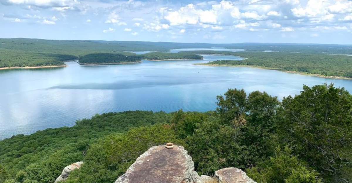
Summer arrives, and this little lake town changes almost overnight. Quiet roads grow busy, boat trailers appear before breakfast, and popular shoreline access points fill faster than longtime residents remember.
The lake still delivers the broad views that first drew people here, but the experience around it feels far less peaceful during peak season. In Arkansas, communities built around outdoor recreation often welcome visitors while also feeling the strain they bring.
That tension is especially clear here. Locals talk about traffic that slows near the water and weekends that require more planning than they once did.
A town with barely more than a hundred residents can suddenly feel much larger when vacationers roll in. The crowds have not erased the beauty of the place, but they have changed its rhythm.
By the time summer is in full swing, the difference is impossible to miss.
Where The Highway Crosses The Narrows
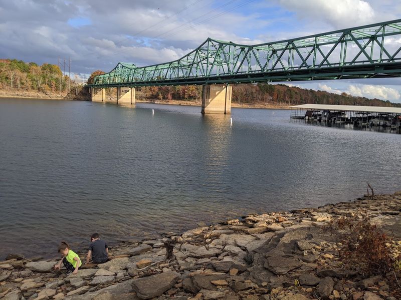
Few road crossings in the Ozark region carry as much drama as the one where Arkansas Highways 16 and 92 meet the lake at its narrowest point.
At a geological feature called The Narrows, the lake pinches into a water-filled gorge, and the highway has no choice but to leap across it.
The Narrows Bridge serves as the architectural answer to that natural challenge, connecting the community on one shore to the town of Greers Ferry on the other.
For drivers making the crossing for the first time, the sudden appearance of open water on both sides of the road tends to produce a satisfying double take.
Locals have grown fond of the bridge not just as a commuter route but as a landmark that helps orient visitors who are still learning their way around the lake.
The highway crossing also marks a kind of psychological threshold, signaling that you have officially arrived in lake country.
On busy summer weekends, traffic slows noticeably here, and the bridge becomes an unintentional scenic overlook as drivers cross into Higden.
Wooded Roads Leading Toward The Water
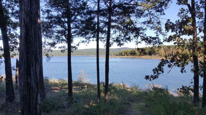
Something almost theatrical happens when you turn off the main highway and follow one of the smaller roads toward the water around Higden.
The canopy closes in overhead, and the mix of red cedar, black gum, red oak, elm, pecan, and sweet gum creates a green tunnel that makes the lake feel like a secret reward waiting at the end.
Many of these routes have histories that predate the lake entirely, having once served as ordinary community roads before Greers Ferry Lake was formed in the early 1960s.
A handful of those old paths simply vanish beneath the surface now, repurposed by locals as informal boat launches where you can slide a kayak or a flat-bottomed boat into the water without ceremony.
The forests lining these roads are dense enough to muffle road noise and create a genuine sense of separation from the busier world outside.
Wildlife sightings along these wooded corridors are common, and patient drivers sometimes spot deer moving through the underbrush in the early morning hours.
Every bend in the road feels like a quiet invitation to slow down and pay closer attention to what this corner of Arkansas has been growing for decades.
Rocky Shorelines Beneath Forested Hills
The edges of Greers Ferry Lake do not offer the soft sandy beaches that many coastal visitors might expect, and honestly, that is part of their appeal.
Rocky outcroppings jut out along the shoreline, worn smooth in some places and jagged in others, creating natural platforms that locals use for fishing, sunbathing, and simply staring at the water.
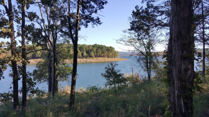
The forested hills rising directly behind the shoreline give the scenery a layered quality, with reflections of the tree line shimmering across the clear surface on calm mornings.
Wildlife habitat along these rocky edges is remarkably rich, supporting birds, turtles, and various fish species that draw nature enthusiasts with binoculars and cameras.
The clarity of the lake water near the rocks is striking, allowing you to see the bottom in the shallows and watch small fish dart between the submerged stones.
Photographers tend to linger here longer than they plan to, finding new compositions around every bend of the shoreline.
The rugged beauty of these rocky banks is the kind that rewards the visitor who is willing to leave the paved path and pick their way carefully toward the water’s edge.
A Small Town Shaped By The Lake
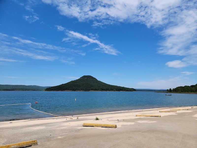
Higden is one of the quieter incorporated towns in Cleburne County, but its story is far bigger than its small size suggests.
The original settlement did not stand where the town sits today. It occupied lower ground that disappeared beneath the rising waters of Greers Ferry Lake when the reservoir was created in the early 1960s.
Residents moved to higher ground on a nearby hill, and some accounts suggest that remnants of old homes and other structures still rest beneath the lake’s clear surface.
That underwater history gives the community an unusual identity, with the lake serving as far more than a scenic backdrop. It is the reason the present-day town exists where it does.
In recent decades, the appeal of lakefront living has brought noticeable development, including expensive homes and visitor-focused businesses along the shoreline.
The town’s character has shifted as a result, blending the quiet rhythms of a long-established rural community with the energy of a growing recreational destination.
Today, Higden remains a small place with a surprisingly layered history, deeply shaped by relocation, rising water, and the lasting influence of Greers Ferry Lake in Cleburne County, Arkansas for decades now.
Boat Docks Along The Quiet Coves
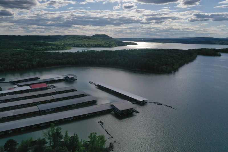
Greers Ferry Lake is not short on places to put a boat in the water, and that accessibility is a big part of why the crowds keep coming back each summer.
The lake supports nine marinas and twenty-two boat ramps spread across its thirty-thousand-acre surface, giving anglers, families, and water sports enthusiasts a wide range of entry points.
Peters Sugar Loaf Marina in Higden offers wet slips for rent and pontoon boats for those who arrive without their own vessel, making the lake accessible even for first-time visitors.
Lacey’s Narrows Marina also serves the boating community in the area, adding another option for anyone looking to spend a day on the water.
Many private residences along the shoreline have their own docks extending into the coves, a detail that speaks to just how deeply lake life has embedded itself into the local culture.
The quieter coves away from the main launch areas offer a noticeably different experience, with calmer water and fewer boats competing for space on busy holiday weekends.
Finding one of those tucked-away coves on a weekday morning feels like discovering the version of the lake that the earliest residents of Higden once knew.
Lake Views Framed By The Ozarks
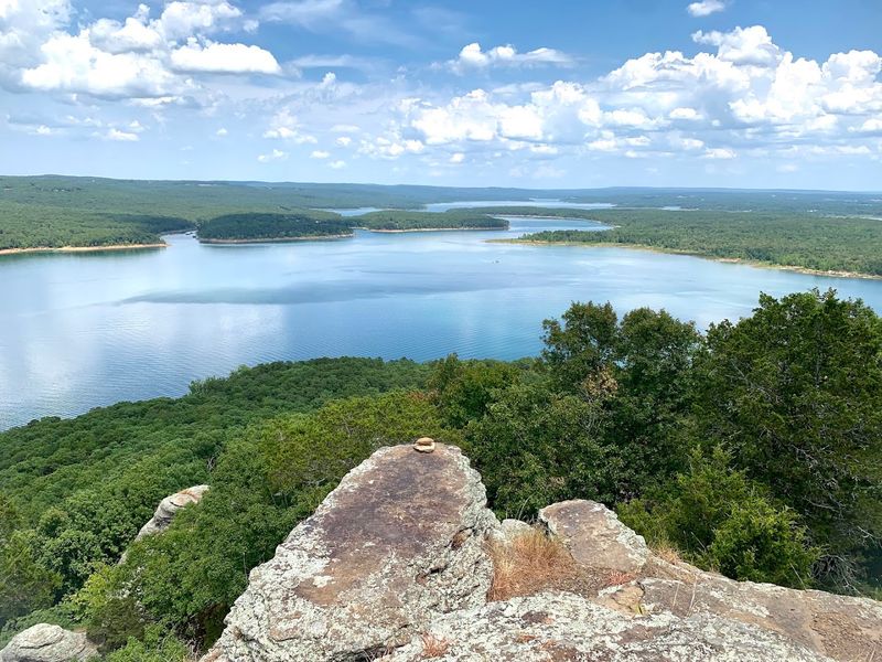
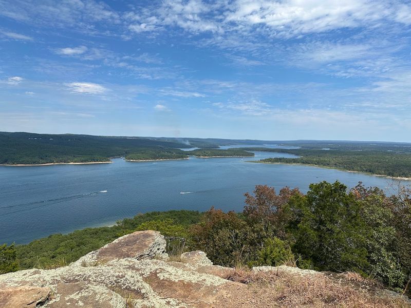
Any elevated point near Higden opens onto a view that is hard to describe without resorting to superlatives.
The rolling foothills of the Ozark Mountains wrap around Greers Ferry Lake on multiple sides, creating a natural amphitheater of green ridges and shimmering water that shifts in color throughout the day.
Sugar Loaf Mountain rises directly from the lake as an island, offering hikers a challenging trail that rewards the effort with sweeping panoramic views of the water and the surrounding countryside.
The Narrows Bridge also functions as an unexpected vantage point, delivering wide-open sightlines across the lake that many first-time visitors stop to photograph.
Early mornings produce some of the most dramatic light here, when low mist sometimes settles over the water and the forested ridges appear in soft layers of blue and green.
Sunset views from the western shore paint the lake in shades of orange and gold, drawing small gatherings of locals and visitors who seem to reach an unspoken agreement to simply stand quietly and watch.
The Ozark backdrop transforms every view of this lake into something that feels curated by nature rather than stumbled upon by accident.
Summer Crowds Near The Launch Ramps
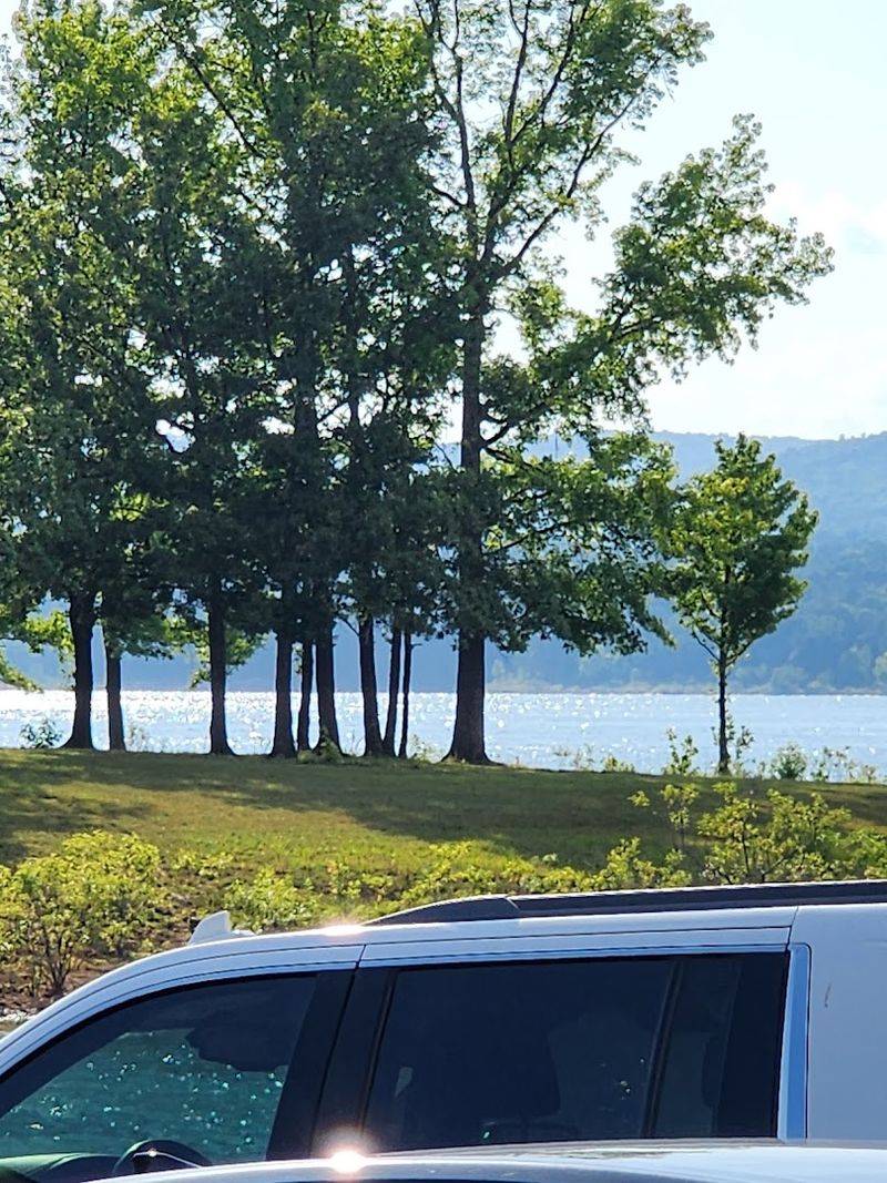
The warm months around Greers Ferry Lake tell a very different story than the peaceful off-season, and people near the launch ramps feel that contrast most sharply.
A recreational carrying-capacity study published in the early 2000s found that some surveyed visitors believed the lake had become more crowded.
The lake remains a major recreational destination during the warmer months, when boating activity increases and popular access points can become busier.
The statewide context adds another layer to this trend, as Arkansas welcomed a record 54.3 million visitors in 2025.
Higden and its surrounding lake area form part of a recreational region that attracts visitors seeking time on the water.
Parking availability and traffic conditions near individual ramps can vary depending on the season, lake level, weather, and time of day.
Residents familiar with the area often plan their lake visits around periods when popular recreation sites are less active.
The Bridge That Defines The Landscape
Not every bridge earns the status of a community landmark, but the Narrows Bridge near Higden has done exactly that, becoming as recognizable to locals as the lake itself.
Built in 1961 as part of the broader Greers Ferry Lake project, this cantilever truss bridge was engineered to stand high above the terrain that would soon be flooded when the reservoir filled.
The structure connects Higden to the neighboring town of Greers Ferry across a segment of the lake, making it an important route for residents on both shores.
From the bridge deck, the views extend across open water in both directions, framed by the wooded ridgelines of the Ozark hills that line the lake’s far shores.
The bridge has appeared in photographs of the area for decades, with its steel structure creating a recognizable contrast against the surrounding water and hills.
The engineering of the bridge reflects the ambition of the entire Greers Ferry Lake project, which reshaped this part of the state in ways that are still unfolding today.
More than six decades after its construction, the bridge remains one of the area’s most recognizable structures.